
perched water table depth
Type of resources
Available actions
Topics
Keywords
Contact for the resource
Provided by
Years
Formats
Representation types
-
Soil data of LTER Zöbelboden, Austria. Soil inventory is carried out since 1992 on regular positions (approx 65) in the catchment measuring soil chemistry. Soil water chemistry is measured in forest plots (2-3) using lysimeter sampling and analyses on a bi-weekly to monthly basis. Soil hydraulic characterizations exist for the major soil types in the catchment. Soil CO2 and N2O respiration data is available for some years
-
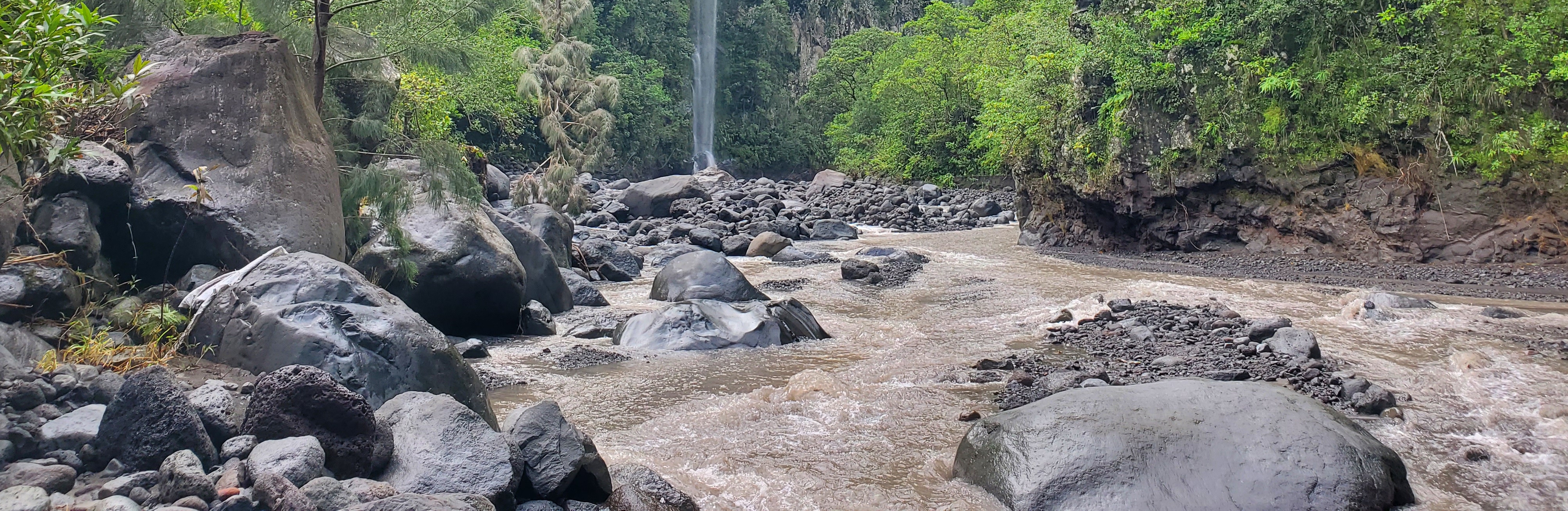
The Bassin de la Rivière des Pluies is located on Réunion Island (French Overseas, Indian Ocean). This volcanic island results from the emission of basaltic products from the Réunion hotspot that initiated 65 Myrs ago with the development of the Deccan traps. Rivière des Pluies drains a watershed of 46 km2 located on the windward side of the dormant Piton des Neiges volcano, from 2276 msl to the sea shore. The Rivière des Pluies catchment is mainly composed of lava flows and breccias aged from 1.4 Ma to 200 ky. The overall watershed is made of a main canyon deeply incised in the volcano flank and a large planeze covered by the deposits of the last explosive eruptions of Piton des Neiges. The combined action of the vegetation and alteration along a strong altimetric gradient produced a wide range of soils typically ranging from 0.5 to 6 meters. Vegetation is dominated by tropical rainforest. The hydrologic regime is torrential: flow rate is characterized by abrupt variations due to tropical rains. Storms and cyclones only occur during the rainy season from december to april.
-
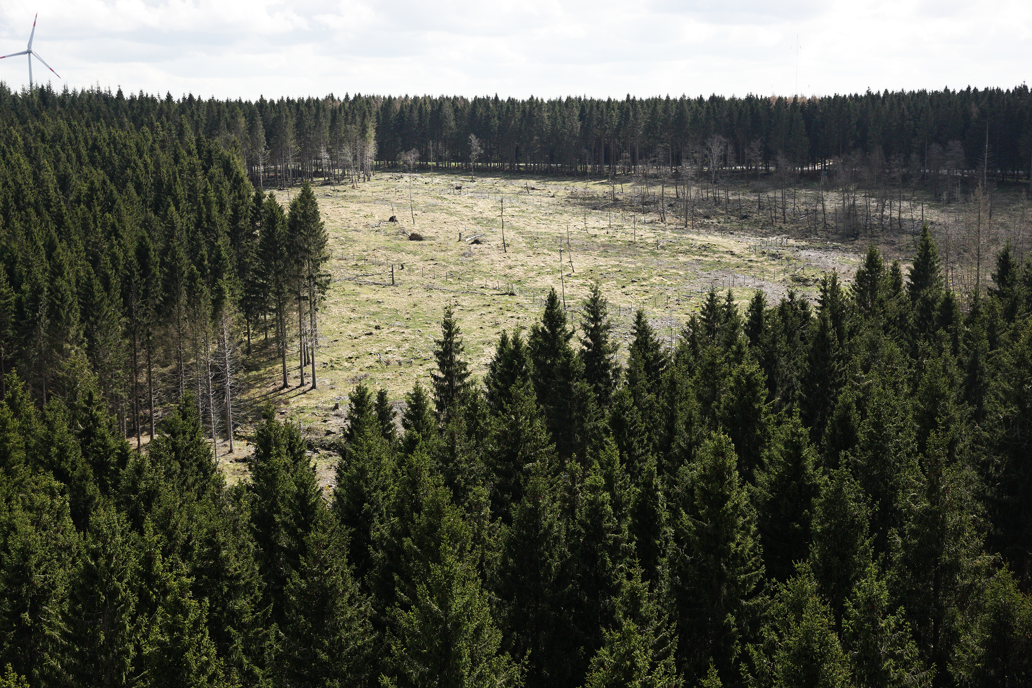
The Wüstebach catchment is located in the Eifel National Park and covers an area of 38.5 ha, with mean altitude of about 610 m. The geology is dominated by Devonian shale, which is covered by a periglacial solifluction layer of about 1–2 m thickness. Cambisols and Planosols have developed on the hillslopes, whereas Gleysols and Histosols have formed in the valley. The main soil texture is silty clay loam and the litter layer has a thickness between 0.5 and 14 cm. The mean annual precipitation is about 1200 mm. Norway Spruce planted in 1946 is the prevailing vegetation type. During late summer/early autumn of 2013, trees were almost completely removed in an area of 9 ha by the national park forest management in order to promote the natural regeneration of near-natural deciduous forest from spruce monoculture forest.
-

Dong Cao is a small agricultural catchment (47 ha) of northern Vietnam, located at 70 km from Hanoi, in a sloping land environment. The objective is to monitor the impacts of land use changes (from cassava to fodder and tree plantations) and possible climate changes upon hydrological and sedimentary fluxes and budgets. The catchment has an elevation of 125 m to 485 m and slopes range from 15 to 120%. Monitoring devices include an automatic meteorological station, and weirs to monitor discharge, suspended sediment and bedload. More information is available on https://mtropics.obs-mip.fr/ and in the following paper: Valentin, C., et al., 2008. Runoff and sediment losses from 27 upland catchments in Southeast Asia: Impact of rapid land use changes and conservation practices. Agric. Ecosyst. Environ. 128, 225–238. https://doi.org/10.1016/j.agee.2008.06.004
-
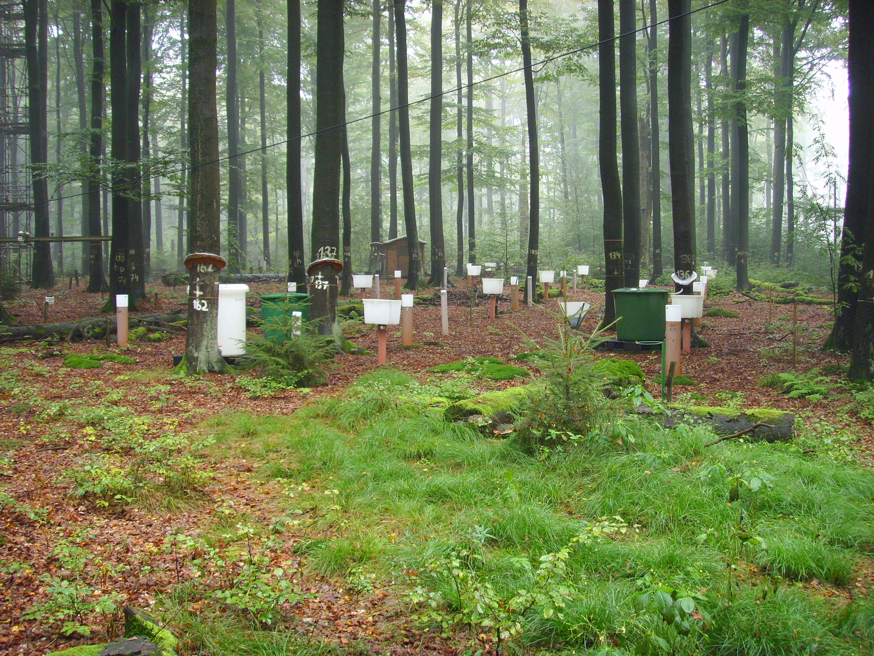
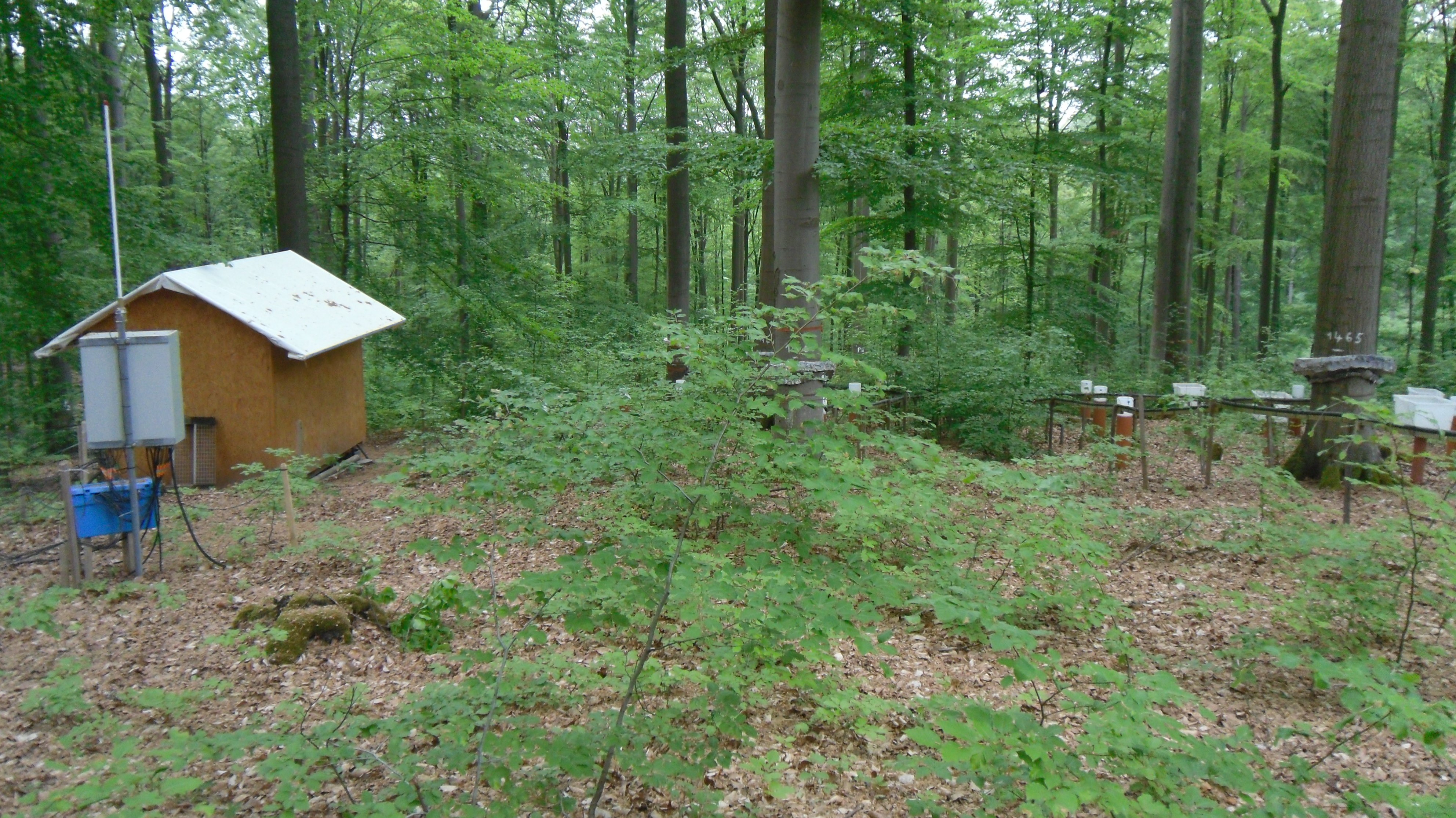
Paired-catchment, long-term nitrogen-addition experiment in a subalpine Picea abies forest
-
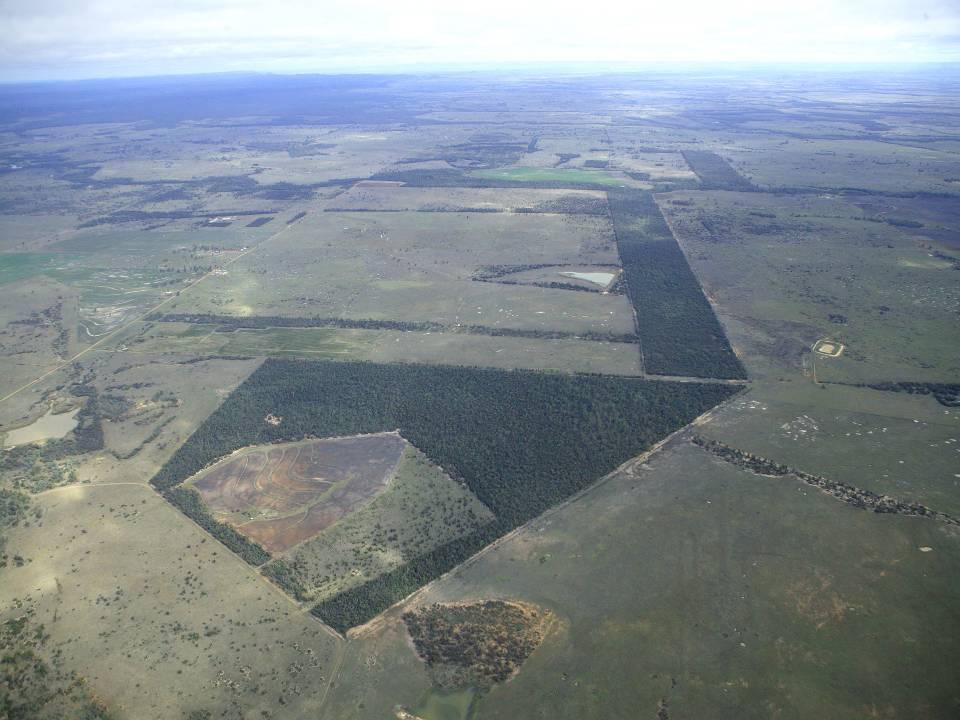
The aim of the Brigalow Catchment Study is to determine the effects of land clearing and land use change on hydrology, water quality, soil fertility and crop and animal productivity in the Brigalow Belt bioregion of central Queensland, Australia
-
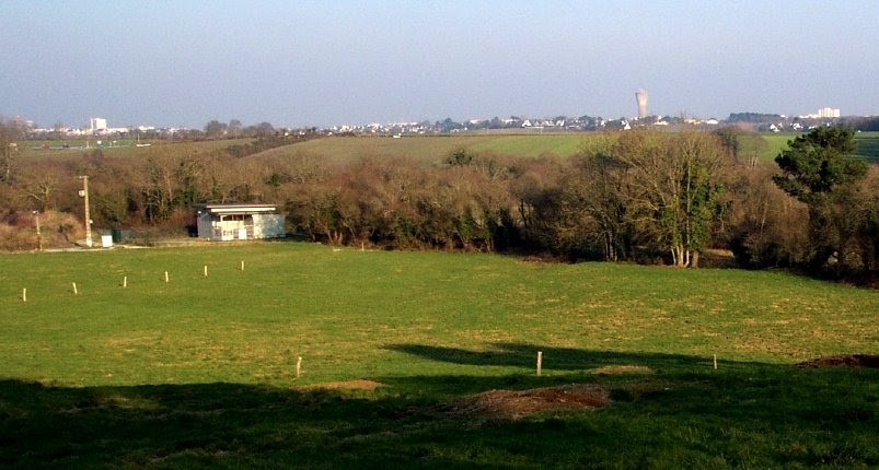
The Ploemeur-Guidel observatory (Britanny, France) is focusing on surface-depth relationships in a fractured crystalline geological context and oceanic climate. It is built on 2 sub-sites, one highly anthropized, the other in natural state. In Ploemeur, groundwater has been pumped since 1991, supplying more than 1 million m3 of clean drinking water annual at a sustainable rate. Such high productivity is explained the specific fractured network in granite and micaschists, draining deep geological layers (~400 m). Extracted water quality is very good, with limited nitrate concentration, in a region that has been strongly affected by widespread pollution. Guidel site is in a similar, but natural context. Deep iron-rich groundwater is upflowing, creating surface and deep groundwater-dependent ecosystems, and feeding a classified coastal wetland. Both sites have a very dense equipment to study rapid to long-term surface-depth exchanges: a flux tower, unsaturated zone monitoring, a network of ~50 shallow (<10m) and deep boreholes (>80m), hydrochemical, temperature and deformation. An well-characterized fractured experimental site offers the possibility to conduct experiments to test innovative instruments and develop new methodologies
-
Solling Experimental Forest
-
Krofdorf Forest hydrological research area 4 catchments: A1 (9 ha), A2 (20 ha), B1 (11 ha), B2 (14 ha)
-
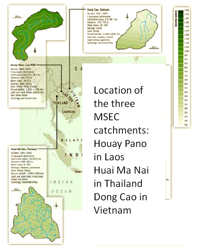
Houay Pano is a small agricultural catchment (60 ha) of northern Lao PDR, 10 km from the UNESCO world heritage city of Luang Phrabang, in a sloping land environment monitored since 1998. The objective is to monitor the impact of land use changes from annual crops (upland rice, Job’s tear and maize, cultivated with slash and burn system) to perennial (teak trees), and of climate changes upon hydrological and sedimentary fluxes and budgets, along with water quality (including microbial contamination). The mean slope is 48%. Alfisol, Ultisol, Entisol developed on shale and shist. Monitoring devices include an automatic meteorological station, weirs to monitor discharge from nested catchments, suspended sediment, and bedload, piezometers, and electrical resistivity. More information is available on https://mtropics.obs-mip.fr/ and in the following papers: Boithias, L., et al., 2021. The Multiscale TROPIcal CatchmentS critical zone observatory M-TROPICS dataset II: land use, hydrology and sediment production monitoring in Houay Pano, northern Lao PDR. Hydrol. Process. 35, e14126. https://doi.org/10.1002/hyp.14126 Ribolzi, O., et al., 2017. From shifting cultivation to teak plantation: effect on overland flow and sediment yield in a montane tropical catchment. Sci. Rep. 7, 3987. https://doi.org/10.1038/s41598-017-04385-2 Valentin, C., et al., 2008. Runoff and sediment losses from 27 upland catchments in Southeast Asia: Impact of rapid land use changes and conservation practices. Agric. Ecosyst. Environ. 128, 225–238. https://doi.org/10.1016/j.agee.2008.06.004 More information is available on https://mtropics.obs-mip.fr/ and in the following papers: Boithias, L., et al., 2021. The Multiscale TROPIcal CatchmentS critical zone observatory M-TROPICS dataset II: land use, hydrology and sediment production monitoring in Houay Pano, northern Lao PDR. Hydrol. Process. 35, e14126. https://doi.org/10.1002/hyp.14126 Ribolzi, O., et al., 2017. From shifting cultivation to teak plantation: effect on overland flow and sediment yield in a montane tropical catchment. Sci. Rep. 7, 3987. https://doi.org/10.1038/s41598-017-04385-2 Valentin, C., et al., 2008. Runoff and sediment losses from 27 upland catchments in Southeast Asia: Impact of rapid land use changes and conservation practices. Agric. Ecosyst. Environ. 128, 225–238. https://doi.org/10.1016/j.agee.2008.06.004