
perched water table thickness
Type of resources
Available actions
Topics
Keywords
Contact for the resource
Provided by
Years
Formats
Representation types
-
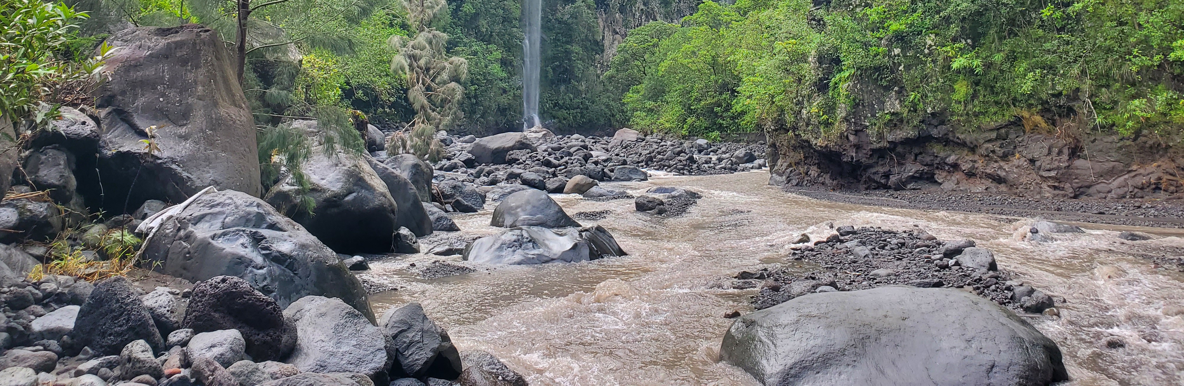
The Bassin de la Rivière des Pluies is located on Réunion Island (French Overseas, Indian Ocean). This volcanic island results from the emission of basaltic products from the Réunion hotspot that initiated 65 Myrs ago with the development of the Deccan traps. Rivière des Pluies drains a watershed of 46 km2 located on the windward side of the dormant Piton des Neiges volcano, from 2276 msl to the sea shore. The Rivière des Pluies catchment is mainly composed of lava flows and breccias aged from 1.4 Ma to 200 ky. The overall watershed is made of a main canyon deeply incised in the volcano flank and a large planeze covered by the deposits of the last explosive eruptions of Piton des Neiges. The combined action of the vegetation and alteration along a strong altimetric gradient produced a wide range of soils typically ranging from 0.5 to 6 meters. Vegetation is dominated by tropical rainforest. The hydrologic regime is torrential: flow rate is characterized by abrupt variations due to tropical rains. Storms and cyclones only occur during the rainy season from december to april.
-

Dong Cao is a small agricultural catchment (47 ha) of northern Vietnam, located at 70 km from Hanoi, in a sloping land environment. The objective is to monitor the impacts of land use changes (from cassava to fodder and tree plantations) and possible climate changes upon hydrological and sedimentary fluxes and budgets. The catchment has an elevation of 125 m to 485 m and slopes range from 15 to 120%. Monitoring devices include an automatic meteorological station, and weirs to monitor discharge, suspended sediment and bedload. More information is available on https://mtropics.obs-mip.fr/ and in the following paper: Valentin, C., et al., 2008. Runoff and sediment losses from 27 upland catchments in Southeast Asia: Impact of rapid land use changes and conservation practices. Agric. Ecosyst. Environ. 128, 225–238. https://doi.org/10.1016/j.agee.2008.06.004
-
The Ploemeur-Guidel observatory (Britanny, France) is focusing on surface-depth relationships in a fractured crystalline geological context and oceanic climate. It is built on 2 sub-sites, one highly anthropized, the other in natural state. In Ploemeur, groundwater has been pumped since 1991, supplying more than 1 million m3 of clean drinking water annual at a sustainable rate. Such high productivity is explained the specific fractured network in granite and micaschists, draining deep geological layers (~400 m). Extracted water quality is very good, with limited nitrate concentration, in a region that has been strongly affected by widespread pollution. Guidel site is in a similar, but natural context. Deep iron-rich groundwater is upflowing, creating surface and deep groundwater-dependent ecosystems, and feeding a classified coastal wetland. Both sites have a very dense equipment to study rapid to long-term surface-depth exchanges: a flux tower, unsaturated zone monitoring, a network of ~50 shallow (<10m) and deep boreholes (>80m), hydrochemical, temperature and deformation. An well-characterized fractured experimental site offers the possibility to conduct experiments to test innovative instruments and develop new methodologies
-
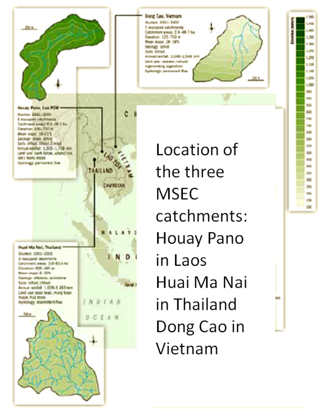
Houay Pano is a small agricultural catchment (60 ha) of northern Lao PDR, 10 km from the UNESCO world heritage city of Luang Phrabang, in a sloping land environment monitored since 1998. The objective is to monitor the impact of land use changes from annual crops (upland rice, Job’s tear and maize, cultivated with slash and burn system) to perennial (teak trees), and of climate changes upon hydrological and sedimentary fluxes and budgets, along with water quality (including microbial contamination). The mean slope is 48%. Alfisol, Ultisol, Entisol developed on shale and shist. Monitoring devices include an automatic meteorological station, weirs to monitor discharge from nested catchments, suspended sediment, and bedload, piezometers, and electrical resistivity. More information is available on https://mtropics.obs-mip.fr/ and in the following papers: Boithias, L., et al., 2021. The Multiscale TROPIcal CatchmentS critical zone observatory M-TROPICS dataset II: land use, hydrology and sediment production monitoring in Houay Pano, northern Lao PDR. Hydrol. Process. 35, e14126. https://doi.org/10.1002/hyp.14126 Ribolzi, O., et al., 2017. From shifting cultivation to teak plantation: effect on overland flow and sediment yield in a montane tropical catchment. Sci. Rep. 7, 3987. https://doi.org/10.1038/s41598-017-04385-2 Valentin, C., et al., 2008. Runoff and sediment losses from 27 upland catchments in Southeast Asia: Impact of rapid land use changes and conservation practices. Agric. Ecosyst. Environ. 128, 225–238. https://doi.org/10.1016/j.agee.2008.06.004 More information is available on https://mtropics.obs-mip.fr/ and in the following papers: Boithias, L., et al., 2021. The Multiscale TROPIcal CatchmentS critical zone observatory M-TROPICS dataset II: land use, hydrology and sediment production monitoring in Houay Pano, northern Lao PDR. Hydrol. Process. 35, e14126. https://doi.org/10.1002/hyp.14126 Ribolzi, O., et al., 2017. From shifting cultivation to teak plantation: effect on overland flow and sediment yield in a montane tropical catchment. Sci. Rep. 7, 3987. https://doi.org/10.1038/s41598-017-04385-2 Valentin, C., et al., 2008. Runoff and sediment losses from 27 upland catchments in Southeast Asia: Impact of rapid land use changes and conservation practices. Agric. Ecosyst. Environ. 128, 225–238. https://doi.org/10.1016/j.agee.2008.06.004
-
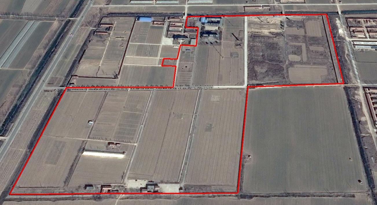
The Yucheng Comprehensive Experiment Station (YCES) of Chinese Academy of Sciences (CAS) is located at the irrigation district of the Yellow River Basin in the Huang-Huai-Hai Plain, also called North China Plain. Physiognomy is characterized as hinterland covered mainly by fluvo-aquic soil (Fluvisol or cambisal) and salinized fluvo-aquic soil in the Yellow River Alluvial Plain. This region is dominated by warm-temperate semi-humid monsoon climate with ample energy and water resources. Historically, natural disasters such as drought, waterlogging, salinization, and wind erosion frequently occurred, resulting in vulnerable ecological environment and low grain production. Integrated improvements and managements were deployed in last several decades, and this region has become suitable for planting winter wheat, corn, cotton, and soybean with high yields in the Huang-Huai-Hai Plain. Research objectives and contents Objectives: regional sustainable agriculture rational utilization of natural resources such as water, land, climate, biomass, etc. Contents: conducting long-term observations and experiments understanding the mechanism of energy transfer and mass cycle in farmlands developing models from point to regional scales improving and developing instruments and measurement methods improving agro-ecosystem managements demonstrating research results and technologies Research achievements: Outstanding research results and massive experiment data have been achieved at the YCES. The achievements cover research fields of farmland evapotranspiration, crop water use, water transfer mechanism, experimental remote sensing techniques, regional agriculture demonstration, and technology transfer. More than 1,000 papers, 15 monograph books, and 5 data sets have been published. A number of awards were granted by national, CAS, and international academic organizations, for example, Agriculture Prize granted by the Third World Academy of Sciences Science and Technology Progress Award by Chinese Academy of Sciences National Top Award of Science and Technology Progress
-
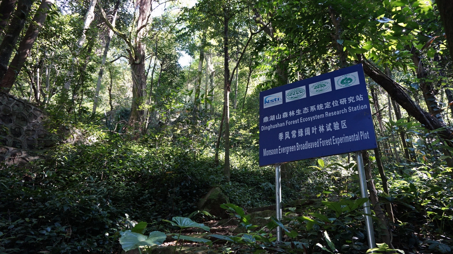
DHS has well protected monsoon evergreen broadleaf forest and its successional forests. Therefore, DHS is an ideal place to research successional processes and patterns of subtropical forest ecosystems, as well as to restore or rehabilitate the degraded forest ecosystems in subtropics of China.