
physical parameter
Type of resources
Available actions
Topics
Keywords
Contact for the resource
Provided by
Years
Formats
Representation types
-
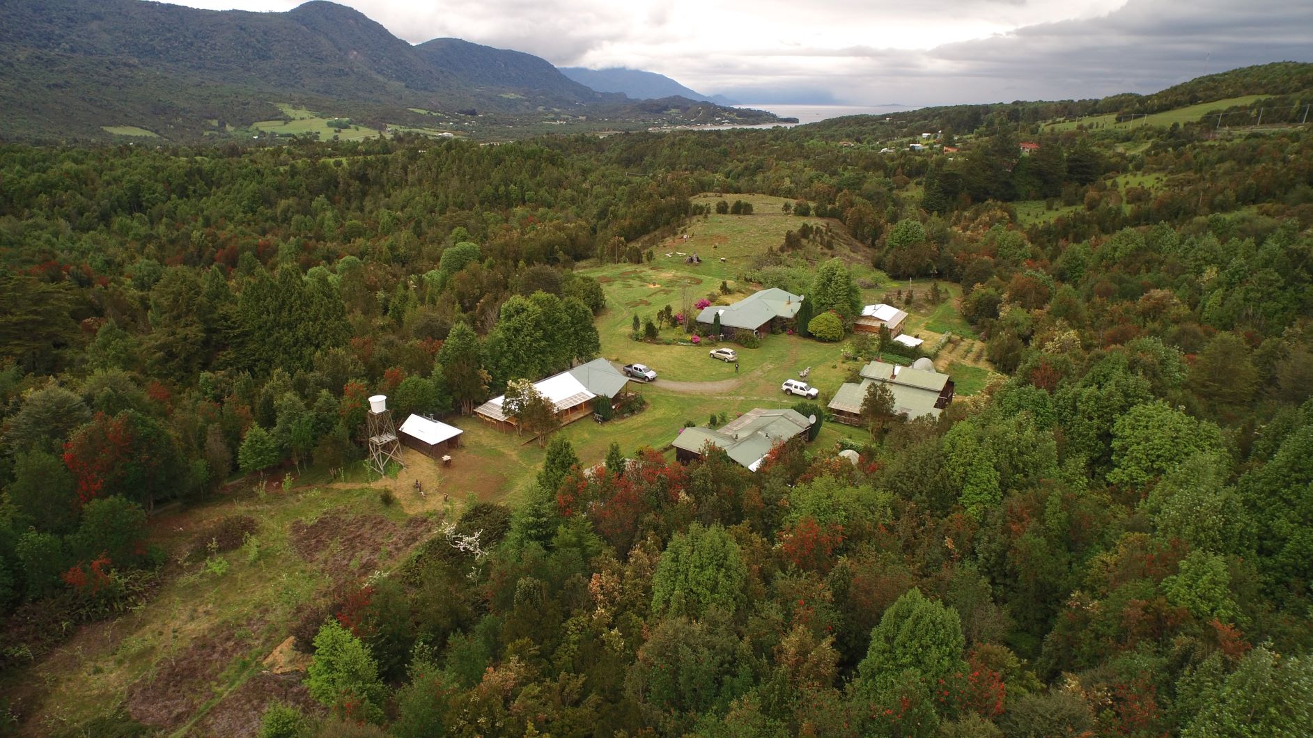
The site is located in Los Lagos Region, Mostly valdivian type forest with North Patagonic influence.
-
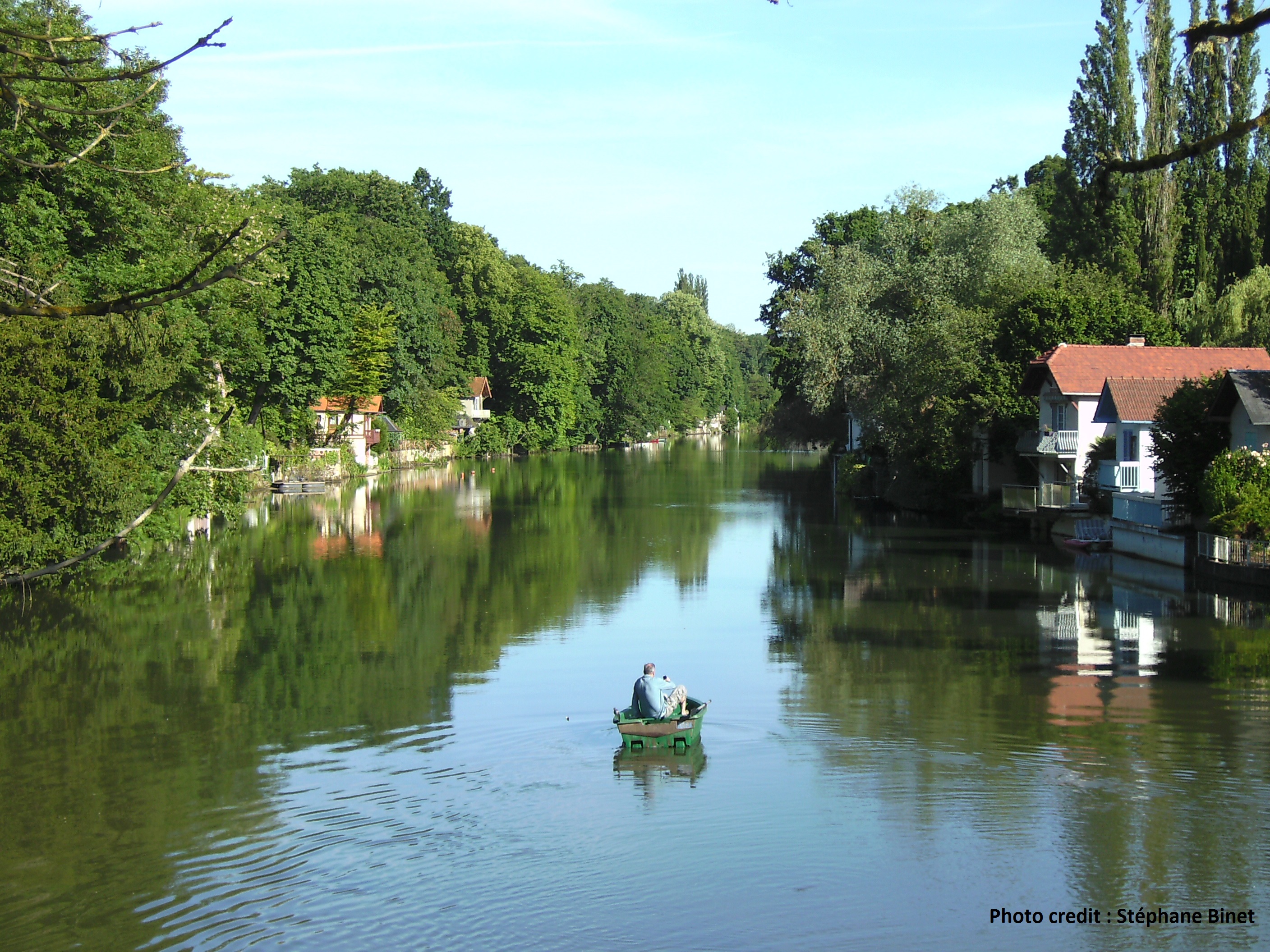
The Val d’Orléans is a vast depression in the Loire River main flow, 37 km long and from 4 to 7 km wide. This is a saturated karst aquifer, hosted within a carbonate lacustrine deposit called the Beauce limestone with a high porosity overlain by the Quaternary alluvia of the Loire River. The Loire River feeds more than 80% of the water hosted in the carbonate karst aquifer (11.5 m3/s during low water periods). Water outflows toward several resurgences of the Loiret River through a saturated karst networks.
-
Livingston Island (62º39’S, 60º21’W) is situated in the South Shetlands, one of the Earth’s regions where warming has been more significant in the last 50 years. Livingston island shows high mountain relief, is 90% covered by glaciers and the bedrock in the research area (Hurd Peninsula) is a low-grade metasedimentary sequence of sandstone, shales and quartzite. About 10% free of ice vegetated terrains.
-
The chosen area is located in the last stretch of the Parana River in Brazil without reservoirs. However, the whole dynamics of this ecosystem is influenced by the operation of a large number of reservoirs located upstream. These reservoirs also contribute to oligotrophization of the floodplain, and promote changes in the hydrological level of the river, reducing the intensity of the flood pulse and, especially, increasing the frequency of smaller pulses. These changes affect also the connectivity between the environments of the floodplain, supporting the concept of Discontinuity Serial in floodplain rivers. The reservoirs also represent propagule sources of non-native species, causing environments located downstream of these reservoirs become more susceptible to invasion. Space large-scale events and time, such as those related to the El Niño - Southern Oscillation also strongly influence the dynamics of ecosystem processes in the floodplain and are not counteracted by existing dams in the basin, unlike the seasonal flood pulses and annual recurrence.
-
The LTSER platform Neusiedler See – Seewinkel represents Europe‘s most western steppe lake - Lake Neusiedl (Austria) - and the cultural landscape that it’s surrounded by. It extends a total area of about 500 km² and is characterized by the steppe lake, it’s reed belt and a mosaic of salt marshes, periodically dry saline lakes, sand habitats, dry and wet grasslands, vineyards, cropland, touristic infrastructure and rural settlements. The region (average altitude 120 m.a.s.l.) is characterised by a hot, dry Pannonian climate with an annual precipitation of 600 mm and temperatures between 40 °C in summer and -20 °C in winter, making this area unique in Austria and contrasts the alpine landscapes of western Austria. Located on the eastern edge of the alps and the western edge of the small hungarian plain the area is one of Austria’s hotspots of biodiversity. Alpine, asian, mediterranean and nordic species are present as well as endemics. The high diversity of habitats results from a high variability of environmental factors as different soil types, flooding and draught but also anthropogenic influence. The LTSER platform includes 8 national institutions: Biologische Station Neusiedler See, Nationalpark Neusiedler See – Seewinkel, ABOL (NHM Wien), Hydrographischer Dienst Burgenland, Medizinische Universität Wien, Universität Wien and Umweltbundesamt. Scientific research is therefore wide but can be summarised on (1) monitoring of freshwater ecosystems, (2) bird migration and breeding behaviour, (3) mapping and assessment of vegetation, (4) monitoring of climate and effects of climate change, (5) monitoring of insects, (6) conservation management and (7) regional development. The aim of the research is to provide decision-making tools for sustainable ecosystem management and conservation as well as sustainable regional development.
-
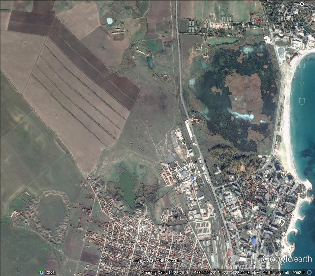
The Sulphidic aquifer of South Dobrogea offers Mars-analogue sites in the form of isolated subsurface habitats characterised by the presence of toxic compounds (H2S, CH4, NH4+) dissolved in suphidic water and an entire ecosystem based on chemosynthesis that has been isolated for over 5.5 million years (since the Messinian Crisis when organisms retreated underground to find shelter and humidity as well as a sustainable source of nutrients provided by the microbial biofilms thriving on the chemicals dissolved). The various physical-chemical features of microniches of this ecosystem (darkness, lack of O2, increased levels of H2S and CH4 – in Movile Cave; strong light, high temperature (up to 40°C in summer) and O2 – in the terrestrial sulphidic springs; dim light, increased concentration of salts, variable temperature – in the case of submarine springs) are mirrored by different structures of the microbial communities providing insights on the origin of such ecosystems and a better understanding of how an isolated subsurface ecosystem evolves and adapts to such conditions. The aquifer has numerous resurgences in the form of terrestrial and underwater (on the bottom of the sea) sulphidic springs.
-
The Sylt Roads time series is closely related to the Helgoland Roads time series and comprises an almost identical parameter set. Sylt Roads was initiated in 1974 and is still ongoing. Its main station located in the Sylt-Romo bight close to List/Sylt (55.030000N; 8.460000E) is generally sampled twice a week. Two other stations (Entrance Koenigshafen 55.038300N; 8.438300E and Ferry Terminal 55.015530N; 8.439900E) are sporadically sampled depending on tide and weather conditions. The measured parameters comprise phytoplankton, zooplankton, water temperature, salinity, pH, chlorophylla and nutrient (N,P, Si) analyses. The plankton time-series is augmented by the biological parameters gelatinous zooplankton, meroplankton, primary productivity, fish monitoring, macroalgae, macro- and microzoobenthos providing a unique opportunity to investigate longterm changes at an ecosystem scale.
-

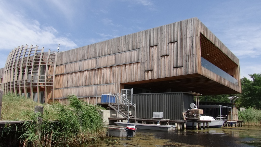
Biologische Station Neusiedler See is situated at Lake Neusiedl in Illmitz (Austria) and is a service department of the office of the provincial government of Burgenland. The institution offers high scale experience in basic and applied ecological research in Burgenland over the last 50 years. Located in the middle of the Neusiedler See – Seewinkel national park the Biological station hosts a high standard chemical and microbiological laboratory for water analysis, which has an accreditation for a variety of physico-chemical, chemical and microbiological parameters as well as diverse sampling procedures. The Institution provides expert opinions for water quality as well as applied cross-sectoral research and ecosystem monitoring. The Biological Station is a well-known cooperation partner of local, regional, national and international institutions, stakeholders, Universities and state offices of Burgenland. With several different subsites and partners (ABOL (NHM Wien), Hydrographischer Dienst Burgenland, Medizinische Universität Wien, Universität Wien, Umweltbundesamt), the Biological Station is able to provide long-term data regarding meteorology, limnology, lake chemistry, entomology, botany, air quality and carbon-fluxes. Thus, the Biological Station provides bases for decision making with regard to the development of a balanced cultural landscape.
-
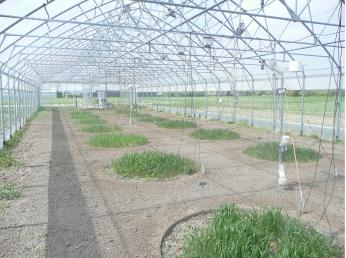
The AGES-Lysimeter station was built in autumn 1995 to study the long-term effects of agricultural practices on soil, water budget and water quality. Besides the monitoring of soil water quality, its design enables the continuous monitoring of water-budget parameters to evaluate the reliability of simulation models based on data derived from different soil types. The lysimeter station consists of 18 lysimeters with three different soil types in six replicates each, representing the main soil types of the Marchfeld production area. According to WRB, the soils can be classified as: • Calcic Chernozem (loamy silt, 1.57% Corg) • Calcaric Phaeozem (loamy sand, 0.75% Corg) • Gleyic Phaeozem (loam, 1.68% Corg) The area of the Lysimeter Station is located in a transition zone between the western European temperate oceanic climate (mild winters; wet and cool summers) and the eastern European temperate continental climate (cold winters; hot and dry summers). From the phyto-sociological point of view the whole area shows typical continental character.
-
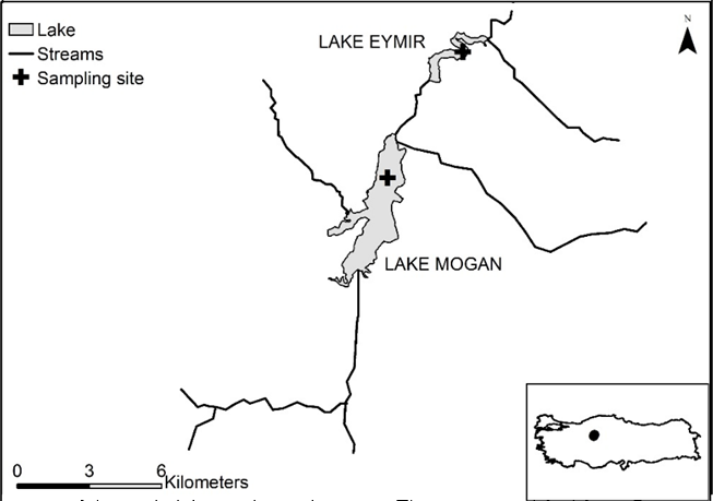
Lake Eymir (area: 1–1.3 km2, average depth: 3.2 m, maximum depth) and Lake Mogan (area: 5.6–8 km2, average depth: 2.4 m, maximum depth: 2.8–5.3 m) are connected alkaline lakes (average alkalinity> 6.5 meq / L for both lakes). Lake Eymir (39◦570 N, 32◦530 E) and Lake Mogan (39◦470 N, 32◦470 E) are at 20 km south of Ankara, Turkey and at an altitude of 970 meters and Lake Eymir located in Middle East Technical University campus since 1956. In 1997, Lake Mogan was abundant in aquatic plants and had low chlorophyll-a (Chl-a) values (8.8 ± 2 µg/L) and average total phosphorus (TP) concentration (63 ± 5 µg/L). Lake Eymir was clean enough to meet the drinking water needs of Middle East Technical University before 1970s. However, between 1970 and 1995, there was a deterioration in water quality in both lakes by the introduction of untreated sewage into the lakes. In 1995, a system was established for the treatment of waste water, and the wastes of a few restaurants around Lake Mogan were controlled and the phosphorus input was reduced by 88% by then. Lake Eymir and Mogan ecological monitoring research programme was continued for 23 years by METU-Limnology Laboratory and Ecosystem Research and Implementation Center (EKOSAM) and it is the first and only long-term and continuous work for freshwater research done in Turkey. Thanks to these studies, effective restoration studies have been carried out to reduce eutrophication in these lakes. Hydrological data, which are very important for lake ecosystems, could be followed in detail by these long-term studies. Moreover, a high frequency automated system was established in Lake Eymir in 2015.