
plant carbon concentration
Type of resources
Available actions
Topics
Keywords
Contact for the resource
Provided by
Years
Formats
Representation types
-
The site is located in the Southern Carpathians (Romania). The predominant ecosystems are grasslands located above tree line, dominated by Carex curvula, Juncus trifidus (alpine zone) and Festuca airoides, Nardus stricta (subalpine zone). The site consists of monitoring points in subalpine and alpine meadows in the Bâlea-Paltinul area.
-
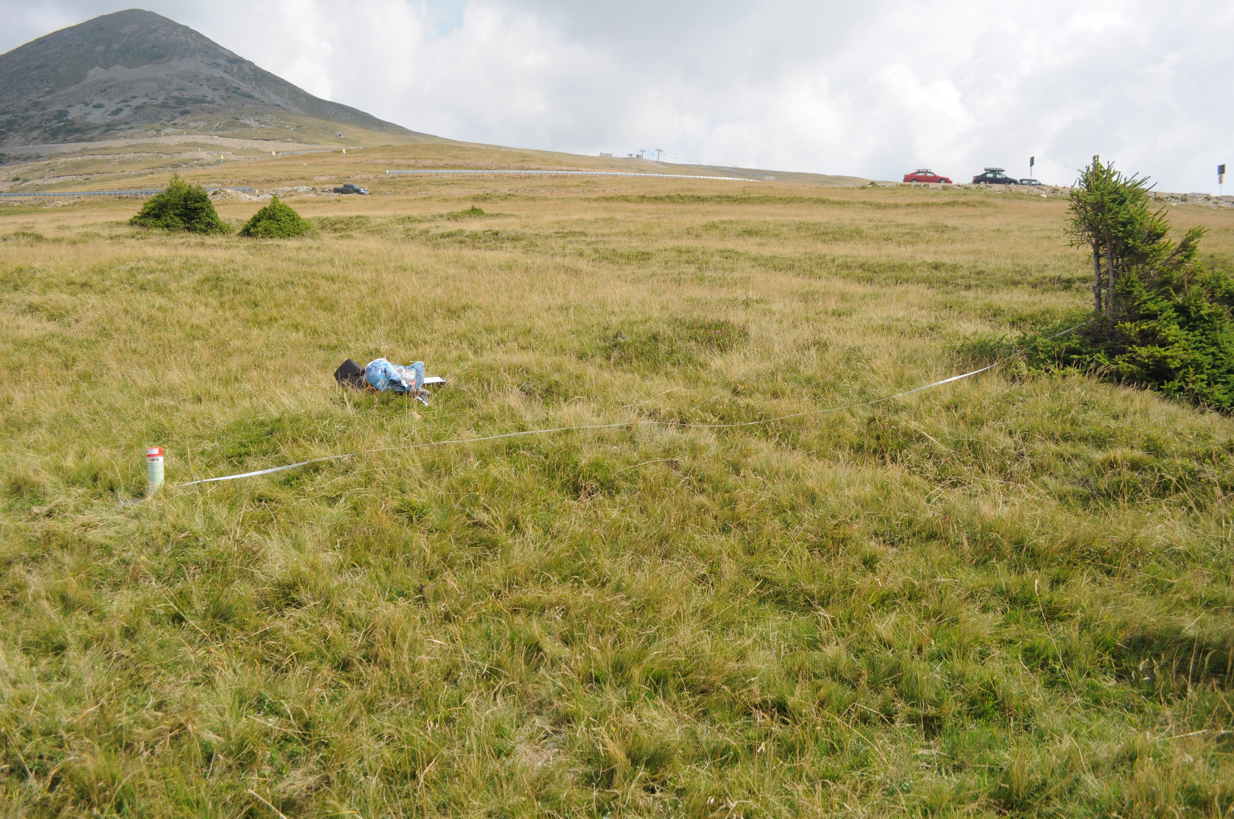
The site is located in the Southern Carpathians (Romania). The predominant ecosystems are grasslands located above tree line, dominated by Carex curvula, Juncus trifidus (alpine zone) and Festuca airoides, Nardus stricta, Festuca nigrescens (subalpine zone). The site consists of monitoring points in subalpine and alpine meadows.
-
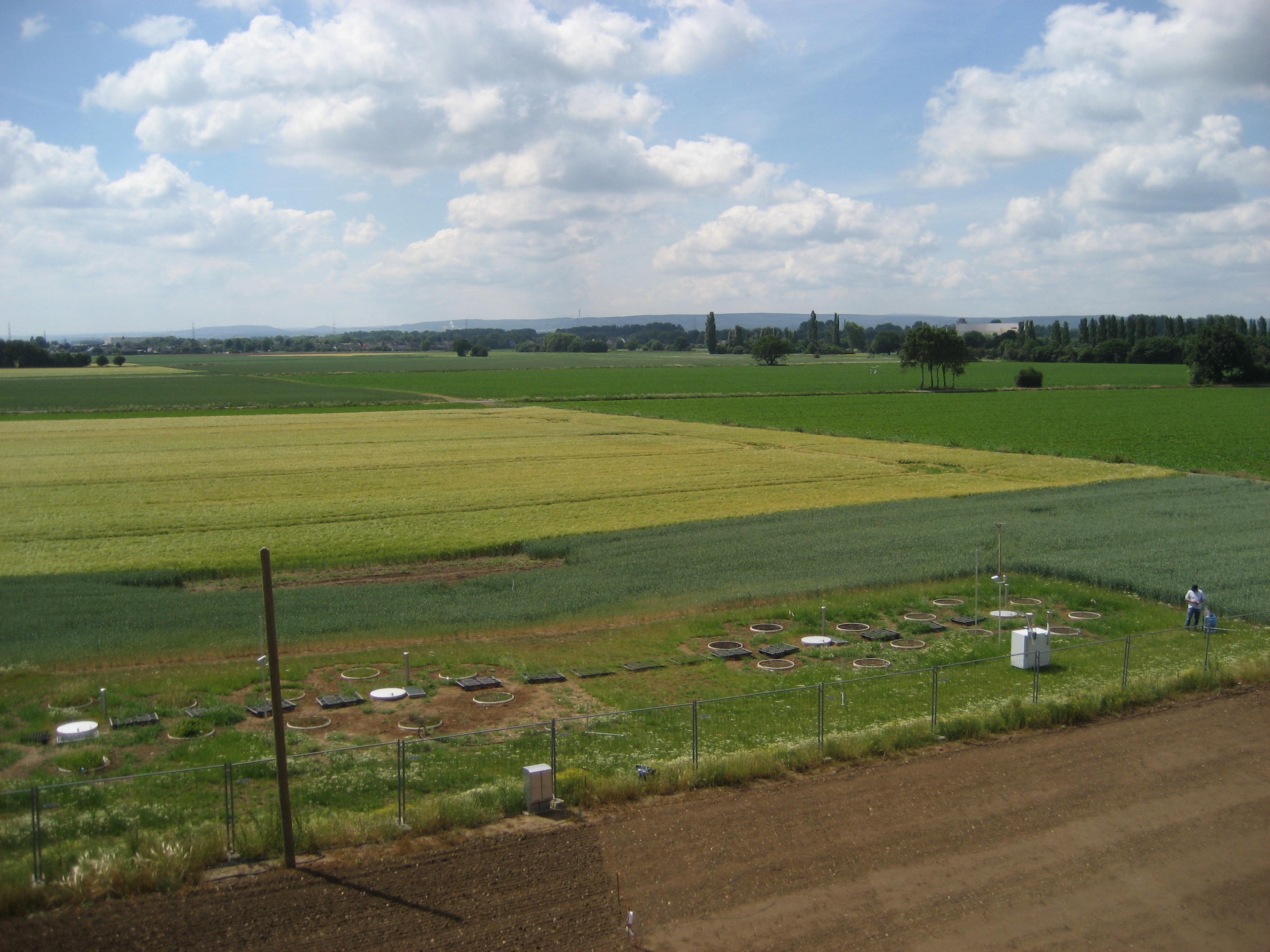
The Selhausen site represents the heterogeneous agricultural rural area of the lower Rhine valley. The climate is temperate maritime with a mean annual temperature of 10°C and annual precipitation of 700 mm for the period from 1961 to 2014 (meteorological tower, Forschungszentrum Jülich). The most important crops in the region of Selhausen are sugar beet (beta vulgaris), winter wheat (triticumavesticum), winter barley (hordeum vulgare), maize (zea mays) and rape seed (brassica napus). Only parts of the region are managed as grasslands. The underlying Quaternary sediments are mostly fluvial deposits covered with loess. Major soil types are luvisols and gleyed cambisols, partly with large contents of gravel. The land surface is generally flat with slopes up to 4° in the area of a former channel of the Rur River system. From 2007 to 2010 a first long-term eddy covariance study was conducted within the Selhausen region (measurements can be found at the European fluxes database cluster, ID: DE-Seh). In spring 2011 a new station (50.865°N, 6.447°E, 203m a.s.l.) was equipped with a CSAT3 sonic anemometer and LI7500 gas analyzer. Besides flux measurements and typical climate parameters (radiation, air temperature, air humidity, soil moisture, soil temperature etc.), also the phenological development of the crops and farming activities were recorded. The station fits now the standards of a Level-1 site for the European project ICOS (Integrated Carbon Observation System). As a pan-European long-term research infrastructure ICOS aims at providing harmonized and high-precision scientific data on carbon cycle and greenhouse gas budget and perturbations.
-
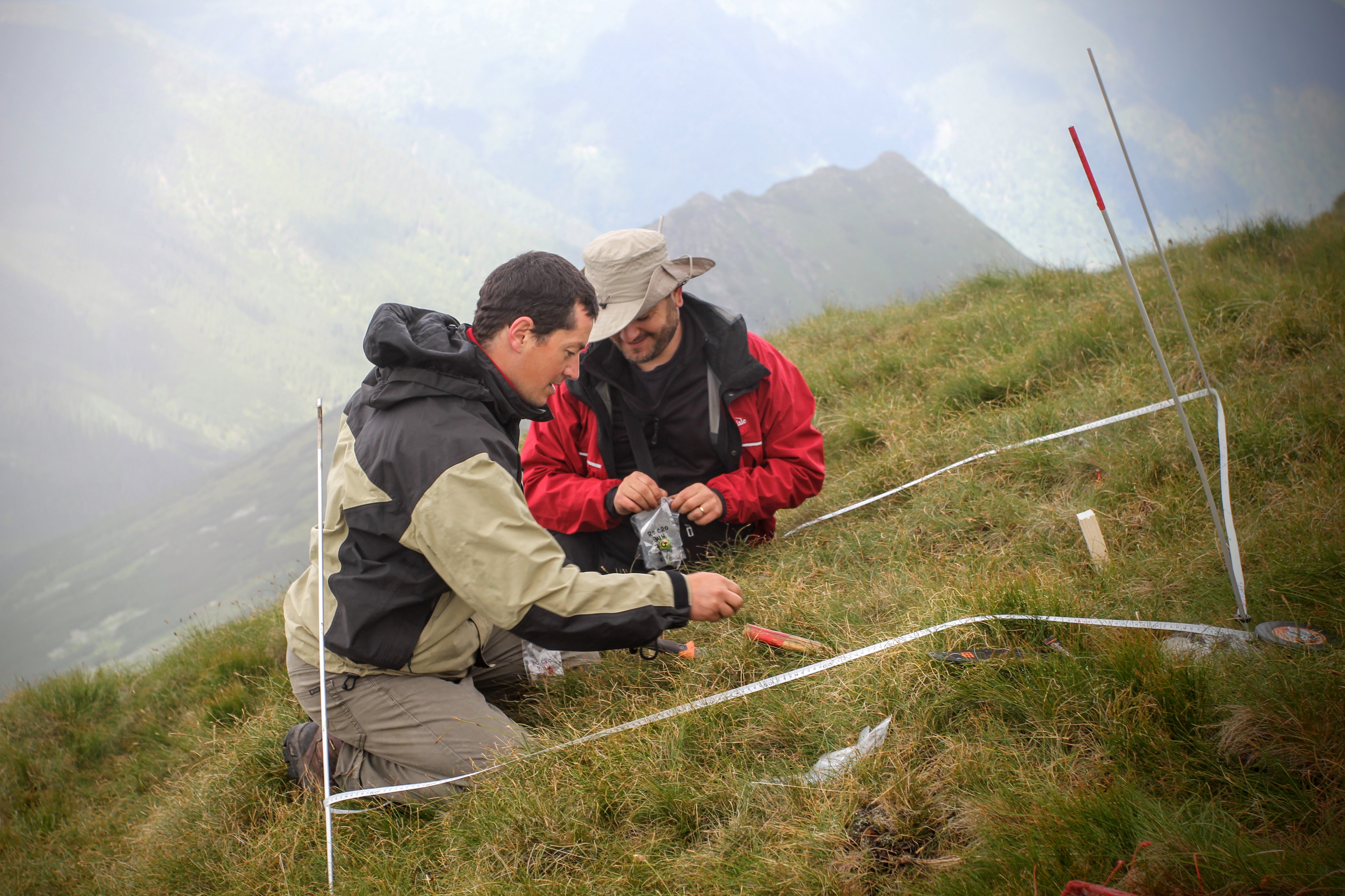
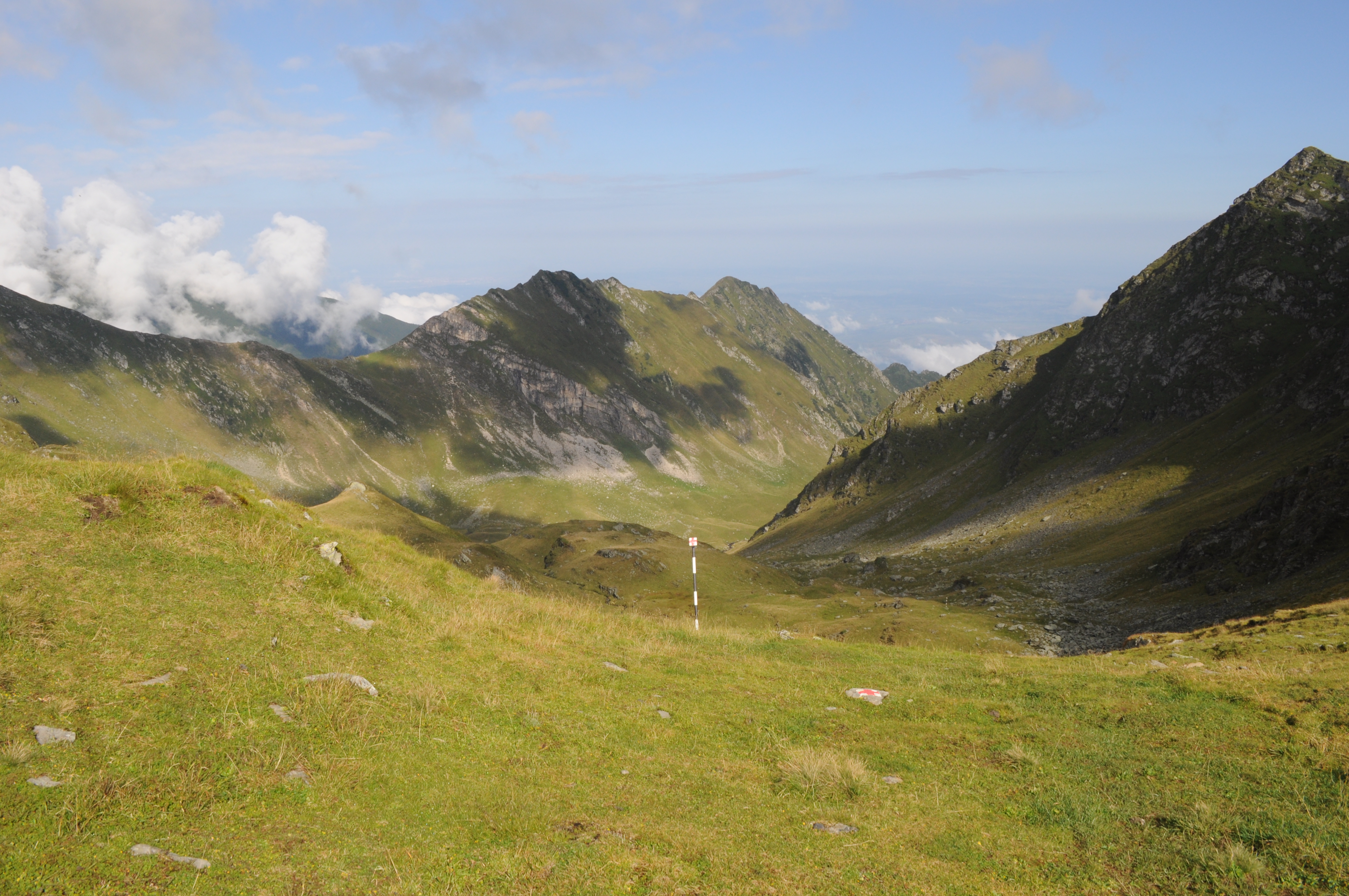
The site is located in the Eastern Carpathians (Romania). The predominant ecosystems are grasslands located above tree line, dominated by Carex curvula, Juncus trifidus (alpine zone) and Nardus stricta, Festuca airoides (subalpine zone). The site consists of monitoring points in subalpine and alpine meadows across the whole range of the Rodna Mountains.
-
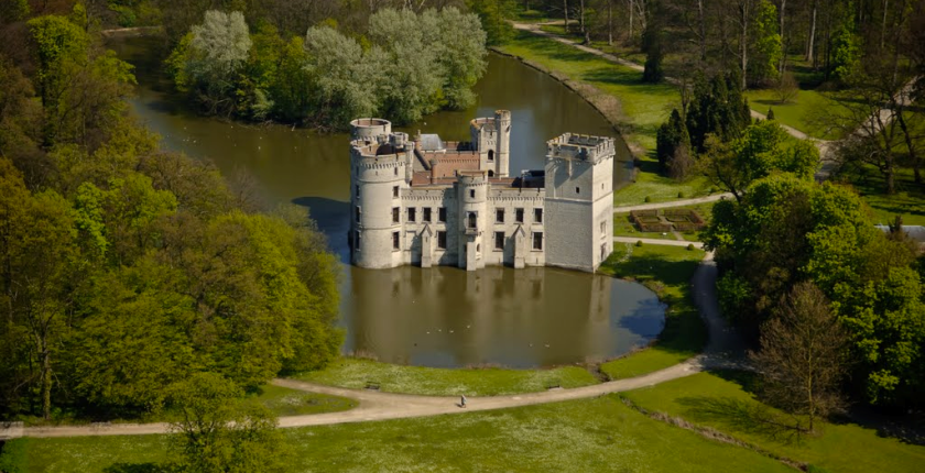
The site of Botanic Garden Meise is a 92 ha domain near Brussels. It has been assembled from parts of two historic castle parks. For more than 75 years it has been home to a collection of plants, as well as a research institute dedicated to botany, forming one of the largest botanic gardens in Europe but also an important tourist attraction close to Brussels. Some habitats get a high degree of disturbance, either due to garden maintenance, or from the large number of visitors. There are also managed and more natural areas. A variety of terrestrial and aquatic habitats occur, among which valuable woody (semi-)natural areas, and also managed meadows. The study of biodiversity in the park has relealed an exceptional species richness in many taxonomic groups. More than 600 wild vascular plant species have been found since 2002, including rare species that were inadvertently introduced during the 19th century, so called wood lawn neophytes . Since 1993 the ectomycorrhizal fungi have been monitored, and there are observations of 52 Red List species in the domain. The park is also the richest Belgian site for Laboulbeniales (Ascomycetes), obligate ectoparasites of Arthropoda. Especially the wet ash-alder forests hold a number of rare and unique taxa and host-parasite combinations, some of them with only a few localities known worldwide. Moreover, the domain is a biodiversity hotspot for lichens and lichenicolous fungi, among other factors as a result of management, such as the regular maintenance of the undergrowth which has a positive effect on light-loving epiphytic lichens, and also due to the diversity of habitats and the large range of different substrates of varying age and of ecological conditions. Another well represented group are diatoms (Bacillariophyta), of which a mere survey in a small pond already yielded two species which have been described as new to science. The site is also rich in fauna, for example rare bat species that overwinter in our historical underground ice cellars. The diverse range of cultivated species also attracts an enormous range of arthropods and plant pathogens, which we know exceeds what we know of it.
-
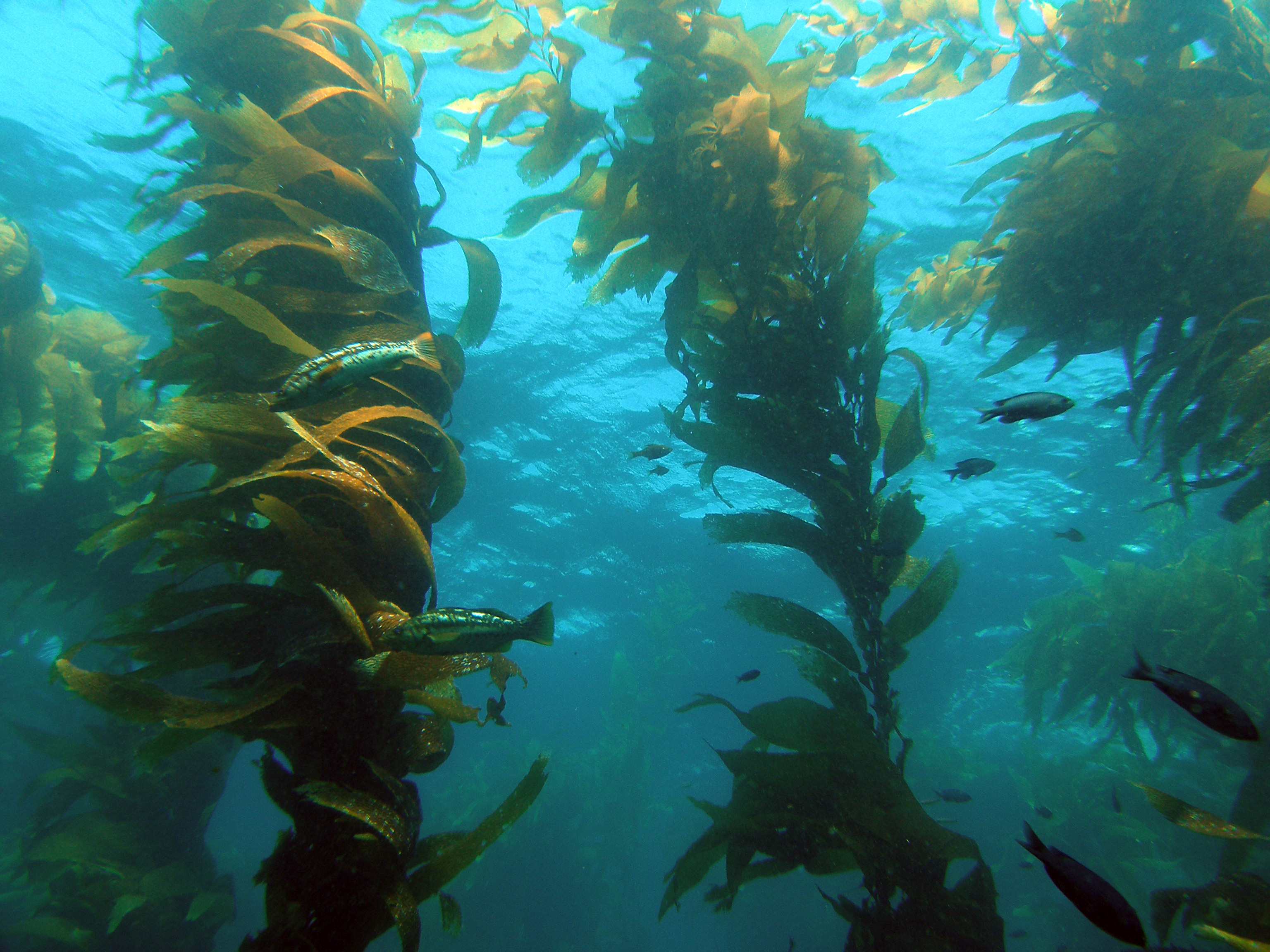
The Santa Barbara Coastal Long Term Ecological Research (SBC LTER) site is an interdisciplinary program established in 2000 to understand the ecology of coastal kelp forest ecosystems. Our research is focused on the nearshore waters of southern California, where ocean currents and climate are highly variable with season and longer-term cycles, including the El Niño-Southern Oscillation and the Pacific Decadal Oscillation. SBC’s principal study domain is a 10,000 square kilometer area of the northern portion of the Southern California Bight that includes the Santa Barbara Channel and the steep coastal watersheds, small estuaries and sandy beaches that border the Channel.
-
The Kellogg Biological Station (KBS) is located in southwest Michigan in the eastern portion of the U.S. cornbelt, 50 km east of Lake Michigan in the SW corner of the state (42° 24′ N, 85° 24′ W, elevation 288 m). Annual rainfall at KBS averages 1,005 mm/y with about half falling as snow; potential evapotranspiration (PET) exceeds precipitation for about 4 months of the year. Mean annual temperature is 10.1 °C. KBS is 1600 ha of cropping systems, successional communities, and small lakes. Surrounding KBS is a diverse, rural-to-semirural landscape typical of the U.S. Great Lakes and upper Midwest regions. The diversity of land use, soil and vegetation types, and aquatic habitats within a 50-km radius of the Station is high. Most of southwest Michigan is on the pitted outwash plain of the morainic system left by the last retreat of the Wisconsin glaciation, circa 12,000 years ago. Soils in the area developed on glacial till, and include well- and poorly-drained alfisols, mollisols, and entisols. Most regional soils are sandy loam and silty clay loam of moderate fertility, principal Station soils are Typic Hapludalfs. Land use around KBS ranges from urban (Kalamazoo, with a metropolitan population of 180,000, is 20 km south of the Station) to rural; vegetation ranges from cultivated and early successional old fields to older growth oak-hickory and beech-maple forests; and aquatic habitats include more than 200 bodies of water of different morphometries, alkalinities, and degrees of eutrophication within 50 km. Cropping systems in the area are typical of the U.S. cornbelt — mainly corn/soybean rotations with wheat of varying importance, and alfalfa an important forage crop. KBS yields are typical of non-irrigated yields elsewhere in the North Central Region. KBS LTER research is carried out in a variety of experimental systems. The most important of these is the Main Cropping System Experiment (MCSE), which was started in 1989 and consists of 11 different cropping systems or successional plant communities, ranging from annual corn-soybean-wheat rotations to late-successional deciduous forest. All communities are replicated within the landscape.
-
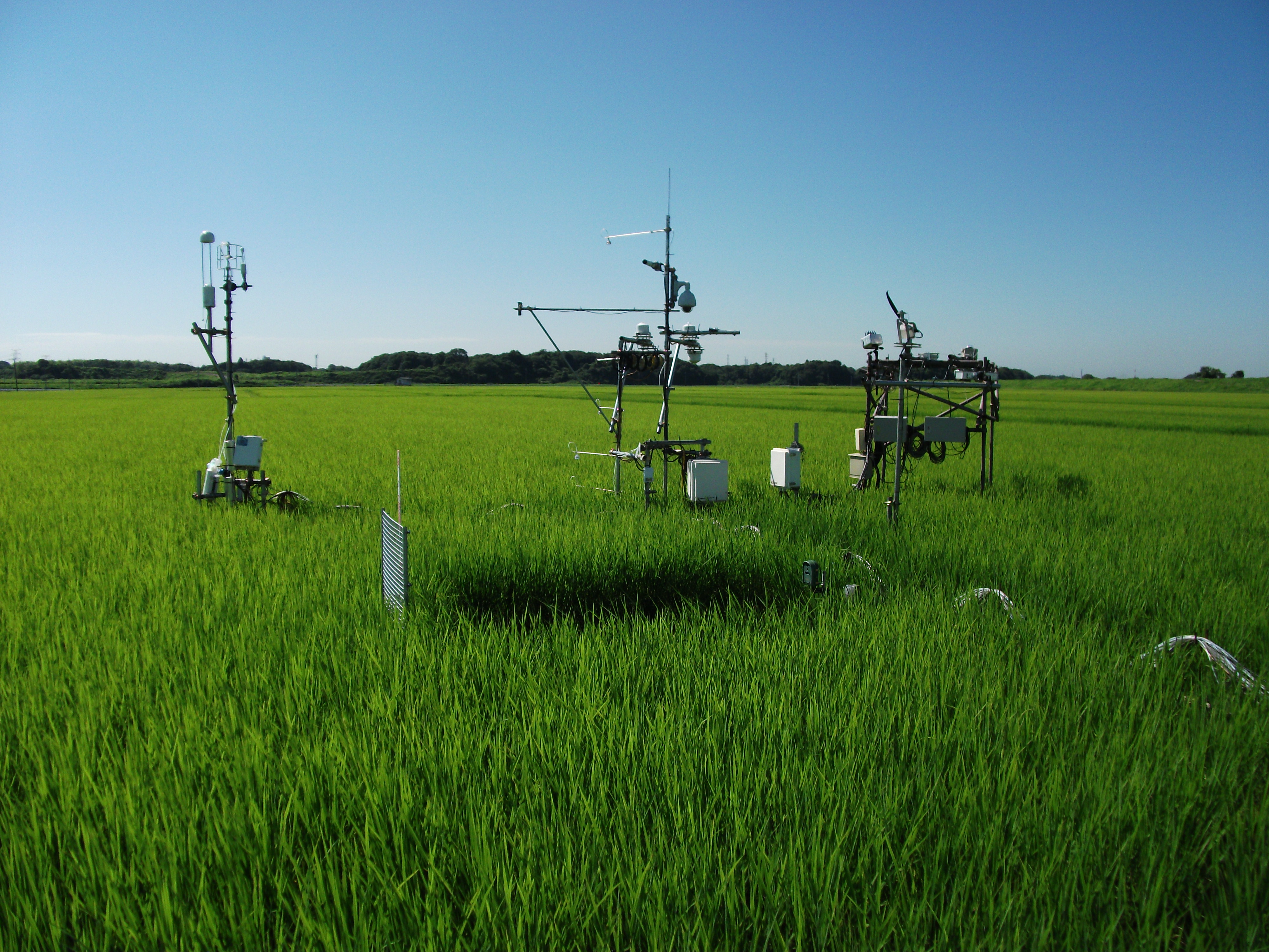
The Mase rice paddy site is a flux station in the AsiaFlux micrometeorological tower network. Located in a regularly cultivated rice paddy area of the Kanto plain in Japan, the site was established in 1999. The initial motivation was to quantify the energy and carbon balance in the rice paddy (ca, 54 a) where the tower was situated. Because of the accessibility and line-power availability, the site has involved many researchers and students from universities and institutes, broadening its target to studies on satellite and field remote sensing, ecosystem modelling, and nutrient cycling.
-
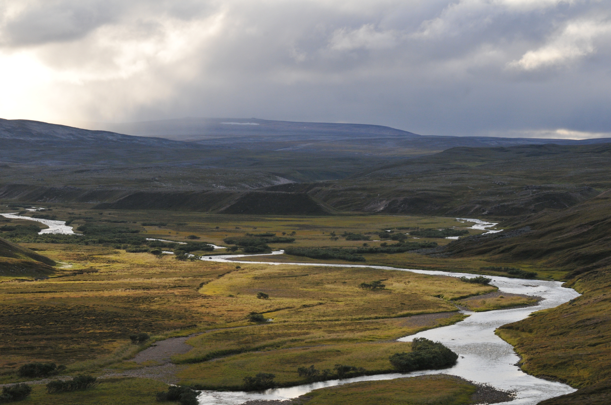
COAT Varanger is a subsite under the COAT platform located mainly on the Varanger penninsula in the low arctic. Long-term monitoring and research on tundra ecosystems are conducted on this site.
-
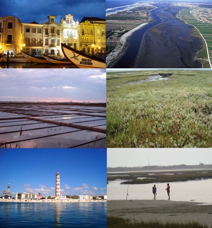
The Ria de Aveiro is a coastal lagoon located in the northwest coast of Portugal, in the western Atlantic Ocean (40º38’N, 08º 45’W). It is a complex social-ecological system that lays between the marine and terrestrial domains. In terms of climatology, this region is under the influence of a temperate maritime climate with a warm period between July and September, and a cold period between December and February. The annual range of the monthly average temperature is around 10ºC. Rainfall occurs mainly between October and May, with higher precipitations in December and January. From the geological point of view, the Ria de Aveiro is a recent feature formed through the accumulation of marine and riverine sediments during the last 1000 years in a wide and shallow bay. These mechanisms have not yet attained equilibrium and the present tendency is to silt up. Much of the present-day geomorphology of the Ria has been determined by human intervention directed to counterbalance this silt-up tendency. The connection between the Ria de Aveiro coastal lagoon and the Atlantic Ocean (through a single inlet of 1.3 km long and 350 m wide) enables the water exchange and the formation of a shallow lagoon. The lagoon is approximately 45 km long, 10 km wide and covers an area of approximately 83 km2 and 66 km2 of wetland at high and low water, respectively. It consists of four main channels with several branches forming island and inner basins. The Ria de Aveiro also integrates the Vouga River estuary and the freshwater wetland Pateira de Fermentelos. The combination of the freshwater discharge and the tidal penetration creates a longitudinal salinity gradient from about 0 in the river to about 36 at the ocean entrance. The landscape of the Ria de Aveiro is shaped into a vary of beaches, dunes, sand flats, mud flats, salt marshes, seagrasses, and small water channels creating farmlands and smallholdings named “Bocage”, which is associated to a rich biodiversity. From these habitats, the salt marshes of the Ria de Aveiro are remarkable due to its large extension and continuity, being one of the largest areas of salt marshes in Portugal and in Europe, housing a rich wintering population of waders. “Bocage” is also relevant due to the rushes (Juncus maritimus) or reeds (Phragmites australis) tidal marshes, rice fields, livestock and woodlands composed by tree species such as Eucalyptus globulus and Pinus pinaster. The Ria de Aveiro is inhabited by waders birds (the flamingo Phoenicopterus roseus, the purple heron Ardea purpurea), birds of prey (the marsh harrier Circus aeruginosus, the black kite Milvus migrans), reptiles (the Iberian emerald lizard Lacerta schreiberi), amphibians (the Iberian painted frog Discoglossus galganoi and the European tree frog Hyla arborea), fishes (lampreys such as the Petromyzon marinus, shad Alosa alosa and eels Anguilla anguilla), and mammals (the otter Lutra lutra, the least weasel Mustela nivalis). The variety of habitats of this area and associated biodiversity, provides of good and services to the population including the regulating, cultural and provisioning ecosystem services. The natural capital of this coastal lagoon is recognized internationally, namely by its classification as Natura 2000 area, Special Protection Area (SPA), Site of Community Importance (SIC) and Ramsar site under the European Habitats and Bird Directives. The major urban settlement in the lagoon watershed area is Aveiro city (60,000 inhabitants approximately). The Ria de Aveiro has enabled the development of economic activities such as commercial fisheries, bait digging, aquaculture, salt pans, a prosperous harbour, maritime traffic, manufacturing, tourism, recreation, sports and agriculture. As a consequence, this area is subject to anthropogenic pressures that impact the coastal lagoon and the adjacent freshwater areas of the Vouga River. The identification of these impacts is a continuous collaborative work between the research institutions and stakeholders who depend on different aspects of the environment, including city dwellers and local organisms. For example, they are local fishermen, divers, surfers, and also members of the jurisdictions regulated by different economic and political systems, such as representatives of the town hall, owners of tourism companies and institutes for conservation of the nature. To counteract the current pressures of the human activities management options have been co-developed, for at least one decade, to implement ecosystem-based management in frame of environmental policies, considering the complexity of the Ria de Aveiro and its connectivity across marine, transitional, freshwater, and terrestrial domains.