
plant density
Type of resources
Available actions
Topics
Keywords
Contact for the resource
Provided by
Years
Formats
Representation types
-
The introduction of non-indigenous species (NIS), also known as alien species, is a pressing issue throughout the world nowadays, mostly linked to globalization. Transitional environments are particularly exposed to this threat due to the importation of seafood for either aquaculture or sale. According to the most recent observations, the Mar Piccolo of Taranto hosts 36 NIS positively identified, divided in 13 invertebrates, 15 macroalgae, and 8 planktonic species. This basin ranks third among the Mediterranean hot spots for seaweed introduction, after the Thau Lagoon (southern France) and the Venice Lagoon. Continuous monitoring activities are carried out to early identify new introductions and follow the fate of those already introduced.
-
Within the approximately 26 hectare gardens many plant and tree species are cultivated, including 450 species native to Japan growing in the open air and 11 types of Japanese forest.
-
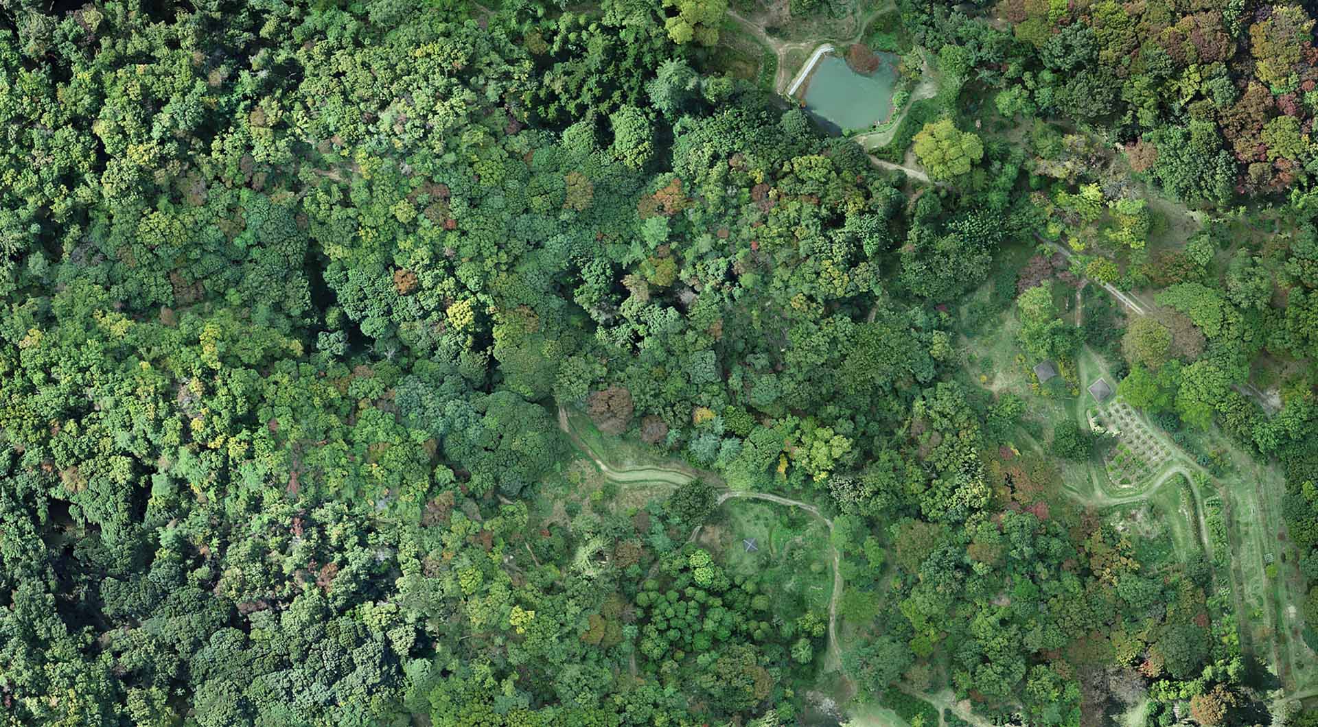
Studies on ecological successions have a long tradition and strongly contributed to the understanding of community assembly, niche theory and ecosystem structure and functionality. Reports on ecological successions are however mostly restricted to one or two taxonomical groups, neglecting the mutual influences and dependencies between multiple taxonomic groups that are the building blocks of multidiverse communities. We introduce the Alpine research platform Ödenwinkel to promote observational and experimental research on the emergence of multidiversity and ecosystem complexity. We established n = 140 permanent plots along the successional gradient of the forefield of the Ödenwinkelkees glacier at the end of Stubachvalley in the Hohe Tauern range (National Park Hohe Tauern, Land Salzburg, Austria). In summer 2019 we completed a first full inventory of biotic and abiotic characteristics of these plots covering the diversity and composition of vascular plants, bryophytes, arthropods and other animals, bacteria and fungi as well as some geomorphologic properties. In this paper we introduce the design of the research platform and show first results on the diversity and composition of vascular plants along the successional gradient. The Ödenwinkel platform will be available as long-term ecological research site where researchers from various disciplines can contribute to accumulate knowledge on ecological successions and on how interactions between various taxonomical groups structure ecological complexity in this alpine environment.
-
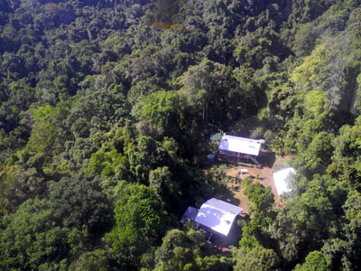
The site comprises 10,000 ha of pristine lowland rainforest in northern Papua New Guinea, owned by indigenous landowners from Wanang Village and declared as Conservation Area. The forest has >500 species of woody plants and largely intact, mildly hunted vertebrate communities. The site includes a field research station (phone, radio, accommodation, catering, solar power) accessible on foot or by helicopter. Further, the site has 50-ha forest dynamics plot from the Center for Tropical Forest Science network, with >300,000 stems tagged and monitored from 2012. There is significant background information on plants, birds, frogs, and several insect taxa. Insect monitoring programme is planned from 2013.
-
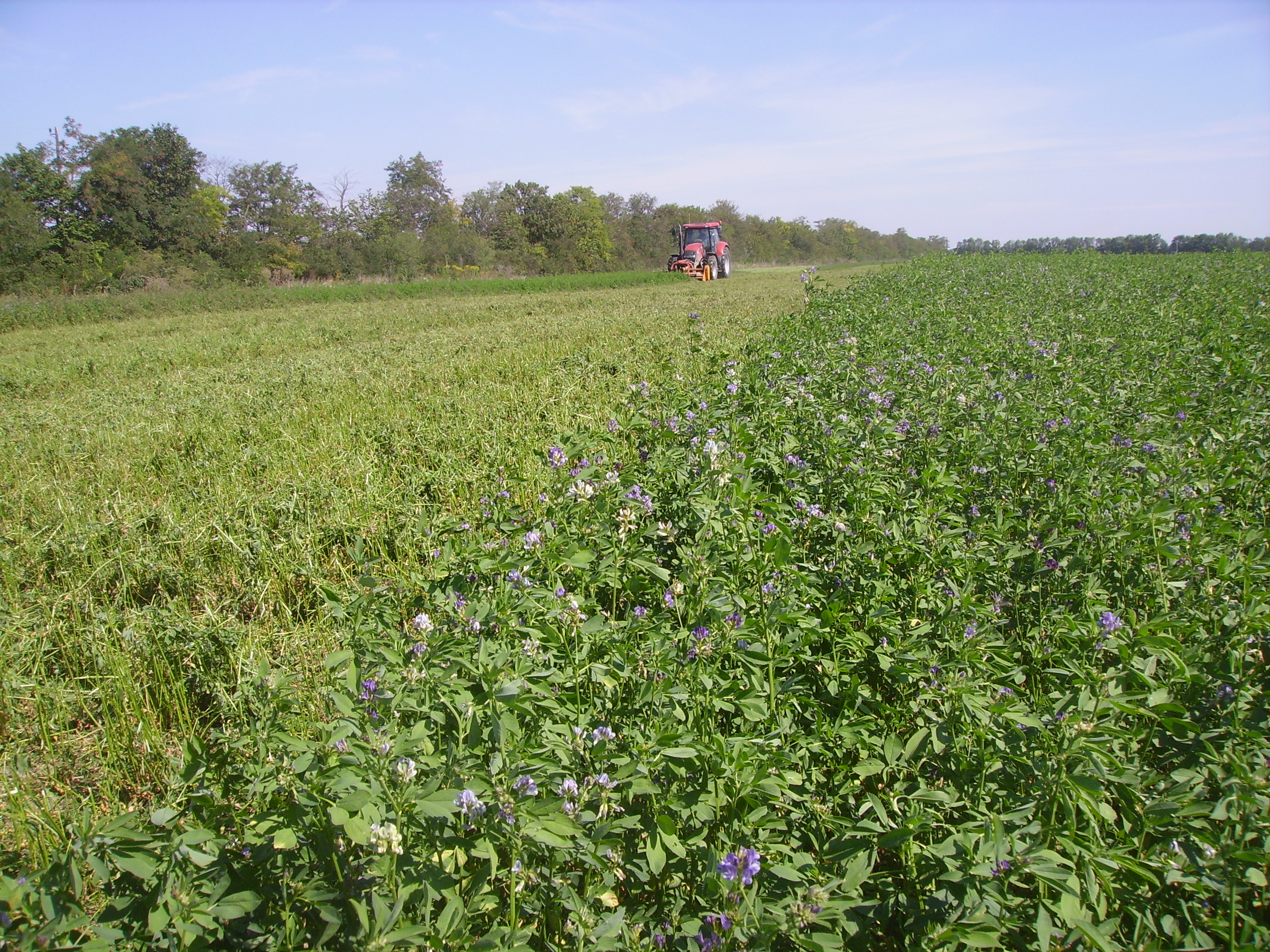
The Rutzendorf Experimental Station is an agricultural research site of the University of Natural Resources and Live Sciences Vienna (BOKU), belonging to the Landwirtschaftliche Versuchswirtschaften GmbH. It is representative for the productive soils managed as arable land in the Marchfeld area (Lower Austria). The soil is described as a silty loamy Calcaric Phaeozem (WRB), a Chernozem according to Austrian soil classification. Management on the farm is without livestock, no organic fertilizers are applied. The farm was converted to organic farming in the production year 2002/03. The 8-year crop rotation comprises luzerne (2 yrs), winter wheat*, grain maize, spring barley*, field peas*, winter wheat, winter rye. Cover crop mixtures are grown where indicated in the crop rotation with an asteric. Current research questions include to study (i) the long-term sustainability and productivity of the stockless organic arable system compared to a livestock-keeping system, (ii) the mitigation of climate change effects on the soil-plant system by reducing soil cultivation intensity, and (iii) the development of biodiversity following the conversion to organic farming and enhancement of landscape elements. Regularly meteorological data, crop yields and quality, physical, chemical and biological soil traits, weed species and diaspores, springtails, wild bees and other animal species are assessed. Studies have been conducted as research projects financed nationally and by the European Union, e.g. in two EIP projects.
-
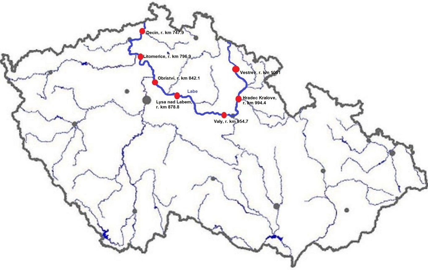
The Elbe River is one of the major rivers in Central Europe. It springs at an altitude of about 1,400 meters in the Giant Mountains in the north of the Czech Republic. It flows through eastern, middle, and northern Bohemia, and its catchment area includes most of Bohemia. The Elbe traverses the northeastern part of Germany and flows into the North Sea. The total river length is 1,094 km. In the Czech Republic, the monitored river length is 371 km and the catchment area includes 49,933 km2. The average flow at the Czech-German borders is 311 m3 s-1. Many weirs dam the watercourse of Elbe River in the Czech Republic. This artificial intervention is crucial for the characteristics of the riverbed, its width, depth, and bottom substrate. The width of the riverbed in the monitored area ranges from approx. 10 m on the upper course to approx. 150 m on the lower course and river sections above the weirs. The depth of the river varies from 0.5 m in the upper parts and below the weirs to more than 5 m in the lower course and above the weirs. The bottom substrate varies from the stony, gravelly, and sandy fractions in shallow and fast-running sections to muddy/silty fractions in slow-running sections above the weirs. The main tributaries of the Elbe in Bohemia are Metuje, Orlice, Jizera, Ploučnice, Vltava, Ohře and Bílina rivers. The catchment area is densely populated. The river is exposed to various sources of pollution (organic, agricultural, and industrial) and hydromorphological pressures (straightening, shortening, regulation of meanders, and fragmentation of river continuity). There are seven permanent monitoring sites on the Elbe River in the Czech Republic: Děčín (river kilometer 747.9), Litoměřice (796.9), Obříství (842.1), Lysá nad Labem (878.8), Valy (954.7), Hradec Králové (994.4) and Vestřev (1051). The Elbe basin long term environmental research has been organised by the Ministry of Environment of the Czech Republic and cooperation institutions since 1993. More than 600 physicochemical parameters, including sensory properties of water, are regularly monitored in at least nine different types of matrices (water, sediment, periphyton, floats, sedimentable floats, benthos, fish tissues, fish fry, and Dreissena polymorpha tissue) and using passive samplers. Among the main monitored characteristics belong balances of macroelements (carbon, nitrogen, oxygen, phosphorus), concentrations of inorganic salts, heavy metals and various organic pollutants such as pesticides, personal care products (including drugs) and other anthropogenic substances in the environment. Characteristics such as abundance and species composition are regularly monitored in fish, macrophytes, macrozoobenthos, phytobenthos and plankton.
-
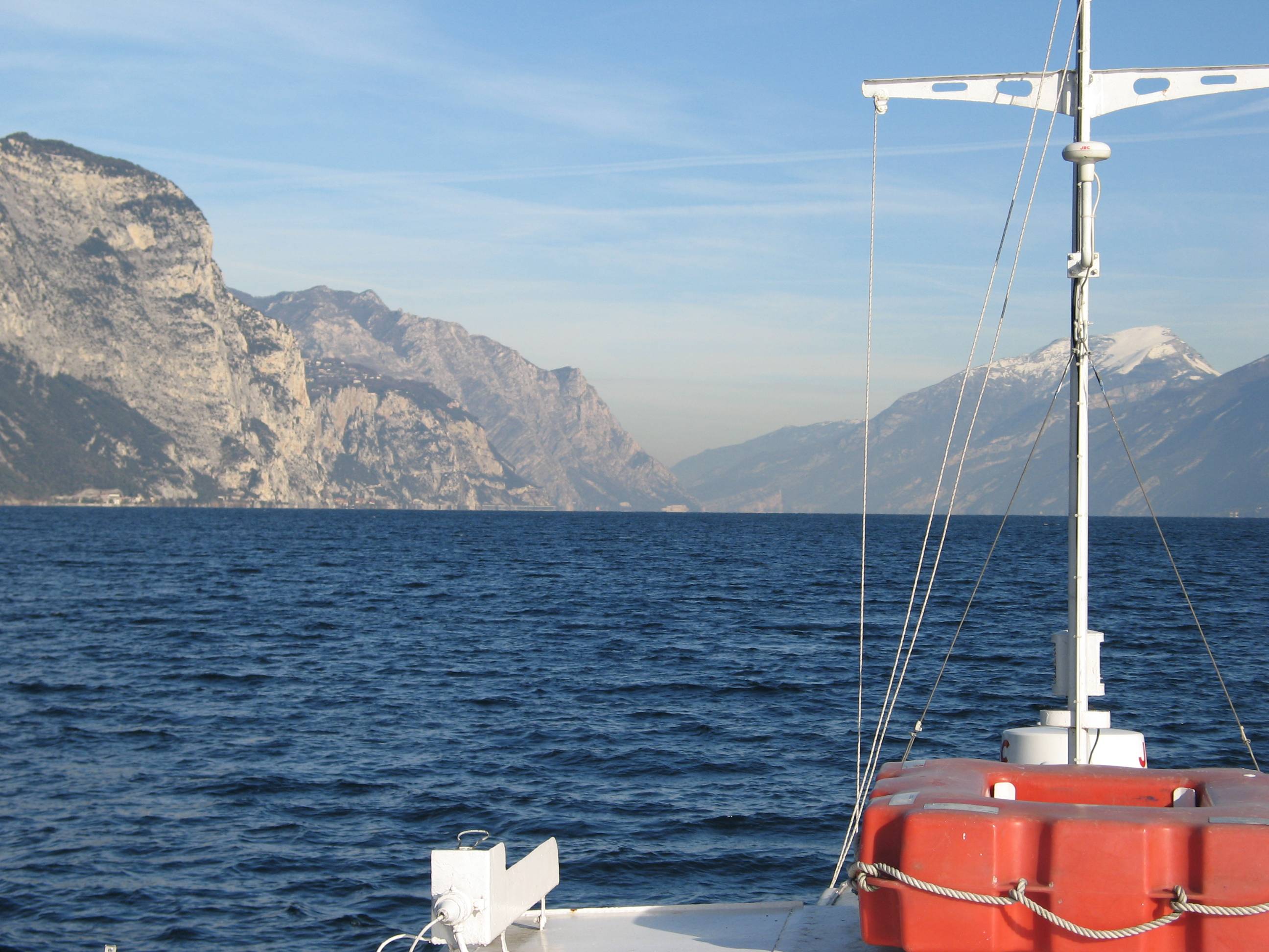
Lake Garda has the largest volume (49 billions of cubic meters) and the most extensive area (368 km2) of Italian lakes. Along with lakes Orta, Maggiore, Lugano, Como, Iseo and Idro, it forms part of the group of deep lakes located south of the Alps in one of the most densely populated and highly productive area of Italy. With a total volume of over 124 billions of cubic meters, these lakes constitute one of the largest freshwater supplies in Europe. Their waters are used for agriculture, industry, fishery and drinking. Moreover, they are an important resource for recreation and tourism thanks to both attractive landscape and water quality. In Lake Garda, sporadic studies were carried out irregularly by various Institutions up to the end of the 1980s. Since the beginning of the 1990s, continuous monthly samplings and measurements were carried out by the Department of Biology of the Padova University (Responsible, Nico Salmaso), with the collaboration of ARPAV. Since 2005 the whole limnological research is performed by the Limnological research group of the Agrarian Institute of S. Michele all’Adige – E. Mach Foundation (S. Michele all’Adige, Trento; coordinator, Nico Salmaso). Since the 1970s, Lake Garda showed an increase in the trophic status, with mean annual concentrations of total phosphorus in the whole water column increasing from ca. 10 µg P/L to 20 µg P/L. In the last 4-5 years of observations, TP showed a stabilisation of the concentrations, around 18 µg P/L. At the community level, annual phytoplankton cycles underwent a unidirectional and slow shift mainly due to changes in the species more affected by the nutrient enrichment of the lake. After a first and long period of dominance by conjugatophytes (Mougeotia) and diatoms (Fragilaria), phytoplankton biomass in recent years was sustained by cyanobacteria (Planktothrix). Other important modifications in the development of phytoplankton were superimposed on this pattern due to the effects of annual climate fluctuations principally mediated by the deep mixing events at spring overturn. Main specific research objectives in this LTER station include: -Changes in the physical, chemical and biological variables at different temporal scales, from months to decades and centuries (paleoecology). Update of the time series of hydrological, climatological and limnological data, whith special attention to lake evolution and effects on biotic communities in relation to ongoing climatic changes. Definition of predictive models. - Identification of the environmental and biotic mechanisms favouring the development of cyanobacteria (including the recent appearence of blooms and new species). Identification of the factors selecting for the development of toxic strains, the production and concentrations of epato- and neurotoxins, and their impact on trophic webs and water usability. The limnological field facilities of the limnological research group include 2 rubber dinghies, 2 multi-parameter probes, a fluoroprobe, a FlowTracker Handheld ADV Sonntek, underwater Quantum sensors, a Kajak corer and an Eckman dredge for sediment sampling. The unit also has several laboratories. These include the hydrobiology and microscopy laboratory, equipped for analyses of basic limnological variables (photosynthetic pigments, dry weight, dissolved oxygen, water turbidity, macrophytes) and of phytoplankton, picoplankton and periphyton samples (microscopes, invertoscopes, fluorescent microscopy, image analysis). The analytical and environmental chemistry laboratory is equipped for analysis of the major ions and nutrients (phosphorus, nitrogen and silica), as well as organic molecules (with focus on cyanotoxins) by means of spectrophotometry, ion chromatography and Liquid Chromatography-Mass Spectrometry (LC-MS). We have access to genetic laboratories equipped with the principal analytical tools, i.e. PCR, electrophoresis, and sequencing. The data collected at monthly frequency since 1991 includes water temperature and oxygen. Phytoplankton was collected since 1993, while complete data recording (including chemistry and zooplankton) begun in 1995.
-
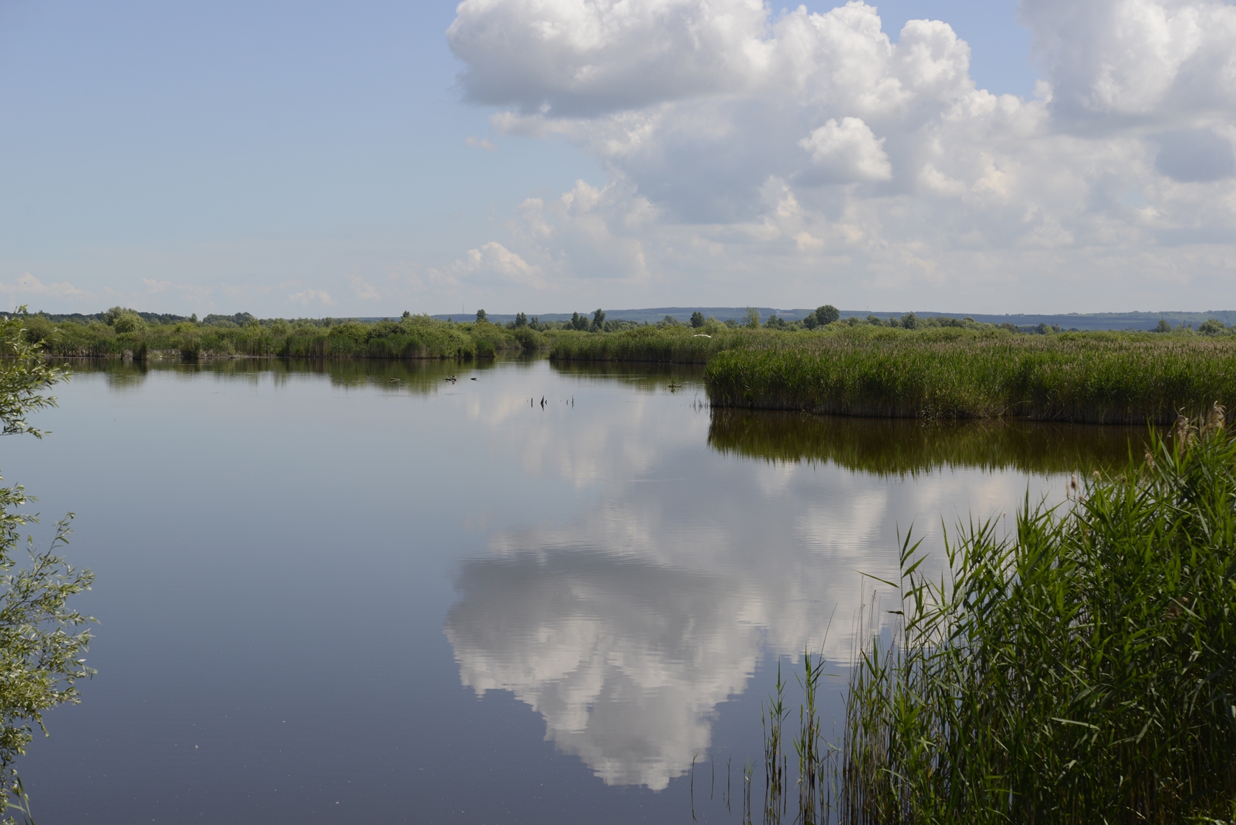
In order to combat the eutrophication of Lake Balaton, the Kis-Balaton Water Protection System (KBWPS) was initiated in the early 1980s. Originally, the KBWPS consisted of an 18 km2 shallow (less than 1.3 m) artificial lake system (Lake Hídvégi) and a 16 km2 wetland, which were constructed on the site of the former Kis-Balaton wetland in the mid-1980s. Later, the wetland part of the KBWPS was significantly enlarged (over 50 km2). Lake Hídvégi was designed to retain nutrients and provide ideal conditions for algae growth, while the wetland component of the KBWPS prevented these algae from entering Lake Balaton. Regular limnological, ornithological, ichthyological and plant ecological measurements are carried out in both Lake Hídvég and the wetland part of the KBWPS.
-
The Sani Environmental Observatory (S.E.O.) is located within a mature, near-coastal Aleppo pine (Pinus halepensis L.) ecosystem at the peninsula of Kassandra, in Chalkidiki, Greece. It is part of the Stavronikita forest, which comprises approximately 300 ha of land covered mainly by forests and to a lesser extend by shrubs and pastures. The Observatory aims primarily at the assessment of the carbon and water balance of this typical low-elevation forest ecosystem to the ongoing climatic shift. Such ecosystems may be prone to the intensified heat and drought events, as well as to the associated insects’ and pathogens’ outbreaks, which are increasingly occurring at the Mediterranean region and particularly at its eastern part. Although Aleppo pines, as well as other Mediterranean pines, are generally adapted to the region’s xerothermic conditions, the in-depth understanding of their ecophysiological and growth responses will allow us to predict the potential of such ecosystems to adapt to climate change. SEO also serves to assess the carbon stocks and fluxes and the contribution of these natural, old-growth ecosystems to carbon sequestration and, thus, to climate change mitigation. S.E.O. is developed by the Forest Research Institute (Lab of Forest Ecophysiology) of the Hellenic Agricultural Organization Dimitra with the support of Sani Resort SA, the owner of the studied forest ecosystem, presenting a nice example of collaboration between the research community and the private sector. Given that SEO is located at a region of high touristic and aesthetic value, close to a wetland and the sea, the Observatory also plans actions to familiarize people with environmental monitoring and the multiple functions and services of the studied Mediterranean ecosystem.
-
The Yatsugatake-Kawakami Forest of Mountain Science Center, University of Tsukuba, consists of three forest areas: the Yatsugatake Forest (80 ha) located in Minamimaki, Nagano Prefecture, Japan, the "Megumi-no-Mori" (14 ha) on the campus where the administration building is located, and the Kawakami Forest (189 ha) located in Kawakami, Nagano Prefecture, Japan. The Yatsugatake Forest is 1400-1450 m above sea level, and the Megumi-no-Mori is 1350 m above sea level. The forest is characterized by gentle slopes without remarkably topographic change and a mosaic of secondary deciduous broad-leaved forest dominated by oak (Quercus crispula) and Asian black birch (Betula davurica), and intermediate moor characterized by thatch herb (Moliniopsis japonica) and Japanese alder (Alnus japonica). Rare plants such as primrose (Primula sieboldii) and drosera (Drosera rotundifolia) are also found here. Black soil is distributed throughout the Yatsugatake Forest and Megumi-no-Mori. The Kawakami Forest is located between 1360 and 1700 m above sea level. 70% of the forest area is planted with Japanese larch (Larix kaempferi). The rest is a secondary deciduous broadleaf forest dominated by oak and birch. Some of the forests are dominated by a beech (Fagus crenata) stand, a natural Sawara cypress (Chamaecyparis pisifera) stand, and spruce (Picea alcokiana) stand. The forest is covered with brown and black soils, and the topography of the forest is more varied than that of the Yatsugatake Forest, including ridges and valleys. In the Kawakami Forest, an ecological survey of forest mammals is also being conducted. At these three forests, education and research are conducted on ecological surveys of trees, rare plants, and wildlife (population dynamics and conservation ecology), forest meteorological observations, and artificial forest management and operation.