
plant development stage
Type of resources
Available actions
Topics
Keywords
Contact for the resource
Provided by
Years
Formats
Representation types
-
Modeled with Mohid
-
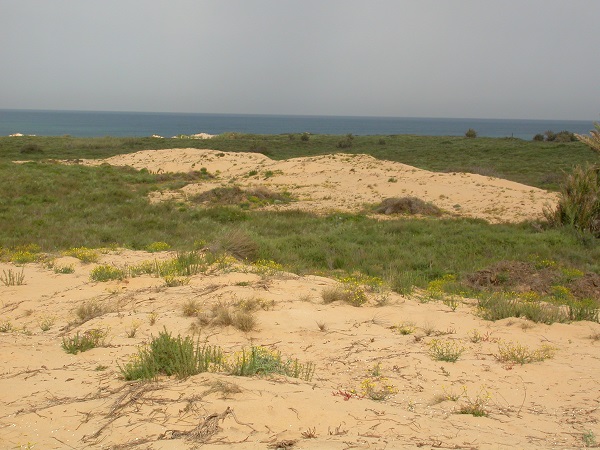
Coastal sand dune
-
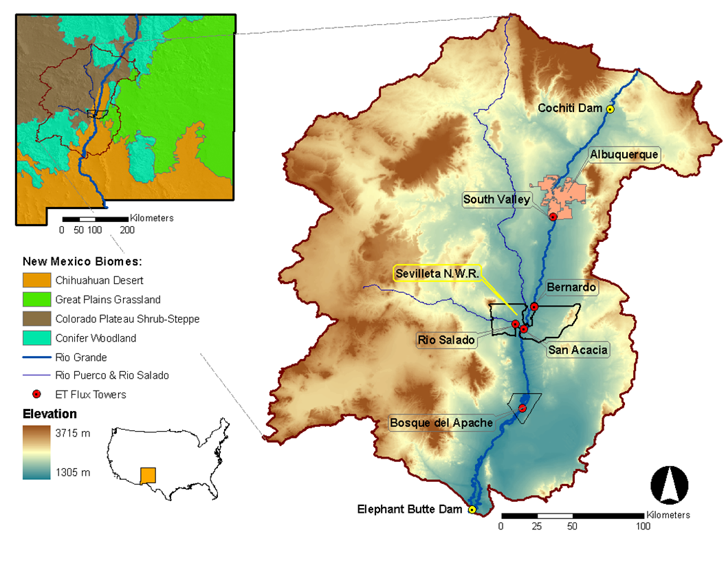
Desert grassland, shrubland, woodland, forest and riparian habitats in central New Mexico, USA
-
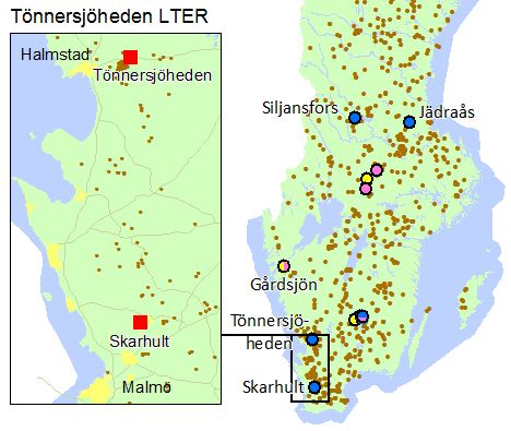
Tönnersjöheden and Skarhult experimental forests are situated in the nemoral/nemo-boreal zone closed to the Atlantic sea in South Sweden. Tönnersjöheden (1143 ha) was established as an experimental forest in 1923 with the original aim of studying ecosystems in transition from low productive broad-leaved forests and open Calluna heath-lands to conifer dominated forests. Skarhult (180 ha) was opened as an experimental forest in 1989 with a main focus on management and ecology of broad-leaved forest stands. Forests at Tönnersjöheden are dominated by old growth broad-leaved stands with long continuity, first and second rotations of planted coniferous stands and a number of planted stands with exotic tree species. Forests at Skarhult are dominated by naturally regenerated and planted pure and mixed broad-leaved forest stands of European beech (Fagus sylvatica L.), common oak (Quercus robur L.) and ash (Fraxinus excelsior L.). Research and monitoring activities cover a broad range of basic and applied subjects in the field of forest and forest related environmental sciences. The experimental forests are well-documented and well-described concerning history, climate, soils, vegetation and forest stands.
-
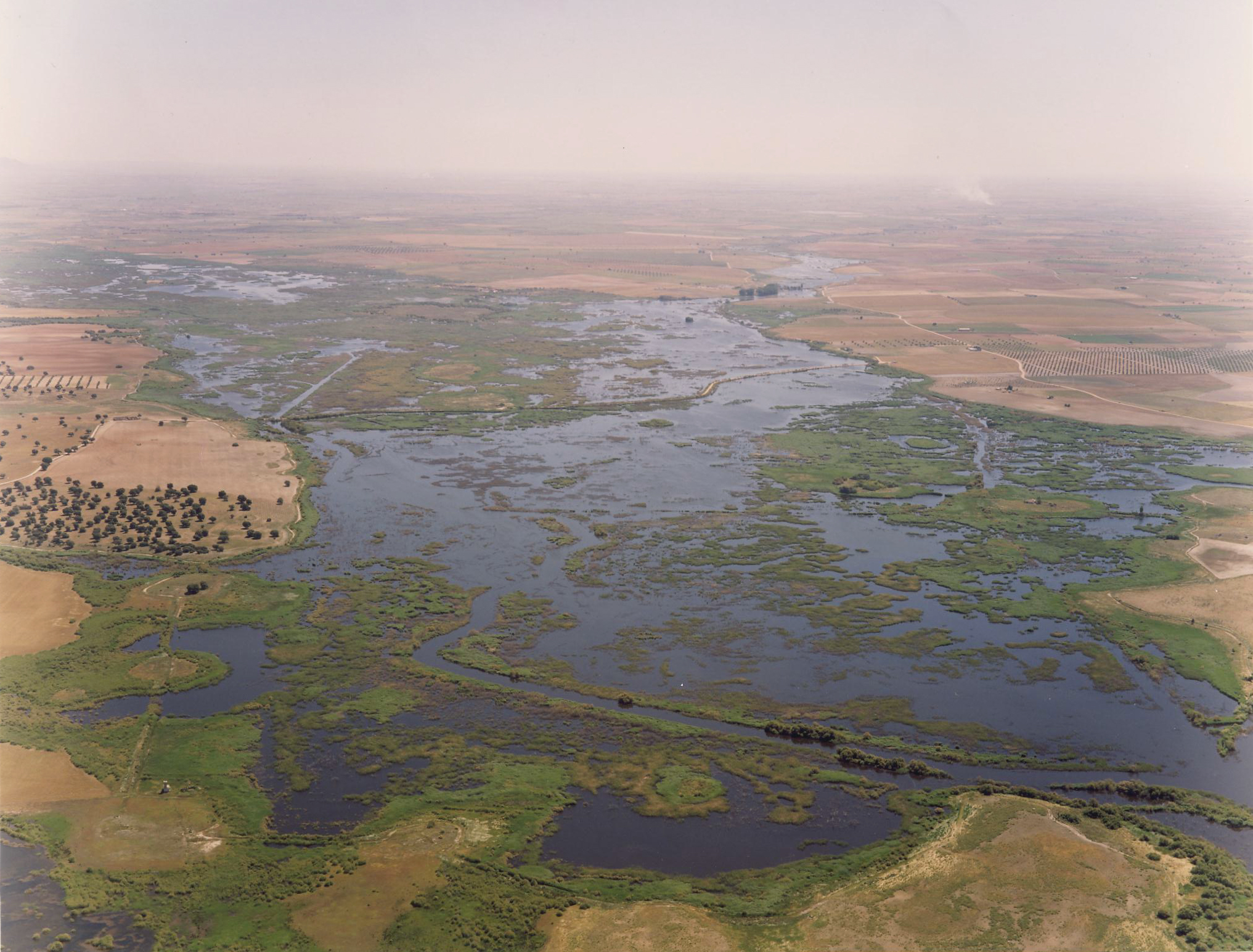
Las Tablas de Daimiel National Park (TDNP) is a floodplain wetland located at Central Spain in the core of La Mancha Húmeda Biosphere Reserve. Until the 1970s, wetland inundation was due to natural flooding of both the Gigüela and the Guadiana Rivers, and to the aquifer discharge (Llanura Manchega Occidental aquifer) as the groundwater table was close to the surface. Historically, the wetland´s inundation was also promoted by small water-mill dams which helped to increase the water-level. TDNP is the typical example of wetland degradation in the Mediterranean Europe, including dessication, agriculture conversion, groundwater overexplotitation and water quality impairing. Most importantly, aquifer overexploitation resulting from excessive agricultural irrigation strongly changed the ecosystem hydrology from a semi-permanent wetland to a highly fluctuating ecosystem with long periods (several years) of almost complete dryness. From the 1870s until the 1950s, the area was a private hunting park. It then became a National Hunting Reserve and later, in 1973, a National Park. It was included in the Ramsar convention in 1982. Its main environmental values are the large waterfowl populations, the European cut-sedge and the reed, and the plasticity of the ecosystem to absorb different threats.
-
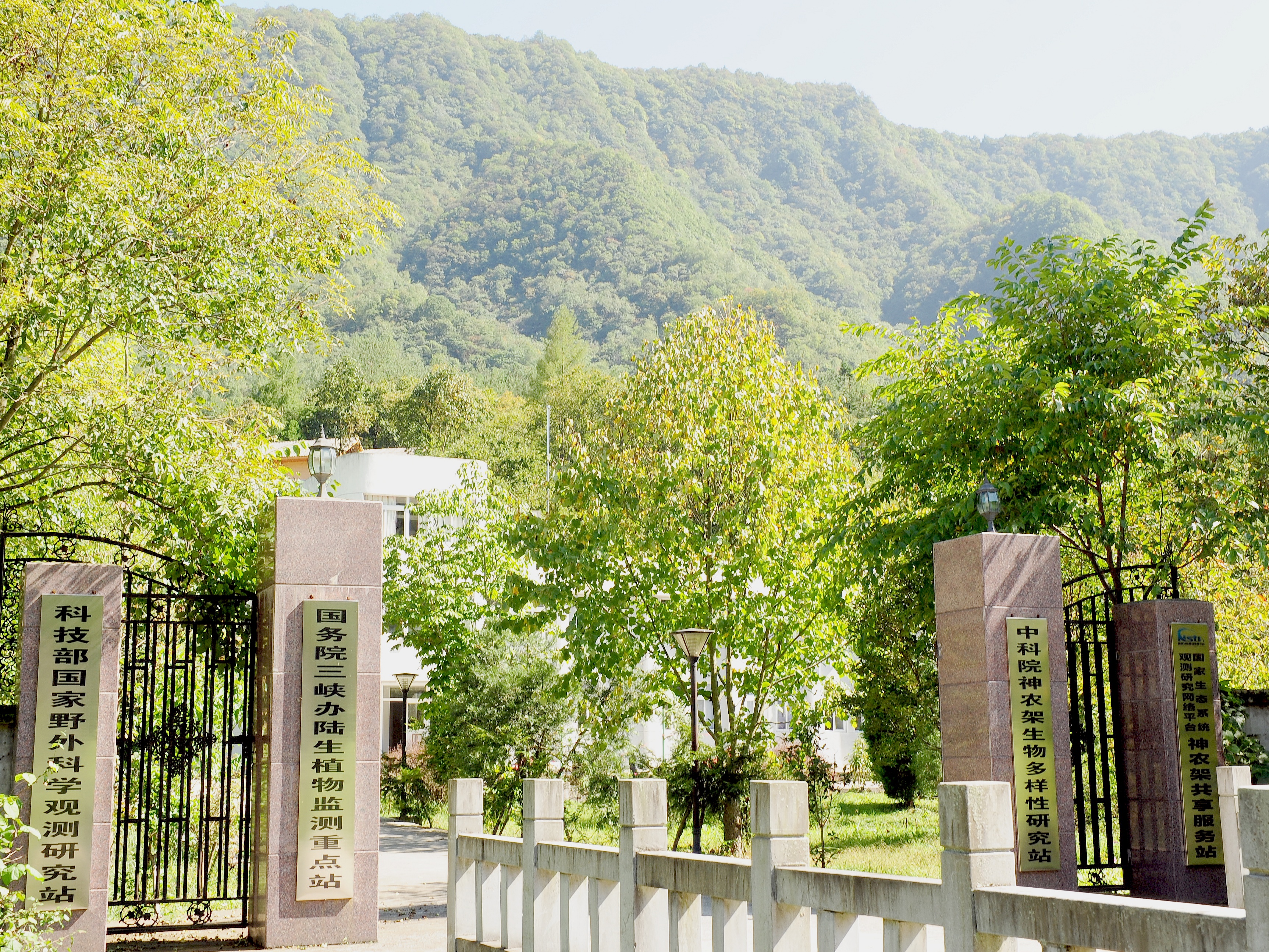
Shennongjia Station is located in Xingshan County, Hubei Province, China. It is located in the southern slope of Mount Shennongjia. The altitude is 1290m above sea level. The typical forest types are the northern subtropical mixed evergreen and deciduous broadleaved forest. Shennongjia Station was established in 1994, it became a station of National Field Research Station network running by the Ministry of Science and Technology of the People’s Republic of China in 2005, and became a member of Chinese Ecosystem Research Network (CERN), CAS in 2008.
-
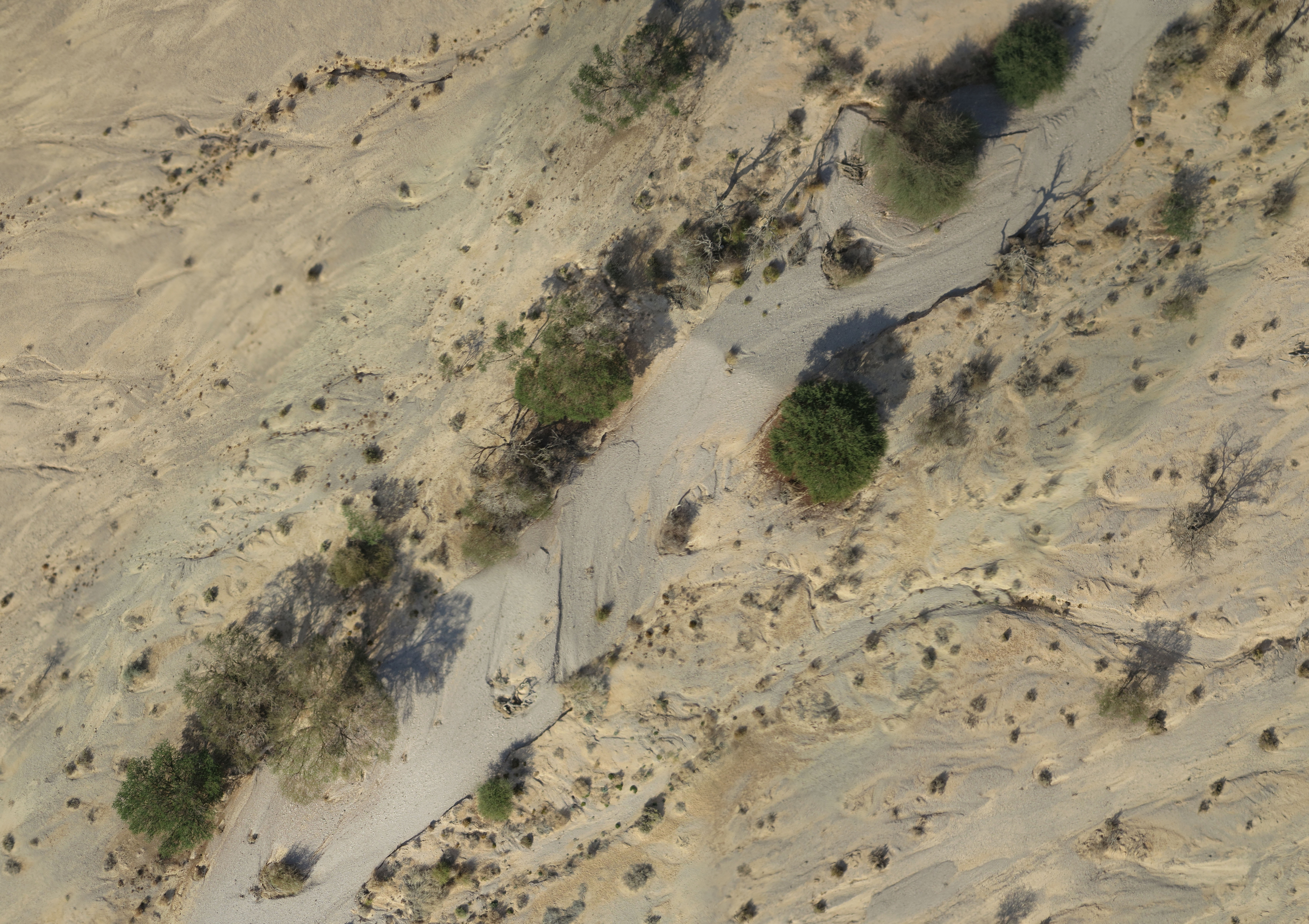
A small watershed that collects floods and run-off. The lowest place is home to a (relativity) dense Acacia savana. The slopes are completely bare. The wadi is covered with alluvium resting on a 6 m layer of red surface of late Pleistocene, which includes silt, clay and fine sand. Rainfall is 30 mm
-
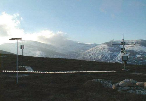
UK Environmental Change Network (ECN) site. The Cairngorms site is located high in the Cairngorms, near Aviemore in Speyside, Scotland. The site lies on the North-Western flank of the Cairngorms encompassing the catchment of the Allt a' Mharcaidh (a site in the ECN freshwater network). It is part of the Invereshie and Inshriach National Nature Reserve, within the Cairngorms National Park, and covers some 10 km2. This is the first ECN site in the UK's sub-arctic zone and is an important link not only to other upland ECN sites but to alpine site in Europe and globally through the GLORIA network, and also to networks across the Arctic (SCANNET and INTERACT). The Cairngorms site has been used intensively for research since the 1970s. An Automatic Weather Station (AWS) has been operating at the site since 1984 and was used in the Surface Water Acidification Programme from 1984 to 1994. CEH and MI have used the site for long-term hydrological and snow studies for about 15 years. From 1997-1999 it was one of the ECOMONT (land use change in mountain areas of Europe) sites. Researchers at several universities and institutes use the site for vegetation, soils and nutrient cycling studies. The site forms part of the larger Feshie catchment in the NICHE programme (National Infrastructure for Catchment Hydrology Experiments). This site is nested within the Cairngorms National Park LTSER site (https://deims.org/1b94503d-285c-4028-a3db-bc78e31dea07).
-
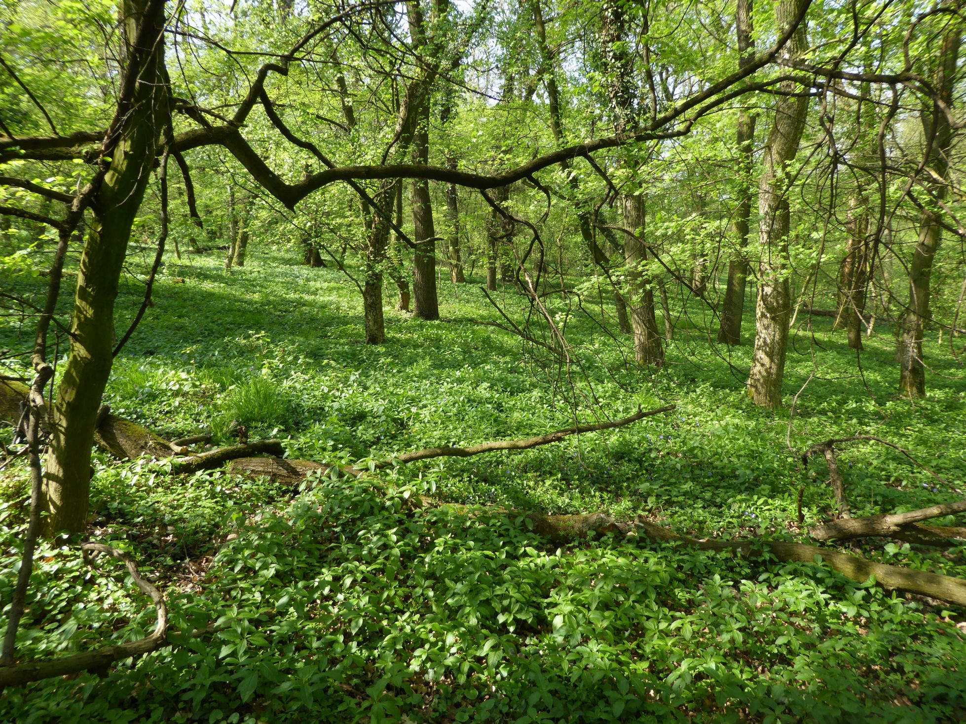
The Bab forest (66 ha) was selected as an example of a lowland deciduous broad-leaved forest on loess for ecosystem research in the International Biological programme (IBP) in 1967. More than 60 researchers performed a comprehensive ecosystem research at the site within IBP and MaB programmes in 1967-1975. This period finished by production of syntheses in micro-meteorology and micro-climate, soils, soil microbiology, ecophysiological processes of plants (photosynthesis, water relations, mineral nutrition), primary productivity, nutrient cycles, water circulation, and secondary productivity. The ecosphisiological studies continued in 1975-1980, later the research was focused to plant population biology and alien plants invasions. The ecosystem research was re-established in 2007. The inventory of shrub and trees, herb vegetation, selected animal groups allowed identification of changes during 40 years caused probably by the climate changes and anthropogenic disturbances. The differences in decomposition of selected native and invasive plant species were assessed. The biomonitoring of the air pollution was done using mosses as indicator organisms. Now the research is focused to dynamics of forest ecosystem (vegetation, selected invertebrate groups, small mammals) and impact of forestry management (clear-cuts) to structure and dynamics of forest ecosystem. The multisite trampling experiment (ALTER-Net) and tea decomposition experiment (ILTER) were/are performed at the site.
-
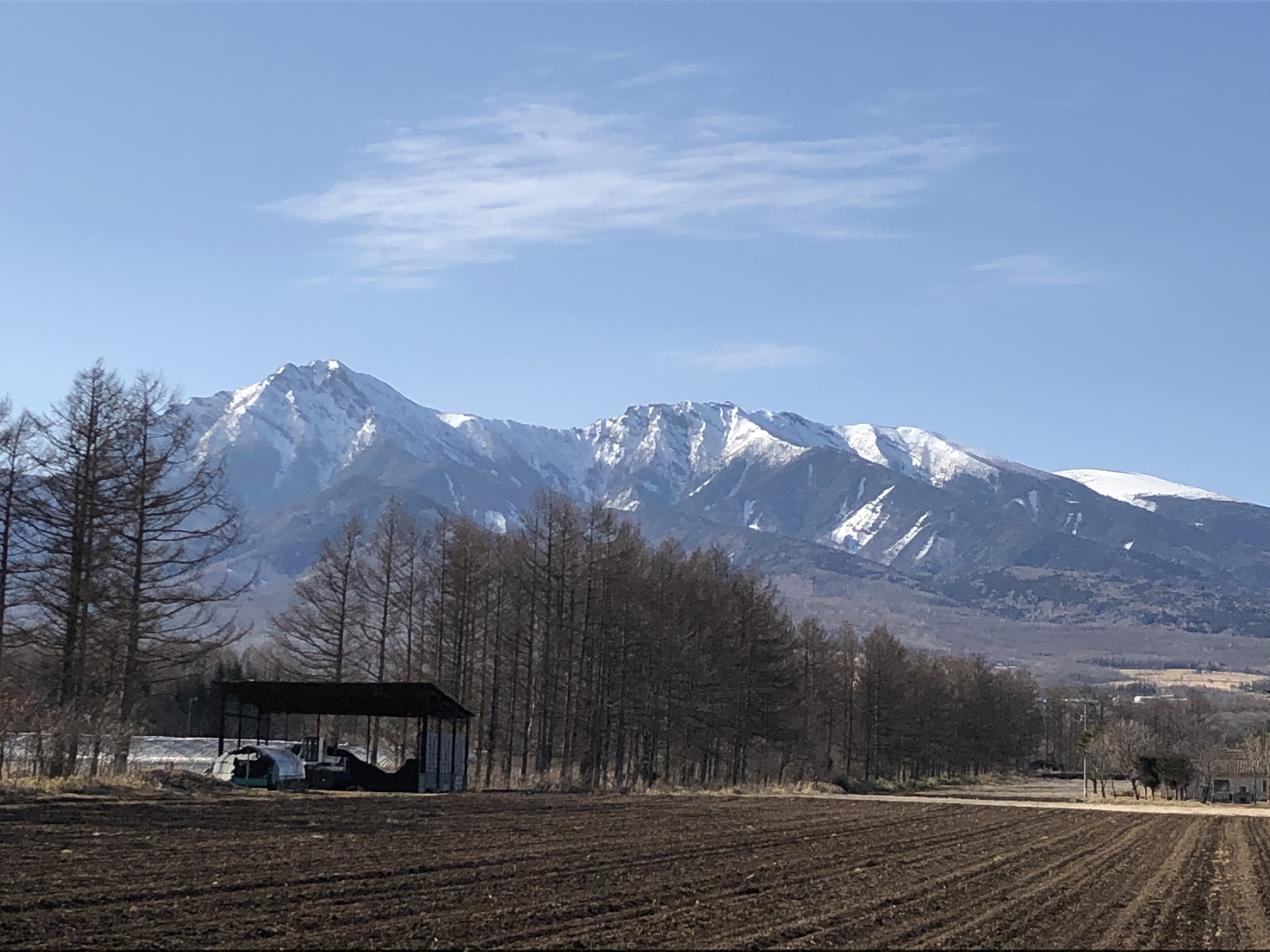
The Yatsugatake-Kawakami Forest of Mountain Science Center, University of Tsukuba, consists of three forest areas: the Yatsugatake Forest (80 ha) located in Minamimaki, Nagano Prefecture, Japan, the "Megumi-no-Mori" (14 ha) on the campus where the administration building is located, and the Kawakami Forest (189 ha) located in Kawakami, Nagano Prefecture, Japan. The Yatsugatake Forest is 1400-1450 m above sea level, and the Megumi-no-Mori is 1350 m above sea level. The forest is characterized by gentle slopes without remarkably topographic change and a mosaic of secondary deciduous broad-leaved forest dominated by oak (Quercus crispula) and Asian black birch (Betula davurica), and intermediate moor characterized by thatch herb (Moliniopsis japonica) and Japanese alder (Alnus japonica). Rare plants such as primrose (Primula sieboldii) and drosera (Drosera rotundifolia) are also found here. Black soil is distributed throughout the Yatsugatake Forest and Megumi-no-Mori. The Kawakami Forest is located between 1360 and 1700 m above sea level. 70% of the forest area is planted with Japanese larch (Larix kaempferi). The rest is a secondary deciduous broadleaf forest dominated by oak and birch. Some of the forests are dominated by a beech (Fagus crenata) stand, a natural Sawara cypress (Chamaecyparis pisifera) stand, and spruce (Picea alcokiana) stand. The forest is covered with brown and black soils, and the topography of the forest is more varied than that of the Yatsugatake Forest, including ridges and valleys. In the Kawakami Forest, an ecological survey of forest mammals is also being conducted. At these three forests, education and research are conducted on ecological surveys of trees, rare plants, and wildlife (population dynamics and conservation ecology), forest meteorological observations, and artificial forest management and operation.