
plant height
Type of resources
Available actions
Topics
Keywords
Contact for the resource
Provided by
Years
Formats
Representation types
-
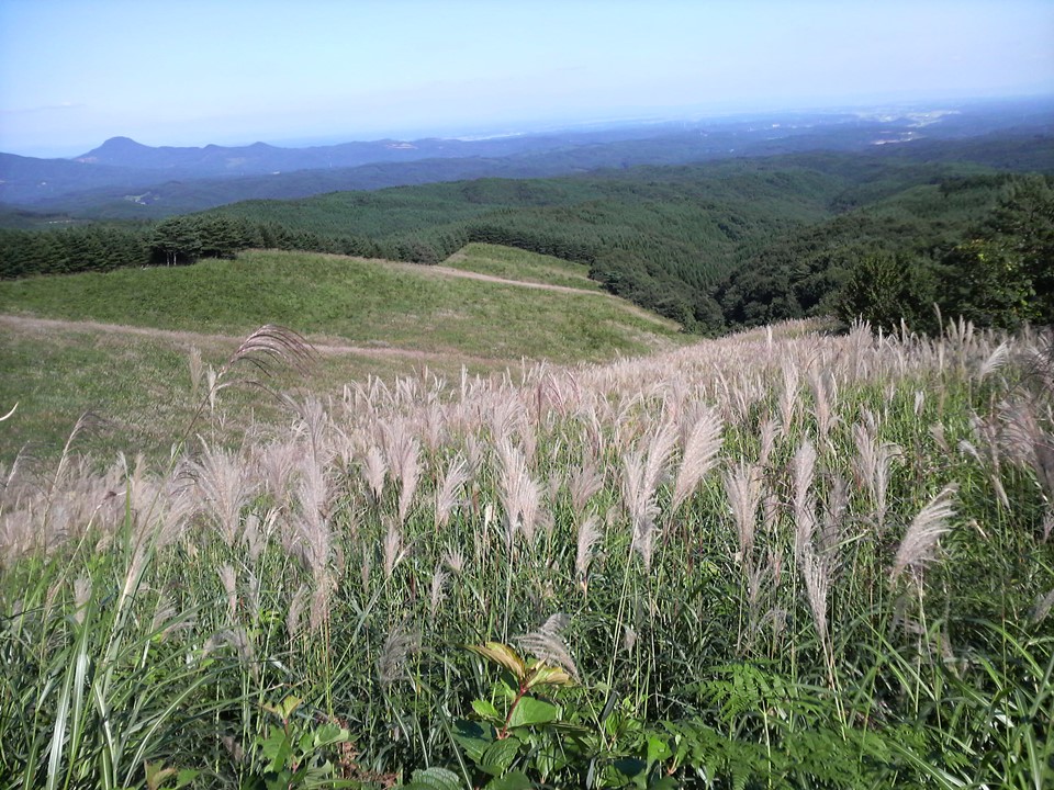
Fujinitayama site is in the Nasu Research station of NARO Institute of Livestock and Grassland science. This experiment started at 1974. In this site which was an abandoned pasture, M. sinensis had occupied at the start of this experiment. This site was divided into three plots, heavy grazing plot (144 head day ha–1 year–1), light grazing plot (73 head day ha-1 year-1), and control plot (non-treatment). In each plot, 20 quadrats were arranged and the coverage and height of all species were measured in every September. M. sinensis grassland which was adapted for mowing changed in Z. japonica grassland was adapted for grazing in both treatment plots. In addition, the dominant speed of Z. japonica in heavy grazing plot was higher than that of light grazing plot. However, Pinus densiflora invaded into all plots including a control plot. When P. densiflora was not cut down by man, it increased every year. So, it is difficult to maintain Z. japonica grassland only by cattle grazing.
-
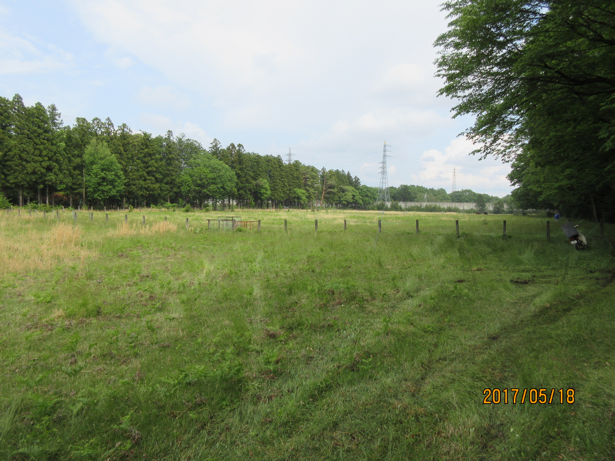
This site was established on a tall, Japanese native grass (Miscanthus sinensis) pasture in 1982. Three different treatments (cutting, cattle grazing and abundoning) has been carried out. Vegetational characteristics is investigated on 60 locations (20 locations x 3 treatments, 2 m x 2 m each) in late August to early September.
-
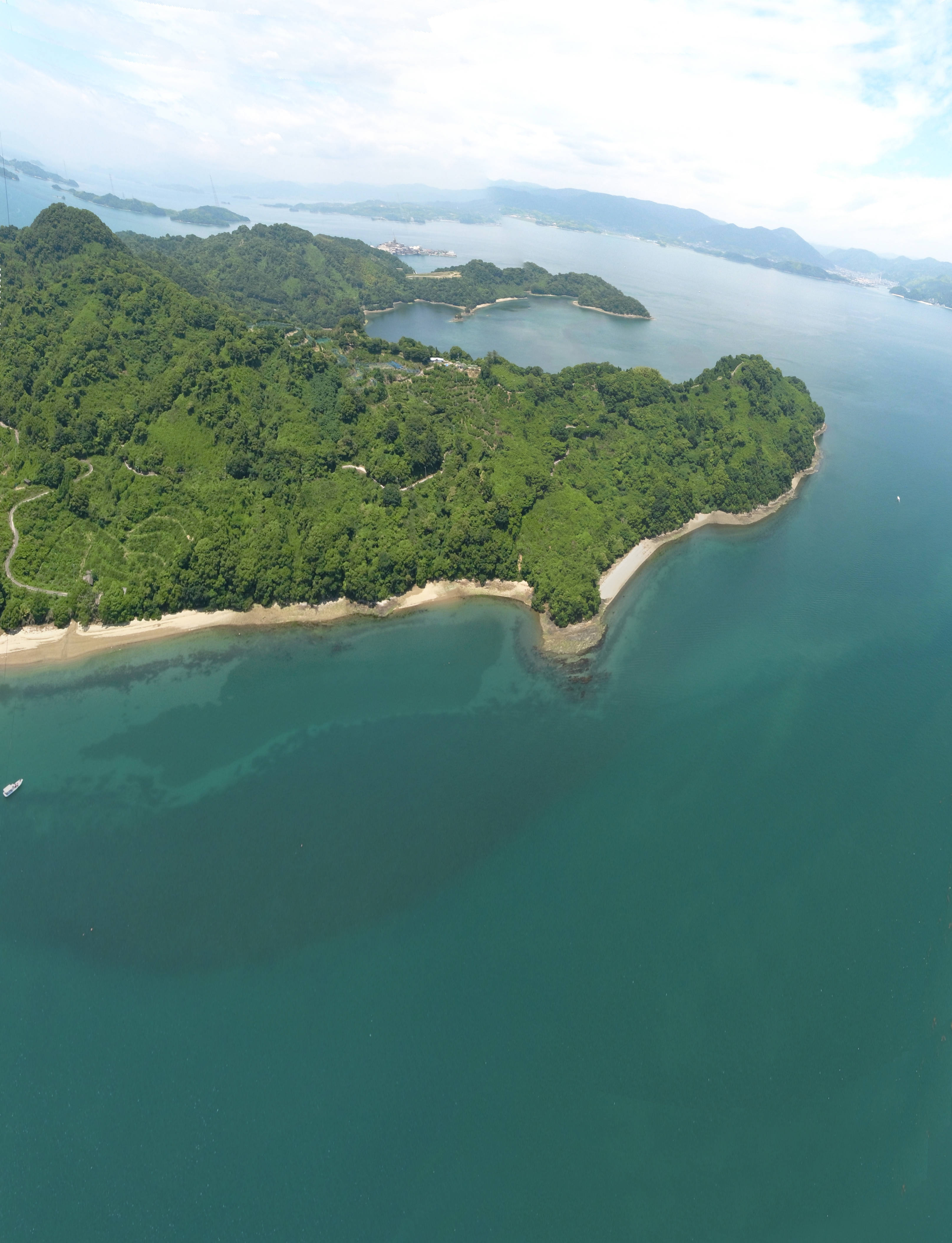
Seto Inland Sea is the largest inland sea of Japan including more than two thousand islands. The complicated coastlines make multiple kind of habitats within a local seascape, which is a suitable environment for coastal marine organisms. Suo-nada and Aki-nada are parts of western part of Seto Inland Sea, especially including many natural and larger tidal flats and seagrass meadows with better condition, respectively. Main researches in the site include ecological researches on the biodiversity and ecosystem functionings of tidal flat and seagrass/algal beds have been conducted to monitor coastal environment and to secure the sustainable utilization of fisheries products.
-
Modeled with Mohid
-
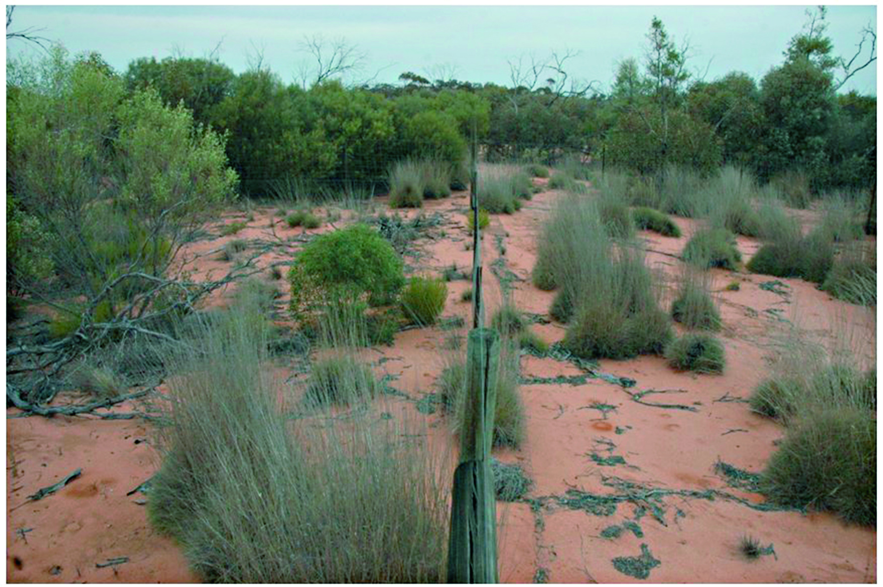
The Mallee Plot Network is located in the red aeolian sand dunefield landscape of the Scotia district within Tarawi Nature Reserve, Scotia Wildlife Sanctuary and Danggali Conservation Park in south-western New South Wales and adjacent areas of South Australia. The study area sits on the south-eastern edge of the Australian arid zone and is close to the arid limits of distribution of the mallee woodland biome, which stretches across the temperate semiarid belt of southern Australia (Noble 1984). Mallee woodlands typically occur in regions In the Scotia district and its surrounding region, mallee woodlands occur within a landscape mosaic that includes patches of woodland dominated by Casuarina pauper (belah) and shrublands dominated by Maireana sedifolia and M. pyramidata (bluebush) (Westbrooke et al. 1998). These latter vegetation types occur on gently undulating sandplains with a calcareous crust not far below the soil surface. In contrast, mallee woodlands dominate transverse east–west oriented dunefields. The dunes are characterised by deep, red sandy loams dominated by Eucalyptus socialis (pointed mallee), E. dumosa and E. costata—occasionally with Callitris verrucosa - with a mixed understorey of hummock grasses and shrubs, and a largely ephemeral ground layer of tussock grasses and forbs. The intervening swales have finer-textured red loams and generally support a wider range of eucalypts including E. oleosa and E. gracilis, but C. verrucosa is absent. Their understoreys typically include a higher density and diversity of shrubs but lack hummock grasses, and the ground layer is typically sparse. Detailed descriptions of vegetation and landscapes are included in Westbrooke et al. (1998). Temporal visits were initially staggered, then annual for 3 years and is now decadal. Between 2012 and 2018 the Mallee Plot Network was a member of Long Term Ecological Research Network (LTERN), Australia, a facility of the Australian Government's Terrestrial Ecosystem Research Network (TERN)..
-
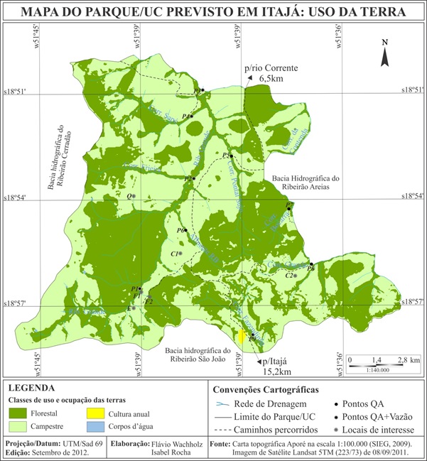
The PELD Jataí site is located in Atlantic Forest remnants in the southern state of Goiás, Brazilian central plateau. Covering about 20,000 hectares of not continuous forests, distributed among the geographic coordinates 18o 55'S and 51o 42'W, with altitudes ranging from 520 to 650 m. The fragments are mostly immersed for pasture matrix. The climate is classified as Aw, tropical savanna, with marked seasonality, rain in summer and dry in winter, typically found in the Brazilian Cerrado. December and January are the months with the highest frequency of rainfall, and June to August there is less rainfall intensities. The annual average rainfall is 1650 mm. The site consists of different forest vegetation types in good conservation status, as woody savanna, deciduous and semideciduous forests; flooded and non-flooded gallery forests and riparian forests along the Rio Corrente, a tributary of the Rio Paranaiba. There are also small fragments of cerrado stricto sensu.
-
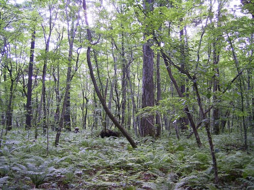
Boreal forest consisting of Betula and Acer species.
-
Tomakomai Research Site is located in a national forest in the city of Tomakomai, Hokkaido. It is part of the national forest compartment 1205, forest group, which is managed by the Eastern Iburi District Forest Office of the Hokkaido Forest Office. The Tomakomai Research Site is a mixed broad-leaved and conifer-leaved forest that consists of Picea jezoensis (Sieb. et Zucc.) Carr. mixed in with cool temperate broad-leaved trees such as Acer mono, Prunus ssiori Fr. Schm., and Cercidiphyllum japonicum Sieb. et Zucc. The volcanic plain outside the City of Tomakomai contains soils that have been disturbed primarily by the eruption of Mt. Tarumae. Around that are expansive man-made forests of Larix kaempferi (Lamb.) Carr., Abies sachalinensis, etc., but there is no record that the 43 ha forest group which contains the research site has been cut. From summer to autumn, the forest floor is covered with Dryopteris crassirhizoma Nakai, with scattered patches of Sasa senanensis (Franch. et Savat.) Rehd. This research is maintained jointly by the Hokkaido Research Center of the FFPRI and the Graduate School of Environmental Earth Science of Hokkaido University.
-
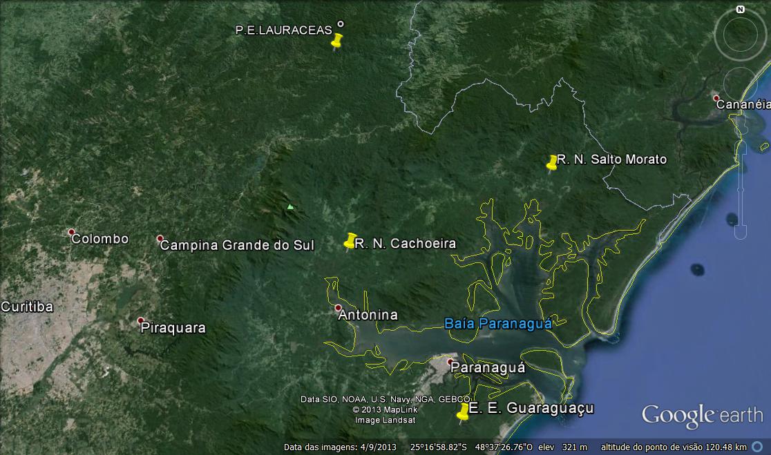
The region of Lagamar covers the coast of Paraná and south of São Paulo, and comprises a complex that includes estuaries, mangroves, coastal lagoons, coastal rivers, salt marshes, lowland and mountain forests. It is a mosaic composed of 43 protected areas, which is the largest remnant of Atlantic Forest in the country. Despite this, some areas of the Lagamar went through a process of urbanization and agricultural expansion, which altered the natural systems on different scales. The areas studied are the Lauraceas State Park, the Cachoeira Natural Reserve, the Salto Morato Natural Reserve and the Guaraguaçu Reserve.
-
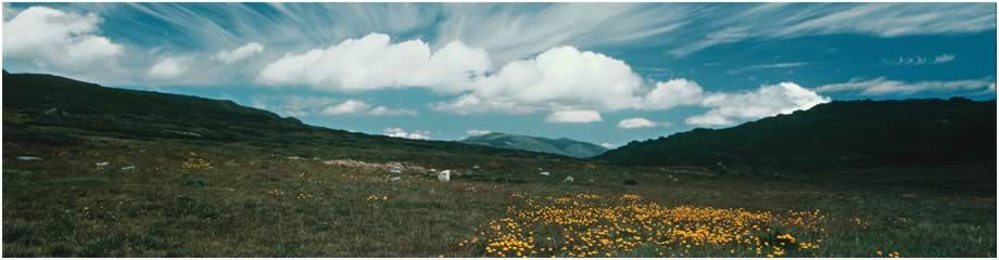
The Victorian Alpine Plot Network is located in Victoria’s Bogong High Plains and other high plains and mountain summits. Temporal visits generally range from every 3 to 10 years with some plots are surveyed annually during initial monitoring. Between 2012 and 2018 the Victorian Alpine Plot Network was a member of Long Term Ecological Research Network (LTERN), Australia, a facility of the Australian Government's Terrestrial Ecosystem Research Network (TERN).