
plant nitrogen concentration
Type of resources
Available actions
Topics
Keywords
Contact for the resource
Provided by
Years
Formats
Representation types
-
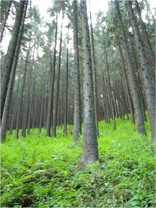
In 1998 a permanent plot (50 x 50 m) was established on the slope of the Nosal Mountain at the height of 970 m asl in 120 year old spruce stand, where in the 120-year-old spruce stand bulk deposition, throughfall and soil solution are collected. The investigations of health status of trees and floral characteristic have been carried out since 2001. The analyses are carried out in a certified laboratory of the Institute for Ecology of Industrial Areas, Katowice (Certificate No AB 325). The basic meteo data are taken from the monitoring station located at Kuźnice (about 1 kn from the plot).
-
COAT Varanger is a subsite under the COAT platform located mainly on the Varanger penninsula in the low arctic. Long-term monitoring and research on tundra ecosystems are conducted on this site.
-
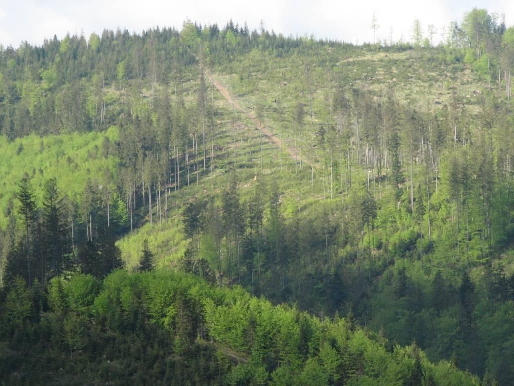
The Brenna monitoring site in the Silesian Beskid (Polish part of the West Carpathians) was established in 1991 and consists of a monitoring station (meteo parameters and air pollution level) at the elevation of 865 m a.s.l. and 7.5 ha and 50 ha catchments at the elevation of 750 m a.s.l under old spruce stand being under reconstruction.The main goals of the monitoring programme is the investigation of: ● Response of spruce stands to air pollution and forest management practice in the mountain area which has been influenced by emissions from the industrial complexes of Silesia and the Czech Republic ● The balance of nutrients in a small mountain catchment. ● Changes in floral characteristics These monitoring activities have been continuing and moreover, the effect of forest management (falling, skidding) on soil (erosion) is monitored. In 2016 the Particulate analyzers (PM10/PM2.5) (The Model 5030 Synchronized Hybrid Ambient Real-time Particulate SHARP Monitor) were installed at the station to measure the inflow of pollutants from industrial regions.Equipment for meteorological measurements is as follows: Barometr LB-716, Thermohigrometer LB-710R, Wind Speed Meter LB-746, Pyranometer PQS1, Thermometer LB-711 (air and soil), Pluviometer RG50A. Additionally, continuous measurements of ozone have been carried out since the nineties (Monitor Thermo Scientific).
-
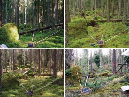
The Słowiński National Park monitoring was established in 1993 and consists of a monitoring station, where the measuring equipment is located, i.e., Wind Speed Meter (Young) pyranometer (LiCo) hygrometers, etc., permanent plots in the 90-year-old spruce and pine stands where bulk deposition, throughfall and soil solution are collected on the monthly basis. The investigations of health status of trees and floral characteristic have been carried out since 1994. The analyses are carried out in a certified laboratory of the Institute for Ecology of Industrial Areas, Katowice (Certificate No AB 325).
-
Nature reserve, Natura 2000, Protected coniferous blueberry forest, catchment, IM site, Podzol soil.
-
The UNESCO-biosphere reserve „Schorfheide-Chorin“ was established in 1990 over an area of approx. 1.300 square kilometres, and is one of the largest protected areas in Germany. Situated in the North-eastern part of Brandenburg, including a major part of the regions Uckermark and Barnim, it represents an impressive cultural landscape with more than 320 lakes, thousands of bogs and mires, extended forests, meadows and arable land. The so-called Schorfheide and the Chorin end moraine curve are two different landscapes, seen under a culture-historical aspect. The Schorfheide stretches along the west side of the motor way A 11 (Berlin-Poland). The Chorin end moraine curve extends East of the motor way. 75 communities and three small towns (Oderberg, Joachimsthal and Greiffenberg) with a total of 35.000 residents are situated in the protected area. The main concept behind the biosphere reserve is the consideration of human impact on the land. It is meant to encourage producers to work in a sustainable manner. Thus, 79 % of the area can be used by man. To protect natural resources, priority is given to organic agriculture and forestry and to an extensive-pasture economy. One of the most important supporting partners is the association “Kulturlandschaft Uckermark e.V.” (For promotion of the Cultural landscape Uckermark)
-
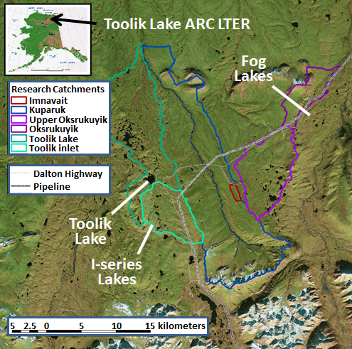
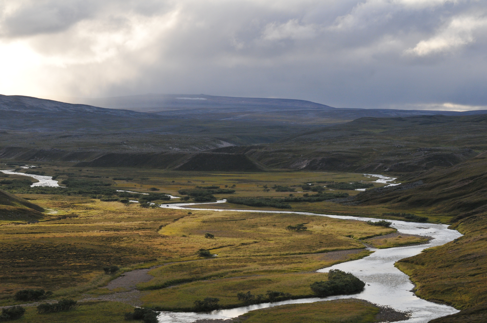
The Arctic LTER research site is in the foothills region of the North Slope of Alaska and includes the entire Toolik Lake watershed and the adjacent watershed of the upper Kuparuk River, down to the confluence of these two watersheds. This area is typical of the northern foothills of the Brooks Range, with continuous permafrost, no trees, a complete snow cover for 7 to 9 months, winter ice cover on lakes, streams, and ocean, and cessation of river flow during the winter. Tussock tundra is the dominant vegetation type but there are extensive areas of drier heath tundra on ridge tops and other well-drained sites as well as areas of river-bottom willow communities. The North Slope is divided into the Coastal Plain (6,000 km2), the Foothills (95,000 km2), and the Mountains (40,000 km2).
-
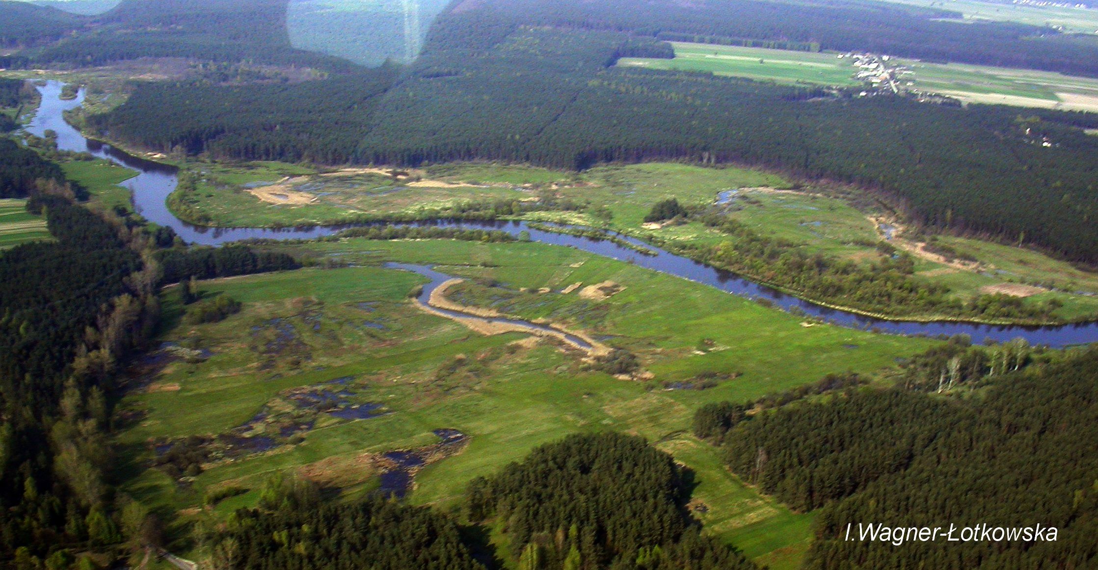
The Pilica River watershed is located in central Poland (length:342 km, catchment area: 9258km2). Its mean and maximum discharge is 21.2 and 139m3 s−1, respectively. Agriculture is found in over 60% of the Pilica catchment, and results in an increased supply of nutrients, humic substances, and other pollutants from non-point sources to the river and the Sulejow Reservoir, which is a spare drinking-water reservoir for the Lodz agglomeration and a recreational area. The LTER site includes the experimental floodplain of the Pilica River valley (51°18'58.46''N and 19°54'10.54''E), located in the middle reach of the river, upstream of the reservoir.
-
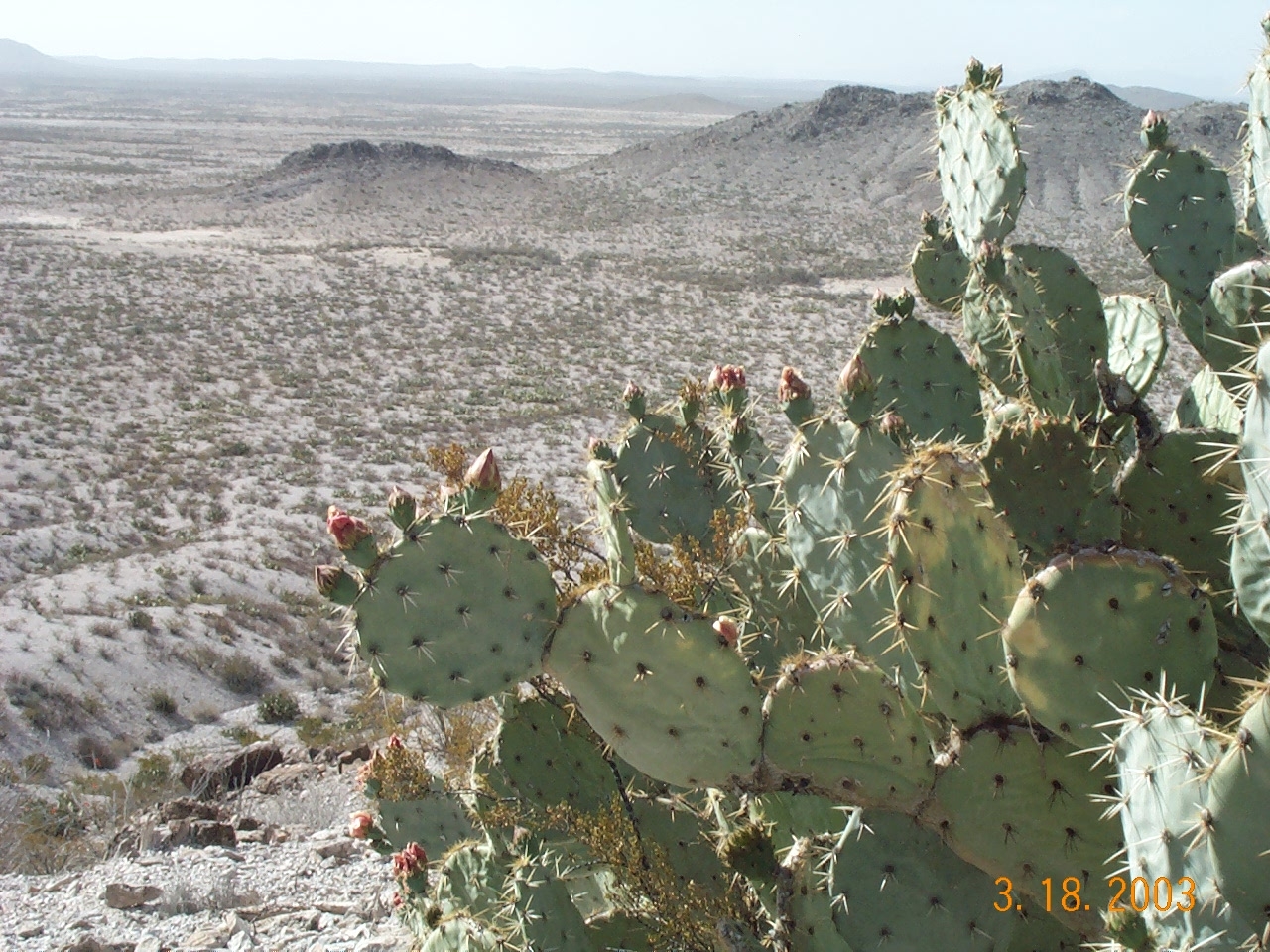
Se ubica en el límite donde se unen los estados norteños de Chihuahua, Coahuila y Durango, en la parte central del desierto chihuahuense. Está conformada por llanuras esérticas en cuencas endorreicas, denominadas bolsones, localizadas a elevaciones entre los 1,000 y 1,200 m; en medio de estas llanuras sobresalen algunas elevaciones de cerros y pequeñas serranías de origen volcánico y sedimentario. Un rasgo geográfico característico del Bolsón de Mapimí consiste en la presencia de formaciones arenosas que llegan a ocupar grandes superficies cubiertas por dunas o extensas planicies de arena.
-
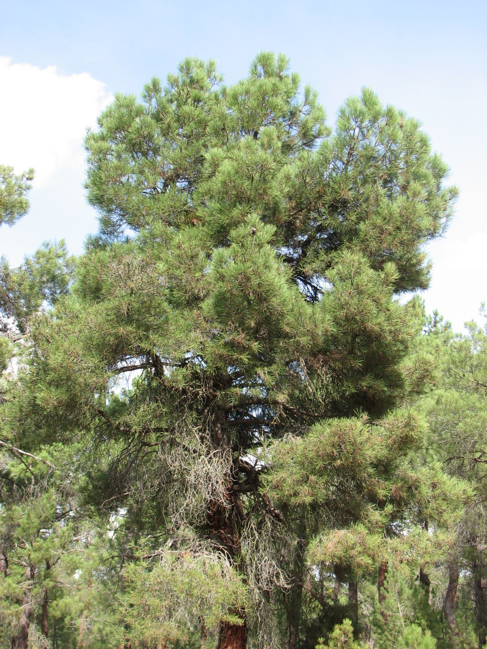
The Intensive Monitoring of Forest Ecosystems (ICP-Forests Level II network) consists currently in 14 monitoring plots representing important Spanish Forest Ecosystems distributed throughout the Spanish mainland showing the most common forest situations of each country and representing rare or endemic situations. The plot 37 Ppr represents a Pinus pinaster forest located in the Castilian region. It is a 41 to 60 years old monoespecific regular forest. The tree layer covers one third of the plot area. Climatic gradient is Supramediterranean. The plot is located on siliceous sands. The soil is poor.