
plant transpiration
Type of resources
Available actions
Topics
Keywords
Contact for the resource
Provided by
Years
Formats
Representation types
-
Model Output for a number of points (csv, excel)
-
Boreal forest consisting of Betula and Acer species.
-
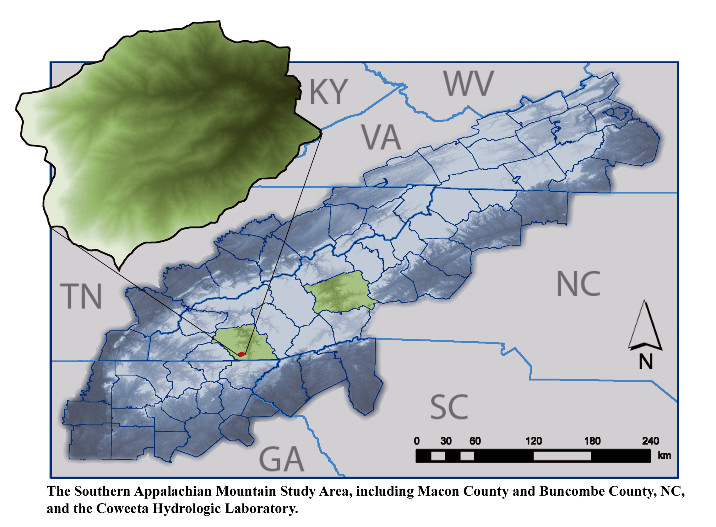
The majority of research is conducted within the US Forest Service Coweeta Hydrologic Laboratory located in the Nantahala Mountain Range of western North Carolina, USA, within the Blue Ridge Physiographic Province. The site is part of the Upper Little Tennessee River Watershed Basin.
-
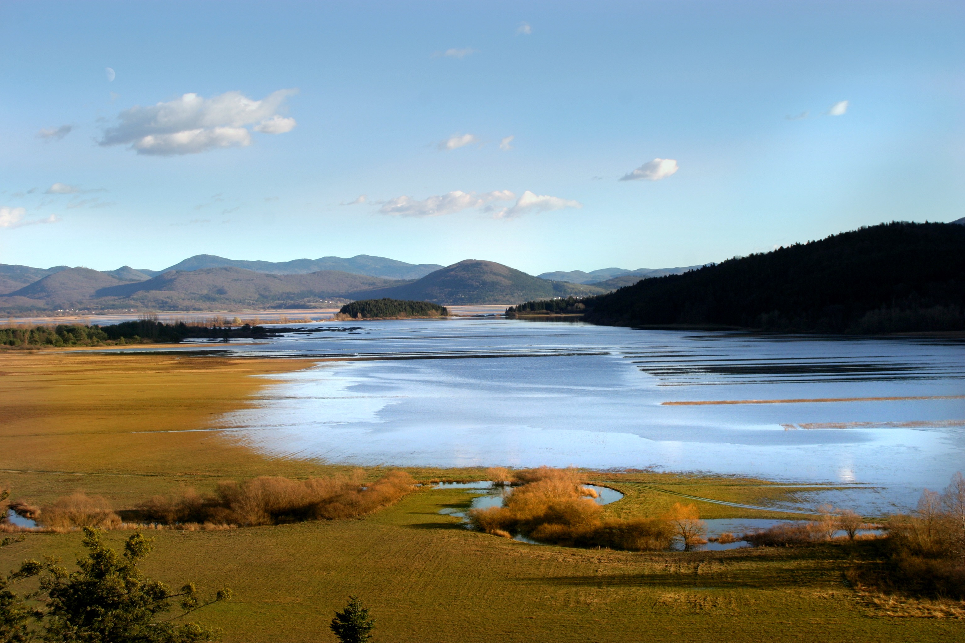
Lake Cerknica is intermittent lake appearing at the bottom of closed depression Cerkniško polje extending on the area of 38 km2. The karst features are associated with carbonate rock, both with limestone and dolomite. About 80 % of inflow consists of karst and only 15% of surface waters. The outflow is completely karstic. In spring and usually late in autumn the lake reaches normal level 550 m a.s.l., covering the area of 26 km2. Polje is flooded for 9 and dry for about 2 months, usually in summer. Lake Cerknica is a highly diverse ecosystem that changes in time and space. Vegetation pattern shows clear zonal distribution that depends on extent and frequency of flooding. The lake supports rich fauna with many endangered species, providing temporary shelters and food for protected large carnivores, such as brown bear, wolf, lynx and numerous species of water birds. In recent decades, flood and drought events have become increasingly irregular altering processes and conditions for many species.
-
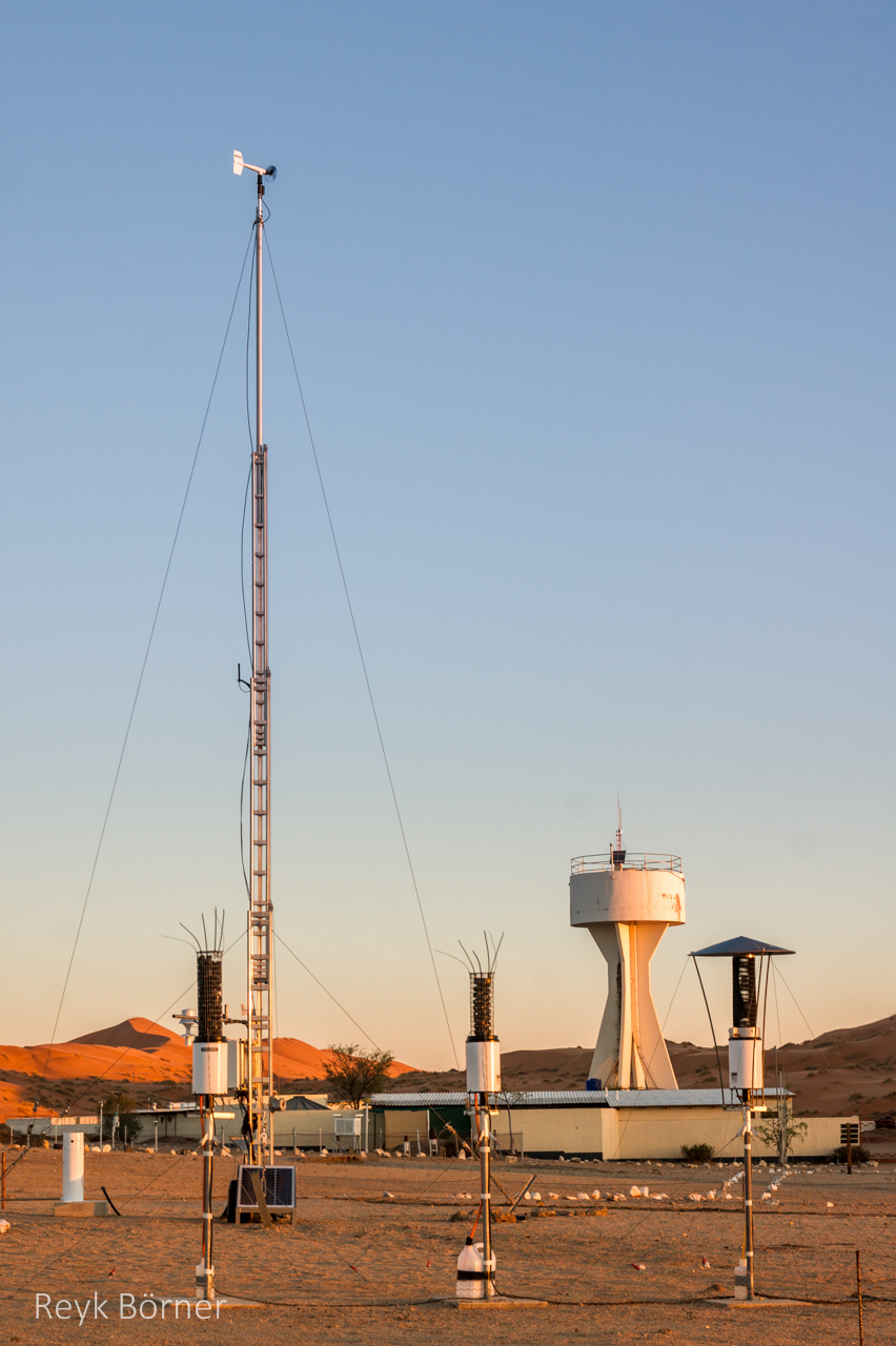
Gobabeb is a Research Centre with accommodation, conference, laboratory and teaching facilities in Namibia's Namib-Naukluft National Park, about 65km from the coast on the northern bank of the ephemeral Kuiseb River. It is located at a point where three main habitats meet (ephemeral river, gravel plain and the Namib erg) and lies within the inland edge of the fog zone. It is the designated monitoring and research centre for the Namib Sand Sea World Heritage Site.
-
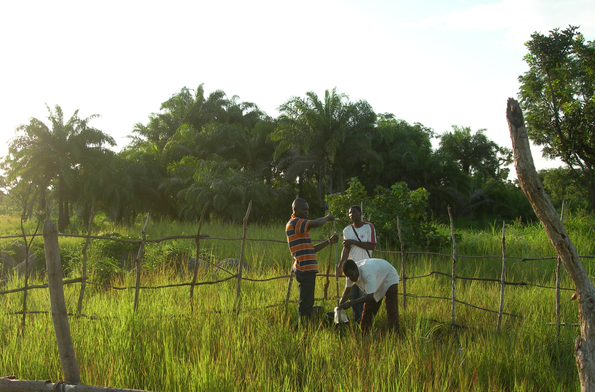
The Oueme mesoscale site (Benin) is part of the AMMA-CATCH observation network. Its characteristics are as follows a 14000 km² basin in sudanian climate on a crystaline basement. The studies focus on the hydrological cycle, the water budget and the hydrological processes.
-
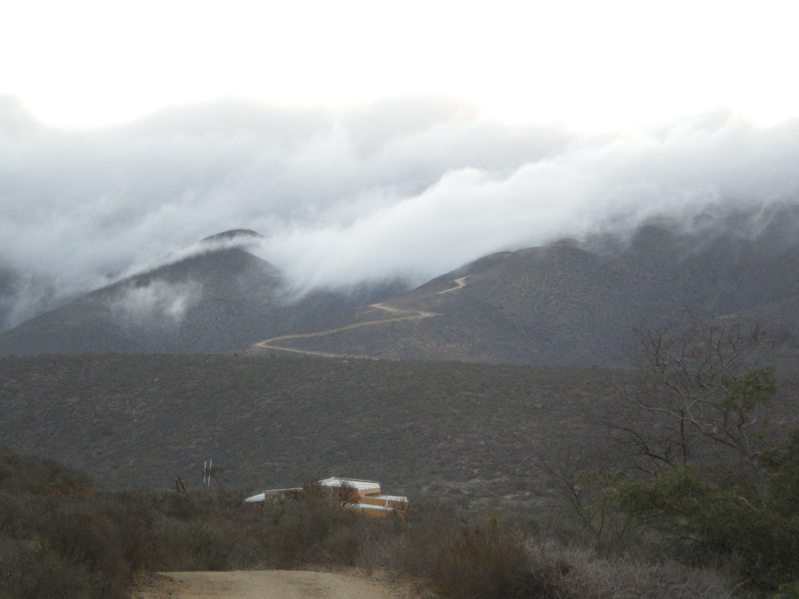
The Fray Jorge experimental site is located inside the Fray Jorge National Park, in the Region of Coquimbo. Its characteristic vegetation is Mediterranean and at the top of the coastal range exists evergreen temperate forests (cloud forests). The climate is Mediterranean with coastal influence.
-
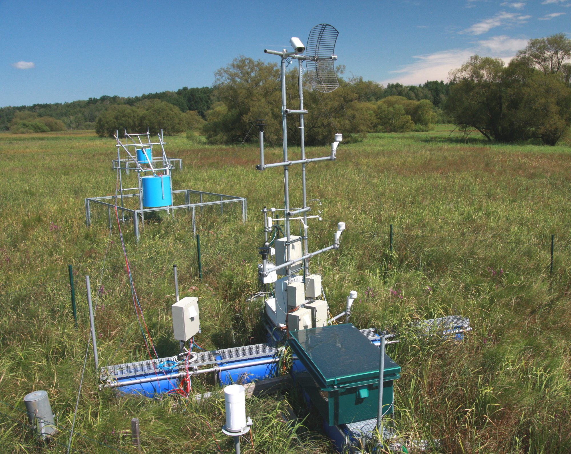
The Třeboň Wet Meadows is an LTER site of a 1 hectare area. It is a part of a wetland with the total area of 450 hectares situated in the inundation area of a large human-made reservoir (Rožmberk fishpond, 5 km2). The Wet Meadows are a predominantly herbaceous wetland with an up to several meters thick layer of organic sediment, which is superimposed on quaternary alluvial sands and clays. The vegetation cover is formed mainly by tall sedges (Carex acuta, C. vesicaria) and reed Canarygrass (Phalaris arundinacea). During the last 50 years, after cessation of mowing, a distinct stand structure of hummocks and hollows has developed. The hummocks are formed by tussocks of Carex acuta. On the site, wide water level fluctuations are recorded in some years. The relatively regular spring floods and irregular summer floods occur as a consequence of snow melting and summer rains in the catchment area, respectively. Extreme floods occurred in the summer of 2002 and both spring and summer of 2006, when the water level culminated at 2 m above the soil surface. The most frequently recorded position of the water level is at about −0.1 m. From 1977 to 2006, meteorological measurements were executed in a meteorological screen. Starting from 2006, the measurements have been executed with electronic sensors connected to data-loggers. Since that time, the site has been equipped for measuring carbon exchange and fluxes of CO2 and H2O (eddy covariance system, Licor). Since the spring of 2011, the site has been equipped for measuring methane and CO2 emissions from the sedges (automatic static flow chamber with a laser gas analyzer, LGR).The Wet Meadows are included in the integrated carbon observation system (ICOS) as a wetland ecosystem station.
-
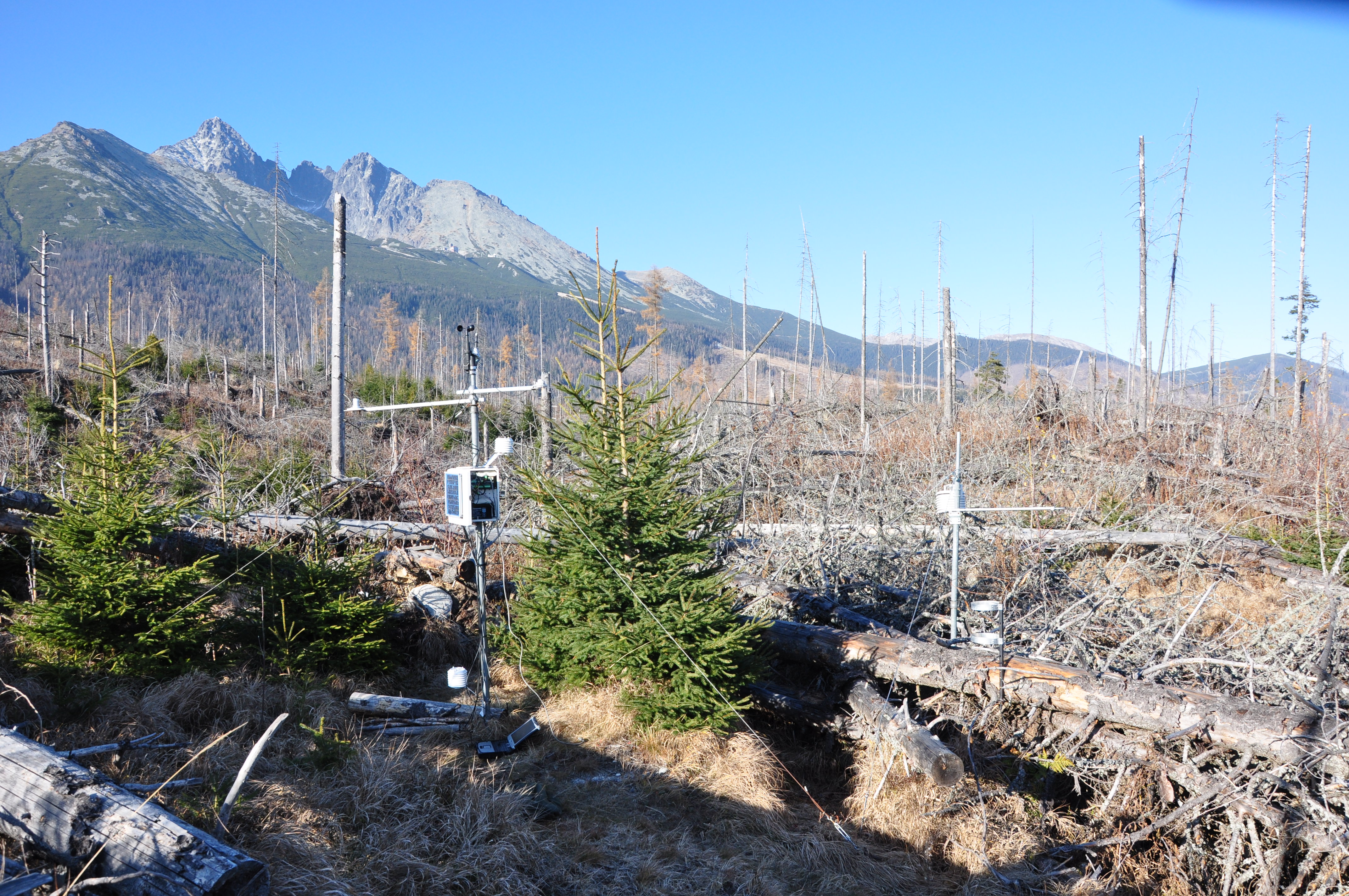
The spruce forest ecosystem has been intensively studied since 1990s (resistance to pollution, insect infestation, weather extremes). After large-scale destruction by wind (12,000 ha) in 2004, consequent bark beetle outbreak (7,000 ha) and fire, the research was focused to four research plots (min. 100 ha each). Three of them were damaged by wind disturbance: plot NEX without forestry management (no timber extraction, no afforestation); plot EXT from which timber was extracted and the plot was afforested; plot FIR damaged by fire one year after the wind disturbance. The last plot (REF) is not affected by wind disturbance (reference plot). The monitoring equipment (meteorological stations, dendrometres, transpiration flow sensors, soil lysimeters, precipitation collectors, etc.) was installed in each plot. The focus was mainly on monitoring the spatial variability of soil, vegetation and zoocenoses. Our studies confirmed permanent disturbance regime on the affected area and unexpectedly fast and successful regeneration of ecosystem after damage. The intense, but short-term increase in nutrient flows (especially nitrogen) and the renewal of carbon sequestration confirm the adaptation of ecosystems to this disturbance regime. We found increase in biodiversity (abundance and diversity of fauna and flora) caused by disturbance. Future risk poses projected warming which might dramatically change growing condition for dominant tree species and increase population of bark beetles.
-
Skogaryd is designed and state of the art equipped for interdisciplinary landscape and atmospheric studies that encompasses the complete catchment from a pristine bog via streams, riparian zones and forests to lakes, as well as the subsequent exchange between the atmosphere and surface waters The station also elucidating Greenhouse Gas (GHG) emissions from drained organic forest soils and are used for testing ecosystem models. The terrestrial sites at Skogaryd measure GHG emissions with eddy covariance (EC), CO2, H2O and N2O/CH4 (site dependent) and abiotic/biotic variables. They also have automatic stream station (flow, DIC/DOC etc.) and will be equipped with cameras/spectrometers for phenological studies and satellite ground truth validation. The forest sites are equipped for below ground studies; suction/gas probes, fine root production, Mycorrhiza, sap flow, above litter fall, tree production etc. At the lake CO2, H2O and CH4 are measured with EC. Abiotic and weather data are monitored. The sites have electric power, internet connection, boardwalks, bridges or boats. They have capacity for chamber/profile studies and process studies.