
population changes over time
Type of resources
Available actions
Topics
Keywords
Contact for the resource
Provided by
Years
Formats
Representation types
-
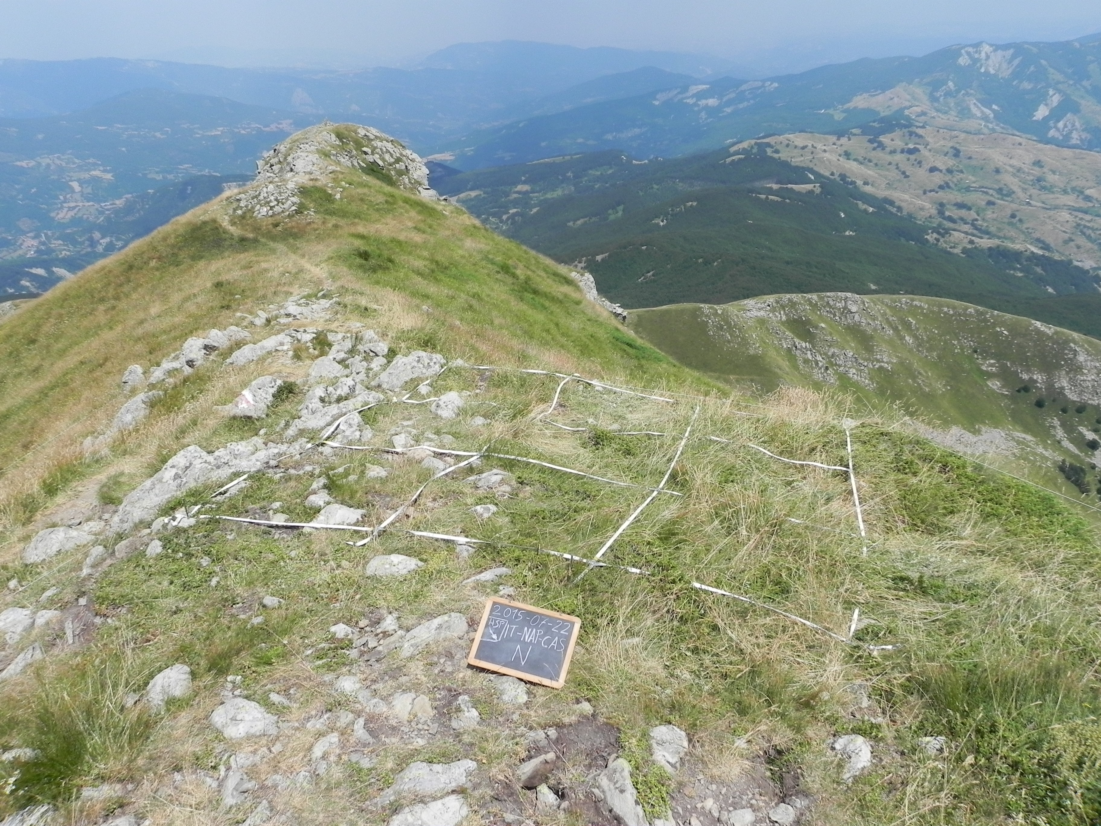
The site consists of “orographic islands” with high elevation vegetation in central Mediterranean basin, along the Apennines mountain range, within the Appennino Tosco-Emiliano National park and partially in the Appennino Modenese Regional park. It includes 64 permanent plots for plant species monitoring, distributed from timberline zone to the subalpine/alpine belt (1722-2000 m), that belong to the GLORIA project’s world network (GLobal Observation Research Initiative in Alpine ecosystems); The plots lie at the top of four summits, displayed along an altitudinal gradient, chosen following the GLORIA Target Region selection criteria. Furthermore, other 26 permanent plots, detached from the GLORIA project, have been settled on mount Prado. The observation and the long-term monitoring of vegetation and alpine plant species population started in 1999. The collection of soil temperature and osmotic potential started in 2001 and 2013, respectively. The site is resurveyed regularly to collect vegetation data (in term of presence/absence and coverage) and climatic data (temperature and osmotic potential data series recorded every 30 minutes by data loggers) in order to assess impacts of climate change on plant communities and single plant species of interest.
-
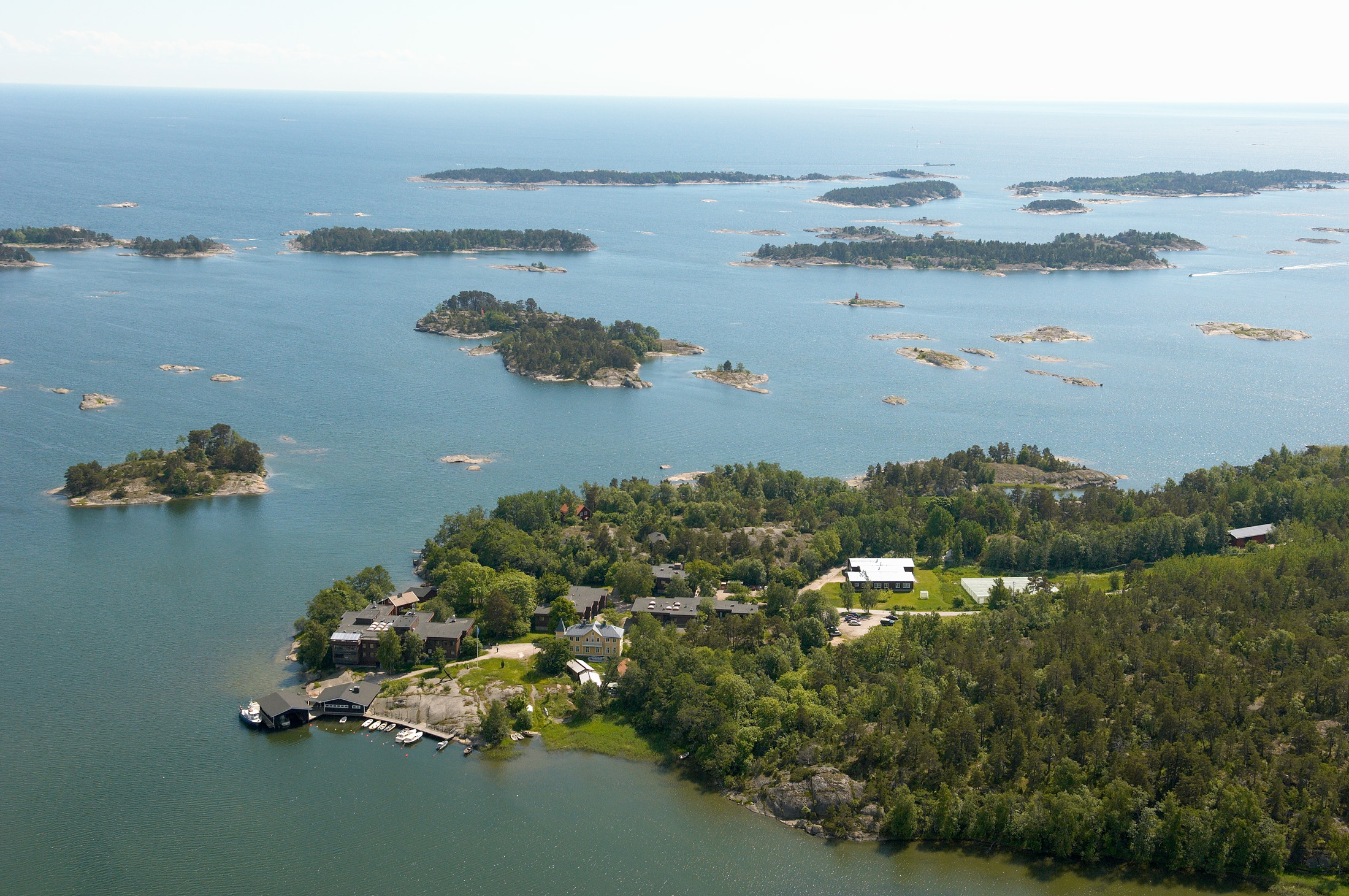
The WelFin LTER-site is located at the Hanko peninsula, at the entrance to the Gulf of Finland. The activities are largely focused to the coastal areas surrounding Tvärminne Zoological Station (University of Helsinki); a marine station established in 1902. The site is well equipped to meet the research demands, offering differently sized research vessels, field equipment, a range of climate chambers, and modern analytical instrumentation. A large part of the surrounding area is a nature reserve, to be used only for science and education. Many of the partners of this site have a long history of scientific collaboration. Although high-quality basic research continues to be at the heart of the site’s activities, many of the research questions nowadays include aspects of human induced long-term change.
-
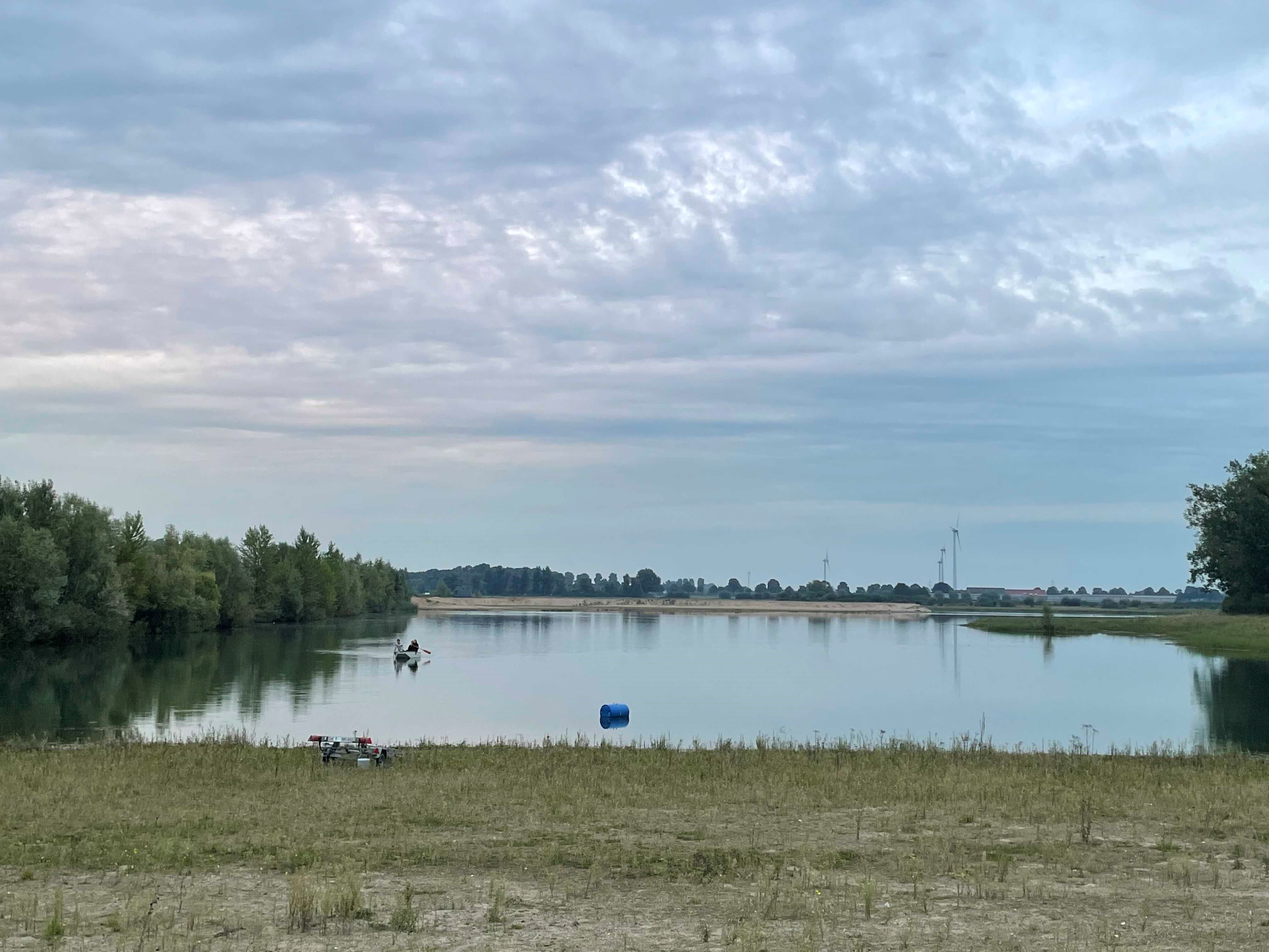
How do freshwater ecosystems react to changing environmental conditions and to what extent can these changes be captured in the dynamics of eco-evolutionary processes? The project REES ('Rhine Eco-Evolutionary System') aims at the long-term assessment of eco-evolutionary interactions in the Rhine as a limnic habitat under consideration of diverse associated water bodies. The study area includes the main flow channel of the Rhine (km 845, North Rhine-Westphalia), as well as Rhine oxbows, Rhine water-fed gravel pit lakes in ecological succession and the surrounding floodplain (Rees, district of Kleve). The Ecological Research Station Rees-Grietherbusch of the Institute of Zoology (University of Cologne) and the Nature Conservation Center District Kleve e.V. form the central infrastructure of the study area. In addition, the Ecological Rhine Station of the University under the direction of Prof. Dr. Arndt is also associated to the project, which enables direct sampling and experimental recording of the main Rhine flow channel. The extensive system of standing and flowing freshwater bodies covered in the REES study site allows the investigation of dynamic variations in biodiversity composition at all levels, from species diversity of communities to genomic diversity at the molecular level of individuals and populations. Along a selected trophic cascade, representative species will be long-term observed and analyzed ecologically and especially also (population-)genomically. The incorporation of ecological genomics is the core aspect of this LTER-D project, which is intended to capture the feedback of evolutionary changes on the ecological system. Population genomic approaches can be used to infer both evolutionary and ecological processes from genomic data. To cope with the dimension of this project, REES is designed as an interdisciplinary collaboration project and currently counts seven project partners with corresponding subordinate projects.
-
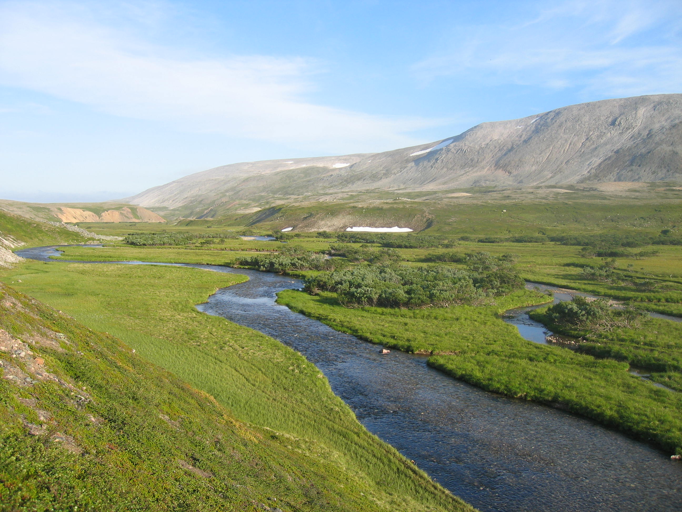
The Climate-Ecological Observatory for Arctic Tundra (COAT) platform covers two sites in the Norwegian terrestrial arctic - low-arctic Varanger Peninsula and high-arctic Svalbard. Long-term monitoring and research on tundra ecosystems are conducted on these sites.
-
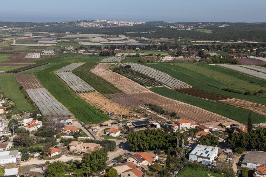
The Ramat Hanadiv LTSER platform is a unique texture of the region surrounding Hanadiv Valley and Taninim River basin. It integrates nature values with agriculture, rural communities, and heritage sites. The platform extends over an area of apprx. 15,500 hectares, including Ramat Hanadiv Nature Park and five neighboring municipal Councils: 1. Binyamina Givat-Ada (Urban; Local Council ) 2. Zikhron Ya’akov (Urban; Local Council ) 3. Hof Hacarmel (Rural; Regional Council) 4. Jisr A-Zarqa )Arab village; Local Council) 5. Alona (Rural; Regional Council) Ramat Hanadiv LTER site is located in the heart of the platform, at the southern tip of the Carmel Mountain Ridge. Ramat Hanadiv spreads over approximately 450 hectares of typical natural Mediterranean vegetation, surrounding the Memorial Gardens in which Baron Benjamin Edmond de Rothschild and his wife are buried. With mean annual rainfall of 500-600 mm and mean annual temperature of 170C-190C, Ramat Hanadiv Nature Park is characterized by diverse habitats and communities.
-
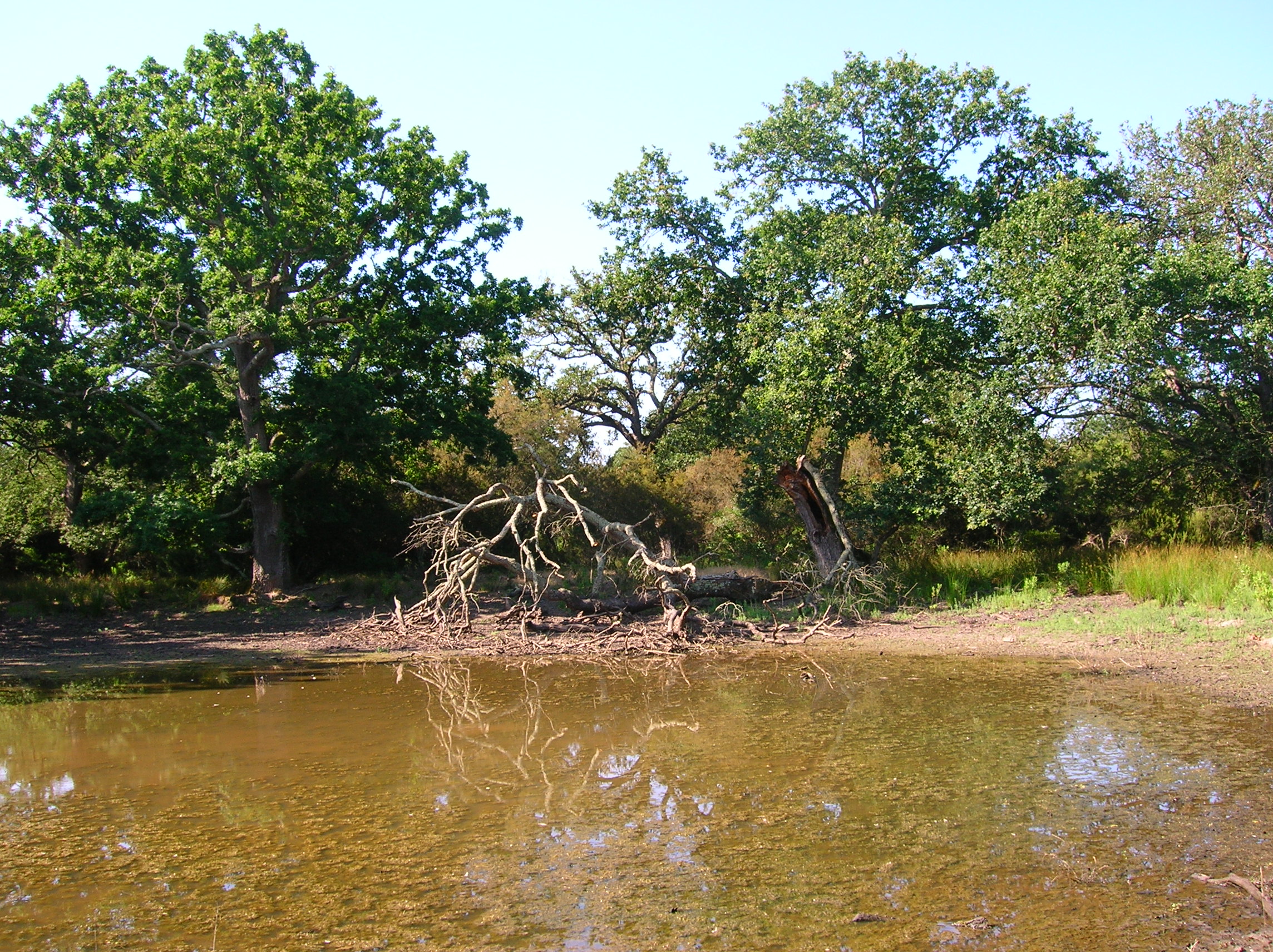
The Presidential Estate of Castelporziano stretches itself over an area of about 6100 ha and is located approximately 24 km from the city of Rome. The territory is characterized by remarkable natural features. It shows most of the typical Mediterranean ecosystems (relict strips of lowland forest with hygrophilous vegetation, deciduous and evergreen mixed oak woods, Mediterranean scrub, dune vegetation). Until recently (2019), there were large surfaces of stone pine unfortunately destroyed by the combined action of alien pest Toumeyella parvicornis with Tomicus destruens, the main pest of Mediterranean pine forests. Inside the Estate, there are two Special Areas of Conservation (SACs): one concerning the coastal strip (IT6030027) and the other one concerning hygrophulous oak-woods (IT6030028). In addition to including the two SACs, the Estate is in its entirety Special Protection Area (SPA - IT 6030084). From a botanical point of view this area, together with the neighbouring Castelfusano territory, represents what remains of the vast forest system that covered the entire delta of the Tiber and the surrounding areas. The land is mostly flat, but in the North there are modest reliefs that are not higher than 85 m. on sea level. A complex set of ancient dunes and a chain of more recent dunes stretch out along the coastline. There are many temporary and permanent natural pools and wetland areas with seasonal floodings caused by meteoric water and groundwater, which usually dry out during summer and represent sites with the greatest biodiversity. From an ecological point of view, those “relict wetland areas” play actually a very important role for biodiversity because of plant species which are typical of hydrosoil and in the past were widespread but have now almost disappeared.
-
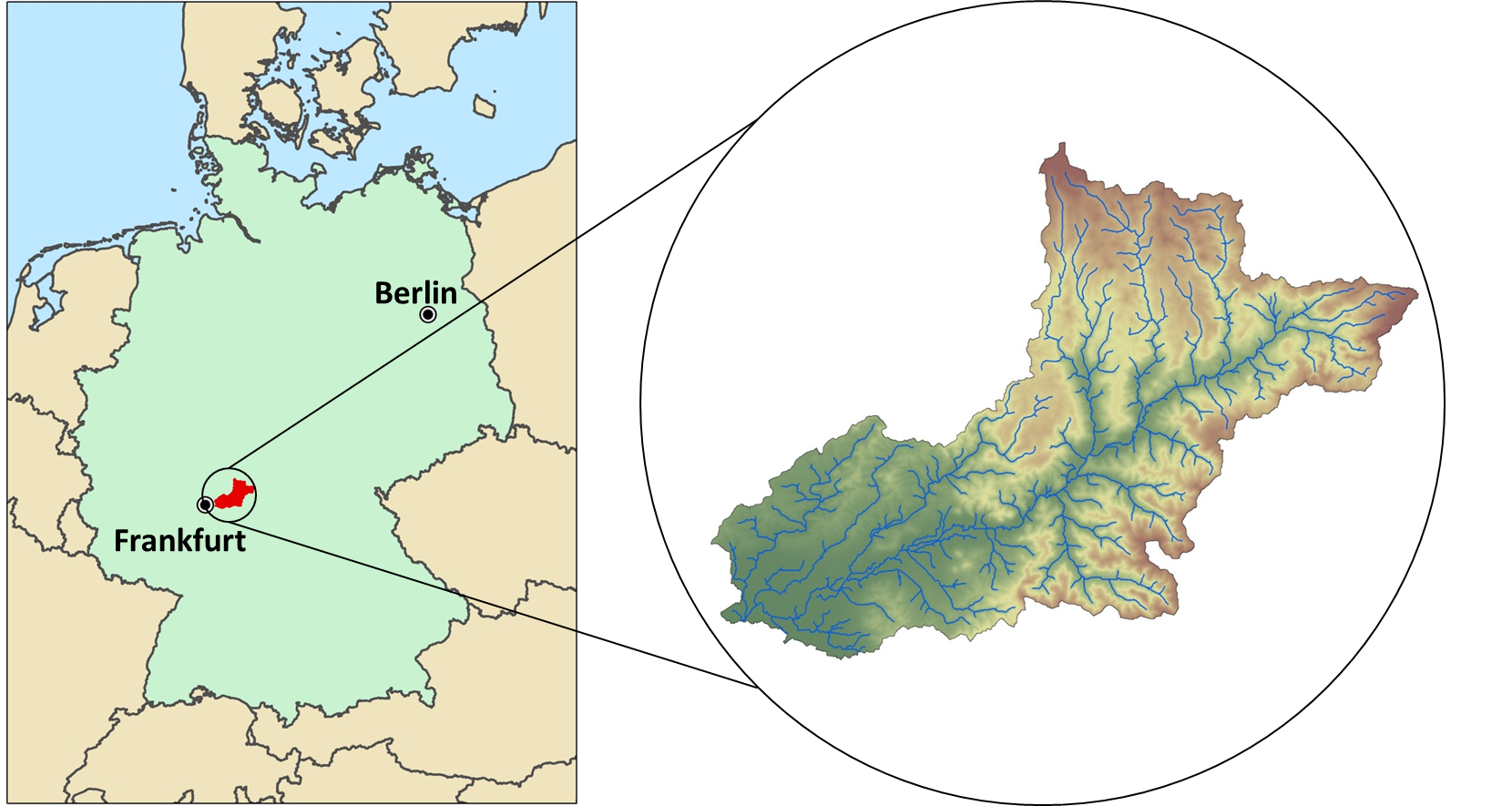
The Rhine-Main-Observatory (RMO) covers the drainage basin of the Kinzig River in Hesse, Germany (~1060km²). Situated at the fringe of the Rhine-Main area, the second largest metropolitan area in Germany, the Kinzig River divides three lower mountain ranges (Rhön, Vogelsberg, Spessart). Therefore, the Rhine-Main-Observatory includes both densely populated areas on the outskirts of the Rhine-Main metropolitan region as well as natural landscapes with little anthropogenic disturbance. This creates a highly diverse mosaic of land uses along a wide gradient of exploitation activities, from vibrant city centers to dense industrial areas; and from intensively and extensively used agricultural land, to heavily managed forests and natural reserves. The RMO was started officially in 2007, however many of the data series started much earlier. The scientific focus of the work in the RMO lies in understanding the role of land use and (micro-) climate in shaping meta-community structures in a fragmented river-floodplain ecosystem. The monitoring comprises a broad variety of permanent biotic and abiotic monitoring sites, as well as additional context-dependent monitoring schemes.
-
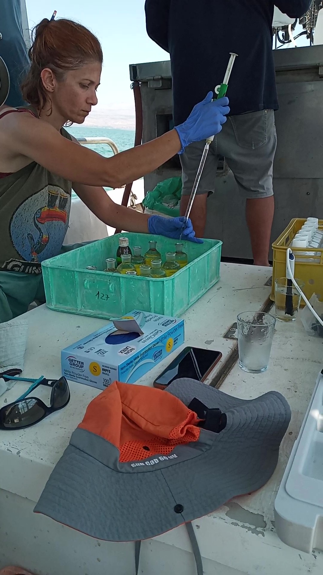
The Kinneret Limnological Laboratory (KLL) is situated at the ‘Sapir’ Site (Tabha) on the shores of Lake Kinneret (Sea of Galilee). The Lake Kinneret monitoring program conducted by KLL has been operating since Jan. 1969. The program has provided a unique database and information, due to the sampling resolution, accuracy of the measurements, and their continuity, it is used to make operational decisions and environmental policy. The monitoring program includes several stations around the lake and from numerous depths and includes fixed on-lake, high-resolution, and manual sampling of water samples analyzed in the laboratory. The Kinneret monitoring program has expanded in recent years and currently has four fixed on-lake and online sampling platforms, strategically placed, each with thermistor chains and multi-probe sensor systems including one that is a profiling system. Also, the program includes collaboration with the Ministry of Agriculture to carry out monitoring of fish and fisheries in the lake. As the lake suffers typically from two seasonal cyanobacteria blooms, (i.e., a winter Microcystis bloom and a summer N-fixing cyanobacteria bloom) routing monitoring of cyanobacteria biomass and toxins is conducted and adaptive to the extent of the bloom. This is carried out simultaneously with satellite imaging over the lake.
-
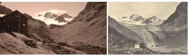
The site is located at the main Alpine ridge in Silvretta group right at the border between Austria and Switzerland. Jamtalferner glacier and it's forefield is subject to scientific reseach for more than 100 years. Current monitoring includes climate, hydrology, glacier mass balance, permafrost, paleoglaciology, society and biotic succession in the periglacial area. In addition to that, several short time research projects are carried out, e.g. concerning glacier albedo. The site inlcudes the are from the highest peaks at 3384 m a.s.l. and the valley further down to the communities of Galtür and Ischgl (1263 m a.s.l.). More information can be found at the website of the environmental education program Jamtal www.umweltbildung-jamtal.info.
-
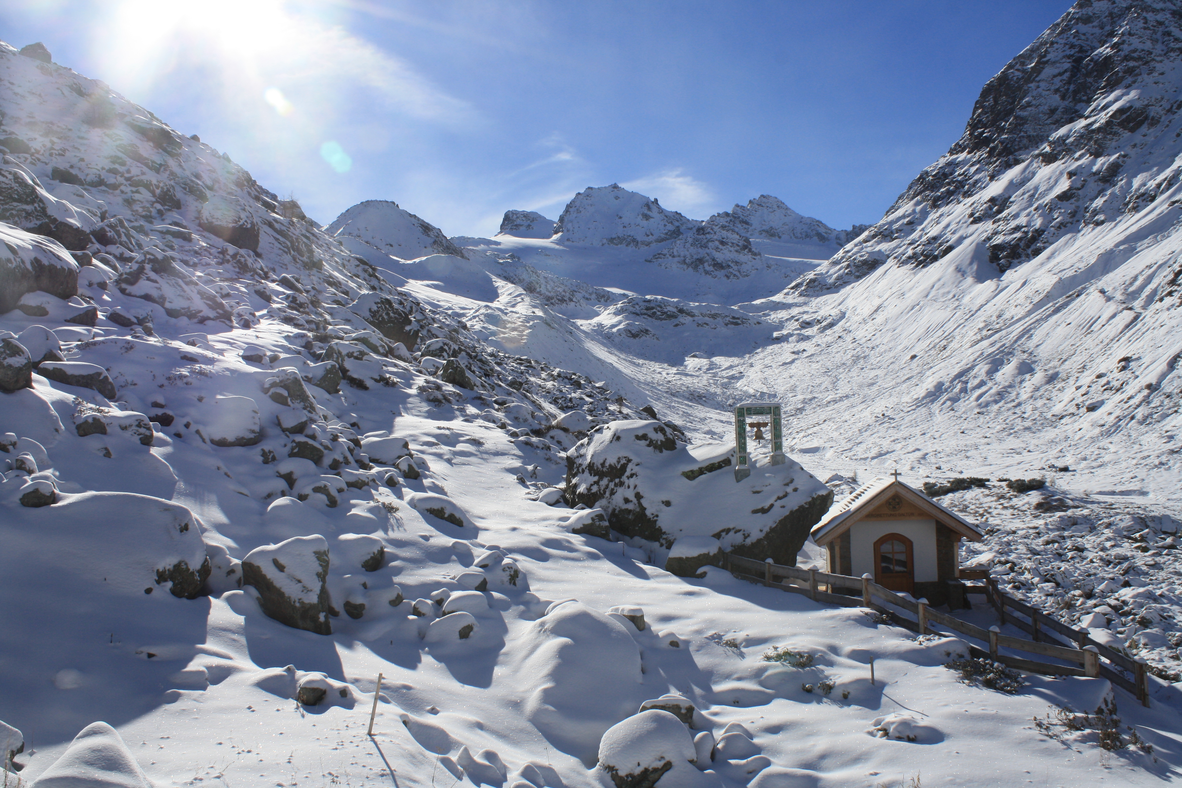
The LTSER platform Oberes Paznaun includes the communities of Ischgl and Galtür (225 km²), and covers an elevation range from 1263 to 3384 m.a.sl.. The village of Galtür is one of the highest permanently inhabited places in the Alps. Fluchthorn, the highest peak of the largely glacier-covered Silvretta, was taken down by about 30m in 2023, when a major rock fall occurred as a result of reducing permafrost. Both the effects of climate and those of land use change affect the very sensitive livelihoods in the are, exposed as they are to natural hazards, such as avalanches, rock fall and floods. The region was economically weak until winter tourism boomed from the 1970s. Skiing as dominant source of income now has an impact on land use as well as on social and economic structures in the region. Management issues arise from the high number of incoming tourists. Local stakeholder networks involved in spatial planning and hazard management are also part of the LTSER Platform. The local Alpinarium museum is dedicated to presenting the livelihoods of mountain communities and acts as a local hub for linking science and society. Apart from the long-term monitoring of the environmental parameters, initiated in 1895 with glacier length changes, the socio-economic research in the Paznaun area dates back to the 1960s. Socio-economic and socio-ecological research in the region focuses on the multiple feedbacks between environmental and socio-economic changes in the region. The avalanche disaster of Ischgl and Galtür in 1999 affected disaster management and related structures in many ways, not only for the region, but for all of Austria, for instance leading to the foundation of crisis intervention teams. The question of how to deal with impacts of climate change, for example on hydrology and water management, is part of research projects in the area connecting stakeholders and scientists. The overarching aim of the platform Oberes Paznaun is linking up geosphere, atmosphere, hydrosphere and biosphere research with local political and administrative processes for sustainable development in a warming future.