
pore structure
Type of resources
Available actions
Topics
Keywords
Contact for the resource
Provided by
Years
Formats
Representation types
-
None
-
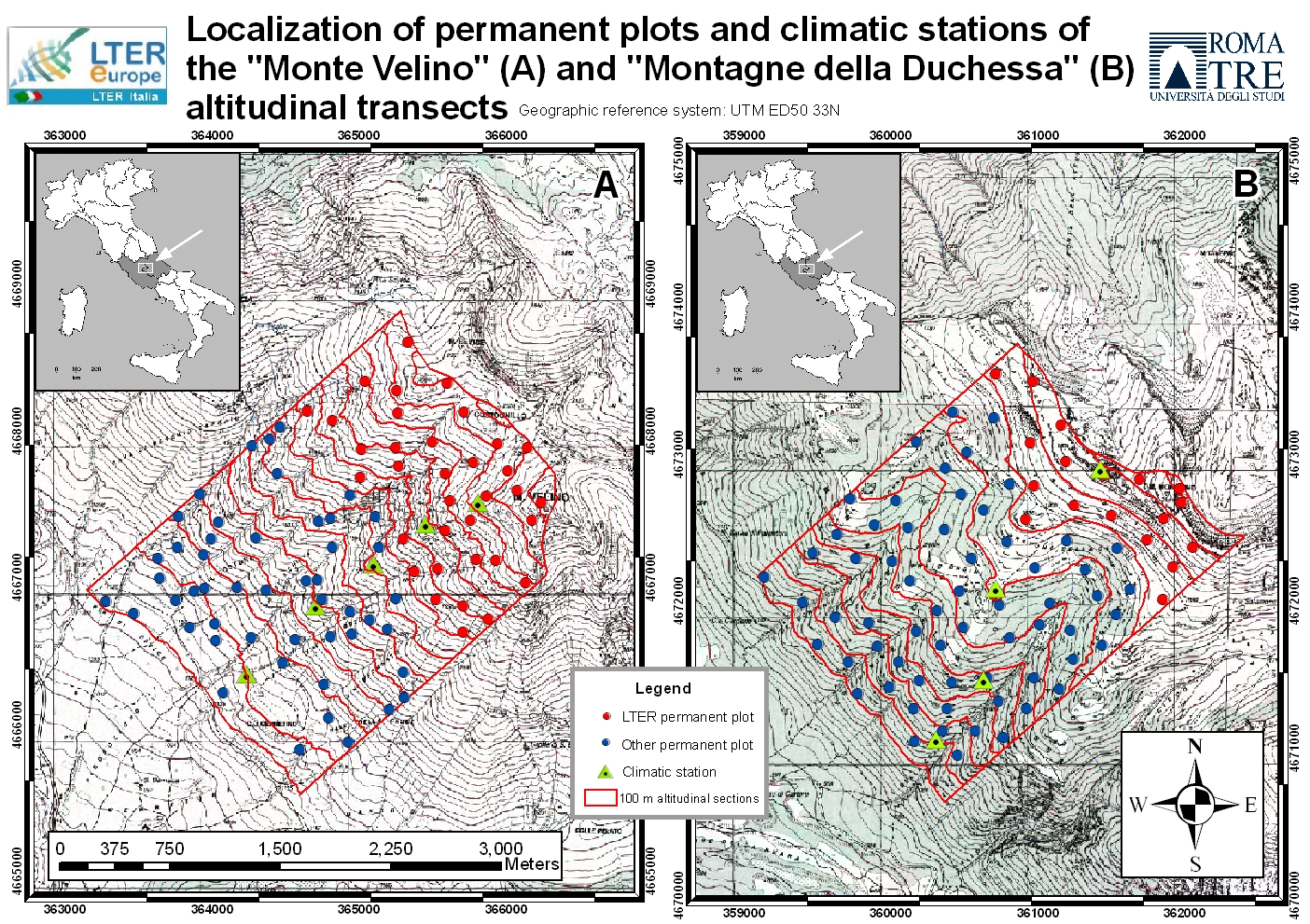
The site includes a large mountainous area in the Central Apennines, almost in the centre of the Italian peninsula and about 70 km west of Rome. It represents an “orographic island” in the Central Mediterranean basin, along the Apennines mountain range. Since 1993, the vegetation has been surveyed at six permanent high elevation plots (Mount Sevice research station, Mount Velino, 2125-2225 m a.s.l.) and (since 2005) at an additional 55 plots along two elevation transects (SW slope of Mount Velino and Mount Morrone), including primary and secondary grasslands, beech forests and alpine tundra. Since 2014, micro-climate data (GLORIA method) have been continuously recorded at the high elevation plots. Vegetation is surveyed yearly in the 6 high elevation plots (each 100 m2 in size) grouped in two cluster-plots (each of 3 plots). Structure and composition changes are studied in two ecologically opposite primary plant communities, both above the timberline: snow-bed grassland and alpine tundra, both characterized by extreme below zero temperatures all year round and frozen soil for 8 months per year, but with very different snow cover duration. Based on the first 30 years of observation, a clear trend toward a decrease of snow dependant species and a parallel increase in drought- and stress-tolerant species has been recognized, linked to a general process of climate change, more accelerated in Southern Europe.
-
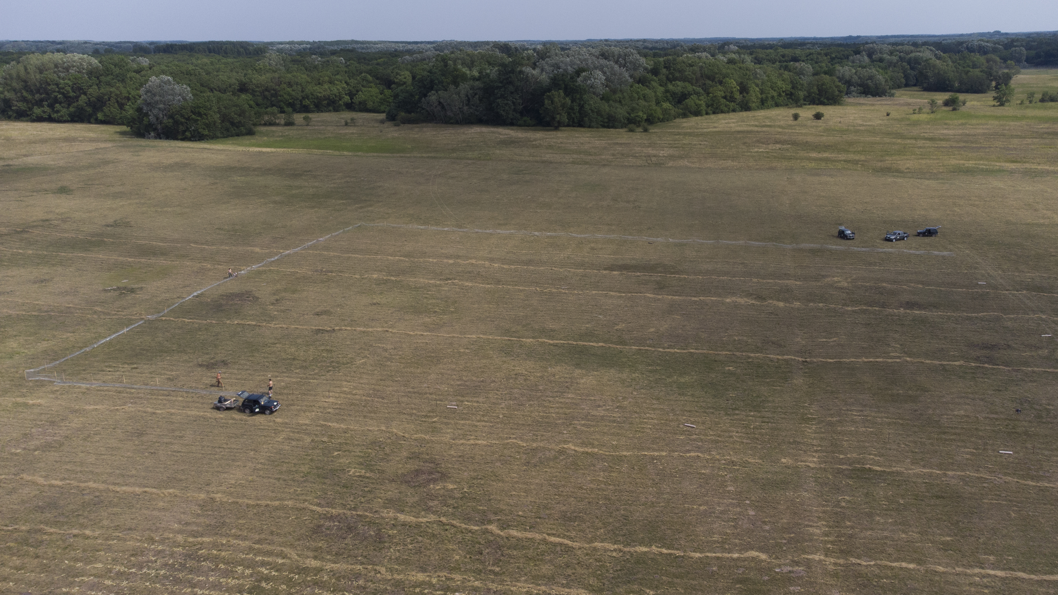
The site is a revitalized young steppe habitat patch, dominated by fescue (Festuca rupicola). The average altitude is around 100 m. The site is a grazing spot and it was recently used for the reintroduction of the European ground squirrel (Spermophilus citellus) to the area after 70 years. Other important species present at the site include Vojvodina blind mole rat (Nannospalax (leucodon) montanosyrmiensis) and Spring meadow saffron (Bulbocodium versicolor).
-
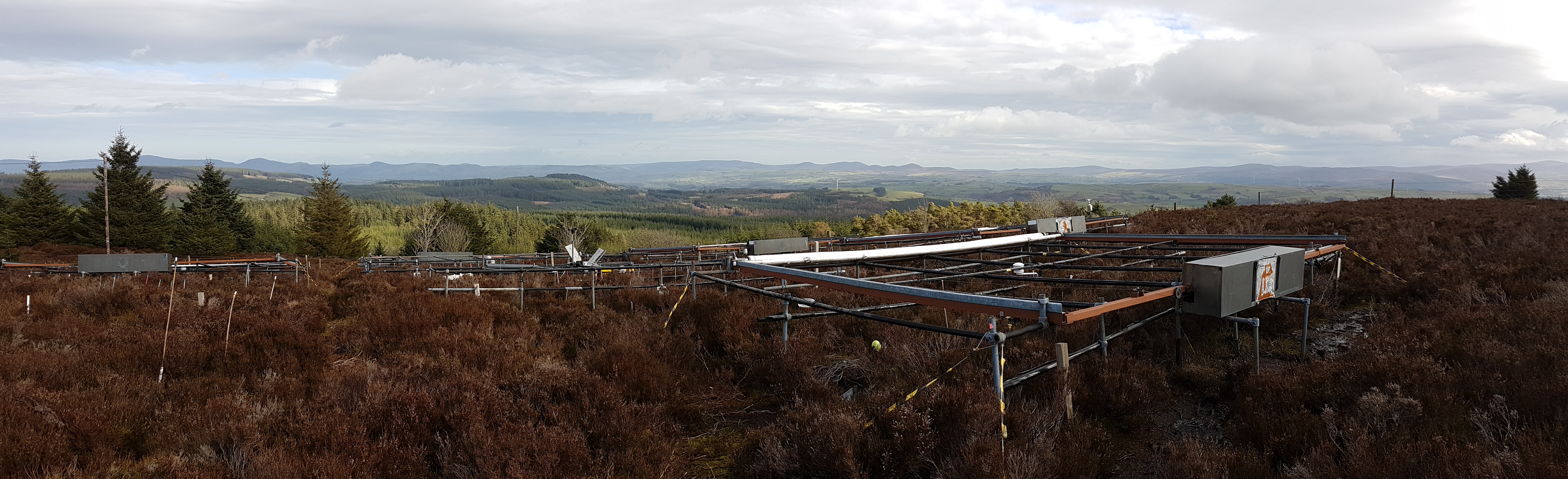
The site is located in Clocaenog Forest in North East Wales (53o 03’ 19’’N -03o 27’ 55’’ W). It is a typical upland west-atlantic moorland, dominated by the evergreen shrub Calluna vulgaris (heather). Heather makes up >60% of the plant biomass at the site, but Vaccinium myrtillus and Empetrum nigrum are also present.
-
Vestskoven is a 15 km2 ongoing afforestation area located 15 km west of central Copenhagen. Since 1967 arable land has successively been bought up for afforestation in order to establish a large forest area for outdoor activities and wood production. In 1998, afforestation chronosequences in oak (Quercus robur) and Norway spruce (Picea abies) were established as a research platform to quantify soil carbon dynamics, water recharge, nitrogen budgets and ground vegetation species diversity. The soil and grund vegetation species composition were resampled in the chronosequences after 13 years in 2011. Since 2003, an ICP-Forests Level II/Core plot with integrated monitoring under the UN Convention on Long-Range Transboundary Air Pollution (CLRTAP) is placed in an oak stand. Monitoring has developed over time. There is no time limit on the monitoring financed by the Ministry of Environment and Food in Denmark.
-
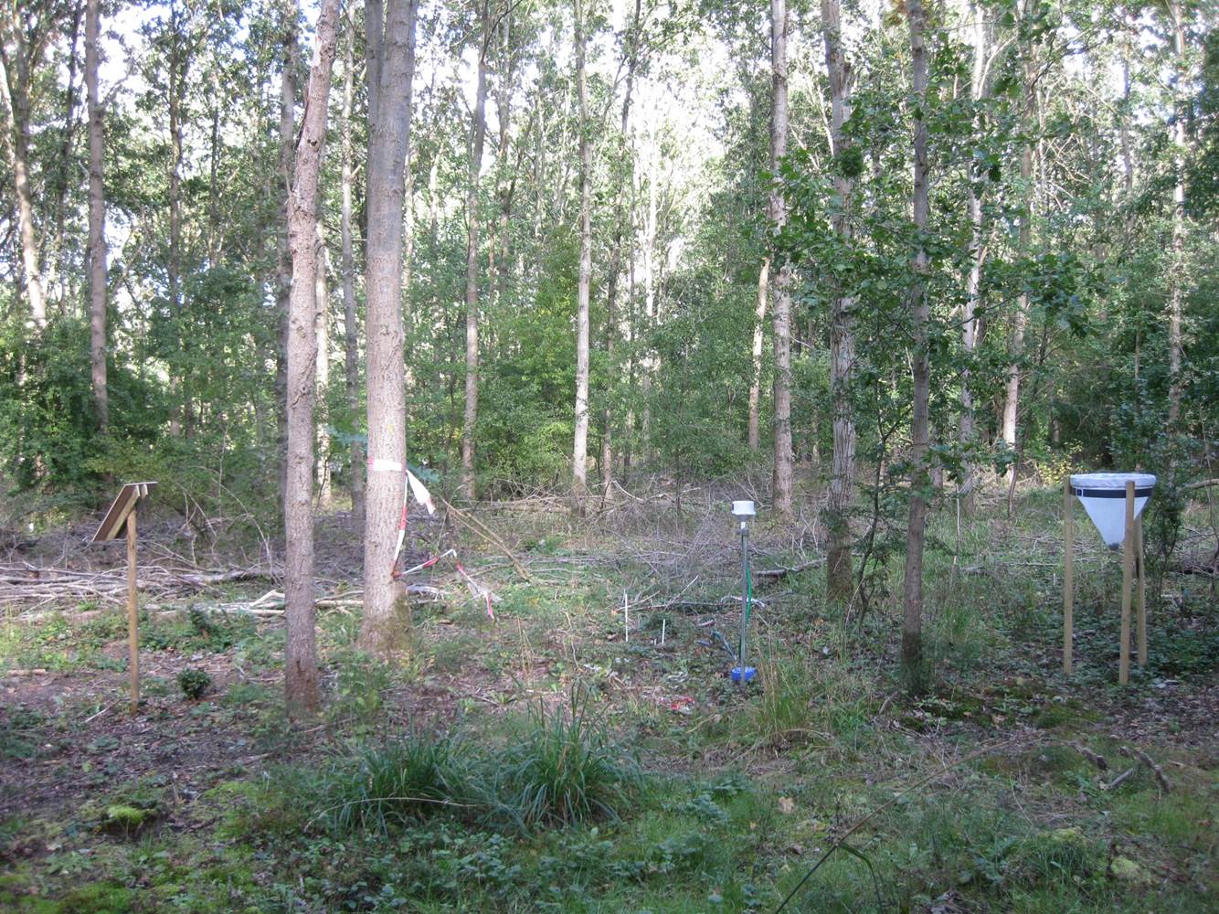
Suserup Skov (19.2 ha) is an old growth temperate forest dominated by beech Fagus sylvatica, pedunculate oak Quercus robur, ash Fraxinus excelsior, wych elm Ulmus glabra, and black alder Alnus glutinosa, admixed with lime Tilia platyphyllos and sycamore maple Acer pseudoplatanus. KU/IGN-SNB, is a 19,2 ha old-growth beech-dominated mixed deciduous forests on western Zealand owned by Sorø Academy. The forest use dates back to 4200 BC. A conservation act was placed on the forest in 1925 for biological and recreational purposes but allowing a minimum odd felling until the act was updated in 1961 to a non-intervention forest. The forest is unique at European level in terms of nonintervention, and the long-term status as non-intervention forest has led to a unique steady state in biomass and accumulation of dead wood, thus serving as an important reference site for unmanaged temperate deciduous forest development. There are long-term data records of e.g. biomass, dead organic matter, soil, forest structure, flora and fungi starting from 1992. The platform is included in a series of paired managed and non-intervention forests for studies of forest structure, biodiversity and biogeochemistry in mature and old beech-dominated forests. Suserup Forest includes an ICP Forests level II plot (2001-). Upgrades: eLTER master sites: soil moisture content (TDR), remote sensing of growth and forest structure, LAI, NDVI (Lidar, camera), continuous plant phenology (web cam),and insect monitoring (optical sensors) as biodiversity measures, ambient air quality and air pollution.