
prey availability
Type of resources
Available actions
Topics
Keywords
Contact for the resource
Provided by
Years
Formats
Representation types
-
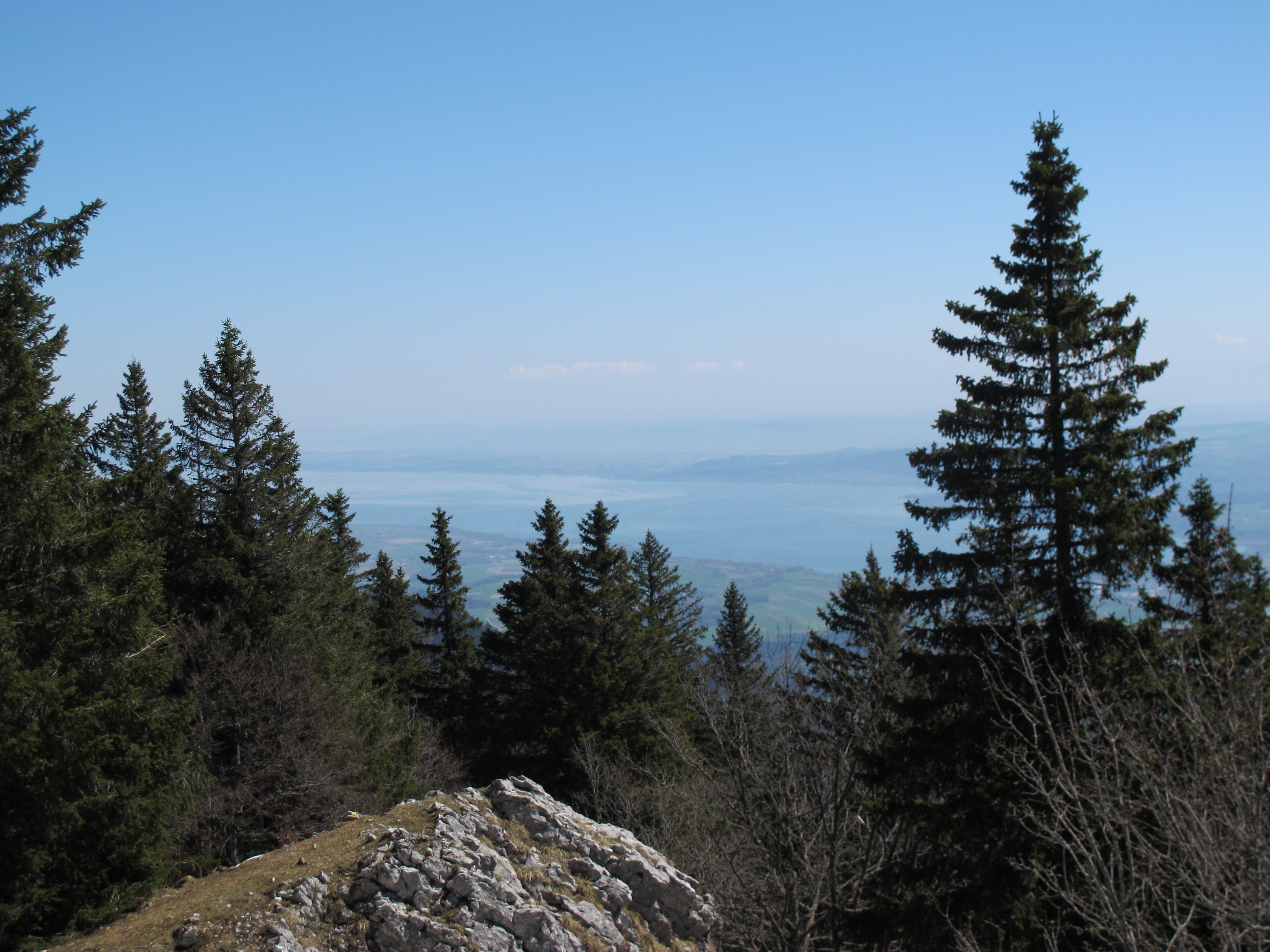
Socio-ecological interactions in ecosystems of mid-altitude mountains The LTSER Zone Atelier Arc Jurassien belongs to LTER-France network and is located in eastern France.The LTSER site Jurassian Arc (ZAAJ stands for Zone atelier Arc jurassien, in French) is designed to promote long-term interdisciplinary research into the environment and ecosystems in relation to society issues. It federates a network of research partnerships around interactions between the environment, society and the dynamics of moutain socio-ecological systems.ZAAJ helps to capitalise on field data and to analyze and promote the results from long-term observation schemes at the interface between ecology, the environment and society. Benefiting of more than 25 years of experience on the issue, accredited by the CNRS Ecology and Environment Institute (INEE) in 2013, ZAAJ is a cluster of five research units totalling 40 researchers.
-
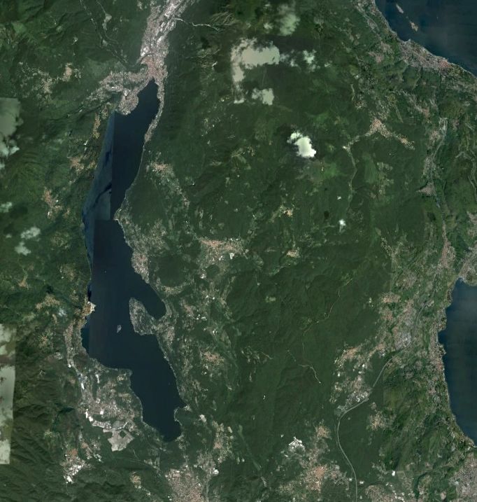
Lake Orta is a deep subalpine lake, located in Northern Italy, at a mean altitude of 290 m a.s.l. Its perimeter is 33,8 km, surface area 18,14 km2, volume 1,29 km3. Lake Orta has a maximum depth of 143 m and a mean depth of 71 m. Lake Orta is well known for being polluted by industrial discharges (copper sulphate and ammonia) since the late 1920: as a consequence, the pH of the lake water dropped down till 4 and the food web was almost completely destroyed, except for some few, strongly adapted species. The pollution stopped around mid 1980s and a liming intervention was carried out in 1989-1990, to neutralize the acidic waters of the lake. The recovery was very fast, new species started to colonise the lake just after the liming. The lake, however, is still at risk, due to the large amount of heavy metals stored in the sediments.
-

The Seine estuary is a megatidal estuary located in northern France. It is the third largest estuarine ecosystem in the country after the Gironde and Loire along the French Atlantic coast; its waters flow into the English Channel. The geographical zone of influence of the Seine estuary runs from just upstream of the Poses dam, at the limit of the tidal penetration into the estuary — 160 km upstream of Le Havre —to the eastern part of the Bay of Seine. It can be divided into three sections: the fresh water upstream section (125 km), the mixing zone characterized by varying salinity levels (35 km), and the marine downstream section under the influence of the Seine River. The megatidal regime generates a turbidity maximum in the mixing zone (middle estuary) between the marine and fluvial sections of the estuary. The Seine estuary is a typical estuarine ecosystem: highly stressed by natural fluctuations and anthropogenic pressures, and hosting a rich ecological system. The Seine valley and its estuary are of major economic importance for France, with the presence of two maritime ports. It’s watershed (79,000 km2) is the home to 17 million people, and accounts for 50 % of the river traffic in France, 40 % of the country's economic activity, and 30 % of its agricultural activities. In addition to the Greater Paris area (> 11 million inhabitants), which contributes heavily to the Seine estuary's upstream inputs, two other major river settlements — Rouen (500,000 inhabitants) and Le Havre (300,000 inhabitants) — are maritime ports of international importance. Due to economic development, the Seine estuary has been subjected to major hydrodynamic, ecological, biogeomorphological and biogeochemical changes. The importance of studying the effects of anthropogenic impacts on estuarine ecosystems has increased in the last decade, especially under the Water Framework Directive, which aims to achieve “good environmental status” of all European water bodies.
-
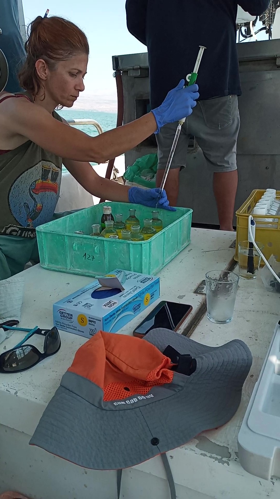
The Kinneret Limnological Laboratory (KLL) is situated at the ‘Sapir’ Site (Tabha) on the shores of Lake Kinneret (Sea of Galilee). The Lake Kinneret monitoring program conducted by KLL has been operating since Jan. 1969. The program has provided a unique database and information, due to the sampling resolution, accuracy of the measurements, and their continuity, it is used to make operational decisions and environmental policy. The monitoring program includes several stations around the lake and from numerous depths and includes fixed on-lake, high-resolution, and manual sampling of water samples analyzed in the laboratory. The Kinneret monitoring program has expanded in recent years and currently has four fixed on-lake and online sampling platforms, strategically placed, each with thermistor chains and multi-probe sensor systems including one that is a profiling system. Also, the program includes collaboration with the Ministry of Agriculture to carry out monitoring of fish and fisheries in the lake. As the lake suffers typically from two seasonal cyanobacteria blooms, (i.e., a winter Microcystis bloom and a summer N-fixing cyanobacteria bloom) routing monitoring of cyanobacteria biomass and toxins is conducted and adaptive to the extent of the bloom. This is carried out simultaneously with satellite imaging over the lake.