
radiation below canopy intensity
Type of resources
Available actions
Topics
Keywords
Contact for the resource
Provided by
Years
Formats
Representation types
-
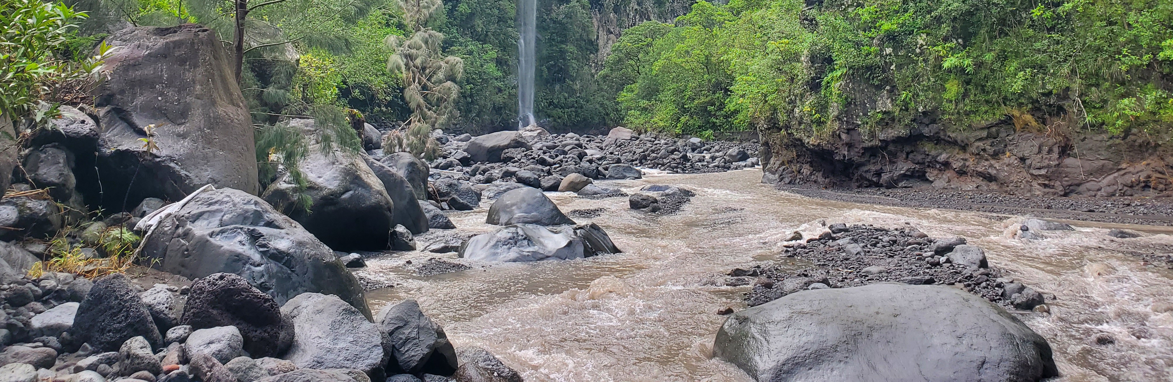
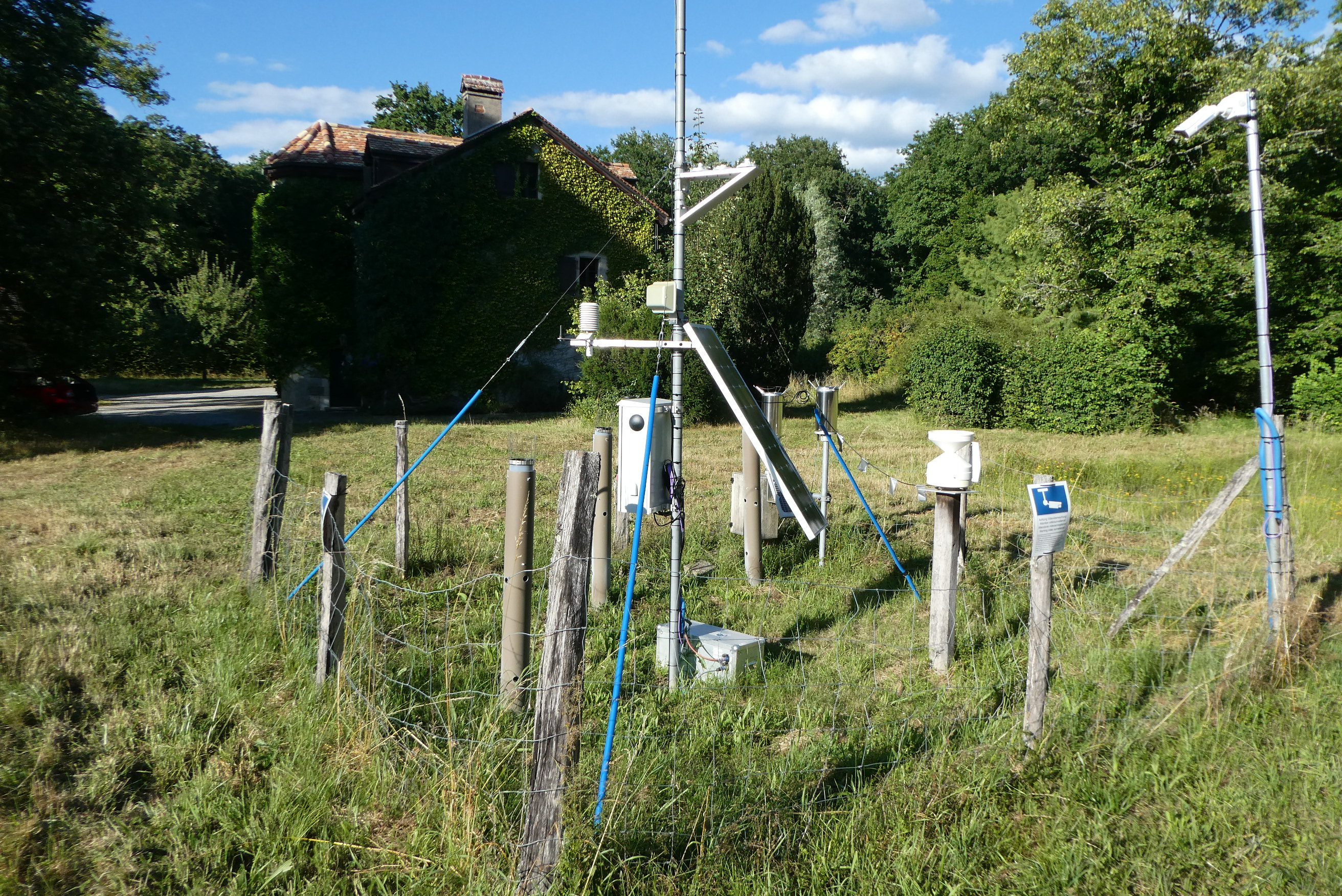
The Bassin de la Rivière des Pluies is located on Réunion Island (French Overseas, Indian Ocean). This volcanic island results from the emission of basaltic products from the Réunion hotspot that initiated 65 Myrs ago with the development of the Deccan traps. Rivière des Pluies drains a watershed of 46 km2 located on the windward side of the dormant Piton des Neiges volcano, from 2276 msl to the sea shore. The Rivière des Pluies catchment is mainly composed of lava flows and breccias aged from 1.4 Ma to 200 ky. The overall watershed is made of a main canyon deeply incised in the volcano flank and a large planeze covered by the deposits of the last explosive eruptions of Piton des Neiges. The combined action of the vegetation and alteration along a strong altimetric gradient produced a wide range of soils typically ranging from 0.5 to 6 meters. Vegetation is dominated by tropical rainforest. The hydrologic regime is torrential: flow rate is characterized by abrupt variations due to tropical rains. Storms and cyclones only occur during the rainy season from december to april.
-

Tronchaney, Conca di Torgnon, (Torgnon, Aosta), + 388330 + 5075950; Aosta Valley
-
Tellinod, Conca di Torgnon, (Torgnon, Aosta), +389680 +5077920; Valle d'Aosta region
-
Síkfőkút LTER Europe site is a temperate deciduous forest site, unmanaged since the late 1960ies. It is situated in the Szőllőcske forest reserve area on the southern foothills of Bükk Mountains, NE Hungary. The site is covered by a mature coppice oak forest (105 years old) with Q. petraea and Q. cerris in the upper canopy layer and other woody species occurring in the secondary canopy layer and shrub layers (Acer sp., Cornus sp, Euonymus sp., Crataegus sp.) The site was seriously impacted by oak decline during 1980ies. The soil has been classified as a brown forest soil type according to the Hungarian Soil Classification System which corresponds to Luvisol according to FAO WRB. Long-term data are available on climate, soil variables and forest structural and functional characteristics (for period 1973-2016).
-
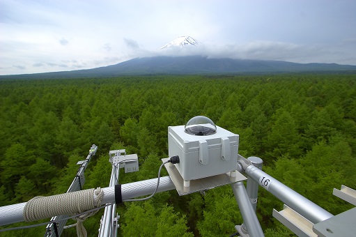
The Fuji Hokuroku Flux Observation Site (FHK) (35° 26'N, 138° 45'E, 1100m above sea level) is located in a mature larch forest of 55-60 years old at the foothills of Mt. Fuji. The micrometeorological, meteorological and biomass measurements were started in 2006. Active studies are now conducted for technological development of various gas flux measurement methods, including other greenhouse gases such as methane. The site is also used for ground measurement to validate satellite remote sensing data, various training programs, and joint investigations with Asian researchers.
-
Oulanka Research Station is part of the Infrastructure Platform and is situated in Kuusamo as a regional unit of the University of Oulu. The station is located in the Oulanka river valley within the Oulanka National Park (66°22'N, 29°19'E). The area lies within the boreal coniferous forest-zone (Taiga), where Norway spruce and Scots pine prevail. In the Oulanka river valley there are, also many alluvial meadows, stream mouths and crags supporting luxurious plant communities. The bedrock is calcium-rich in places. Bogs, fens and marshes as well as numerous springs, ponds and lakes, brooks and rivers characterize the landscapes. All these factors together create a diverse and exceptional rich environment with rich flora and fauna.In terms of temperature Oulanka has a continental climate. The coldest and warmest ever measured temperatures are -48.0°C and 32.1°C. The difference between the mean temperature of coldest (January, -15°C) and the warmest (July, 15°C) month is 30°C. The mean temperature for the whole year is c. -0.5°C (1967-2009).
-
The site Bily Kriz (Bílý Kříž) is located in Moravian-Silesian Beskids Mountains. Ecosystem type: Managed secondary pure Norway spruce stand. Prevailing species: Norway spruce (Picea abies [L.] Karst.) Height of the stand: 17 m (2016) Understory: Vaccinium myrtillus L. Year of plantation: 1981 by 4 years old seedlings
-
The Yatir Research site was set up in 2000 at the center of the Yatir Forest, a 2'800 ha afforestation system of mainly P. halepensis trees, and is located on the southern end of the Hebron mountain range and at the northern edge of the Negev desert (31° 20’ N; 35° 3’ E; elevation 600 to 850 meters above sea level). Most of the area was planted during the 1960s-1970s. The site is located in the transition zone between the semi-arid and arid Mediterranean climates. Average air temperature for January and July is 10 and 25°C, respectively. Mean annual potential ET is 1600 mm, and mean annual precipitation is 285 mm. Only winter precipitation occurs in this region, creating a distinctive wet season (winter, December to March) and an extended dry season (summer, June to October), with short transition periods between them: a wetting season (autumn) and a drying season (spring). Research in the site mainly focuses on ecophysiology and ecohydrology, energy, carbon and water budgets, influence of stand density (through manipulation experiments), boundary layer dynamics and ecosystem interactions with the climate.
-
Hainich is a large deciduous forest area in Thuringia and is situated in central Germany not far from the town of Eisenach with the famous Wartburg Castle. With a total area of ca. 16.000 hectares (13.000 hectares of which is forest), Hainich is the largest continuos area of deciduous forest in Germany. On the 31.12.1997 the southern part of Hainich, with an area of 7.500 hectares, was declared Germany’s 13th National Park. Since then it has been seen as a place of relaxation close to nature that is open to sustainable tourism. The area has gone through an amazing development which is quite unique. Since 2011 Hainich is part of UNESCO World Heritage Site "Primeval Beech Forests of the Carpathians and the Ancient Beech Forests of Germany".
-
The forest site "Jussy" has been installed in 1995 as part of the Swiss Long-term Forest Ecosystem Research Programme LWF. The programme investigates anthropogenic and natural forces on the long-term health of the forests and the potential risks to humans. For this, a profound understanding of the relationship between processes, causes and effects in the ecosystem are necessary. The objectives of the LWF research programme include (i) early detection and a representative assessment of changes in forest condition, (ii) determination of external influences, both from anthropogenic and natural sources such as element inputs and climate and their effect on the forest ecosystem, (iii) development of indicators to assess the condition of the forest, (iv) integrated risk assessment based on different stress scenarios, and (v) extended platform for internal and external research projects. The LWF research programme provides, on the one hand, long-term data series from the last 20 years, together with a scientific interpretation to national and international policy makers. On the other hand, the available data and latest LWF infrastructure provide an attractive scientific platform for collaboration with both national and international partners. The site is located close to Jussy in the canton of Geneva, within a natural, mixed forest stand which mainly consists of 90 year-old sessile oak (Quercus petrea), 60 year-old aspen (Populus tremula), and 60 year-old European hornbeam (Carpinus betulus) trees. Among others, the site is equipped with two meteorological measurement stations; one is located within the forest stand, the second is co-located in the nearby open-field, allowing to measure the forest stand effect on micro-climate. The following parameters are being measured (starting-end year): Atmospheric deposition (throughfall and bulk deposition) (1997-today), Circular vegetation plots (1995-today), Crown Condition Assessment (1995-today), Deadwood survey (1995, 2005-today), Diameter and Height measurements (2000-today), Foliar analyses (1997-today), Leaf area index (LAI) (1996-today), Lichens (2003-today), Litterfall (1997-1998), Manual circumference band measurement (2001-today), Matric potential (manual suction cups) (1996-today), Meteorological measurements (1997-today), O3 Injuries (2002-today), Ozone visible injury assessment (2002-today), Passive sampling of NH3 (1999-2000), Passive sampling of NO2 (1999-2000), Passive sampling of O3 (2000-today), Permanent vegetation quadrats (1995-today), Phenological observations (1997-today), Soil matrix chemistry (1995-today), Soil morphology (1995-today), Tree core sampling (1916-1998), Tree crown measurements (1995-today), Deadwood sampling (2009-today).