
redox potential of water
Type of resources
Available actions
Topics
Keywords
Contact for the resource
Provided by
Years
Formats
Representation types
-
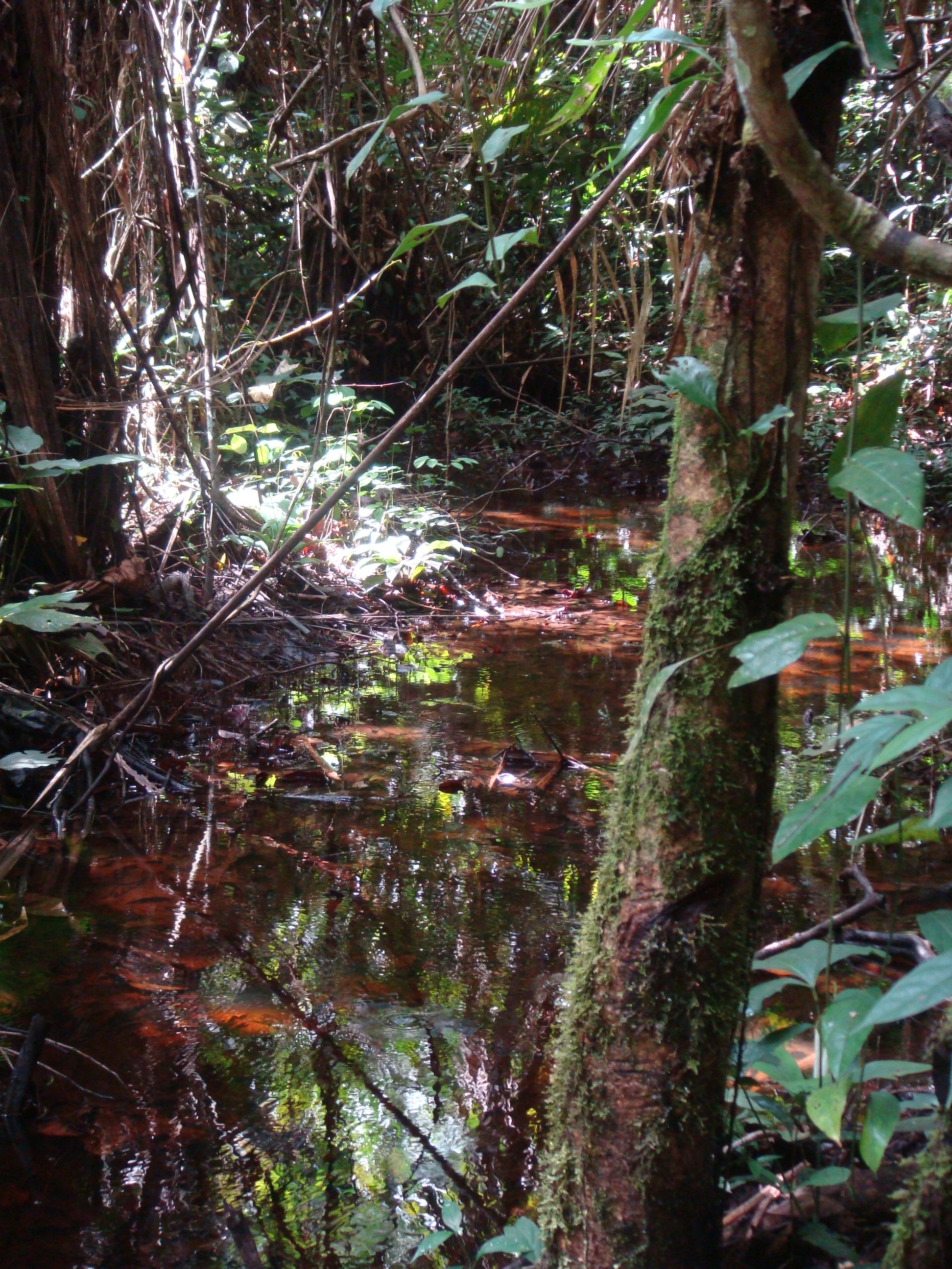
National Network Name : rbv_czo Nested watersheds in humid tropical forest of Cameroon from the Mengong experimental watershed (0.6 km2) to the Nyong River at Olama (18500 km2) Granitoid bedrock secondary forest low anthropogenic pressure Monitoring initiated in 1994 for some parameters more details at : https://mtropics.obs-mip.fr/
-
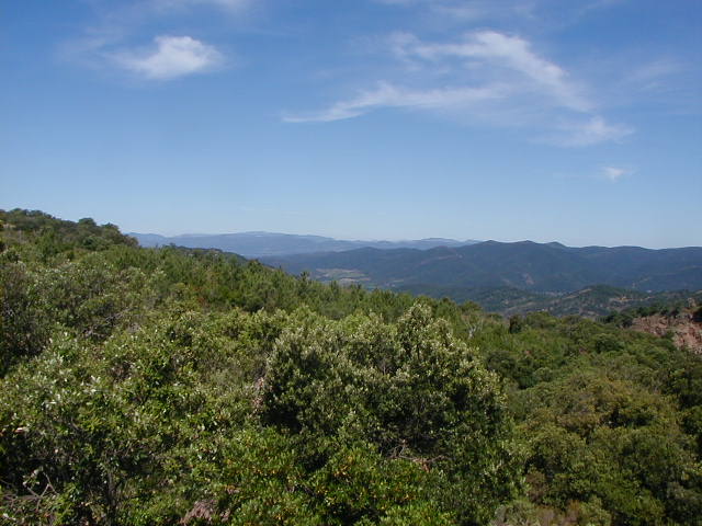
The Watershed Research and Experimentation of Real Collobrier is a privileged site for the observation and the study of the water cycle in the Mediterranean forest. It is a landmark site of the hydro regional climatology where many cognitive approaches have been carried out. Observation network allows the study of phenomena with a particularly fine scale, which makes it an ideal laboratory for the development of methodologies directly applicable in operation al hydrology. The watershed is instrumented since 1966. It has long chronic hydro-climatic data for fifty years, with 15 rain gauges and 7 flow gauges. Climatology and physico-chemical measurements are also carried out continuously. The multidisciplinary approach, associated with specific experiments, allows a deepening of our understanding of the interaction soil-water-atmosphere.
-
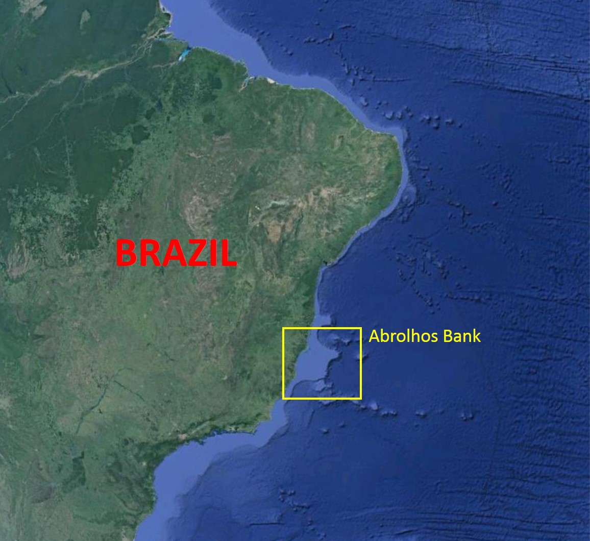
The Abrolhos Bank is located along the eastern Brazilian coast and is characterized by an enlargement of the Brazilian shelf (~46.000 km2), reaching approximately 200 km in width. The Abrolhos Bank encompasses three main megahabitats and a complex bathymetry. Rhodolith beds comprise the largest megahabitat, with 20,904 km² (43% of the mapped area), followed by unconsolidated sediments' megahabitat covering 19,151 km2 (39%) and by the reefal megahabitat with 8844 km2 (18%). Rhodolith beds and unconsolidated sediments are topographically less complex and form larger continuous extensions when compared to the reefal megahabitat, which is structurally complex and more patchily configured, even when examined at the regional scale.
-
Aquitain's karsts observatory (Aquitaine, France) regroups different karst sites located on the edge of the Aquitain sedimentary basin. These karst watersheds range from 0.01 km² (Lascaux cave) and 1 km² (Cussac cave) up to 100 km² (Toulon springs) and the land use consists of forests and agriculture under modified oceanic climate. This observatory consists of various observation and experimentation sites like patrimonial caves and large karstic hydrosystem outlets.
-

Huai Ma Nai is a small agricultural catchment (93 ha) of northern Thailand, 60 km from the city of Phrae, in a sloping land environment. The objective is to the impacts of land use changes, from mung bean and soya bean to maize, upon hydrological and sedimentary budgets. Agricultural practices are very intensive, based on high quantities of fertilizers, herbicides and pesticides, and mechanized cultivation. The mean slope is 12.9%%. Soils are thin Alfisols and Ultisols with sandy clay loam to clayey texture, high coarse fragment content, low pH, high bulk density and low-medium cation exchange capacity. Monitoring devices include an automatic meteorological station since 2001, and weirs and flume to monitor discharge from nested catchments, suspended sediment and bedload. More information is available on https://mtropics.obs-mip.fr/ and in the following paper: Valentin, C., et al., 2008. Runoff and sediment losses from 27 upland catchments in Southeast Asia: Impact of rapid land use changes and conservation practices. Agric. Ecosyst. Environ. 128, 225–238. https://doi.org/10.1016/j.agee.2008.06.004
-
Lodz is the third-largest city in Poland. Located in the central part of the country, approximately 135 km south-west of Warsaw. It has a population of 753,192 people. It is the capital of Lodz Voivodeship. Although Lodz was given city rights in 1423, it developed rapidly only in XIX century. It became a centre of textile industry for central and Eastern Europe. During the economic transition of the 1990s Lodz lost its industry. Since that time it has been developing towards the centre of culture, education, and technology. Lodz has a network of numerous but small water courses, and is located in the hills that constitute the first order watershed between the largest Polish rivers, the Wisła and the Odra. The rivers flow in a star-shaped structure to the north to supply the Bzura, then the Wisła, and to the south to supply the Ner and the Odra. This situation affords benefits in eliminating the risk of flooding posed by one major river, on the other hand, exposing the source areas to adverse environmental conditions resulting from urbanization, is unfavourable, and increases risk of flood and drought. The research in the city is organized around issues like: urban sprawl and its effects on environment, society and health; development of blue-green infrastructure; social inclusion and marginalization; eco-gentrification; ecosystem services and their valuation; development of ecohydrological NBS to support regulatory services in the city. LTSER is strongly focused on implementations in the area of integrative city revitalization, water management, and restoration of rivers. The platform consists of two big demonstration - implementation areas with monitoring system for discharges and water quality, however based on learning-alliance group of stakeholders it is linked to many data sources on environmental monitoring, biodiversity, economy, societal information. The future research-implementation-collaboration challenge is NBS linked revitalization of old town, increase adaptive potential of urban areas to climate change, and protection of green ring and blue-green network of the city.
-
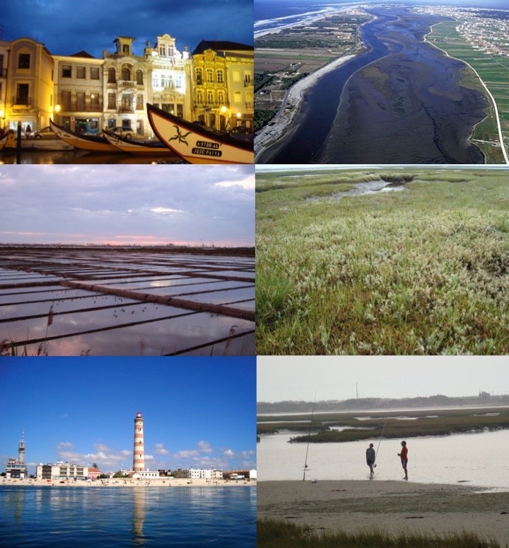
The Ria de Aveiro is a coastal lagoon located in the northwest coast of Portugal, in the western Atlantic Ocean (40º38’N, 08º 45’W). It is a complex social-ecological system that lays between the marine and terrestrial domains. In terms of climatology, this region is under the influence of a temperate maritime climate with a warm period between July and September, and a cold period between December and February. The annual range of the monthly average temperature is around 10ºC. Rainfall occurs mainly between October and May, with higher precipitations in December and January. From the geological point of view, the Ria de Aveiro is a recent feature formed through the accumulation of marine and riverine sediments during the last 1000 years in a wide and shallow bay. These mechanisms have not yet attained equilibrium and the present tendency is to silt up. Much of the present-day geomorphology of the Ria has been determined by human intervention directed to counterbalance this silt-up tendency. The connection between the Ria de Aveiro coastal lagoon and the Atlantic Ocean (through a single inlet of 1.3 km long and 350 m wide) enables the water exchange and the formation of a shallow lagoon. The lagoon is approximately 45 km long, 10 km wide and covers an area of approximately 83 km2 and 66 km2 of wetland at high and low water, respectively. It consists of four main channels with several branches forming island and inner basins. The Ria de Aveiro also integrates the Vouga River estuary and the freshwater wetland Pateira de Fermentelos. The combination of the freshwater discharge and the tidal penetration creates a longitudinal salinity gradient from about 0 in the river to about 36 at the ocean entrance. The landscape of the Ria de Aveiro is shaped into a vary of beaches, dunes, sand flats, mud flats, salt marshes, seagrasses, and small water channels creating farmlands and smallholdings named “Bocage”, which is associated to a rich biodiversity. From these habitats, the salt marshes of the Ria de Aveiro are remarkable due to its large extension and continuity, being one of the largest areas of salt marshes in Portugal and in Europe, housing a rich wintering population of waders. “Bocage” is also relevant due to the rushes (Juncus maritimus) or reeds (Phragmites australis) tidal marshes, rice fields, livestock and woodlands composed by tree species such as Eucalyptus globulus and Pinus pinaster. The Ria de Aveiro is inhabited by waders birds (the flamingo Phoenicopterus roseus, the purple heron Ardea purpurea), birds of prey (the marsh harrier Circus aeruginosus, the black kite Milvus migrans), reptiles (the Iberian emerald lizard Lacerta schreiberi), amphibians (the Iberian painted frog Discoglossus galganoi and the European tree frog Hyla arborea), fishes (lampreys such as the Petromyzon marinus, shad Alosa alosa and eels Anguilla anguilla), and mammals (the otter Lutra lutra, the least weasel Mustela nivalis). The variety of habitats of this area and associated biodiversity, provides of good and services to the population including the regulating, cultural and provisioning ecosystem services. The natural capital of this coastal lagoon is recognized internationally, namely by its classification as Natura 2000 area, Special Protection Area (SPA), Site of Community Importance (SIC) and Ramsar site under the European Habitats and Bird Directives. The major urban settlement in the lagoon watershed area is Aveiro city (60,000 inhabitants approximately). The Ria de Aveiro has enabled the development of economic activities such as commercial fisheries, bait digging, aquaculture, salt pans, a prosperous harbour, maritime traffic, manufacturing, tourism, recreation, sports and agriculture. As a consequence, this area is subject to anthropogenic pressures that impact the coastal lagoon and the adjacent freshwater areas of the Vouga River. The identification of these impacts is a continuous collaborative work between the research institutions and stakeholders who depend on different aspects of the environment, including city dwellers and local organisms. For example, they are local fishermen, divers, surfers, and also members of the jurisdictions regulated by different economic and political systems, such as representatives of the town hall, owners of tourism companies and institutes for conservation of the nature. To counteract the current pressures of the human activities management options have been co-developed, for at least one decade, to implement ecosystem-based management in frame of environmental policies, considering the complexity of the Ria de Aveiro and its connectivity across marine, transitional, freshwater, and terrestrial domains.
-
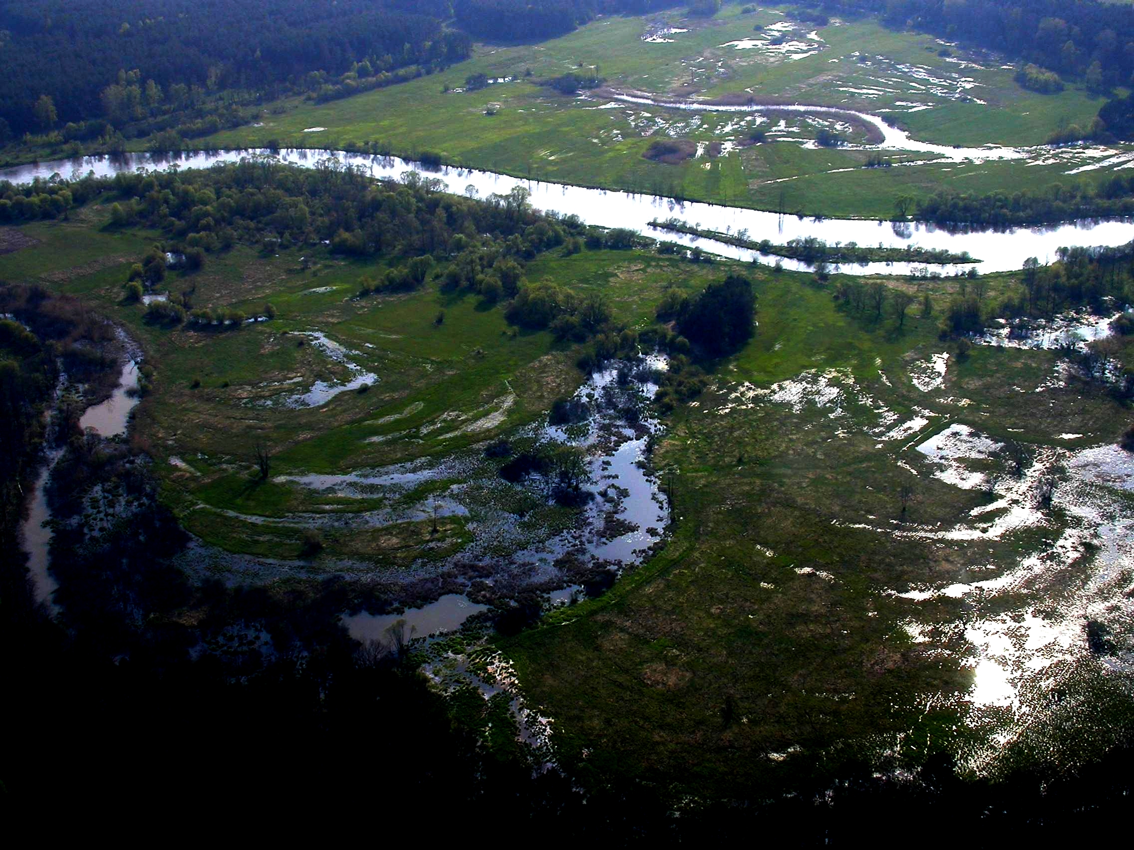
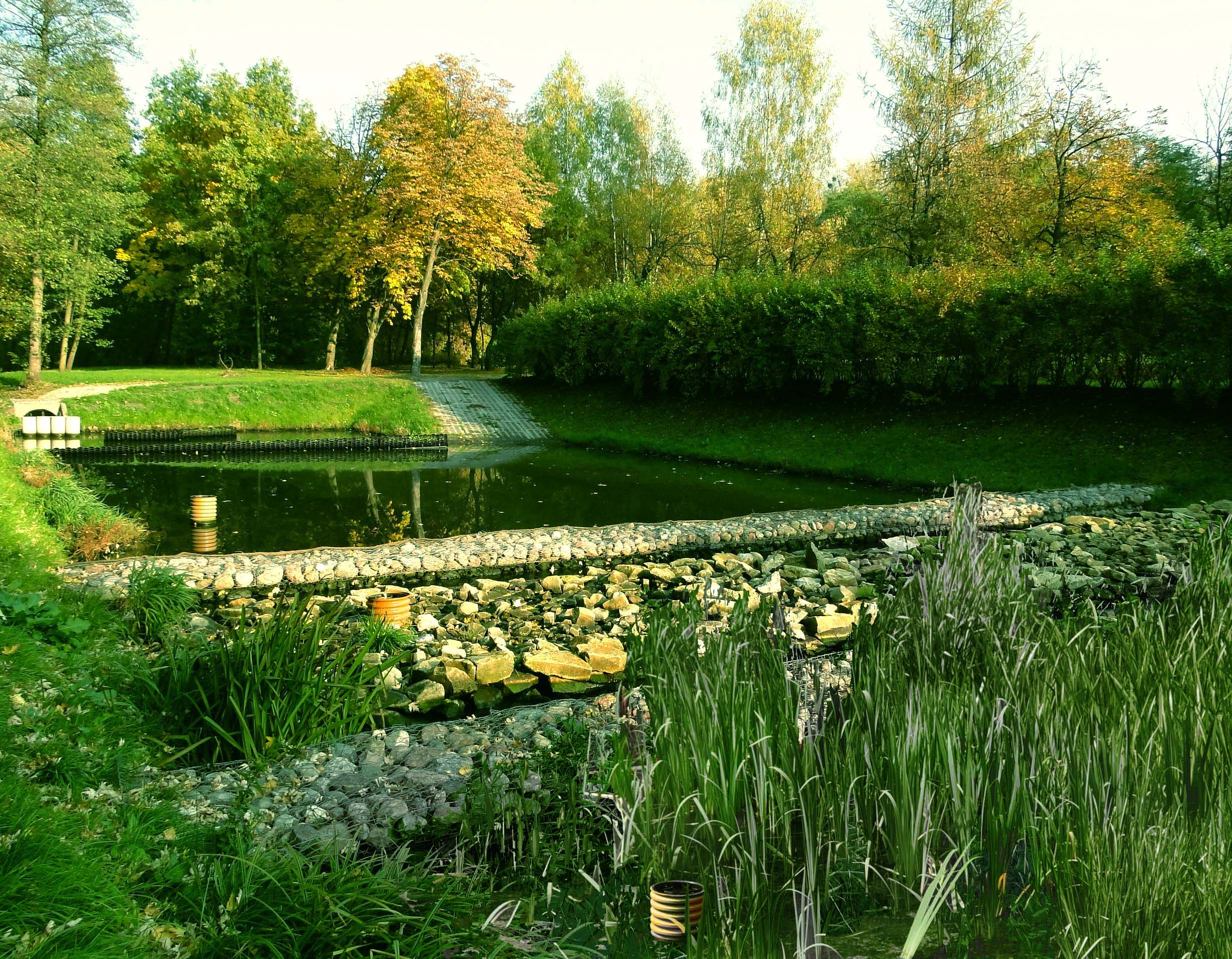
The UNESCO/UNEP demonstration project of the Pilica River is an LTSER platform comprising four spatial levels: the river and its catchment, the floodplains, and a lowland reservoir. The main activities focus on: implementation of the operational procedures for hydro-biomanipulation at the dam; enhancing the absorbance capacity of floodplain for nutrients and pollutants; identification of hot-spots for the eutrophication of the reservoir in the Pilica catchment; enhancing the potential for nutrient assimilation by small rivers and streams through restoration of plant buffering zones. The site covers the upstream part of the Pilica River catchment (above the Sulejow Reservoir) with marshes, flooded meadows, willow shrubs, arable land, woodlands and small streams. The site was launched in 1996 within the UNESCO-IHP Ecohydrology programme as a demonstration and experimental project that incorporates social factors and refers to management issues of complex catchment-river-reservoir system. Part of the project has been establishing of multi-stakeholder platform and permanent collaboration with local and regional decision makers.
-
The station has a arid moderate climate, with a annual temperature of 11.2 ℃ but higher in summer and lower in winter relative to areas with the same latitude. Due to dramatic temperature fluctuation in spring and autumn, frozen damage resulted from low temperature in spring and early cooling in autumn often occurs. The annual mean precipitation is as low as 45.7 mm, thus rivers are charged mainly by precipitation in mountains and snowmelt. Frozen-free day, sunshine duration and annual mean wind velocity are, respectively, 207 d, 2940 h and 2.4 m/s. Disaster weather includes dust storm in spring, hail and accidentally continuous high temperature in summer.Aksu station (E80°51′, N40°37′, 1028 m a.s.l.), found in 1982 and affiliated with Xinjiang Institute of Ecology and Geography, was listed in the top-5 stations for irrigation experiment in Xinjiang and became a member of special environment and disaster detection network, CAS in 2002. After development of years, it entered National Field Station Network and Chinese Ecosystem Research Network (CERN) in 2005. The station is located in the source area of Tarim River where its three headstreams (i.e., Aksu, Yeerqiang and Hetian River) converge, and the vastest oasis develops in Tarim Basin under the hyperarid environments. This area is typical of Tarim Basin for dramatic watercourse meandering and great agro-water consumption, thus forming a ideal experimental field for monitoring and researching water, salt and nutrient processes in oasis cropland system, as well as for exploring sustainable oasis agriculture, theory and technologic demonstration of water-saving irrigation.
-
Lake Võrtsjärv is the largest inland water body in Estonia. Is located in Central part of the country (58.286560, 26.049585). Is a large (270 km2) shallow polymictic lake with a maximum depth of 6 m and a mean depth of 2.8 m. According to the classification by Lewis (1983) belongs to continuous rather than discontinuous cold polymictic lakes. Lake Võrtsjärv Buoy was deployed in the summer of 2010 near the deepest point of the lake (N 58.211798, E 26.103163) to gather high resolution data on meteorology and water quality of the lake. YSI EMM 700 bay buoy has been used for float. YSI 6600 V2-4 multisonde (at 1 meter) was fixed at 1 meter depth for underwater measurements. The buoy is equipped with a Vaisala Weather Transmitter WXT520 and a Li-Cor pyranometer (LI-200) for weather parameters. Data collection was controlled with Campbell CR1000 datalogger. System was renewed in 2021. Current underwater measurements are collected with EXO2 multisond and data collection is controlled by Flydog Marine datalogger.