
reflected global radiation irradiance
Type of resources
Available actions
Topics
Keywords
Contact for the resource
Provided by
Years
Formats
Representation types
-
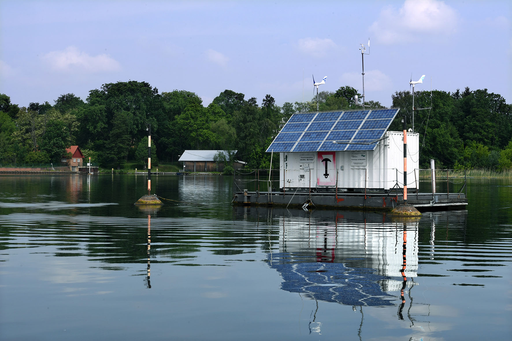
Lake Müggelsee is a shallow (mean depth 4.9 m, max depth 8 m), eutrophic lake situated southeast of the city of Berlin (Germany, 52° 26’ N, 13° 39’ E). The lake is polymictic and usually fully mixed due to the wind fetch of its relatively large surface area of ~750 ha. The River Spree enters the lake from south-east and the outflow is situated in the north-west of the lake. The lake has an average retention time of about 6-8 weeks. Due to its location in a transition zone from a maritime to a more continentally characterized climate, the lake experiences large annual and inter-annual variability in local weather conditions. Data availability spans the time period from 1979-ongoing. Sampling intervals are weekly and biweekly during the winter months. We monitor phytoplankton, zooplankton, and major nutrients and abiotic variables at at weekly temporal scales at 5 different locations across the lake. Fish, macrophytes, MZB, periphyton are sampled yearly. Additionally, we run an automatic lake station (https://www.igb-berlin.de/messstation-mueggelsee) continuously recording water temperature, pH, oxygen, conductivity, fluorescence in -situ in real time. Moreover, the station is equipped with a meteorological station monitoring air temperature, wind, humidity, precipitation, global radiation. Müggelsee is a GLEON (Global Lakes Observatory Network http://www.gleon.org/ ) and an LTER -D site.
-
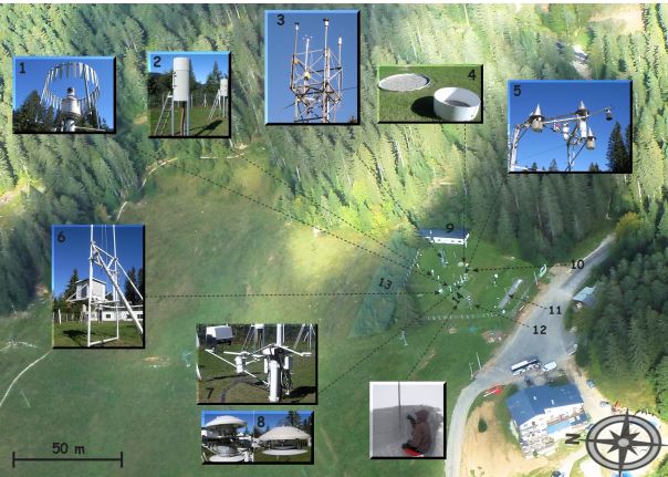
The Col de Porte pilot site is located near Grenoble, in the Chartreuse massif (elevation : 1325m, latitude : 45°30’N, longitude : 5°77’ E). At this mountain site located in a grassy meadow surrounded by a coniferous forest; all the measurements are located within an flat area of 50 × 50 m. Meteorological and snow parameters are recorded hourly since 1961. These parameters are : - Air temperature and relative humidity of air - Incoming and outcoming short and long-wave radiations - Wind speed and direction - Precipitation - Snow depth, snow water equivalent - Settlements and snow temperatures of the different layers of the snowpack Weekly snowpack profiles are also carried out, including major stratigraphic properties of snow (temperature, density, liquid water content, snow type). All sensors are located within a radius of a few tens of meters. (1) Geonor precipitation gauges (3 sensors) and OTT2 (1 sensor), (2) PG2000 heated and non-heated precipitation gauges, (3) windspeed measurements at the top of the 10 m meteorological mast and at the same level of the precipitation gauges, (4) lysimeters (2 sensors), (5) snow depth and surface temperature sensors and settling disks, (6) temperature and relative humidity of air sensors placed in the shelter, (7) Incoming and outcoming longwave and shortwave radiation sensors placed on the rotating arm, (8) close-up on the 4 components radiation sensors, (9) building (cold room, data acquisition, lab space), (10) cosmic rays counter for SWE measurements, (11) former experimental area for the study of road/snow interactions, (12) automatic snow and weather station Nivose for testing purposes (generally used in remote mountain areas), (13) forest area impacted by the cut in 1999, (14) snow pit area, Fore more information refer to : Morin, S., Lejeune, Y., Lesaffre, B., Panel, J.-M., Poncet, D., David, P., and Sudul, M.: An 18-yr long (1993-2011) snow and meteorological dataset from a mid-altitude mountain site (Col de Porte, France, 1325 m alt.) for driving and evaluating snowpack models, Earth Syst. Sci. Data, 4, 13-21, doi:10.5194/essd-4-13-2012, 2012
-
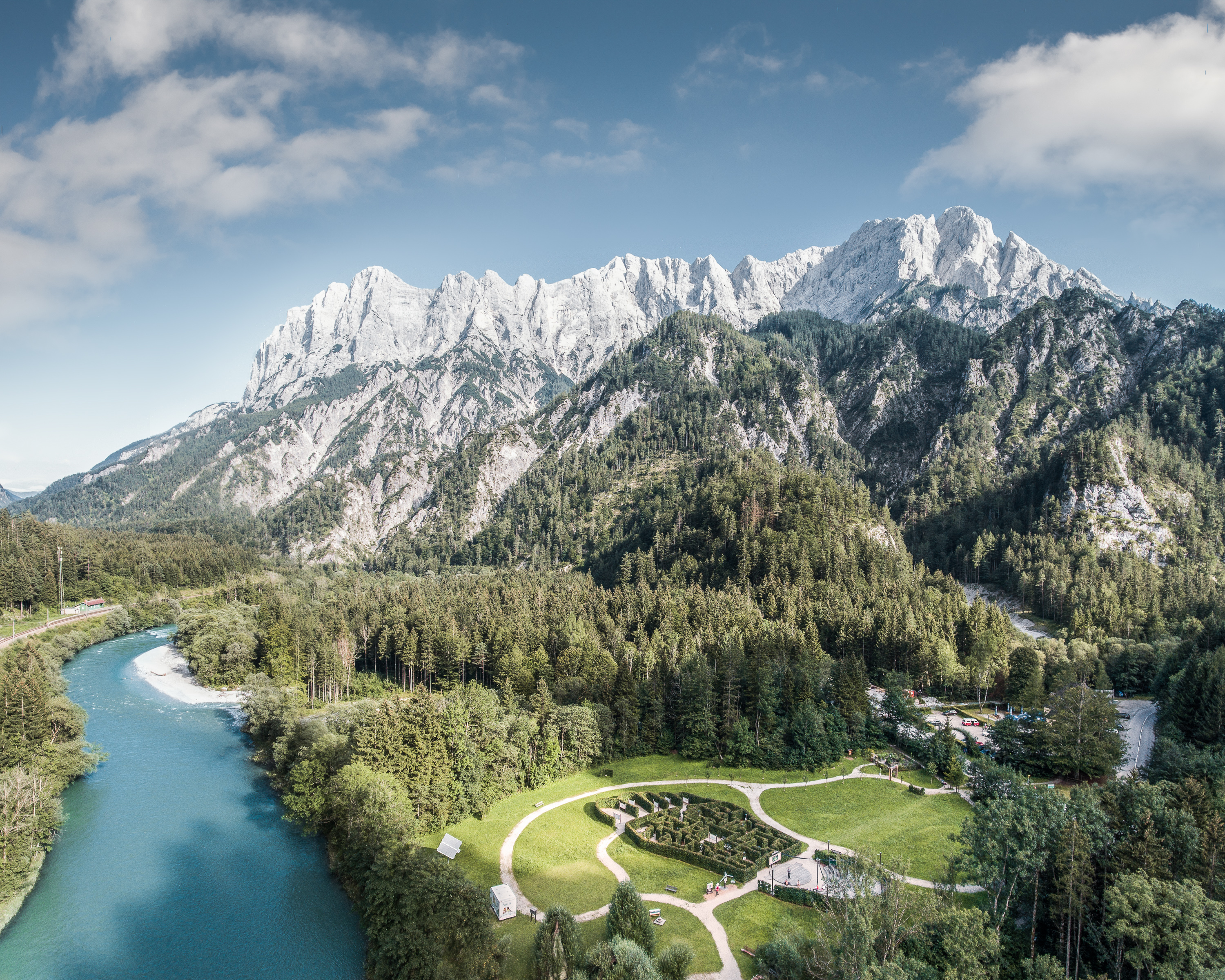
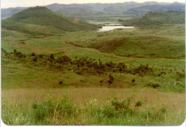
The Gesäuse Nationalpark and the Johnsbach valley belong to the Ennstal Alps, a part of the Northern Limestone Alps. They are situated in the province of Styria in the center of Austria. Together, they form the joint test site named Gesäuse-Johnsbachtal. This region is characterized by a mountainous landscape which is cut by the river “Enns”. In the north, it borders Eisenwurzen Nature Park and is only 6 km away from the Kalkalpen, a National Park in Upper Austria. In the south, the borders are the Eisenerzer Alps. The total area of the site is about 155 km². The terrain shows a great elevation range from 600-700 m in the Johnsbach valley to over 2300 m in the summit region of the Gesäuse, with Hochtor (2369 m) being the highest mountain. Due to the great range of altitude differences within small areas the Gesäuse-Johnsbachtal shows extremely diverse habitats and, consequently, species of animals and plants. In general, the landscape is dominated by mountain forests along with high Alpine rock formations and meadows. These complex topographic, hydrological, geological, geomorphological and meteorological conditions pose a scientific challenge for all kinds of environmental monitoring and modeling.
-
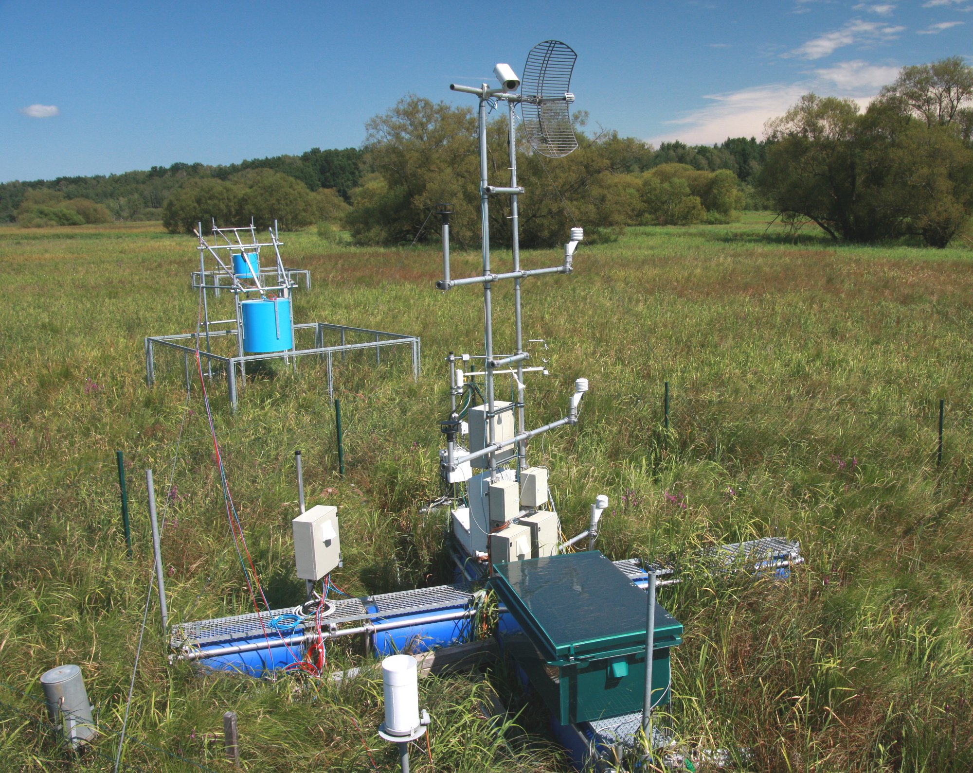
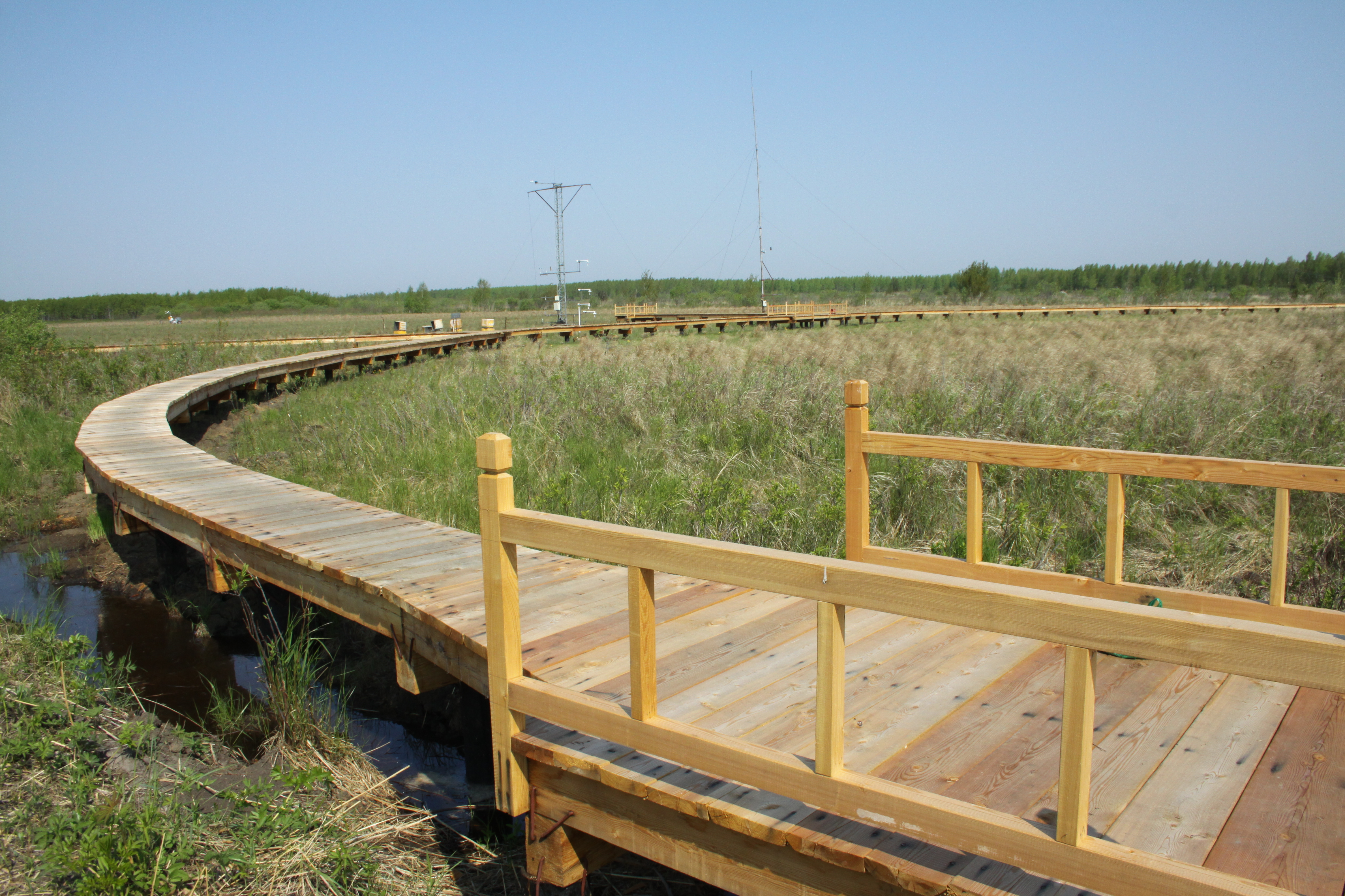
The Třeboň Wet Meadows is an LTER site of a 1 hectare area. It is a part of a wetland with the total area of 450 hectares situated in the inundation area of a large human-made reservoir (Rožmberk fishpond, 5 km2). The Wet Meadows are a predominantly herbaceous wetland with an up to several meters thick layer of organic sediment, which is superimposed on quaternary alluvial sands and clays. The vegetation cover is formed mainly by tall sedges (Carex acuta, C. vesicaria) and reed Canarygrass (Phalaris arundinacea). During the last 50 years, after cessation of mowing, a distinct stand structure of hummocks and hollows has developed. The hummocks are formed by tussocks of Carex acuta. On the site, wide water level fluctuations are recorded in some years. The relatively regular spring floods and irregular summer floods occur as a consequence of snow melting and summer rains in the catchment area, respectively. Extreme floods occurred in the summer of 2002 and both spring and summer of 2006, when the water level culminated at 2 m above the soil surface. The most frequently recorded position of the water level is at about −0.1 m. From 1977 to 2006, meteorological measurements were executed in a meteorological screen. Starting from 2006, the measurements have been executed with electronic sensors connected to data-loggers. Since that time, the site has been equipped for measuring carbon exchange and fluxes of CO2 and H2O (eddy covariance system, Licor). Since the spring of 2011, the site has been equipped for measuring methane and CO2 emissions from the sedges (automatic static flow chamber with a laser gas analyzer, LGR).The Wet Meadows are included in the integrated carbon observation system (ICOS) as a wetland ecosystem station.
-
Qianyanzhou Agricultural Experimental Station of Red Soil and Hilly Land, was founded as a pilot experimental site for ecological recovery in South China In 1983. In 1985, it was selected as an Integrated Development Demonstration Base of Mountain-Lake-River Project of Jiangxi Province. In 1992, as an international experiment station, it was nominated by MAB as a training center of UND Jiangxi Project. Qianyanzhou Station became a member of CERN in 1991 and a member of ChinaFLUX in 2002.
-
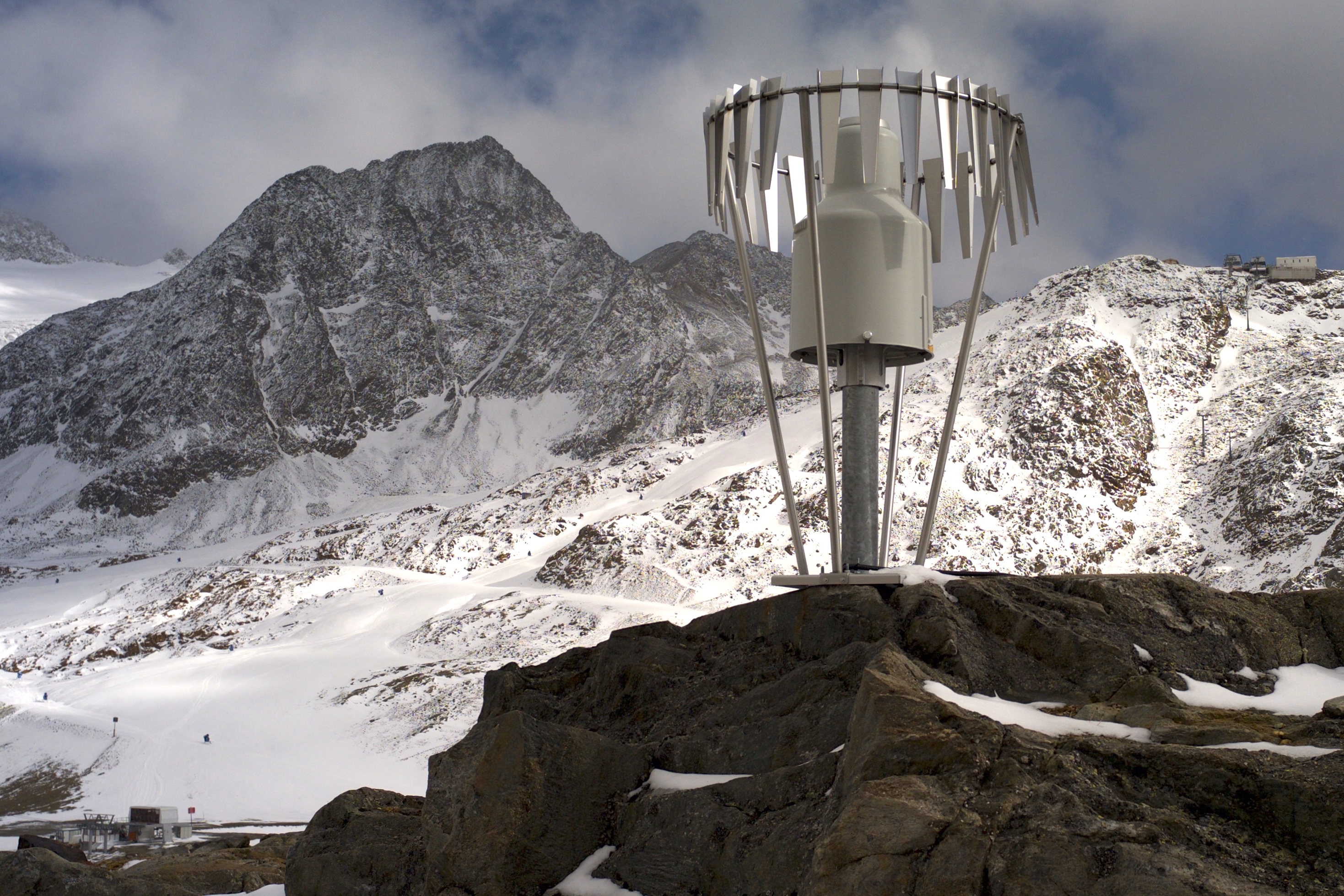
In the Rofental (Ötztal Alps) a consortium of the three institutions, and open to research partners worldwide, concentrates on studying and monitoring cryospheric, atmospheric and hydrological processes and changes with particular attention to the complex topography and climate settings of the Alpine terrain. First documents from glaciers in the Rofental, Ötztal Alps, date back as far as 1601 and regular observations and systematic studies had begun more than 150 years ago. First geodetic maps where generated in the late 19th century, first rain gauges were mounted in 1929 and glacier mass balance time series of Hintereis-, Vernagt- and Kesselwandferner are among the longest uninterrupted world-wide, building a basis for regional hydrological studies, for glacier-climate and ice dynamic research, and for estimating the world wide glacier’s contribution to sea level rise. By 2014, networks of stakes and pits for mass balance monitoring are maintained at Hochjoch-, Hintereis-, Kesselwand- and Vernagtferner by the consortium members. Runoff gauges at Vernagtferner and in Vent (operated by the Hydrological Office of Tyrol) and a network of rain gauges in the Rofental basin are the basis for high mountain hydrological studies. A varying number of automatic weather stations on and in the surroundings of the glaciers are operated by the Rofental consortium. The glaciers in the Rofental are frequently used as a test site for process studies, model development and evaluations and for new remote sensing or ground based methods in glaciological research. A series of airborne LIDAR derived high resolution DTMs of Hintereisferner and its surroundings are available since 2001. They are subject of ongoing evaluations and method comparison studies as well as for monitoring and studying periglacial morphodynamics. The generated data are available from the consortium partners, glaciological key results are annually reported to the World Glacier Monitoring Service (WGMS). A research station on Hintereisferner (with observer status in the Horizon 2020 INTERACT network) and one at Vernagtbach serve as logistic bases for fieldwork. In recent studies, socio-ecological research aspects – e.g. in relation with the use of water for energy production and tourism – comprise the natural scientific investigations.
-
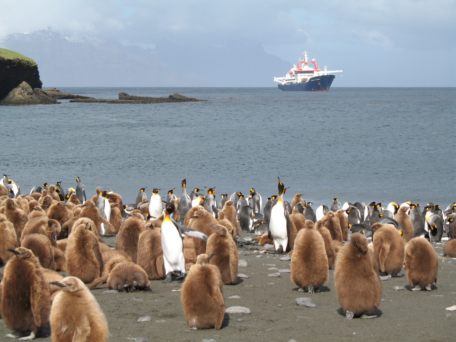
The LTSER Zone Antarctique belongs to LTER-France network and is located in Antarctica (Adelie Land), French sub-Antarctic Islands (Crozet archipelago, Kerguelen Islands, Saint-Paul et Amsterdam Islands) and southern ocean. General information below concerns Kerguelen Islands. The ZATA measures the impacts of climate change and human activities on antarctic and sub-antarctic ecosystems.
-
Sanjiang Plain Marsh Ecological Experimental Station (SJM) is located in one of the largest marshes distribution areas, Sanjiang Plain, which is a low plain formed by the Heilongjiang River, Songhua River, Wusuli River. The station (133°31′E,47°35′N) has an altitude of ~56 m.a.s.l, belongs to the temperate continental monsoon climate zone, with the mean annual temperature of 1.9℃, and annual rainfall of ~600 mm. The area has an annual frost-free period of 125 d and is a typical seasonal frozen area with the freezing and thawing period from early November until the middle of June in the next year. The dominated vegetation composition are Carex lasiocapa, Carex pseudocuraica, Carex meyeriana, Glyceria spiculosa, Deyeuxia angustifolia, and the soil types are mainly meadow bog soil, humus bog soil and gley white paper clay, white pulp meadow soil, etc.The main crops are soybeans and rice in this area.
-

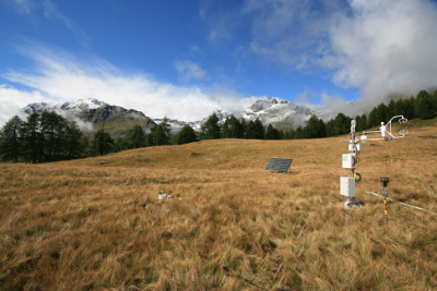
Tronchaney, Conca di Torgnon, (Torgnon, Aosta), + 388330 + 5075950; Aosta Valley
-
Tellinod, Conca di Torgnon, (Torgnon, Aosta), +389680 +5077920; Valle d'Aosta region