
reflected radiation intensity
Type of resources
Available actions
Topics
Keywords
Contact for the resource
Provided by
Years
Formats
Representation types
-
Cime bianche, Colle Superiore di Cime Bianche, (Valtournenche, Aosta), +398720 +5086095; Valle d'Aosta region
-
Cap Prud'homme (CAP) is located on the coast of the Antractic Ice sheet (Dumont d'Urville station). Mass balance is measured alo,g 3 different stake networks at the camp and over 150 km inland. Meteorological information are recorded at 2 stations. Dynamics of the ice is measured on the Astrolabe glacier. CAP is a part of the French Glacier Observatory GLACIOCLIM/CRYOBS-CLIM.
-
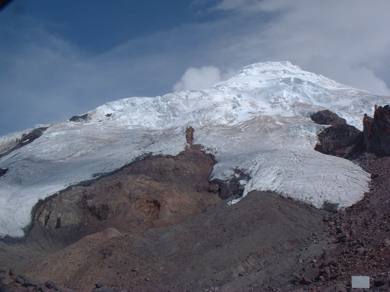
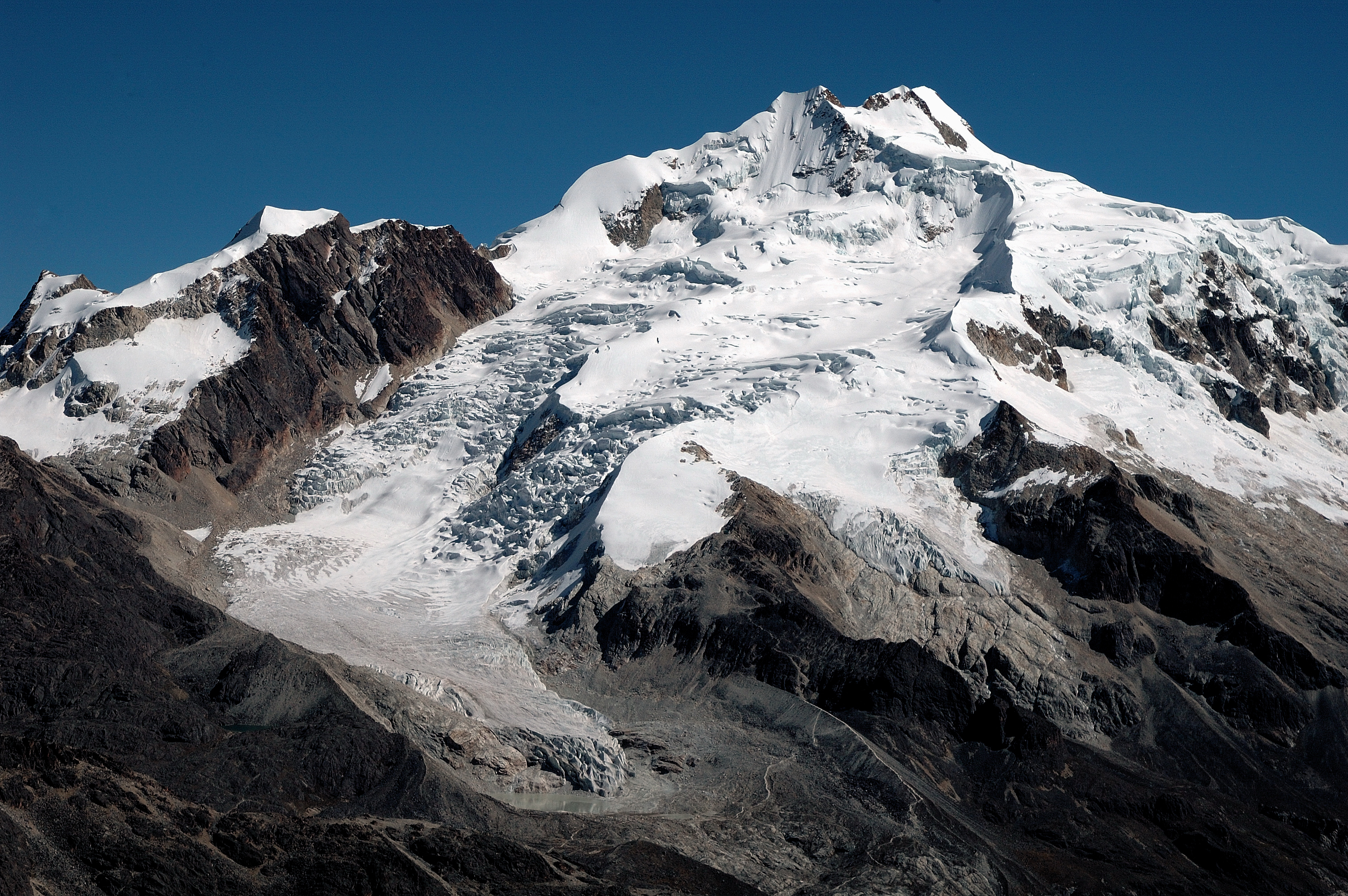
Antizana 15 alpha Glacier is one of the 17 tongues of the Antizana volcanoe in Ecuador, from 4820 to 5760 m a.s.l..
-
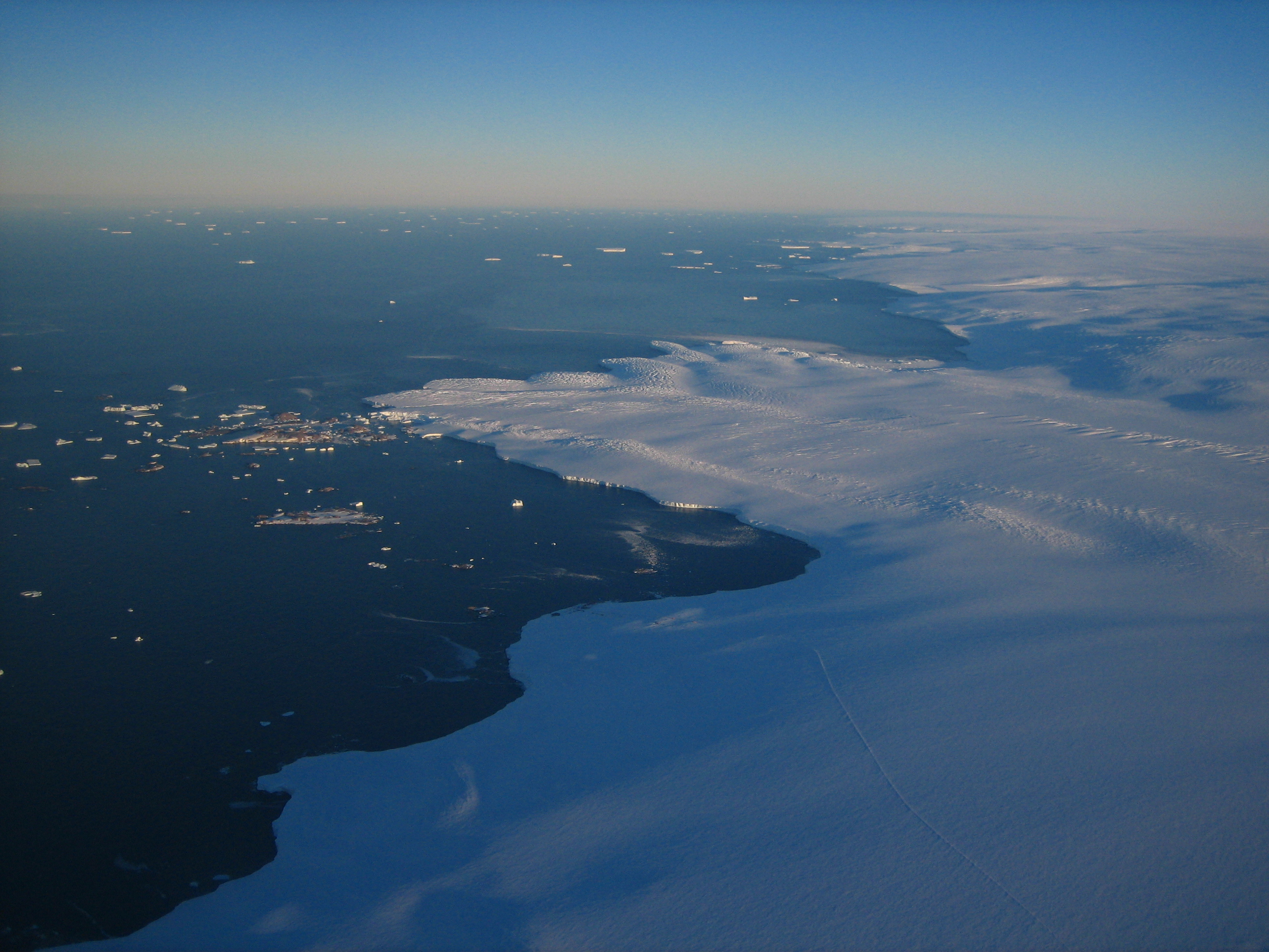
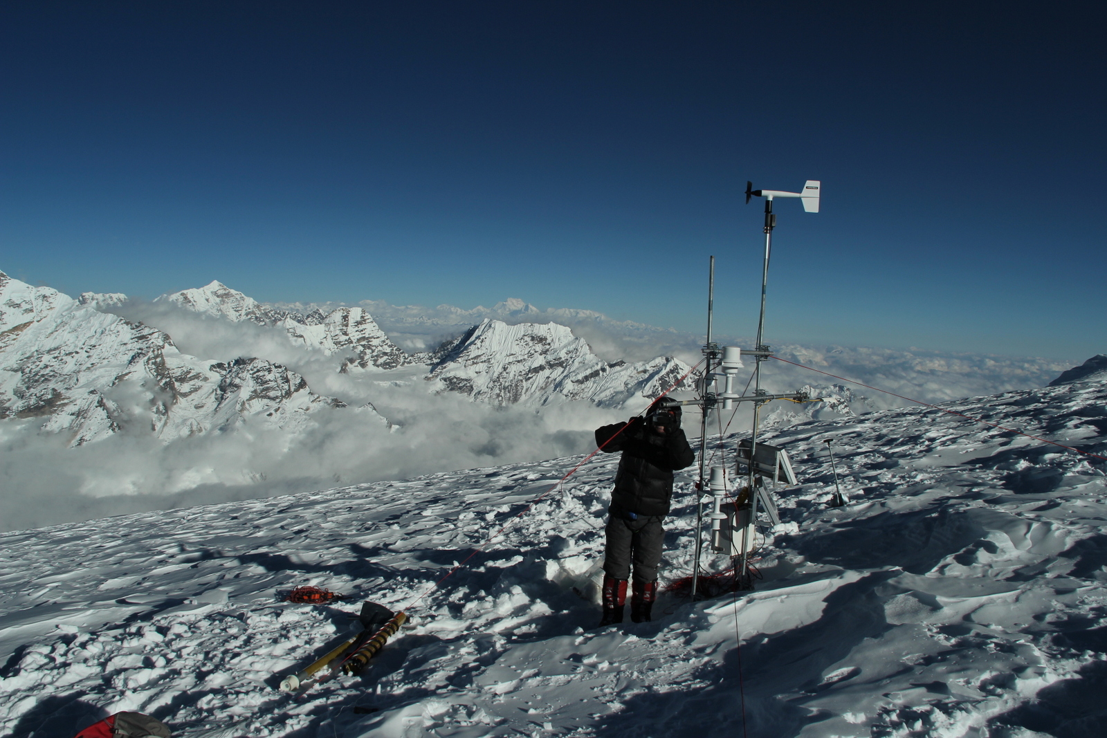
Concordia is a joint French-Italian research facility opened in 2005 on the Antarctic Plateau, Antarctica (-75.1, 123.33), managed together by PNRA (Italian National Antarctic Programme) and IPEV (Institut Polaire Francais Paul Emile Victor). It is built at 3,233 m above sea level on the third highest summit of Antarctica: Dome C.
-
Zongo Glacier is located in the Huayna Potosi region (Cordillera Real, Bolivia) 30 km north of La Paz city, between the dry Altiplano plateau in the west and the wet Amazonian basin in the east, under outer tropics meteorological conditions (strong seasonality in precipitation, low seasonality in temperature).
-
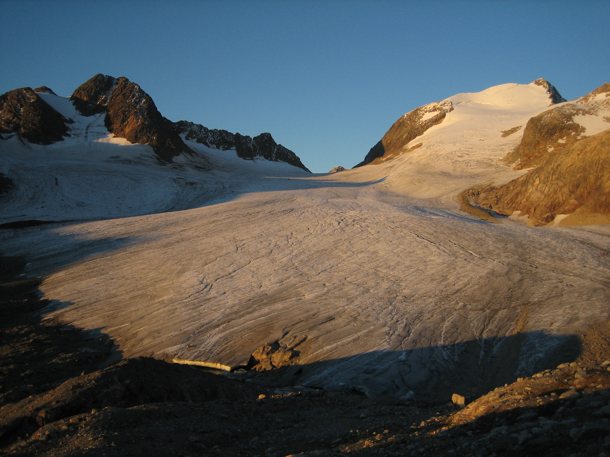
Mera glacier (MER) is located in Nepal, near the Khumbu valley. This glacier is free debris cover. Mas sbalance and dynaic measurements were initiaited in 2007. In addition, meteorological observations complete the data base. 2 weather stations are on the moraine and on the glacier itself. MER is a part of the French Glacier Observatory GLACIOCLIM/CRYOBS-CLIM. All the series on Mera glacier (MER) are unique and necessary for glaciological studies because Himalaya is still partly unknown in terms of future evolution. Data permit to calibrate models in order to determine future glacier evolution. Mera data are also unique to test hydrological model in the catchment.
-
Saint-Sorlin glacier (SSO) is located in the Arvan valley, between 2700 and 3400 m altitude. The glacier is situated in the Grandes Rousses massif, and one of the glaciers with longest records of glacier mass balance worldwide. Data series are continuous and cover few decades (more than 50 years of mass balance measurements).This site is also characterized by the complete glaciological parameters performed annually to complete annual and seasonnal mass balance : ice velocity, ice thickness variation, snout position.In addition, meteorological observations complete the data base. 1 weather station, running since 2005, is located on the moraine, close to the snout of the glacier. SSO is a part of the French Glacier Observatory GLACIOCLIM/CRYOBS-CLIM.
-
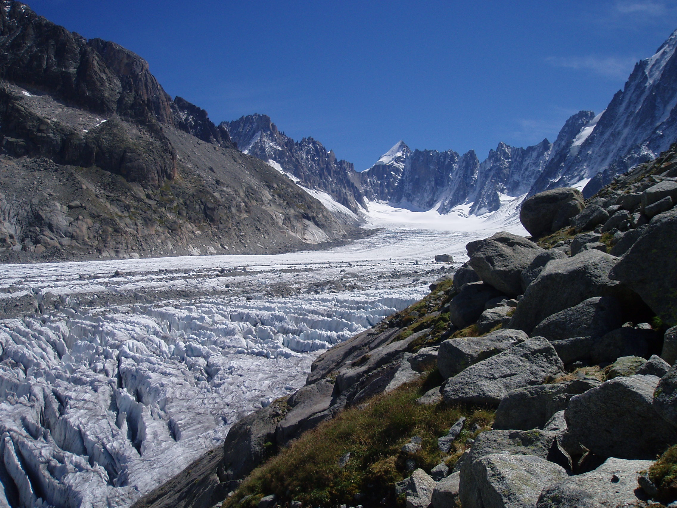
Argentiere glacier (ARG) is located in the Mont-Blanc valley (France), between 1500 and 3400 m altitude. The glacier is one of the glaciers with longest records of glacier mass balance worldwide. Data series are continuous and cover few decades.This site is also characterized by the complete glaciological parameters performed annually to complete annual and seasonnal mass balance : ice velocity, ice thickness variation, snout position.In addition, meteorological observations complete the data base. 1 weather station, running since 2006, is located on the moraine. ARG is a part of the French Glacier Observatory GLACIOCLIM/CRYOBS-CLIM.
-
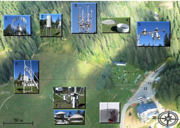
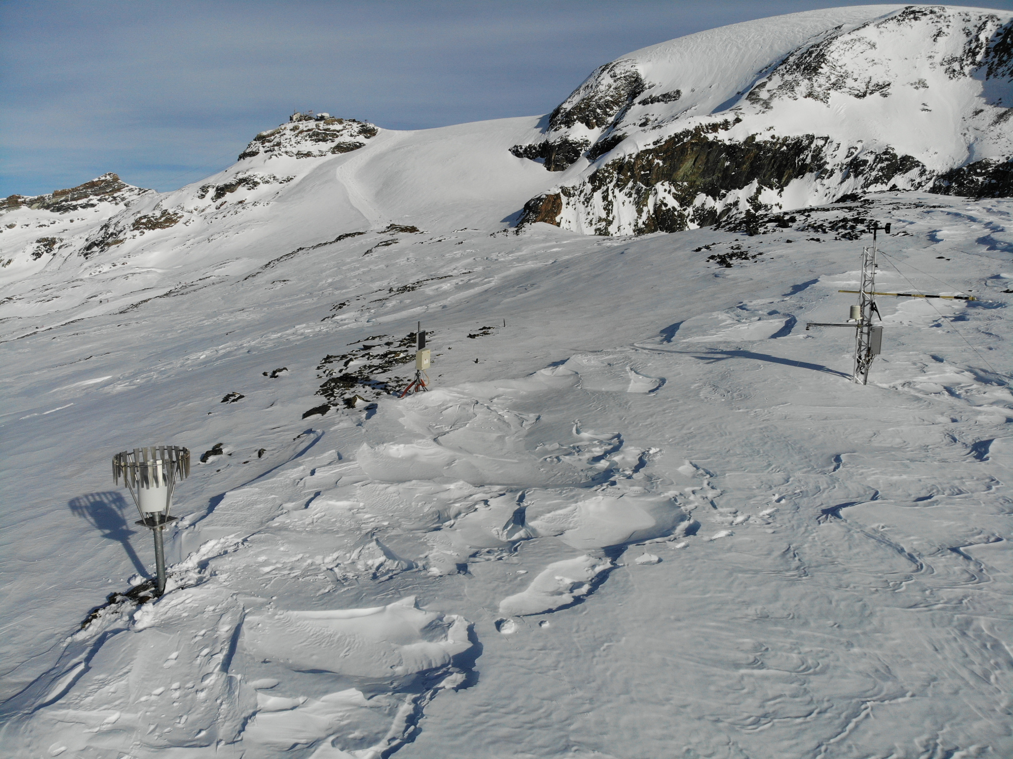
The Col de Porte pilot site is located near Grenoble, in the Chartreuse massif (elevation : 1325m, latitude : 45°30’N, longitude : 5°77’ E). At this mountain site located in a grassy meadow surrounded by a coniferous forest; all the measurements are located within an flat area of 50 × 50 m. Meteorological and snow parameters are recorded hourly since 1961. These parameters are : - Air temperature and relative humidity of air - Incoming and outcoming short and long-wave radiations - Wind speed and direction - Precipitation - Snow depth, snow water equivalent - Settlements and snow temperatures of the different layers of the snowpack Weekly snowpack profiles are also carried out, including major stratigraphic properties of snow (temperature, density, liquid water content, snow type). All sensors are located within a radius of a few tens of meters. (1) Geonor precipitation gauges (3 sensors) and OTT2 (1 sensor), (2) PG2000 heated and non-heated precipitation gauges, (3) windspeed measurements at the top of the 10 m meteorological mast and at the same level of the precipitation gauges, (4) lysimeters (2 sensors), (5) snow depth and surface temperature sensors and settling disks, (6) temperature and relative humidity of air sensors placed in the shelter, (7) Incoming and outcoming longwave and shortwave radiation sensors placed on the rotating arm, (8) close-up on the 4 components radiation sensors, (9) building (cold room, data acquisition, lab space), (10) cosmic rays counter for SWE measurements, (11) former experimental area for the study of road/snow interactions, (12) automatic snow and weather station Nivose for testing purposes (generally used in remote mountain areas), (13) forest area impacted by the cut in 1999, (14) snow pit area, Fore more information refer to : Morin, S., Lejeune, Y., Lesaffre, B., Panel, J.-M., Poncet, D., David, P., and Sudul, M.: An 18-yr long (1993-2011) snow and meteorological dataset from a mid-altitude mountain site (Col de Porte, France, 1325 m alt.) for driving and evaluating snowpack models, Earth Syst. Sci. Data, 4, 13-21, doi:10.5194/essd-4-13-2012, 2012
-
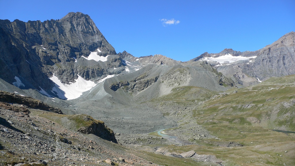
The Bessanese high-elevation experimental site is located in the Western European Alps (Graian Alps, municipality of Balme, Italy). This site is representative of the glacial and periglacial environments of the Alps. In this site, glaciers have been the main morphogenetic agent: the head of the basin hosts a well-developed glacial cirque, while the LIA has left an imposing moraine on the left side of the glacier as an indelible mark in the landscape. Additional cryogenic and atmospheric processes, running waters and gravity have contributed to shape the study area. These latter processes are becoming more and more important, compared to glacier shaping, in the present context of climate change, which led to an impressive-areal and volume reduction of the glacier. Most of the area once occupied by the glacier is now covered with debris which, in many cases, is ice-cored, or contains ice lenses. Downstream of the main lake of the basin, located at an elevation of about 2580 m, the debris forms a large and characteristic rock glacier. Among gravitative processes, rockfalls are particularly common and relevant from the hazard point of view in the study area. dataset available on Pangaea repository: 1. Nigrelli, Guido; Chiarle, Marta; Merlone, Andrea; Coppa, Graziano; Musacchio, Chiara (2022) – Rock temperature variability in the alpine cryosphere. Pangaea Data Publisher for Earth & Environmental Science, https://doi.pangaea.de/10.1594/PANGAEA.950246 2. Nigrelli, Guido; Barbero, Secondo; Chiarle, Marta (2021) – Solar radiation at the Bessanese high-elevation experimental site (Italy). Pangaea Data Publisher for Earth & Environmental Science, https://doi.org/10.1594/PANGAEA.930679 3. Nigrelli, Guido; Chiarle, Marta; Merlone, Andrea; Coppa, Graziano; Musacchio, Chiara (2018) – Rock and debris temperature in the alpine cryosphere. Pangaea Data Publisher for Earth & Environmental Science, https://doi.org/10.1594/PANGAEA.894317