
residence time
Type of resources
Available actions
Topics
Keywords
Contact for the resource
Provided by
Years
Formats
Representation types
-
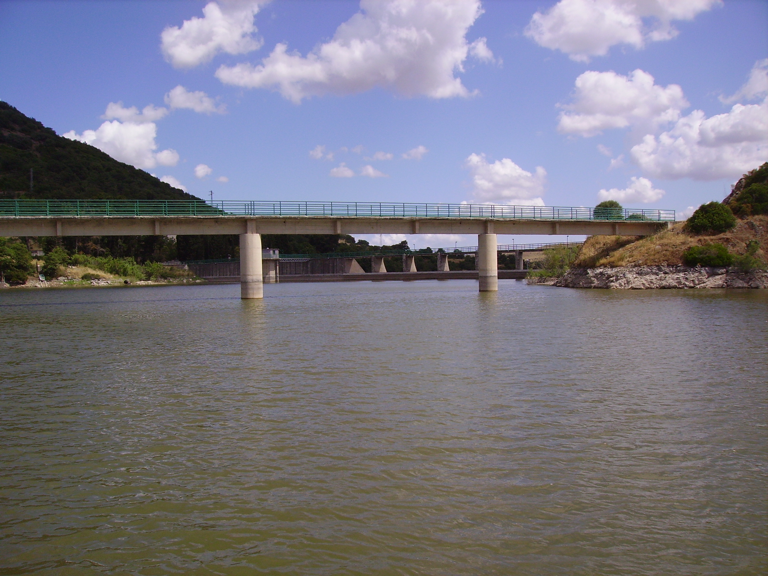
Bidighinzu Lake is a warm monomitic and hypereutrophic reservoir located in northwestern Sardinia at 334 m a.s.l. Built in 1956, it is mainly used for drinking water for a population of about 160,000 users. Bidighinzu Lake covers a surface area of 1.7 × 10⁶ m² and has a maximum volume of 12.2×10⁶ m³ and a mean depth of 7.3 m. According to ECOSTAT, it belongs to the LM7 category (altitudes <800 m a.s.l., mean depths >15 m, conductivity <2.5 mS cm−1). Its watershed has a surface area of 52 km² with a geological substrate consisting of basalt, limestone, and shale. The supplies of water from the catchment to the lake are insufficient to make up for the losses and human demands. Consequently, the lake receives additional water from Temo Lake and Rio Mannu-Su Tulis river lock, localized in different watersheds. Problems of potabilization have arisen since the early years of the reservoir’s use, particularly in summer-autumn, because of hypolimnic deoxygenation and the excessive presence of algae in the epilimnion. To face this situation, different restoration actions were carried out in Bidighinzu Lake. Among the most important: the installation in 1966 of an aeration system in the area around the water intake tower and in 1987 the reduction of nutrient loads from the watershed by the diversion of civil and industrial wastewater downstream of the dam. A comparison among data collected from just before to about 10 years after this last action the site did not show any improvement in the trophic status. Since 2006, the lake is managed by the Sardinia Water Authority (ENAS) and is part of LTER-Italy. The site has real-time remote monitoring station equipped with a multiparameter probe housed on floating platform. The main scientific purposes at present concern the relationships between trophic status, abundance of cyanobacteria and the presence of toxins; the assessment of climate change and local factors on the phytoplankton dynamics; the development of territorial indicators related to the trophic conditions based on the land cover and use of catchment areas. Recently in Lake Bidighinzu it was conducted an experimental activity, with an aeration system with micro-bubbles. The aim was to maintain sufficient oxygen in the hypolimnetic waters, especially in the summer months, in order to improve the purification process, prevent phosphorus release from sediments and mitigate eutrophication. Available data sets include information on phytoplankton and limnological variables since the last 70.
-
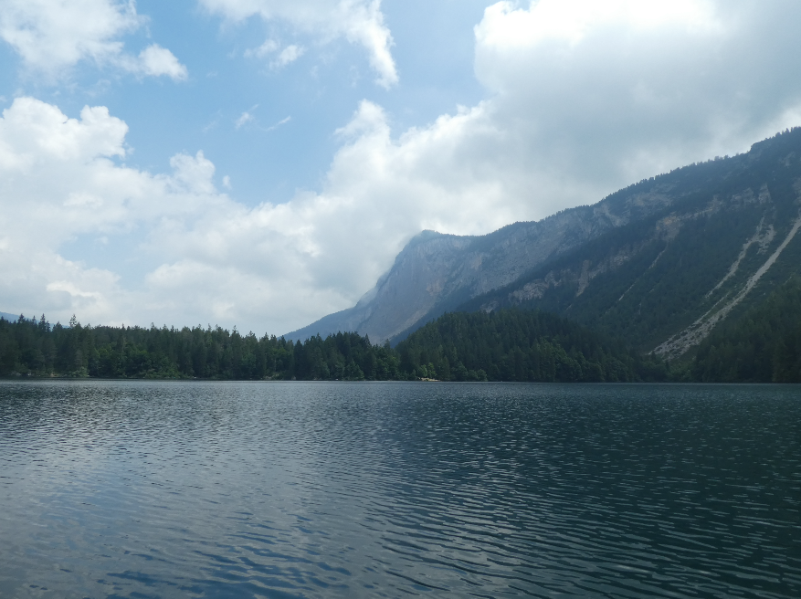
Lake Tovel has a long history of limnological research and over 300 publications since the late 1800s, including an intensive study by E. Baldi in the 1930s, document the continued interest in this lake. Tovel is famous for its clear waters and past red dinoflagellate blooms (Flaim et al. 2004. Phycologia 43:737–743) that no longer occur due to changes in land use (Borghi et al. 2006. Studi Trent. Sci. Nat., Acta Biol. 81:1-472). Besides its intrinsic biological value, Lake Tovel provides irrigation water and electrical energy to the local population, and its location in the heart of the Adamello Brenta Natural Park makes it an important tourist attraction. Following several sporadic surveys, since 1995 the lake is part of an ongoing long-term limnological study conducted by the Fondazione E. Mach (FEM) at S. Michele all’Adige TN, that includes temperature profiling, chemical and biological data taken at monthly intervals during the ice-free period and occasional winter sampling. FEM is well equipped for limnological field work with dinghy with electrical motor, multi-parameter probe, fluoroprobe, underwater quantum sensor, Eckman dredge, plankton nets, water sampling bottles, etc. Laboratory facilities include microscopy (bright field, phase contrast, interferential, fluorescent, inverted microscopes and stereoscopes) with image analysing software, a wet lab and a fine chemistry lab for nutrients and major ions in water as well as organics by ion chromatography and liquid chromatography-Mass Spectrometry (LC-MS). Also available are molecular laboratories equipped with basic (PCR, electrophoresis) and advanced techniques (Sanger and NG sequencing). Limnological data are supported by meteorological data provided by a meteorological station situated in the lake and active since 1976. Recently, sensors for high frequency data (HFD) for temperature, dissolved oxygen, light (at various depths) and water level have been installed on a central lake platform. Notwithstanding its modest altitude (1178 m asl), Tovel has characteristics similar to a 'high altitude' lake because its waters are particularly cold and transparent. The lake is oligotrophic (PT <10 µg/L) with a high biodiversity of plankton, especially of flagellates (Hansen & Flaim 2007J Limnol 66:107-141)and rotifers (Obertegger et al. 2008 J Plank Res 30:633–643). Cold-water dinoflagellates from the lake have been studied for their life cycles (Flaim et al. 2009 Hydrobiologia 639:85–98), lipid profiles (Flaim et al. 2012 Hydrobiologia 698: 285-293) and their response to stressors such as UVR (Obertegger et al. 2011 J. Phycol. 47:811–820). Furthermore, marked water level fluctuations due to the input of snowmelt water are influential in structuring the plankton community (Obertegger et al. 2007. Aquat. Sci. 69:575 – 583). Lake Tovel is an ideal ‘natural laboratory’ where we study the biotic and abiotic parameters tied to climate change and verify ecological theories.
-

The BLE LTER program (https://ble.lternet.edu/) focuses on productivity, trophic relationships, and biogeochemical cycling in the network of lagoons that span Alaska’s northernmost coastline. BLE is examining factors that affect the stability and resilience of microbial and metazoan food webs, including drivers and forms of primary production, in these highly dynamic ecosystems.
-
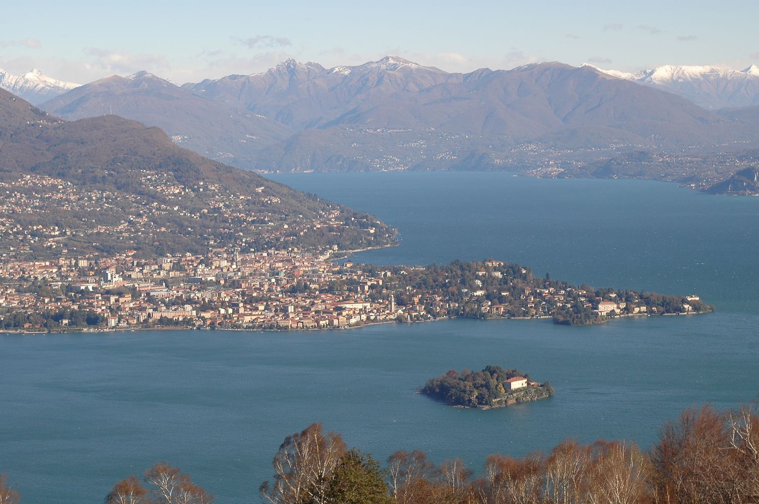
Lake Maggiore was studied since the beginning of last century although not systematically. Regular research started by the foundation in 1938 of the Italian Institute of Hydrobiology "Dr. Marco De Marchi" located in Verbania Pallanza. A limnographic (level and temperature profile) and weather station came into operation in 1952. Studies on plankton and on hydrochemistry of Lake Maggiore continued between the 1950s and the 1970s, showing the progressive eutrophication of the lake. Thanks also to the research of the institute, in the 1980s effective actions to control the eutrophication were undertaken, with the large-scale activation of waste water treatment plants. In the same period a program, still active, of systematic monitoring and research sponsored by the CIPAIS (International Commission for the Protection of the Italian Swiss Waters) started: it allowed collecting an uninterrupted and long-time series, with high sampling frequency, of data related to meteorology, hydrology, physic and chemistry of the lake, organic carbon and bacterial populations, phyto-and zooplankton. The analysis of these time series highlighted an oligotrophication process leading to the current state of oligotrophy of Lake Maggiore. Recent studies also showed the effects of global warming on Lake Maggiore, which went towards the gradual warming of deep hypolimnion as well as the raising of the average temperature of the surface layers.
-
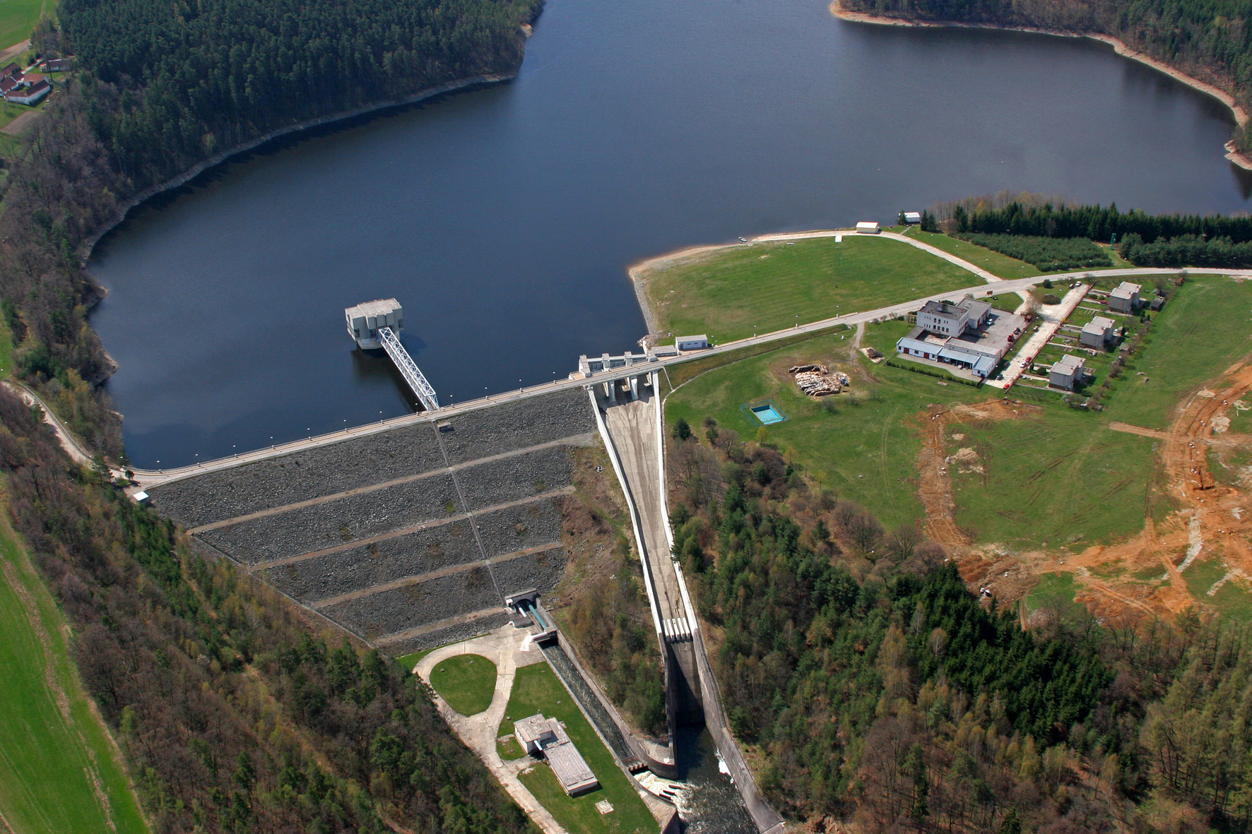
The Římov Reservoir was constructed in 1971–1978 at 21.85 km of the Malše River (tributary of the Vltava River), downstream its confluence with the Černá stream. The reservoir serves as an important drinking water supply for South Bohemia and helps to maintain a minimum flow downstream. The dam is 47 m high and 290 m long. Reservoir volume is 34.3×10⁶ m3, the catchment area is 489 km2.Mean annual flow is 4,3 m3 s-1 and mean theoretical water retention time 92 days. The Římov Reservoir is a canyon-shaped impoundment with steep banks, the „tower“ for drinking water input is at 5 m distance from the dam. Being a drinking water source, Římov Reservoir is protected and no other uses are allowed. Regular investigations of the Římov reservoir in its lacustrine part started in 1979 and have continued at three-week intrevals up to now. Since 1997, the Římov reservoir has been a part of the Czech LTER network. The parameters studied include physical, chemical and biological data on pelagic organisms like bacteria, protists, phytoplankton and zooplankton. Once per year, the abundance and species composition of fish is investigated. Besides regular monitoring, a lot of extensive studies were done of pelagic organisms, their diversity, interactions and functions as well as chemical processes in water and sediment, both in the lacustrine part and in the canyon-shaped riverine part near the inflow. Such intense studies were possible due to the vicinity of well equipped labs in České Budějovice and the construction of a field station at the dam (in 1994).
-
Lake Orta is a deep subalpine lake, located in Northern Italy, at a mean altitude of 290 m a.s.l. Its perimeter is 33,8 km, surface area 18,14 km2, volume 1,29 km3. Lake Orta has a maximum depth of 143 m and a mean depth of 71 m. Lake Orta is well known for being polluted by industrial discharges (copper sulphate and ammonia) since the late 1920: as a consequence, the pH of the lake water dropped down till 4 and the food web was almost completely destroyed, except for some few, strongly adapted species. The pollution stopped around mid 1980s and a liming intervention was carried out in 1989-1990, to neutralize the acidic waters of the lake. The recovery was very fast, new species started to colonise the lake just after the liming. The lake, however, is still at risk, due to the large amount of heavy metals stored in the sediments.
-
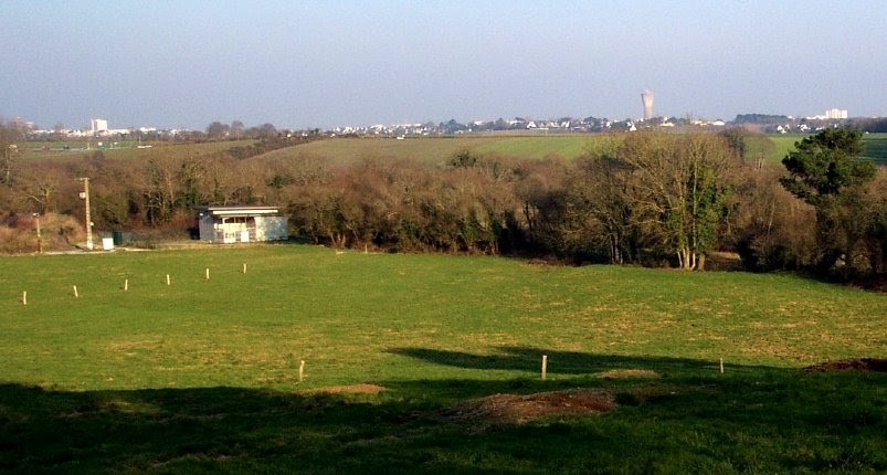
The Ploemeur-Guidel observatory (Britanny, France) is focusing on surface-depth relationships in a fractured crystalline geological context and oceanic climate. It is built on 2 sub-sites, one highly anthropized, the other in natural state. In Ploemeur, groundwater has been pumped since 1991, supplying more than 1 million m3 of clean drinking water annual at a sustainable rate. Such high productivity is explained the specific fractured network in granite and micaschists, draining deep geological layers (~400 m). Extracted water quality is very good, with limited nitrate concentration, in a region that has been strongly affected by widespread pollution. Guidel site is in a similar, but natural context. Deep iron-rich groundwater is upflowing, creating surface and deep groundwater-dependent ecosystems, and feeding a classified coastal wetland. Both sites have a very dense equipment to study rapid to long-term surface-depth exchanges: a flux tower, unsaturated zone monitoring, a network of ~50 shallow (<10m) and deep boreholes (>80m), hydrochemical, temperature and deformation. An well-characterized fractured experimental site offers the possibility to conduct experiments to test innovative instruments and develop new methodologies
-
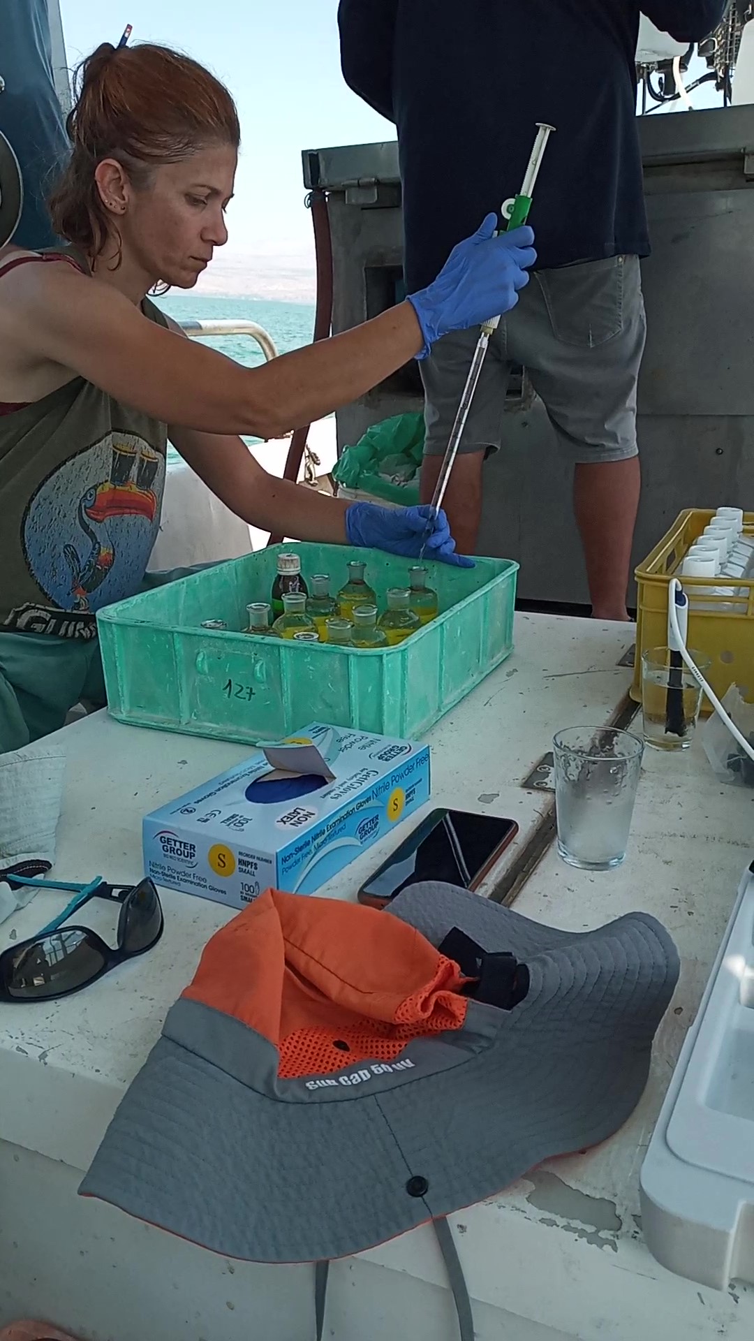
The Kinneret Limnological Laboratory (KLL) is situated at the ‘Sapir’ Site (Tabha) on the shores of Lake Kinneret (Sea of Galilee). The Lake Kinneret monitoring program conducted by KLL has been operating since Jan. 1969. The program has provided a unique database and information, due to the sampling resolution, accuracy of the measurements, and their continuity, it is used to make operational decisions and environmental policy. The monitoring program includes several stations around the lake and from numerous depths and includes fixed on-lake, high-resolution, and manual sampling of water samples analyzed in the laboratory. The Kinneret monitoring program has expanded in recent years and currently has four fixed on-lake and online sampling platforms, strategically placed, each with thermistor chains and multi-probe sensor systems including one that is a profiling system. Also, the program includes collaboration with the Ministry of Agriculture to carry out monitoring of fish and fisheries in the lake. As the lake suffers typically from two seasonal cyanobacteria blooms, (i.e., a winter Microcystis bloom and a summer N-fixing cyanobacteria bloom) routing monitoring of cyanobacteria biomass and toxins is conducted and adaptive to the extent of the bloom. This is carried out simultaneously with satellite imaging over the lake.