
root density
Type of resources
Available actions
Topics
Keywords
Contact for the resource
Provided by
Years
Formats
Representation types
-
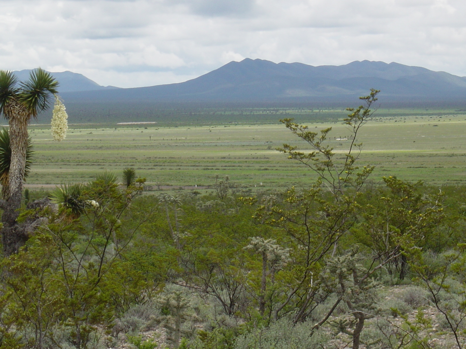
Los esfuerzos de investigación se enfocan a la región del altiplano mexicano conocida como “El Tokio”, donde se distribuyen los pastizales gipsófilos y salinos en el noreste de México y la cual es reconocida como una región prioritaria para la conservación de especies de aves residentes endémicas y migratorias. El área se caracteriza por valles intermontanos en los cuales se presentan suelos con altos contenidos de yeso y carbonatos de calcio, así como pastizales de porte bajo que no rebasan los 15 cm de altura en promedio. En estos valles habita el perrito llanero mexicano (Cynomys mexicanus), especie clave en el ecosistema. La vegetación circundante a estos valles está caracterizada por matorrales de gobernadora (creosote bush) con elementos sobresalientes de Yucca. El área es fuertemente impactada por actividades agrícolas y ganaderas, las cuales se llevan a cabo desordenadamente y sin medidas de mitigación.
-
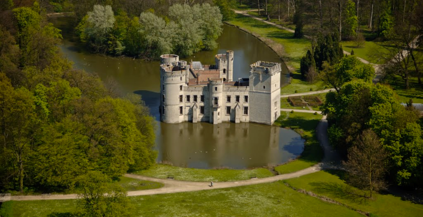
The site of Botanic Garden Meise is a 92 ha domain near Brussels. It has been assembled from parts of two historic castle parks. For more than 75 years it has been home to a collection of plants, as well as a research institute dedicated to botany, forming one of the largest botanic gardens in Europe but also an important tourist attraction close to Brussels. Some habitats get a high degree of disturbance, either due to garden maintenance, or from the large number of visitors. There are also managed and more natural areas. A variety of terrestrial and aquatic habitats occur, among which valuable woody (semi-)natural areas, and also managed meadows. The study of biodiversity in the park has relealed an exceptional species richness in many taxonomic groups. More than 600 wild vascular plant species have been found since 2002, including rare species that were inadvertently introduced during the 19th century, so called wood lawn neophytes . Since 1993 the ectomycorrhizal fungi have been monitored, and there are observations of 52 Red List species in the domain. The park is also the richest Belgian site for Laboulbeniales (Ascomycetes), obligate ectoparasites of Arthropoda. Especially the wet ash-alder forests hold a number of rare and unique taxa and host-parasite combinations, some of them with only a few localities known worldwide. Moreover, the domain is a biodiversity hotspot for lichens and lichenicolous fungi, among other factors as a result of management, such as the regular maintenance of the undergrowth which has a positive effect on light-loving epiphytic lichens, and also due to the diversity of habitats and the large range of different substrates of varying age and of ecological conditions. Another well represented group are diatoms (Bacillariophyta), of which a mere survey in a small pond already yielded two species which have been described as new to science. The site is also rich in fauna, for example rare bat species that overwinter in our historical underground ice cellars. The diverse range of cultivated species also attracts an enormous range of arthropods and plant pathogens, which we know exceeds what we know of it.
-
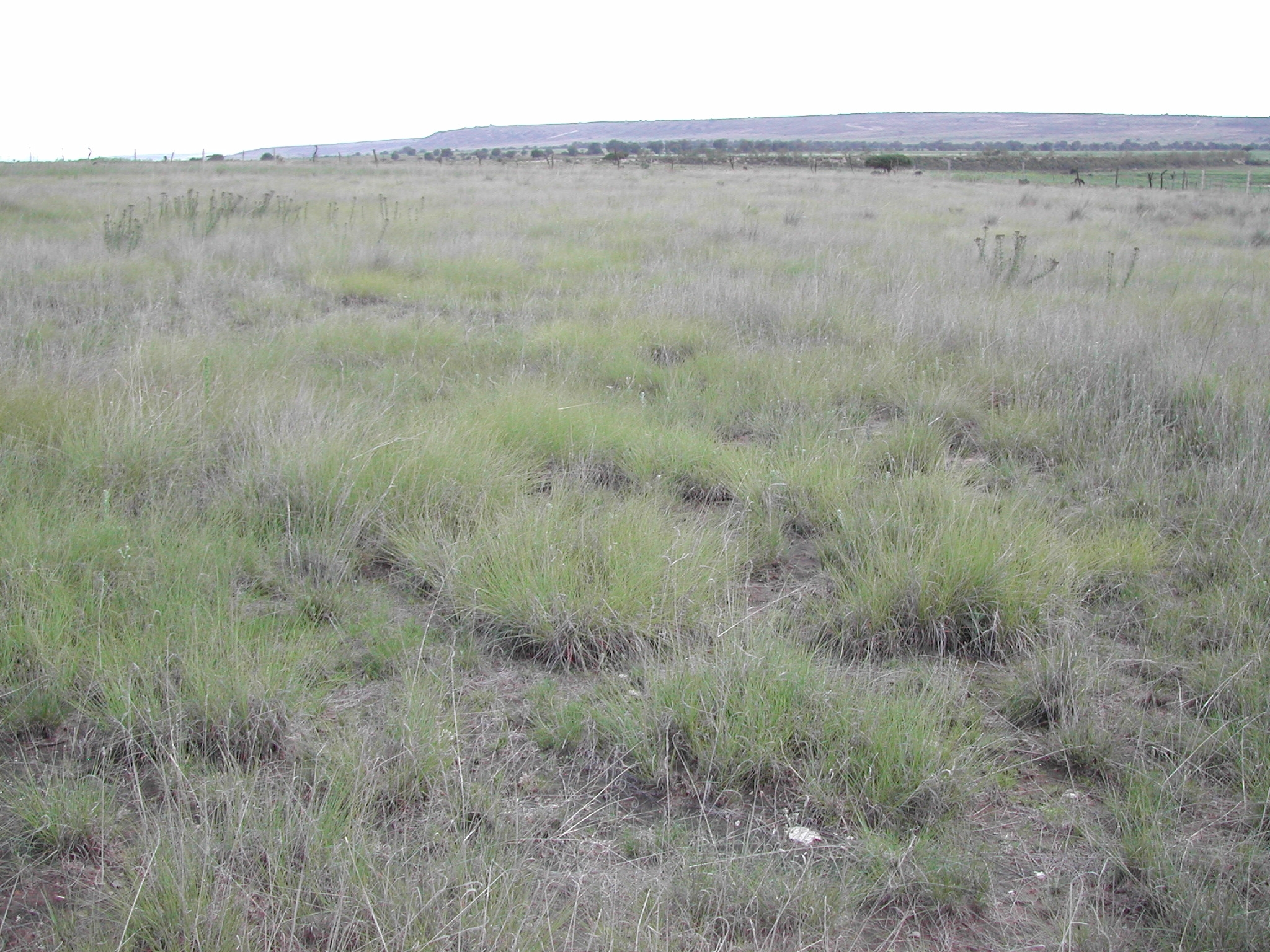
Los sitios están localizados a lo largo del bioma de pastizal semiárido que se extiende desde el norte del estado de Chihuahua, hasta la subprovincia geográfica de los Llanos de Ojuelos en el noreste de Jalisco. Todos exhiben una vegetación de pastizal semiárido dominado por gramíneas cortas del género Bouteloua. La topografía se caracteriza por llanuras, mientras los suelos predominantes están clasificados como xerosol háplico asociado a litosol y xerosol háplico asociado con litosol y planosol éutrico; estos suelos son someros (menos de 50 cm de profundidad). El tipo de uso histórico ha sido de pastoreo, aunque existen algunas áreas donde se realizó agricultura de temporal.
-
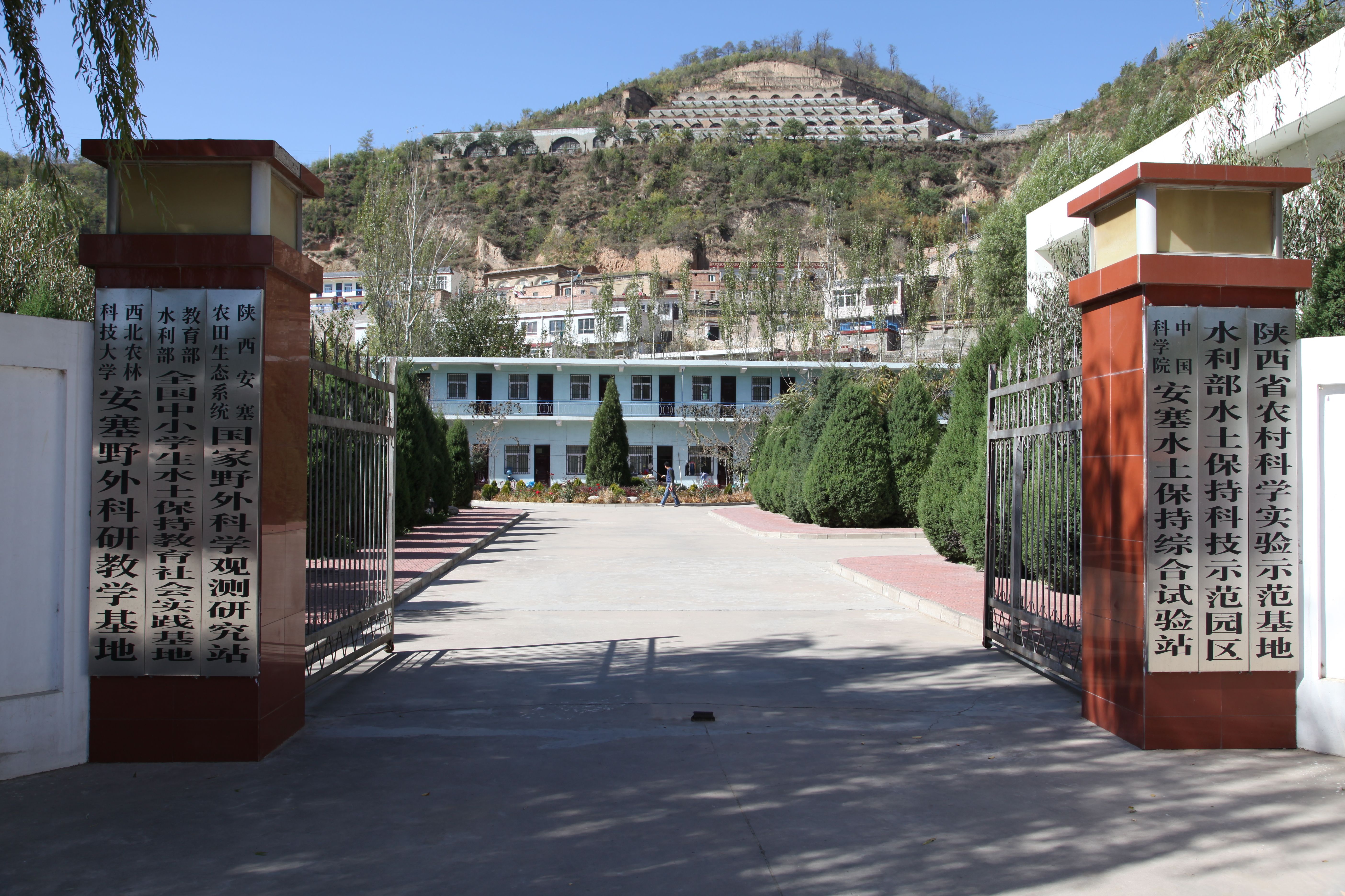
Ansai Integrated Experimental Station on Water and Soil Conservation is a part of Chinese Ecosystem Research Network, which located in the typical loess hilly and gully region and situates near the center of the Loess Plateau in the Shaanxi Province. The loess-derived soils are fertile but extremely susceptible to erosion. Soil erosion in the study area is much higher than that in the southern part of the Loess Plateau. The climate belongs to transition zone of warm temperate semi-humid to semi-arid, which is dry and windy in spring, hot and rainy in summer, and dry and cold in winter. The mean annual temperature is 8.8 °C. The minimum and maximum temperatures are −23.6 °C in February and 36.8 °C in July. The frost-free period is 157 days. The mean annual precipitation is 505 mm, 70% of which falls between July and September in the form of short heavy storm. The soil is silt loam with the contents of sand, silt, and clay being 24%, 65%, and 11%. Ansai station mainly focus on vegetation rehabilitation, monitoring and assessment of rehabilitation, and monitoring in watershed.
-
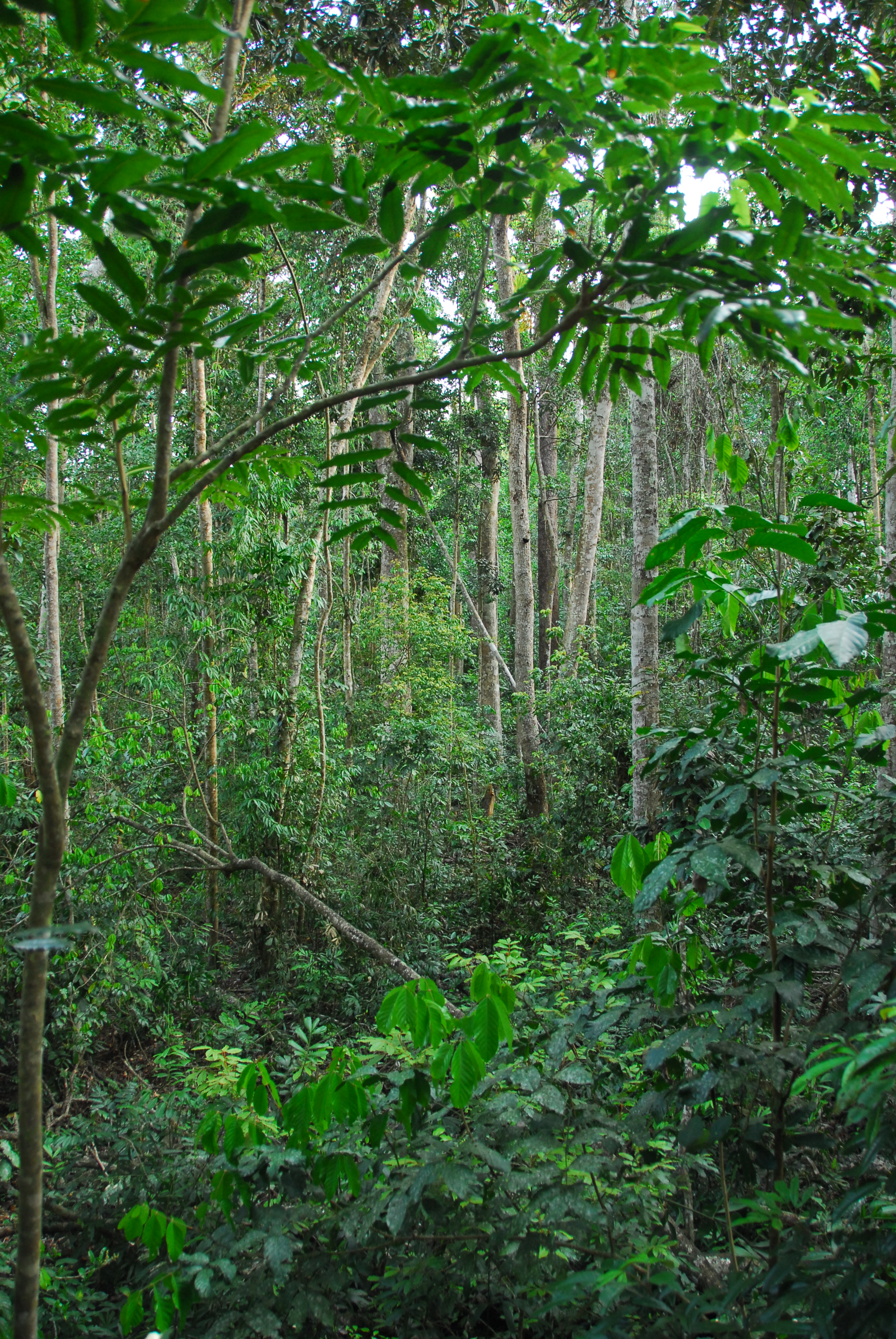
Except for minor disturbances associated with selective logging on two plots, the Tropical Rainforest Plot Network plots were established in old growth forest and all plots have thereafter been protected. Plots have been regularly censused and at each census the diameter at breast height of all stems is recorded. The data collected from the 20 plots provides an insight into the floristical composition, structure and long term forest dynamics of Australian tropical rainforests and allows direct comparisons to be made with long-term monitoring plots at a global scale. Temporal visits were initially conducted every 2 years, then every 5 years from 1990. Between 2012 and 2018 the Tropical Rainforest Plot Network is a member of Long Term Ecological Research Network (LTERN), Australia, a facility of the Australian Government's Terrestrial Ecosystem Research Network (TERN).
-
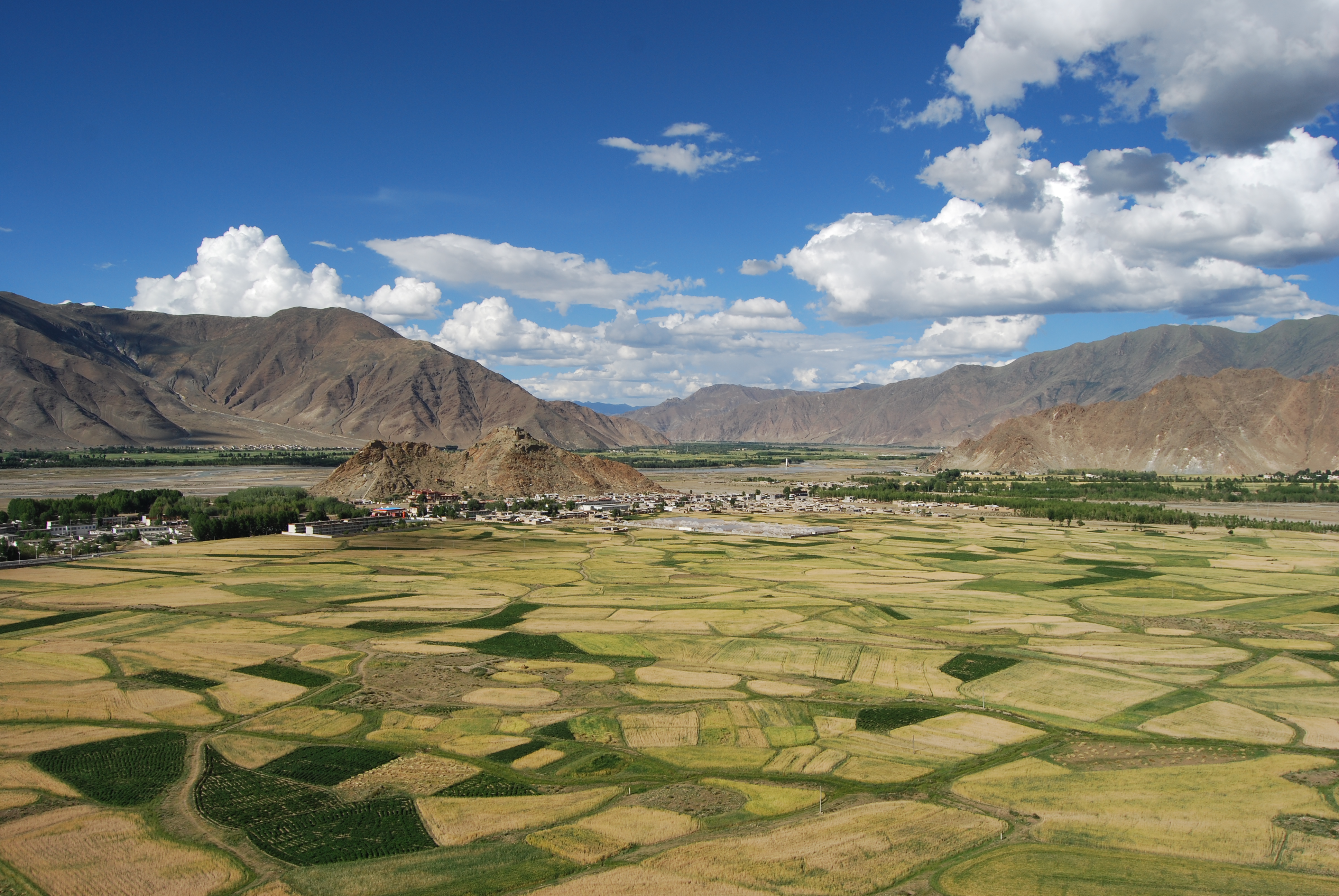
The Lhasa Plateau Ecosystem Research Station is situated at Dagze county, with approximately 3688 m above sea level, Tibet Autonomous Region. It is one of the highest elevation agro-ecological station in World.
-
The first 500 acres of CCESR were acquired in the early 1940s with the understanding that they would be kept in their natural condition and used for scientific and educational purposes. Funds for acquisition of additional land, development of permanent buildings and preparation of accurate maps became available from a variety of sources including personal contributions, the National Science Foundation, the Max Fleischmann Foundation, the Minnesota Natural Resources Commission and the US Land and Water Conservation Program. Cedar Creek lies at the boundary between prairie and forest. It is a mosaic of uplands dominated by oak savanna, prairie, hardwood forest, pine forests, and abandoned agricultural fields and of lowlands comprised of ash and cedar swamps, acid bogs, marshes, and sedge meadows. Large tracts of the pre-agricultural ecosystems of the region are preserved within its boundaries as is a successional chronosequence of more than 80 old fields of known history. A program of prescribed burns, begun in 1964 in a large tract of native oak savanna, has 12 blocks with fire frequencies ranging from one per year, to one per 7 years, to unburned controls. These have diverged dramatically in their vegetation and soils in response to fire frequency and some areas are now exhibiting characteristics not seen in this region since settlement in the 1800s. The soils of Cedar Creek, derived from a glacial outwash sandplain, span five of the ten soil orders. Upland soils are nitrogen poor: numerous nutrient addition experiments performed in both old fields and native savanna have shown that nitrogen is the major soil resource that limits plant growth. Cedar Creek has a continental climate with cold winters, hot summers, and precipitation (66 cm/yr) spread fairly evenly throughout the year. The mean July temperature is 22.2OC while the mean January temperature is -lOoC.
-
Norway Spruce-Fir-Red Beech Forest on Limestone The experimental site Mühleggerköpfl is located on the northern edge of the Alps and receives air pollutants that are transported over long distances, by predominant westerly winds; local emissions from rural settlements are low. The LTER site has an area of 20 hectares. It is a privately owned mature montane forest rich in Norway spruce in the Northern Limestone Alps at 920 m a.s.l. on a north–north-east facing slope of a mountain (47° 34’ 50” N; 11° 38’ 21” E). The site on an isolated calcareous outcrop in the valley of Achenbach represents a watershedsmall catchment. Routinely measured parameters over the years have included climate (air temperature, precipitation, and air humidity), soil temperature, soil water content, soil solution chemistry, nutrient content of Norway spruce needles, air quality, deposition of N, and surface runoff. The climate is cool and mesic with maximum precipitation in summer and a snow-free period from April/May to November/December. The mean annual air temperature and precipitation from on-site measurements are 6.8°C and 1580 mm, respectively. The annual variability of the precipitation is small. Moist conditions are also evident from the high relative air humidity.
-

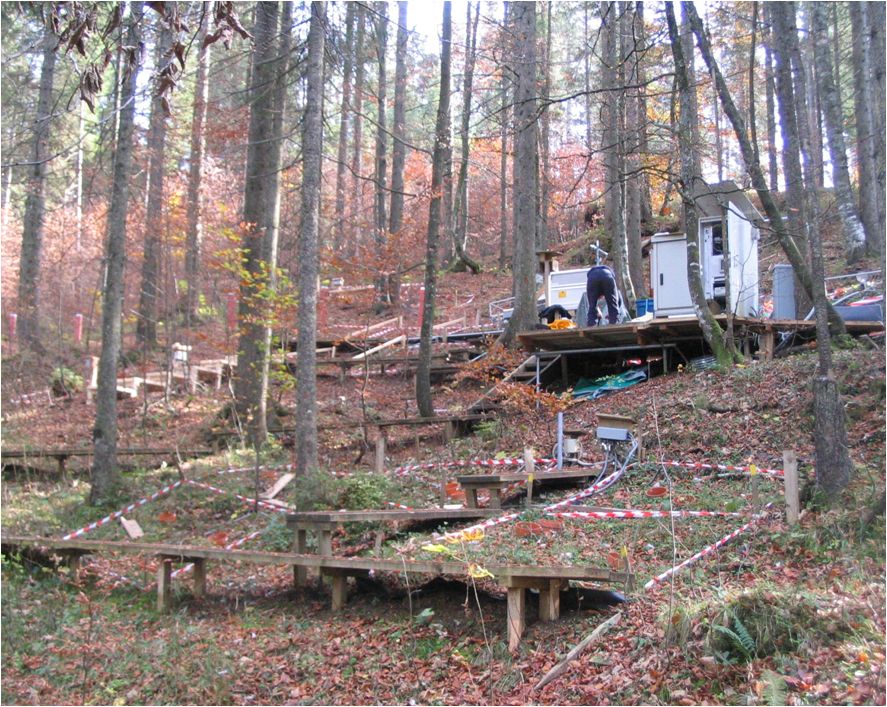
The Hölstein site is located in in the eastern part of the Swiss Jura mountains (47°26’16.4’’, 7°46’31.1’’; 540 m a.s.l.), in a mixed, temperate forest with an exceptionally high biodiversity and a vigorous tree regeneration. The research plot has a size of 1.6 ha and comprises 540 mature trees. The main tree species are Fagus sylvatica and Picea abies with an admixture of Abies alba, Quercus petraea, Pinus sylvestris, Acer pseudoplatanus, Carpinus betulus, Fraxinus excelsior and Sorbus torminalis. A canopy crane is installed in the center of the research area to access the tree canopies for in situ measurements and for sampling of leaf material. Rainout shelters will be installed in 2019 for conducting a long-term throughfall exclusion experiment.
-
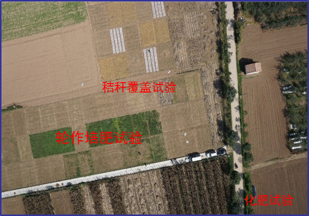
Changwu station was found in 1984 as one of field experiment stations of Institute of Soil and Water Conservation, Chinese Academy of Sciences (ISWC, CAS). It joined the Chinese Ecosystem Research Network (CERN) organized by CAS in 1991 and the National Ecosystem Research Network of China (CNERN) in 2005 by the Ministry of Science and Technology of the People’s Republic of China. The station located in Wangdong Village, Hongjia town, Changwu County, Shaanxi Province, 200 km away from Xi’an city. Its location is E107°41′ and N35°12′, south of the Loess Plateau. It belongs to the warm temperate semi-humid continental monsoon climate. Mean annual precipitation is 580mm and temperature 9.1℃, frost-free day 171. The elevation is about 1200 m and the depth of ground water is 50-80m. Main crops are winter wheat, spring maize, potato, sorghum, millet, beans and so on. The zonal soil is called Heilu soil with a parent material of clay loam Malan loess paleosol soil with an average depth in excess of 100m that were deposited during the Quaternary period. It belongs to the high table land - gully region, and a typical rain-fed agricultural area on the Loess Plateau. Wangdong small watershed, which the station located in, is 6.3km2. Three landform types are high table land, slop land called “Liang” and valley, which occupy the total area of watershed with 35%, 35.6% and 29.4%, respectively. The soil is deep and has good physical properties, like reservoir, support the agro-ecological system.