
root dry weight
Type of resources
Available actions
Topics
Keywords
Contact for the resource
Provided by
Years
Formats
Representation types
-
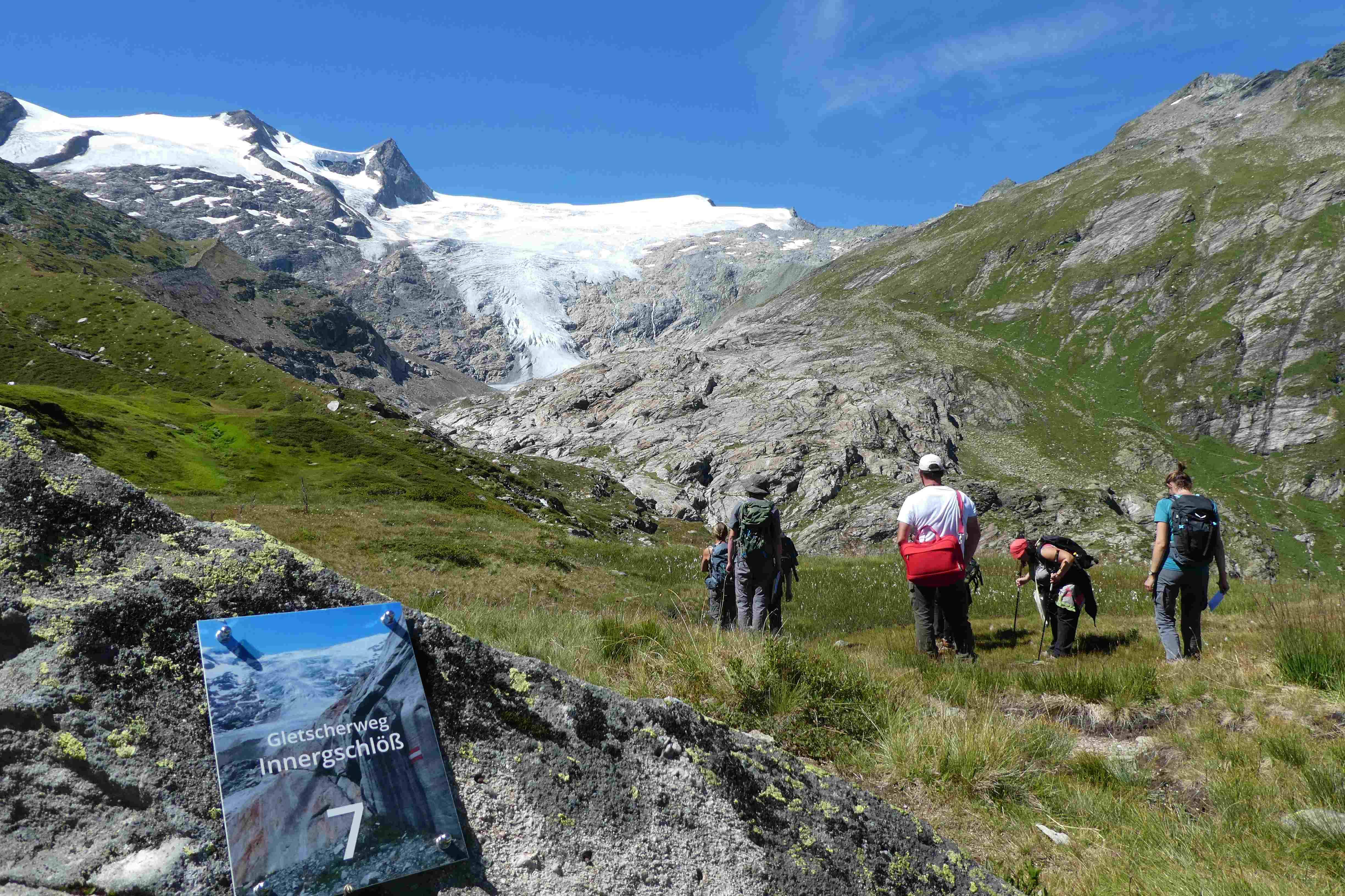
Hohe Tauern NP was established more than 40 years ago as one of the biggest protected areas in Central Europe to protect at long-term wide areas of the Austrian main-ridge of the Alps. The 1.856 square kilometre Hohe Tauern National Park is split into a 1.213 square kilometre core zone and a 643 square kilometre buffer zone and stretches over three provinces. Until the first and largest national park in Austria was actually created, the three provinces of Carinthia, Salzburg and Tyrol had to establish the corresponding legal framework. The Provincial Parliament of Carinthia passed the legislation to create the Hohe Tauern National Park in 1981. Salzburg followed with its national park legislation in 1984, followed by Tyrol in 1992. In this 40 years Hohe Tauern NP established the Nationalpark idea in its region working together with all stakeholders (land owners, tourism, majors, hunting organisations, governmental departments…). The International Union for the Conservation of Nature IUCN awarded Carinthia in 2001 and Salzburg and Tyrol in 2006 with the international recognition of a national park with its "Category II" listing. The distinction that the national park has with a core zone, where nature can develop without human influence and a buffer zone, where traditional cultivation could be continued was key for gaining this international recognition. Contractual agreements between landowners, hunters and the national park paved the way and were pioneering for many protected areas. Hohe Tauern NP contains 3 main zones: - core zone (km²): 1.078 - buffer zone (km²): 643 - special protected areas (km²): 135 About 845 km² of the area is nature zone, which remains untouched by humans (no land use based on IUCN criteria, i.e. no hunting, no grazing). The altitudinal belts from the valleys to the summits of the three-thousand-metre-tall mountains represent an exceptional biodiversity. This is home to many plants and wildlife species originating from the Central Asian tundra, the Arctic and even Southern Europe. The preservation of all significant Alpine ecosystems across large areas of the Hohe Tauern National Park has been unimpaired. More than one third of all plant species recorded in Austria can be found in the national park. For mammals, birds, reptiles and amphibians, this figure is at around 50%. Even those animals that were nearly extinct in almost all of Europe at the beginning of the 19th century are now provided a safe habitat in the Hohe Tauern National Park. This impressive biodiversity is a result of the different prevailing climatic, geological, geomorphological and hydrological conditions in the high mountains and the differing adaptation strategies of the plants and animals. The Tauern Window – a unique tectonic window in terms of shape and size – provides insight into the deepest tectonic layer of the Alps and is thus key for understanding the geological structure of the Alps. Rocks of differing ages, different origins and different chemical composition harbour a genuine hoard of up to 200 different minerals. Nature protection (ecosystems/Natura2000 habitats) and species conservation projects play a big role in the work and history of Hohe Tauern NP (e.g. bearded vulture, ibex, golden eagle, …). The NP and its work do not stop at the protected areas borders and for a lot of species it is important that the whole region is aware of its impacts on biodiversity. According to the altitude gradation of the Hohe Tauern National Park "high mountain habitat types" are typical. Based on the aerial photo interpretation of the National Park montane to alpine grassland and pastures dominate with a third. This also reflects the zoning with the outer zone in the sense of an Alpine cultural landscape zone with alpine pastures – and the transition to the high alpine core zone. The core zone is formed by the "eternal ice" of the glaciers around the highest mountains of Austria as well as scree slopes with and without pioneer vegetation dominate. CORINE Land Cover L3 (2018): 35 % bare rocks, 24 % natural grasslands, 20 % sparsely vegetated areas, 9 % coniferous forest, 7 % glaciers and perpetual snow, 2 % moors and heathland, 1 % pastures.
-

The Hölstein site is located in in the eastern part of the Swiss Jura mountains (47°26’16.4’’, 7°46’31.1’’; 540 m a.s.l.), in a mixed, temperate forest with an exceptionally high biodiversity and a vigorous tree regeneration. The research plot has a size of 1.6 ha and comprises 540 mature trees. The main tree species are Fagus sylvatica and Picea abies with an admixture of Abies alba, Quercus petraea, Pinus sylvestris, Acer pseudoplatanus, Carpinus betulus, Fraxinus excelsior and Sorbus torminalis. A canopy crane is installed in the center of the research area to access the tree canopies for in situ measurements and for sampling of leaf material. Rainout shelters will be installed in 2019 for conducting a long-term throughfall exclusion experiment.
-
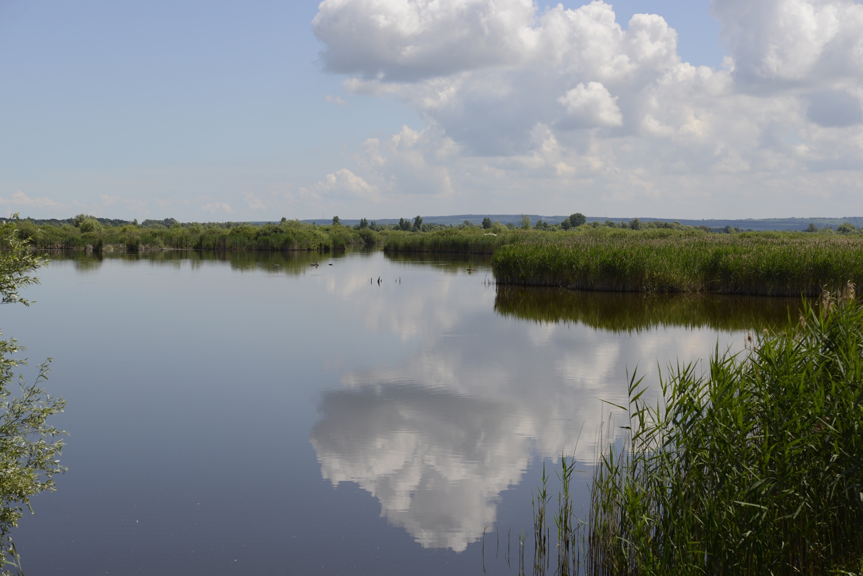
In order to combat the eutrophication of Lake Balaton, the Kis-Balaton Water Protection System (KBWPS) was initiated in the early 1980s. Originally, the KBWPS consisted of an 18 km2 shallow (less than 1.3 m) artificial lake system (Lake Hídvégi) and a 16 km2 wetland, which were constructed on the site of the former Kis-Balaton wetland in the mid-1980s. Later, the wetland part of the KBWPS was significantly enlarged (over 50 km2). Lake Hídvégi was designed to retain nutrients and provide ideal conditions for algae growth, while the wetland component of the KBWPS prevented these algae from entering Lake Balaton. Regular limnological, ornithological, ichthyological and plant ecological measurements are carried out in both Lake Hídvég and the wetland part of the KBWPS.
-
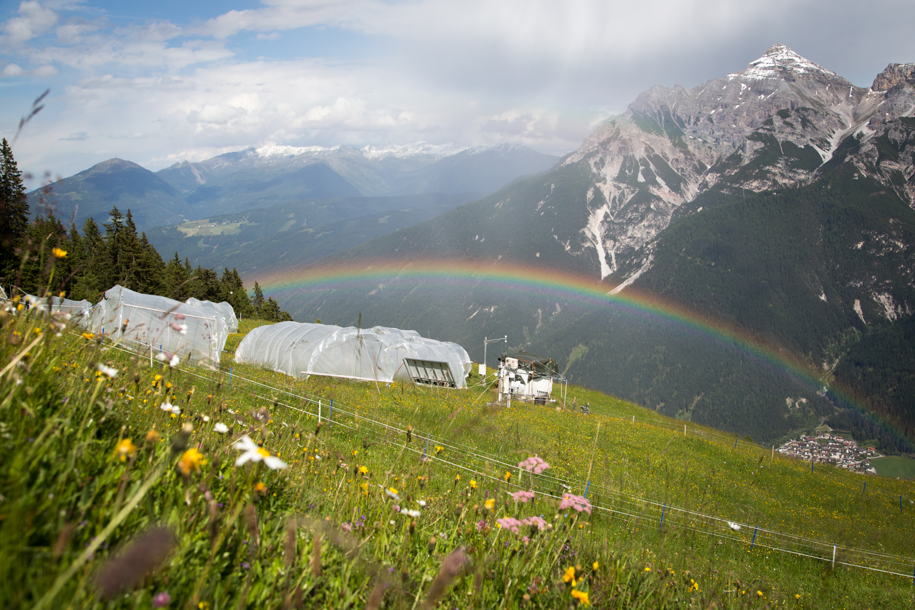
'Tyrolean Mountain Grassland and -Forest' currently consits of 'Stubai - combination of Neustift meadows and Kaserstattalm' (DEIMS.iD: https://deims.org/324f92a3-5940-4790-9738-5aa21992511c). Additional forested research locations may be added in the future.
-

As the largest contiguous pine forest in Switzerland, the Pfyn forest in Canton Valais (46° 18' N, 7° 36' E, 615 m ASL) offers the best conditions for such measurements. In light of this, a WSL research team installed a long-term experiment of 20 years duration in the Pfyn forest. The average temperature here is 9.2°C, the yearly accumulated precipitation is 657 mm (average 1961-1990). The pines in the middle of the forest are about 100 years old and 10.8 m high. The test area has 876 trees covering 1.2 ha divided into 8 plots of 1'000 m2 each (Image 4). Between the months of April and October four of these plots are irrigated by a sprinkler system providing an additional 700 mm of water, annually. In the other four plots, the trees grow under natural, hence relatively dry conditions.
-
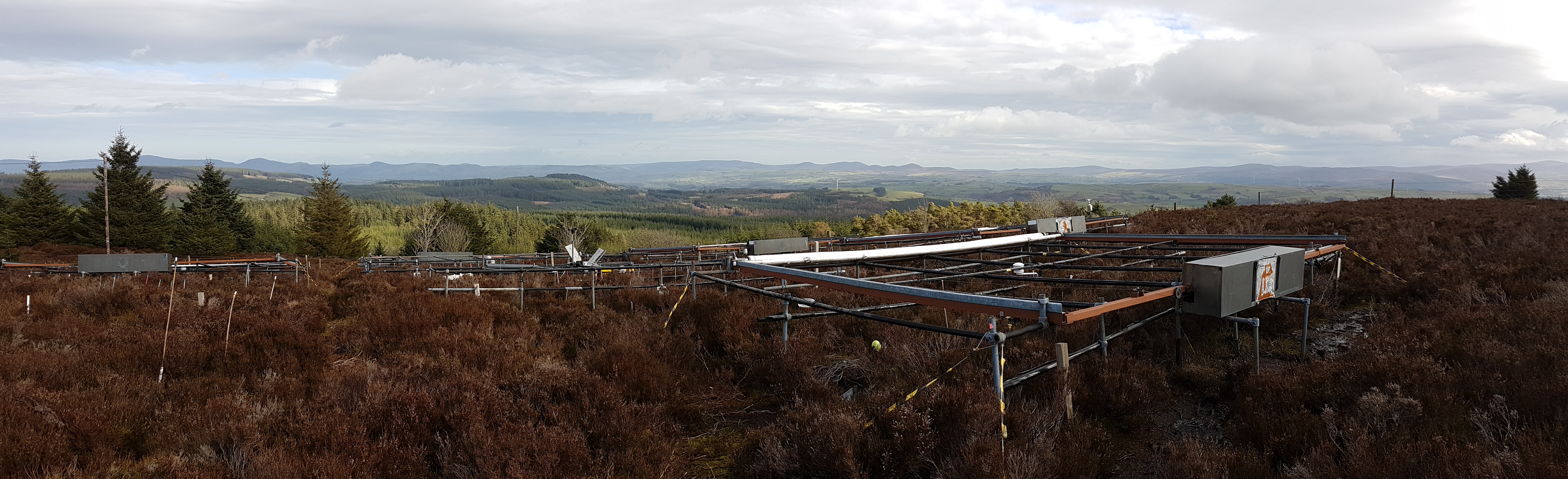
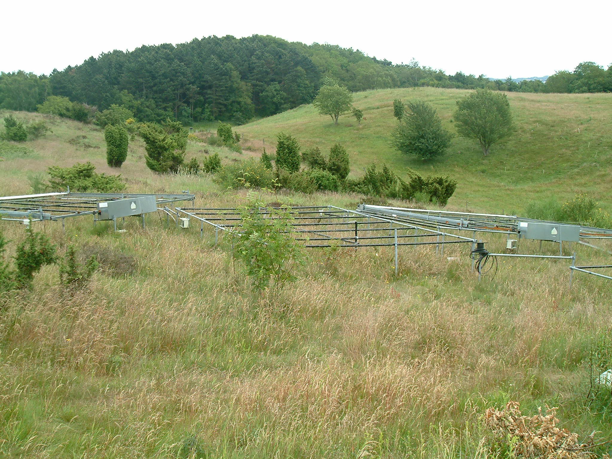
The site is located in Clocaenog Forest in North East Wales (53o 03’ 19’’N -03o 27’ 55’’ W). It is a typical upland west-atlantic moorland, dominated by the evergreen shrub Calluna vulgaris (heather). Heather makes up >60% of the plant biomass at the site, but Vaccinium myrtillus and Empetrum nigrum are also present.
-
Mols Bjerge National Park or Nationalpark Mols Bjerge is a Danish national park in the area known as Mols Bjerge (lit.: Mols Hills) in Syddjurs Municipality, Central Jutland, inaugurated on the 29th of August 2009. The protected area, measures 180 square kilometres (69 sq mi) in size. The Mols Hills, reaching a height of 137 metres (449 ft), are centrally located in the park, and take up 2,500 ha. "More than half of all wild Danish plant species" can be found at Mols Bjerge. The park comprise most of the southern parts of the headland of Djursland. It is bounded on the east by the sea of Kattegat, the forests of Kaløskovene in the west and to the south by multiple inlets, coves and plains of glacially generated moraine. The town of Ebeltoft, along with villages and summer house residence areas, are considered part of the park. Land in the national park is held under both private and state ownership. Nearly 33% of the park is cultivated and 80% of the hill area is under private ownership. Mols Bjerge National Park has a rolling and widely varying topography of woodlands and open countryside, created with the end of the last ice age. Elevation in the park area varies in height rising to a maximum of 137 metres (449 ft) in Mols Hills, with many types of habitats such as heath, forests, pastures, bogs, meadows, a variety of coastal habitats and sea
-
Vestskoven is a 15 km2 ongoing afforestation area located 15 km west of central Copenhagen. Since 1967 arable land has successively been bought up for afforestation in order to establish a large forest area for outdoor activities and wood production. In 1998, afforestation chronosequences in oak (Quercus robur) and Norway spruce (Picea abies) were established as a research platform to quantify soil carbon dynamics, water recharge, nitrogen budgets and ground vegetation species diversity. The soil and grund vegetation species composition were resampled in the chronosequences after 13 years in 2011. Since 2003, an ICP-Forests Level II/Core plot with integrated monitoring under the UN Convention on Long-Range Transboundary Air Pollution (CLRTAP) is placed in an oak stand. Monitoring has developed over time. There is no time limit on the monitoring financed by the Ministry of Environment and Food in Denmark.
-
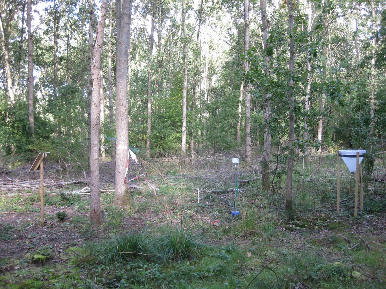
Suserup Skov (19.2 ha) is an old growth temperate forest dominated by beech Fagus sylvatica, pedunculate oak Quercus robur, ash Fraxinus excelsior, wych elm Ulmus glabra, and black alder Alnus glutinosa, admixed with lime Tilia platyphyllos and sycamore maple Acer pseudoplatanus. KU/IGN-SNB, is a 19,2 ha old-growth beech-dominated mixed deciduous forests on western Zealand owned by Sorø Academy. The forest use dates back to 4200 BC. A conservation act was placed on the forest in 1925 for biological and recreational purposes but allowing a minimum odd felling until the act was updated in 1961 to a non-intervention forest. The forest is unique at European level in terms of nonintervention, and the long-term status as non-intervention forest has led to a unique steady state in biomass and accumulation of dead wood, thus serving as an important reference site for unmanaged temperate deciduous forest development. There are long-term data records of e.g. biomass, dead organic matter, soil, forest structure, flora and fungi starting from 1992. The platform is included in a series of paired managed and non-intervention forests for studies of forest structure, biodiversity and biogeochemistry in mature and old beech-dominated forests. Suserup Forest includes an ICP Forests level II plot (2001-). Upgrades: eLTER master sites: soil moisture content (TDR), remote sensing of growth and forest structure, LAI, NDVI (Lidar, camera), continuous plant phenology (web cam),and insect monitoring (optical sensors) as biodiversity measures, ambient air quality and air pollution.
-
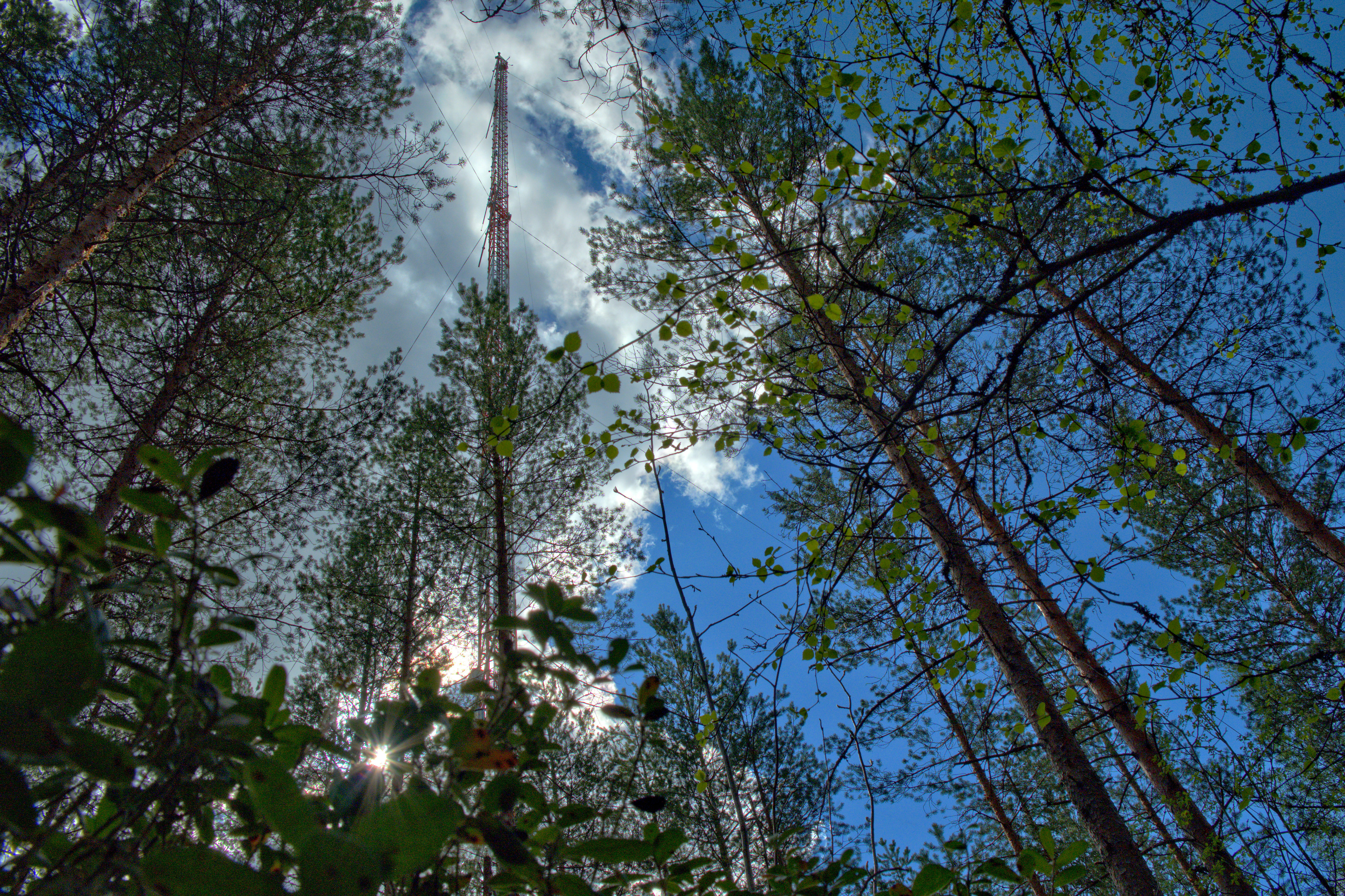
The Hyytiälä SMEAR II site (Station for Measuring Ecosystem-Atmosphere Relations) is situated in the Hyytiälä Forestry Field Station of the University of Helsinki. The site consists is a managed, 60-yr old Scots pine forest stand. The main idea of SMEAR type infrastructures is continuous, comprehensive measurements of fluxes, storages and concentrations in the land ecosystem–atmosphere continuum. The forest measurements are operated continuously since 1996, and include e.g. leaf, stand and ecosystem scale measurements of greenhouse gases, volatile organic compounds, pollutants (e.g. O3, SO2, NOx) and aerosols, in addition to full suite of meteorological measurements. The biogeochemical cycles and vegetation–soil–atmosphere interactions are studied both experimentally and with long-term observations. The site has full carbon, water and nitrogen budgets made over 10 years, and it is a full ICOS ecosystem and atmospheric station. Ecosystem and atmosphere measurements also exist nearby in two open oligotrophic fen sites and a humic lake with forested catchment. Most of the measured data can be retrieved from: https://smear.avaa.csc.fi/