
sapwood area
Type of resources
Available actions
Topics
Keywords
Contact for the resource
Provided by
Years
Formats
Representation types
-
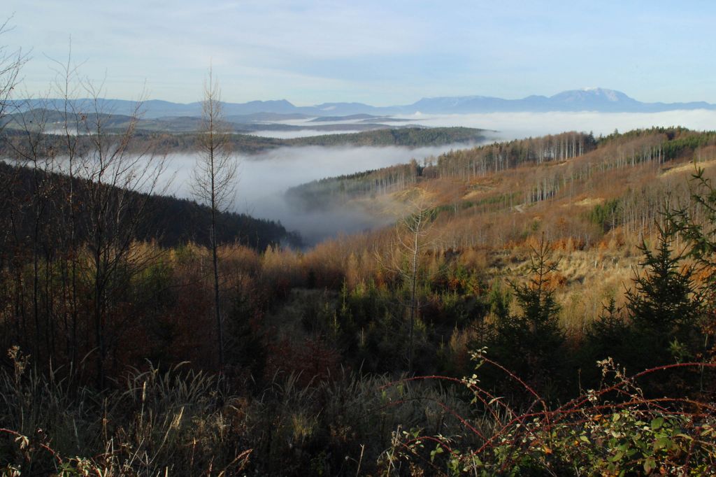
The Lehrforst Rosalia (Rosalia University forest) is about 1000 ha, covered with all major tree species and forest types in Austria (Norway spruce, Fir, Larch, Scots pine, Beech, Oak, etc). The forest area is located in the Rosalia Mountains near the Lower Austria/Burgenland border. The Demonstration Forest (950 ha) was set up in 1972 with an agreement between the Austrian Federal Forests (Österreichische Bundesforste, ÖBf, https://www.bundesforste.at/english.html) and BOKU. Nevertheless, the University is active in this area since 1875; considerable documentation regarding forest description and planning was elaborated by that time. It is located on the western slope of the mountainous ridge called „Rosaliengebirge“ in the southeastern part of Lower Austria (LAT 47°42’N, LON 16°17’ E). Elevation is between 300 and 720 m a.s.l, annual mean temperature of 6.5 deg C and 800 mm annual precipitation. The forest is mainly composed of beech associations (Fagetums) , peripheral also spruce-fir-beech forest association (Abieti-Fagetum). The Key task of the Forest Demonstration Centre ist supporting the educational and research work of the University of Natural Resources and Life Sciences. Accordingly, accommodation, work and teaching facilities are provided. The research focus lies on following areas: · Collection and hold ready of area-based and environmental Data · Establishing and monitoring of sample plots especially for beech growth and treatment related questions · Characterization of local and microclimate · Environmental impacts to forest ecosystems · Monitoring and modelling of small forested watersheds Essential research and educational infrastructure are: · 4 Weather monitoring stations · 2 scaffolding towers for measuring (35m) with instrument cabin · 4 Measuring weirs for runoff monitoring (Watershed 230 ha) · radio linked data collection and on-line hosting · Surveying and Mapping equipments (terrestric and GPS) · Long-term experiment simulating drying and rewetting of forest soils (DRAIN Station) · IT-Room with different Software-packages (GIS, Planning Tools etc.) · Laboratories and work rooms · Lecture Rooms · Accommodation for > 40 people The available data range from base data (GIS-Data), meterological and hydrological time series (since 1990), inventory data of growing stock, data of different plots to measuring data related to numerous projects.
-
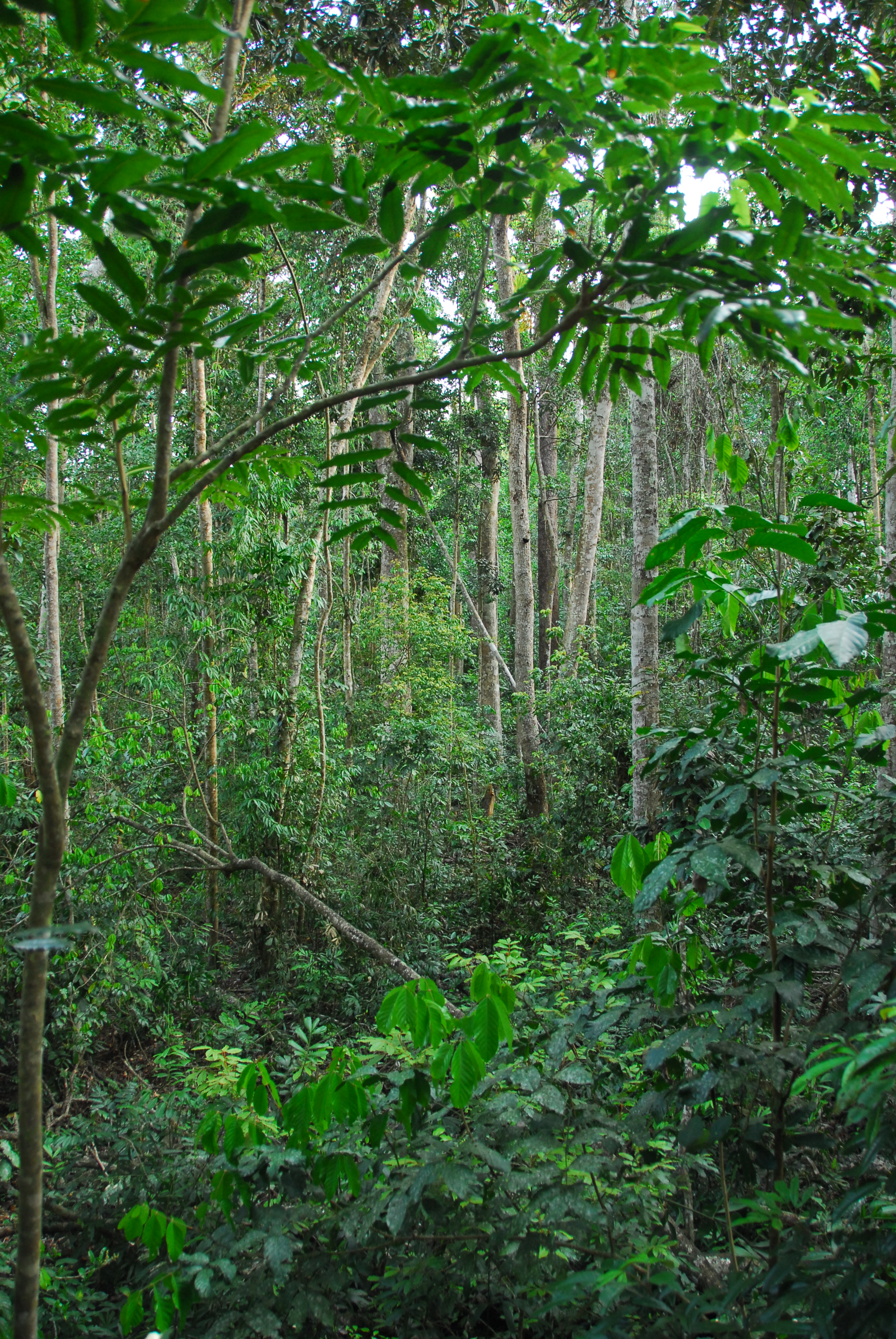
Except for minor disturbances associated with selective logging on two plots, the Tropical Rainforest Plot Network plots were established in old growth forest and all plots have thereafter been protected. Plots have been regularly censused and at each census the diameter at breast height of all stems is recorded. The data collected from the 20 plots provides an insight into the floristical composition, structure and long term forest dynamics of Australian tropical rainforests and allows direct comparisons to be made with long-term monitoring plots at a global scale. Temporal visits were initially conducted every 2 years, then every 5 years from 1990. Between 2012 and 2018 the Tropical Rainforest Plot Network is a member of Long Term Ecological Research Network (LTERN), Australia, a facility of the Australian Government's Terrestrial Ecosystem Research Network (TERN).
-
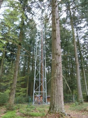
The site is a mixed mature forest composed mainly of Fagus Sylvatica, Pseudotsuga menziesii and Picea abies. The soil (100-150 cm deep) is a silty and stony soil with B structural horizon composed by schist and phyllades. Fluxes of CO2 and water vapour and micrometeorological measurements are performed above the forest by an eddy-covariance system installed on a tower since 1996. During the successive measurement years, several complementary campaigns have been organised : forest inventory, automatic soil respiration measurements, advection, ecosystem water budget, diffusion of CO2 and stable isotopes in soil, volatile organic compounds fluxes, soil carbon content inventory, monthly evolution of nitrogen deposition... Research activities are carried out by the University of Liège (GxABT) and the Université catholique de Louvain (UCL) within the ICOS infrastructure.
-
The Sani Environmental Observatory (S.E.O.) is located within a mature, near-coastal Aleppo pine (Pinus halepensis L.) ecosystem at the peninsula of Kassandra, in Chalkidiki, Greece. It is part of the Stavronikita forest, which comprises approximately 300 ha of land covered mainly by forests and to a lesser extend by shrubs and pastures. The Observatory aims primarily at the assessment of the carbon and water balance of this typical low-elevation forest ecosystem to the ongoing climatic shift. Such ecosystems may be prone to the intensified heat and drought events, as well as to the associated insects’ and pathogens’ outbreaks, which are increasingly occurring at the Mediterranean region and particularly at its eastern part. Although Aleppo pines, as well as other Mediterranean pines, are generally adapted to the region’s xerothermic conditions, the in-depth understanding of their ecophysiological and growth responses will allow us to predict the potential of such ecosystems to adapt to climate change. SEO also serves to assess the carbon stocks and fluxes and the contribution of these natural, old-growth ecosystems to carbon sequestration and, thus, to climate change mitigation. S.E.O. is developed by the Forest Research Institute (Lab of Forest Ecophysiology) of the Hellenic Agricultural Organization Dimitra with the support of Sani Resort SA, the owner of the studied forest ecosystem, presenting a nice example of collaboration between the research community and the private sector. Given that SEO is located at a region of high touristic and aesthetic value, close to a wetland and the sea, the Observatory also plans actions to familiarize people with environmental monitoring and the multiple functions and services of the studied Mediterranean ecosystem.
-
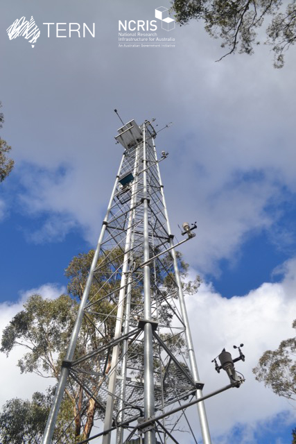
The Victorian Dry Eucalypt SuperSite is a member of the Australian SuperSite Network (SuperSites, http://www.supersites.net.au/), a facility within the Australian Terrestrial Ecosystem Network (TERN, http://www.tern.org.au/) and has two nodes (Whroo and Wombat). The Victorian Dry Eucalypt SuperSite - Whroo site near Shepparton was established in 2011. The vegetation is dominated by two main Eucalypt species: Eucalyptus microcarpa (Grey Box) and Eucalyptus leucoxylon (Yellow Gum). Smaller numbers of Eucalyptus sideroxylon (Ironbark) and Acacia pycnantha (Golden Wattle) are also found on site. The surrounding area includes the Whroo Historical area, and Rushworth State containing remnant native vegetation. Key research objectives include: • What are the elements of structure, composition, functions and processes of the dry eucalypt forests of South Eastern Australia required for the sustainable management of these ecosystems? • What is the carbon sink/source strength of a dry sclerophyll forest and what is their contribution to Australia’s National Carbon Inventory? • What is the magnitude of emission and/or uptake of non-CO2 greenhouse gases, such as nitrous oxide and methane of dry eucalypt forest? • How will climate variability, drought or fire influence the ecosystem processes of dry eucalypt forest? . The site is on the lands of the Ngurai-illam-wurrung Aboriginal people.
-
Síkfőkút LTER Europe site is a temperate deciduous forest site, unmanaged since the late 1960ies. It is situated in the Szőllőcske forest reserve area on the southern foothills of Bükk Mountains, NE Hungary. The site is covered by a mature coppice oak forest (105 years old) with Q. petraea and Q. cerris in the upper canopy layer and other woody species occurring in the secondary canopy layer and shrub layers (Acer sp., Cornus sp, Euonymus sp., Crataegus sp.) The site was seriously impacted by oak decline during 1980ies. The soil has been classified as a brown forest soil type according to the Hungarian Soil Classification System which corresponds to Luvisol according to FAO WRB. Long-term data are available on climate, soil variables and forest structural and functional characteristics (for period 1973-2016).
-
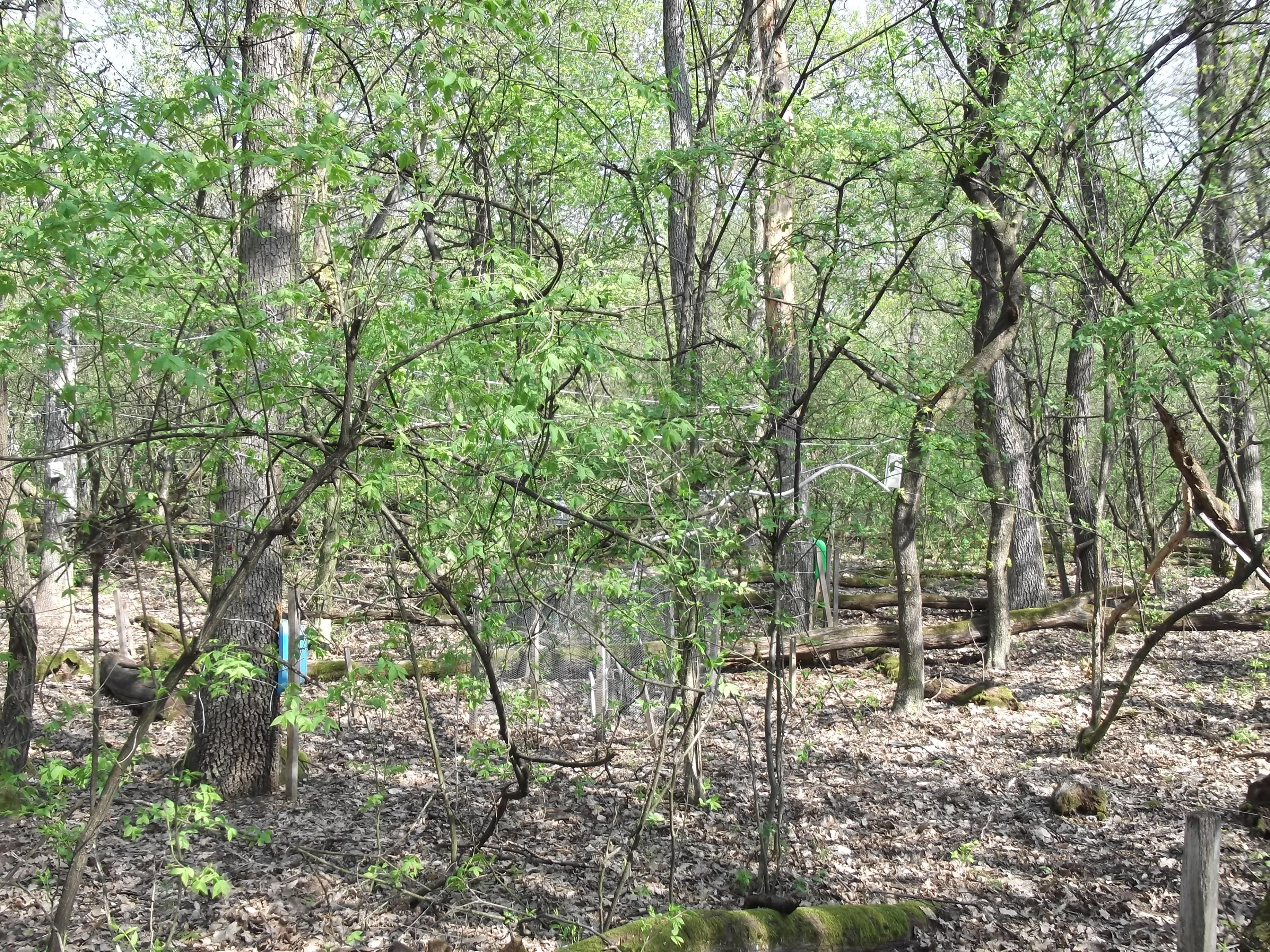
The site comprises 4 plots installed in an oak and beech forest of 60 ha: 2 plots are in pure stands dominated either by oak (1.22 ha) or by beech (0.88 ha) and the two other plots are in mixed stands of contrasted densities (1.05 and 1.75 ha). All the stands are close to each other and are in very similar ecological conditions.
-

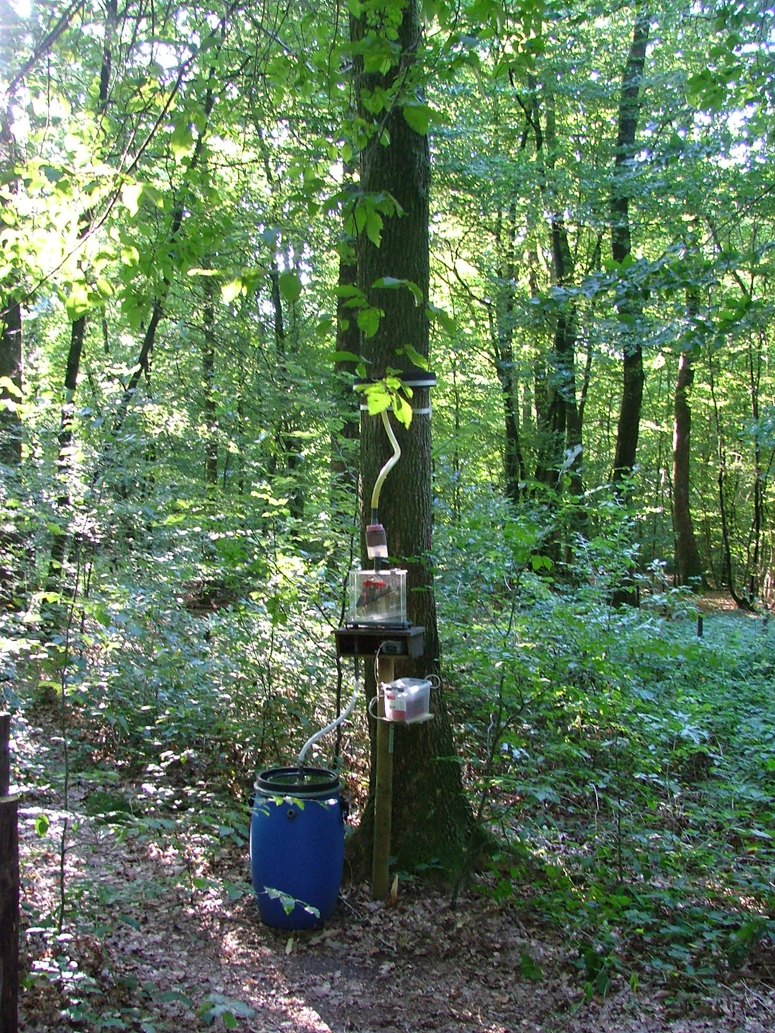
ICP forest monitoring plots: 0.5 ha of fenced stand + 20 m buffer area. Managment, data collection and reserch activities carried on by catholic university of Louvain (UCL)
-
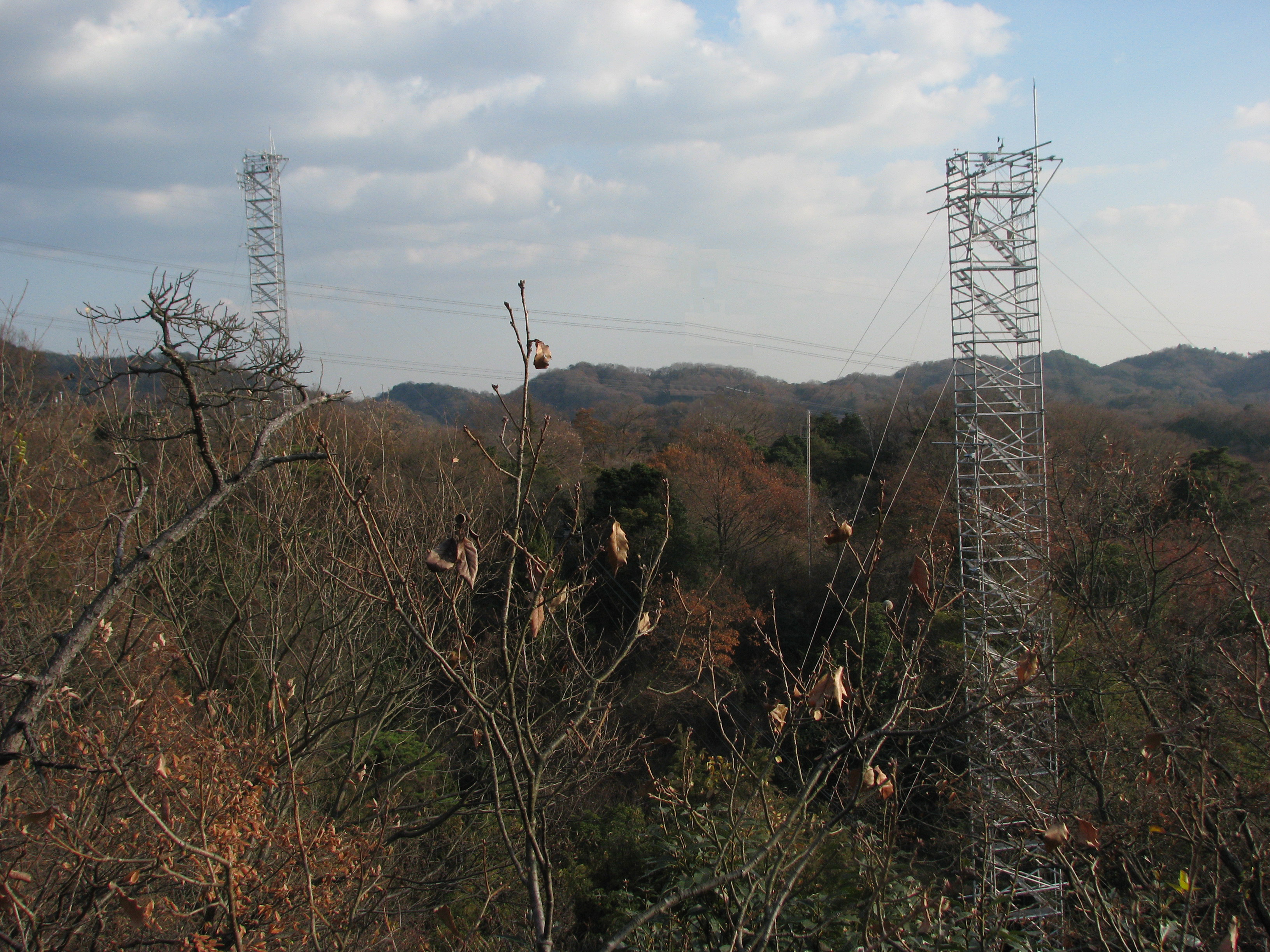
Suburban Kyoto
-
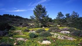
In September 1993, Ramat Hanadiv inaugurated the Long Term Ecological Research (LTER) station as part of the global and Israel LTER network. One of the main areas of activity at the station is a long-term monitoring program. The long-term monitoring program includes continuous monitoring of several parameters and organisms as determined in advance: Gazelles, chukars, passerines, butterflies, herbaceous vegetation, and woody vegetation. A meteorological station has been established in the park to collect climactic data. The information is gathered and stored in a web-based database providing baseline data that can serve in the future as a point of reference. Our aspiration is that the combination of monitoring and management will in the long term enable the conservation and enrichment of the diversity of species, communities, landscapes, and processes of the Mediterranean landscape. In addition to the activities of the LTER station, Ramat Hanadiv is also implementing dozens of studies focusing on a wide range of fields. These studies are carried out by students and researchers from universities throughout Israel. In the Israeli context Ramat Hanadiv is a unique case of a natural area that is actively managed, intensively studied and mapped on all levels. As such, it cam serve as an example of nature conservation and management of Mediterranean ecosystems in Israel.