
saturated water content
Type of resources
Available actions
Topics
Keywords
Contact for the resource
Provided by
Years
Formats
Representation types
-
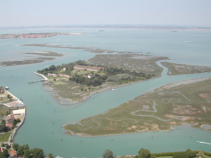
The research activities in the lagoon, as well as the understanding of natural phenomena, are directed to the study of the ecological effects of the major pressures acting on the system, including which the input of nutrients from agricultural and urban sources, industrial activity and port (Porto Marghera, Venice Maritime Station, the commercial port in Chioggia), the release of pollutants accumulated in sediments, the intense traffic ships and smaller boats,, the morphological trivialization. In recent decades the Tapes philippinarum has generated problems related to collection techniques. Is focusing attention to the increasing presence of alien species both plant that animals.
-
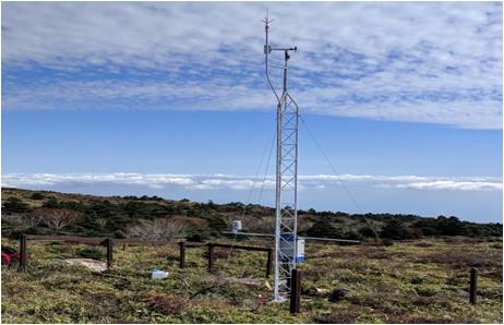
Mt Halla San is in Jeju Island, the only volcanic subtropical island, in South Korea. Every year the island is hit by several typhoons. It has shaped unique environmental characteristics and biodiversity. In addition the mountain is one of the most popular vacation sites with growing ecological concern.
-
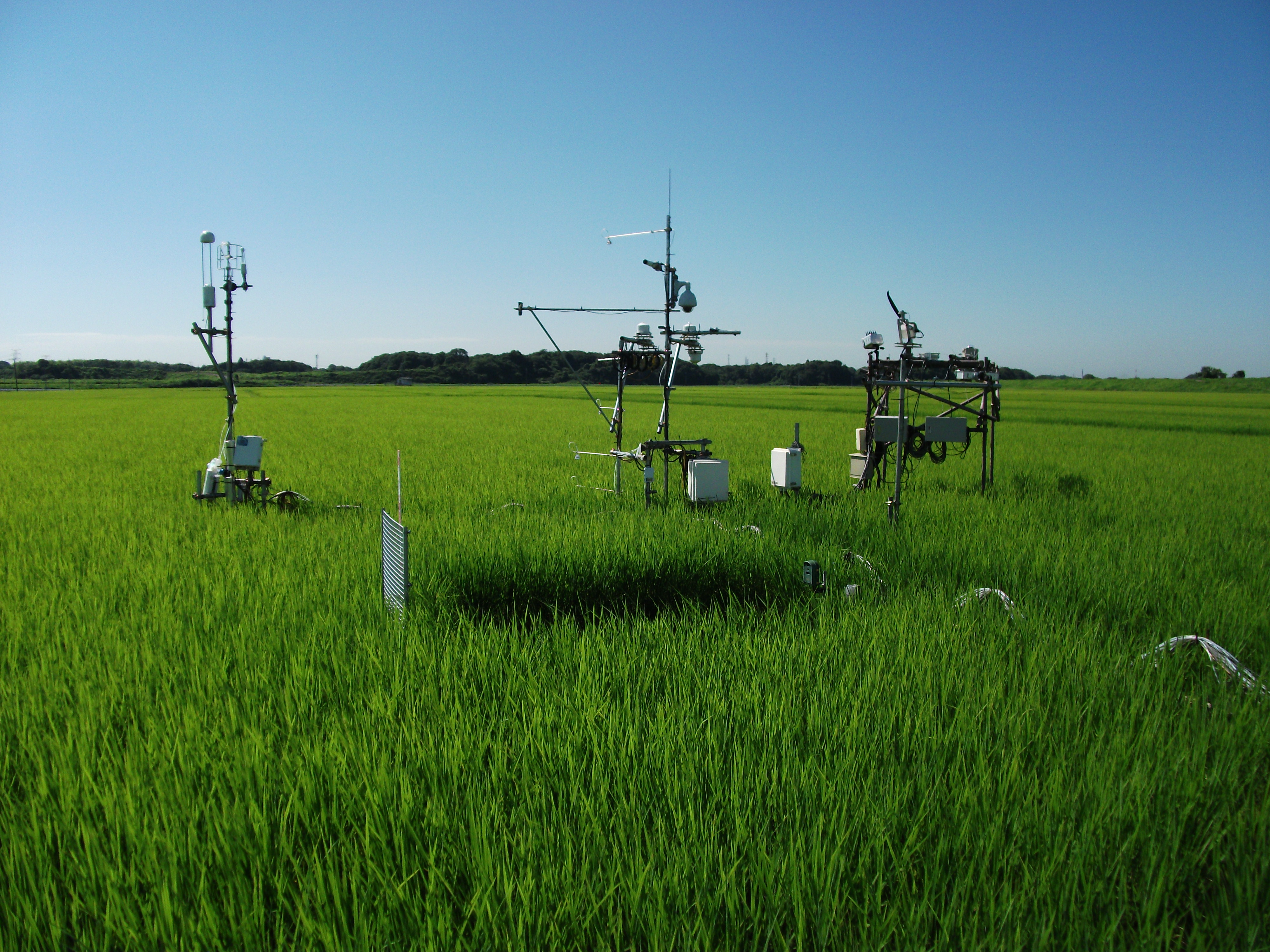
The Mase rice paddy site is a flux station in the AsiaFlux micrometeorological tower network. Located in a regularly cultivated rice paddy area of the Kanto plain in Japan, the site was established in 1999. The initial motivation was to quantify the energy and carbon balance in the rice paddy (ca, 54 a) where the tower was situated. Because of the accessibility and line-power availability, the site has involved many researchers and students from universities and institutes, broadening its target to studies on satellite and field remote sensing, ecosystem modelling, and nutrient cycling.
-
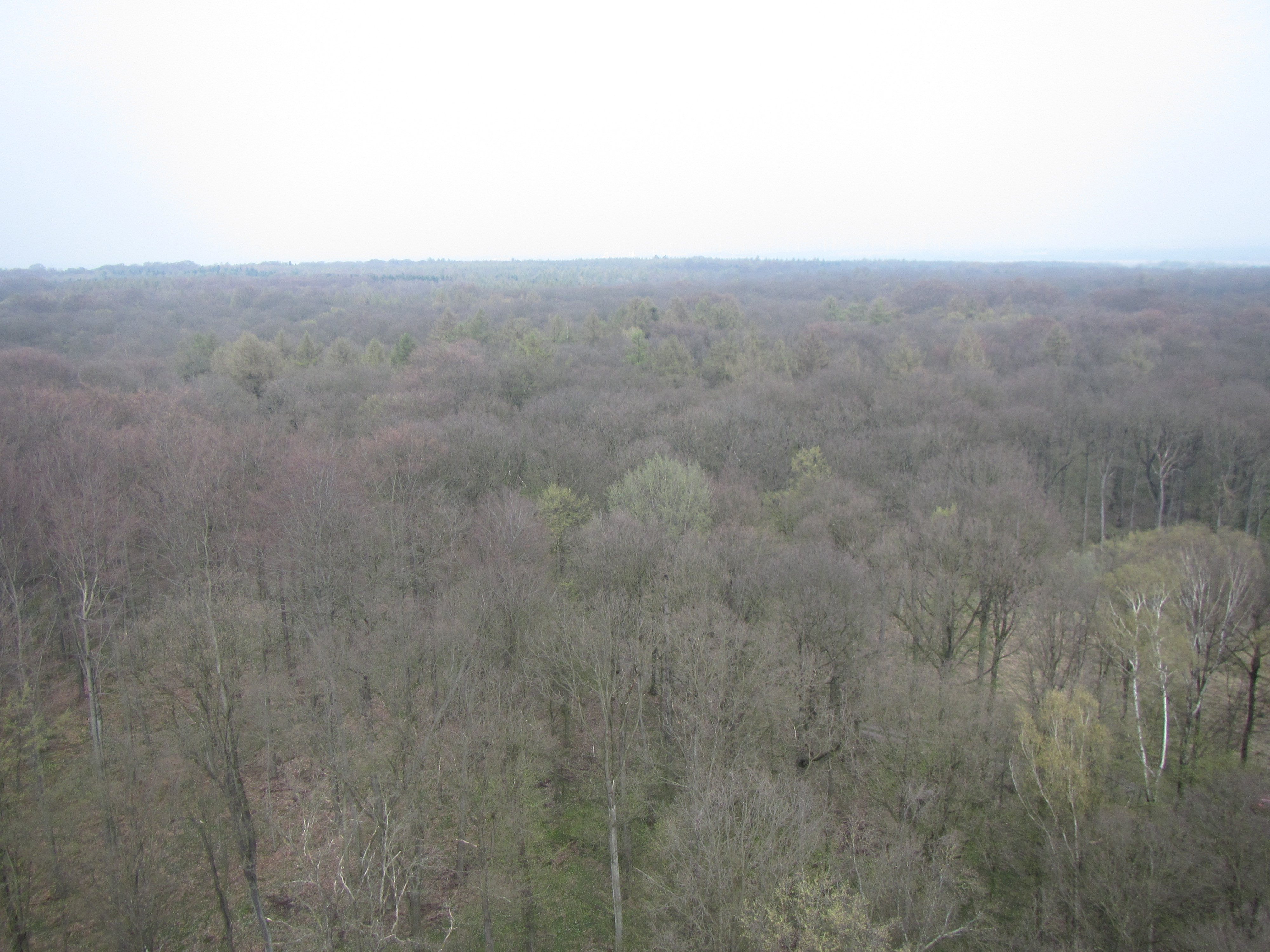
The Hohes Holz is a mixed beech forest, with an intensive research site with respect to carbon and water cycle at the northern border of the Bode catchment close to Magdeburg, Germany. It is certified as class 1 ecosystem station in ICOS.
-
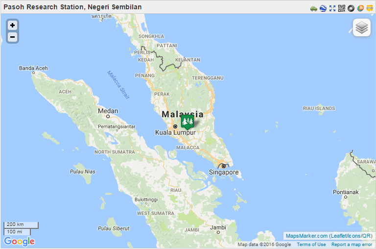
From 1970 to 1974, the Pasoh FRIM Research Station (Pasoh FRS) has been a site for intensive research of lowland rain forest ecology and dynamics under a joint research project between University of Malaya and the International Biological Programme (IBM). Pasoh forest was also the main study site for the Reproductive Biology of Forest Trees Project, a joint research project between University of Aberdeen and University of Malaya from 1974 to 1978. Since then, various research projects on biodiversity, forest productivity, flora, fauna, micrometeorology, soils, hydrology and nutrient cycling were conducted in collaboration with local universities.. In December 1977, Forest Research Institute Malaysia (FRIM) took over the management of the research station from University of Malaya. This was made possible through the collaboration with the Negeri Sembilan State Forestry Department. The Pasoh forest station has since become a leading tropical forest field research station. This could not have been possible without the commitment from the state forestry department to gazette 1,840 ha of the Pasoh reserve as a Research Forest. All research activities are monitored by the Pasoh Research Committee (PRC) in FRIM since 1999. The Director of the Negeri Sembilan Forestry Department is also a Committee member. The main attraction of the Pasoh Reserve is its floristically rich forest. A total of 335,256 stems 1 cm dbh (diameter at breast height) and above belonging to 814 species, 294 genera and 78 families has been recorded within an area of 50 ha. The most common plant families are the Euphorbiaceae and Annonaceae among the smaller trees, and the Dipterocarpaceae, Leguminosae and Burseraceae. The most common species is Xerospermum noronhianum (Sapindaceae) locally known as ‘rambutan pacat,/em>’, which accounts for 2.5% of the total number of plants. For trees above 30 cm dbh, the most abundant species is Shorea leprosula (meranti tembaga), a member of the Diptrerocarpaceae family. Being an isolated forest surrounded by oil palm estates and other land uses, forest gaps, formed by windthrow of a large tree or a group of trees, are a fairly common feature at Pasoh. Within these gaps, one can find many regenerating seedlings and saplings. Although Pasoh lacks charismatic animals such as tigers and elephants, it still harbours a good composition of small mammals, primates and birds Today Pasoh is not only the site of many research studies by both local scientists and scientists from abroad but is also an educational centre for school children, college and university students as well as the general public.
-
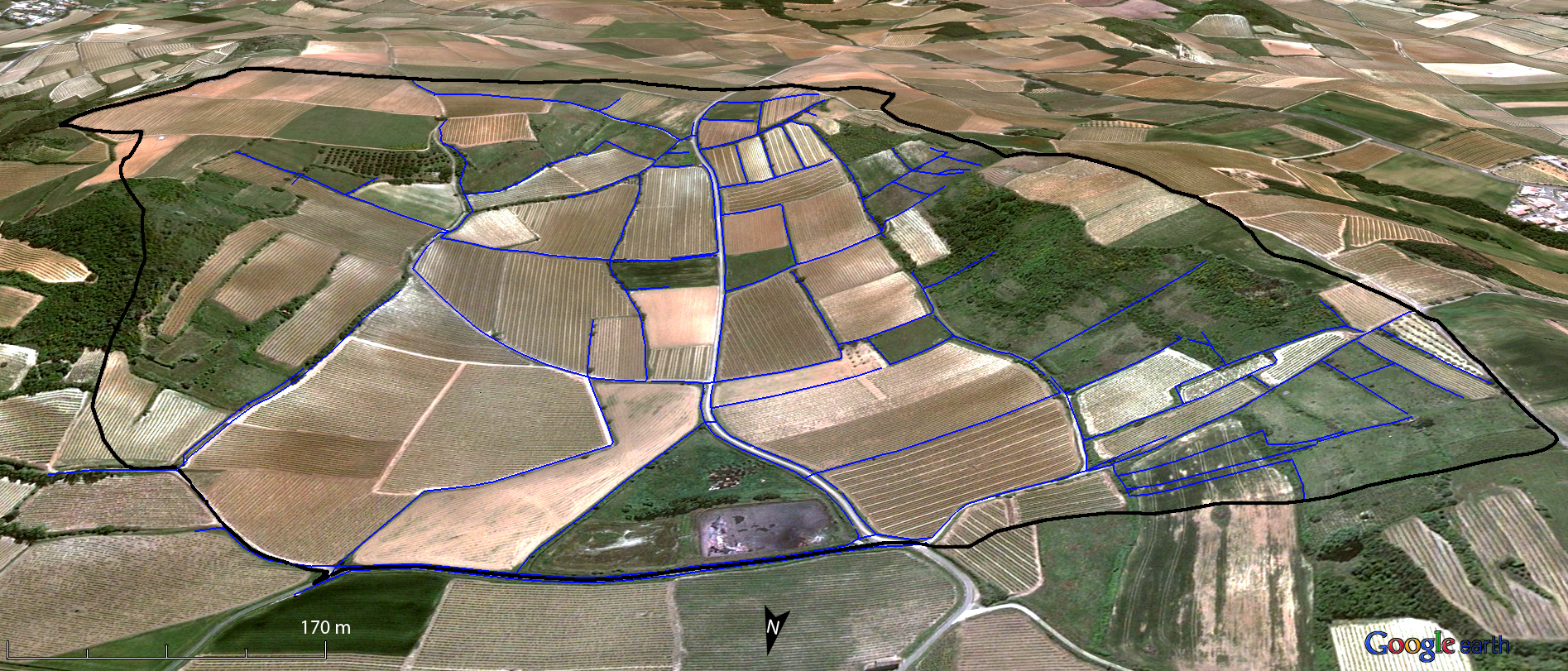
Small agricultural catchment (91 ha) in a vineyard Mediterranean environment with 20 years of data: impact of global change (climate and anthropogenic activities as agricultural practices) on water and erosion balance, fluxes and quality. Soils: calcisoils and cambisoils. Bedrock: Marine and coastal miocene deposits. Continuous automatic measurements at nested scales from plot to catchment outlet (surface runoff, shallow groundwaters, surface-atmosphere fluxes) and continuous monitoring of anthropogenic activities . More information available on http://www.obs-omere.org. Roujan experimental catchment belongs to the French SOERE-RBV Network.
-
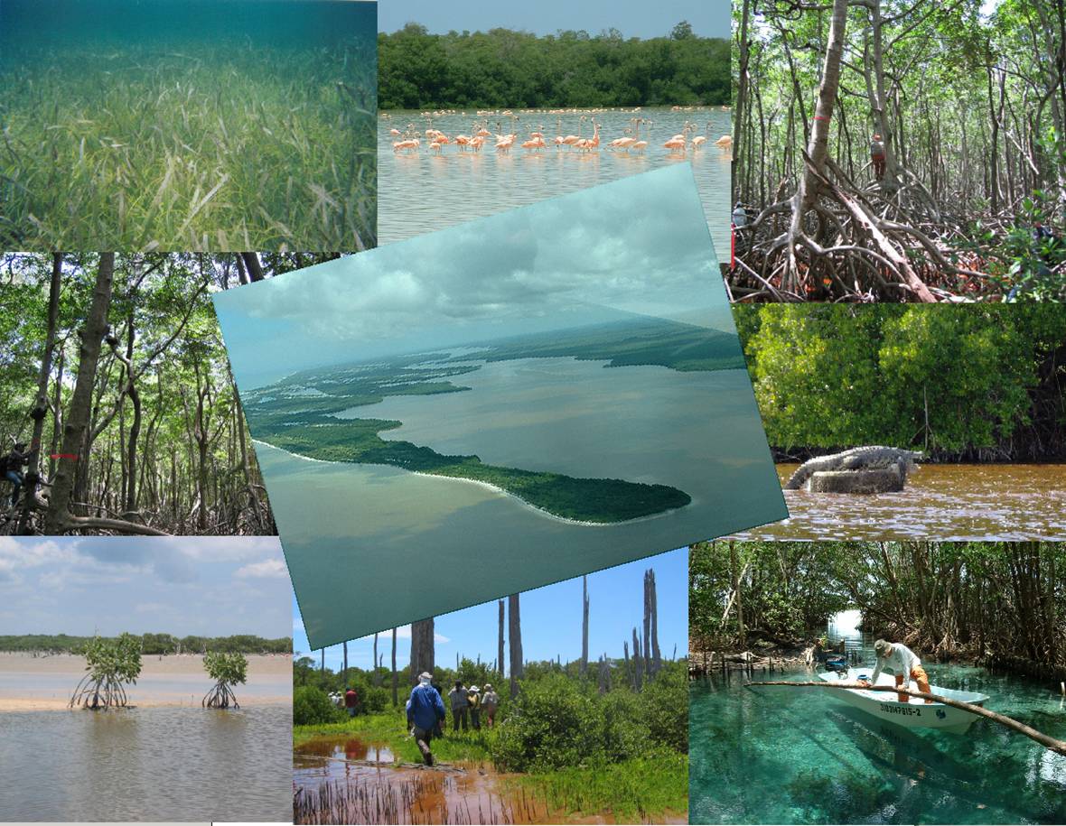
El área de estudios del grupo Ecopey se encuentran lagunas y dunas costeras, manglares, selvas bajas inundables y petenes, que forman un interesante mosaico de hábitats bien conservados; se encuentran también sabanas, áreas de uso agropecuario y centros de población. En la región se encuentran tres áreas protegidas: la Reserva Estatal El Palmar y la Reserva de la Biosfera Ría Celestún en el estado de Yucatán y la Reserva de la Biosfera de los Petenes en el norte del estado de Campeche. La diversidad de ambientes permite diseñar experimentos de largo plazo sobre los efectos de eventos naturales e impactos antrópicos sobre la estructura y funcionamiento de ecosistemas costeros.
-
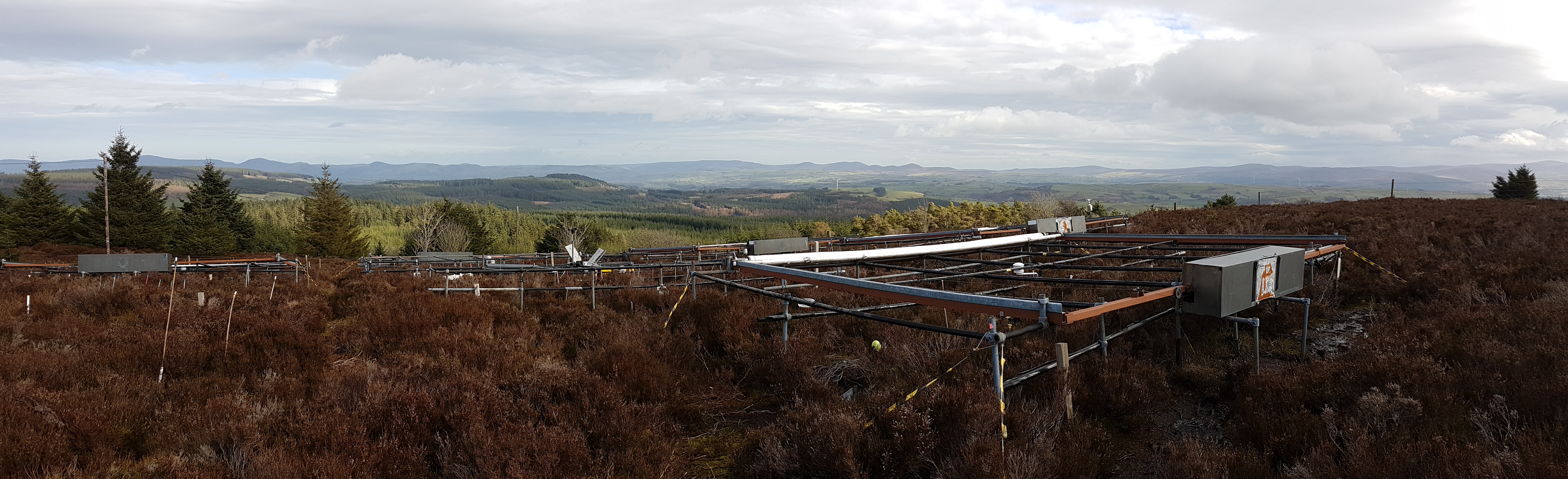
The site is located in Clocaenog Forest in North East Wales (53o 03’ 19’’N -03o 27’ 55’’ W). It is a typical upland west-atlantic moorland, dominated by the evergreen shrub Calluna vulgaris (heather). Heather makes up >60% of the plant biomass at the site, but Vaccinium myrtillus and Empetrum nigrum are also present.
-
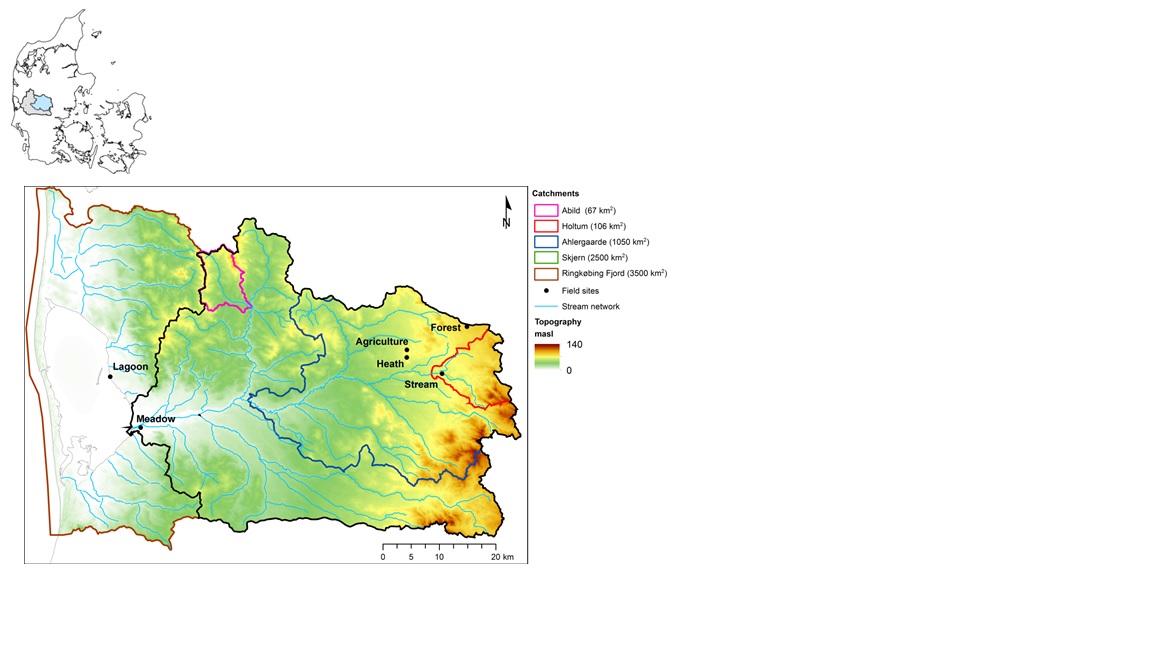
The HOBE experimental catchment is located in the western part of Denmark. The topography of the catchment is relatively flat. The surface elevations in the eastern part of the catchment are about 125 m above sea level at the Jutland ridge and gently decreasing to sea level elevations towards the coast. Alluvial outwash deposits in the form of sand and gravel dominate the central part of the catchment. Towards east, glacial deposits of moraine till are present with a higher content of clay. Also the remnants from the Saale glaciation have higher clay content and the dominant sediment type at these locations is clayey sand. Overall the top sediments are highly permeable with little water retention capability and the stream flow is therefore dominated by groundwater inflow. Based on a classification of the topsoil four soil classes can be identified in the catchment. The by far most dominating soil type is fine/coarse sandy soil. The Quaternary deposits have a thickness less than 50 m in the eastern and central part of the area increasing up to 250 m towards west. The Quaternary deposits are underlain by Miocene sediments in the form of alternating layers of marine, lacustrine and fluvial deposits forming layers of clay, silt, sand and gravel. Further below thick layers of Paleogene clay are found with little permeability and thus acting as a lower impermeable boundary for the aquifer systems. The sand and gravel layers from the Quaternary and Miocene periods form interconnected aquifer systems. The land surface of the catchment is predominantly agriculture and due to the sandy soil characteristics extensive irrigation of the agricultural crops takes place. Based on satellite data the land-use distribution is estimated as follows: grain and corn (55%), grass (30%), forest (7%), heath (5%), urban (2%) and other (1%). The climate of the observatory is of maritime origin and influenced by weather systems coming from the Atlantic Ocean. The weather conditions are variable with frequent precipitation. The prevailing winds from west lead to relatively mild winters and cool summers. The mean annual precipitation is about 1050 mm/year. It varies over the season with highest amounts in the months of October-December and lowest in the months of April-May. The mean annual temperature is 8.20C. The highest mean monthly temperature is in August (16.50C) and the lowest in January (1.40C). Precipitation in the form of snow is highly variable from year to year; in some years, no snowfall occurs and in others, it may stay on the ground for months.
-
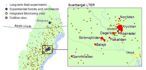
The Svartberget Field-research Infrastructure hosts several unique long-term field research programs, starting in the early 1920’s when the Experimental Forests were established here. Present research includes studies of the effect of different forest practices, climate change, long-range transport of air pollutants on water quality, full carbon budget of boreal mires and forests and long-term soil-tree interactions with nutrient optimization. These research activities has for decades provided excellent opportunities for international researchers to study natural and human induced impacts on the structure and function of the boreal landscape. To date, more than 1000 scientific publications and 100 PhD-theses have contributions from research performed at Svartberget. A main objective of the ongoing research is to assess the role of external drivers, such as land-use, climate change and nutrient supply on soils and waters in the boreal terrestrial landscape. The main strategy has been to increase the interaction between process-based research, environmental monitoring and improved modelling. The plan for the future is to continue to: 1. Generate long-term monitoring data of high quality 2. Provide a long-term climatic context for the experimental and hypothesis-driven research 3. Contribute towards scientifically based guidelines and models for policy and decisions makers.