
sea level
Type of resources
Available actions
Topics
Keywords
Contact for the resource
Provided by
Years
Formats
Representation types
-
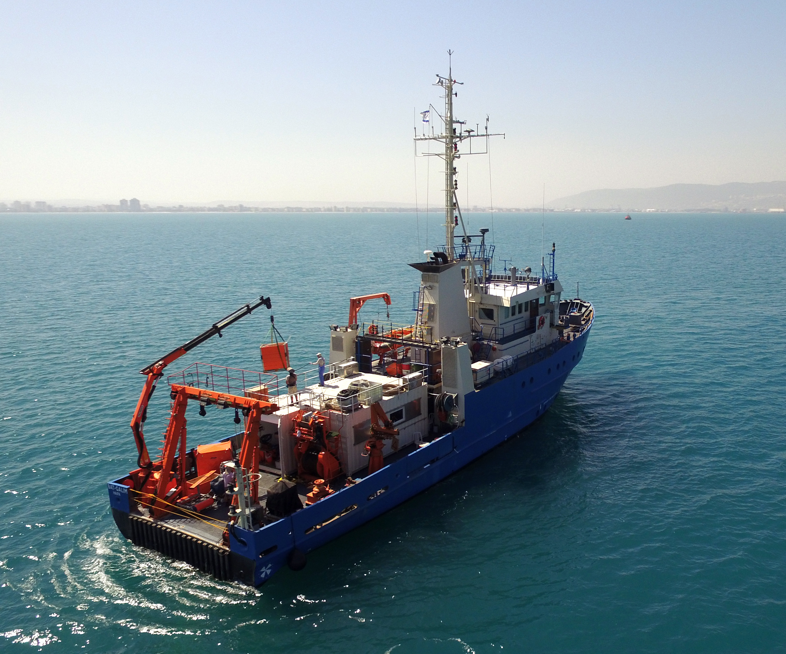
The National Institute of Oceanography (IOLR) is located in Haifa (Tel Shikmona) on the shores of the Mediterranean Sea. The institute engages in research and development in marine sciences and provides information and professional advice to the government and the public sector in the context of the sustainable utilization and conservation of Israel’s marine and coastal resources. The oceanographic studies at the institute are engaged in research, monitoring, and collecting environmental data in the Mediterranean Sea, and in studying natural and unnatural processes. The research topics at the institute include subjects such as; flow and mixing processes; oceanographic models; material cycles; sediment transportation and geological processes; the structure of the seabed; physiology, immunology, and ecology of marine organisms and the populations’ dynamics; the biological diversity in offshore waters and deep seas; effects of human activity on the open sea and coastal environment. IOLR operates advanced instruments and national infrastructures for marine research and monitoring, such as; the national research vessel “Bat Galim”, small ships, and autonomous underwater gliders. A variety of mapping, sampling, data collection, and independent systems are placed at sea for continuous monitoring of environmental variables. In addition, ecological monitoring (community structure, biological diversity, etc.) is carried out in several habitats at a monthly to yearly frequency as follows: • Seasonal ecological monitoring of the Benthos community of the vegetation tables in four sites from north to south since 2009 (also includes a monthly sampling of the water - chlorophyll, nutrients, alkalinity, DIC, temp., pH). • Seasonal ecological monitoring of the benthos community (fish, and biotic cover) of the shallow reefs in the Shekmona/Rash Carmel area. • Annual ecological monitoring of the mesophotic reefs (90-100 meters) at the top of Carmel and the shallow reef. • Monthly zooplankton monitoring at the Hadera station • Monitoring the fish society and the invertebrate community in sandy bottoms • Deep sea monitoring IOLR operates the National Marine Information Center - ISRAMAR, which collects, records, and distributes data and information regarding Israel’s marine environment.
-
The Gulf of Venice is a gulf that borders modern-day Italy, Slovenia and Croatia, and is at the north of the Adriatic Sea between the delta of the Po river in northern Italy and the Istria peninsula in Croatia. The site is under a heavy antropic impact (nutrient loads, coastal towns, fishery, tourism maritime routes). In the past eutrophic events struck the ecosystem and, more recently, frequent mucus macro-aggregates extended in the whole basin. Study of long term historical time series of the biotic community in the Gulf of Venice in relation with the biogeochemical cycles and physical properties of sea-water have been conducted since the '70s.
-
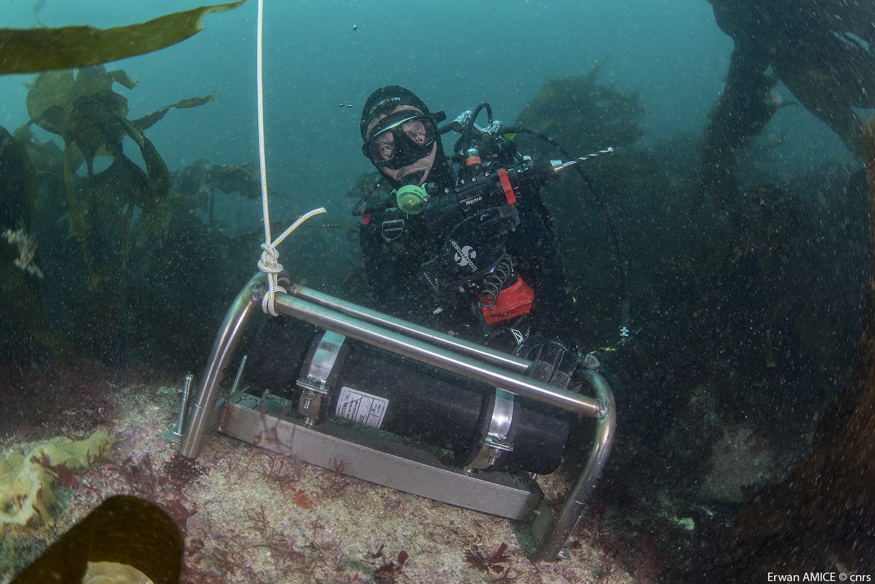
The Morris Kahn Marine Research Station was established in order to provide baseline data and understanding of the marine ecological system in the Mediterranean Sea of Israeli coastal waters. The Charney School of Marine Sciences at the University of Haifa recently established a long-term ecological research station focusing on the eastern Mediterranean basin located in Kibbutz Sdot Yam, 44 km south of Haifa, near Caesarea. The station is called the Morris Kahn Marine Research Station and focuses on five main research topics; · Top Predators · Sediments · Water composition (Biogeochemistry) · Rocky Bottoms · Fish Disease (pathogens) The Israeli coastal area and the eastern Mediterranean Sea is experiencing accelerated development and infrastructure projects along the coastline, and a massive exploitation of marine resources never experienced in our region and nation. Coupled with the effects of global climate change and local polluting factors, life in the shallow and deep sea are changing rapidly. The Morris Kahn Marine Research Station is responsible for collecting biological and ecological data for long term research that will provide insight for understanding processes and predicting the effects of climate change and development on the environment. Such data will allow for science-based decisions that will greatly influence the interaction nature of future generations with the sea and the marine environment. This issue is particularly important given the fact that an majority of the water consumed in Israel is produced through desalinization of sea water, the main energy supply is based off of marine gas fields, aquaculture is gaining momentum as development allows for the cultivation of fish for human consumption in marine farms, and national projects referring to the sea as “developable land” that can be dried and made into artificial islands for various infrastructures. In order to accompany such a momentum in development without the collapse of the ecosystem and destruction of the sea as a natural resource, there is a need to provide reliable and in depth understanding as to how the system works. To accomplish these goals, the station employs top of the line researchers specializing in the Mediterranean as well as collaborate with other academic and research centres in Israel, while providing the best equipment for research and analysis of data collected from the sea including; · Rosetta collecting water samples from different depths · CTD device for measuring physical data of water · Advanced underwater photography and documentation equipment · Closed and controlled water system for aquaculture research · Device for detecting and quantifying nutrients in the water (Seal AA3). · Robot for measuring isotopes in samples (GC-IRMS-MS) · Confocal microscopy · Membrane mass spectrometer · Servers for database backup and maintenance · AAUS diving club performing scientific technical dives · Closed dive systems to allow deep, long, and safe dives · Boat used as a platform for diving and marine monitoring on the continental shelf · Laboratories for dissection · Work rooms for student and guest researchers · Meeting/conference rooms · AUV and ROV (Marine technologies lab) · THEMO buoy for deep sea research · Drones and other aerial devices · Website for sharing information as well as providing accessible information for the general public
-

The Seine estuary is a megatidal estuary located in northern France. It is the third largest estuarine ecosystem in the country after the Gironde and Loire along the French Atlantic coast; its waters flow into the English Channel. The geographical zone of influence of the Seine estuary runs from just upstream of the Poses dam, at the limit of the tidal penetration into the estuary — 160 km upstream of Le Havre —to the eastern part of the Bay of Seine. It can be divided into three sections: the fresh water upstream section (125 km), the mixing zone characterized by varying salinity levels (35 km), and the marine downstream section under the influence of the Seine River. The megatidal regime generates a turbidity maximum in the mixing zone (middle estuary) between the marine and fluvial sections of the estuary. The Seine estuary is a typical estuarine ecosystem: highly stressed by natural fluctuations and anthropogenic pressures, and hosting a rich ecological system. The Seine valley and its estuary are of major economic importance for France, with the presence of two maritime ports. It’s watershed (79,000 km2) is the home to 17 million people, and accounts for 50 % of the river traffic in France, 40 % of the country's economic activity, and 30 % of its agricultural activities. In addition to the Greater Paris area (> 11 million inhabitants), which contributes heavily to the Seine estuary's upstream inputs, two other major river settlements — Rouen (500,000 inhabitants) and Le Havre (300,000 inhabitants) — are maritime ports of international importance. Due to economic development, the Seine estuary has been subjected to major hydrodynamic, ecological, biogeomorphological and biogeochemical changes. The importance of studying the effects of anthropogenic impacts on estuarine ecosystems has increased in the last decade, especially under the Water Framework Directive, which aims to achieve “good environmental status” of all European water bodies.
-
The LTSER Zone Atelier Brest Iroise, created in 2012, is located in Brittany, NW-France. It aims at understanding the functioning and the long-term dynamics of the social-ecological system located along the land-ocean continuum. It combines work along different gradients and at different interfaces: between Earth compartments (sediment-water-atmosphere, land-ocean), tools (observation, experimentation, modeling), disciplines (especially between natural and human and social sciences) and between science and society. About half of the area (3000 km2) is terrestrial, including the watersheds of the Elorn (280 km2, 285,000 inhabitants mostly in the Brest area) and the Aulne (1820 km2, 70,000 inhabitants) rivers which are characterized by intensive agricultural practices. The Bay of Brest is a semi-enclosed coastal Bay, with an area of 180 km2. Part of this Bay and of the Aulne estuary is a Natura 2000 site, operated by the “Parc Naturel Regional d’Armorique” (PNRA). The marine part (3550 km2) of this land-ocean continuum is the Iroise Sea, comprising beaches, the continental shelf, the Sein Island and the Molène-Ouessant archipelago. This area corresponds to the limits of the first marine natural protected area created in France in 2007 (the “Parc Naturel Marin d’Iroise”, PNMI). This area presents exceptional natural and human heritage, including a rich marine biodiversity, human traditions and emblematic activities (e.g. great Scallop fishing).