
sea surface temperature
Type of resources
Available actions
Topics
Keywords
Contact for the resource
Provided by
Years
Formats
Representation types
-
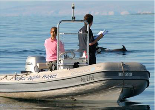
Large marine site located in the Kvarnerić area, around the sheltered coast and waters of the eastern part of the Lošinj and Cres archipelago. It is one of the most important feeding and breeding areas for bottlenose dolphins (Tursiops truncatus) in the Eastern Adriatic. Lithostratigraphic units represented on the coast are dolomites and post sedimentary diagenetic breccia (upper albian, lower cenomanian - K16, K12), rudist limestones (cenomanianmaastricht - K21-6). Soils on the coast are rockyground, anthropogenic soil on karst. The area was created after the transgression of the sea after the last glaciation; marine shelf; highly indented coastline. In July 2006 of preventive protection of a part of the Kvarnerić region for 3 years as a Special Marine Reserve (Cres-Lošinj Special Marine Reserve – CLSMR has been declared.
-
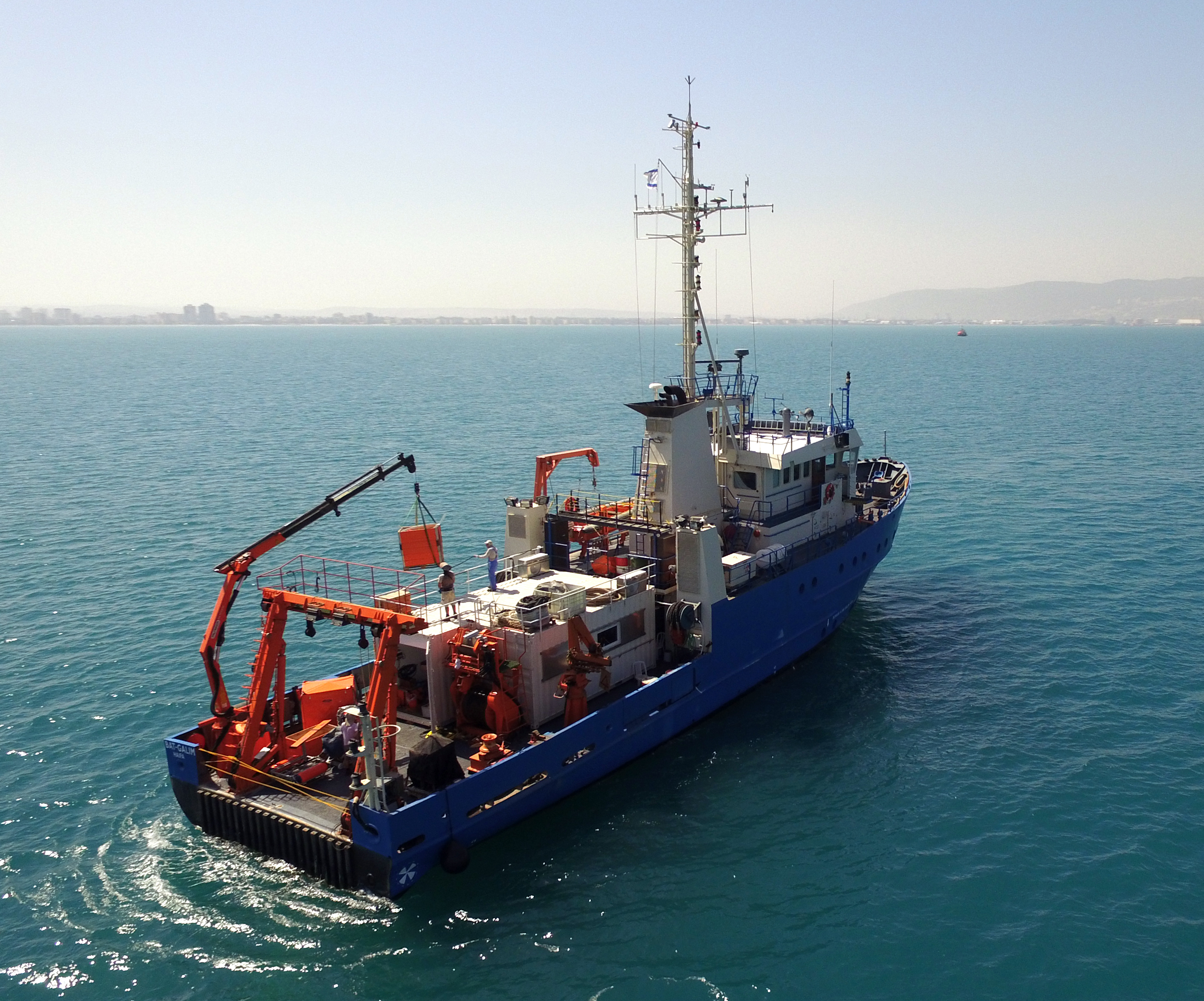
The National Institute of Oceanography (IOLR) is located in Haifa (Tel Shikmona) on the shores of the Mediterranean Sea. The institute engages in research and development in marine sciences and provides information and professional advice to the government and the public sector in the context of the sustainable utilization and conservation of Israel’s marine and coastal resources. The oceanographic studies at the institute are engaged in research, monitoring, and collecting environmental data in the Mediterranean Sea, and in studying natural and unnatural processes. The research topics at the institute include subjects such as; flow and mixing processes; oceanographic models; material cycles; sediment transportation and geological processes; the structure of the seabed; physiology, immunology, and ecology of marine organisms and the populations’ dynamics; the biological diversity in offshore waters and deep seas; effects of human activity on the open sea and coastal environment. IOLR operates advanced instruments and national infrastructures for marine research and monitoring, such as; the national research vessel “Bat Galim”, small ships, and autonomous underwater gliders. A variety of mapping, sampling, data collection, and independent systems are placed at sea for continuous monitoring of environmental variables. In addition, ecological monitoring (community structure, biological diversity, etc.) is carried out in several habitats at a monthly to yearly frequency as follows: • Seasonal ecological monitoring of the Benthos community of the vegetation tables in four sites from north to south since 2009 (also includes a monthly sampling of the water - chlorophyll, nutrients, alkalinity, DIC, temp., pH). • Seasonal ecological monitoring of the benthos community (fish, and biotic cover) of the shallow reefs in the Shekmona/Rash Carmel area. • Annual ecological monitoring of the mesophotic reefs (90-100 meters) at the top of Carmel and the shallow reef. • Monthly zooplankton monitoring at the Hadera station • Monitoring the fish society and the invertebrate community in sandy bottoms • Deep sea monitoring IOLR operates the National Marine Information Center - ISRAMAR, which collects, records, and distributes data and information regarding Israel’s marine environment.
-
The separation line of the semi-enclosed northern basin from the rest of the Adriatic Sea is conventionally defined at the 100 m isobath, at about 43°20’N, from where the bottom depth moderately decreases up to the northern coast reaching the smallest average depth in the northernmost protrusion of the basin, the Gulf of Trieste (surface area 600 km2, volume 9.5 km3, maximal depth approx. 25 m). The oceanographic properties of Gulf of Trieste are affected by water mass exchange with the northern Adriatic at the open western boundary, by local meteorological conditions that induce a pronounced seasonal cycle of seawater temperature (6 - 28 oC) and by the largest freshwater input, the Soča (Isonzo) River. The latter enters the Gulf on the shallower northern coastline with an average flow of 123 m3 s-1 and represents the major source of land-borne nutrients in this coastal zone, in particular of nitrate, whereas inputs along the south-eastern coast are comparatively small (contributing less than 10% to the freshwater balance in the Gulf). The circulation pattern is variable, however the prevailing ENE wind is the most efficient for the water exchange, especially during winter. These physical features, in addition to freshwater inputs, are ultimately reflected in the distribution of nutrients and in the seasonal and inter-annual variability of plankton communities, primary production but also in events of hypoxia/anoxia and mucous macroaggregates, which have characterised the whole northern Adriatic basin in the recent past. The waters of the Gulf of Trieste have been monitored for several physical-chemical and biological variables since 70s’ but the longest and most continuous data set of biological variables is represented by the phytoplankton time series, which started in 1990 when the national monitoring programme has become operational (set by Slovenian Environmental Agency). From 2007 onwards, the monitoring programme complies with the regulations of the EU Water Framework Directive (2000/60/EC).
-
The Transetto Senigallia-Susak is a transect of sampling stations located in the Northern Adriatic Sea. The IRBIM-CNR in Ancona and the Politechnical University of Marche collects from the end of years 80s physical, chemical and biological data. This is an excellent observing site to analyze the characteristics of water masses entering and leaving the North Adriatic Sea and their possible modification. In the site is also located the TeleSenigallia pylon.
-
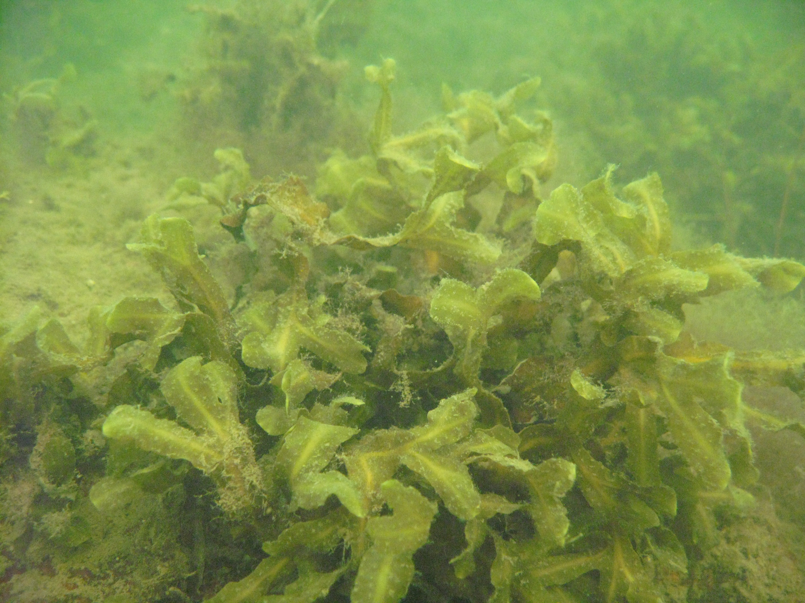
Western part of the Gulf of Riga (the Baltic Sea) littoral and sublitoral zone. The marine site is located on the west coast of the Gulf, in the Engure Nature protected area. The monitoring activities are based on three transects which represent an open area of very similar substrate type. These transects are located on the tip of Mersrags, 2.5 km northwards from the port of Mersrags. Long-term studies of the Gulf of Riga coastal zone communities and macrophytes as the key component of littoral zone under natural and anthropogenic impact and possible threats to the littoral zone biological resources. The SCUBA diving is used in marine site assessment.
-
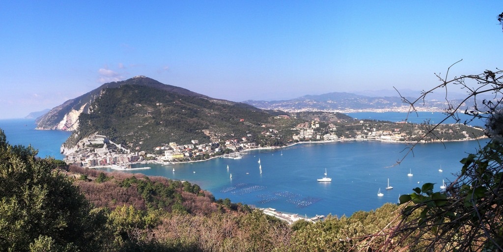
The study area is located between the mouth of the river Magra and the promontory of Monterosso. The Eastern Ligurian Sea is particularly interesting from a scientific point of view because it includes marine protected areas recognized by UNESCO (e.g. Porto Venere, Cinque Terre), located close to activities with potentially high environmental impacts. Furthermore, the site is very interesting for its biodiversity, as there is an unusually high number of species of both flora and fauna (including deep sea species), and it is part of the Whale Sanctuary. A long-term series of data is available and derives from high-frequency measurements and samplings to assess environmental and biological parameters. In particular the data concern the main trophic and physical descriptors (ammonia/ammonium, Fluorescence, Nitrates, Nitrites, Inorganic Phosphate, Silicate, Nitrogen and Total Phosphorus, Oxygen, pH, conductivity, Water Temperature, Turbidity, current speed and direction). Since 2009 seasonal measurement campaigns of physical-chemical parameters are being performed at fixed coordinates in the Gulf of La Spezia. Continuous time series (mainly temperature and conductivity) are also available at fixed locations and a weather station is maintained. Since 1991, every three or six months, data on phenology and structural features of Posidonia oceanica meadows have been collected at Monterosso and campaigns are carried out for the detection of changes in coralligenous communities and long-lived benthic species in the area. Other studies are focused on analyzing the dynamics of colonization and growth of benthic constructors in the Gulf of La Spezia (1997-2005), in order to evaluate the effects of climate change and at analyzing the resilience of communities affected by extreme events. From 2021, S. Teresa Bay hosts the first Italian Smart Bay (https://smartbaysteresa.com), cooperation platform among research institutes (ENEA, CNR and INGV), municipalities, national and international SMEs. Among Smart Bay objectives, the monitoring of the ocean and its ecosystem are prioritized and it serves also as natural laboratory for testing high-tech instruments used for marine environment monitoring. The activities conducted by ENEA on marine ecosystems are mainly focused on the effects of indirect (e.g. climate change) and direct anthropogenic impacts (e.g. pollution, plastics) on marine life in order to evaluate its resilience to prevent and mitigate biodiversity loss and detect conservation measures. In particular, studies are focused on: - Effects of climate change and direct anthropogenic impacts on marine biodiversity in relation to species distribution, community structures and ecosystem functioning; - Vulnerability and ecological and functional adaptation of target species, used to created provisional models; - Ecosystem Services provided by bioconstructional calcifying ecosystems from natural and highly impacted sites (e.g. ports, marinas) and their potential in Nature Based Solutions applied to coastal marine environment.
-
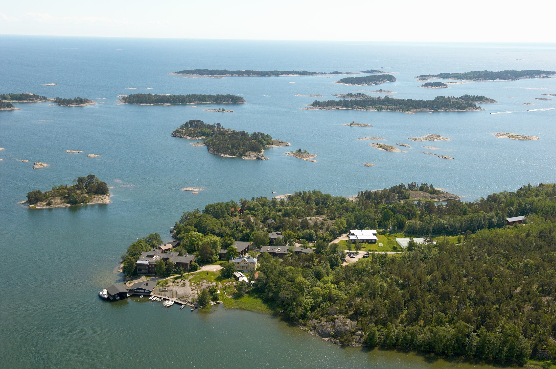
The WelFin LTER-site is located at the Hanko peninsula, at the entrance to the Gulf of Finland. The activities are largely focused to the coastal areas surrounding Tvärminne Zoological Station (University of Helsinki); a marine station established in 1902. The site is well equipped to meet the research demands, offering differently sized research vessels, field equipment, a range of climate chambers, and modern analytical instrumentation. A large part of the surrounding area is a nature reserve, to be used only for science and education. Many of the partners of this site have a long history of scientific collaboration. Although high-quality basic research continues to be at the heart of the site’s activities, many of the research questions nowadays include aspects of human induced long-term change.
-
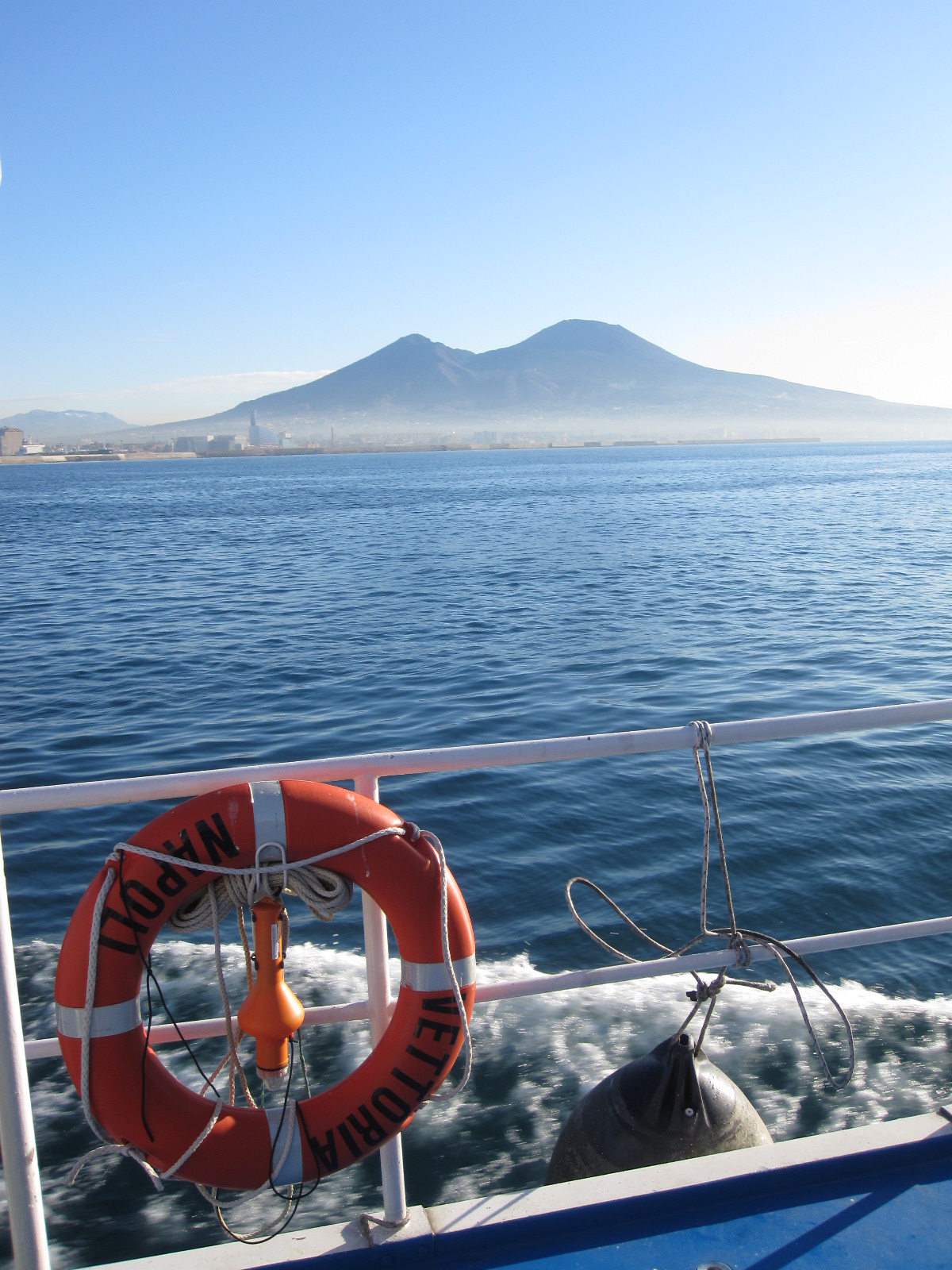
The Gulf of Naples has an extension of ca 870 kmq and an average depth of 170 m. The coastal area, which is inhabited since pre-Roman age, is densely populated and small factories are actively growing. In the Gulf, polluted areas (Sarno river mouth, harbours) coexist with pristine areas, including some Protected Marine Areas. Research on marine organisms has started before since the beginning of 1800, but first ecological studies date back to the 70ies of the last century. The long-term monitoring station (LTER-MC, 40°49’N, 14°15’E) is located 2 nm off Naples city (depth ca 75 m) at the boundary between eutrophied coastal waters and oligotrophic Tyrrhenian waters. Larger areas of the Gulf have been sampled occasionally in several cruises. The MC data set represents one of the few plankton time series available in the Mediterranean Sea, and it is certainly one of the longest.
-
A Long Term Ecological Research Program -GUADALQUIVIR_LTER 1997-2022- has been maintained since 1997 at the Guadalquivir estuary. The temporal and spatial evolution of abundances and biomasses of the aquatic community species -plankton, fish, and crustacean- is monitored monthly since 26 years ago (1997 to present). Community data is resolved at different levels of the ecosystem -individuals, populations, and communities- and completed with their corresponding water environmental data -salinity, temperature, turbidity, dissolved oxygen, nutrients, pH, among others- as well as detailed information on trophic structure and biology of the main species. Since 2021 a new Spanish Science Agency project is working together with Guadalquivir-LTER on the socio-ecology of the region, management, and cooperation among different stakeholders.
-
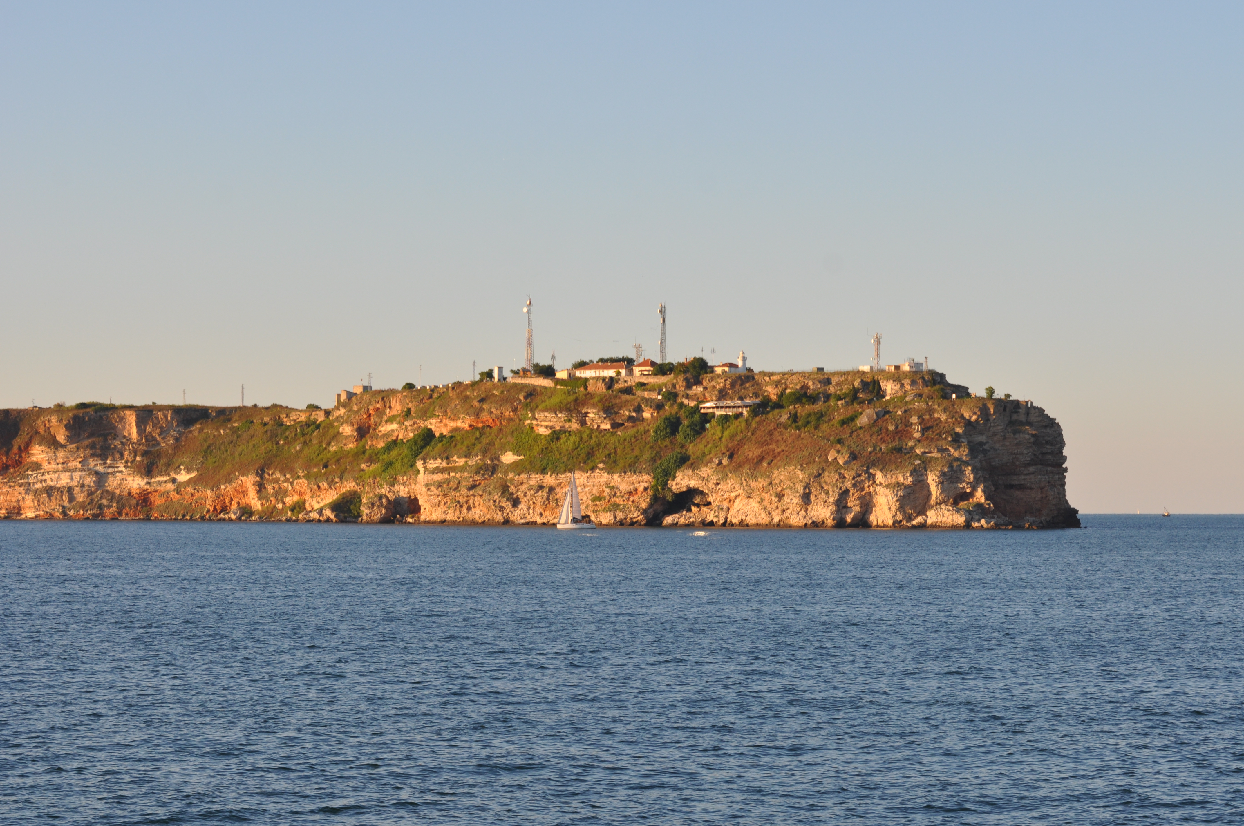
Black Sea site includes three areas: cape Kaliakra, cape Galata and Varna Bay, and Koketrays Sand bank (only for macrozoobenthos). They were chosen on the base of historical data availability and eutrophication/pollution impact. Kaliakra marine area is influenced by eutrophication due to mainly the Danube river inflow. The local anthropogenic impact in the region is insignificant. It is a nature reserve. Cape Galata and Varna Bay sites are under the indirect impact of Varna Bay current and the system Beloslav lake-Varna lake - a cascade introducing nutrients and pollutants of industrial (chemical industry), agricultural, sewage origin and nearby ports. Koketrays Sand bank is an unique benthic habitat. The coordinates of the selected areas are as follow: c. Kaliakra: 28.416667 43.366667 c. Galata: 27.933889 43.186111 Varna Bay: 28.166667 43.166667 Koketrays bank: 27.888889 42.635556