
seed yield
Type of resources
Available actions
Topics
Keywords
Contact for the resource
Provided by
Years
Formats
Representation types
-
The Experimental Farm Groß Enzersdorf is a research and teaching facility of BOKU University of Natural Resources and Life Sciences, Vienna. It was founded in 1902 as a donation to the university by the Austrian emperor; it is a typical arable farm of 140 ha arable fields in Gross-Enzersdorf, Lower Austria. The farm is run in conventional agriculture, but 26 ha are converted to organic farming since more than 20 years. Another 35 ha acreage in Tulln, Lower Austria, plus 6 ha of experimental garden in the city of Vienna, 21. district, are additionally managed by the farm and available for experiments with arable crops, vegetables and fruit species. The experiments include two long-term field experiments that are descibed individually as related plots. These experiments are focussed on long term effects (i) of crop rotation and fertlization since 1906, and (ii) of soil tillage treatments since 1996. The whole farm beyond can be used for any kind of soil, plant or atmosphere observations in experimental settings, representing a typical Pannonian agricultural environment. It is equipped with complete sets of agricultural machinery for large scale farming operation as well as for small experimental plots. On the farm there is also a weather observation station installed by the Austrian Zentralanstalt für Meteorologie und Geodynamik (ZAMG).
-
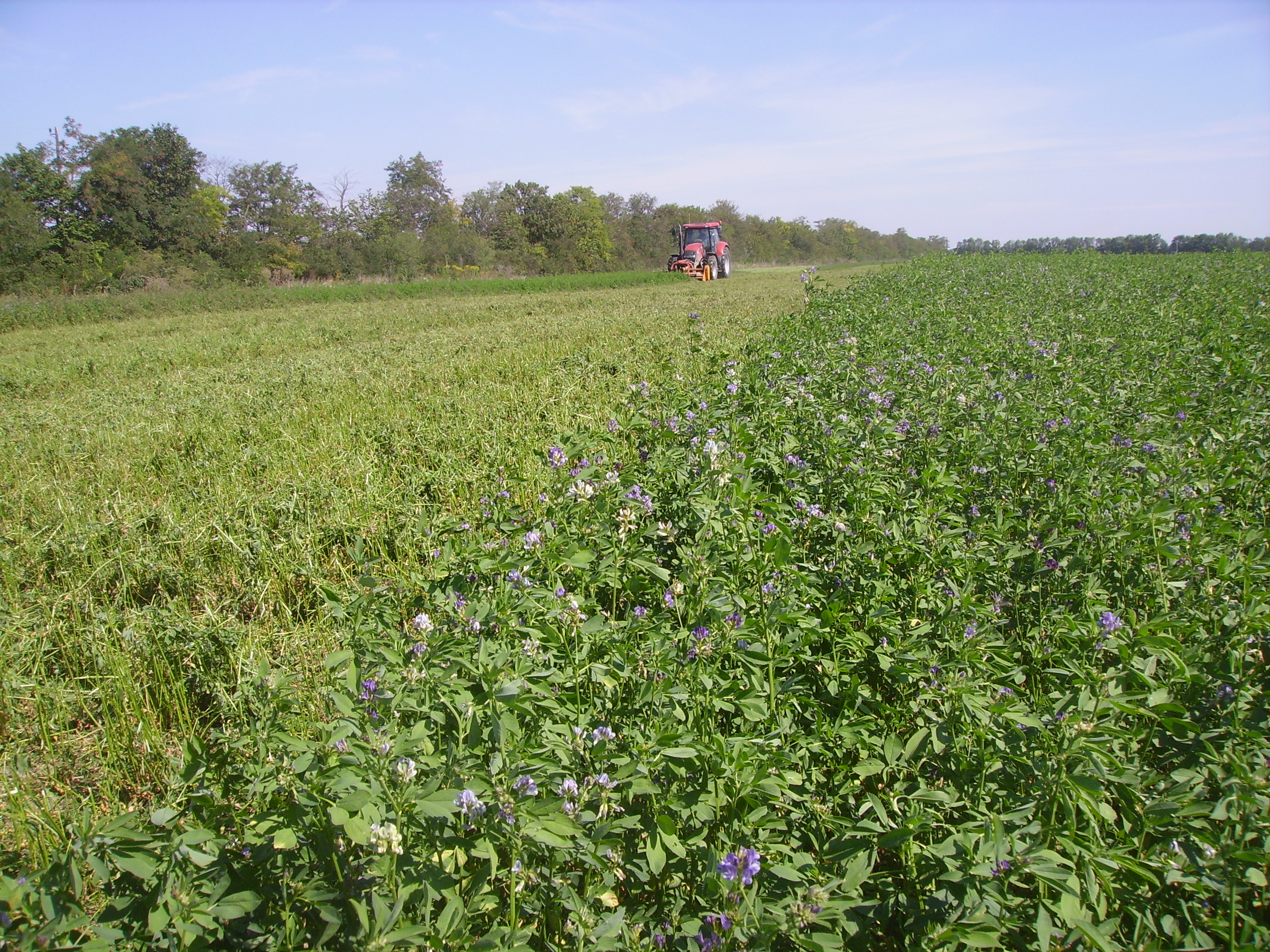
SITES Lönnstorp research station is situated in the Scanian agricultural landscape between Malmö and Lund and has a focus on the design, sustainable development and assessment of arable cropping systems, in conventional and organic farming. The research station is available for research within ecology, agronomy, environmental science, agroecology and other disciplines. SITES Lönnstorp research station have access to 60 hectares of conventional and 18 hectares of organic farm land, mainly cultivated with annual crops, representative for agricultural practise in southern Sweden. The station is also a part of SITES, Swedish Infrastructure for Ecosystem Science. SITES is a nationally co-ordinated infrastructure for terrestrial and limnological field research. In 2016, SAFE (SITES Agroecological Field Experiment) was established at the research station. SAFE make it possible to compare four different agroecosystems, a conventional reference system, an organic system, a perennial system and an agroecological intensified system.
-
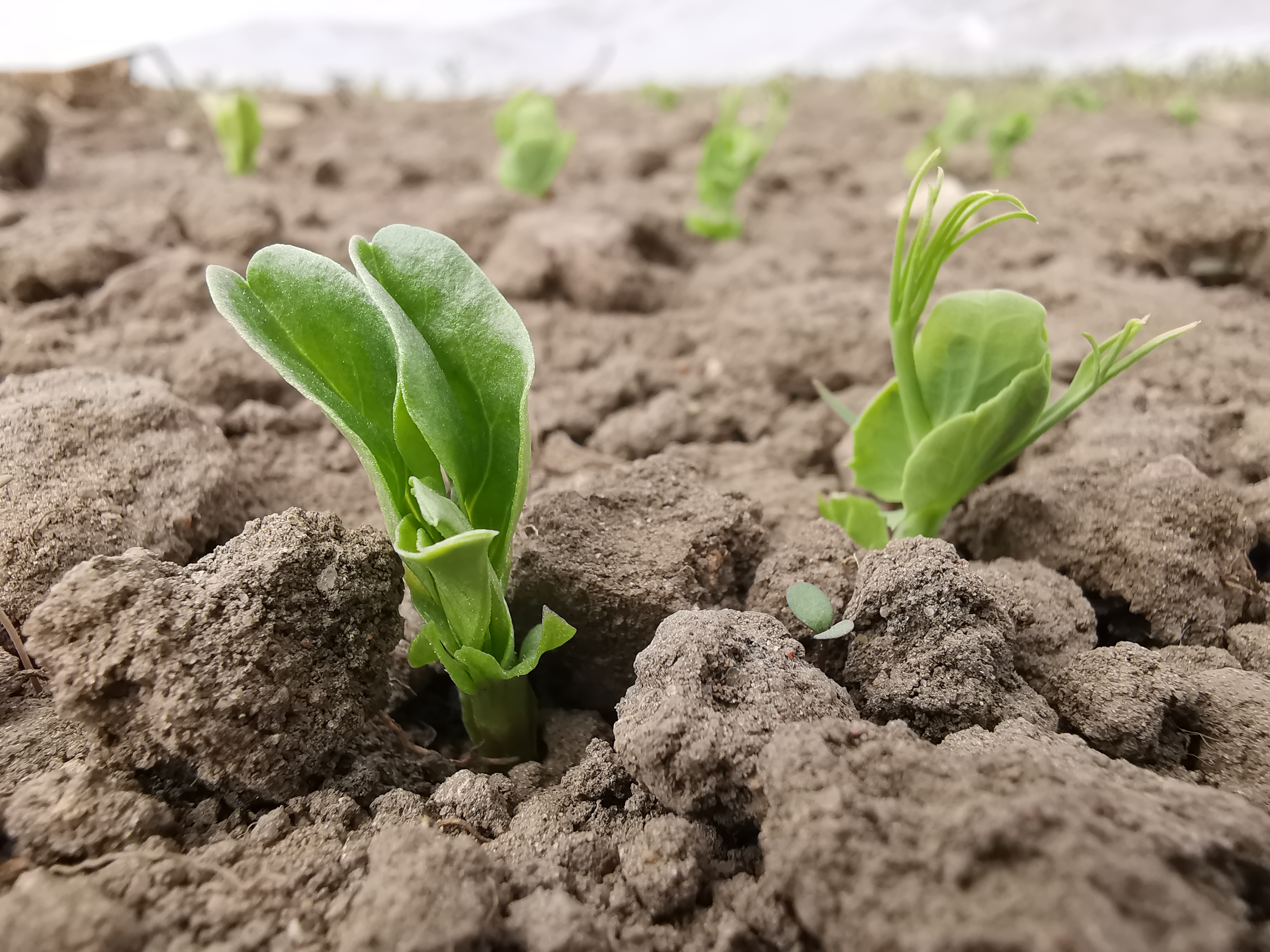
The Rutzendorf Experimental Station is an agricultural research site of the University of Natural Resources and Live Sciences Vienna (BOKU), belonging to the Landwirtschaftliche Versuchswirtschaften GmbH. It is representative for the productive soils managed as arable land in the Marchfeld area (Lower Austria). The soil is described as a silty loamy Calcaric Phaeozem (WRB), a Chernozem according to Austrian soil classification. Management on the farm is without livestock, no organic fertilizers are applied. The farm was converted to organic farming in the production year 2002/03. The 8-year crop rotation comprises luzerne (2 yrs), winter wheat*, grain maize, spring barley*, field peas*, winter wheat, winter rye. Cover crop mixtures are grown where indicated in the crop rotation with an asteric. Current research questions include to study (i) the long-term sustainability and productivity of the stockless organic arable system compared to a livestock-keeping system, (ii) the mitigation of climate change effects on the soil-plant system by reducing soil cultivation intensity, and (iii) the development of biodiversity following the conversion to organic farming and enhancement of landscape elements. Regularly meteorological data, crop yields and quality, physical, chemical and biological soil traits, weed species and diaspores, springtails, wild bees and other animal species are assessed. Studies have been conducted as research projects financed nationally and by the European Union, e.g. in two EIP projects.
-
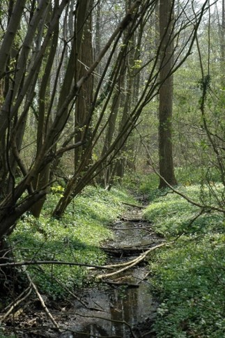
The Aelmoeseneie Forest is a 28.5 ha mixed deciduous forest in the community of Gontrode, just southeast of Ghent. The largest part of the forest is ‘ancient forest’, i.e. it is permanently forested since before 1775, while the forest is surrounded by agricultural land (mostly pastures). The soil consists of a silt loam to loam soil (Planosol), overlaying a mosaic of tertiary clayey and sandy deposits with high base saturation starting at 50 cm depth. Forest management is designed to obtain a more natural tree species composition and to conserve biodiversity. More info can be found at www.aelmoeseneiebos.ugent.be.
-
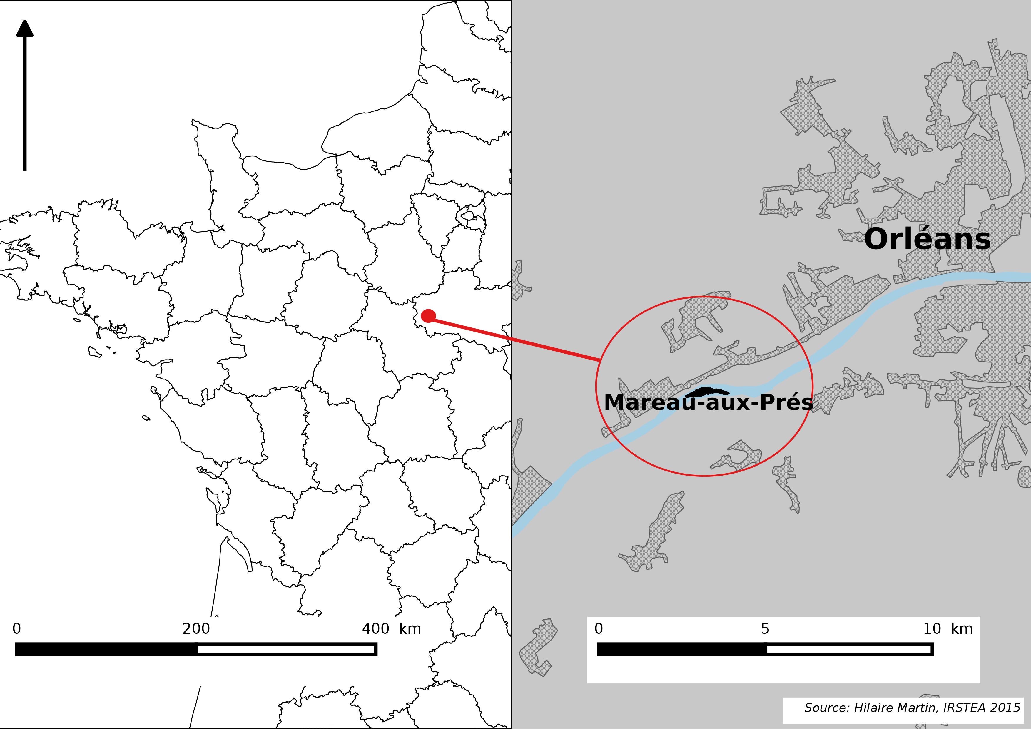
The Mareau-aux-Prés islands, along the Loire river, are characterized by a multiple channel pattern, where natural limestone riffles influence the morphology and spatial distribution of vegetated islands, secondary channels and alluvial bars. Within these islands, in september 2012, fluvial management operations (FMO) were launched. The vegetation of the central sandy-gravelly bar (3 ha area) was uprooted and the bar level lowered in order to maintain the flow capacity of the river. A new sandy-gravelly bar appeared in spring 2013, ideal field support for studying long-term ecological issues. A multidisciplinary research program (‘BioMareau’ project) is currently being conducted from 2012 to 2019, focusing on biodiversity recolonization and on interactions and feedbacks between biotic and abiotic compartments.
-
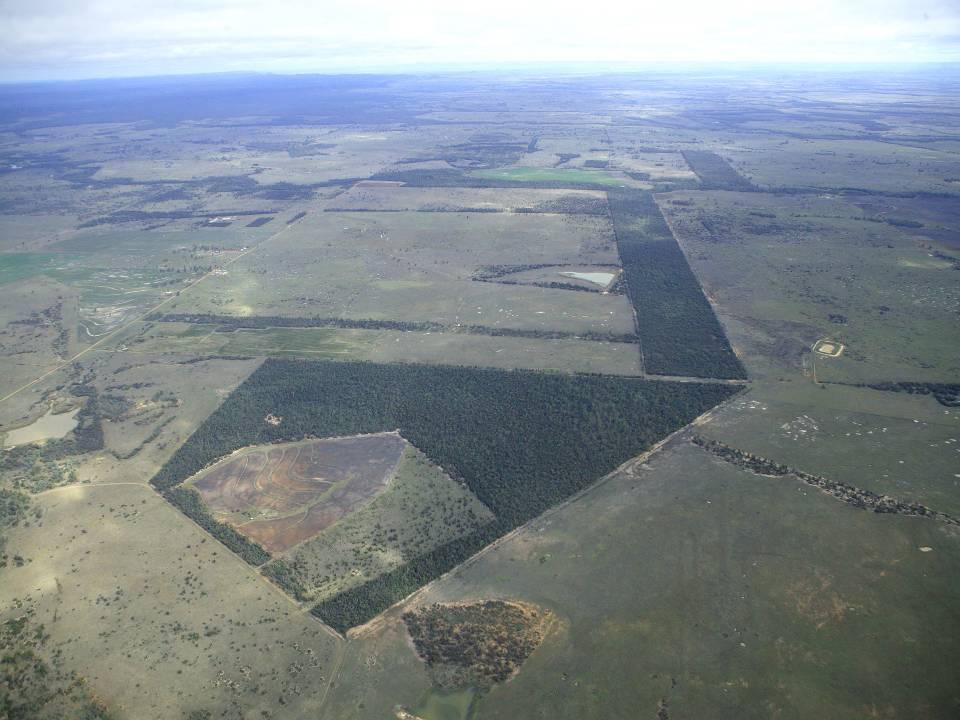
The aim of the Brigalow Catchment Study is to determine the effects of land clearing and land use change on hydrology, water quality, soil fertility and crop and animal productivity in the Brigalow Belt bioregion of central Queensland, Australia
-
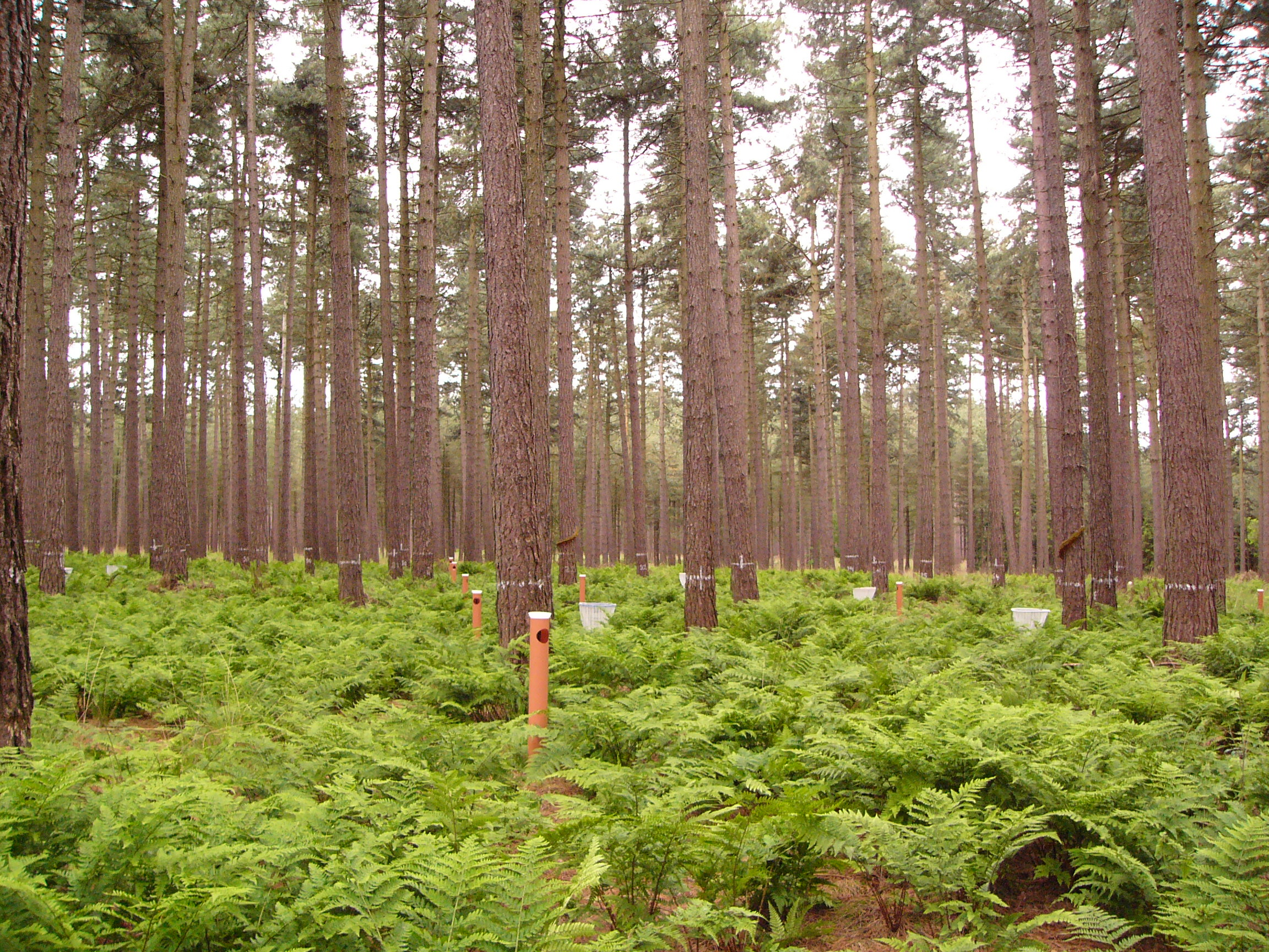
This LTER-site corresponds with a 0.25 ha intensive forest monitoring plot (ICP Forests Level II) including a 0.25 ha buffer zone. The site is located in a homogeneous stand of Corsican pine (Pinus nigra ssp. laricio var. Corsicana Loud.) planted in 1930 on former heathland and is part of Gewestbos Ravels, a landscape (about 1000 ha) with deciduous and coniferous forests, heathland, bogs and pastures in the northern part of the Campine ecoregion of Flanders. The terrain is gently sloping (1-2 %) and the soil is a well-drained sandy soil (Endogleyic Folic Brunic Albic Arenosol (Dystric)). Ground vegetation is dominated by ferns (Dryopteris dilatata and D. carthusiana) and Vaccinium myrtillus. After a storm in February 2007 felled several trees an understorey of Betula pubescens started to develop. Intensive monitoring was started in 1987 with the main objective to study the effects of air pollution on biogeochemical cycling and forest performance (growth, vitality). This yielded a number of long-term data series including on atmospheric deposition, air quality, soil and soil solution chemistry, tree mineral nutrition, ground vegetation and growth. Monitoring will be continued in the future as a statutory task of INBO.
-
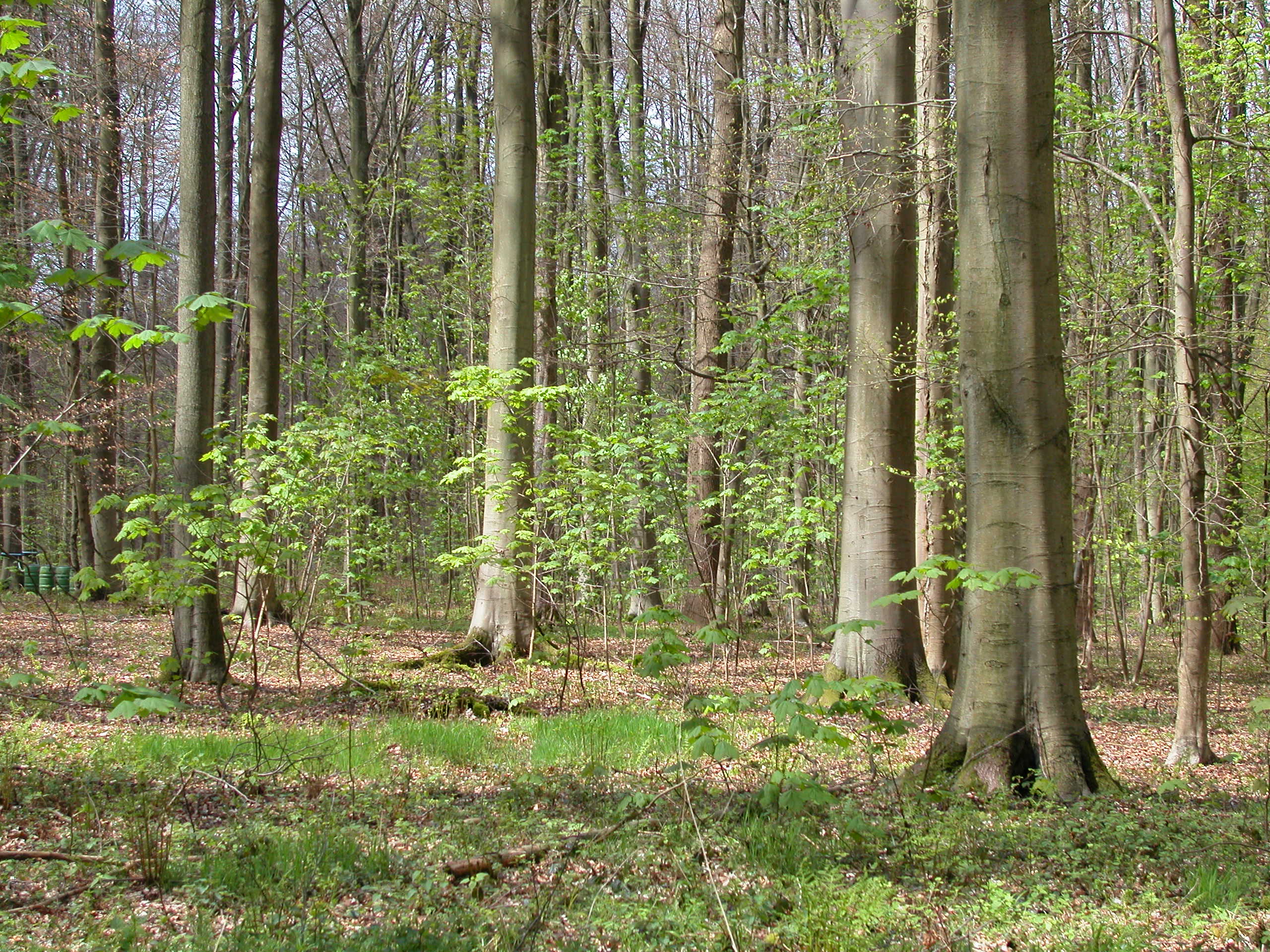
Large forest area, ancient woodland of beech forests, just south of Brussels. In this forest, numerous research activities covering silviculture, forest history, biodiversity inventories, geomorphology, recreation etc... have taken place. Therefore, the complete forest is proposed as an LTSER-platform. Within the forest, two active long-term ecological monitoring programmes are present: - one ICP Forests Level II intensive forest monitoring plot (permanent sampling since 1987) - strict forest reserve monitoring programme on an area of 100 ha (periodic sampling of 15 ha since 1986, extended to 100 ha in 2000) On July 7th 2017, the strict forest reserve 'Joseph Zwaenepoel', together with 4 other unmanaged reserves in the forest, was added to the UNESCO Natural Heritage Site ' Primeval Beech Forests of the Carpathians and Other Regions of Europe' (http://whc.unesco.org/en/list/1133). Besides these, a large number of former research projects, PhD research and a detailed management follow-up make the Sonian Forest one of the best mapped and documented forests in Belgium / Europe.
-
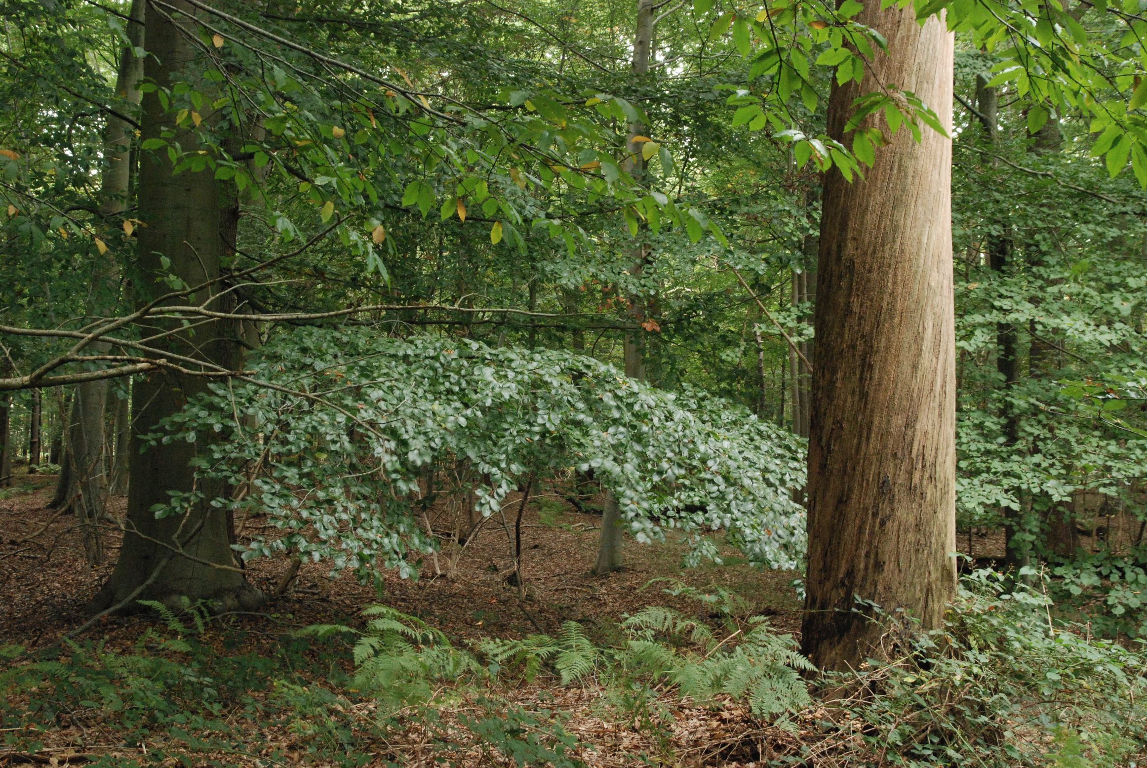
The LTER-site of Wijnendale Forest is a 90 ha scientific zone located in a larger mixed atlantic beech-oak-woodland (300 ha), in the North-West of Belgium, 20 km south of Bruges. The site is located on moderately wet to dry sandy soils. The site is an ancient woodland that used to be managed as coppice with standards. Over the last 100 years it was gradually transformed to a mixed high forest, mainly of oak and beech. The site contains - an ICP Forests Level II plot (0.25 ha), in which effects of air pollution on the forest ecosystem are monitored, according to standard protocols. - a strict forest reserve of 65 ha: here, natural dynamics of forest structure and ground vegetation are monitored, and its effects on biological diversity. - a 25 ha buffer zone, containing both forest and open grassland (extensively managed for nature conservation), where 'open field' measurements are performed. The sampling network in the strict reserve includes >100 sampling plots (0.1 ha) combined with a 1 ha core area. In these plots, full dendrometric surveys (tree position, species, DBH, height, ...) and ground vegetation relevees are performed every 10 years. Additionally, standardised sampling of saproxylic beetles, mosses and fungi were performed and high-resolution air-borne LIDAR and hyperspectral data were recorded in 2012-2014. Main aims for the future are the continuation of the observational networks to provide longer robust time-series that allow more thorough analysis and investigation.
-

The ZA PYGAR covers the whole Garonne river basin up to the upper part of the Gironde estuary (La Reole station). Within this territory, research is structured around 4 main sites: the Pyrénées mountains, covering the upstream part of the Garonne river basin (PYRénées site), the farmland of the foothills of the Pyrénées (Vallées et Coteaux de Gascogne site), the Garonne river (Axe Fluvial Garonne site) and the basin of two tributaries of the Garonne river in the Massif Central moutains (Aveyron-Viaur site).