
sexual reproduction
Type of resources
Available actions
Topics
Keywords
Contact for the resource
Provided by
Years
Formats
Representation types
-
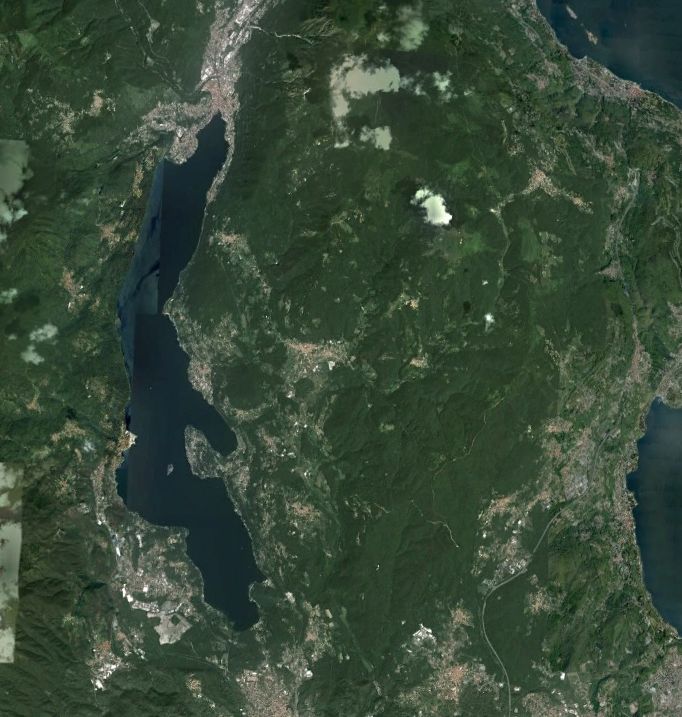
Lake Orta is a deep subalpine lake, located in Northern Italy, at a mean altitude of 290 m a.s.l. Its perimeter is 33,8 km, surface area 18,14 km2, volume 1,29 km3. Lake Orta has a maximum depth of 143 m and a mean depth of 71 m. Lake Orta is well known for being polluted by industrial discharges (copper sulphate and ammonia) since the late 1920: as a consequence, the pH of the lake water dropped down till 4 and the food web was almost completely destroyed, except for some few, strongly adapted species. The pollution stopped around mid 1980s and a liming intervention was carried out in 1989-1990, to neutralize the acidic waters of the lake. The recovery was very fast, new species started to colonise the lake just after the liming. The lake, however, is still at risk, due to the large amount of heavy metals stored in the sediments.
-
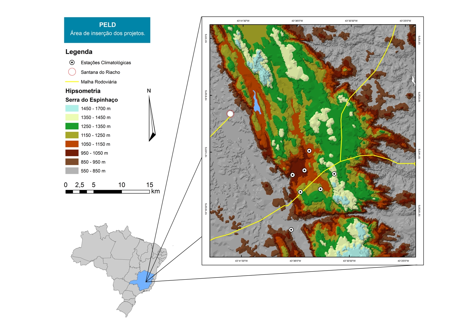
For over 20 years as a team of Long Term Sites in Serra do Cipó PELD-CRSC has been working to answer crucial questions of evolutionary ecology and provide a basis for understanding the spatio-temporal ecosystem functioning and it is future challenges with changes in climate and land use.
-

Historically, the role of the Galapagos Islands has been considered critical due to the evolutionary diversification induced by natural and historical isolation. The Galapagos National Park was established in 1959, based on its historical importance associated with Charles Darwin's voyage and its rare and endemic biodiversity, composed of unique vertebrate and plant communities (Rozzi et al. 2010). In 1978, the Galapagos Islands were declared a UNESCO World Heritage Site, a critical factor associated with this national park (Rozzi et al. 2010). The Galapagos Islands are a pristine area with local and regional climates influenced by the interaction of ocean currents and winds driven by the Inter-Tropical Convergence Zone; ITCZ (Conroy et al. 2008, Trueman and d'Ozouville 2010). The long-term programme includes forty natural aquatic ecosystems (lakes, ponds, lagoons and swamps) that will be sampled on the islands of San Cristobal, Santa Cruz, Isabela and Floreana, where possible along a lowland-highland gradient. The number of sampling points will vary according to environmental heterogeneity and the presence of a littoral region, among other factors.