
sight depth
Type of resources
Available actions
Topics
Keywords
Contact for the resource
Provided by
Years
Formats
Representation types
-
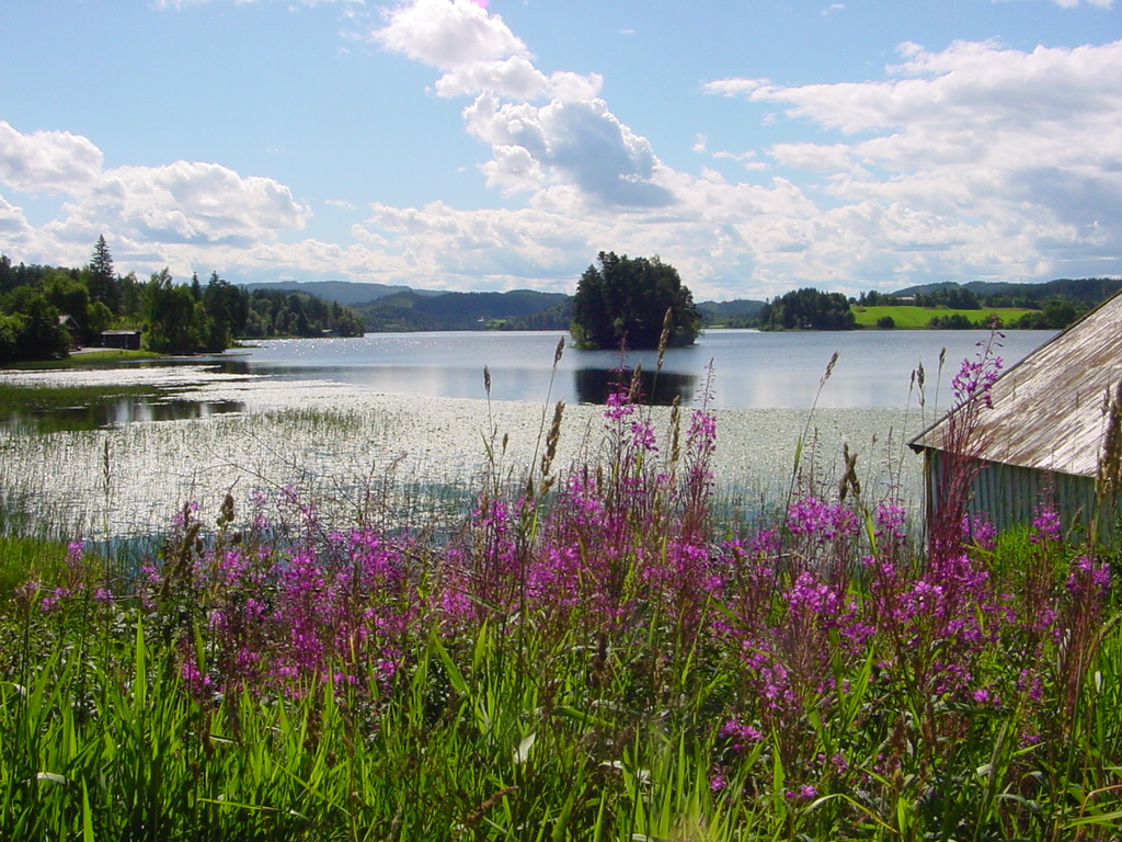
This is a long-term monitoring study of freshwater zooplankton and phytoplankton population changes after introduction of the mysid, Mysis relicta Lovén, 1862 in lake Jonsvatnet. It is an oligotrophic lake located in central Norway (63° 22’ N, 10° 37* E), 150 m above sea level. The lake has three basins divided by narrow sounds with depths of 1 – 3 m. The major basin is Store Jonsvatnet with surface area of 12,4 km2 and the two smaller ones are Lille Jonsvatnet and Kilvatnet with surface areas of 1,6 km2 and 0,8 km2 respectively. The maximum depths of the three basins are 97 m, 37 m and 34 m respectively and the average depth of the lake is 37 m. Method: Plankton are sampled at one station in each lake basin. All samples are taken during the period June-October, twice a month in June - August, once a month in September and one sampling of mysids in late October. Zooplankton is sampled with a 1 m long tube sampler (volume 5 l). A vertical column of water extending from 0 to 20 m depth is consistently sampled every 1 m. Samples from 5 m layers are mixed together and treated as one sample. Phytoplankton is sampled with a water sampler (volume 1.6 l). A vertical column of water extending from 0 to 10 m depth is consistently sampled every 1 m. Samples from 5 m layers are mixed together and treated as one sample. Mysis relicta is sampled in Lille Jonsvatnet with vertical net hauls (net opening 1 m2, mesh size 500 µm) from 1 m above bottom to to the surface.
-
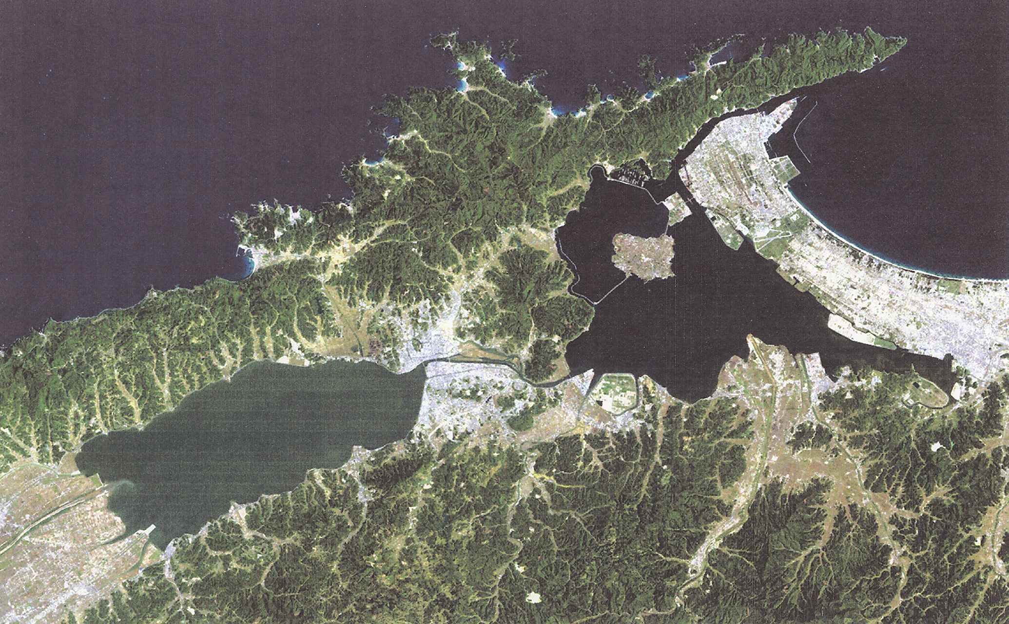
Lake Shinji and Lake nakaumi are coupled coastal lagoon lake systems in Japan, and these lakes have suffered detrimental efects by human activities, especially during the last 40 years, because of the big national projects aiming at desalination and reclamation of these lakes. In the year 2000, however, the land reclamation project in Lake Nakaumi was officially discontinued, leaving Honjou area unreclaimed. Shortly thereafter, desalination project was also terminated. This was the end of a large and expensive series of public works projects, and in 2005, these two lakes were included in the list of wetlands of international importance, and the efforts to restore the lakes are undergone.
-
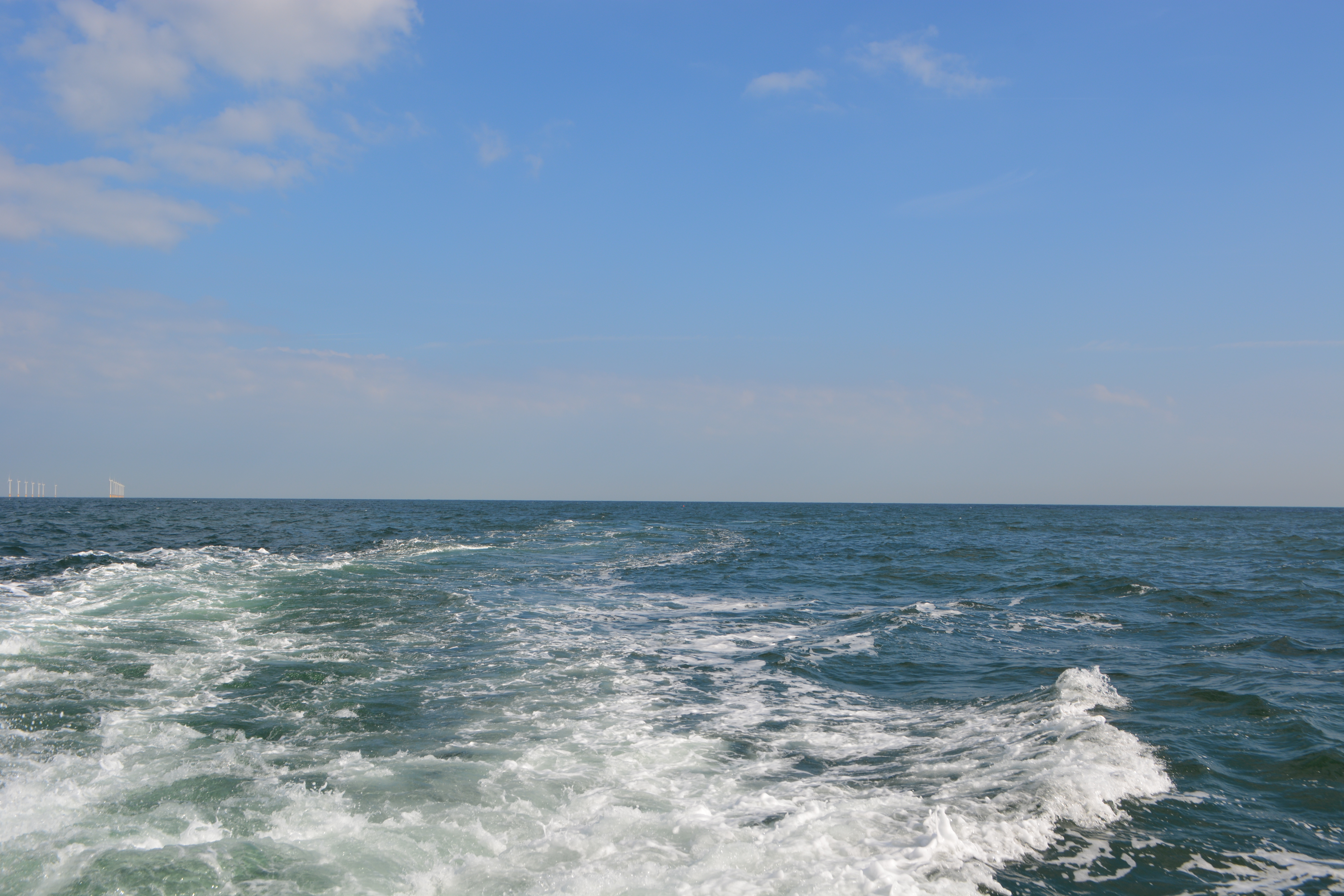
The Belgian part of the North Sea (BPNS) covers the most south-western part of the North Sea and is bordered by the English Channel to the south-west and by the central part of the North Sea to the north-east. The BPNS is mainly influenced by water from the ‘channel’ and from freshwater inputs from the Yzer and Scheldt. Long term data series are being collected for this site at different locations, making use of Thornthon Buoy, Simon Stevin Research vessel and an operational Marine Observatory that includes monthly surveys on the BPNS and an array of sensor networks.
-
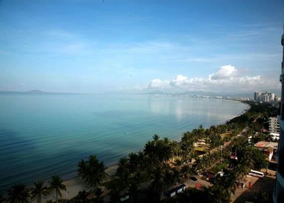
The Sany Bay, covering an area of 120 km2 between 109.3333 and 109.5 E and 18.183 and 18.3 N, surrounded by the Sanya city. It is a typical tropical bay in China. Dongmao Island, Ximao Island and Luhuitou, located in the bay mouth, possess mostly coastal coral reefs. The Sanya River, located in the eastern part of the bay, has many kinds of tropical habitats including coral reefs, mangroves, rocky and sandy shores, mudflats, etc. The coral reefs and mangroves have special resource value and ecological benefits and are, therefore very important to the sustainable social and economical development in these tropical coastal areas. Coral reefs and mangrove areas have important relationships to the regulation and optimization of the tropical marine environments.
-
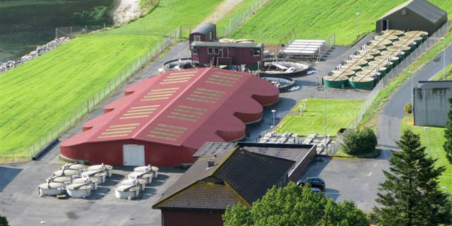
NINA Aquatic Research Station, Ims provides advanced research facilities on aquatic research, primarily focused on fish ecology
-
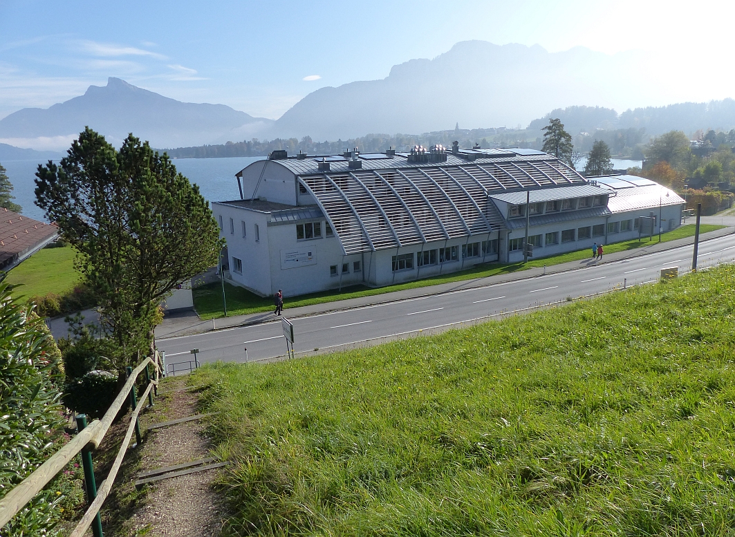
The Mondsee Limnological Institute site is a Natura 2000 area in Upper Austria. Connected to the Research Institute for Limnology, Mondsee of the University of Innsbruck this site has a long tradition of data sampling. The LTER Site Mondsee in the Salzkammergut lake district is of high ecological, socio-economic and touristic importance. In the 1960s and 1970s the lake underwent a period of eutrophication, followed by a period of re-oligotrophication due to sewage water treatment in the 1980s. The lake has been monitored since the 1950s, mainly by the Research Institute for Limnology, Mondsee of the University of Innsbruck and the Institute for Water Ecology, Fisheries and Lake Research of the Federal Agency for Water Management. Long-term data sets are available for physico-chemical parameters (temperature, oxygen, pH, conductivity), nutrients, and phytoplankton.
-
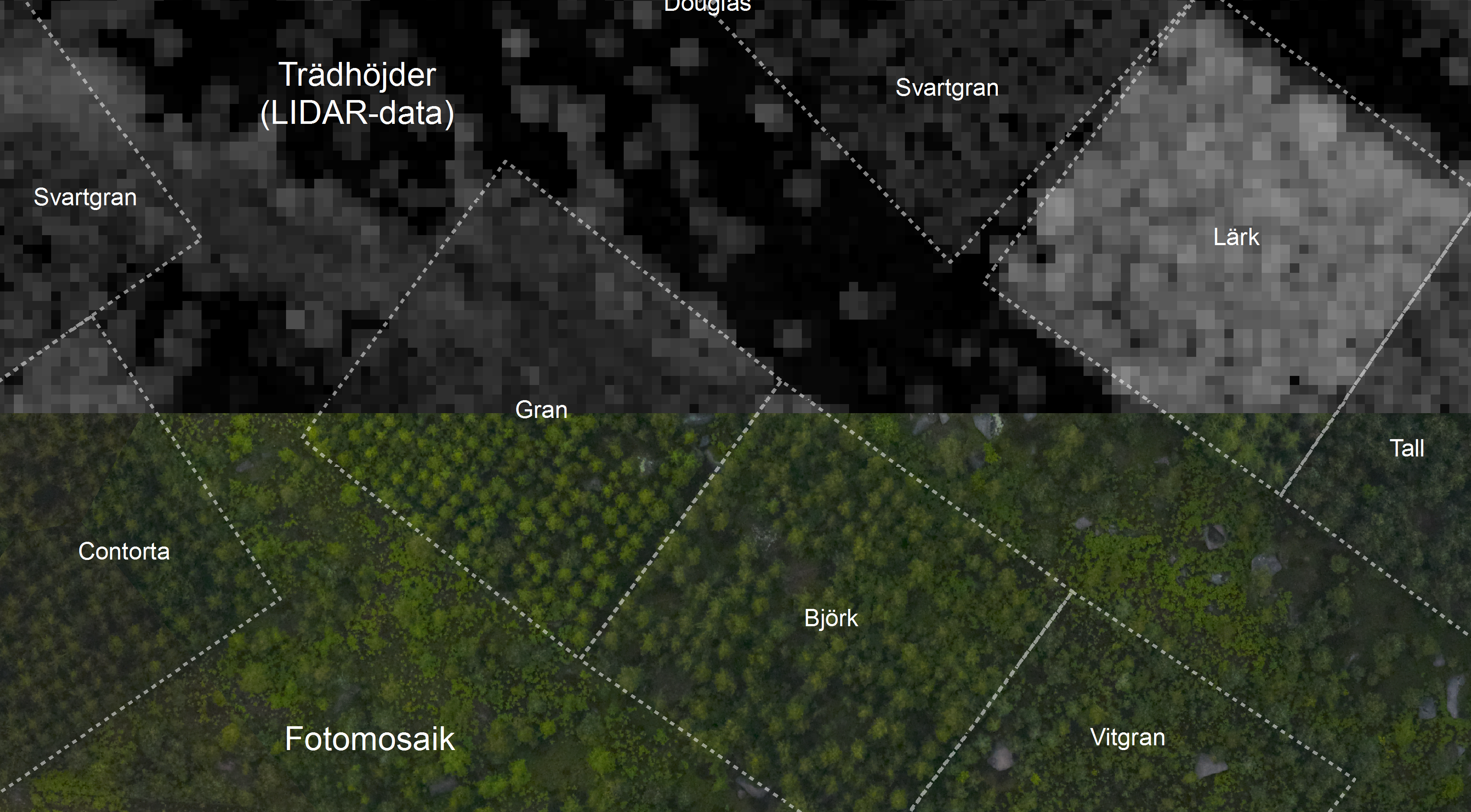
The Asa LTER site consists of 5 subsites; the Asa Experimental Forest, the Asa Experimental Production Forest, the FutMon-sites Sandbäcken and Ängavägen, and the IM site Aneboda. The Asa LTER site is situated in the nemo-boreal forest in south-central Sweden. It consists of five areas, integrated both geographically and thematically. The Asa Research Station has on-site permanent staff responsible for research and monitoring activities. Field laboratories and modern equipment are available as well as offices, lecture/meeting rooms, working rooms and lodging nearby.
-
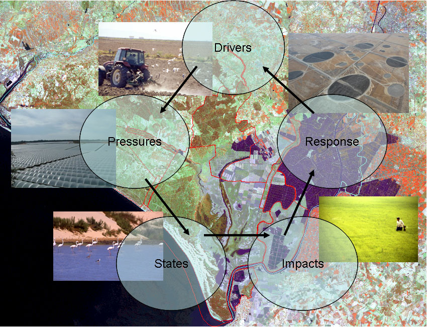
Protected in 1968, Doñana National Park (537 km2) is a UNESCO Biosphere Reserve, a Ramsar Site and a Natural World Heritage Site. It contains the largest wetland in Western Europe, a intricate matrix of marshlands (270 km2), phreatic lagoons, a 25 km-long dune ecosystem with its respective shoreline and representative Mediterranean terrestrial plant communities. Doñana is both a critical stopover site for Palearctic birds migrating to Africa and an important overwintering site for waterfowl. Doñana LTSER platform comprises both the protected area and the surrounding territories (2736 km2) where a complex landscape matrix composed by rice fields, fisheries, irrigated crops, berry greenhouses, vineyards, olives and pine afforestations hold the tributary streams that pour their water to the fluvial marshland, the main figure of Doñana. Doñana surroundings hold over 180000 permanent inhabitants. Inside the protected land, the main 3 ecosystems sustain more than 1550 species of vascular plants, 900 species of arthropods, up to 400 breeding and migratory bird species, 38 mammal species, 72 species of fishes, 40 reptile and amphibian species.
-
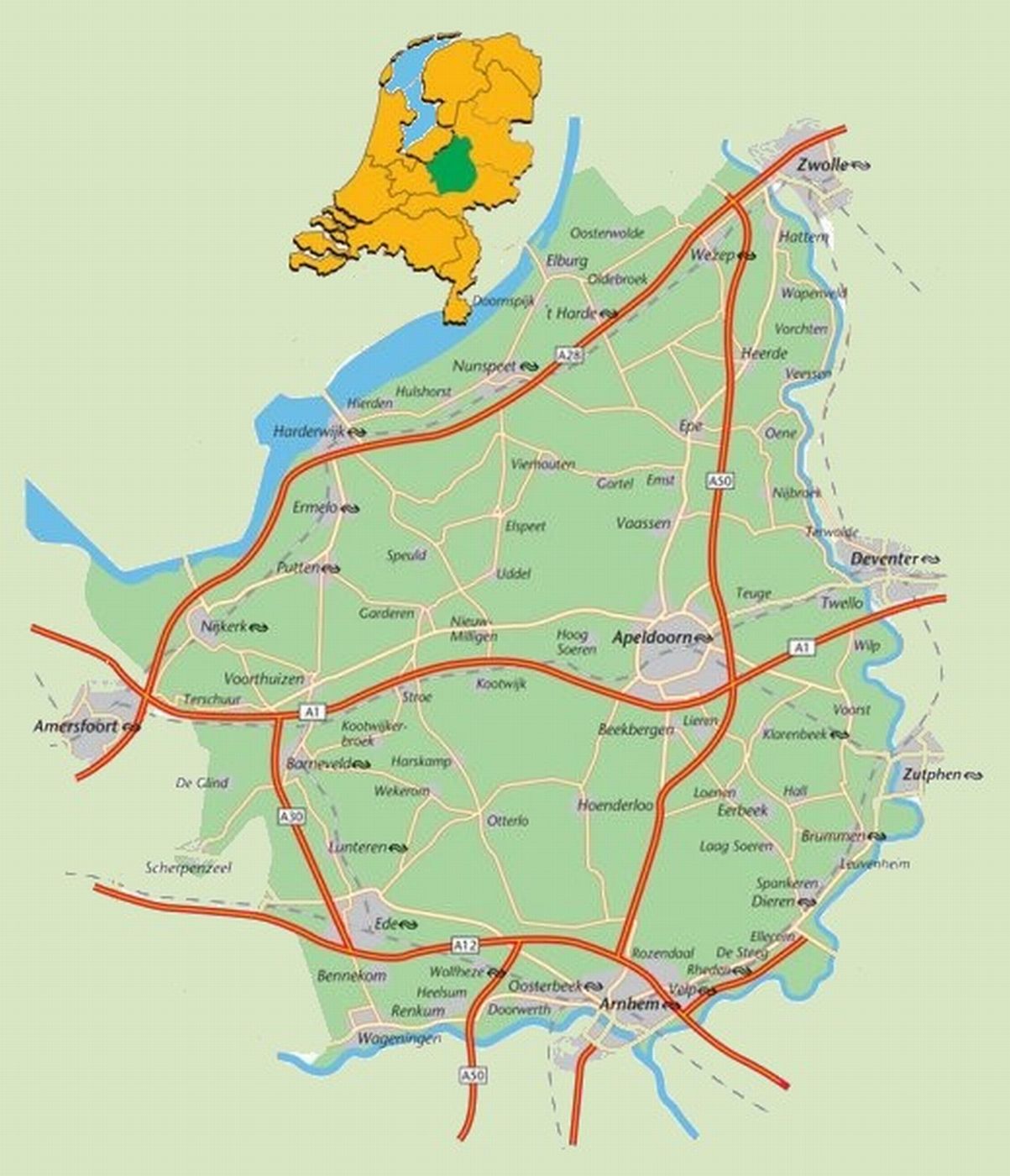
The area defined as ‘the Veluwe’ lies in the province of Gelderland, the Netherlands, West of the river IJssel and North of the river Rhine. The region hosts the largest connected nature area of the country: around 91.947 ha are part of the Natura 2000 area. The natural landscape consists of a mix of forests, heathlands, sand drifts, lakes, and moorlands. The Veluwe was settled a long time ago, and the area is now densely populated (van der Zouwen, 2006). Traces of burial mounds and agricultural fields are indicators of former human settlements. During prehistoric and medieval times, extraction of iron and timber took place on the Veluwe. After the start of the 19th century, large scale deforestation occurred, with several consequences for the nature and the landscape of the area. Human colonization increased rapidly in the 20th century. This resulted in increased infrastructure, intensified agriculture, and increased water extraction, with consequences for the groundwater levels and biodiversity (Jongmans et al., 2012; Schaminée and Jansen, 2009). As it stands, the present nature regions are surrounded by agriculture, settlements, or infrastructure. This means there is a lot of interaction between humans and nature. For example, the National Park De Hoge Veluwe and the Kröller-Müller museum and surrounding attractions get more than half a million visitors per year (ZKA Consultants & Planners, 2013). The unique circumstances of highly populated areas combined with nature provide great opportunities for research on the varied interactions between nature and humans to be carried out. A great array of different ecological and socio-economic research has already been carried out in the Veluwe, which makes it a good quality LTSER platform right from the start. One criteria for a LTSER platform is the definition of relevant themes or research questions (ILTER, 2014).