
sky temperature
Type of resources
Available actions
Topics
Keywords
Contact for the resource
Provided by
Years
Formats
Representation types
-
The typical vegetation of the forest is natural conifer-broadleaved mixed forest, dominated by Betula ermanii, Abies sachalinensis, Picea glehnii, Quercus crispula, and Acer mono, with dwarf bamboo species in the understory. The mean annual temperature is 5.4 ºC and the mean annual precipitation is 1,449 mm.
-
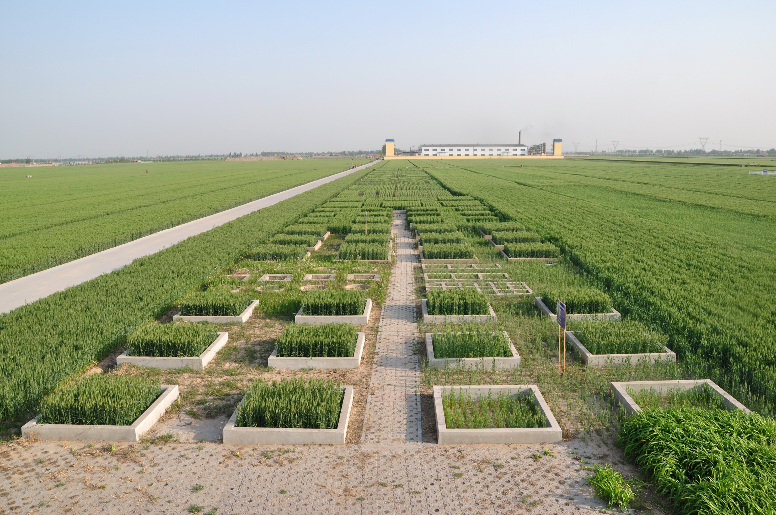
Luancheng station, established in 1981, is one of the field stations of the Chinese Ecosystem Research Network (CERN) and a member of Global Terrestrial Observation System (GTOS). The station is also a demonstration base for modern agricultural technologies in Hebei province. In 2005, the station became one of the stations of the China National Ecosystem Observation and Research Network(CNERN). Luancheng Station is located in Luancheng county of Hebei province (37°53' N, 114°41'E and elevation at 50.1 m), represents the typical high production area in the northern part of the North China Plain. The rapid declining groundwater table has become the main problem that threatens the sustainable agricultural development in this area. The researches conducted at the station focus on the long-term investigations of farmland ecosystem, water and nutrients transfer and regulation mechanisms, modern water-saving technologies, molecular breeding, precision agriculture and regional sustainable agro-ecosystem demonstration models etc.. The station has 28 ha land for field research and provides accommodation for scientists and students to stay. There are laboratories, field research infrastructure and equipments to be used for different experiments.
-
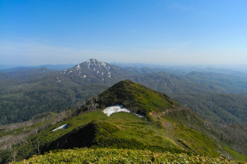
The Akazu Research Forest is the main research forest where much research related to ecohydrology and relevant research fields is conducted. The following topics are of particular importance. 1) For more than 80 years, the rainfall-runoff processes at two different watersheds of Shirasaka and Ananomiya have been investigated. By continuing the long-term hydrological measurement, the effects of ongoing climate change around AKRF and sporadically occurring forest disturbance e.g. forest decline due to disease, on water yield from the three forested watersheds can be analyzed. 2) The paired watershed method is applied to a small watershed in Shirasaka Experimental Watershed in order to evaluate directly the effect of anthropogenic manipulation on runoff and evaporation processes in the treated watershed. 3) To understand the longterm dynamics and succession of a secondary broadleaved forest and accompanying avifauna, long-term ecological research (LTER) in a permanent plot in the AKRF is being conducted.
-
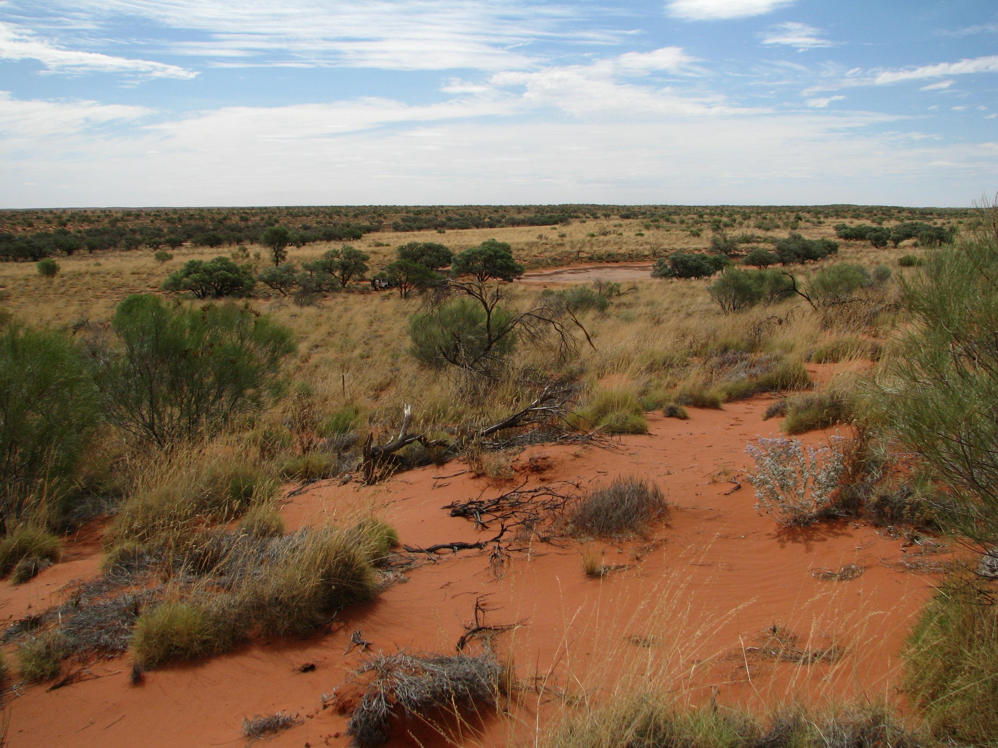
The Desert Ecology Plot Network is located in the Simpson Desert in central Australia. The vegetation in the study region is dominated by hard spinifex (Triodia basedowii E. Pritz), with scattered small woodlands of Georgina gidgee (Acacia georginae F.M. Bailey) interspersed throughout (Figure 9.1). The long-term plots for which data are provided as part of LTERN infrastructure are all located within the spinifex hummock grasslands, but additional survey plots, situated in gidgee woodlands, exist and have been surveyed since 2006 and are revisited whenever possible. Temporal visits are conducted annually. The Desert Ecology Plot Network was a member of Long Term Ecological Research Network (LTERN), Australia, a facility of the Australian Government's Terrestrial Ecosystem Research Network (TERN).
-
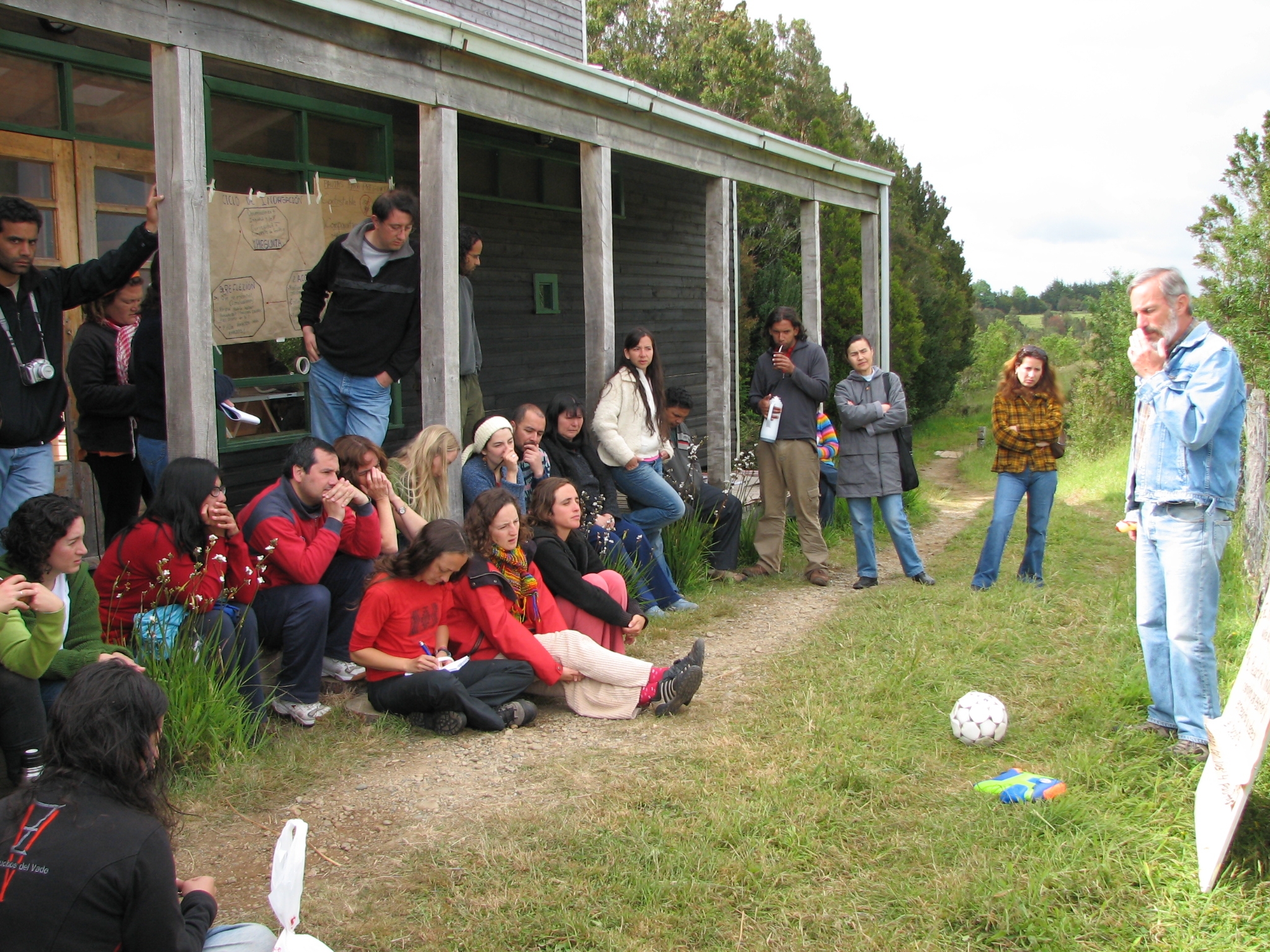
Senda Darwin Biological Station is located along Route 5 south, at a distance of 14 kilometers from the city of Ancud, in the north of Chiloe Island. It aims to facilitate scientific research, environmental education and the application of knowledge for temperate forests conservation.
-
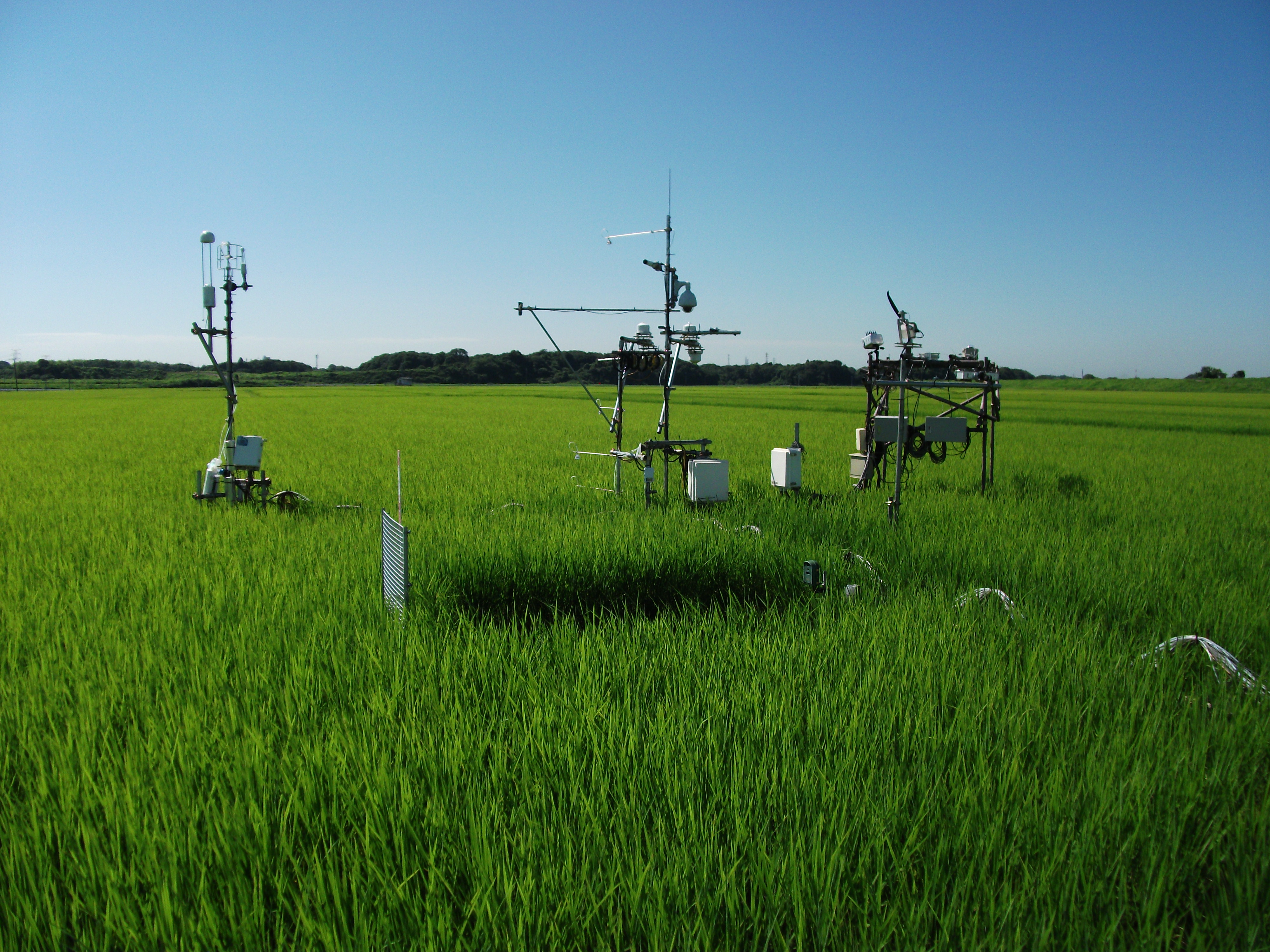
The Mase rice paddy site is a flux station in the AsiaFlux micrometeorological tower network. Located in a regularly cultivated rice paddy area of the Kanto plain in Japan, the site was established in 1999. The initial motivation was to quantify the energy and carbon balance in the rice paddy (ca, 54 a) where the tower was situated. Because of the accessibility and line-power availability, the site has involved many researchers and students from universities and institutes, broadening its target to studies on satellite and field remote sensing, ecosystem modelling, and nutrient cycling.
-
Mt. Jumbongsan site has housed the KLTER(Korea Long Term Ecological Research) station run by Ministry of Environment and National Institute of Ecology since 2004. Mt. Jumbongsan is located between Mt. Soraksan and Mt. Bangtaesan and stretches over Gangwon-do, Baekdudaegan in the Korean Peninsula. The well-preserved old-growth hardwood forest represents the vegetation of Mt. Jumbongsan within the core of Mt. Soraksan Biosphere Reserve designated by UNESCO in 1982. Qurecus mongolica and Lindera obtusiloba are the dominant species in the tree and shrub layer, respectively. Research equipment in the site consists of a flux tower, soil respiration measuring system and a V-notch weir. The flux tower is set for measuring the flow of CO2 and the photosynthesis rate and microclimate of the canopy layer in the area, and the soil respiration measurement system for studying correlation between the amount of CO2 from soil microbes and roots of plants and the soil temperature, and lastly the V-notch weir for measuring the portion material flow running through a mountain valley and hydrological studies. Altogether, we are conducting the study of interactions among various taxa using information produced from the equipment.
-
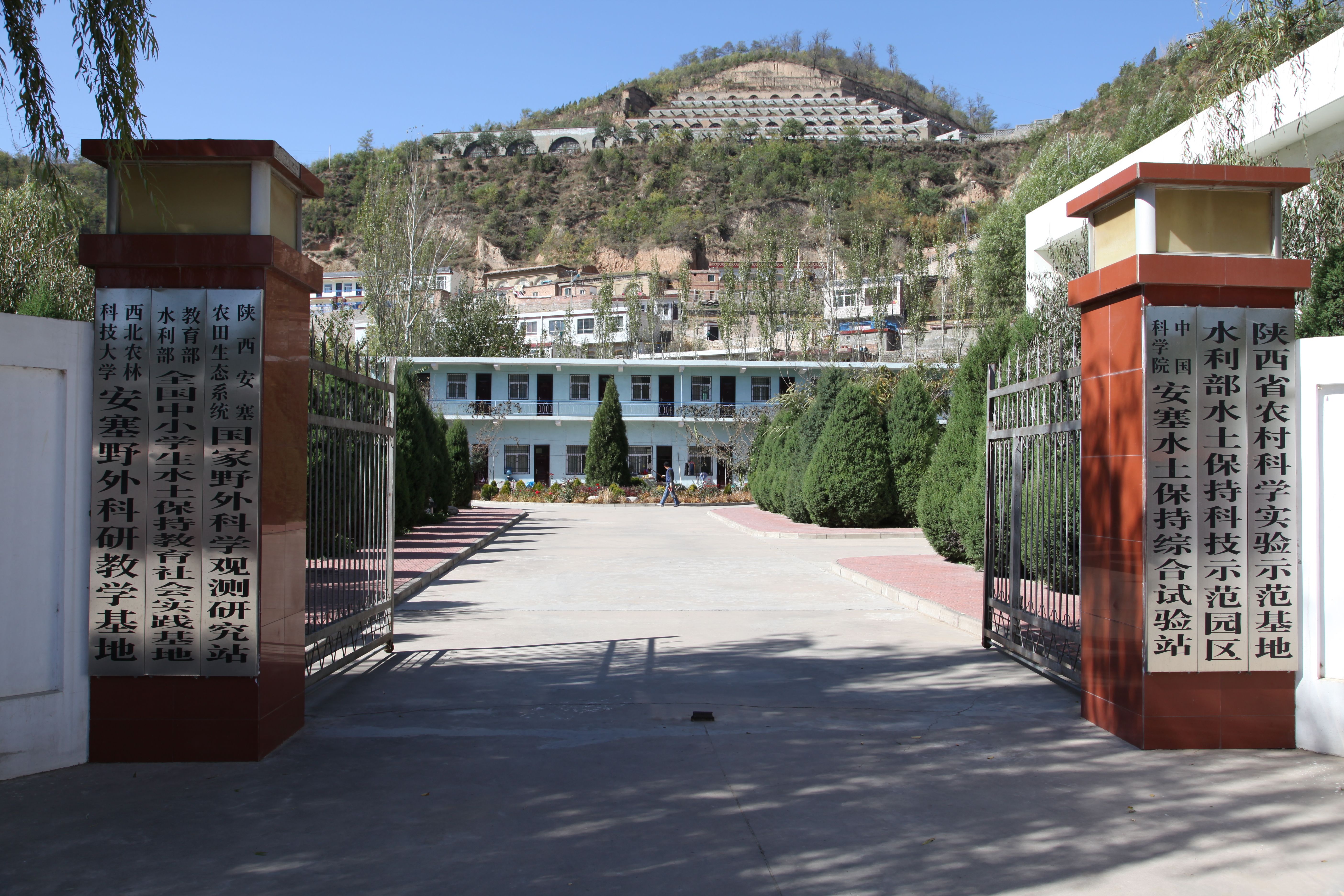
Ansai Integrated Experimental Station on Water and Soil Conservation is a part of Chinese Ecosystem Research Network, which located in the typical loess hilly and gully region and situates near the center of the Loess Plateau in the Shaanxi Province. The loess-derived soils are fertile but extremely susceptible to erosion. Soil erosion in the study area is much higher than that in the southern part of the Loess Plateau. The climate belongs to transition zone of warm temperate semi-humid to semi-arid, which is dry and windy in spring, hot and rainy in summer, and dry and cold in winter. The mean annual temperature is 8.8 °C. The minimum and maximum temperatures are −23.6 °C in February and 36.8 °C in July. The frost-free period is 157 days. The mean annual precipitation is 505 mm, 70% of which falls between July and September in the form of short heavy storm. The soil is silt loam with the contents of sand, silt, and clay being 24%, 65%, and 11%. Ansai station mainly focus on vegetation rehabilitation, monitoring and assessment of rehabilitation, and monitoring in watershed.
-
The Słowiński National Park monitoring was established in 1993 and consists of a monitoring station, where the measuring equipment is located, i.e., Wind Speed Meter (Young) pyranometer (LiCo) hygrometers, etc., permanent plots in the 90-year-old spruce and pine stands where bulk deposition, throughfall and soil solution are collected on the monthly basis. The investigations of health status of trees and floral characteristic have been carried out since 1994. The analyses are carried out in a certified laboratory of the Institute for Ecology of Industrial Areas, Katowice (Certificate No AB 325).
-
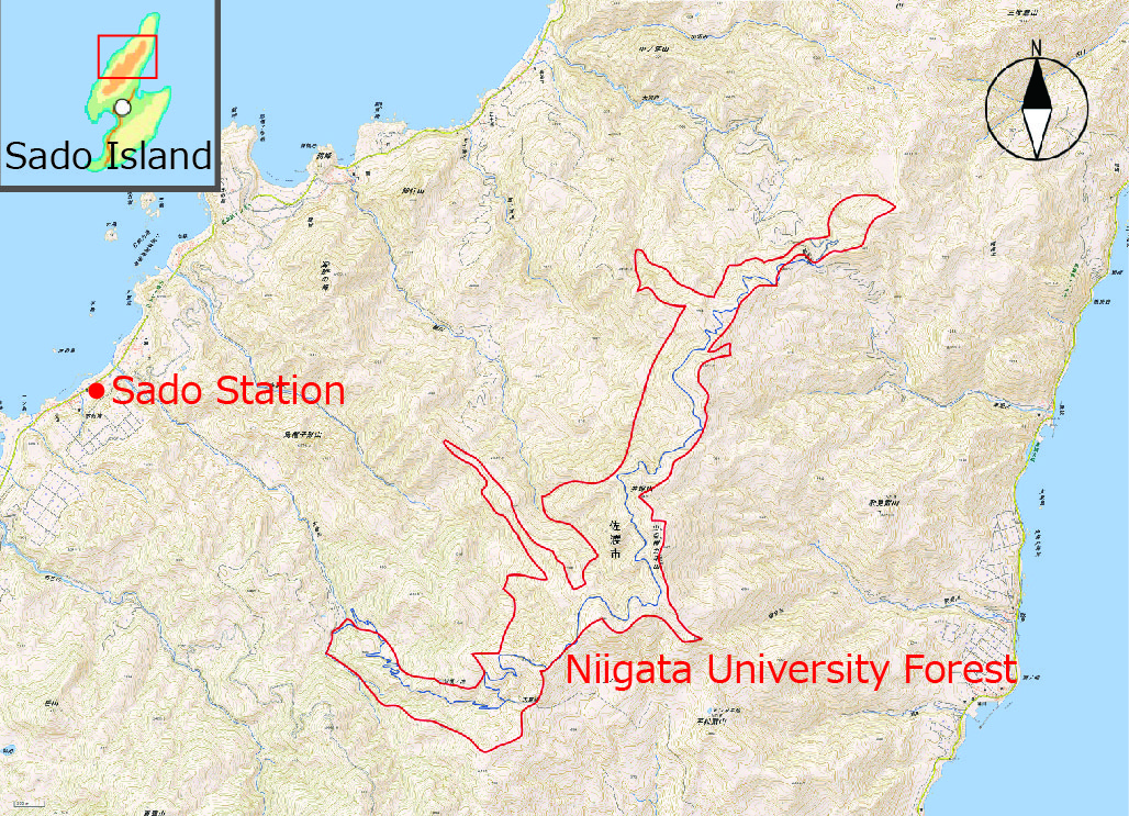
NUF (500ha), which is in the Faculty of Agriculture of Niigata University, is located on Osado Mountains in Sado Island. NUF was found on 1955 and it has been used mainly for education and research of forestry and forest science. NUF has been noted for huge, long-lived conifer timbers (Cryptmeria japonica), two endemic mammals (Lepus brachyurus lyoni and Sorex sadonis), an endemic beetle (Damaster blaptoides capito), and many endangered perennial flowers. Four investigators and Seven technicians are engaged in the station.