
snow cover
Type of resources
Available actions
Topics
Keywords
Contact for the resource
Provided by
Years
Formats
Representation types
-
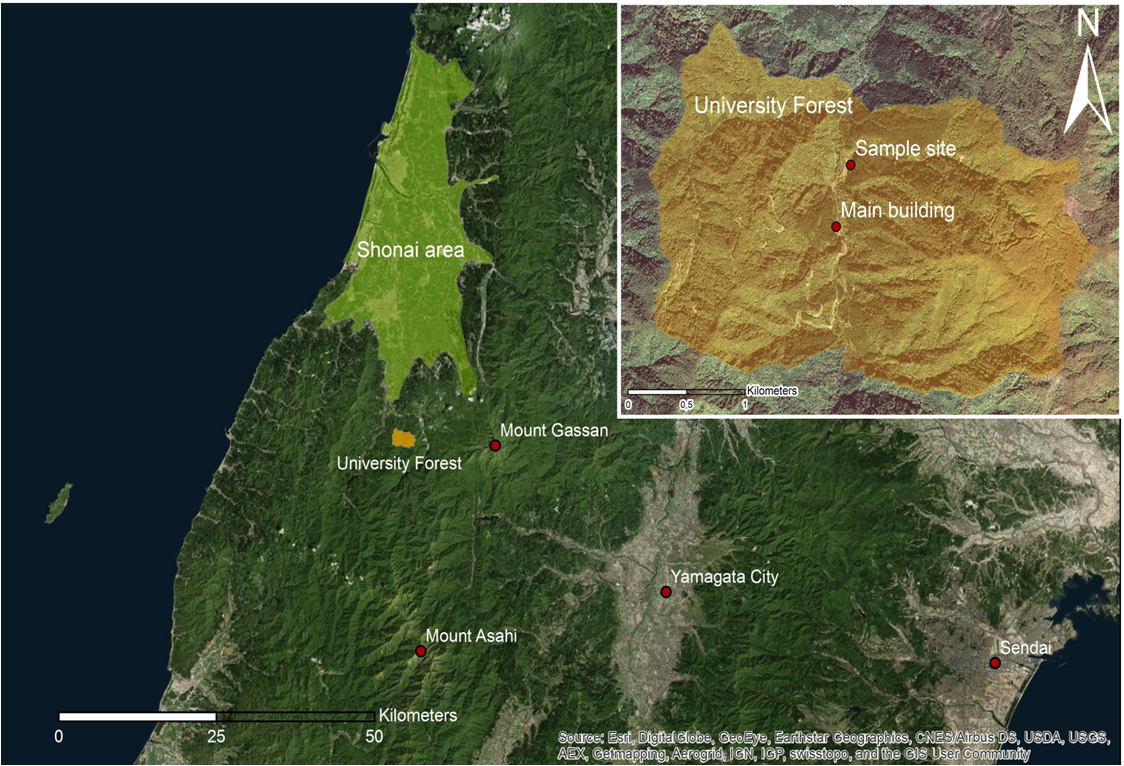
YURF is located 26 km south of Tsuruoka city in Yamagata Prefecture. It is characterized by very steep slopes as well as heavy snowfall in the Asahi Mountains where YURF is located. Almost half of the 753 ha of YURF territory is occupied by natural beech forests and almost 25 % is occupied by Japanese cedar forests, the rest is made of mixed broad-leave forests and small patches of larch and spruce. The Laboratory of Watershed Preservation carries long-term monitoring of water and biochemical cycles in different forest-ecosystems. In order to farther promote joint activities within the Faculty of Agriculture of Yamagata University, YURF collaborates with the Eco-Agriculture Laboratory by joint research on Agro-forestry in the forest using the slash and burn technique to grow Atsumi Turnip. The application of silviculture and agriculture as a single unit is one of the main educational topics of what is called Agro-forestry.
-
Øvre Heimdalen is located by Valdresflya in the eastern part of Jotunheimen on the border between the municipalities of Øystre Slidre and Vågå. The valley floor, which is oriented east-west, is at an altitude of 1,100 metres. The surrounding mountains reach over 1,800 m above sea level. Birch forest grows on the south-facing valley side, but the rest of the area is above the tree line. Research activity in Øvre Heimdalen began in 1957 with documentation of the trout population in Øvre Heimdalsvatn, and how the biomass, growth rate and age composition of the population were affected by environmental conditions.
-
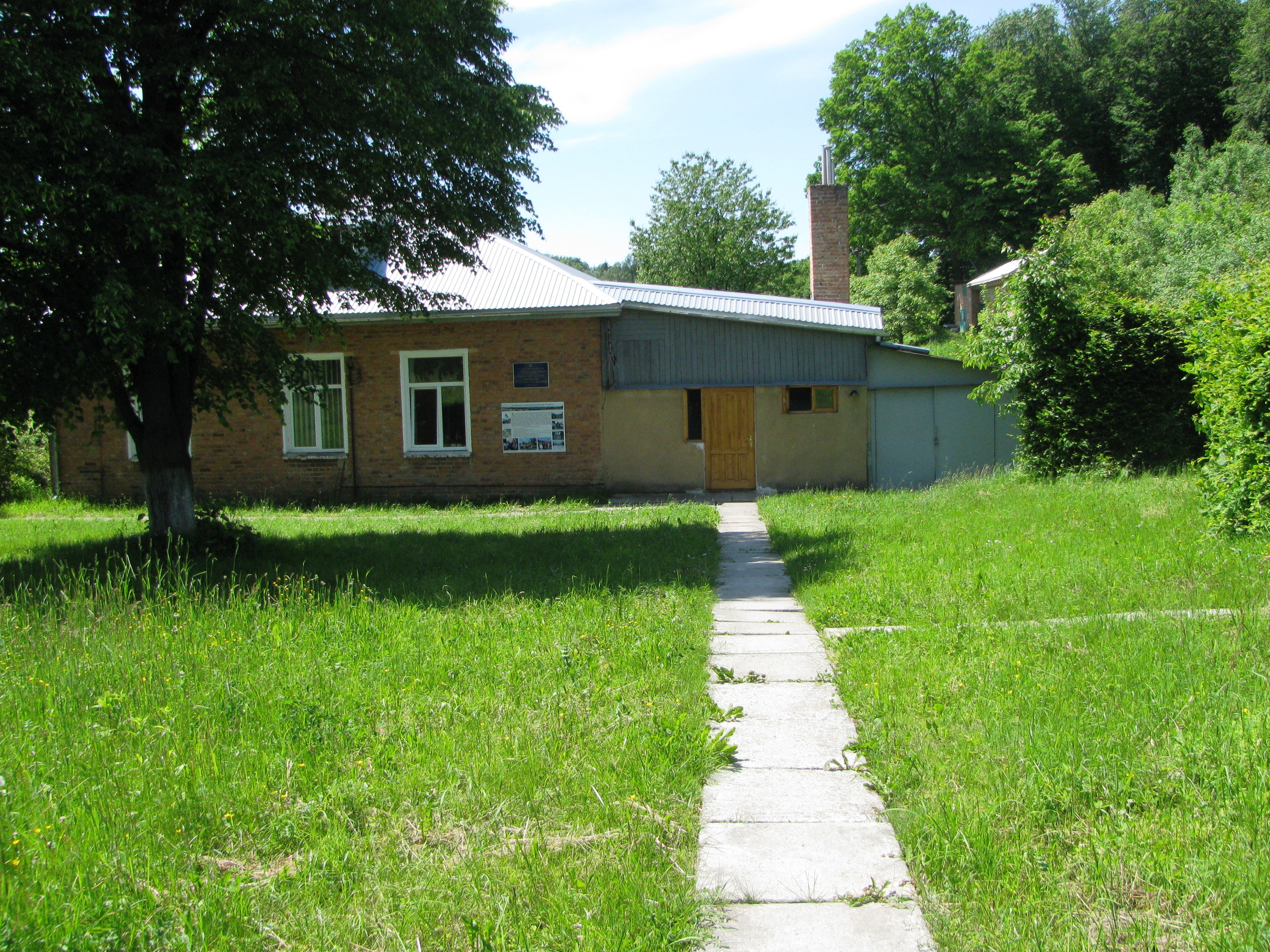
Roztochia lanscape-geophysical station (RLGS) by Ivan Franko National University of Lviv (LNU) is located within the hill ridge of Roztochia which stretches in Ukraine northwest to the Poland. The station is located in urban village Bryukhovychi (49˚55̍02.3̎ N; 23˚57̍06.1̎ E), 8 km from city of Lviv and 12 km from Faculty of Geography. The station was founded in autumn 1968 and is in operation now. There is the only one station in the western regions of Ukraine that has a continuous series of day-night actinometrical and meteorological measurements.
-
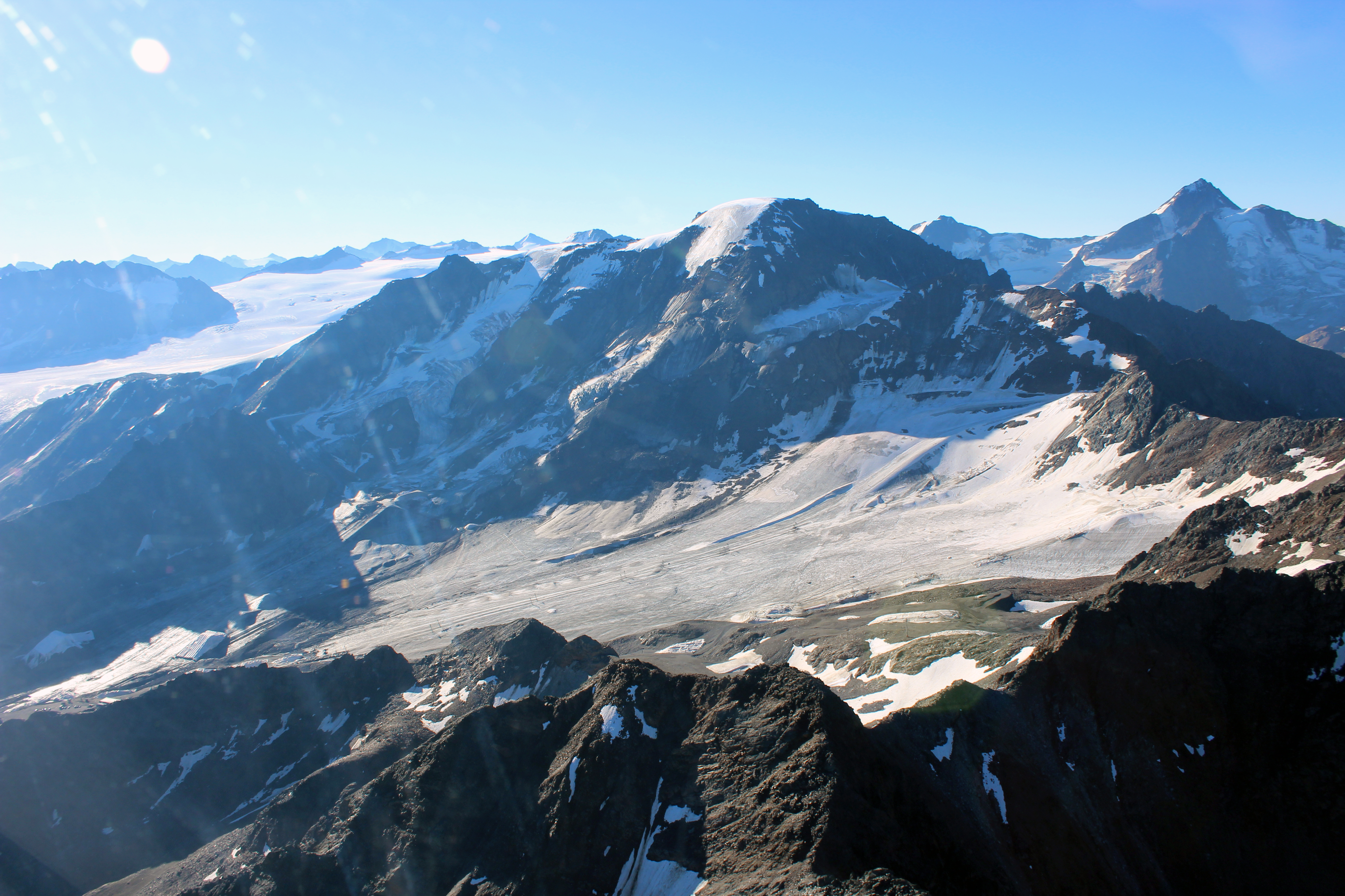
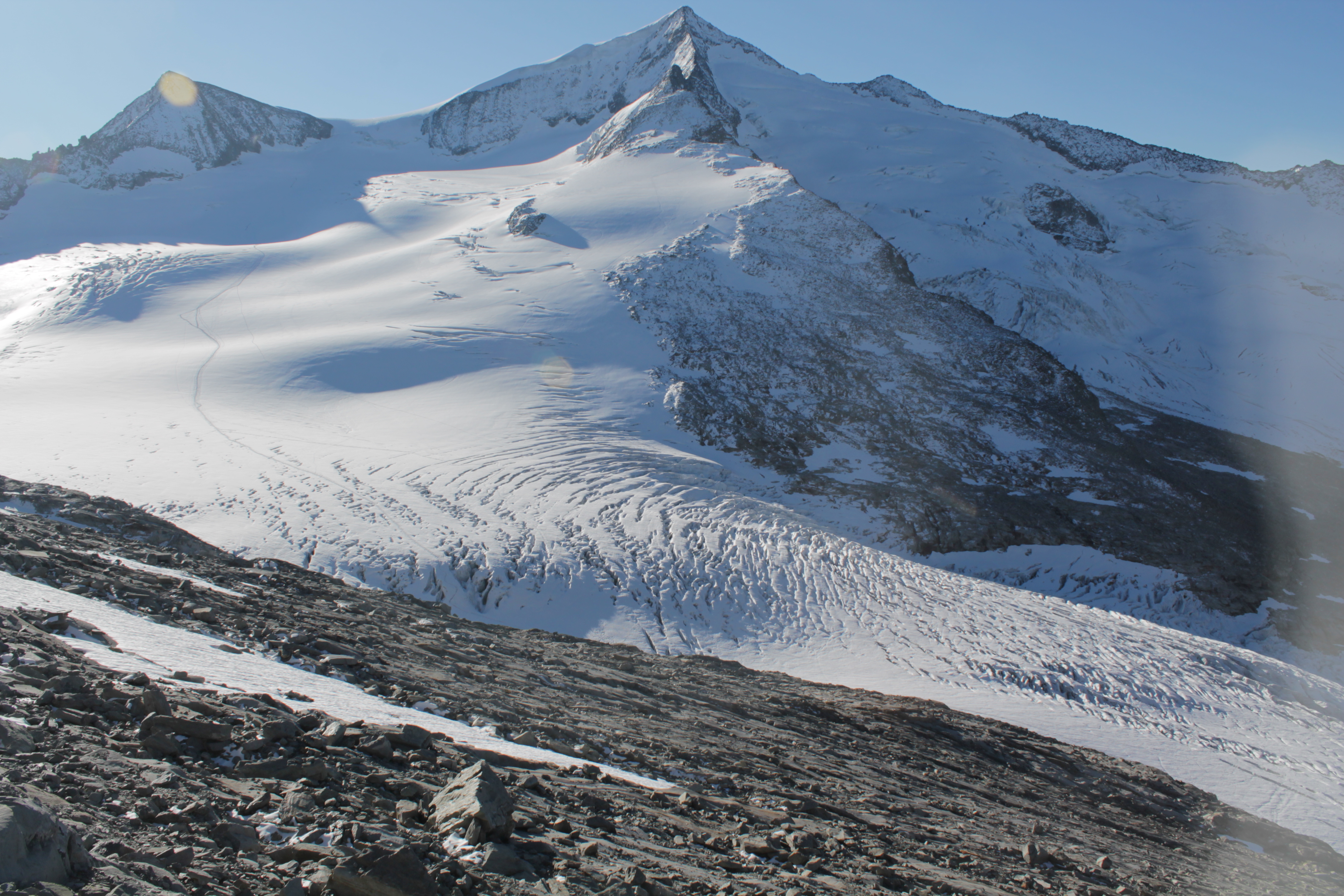
The LTER site Kaunertal reaches from the glaciated peak of the Weißseespitze (3600 m) to the Gepatschferner, the second-biggest Austrian glacier, down to the community of Kaunertal. The Gepatschferner is one of the most thoroughly studied glaciers in Austria, with a chronology of advances and retreats that covers the Holocene. Comprehensive data also exist on changes in the tree line and the distribution of permafrost and rock glaciers. Run-off and mass balance data on the glacier and detailed studies on the geomorphology of the glacier forefield and the role of biota for sediment mobilization complement the studies in the glaciated catchment area. In 2023 we started a project on butterfly monitoring. In 2021 the community of Kaunertal created a museum dedicated to research.
-
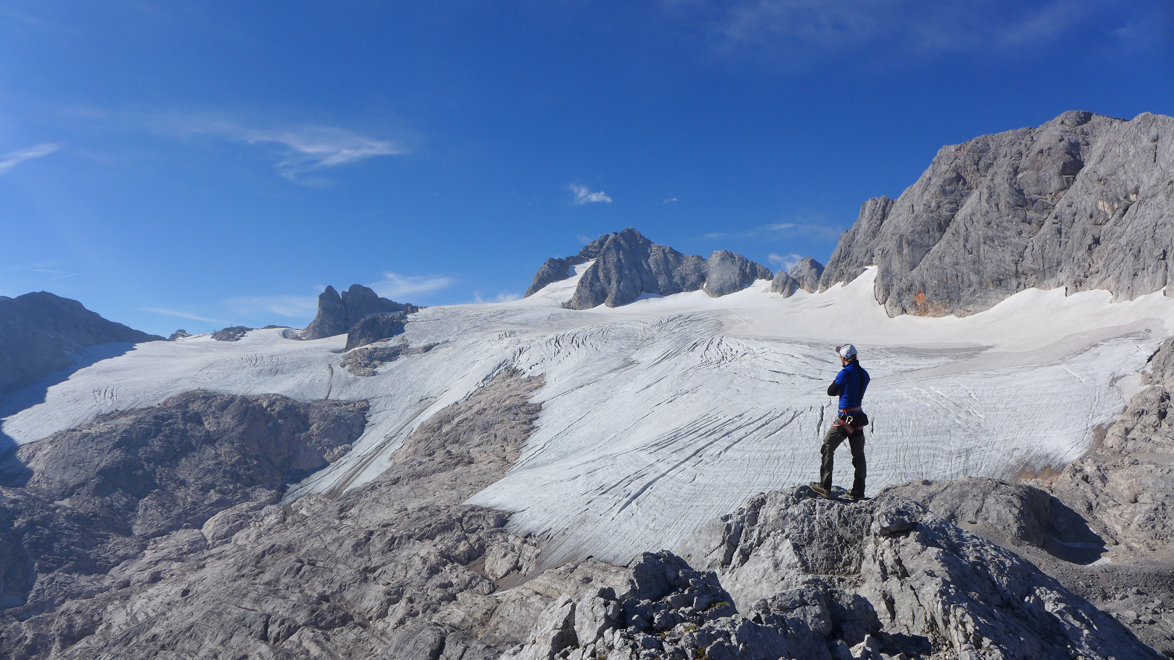
The Hallstätter Glacier is the largest glacier in the northern Limestone Alps. The Hallstätter Glacier is oriented to the northeast and is bordered by Rock walls. The Large plateau above 2550 m.a.s.l. is connected by three short tongues. The largest altitude zone in terms of area is between 2550 m and 2600m. The highest point of the glacier is at 2905 m, the lowest point is on 2240 m. With an area of 2.623 km² (glacier boundary 2020), the glacier lost half of its extent compared to the glacier peak in 1856. In the past 10years, the area has increased by around 13 %.
-
The Venedigerkees in the Hohe Tauern National Park is the easternmost tributary glacier to the former tongue of Obersulzbachkees. As a result of the strong retreat of Obersulzbachkees, the glacier disintegrated into several tributary glaciers, with a large lake remaining at the location of a famous serac zone, the 'Türkische Zeltstadt'. Mass balance of the Venedigerkees is measured since 2011/12 with the direct or glaciological method. Furthermore, an automatic weather station was built between Venedigerkees and Keeskogel in 2018.
-
Tarfala Research Station is located at 1130 m a.s.l. in the high alpine Kebnekaise mountains, northern Sweden. The Tarfala valley catchment reaches from 2100 to 500 m a.s.l. Vegetation spans high alpine flora, mountain heath and meadows and the upper mountain birch forest zone. The lake, rivers and glacier meltwater streams is part of the headwaters for the unregulated Kalix River. The station was established in 1946 with the main aim to study glacier massbalance. The best known glacier is Storglaciären which is one of the most well studied glaciers in the world. The glaciers and terrestrial and aquatic ecosystems formed by the harsch climate in this area is now changing rapidly. Over the years the environmental monitoring program has expanded and includes today mountain meteorology, water discharge and chemistry, permafrost and vegetation. The station belongs to Stockholm University and is part of the Swedish Infrastructure for Ecosystem Science (SITES).
-
The Gesäuse Nationalpark and the Johnsbach valley belong to the Ennstal Alps, a part of the Northern Limestone Alps. They are situated in the province of Styria in the center of Austria. Together, they form the joint test site named Gesäuse-Johnsbachtal. This region is characterized by a mountainous landscape which is cut by the river “Enns”. In the north, it borders Eisenwurzen Nature Park and is only 6 km away from the Kalkalpen, a National Park in Upper Austria. In the south, the borders are the Eisenerzer Alps. The total area of the site is about 155 km². The terrain shows a great elevation range from 600-700 m in the Johnsbach valley to over 2300 m in the summit region of the Gesäuse, with Hochtor (2369 m) being the highest mountain. Due to the great range of altitude differences within small areas the Gesäuse-Johnsbachtal shows extremely diverse habitats and, consequently, species of animals and plants. In general, the landscape is dominated by mountain forests along with high Alpine rock formations and meadows. These complex topographic, hydrological, geological, geomorphological and meteorological conditions pose a scientific challenge for all kinds of environmental monitoring and modeling.
-
The Mullwitzkees is located in the Venediger Group in the core zone of the National Park Hohe Tauern. The upper part of the glacier (outer Mullwitzkees) is oriented to the south.The lower part of the glacier, especially the tongue, is oriented to West-South-West.
-
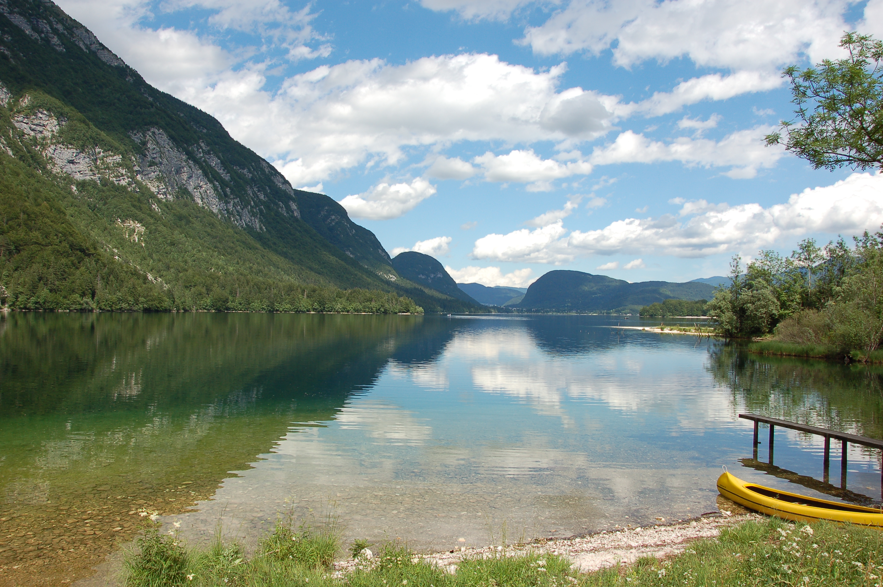
Lake Bohinj is of tectonic-glacial origin and was transformed by the Bohinj glacier. Its surface area is 3.28 km 2 , its volumeWeather conditions and chlorophyll concentrations determine long-term macrophyte community dynamics of Lake...92.5 × 10 6 m 3 and its maximum depth 45 m. It is located at an altitude of 525 m a.s.l. and issurrounded by mountains that are up to 2000 m high. Lake Bohinj is conditioned by the main inflow from River Savica and by several karst springs from the base of Mount Komarča and has a single outflow, River Sava Bohinjka. The residence time of the water in Lake Bohinj is about 4 months, which means that the total volume of the water in Lake Bohinj changes three times a year. The surrounding watershed comprises around 94.3 km2 and is mostly uninhabited, with a large portion extending above the tree line; therefore, the input of nutrients into Lake Bohinj is moderate. This watershed receives about 3300 mm of rainfall a year. Long-term temper-atures show a tendency to a rise. In winter, usually in January, the surface water cools and the lake can be frozen over. From 1961 to 1990, Lake Bohinj was frozen over for a mean of > 50 days/year, while in the decade from 1991 to 2000, the mean number of days with ice cover was reduced to 31 days/year. Since 1990, the lake did not freeze completely in individual years. The majority of the lake catchment area consists of carbon-ate rock, and therefore, the main lake sediment fraction is carbonate, while quartz and feldspar represent a minor part.