
snow depth
Type of resources
Available actions
Topics
Keywords
Contact for the resource
Provided by
Years
Formats
Representation types
Update frequencies
-
Snow depthdata of Oberkainz, Schröckalm and Gscheidegg.
-
Snow depth of meteorological Station Rudolfshütte
-
In 2019, an automatic weather station was built on behalf of the hydrographic service Salzburg. This station is energy self-sufficient. At this station, air temperature, humidity, air pressure, wind strenght, wind direction, snowdepth, irradiation and radiationare measured.
-
Meteorological station Schröckalm
-
The present dataset encompasses part of the data collected since 1960 at Col de Porte on a daily or hourly basis. It encompasses only the incoming radiation, snow height and precipitation data. This data, and the other data acquired at Col de Porte, are extensively described in Lejeune et al., 2019 (https://doi.org/10.5194/essd-11-71-2019). The Col de Porte is located at 1325 m a.s.l., Chartreuse, France. It serves as an observatory of snow and weather conditions in mid-altitude mountains and their evolutions in the context of global climate change. It also sustains snow science process understanding and snowpack model development and evaluation, as well as intrumental development or instruments’intercomparisons. More extensive site metadata and ancillary measurements such as soil properties and masks of the incident solar radiation are also provided in the datapaper. The data are placed on the repository of the Observatoire des Sciences de l’Univers de Grenoble (OSUG) data centre: https://doi.org/10.17178/CRYOBSCLIM.CDP.2018._purpose:Document the evolution of snow and weather conditions under climate change in mid-altitude mountains, help to develop or evaluate snowpack or surface energy balance models including sub-surface components, serve as local reference measurements
-
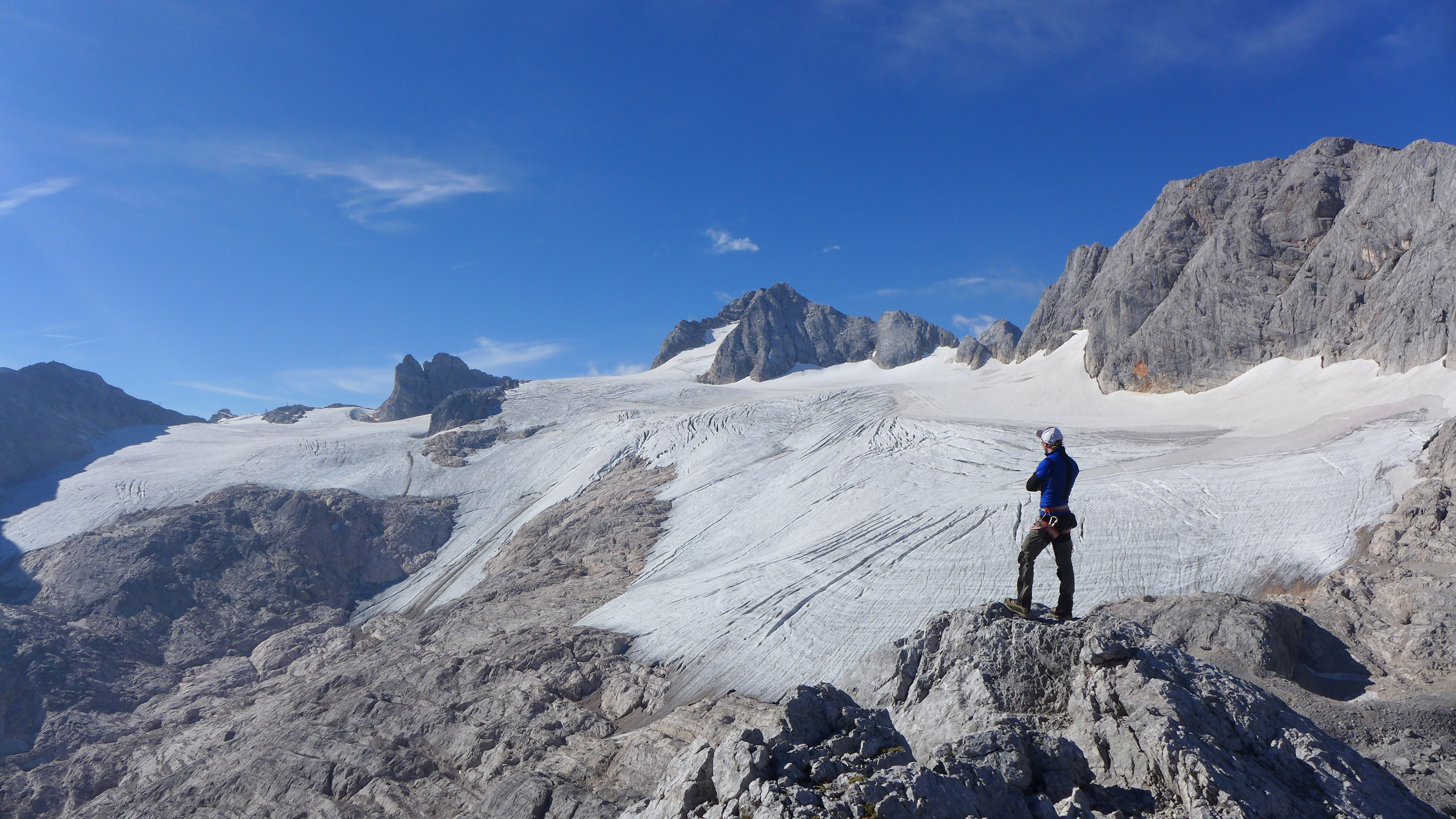
The Hallstätter Glacier is the largest glacier in the northern Limestone Alps. The Hallstätter Glacier is oriented to the northeast and is bordered by Rock walls. The Large plateau above 2550 m.a.s.l. is connected by three short tongues. The largest altitude zone in terms of area is between 2550 m and 2600m. The highest point of the glacier is at 2905 m, the lowest point is on 2240 m. With an area of 2.623 km² (glacier boundary 2020), the glacier lost half of its extent compared to the glacier peak in 1856. In the past 10years, the area has increased by around 13 %.
-
This data set has been used in the past to develop and evaluate physical parameterizations and numerical models of blowing and drifting snow in alpine terrain. Col du Lac Blanc is also a target site to evaluate meteorological and climate models in alpine terrain._ purpose:Document the spatial distribution of snow cover in mountainous terrain
-
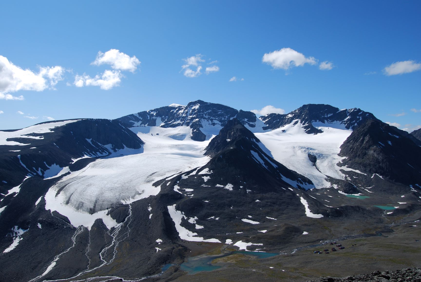
Tarfala Research Station is located at 1130 m a.s.l. in the high alpine Kebnekaise mountains, northern Sweden. The Tarfala valley catchment reaches from 2100 to 500 m a.s.l. Vegetation spans high alpine flora, mountain heath and meadows and the upper mountain birch forest zone. The lake, rivers and glacier meltwater streams is part of the headwaters for the unregulated Kalix River. The station was established in 1946 with the main aim to study glacier massbalance. The best known glacier is Storglaciären which is one of the most well studied glaciers in the world. The glaciers and terrestrial and aquatic ecosystems formed by the harsch climate in this area is now changing rapidly. Over the years the environmental monitoring program has expanded and includes today mountain meteorology, water discharge and chemistry, permafrost and vegetation. The station belongs to Stockholm University and is part of the Swedish Infrastructure for Ecosystem Science (SITES).
-
Øvre Heimdalen is located by Valdresflya in the eastern part of Jotunheimen on the border between the municipalities of Øystre Slidre and Vågå. The valley floor, which is oriented east-west, is at an altitude of 1,100 metres. The surrounding mountains reach over 1,800 m above sea level. Birch forest grows on the south-facing valley side, but the rest of the area is above the tree line. Research activity in Øvre Heimdalen began in 1957 with documentation of the trout population in Øvre Heimdalsvatn, and how the biomass, growth rate and age composition of the population were affected by environmental conditions.
-
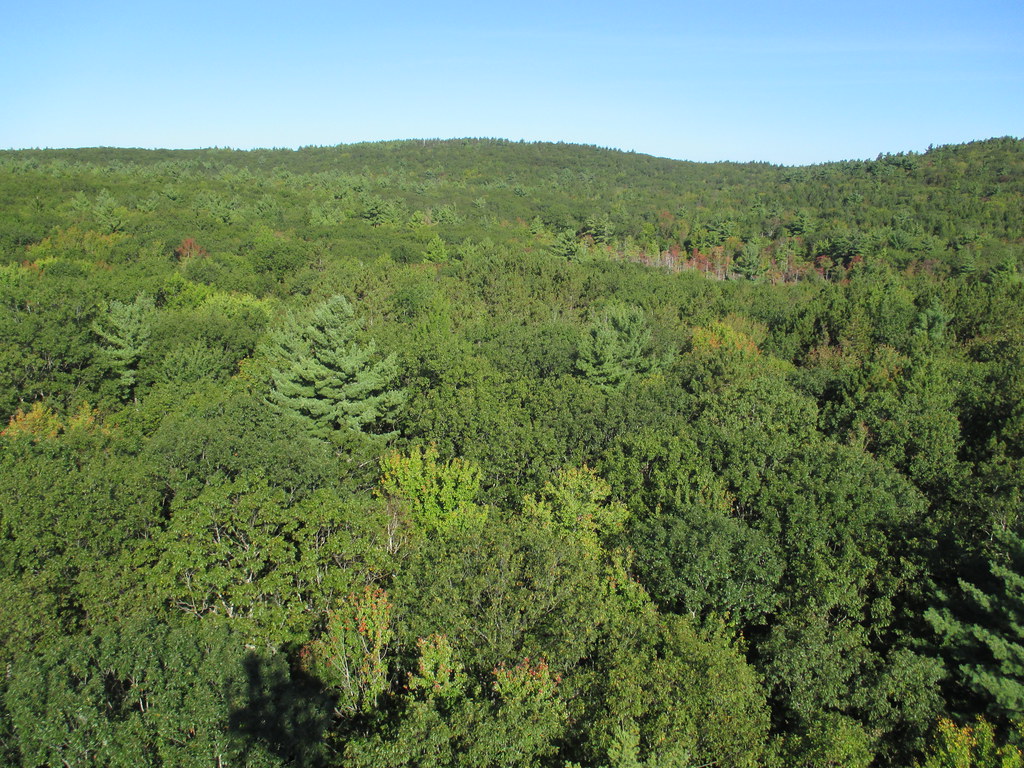
Harvard Forest is a core site in Domain 01: Northeast. Located 73 miles from Boston in Petersham, Massachusetts The Harvard Forest site is spread across 49 km2 of land and is the core NEON site for the Northeast region. Representative habitats at Harvard Forest include northern, transition, and central forests; marshes, swamps, and conifer-dominated bogs; and forest plantations. NEON's meteorological/flux tower and tower sampling plots are located on land owned by Harvard Forest - Harvard University, LTER an forest with a rich history of scientific research. The distributed sampling plots are located along the edge of the Quabbin reservoir which is managed by the Massachusetts Department of Conservation and Recreation, Division of Water Supply Protection. For access to the area along the Quabbin, visitors must be accompanied by a NEON project employee. Total data products collected at this site is 119.