
snow temperature
Type of resources
Available actions
Topics
Keywords
Contact for the resource
Provided by
Years
Formats
Representation types
-
Cime bianche, Colle Superiore di Cime Bianche, (Valtournenche, Aosta), +398720 +5086095; Valle d'Aosta region
-
Saldur Catchment covers an area of app. 100 km2 and includes different elevations, topographic aspects and ecosystems (meadows, pastures, forests and glacier forefields).Measurements started in 2010. In total there are 17 weather stations distributed throughout various ecosystem types (cultivated meadows, pastureland, forest, glacier forefield), which enables analyses at a plot level up to a complete landscape level. Measurements are primarily used to validate hydrological models and to model various ecosystem services such as productivity, water availability and protection against natural hazards. This site is also equipped with five units to measure sap flow in the stem and an automatic dendrometer; the data are used to investigate the influence of climate factors on common coniferous trees in the area.
-
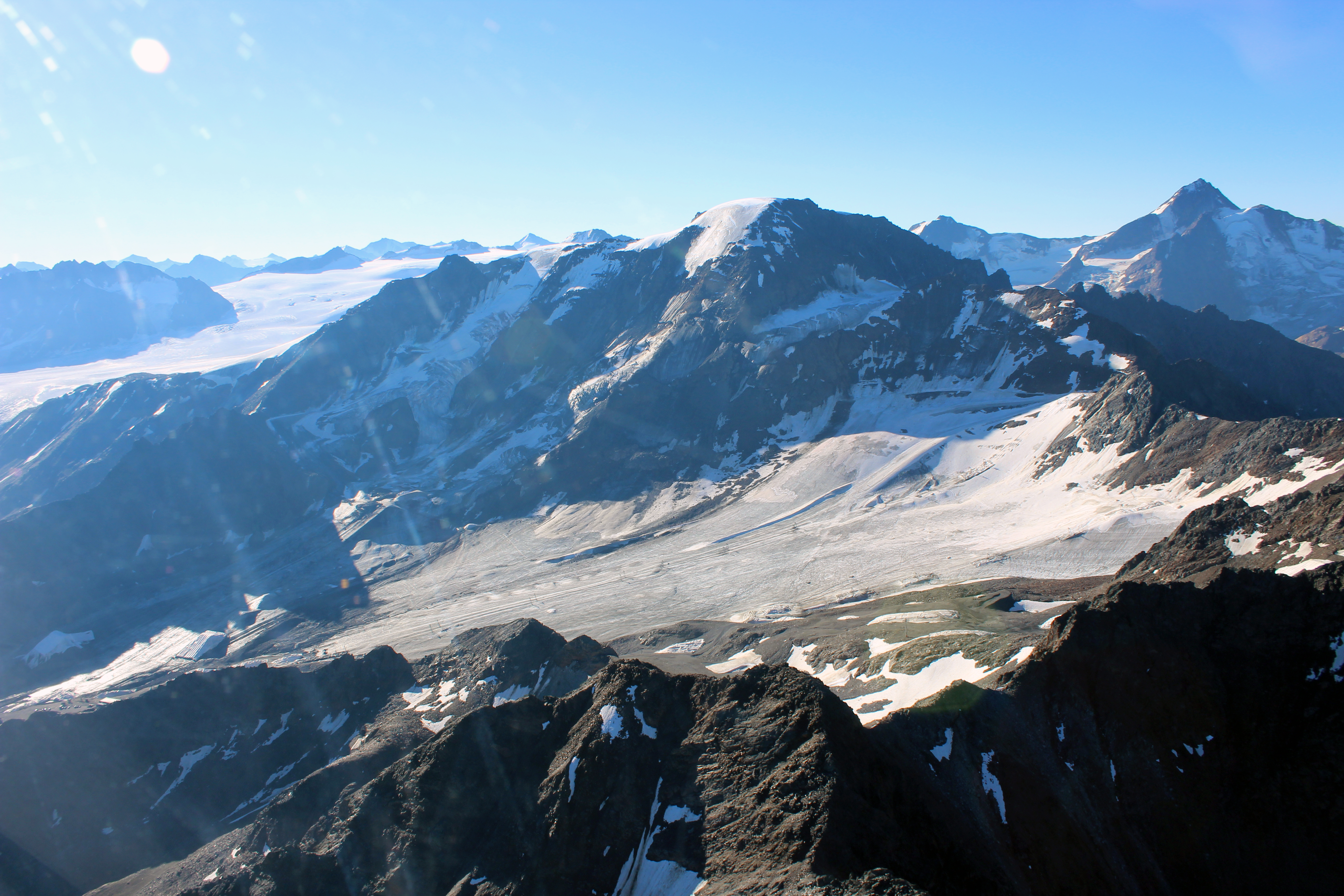
The LTER site Kaunertal reaches from the glaciated peak of the Weißseespitze (3600 m) to the Gepatschferner, the second-biggest Austrian glacier, down to the community of Kaunertal. The Gepatschferner is one of the most thoroughly studied glaciers in Austria, with a chronology of advances and retreats that covers the Holocene. Comprehensive data also exist on changes in the tree line and the distribution of permafrost and rock glaciers. Run-off and mass balance data on the glacier and detailed studies on the geomorphology of the glacier forefield and the role of biota for sediment mobilization complement the studies in the glaciated catchment area. In 2023 we started a project on butterfly monitoring. In 2021 the community of Kaunertal created a museum dedicated to research.
-
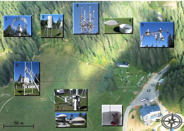
The Col de Porte pilot site is located near Grenoble, in the Chartreuse massif (elevation : 1325m, latitude : 45°30’N, longitude : 5°77’ E). At this mountain site located in a grassy meadow surrounded by a coniferous forest; all the measurements are located within an flat area of 50 × 50 m. Meteorological and snow parameters are recorded hourly since 1961. These parameters are : - Air temperature and relative humidity of air - Incoming and outcoming short and long-wave radiations - Wind speed and direction - Precipitation - Snow depth, snow water equivalent - Settlements and snow temperatures of the different layers of the snowpack Weekly snowpack profiles are also carried out, including major stratigraphic properties of snow (temperature, density, liquid water content, snow type). All sensors are located within a radius of a few tens of meters. (1) Geonor precipitation gauges (3 sensors) and OTT2 (1 sensor), (2) PG2000 heated and non-heated precipitation gauges, (3) windspeed measurements at the top of the 10 m meteorological mast and at the same level of the precipitation gauges, (4) lysimeters (2 sensors), (5) snow depth and surface temperature sensors and settling disks, (6) temperature and relative humidity of air sensors placed in the shelter, (7) Incoming and outcoming longwave and shortwave radiation sensors placed on the rotating arm, (8) close-up on the 4 components radiation sensors, (9) building (cold room, data acquisition, lab space), (10) cosmic rays counter for SWE measurements, (11) former experimental area for the study of road/snow interactions, (12) automatic snow and weather station Nivose for testing purposes (generally used in remote mountain areas), (13) forest area impacted by the cut in 1999, (14) snow pit area, Fore more information refer to : Morin, S., Lejeune, Y., Lesaffre, B., Panel, J.-M., Poncet, D., David, P., and Sudul, M.: An 18-yr long (1993-2011) snow and meteorological dataset from a mid-altitude mountain site (Col de Porte, France, 1325 m alt.) for driving and evaluating snowpack models, Earth Syst. Sci. Data, 4, 13-21, doi:10.5194/essd-4-13-2012, 2012
-
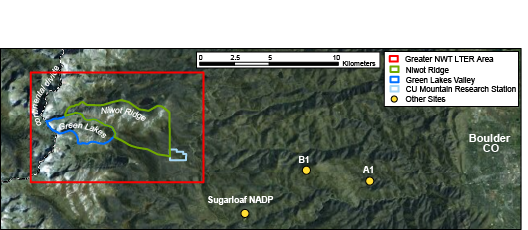
The Niwot Ridge Long Term Ecological Research (LTER) site was established in 1980 with support from the National Science Foundation. The topography, climate and biota of the research site are representative of alpine ecosystems in the southern Rocky Mountains, including extensive expanses of alpine tundra and subalpine coniferous forests, as well as a cirque glacier (Arikaree Glacier), a variety of glacial landforms, lakes and moraines, cirques, talus slopes, patterned ground, and permafrost. The LTER site includes Niwot Ridge, the southern-adjacent Green Lakes Valley, and the University of Colorado’s Mountain Research Station (MRS). Niwot Ridge is part of the Roosevelt National Forest and has been designated a United Nations Educational, Scientific and Cultural Organization (UNESCO) Biosphere Reserve and an Experimental Ecology Reserve (USDA Forest Service). The Green Lakes Valley is a part of the City of Boulder Watershed. The MRS is an interdisciplinary facility devoted to the advancement of the study of mountain ecosystems, providing research and educational opportunities for scientists, students, and the general public.
-
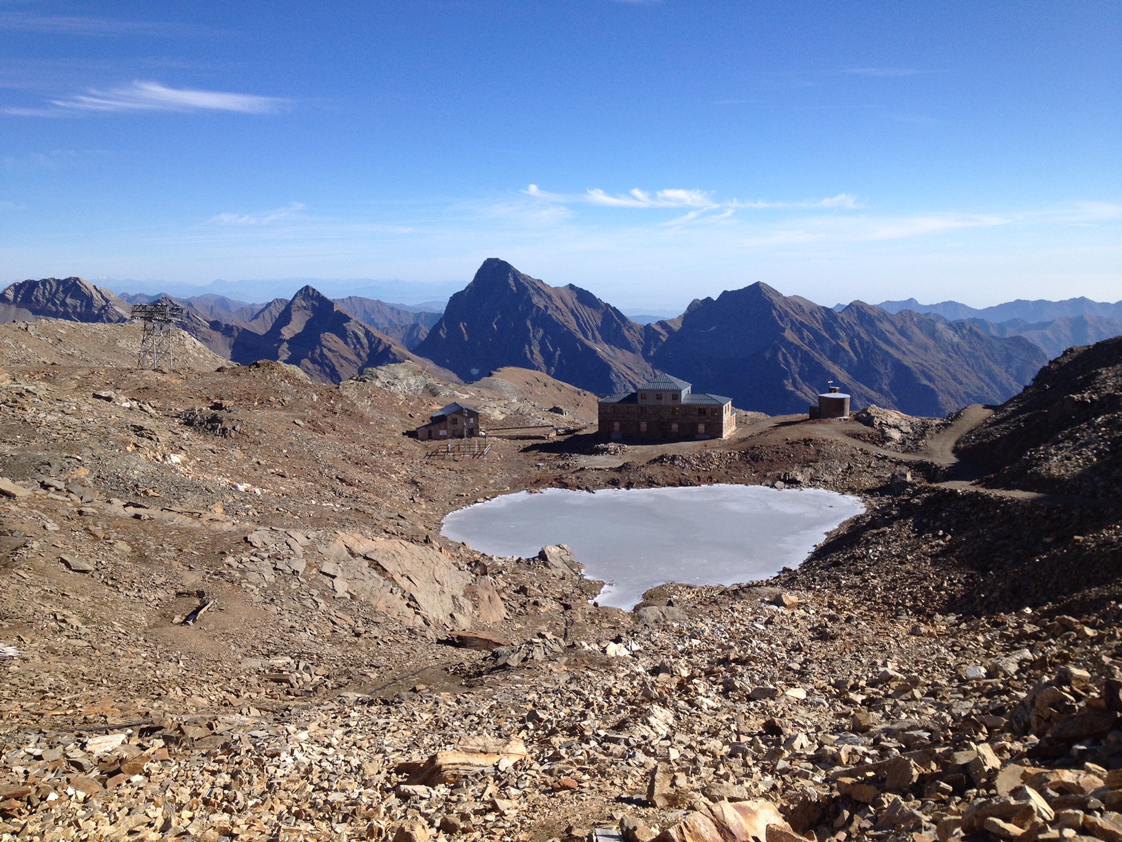
The "Istituto Scientifico Angelo Mosso" research site is located on the watershed between Piedmont and Valle d'Aosta (NW-Italy), in the Municipality of Alagna Valsesia (Monte Rosa massif). The Scientific Laboratories of the "Angelo Mosso Institute" at Col d’Olen (2901 m a.s.l.), the heart of this research site, were built between 1905 and 1907, when it became clear that the Capanna Regina Margherita on Monte Rosa (4554 m a.s.l.), as a high-elevation research centre, had become insufficient to the increasing number of requests for use by the international scientific community. From here the idea promoted by Angelo Mosso (1846-1910), professor of human physiology at the University of Turin, to add an additional structure to the Observatory of the Capanna Regina Margherita for make larger laboratories available to researchers and allow study stays at high elevation. This project soon became a reality thanks to the intervention of Queen Regina Margherita, Ministries of Education and Agriculture, the Italian Alpine Club and various personalities of the time. The research conducted at the Institute did not concern only human physiology, but also other disciplines, including alpine meteorology and glaciology, thanks also to the presence of the Meteorological Observatory that flanked the Institute, directed in the years 1925-40 by Umberto Monterin. It is now home to an automatic snow and weather station, managed by the Alpine Troops-Meteomont service. In addition to the University of Turin, the research groups that operate at the site and contribute to data collection and implementation are currently CNR-IRSA, Alpine Troops Command-Service Meteomont, Monterosa 2000 SpA and Monterosa SpA (Monterosa Ski), Protected areas of Valsesia, ARPA Piemonte, ARPA Valle d'Aosta and Sesia Val Grande Geopark. In addition to the valuable historical series of climate data, a series of research activities are devoted to the study of snow-soil-vegetation interactions, with particular reference to carbon dynamics e soil nitrogen (Magnani et al. 2017a,b; Freppaz et al. 2019). In addition, investigations are performed focusing on the chemical characteristics of high-elevation surface waters, fed by different cryospheric features such as rock glaciers, glaciers, and permafrost (Colombo et al. 2018a,b; 2019a,b; 2020; Vione et al., 2021). New research lines, aimed at investigating the most recent environmental challenges, have been added to the previous ones. For instance, investigations on sources and routes of atmospheric carbon and nitrogen species are ongoing. References: Colombo N. et al. (2018a), https://doi.org/10.1002/esp.4257. Colombo N. et al. (2018b), https://doi.org/10.1016/j.scitotenv.2018.05.098. Colombo N. et al. (2019a), https://doi.org/10.1016/j.scitotenv.2019.06.233. Colombo N. et al. (2019b), https://doi.org/10.1007/s00027-019-0670-z. Colombo N. et al. (2020), https://doi.org/10.1016/j.catena.2020.104700. Freppaz M. et al. (2019), https://doi.org/10.3897/natureconservation.34.30737. Magnani A. et al. (2017a), https://doi.org/10.1657/AAAR0016-037. Magnani A. et al. (2017b), https://doi.org/10.1016/j.catena.2017.03.007. Vione D. et al. (2021), https://doi.org/10.1016/j.scitotenv.2020.143464.
-
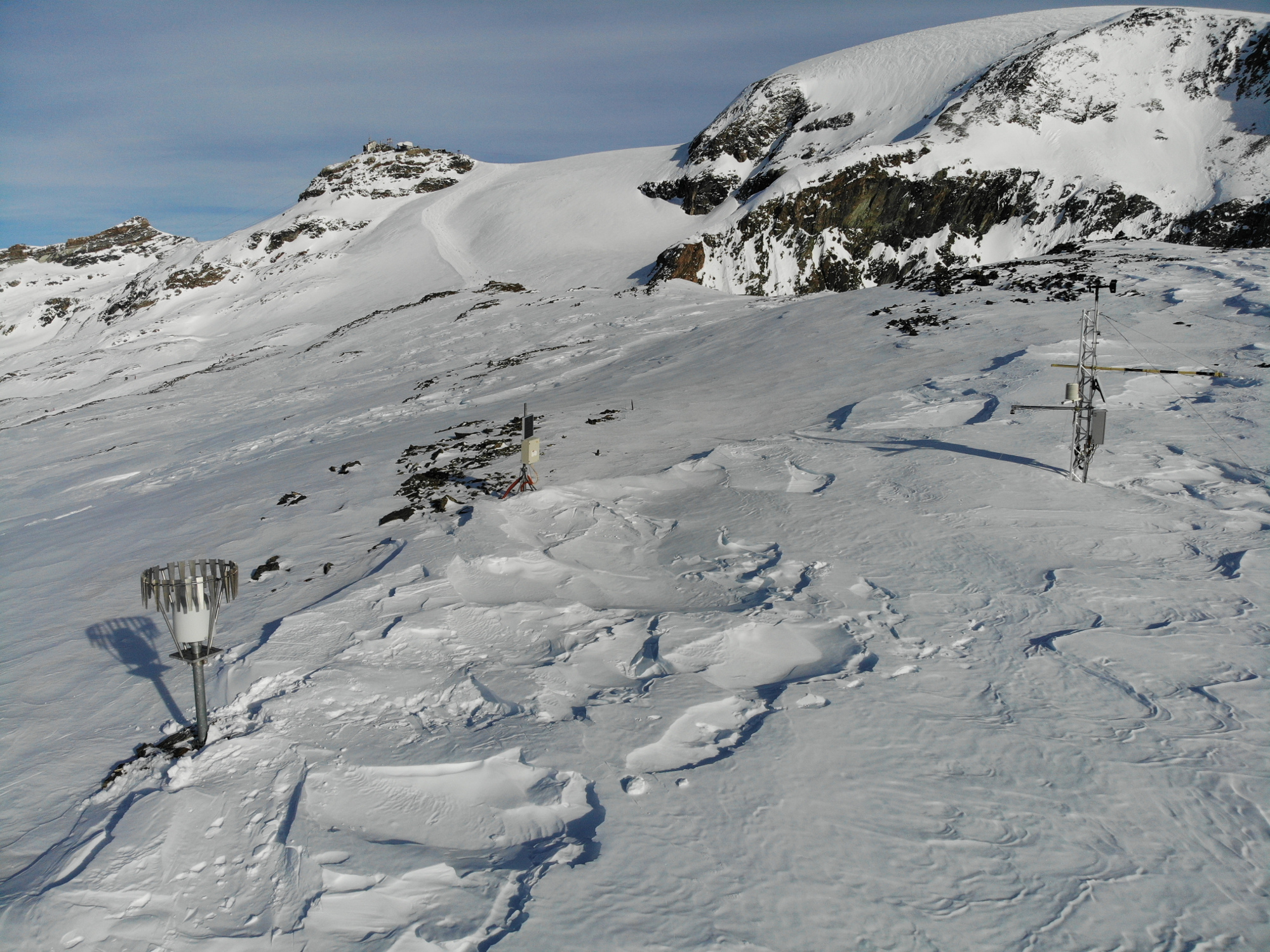
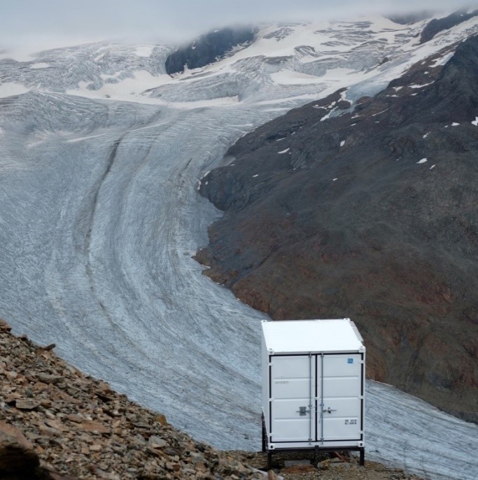
In the Rofental (Ötztal Alps) a consortium of the three institutions, and open to research partners worldwide, concentrates on studying and monitoring cryospheric, atmospheric and hydrological processes and changes with particular attention to the complex topography and climate settings of the Alpine terrain. First documents from glaciers in the Rofental, Ötztal Alps, date back as far as 1601 and regular observations and systematic studies had begun more than 150 years ago. First geodetic maps where generated in the late 19th century, first rain gauges were mounted in 1929 and glacier mass balance time series of Hintereis-, Vernagt- and Kesselwandferner are among the longest uninterrupted world-wide, building a basis for regional hydrological studies, for glacier-climate and ice dynamic research, and for estimating the world wide glacier’s contribution to sea level rise. By 2014, networks of stakes and pits for mass balance monitoring are maintained at Hochjoch-, Hintereis-, Kesselwand- and Vernagtferner by the consortium members. Runoff gauges at Vernagtferner and in Vent (operated by the Hydrological Office of Tyrol) and a network of rain gauges in the Rofental basin are the basis for high mountain hydrological studies. A varying number of automatic weather stations on and in the surroundings of the glaciers are operated by the Rofental consortium. The glaciers in the Rofental are frequently used as a test site for process studies, model development and evaluations and for new remote sensing or ground based methods in glaciological research. A series of airborne LIDAR derived high resolution DTMs of Hintereisferner and its surroundings are available since 2001. They are subject of ongoing evaluations and method comparison studies as well as for monitoring and studying periglacial morphodynamics. The generated data are available from the consortium partners, glaciological key results are annually reported to the World Glacier Monitoring Service (WGMS). A research station on Hintereisferner (with observer status in the Horizon 2020 INTERACT network) and one at Vernagtbach serve as logistic bases for fieldwork. In recent studies, socio-ecological research aspects – e.g. in relation with the use of water for energy production and tourism – comprise the natural scientific investigations.
-
The Climate-Ecological Observatory for Arctic Tundra (COAT) platform covers two sites in the Norwegian terrestrial arctic - low-arctic Varanger Peninsula and high-arctic Svalbard. Long-term monitoring and research on tundra ecosystems are conducted on these sites.
-

Tronchaney, Conca di Torgnon, (Torgnon, Aosta), + 388330 + 5075950; Aosta Valley
-
Umbrella site of Rofental - Austria, Obergurgl - Austria & GLORIA Master Site Schrankogel (AT-SCH), Stubaier Alpen - Austria