
soil albedo
Type of resources
Available actions
Topics
Keywords
Contact for the resource
Provided by
Years
Formats
Representation types
-
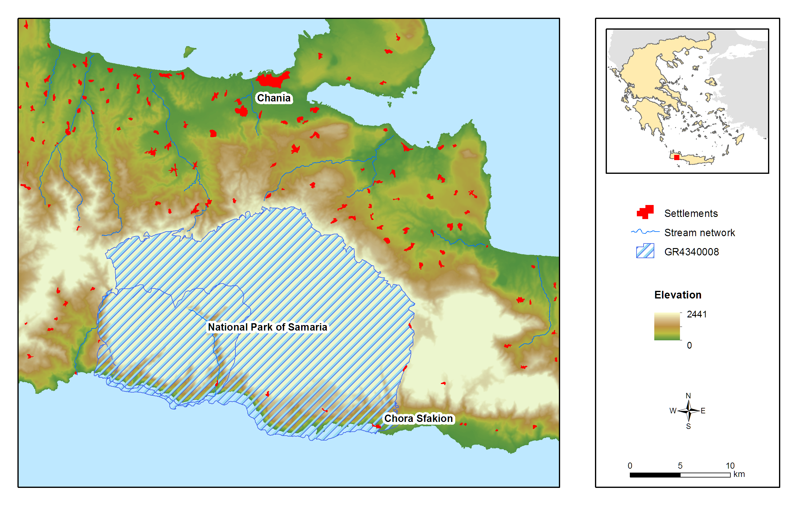
Samaria (White Mountains) National Park is located on the West part of island of Crete and was declared as a National Park via a Royal Decree in 1962. It is a muli-designated area and specifically a National Park, Landscape of Outstanding Beauty, Natura 2000 site coded GR 4340008 and GR4340014 and Biosphere Reserve in the framework of the “Man and Biosphere” Programme of UNESCO. It has been awarded with the European Diploma of Protected Areas of the Council of Europe. Also a hotspot for biodiversity and a place with a strong and important anthropogenic environment (history, special songs, traditions, etc.). It contains one of the largest gorges in the Balkans, Samaria Gorge, with a total length of 13 km while nine main gorges are located within the area of the White Mountains. These specific landscape configuration schemes sustain unique abiotic and biotic environmental characteristics, most of them unknown, because of the site’s wilderness and difficultness for direct scientific filed work. The specificity of the area can be easily identified in numbers: 58.454 ha, altitude ranging from 0-2.454m, more than 50 summits higher than 2000 meters a.s.l., 14 different types of habitats, approximately 40% of the entire extent of the county of Chania. Mean Annual Rainfall is between 600mm to 2000mm depending on the elevation. The entire area comprises one of the two main environmental lungs of Crete and a configuration leading to the current meteorological and hydrological conditions set in the western part of the island. President of the National Park is Dr. Petros Lymperakis, researcher from the Natural History Museum of Crete (lyberis@nhmc.uoc.gr). The National Park is characterized by a rich biodiversity, a high degree of endemism in fauna and flora, distinctive geological configurations and specific landscape features. Distinctive species of fauna found in the area are: the Cretan wild goat (Capra aegagrus cretica), the largest mammal of the island, the Cretan wildcat (Felis sylvestris cretensis) and a species of mouse (Acomys minous) which is considered to be rare. The rich avifauna of the area includes 69 species, with Gypaetus barbatus among others. The area houses 172 endemic species and subspecies, while 97 of them are endemic to Crete and 24 are specifically endemic (steno-endemic) to smaller areas. Some of the most distinctive species are: Cephalanthera cucullata, Nepeta sphaciotica, Bupleurum kakiskalae and Zelkova abelicea. The past 2 years a complete survey has begun in order to identify the Park’s central environmental characteristics. Nowadays, the monitoring system is comprised by: 1) Monitoring and surveillance of 15 terrestrial habitats and 34 species of flora. 2) Monitoring and surveillance of 256 species of avifauna. 3) Monitoring and surveillance of all possible species of fauna, including coastal and marine species. 4) Monitoring and surveillance of two marine habitats. 5) Recording of meteorological and hydrological conditions via four (4) meteo-stations located in the vicinity of the National Park and transmittance of data through the internet. The basic threats and pressures characterizing the site can be cumulated in: Α) Landscape fragmentation Β) Desertification induced by overgrazing and uncontrolled fires C) Modifications in water and groundwater regime induced by large scale infrastructures D) Poaching and uncontrolled abstraction of endemic species of flora E) Massive touristic flow and F) Relative medium and large-scale touristic infrastructures.
-
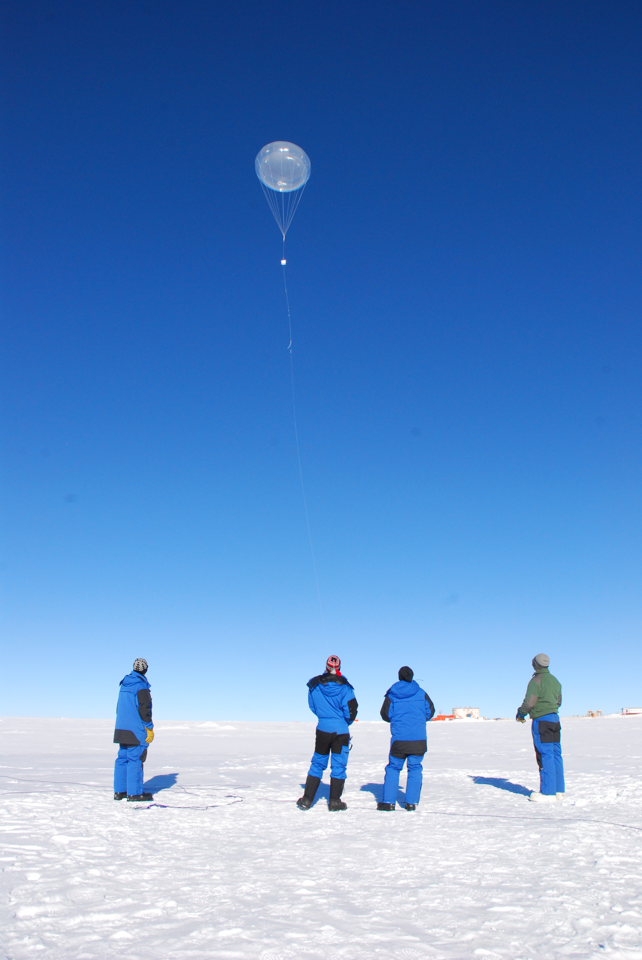
Concordia is a joint French-Italian research facility opened in 2005 on the Antarctic Plateau, Antarctica (-75.1, 123.33), managed together by PNRA (Italian National Antarctic Programme) and IPEV (Institut Polaire Francais Paul Emile Victor). It is built at 3,233 m above sea level on the third highest summit of Antarctica: Dome C.
-
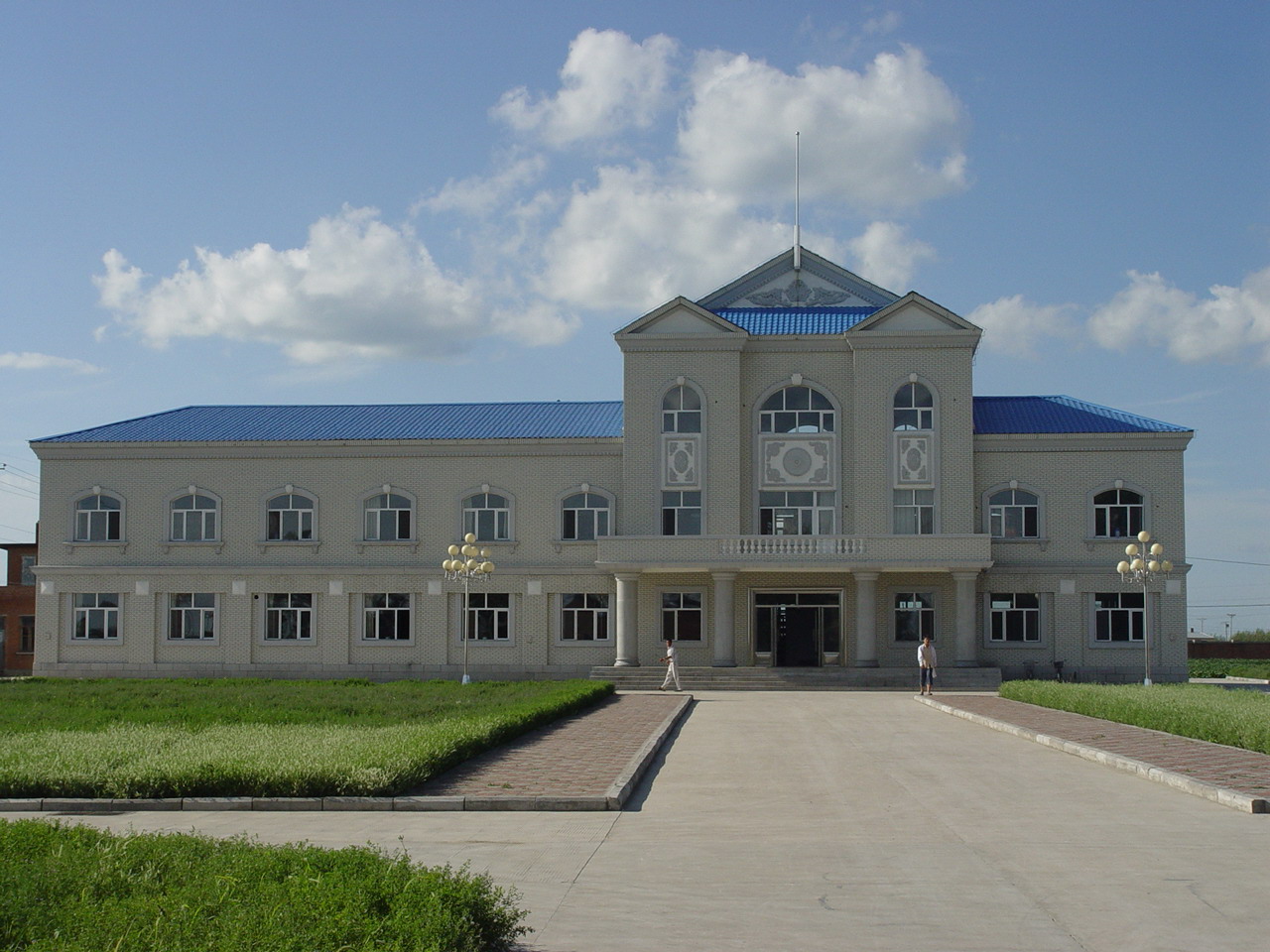
Hailun Agricultural Ecological Station located in Hailun city, Heilongjiang province, was established in 1978, briefly named Hailun Agro-ecosystem Station. The main research fields at that time were the optimal management of agriculture and advanced technology utilization in agricultural production. Chinese ecosystem research network(CERN) established in 1988 selected Hailun station as one of its components. The objective of Hailun station was to study the agro-ecosystem and sustainable development of agriculture in black soil zone in Northease China. Also, Hailun station was considered as one of components, when national field research net was built in 2005.
-
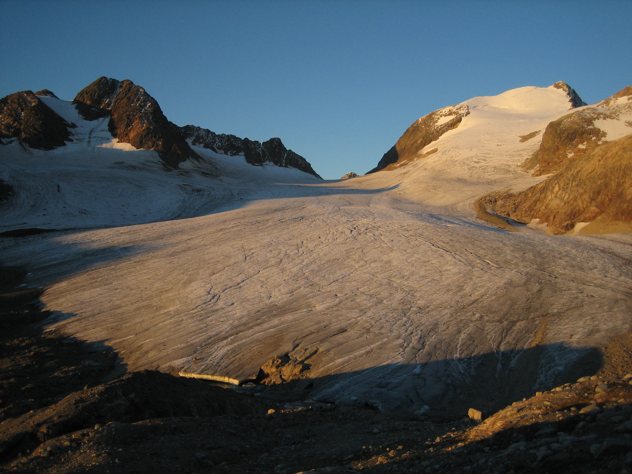
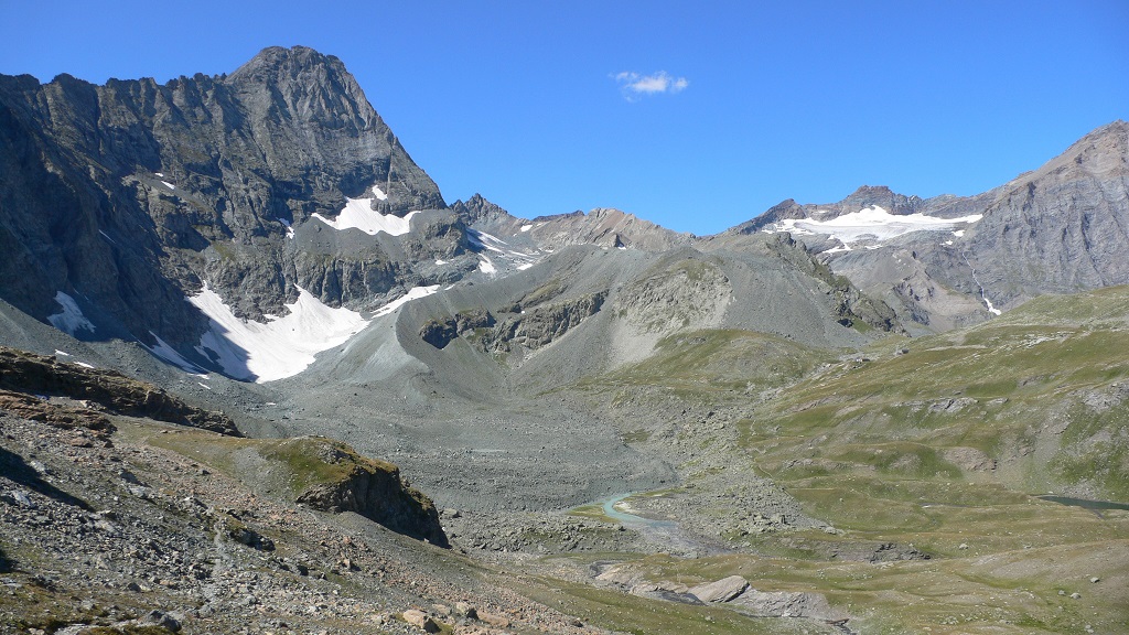
Saint-Sorlin glacier (SSO) is located in the Arvan valley, between 2700 and 3400 m altitude. The glacier is situated in the Grandes Rousses massif, and one of the glaciers with longest records of glacier mass balance worldwide. Data series are continuous and cover few decades (more than 50 years of mass balance measurements).This site is also characterized by the complete glaciological parameters performed annually to complete annual and seasonnal mass balance : ice velocity, ice thickness variation, snout position.In addition, meteorological observations complete the data base. 1 weather station, running since 2005, is located on the moraine, close to the snout of the glacier. SSO is a part of the French Glacier Observatory GLACIOCLIM/CRYOBS-CLIM.
-
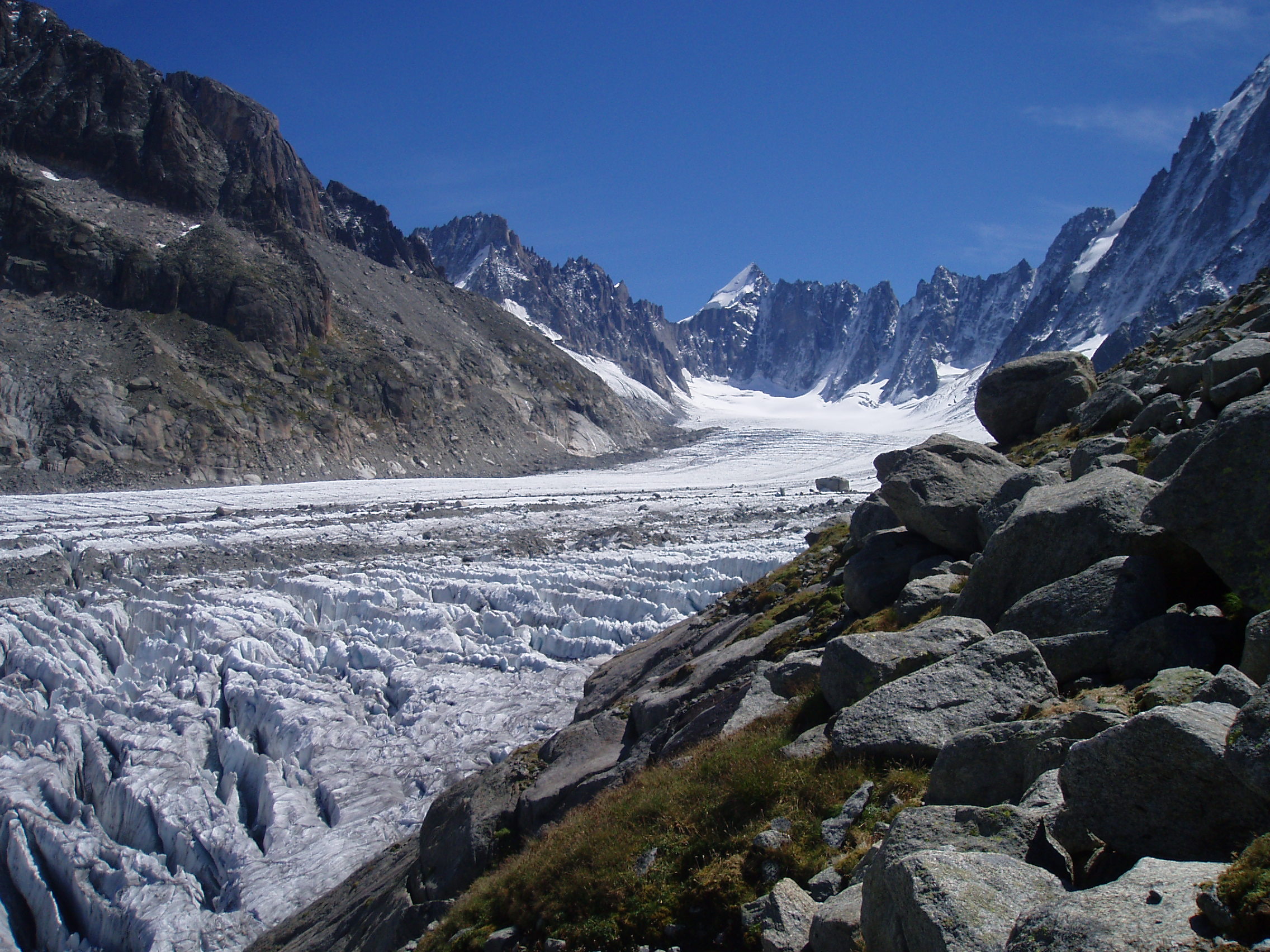
Argentiere glacier (ARG) is located in the Mont-Blanc valley (France), between 1500 and 3400 m altitude. The glacier is one of the glaciers with longest records of glacier mass balance worldwide. Data series are continuous and cover few decades.This site is also characterized by the complete glaciological parameters performed annually to complete annual and seasonnal mass balance : ice velocity, ice thickness variation, snout position.In addition, meteorological observations complete the data base. 1 weather station, running since 2006, is located on the moraine. ARG is a part of the French Glacier Observatory GLACIOCLIM/CRYOBS-CLIM.
-
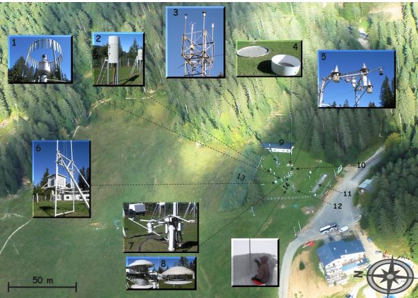
The Col de Porte pilot site is located near Grenoble, in the Chartreuse massif (elevation : 1325m, latitude : 45°30’N, longitude : 5°77’ E). At this mountain site located in a grassy meadow surrounded by a coniferous forest; all the measurements are located within an flat area of 50 × 50 m. Meteorological and snow parameters are recorded hourly since 1961. These parameters are : - Air temperature and relative humidity of air - Incoming and outcoming short and long-wave radiations - Wind speed and direction - Precipitation - Snow depth, snow water equivalent - Settlements and snow temperatures of the different layers of the snowpack Weekly snowpack profiles are also carried out, including major stratigraphic properties of snow (temperature, density, liquid water content, snow type). All sensors are located within a radius of a few tens of meters. (1) Geonor precipitation gauges (3 sensors) and OTT2 (1 sensor), (2) PG2000 heated and non-heated precipitation gauges, (3) windspeed measurements at the top of the 10 m meteorological mast and at the same level of the precipitation gauges, (4) lysimeters (2 sensors), (5) snow depth and surface temperature sensors and settling disks, (6) temperature and relative humidity of air sensors placed in the shelter, (7) Incoming and outcoming longwave and shortwave radiation sensors placed on the rotating arm, (8) close-up on the 4 components radiation sensors, (9) building (cold room, data acquisition, lab space), (10) cosmic rays counter for SWE measurements, (11) former experimental area for the study of road/snow interactions, (12) automatic snow and weather station Nivose for testing purposes (generally used in remote mountain areas), (13) forest area impacted by the cut in 1999, (14) snow pit area, Fore more information refer to : Morin, S., Lejeune, Y., Lesaffre, B., Panel, J.-M., Poncet, D., David, P., and Sudul, M.: An 18-yr long (1993-2011) snow and meteorological dataset from a mid-altitude mountain site (Col de Porte, France, 1325 m alt.) for driving and evaluating snowpack models, Earth Syst. Sci. Data, 4, 13-21, doi:10.5194/essd-4-13-2012, 2012
-
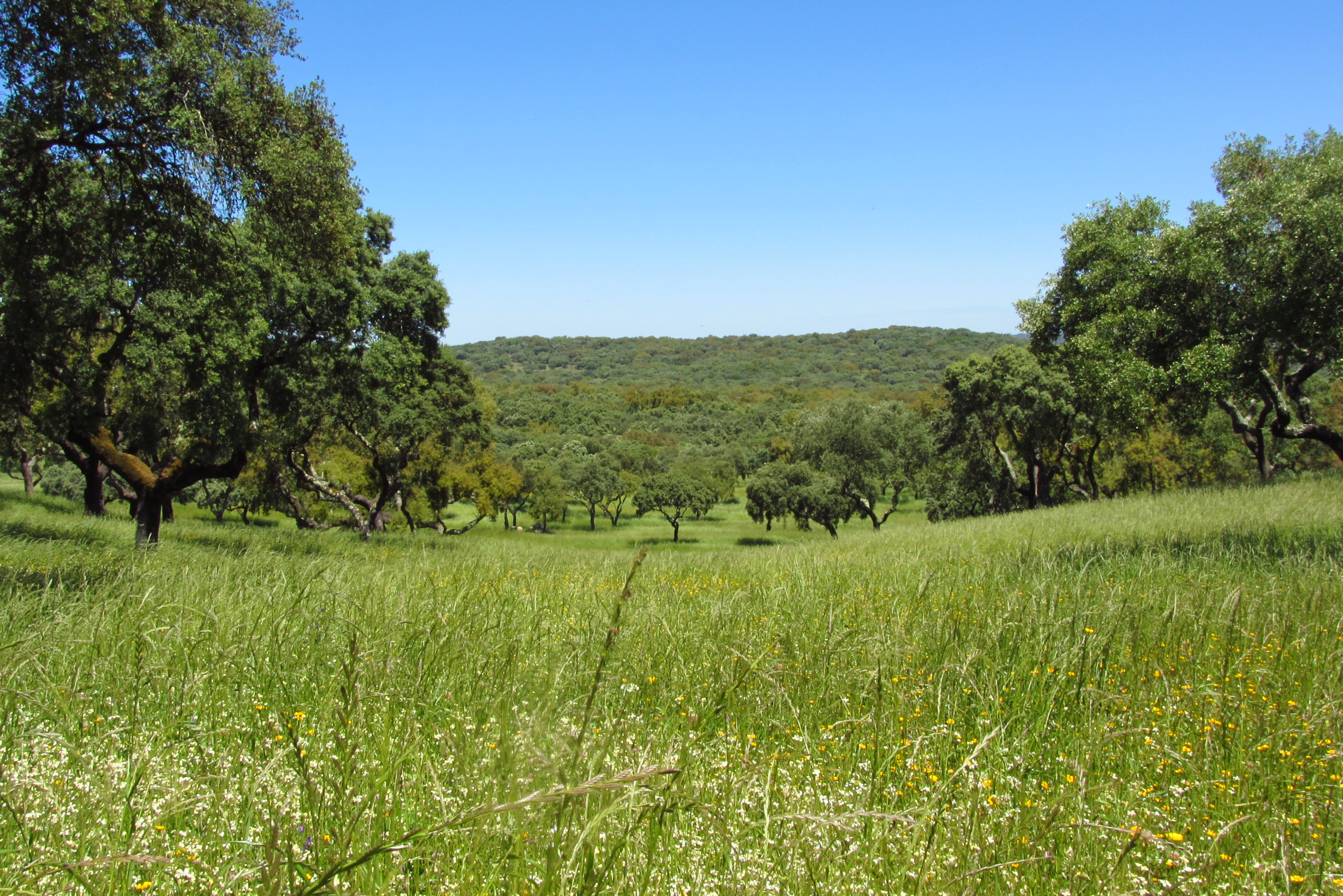
Montados (or dehesas in Spanish) are traditional agro-forestry systems with a savanna type structure, characteristic of the Mediterranean Basin. In Portugal, Montados are mainly distributed in the southern half of the country where the climate is Mediterranean. Annual average precipitation is 600 mm and mean annual temperature is 15ºC, although there is a large variation within the area of distribution of this system. Cork oaks (Quercus suber) and holm oaks (Q. rotundifolia) are the dominant trees, forming pure or mixed stands, with holm oak being dominant in drier regions. Montados with natural or semi-natural pasture and extensive grazing are listed under the EU Habitats Directive (habitat 6310), and are key habitats of Special Areas of Conservation (Habitats Directive) and of Special Protection Areas (Birds Directive), which are part of the Natura 2000 network. Their multifunctional management promotes structural diversity at the stand and landscape level, which combined to a large distribution area and spatial continuity results in high-levels of biodiversity. They are also High Natural Value farmlands that simultaneously fulfill the three criteria considered for their delimitation by the European Commission, since they are dominantly related to a high proportion of semi-natural vegetation, to a mosaic of low intensity agriculture and natural and structural elements and to the presence of rare species (e.g. Lynx pardinus and Aquila pennata). Cork is the most important forest product from Montado systems, with Portugal producing 54% of the world cork. In addition to cork (harvested every 9-12 years), animal production in pastures also provide a source of income. The regulation of water and nutrient cycles and of soil erosion, as well as carbon sequestration are important regulating services to be managed in Montados. From a cultural and recreational perspective, Montados are valued for the landscape aesthetics, natural values and cultural heritage. Strategic actions have been put in place to conciliate human use and biodiversity conservation, such as the publication of national regulations that legally protect the cork and holm oaks. But the most significant one might be forest certification, which has been promoting practices of responsible forest management in more than 70,000 ha of Montado, around 30% of the total certified Portuguese forest area.
-
The station has a arid moderate climate, with a annual temperature of 11.2 ℃ but higher in summer and lower in winter relative to areas with the same latitude. Due to dramatic temperature fluctuation in spring and autumn, frozen damage resulted from low temperature in spring and early cooling in autumn often occurs. The annual mean precipitation is as low as 45.7 mm, thus rivers are charged mainly by precipitation in mountains and snowmelt. Frozen-free day, sunshine duration and annual mean wind velocity are, respectively, 207 d, 2940 h and 2.4 m/s. Disaster weather includes dust storm in spring, hail and accidentally continuous high temperature in summer.Aksu station (E80°51′, N40°37′, 1028 m a.s.l.), found in 1982 and affiliated with Xinjiang Institute of Ecology and Geography, was listed in the top-5 stations for irrigation experiment in Xinjiang and became a member of special environment and disaster detection network, CAS in 2002. After development of years, it entered National Field Station Network and Chinese Ecosystem Research Network (CERN) in 2005. The station is located in the source area of Tarim River where its three headstreams (i.e., Aksu, Yeerqiang and Hetian River) converge, and the vastest oasis develops in Tarim Basin under the hyperarid environments. This area is typical of Tarim Basin for dramatic watercourse meandering and great agro-water consumption, thus forming a ideal experimental field for monitoring and researching water, salt and nutrient processes in oasis cropland system, as well as for exploring sustainable oasis agriculture, theory and technologic demonstration of water-saving irrigation.
-
The Bessanese high-elevation experimental site is located in the Western European Alps (Graian Alps, municipality of Balme, Italy). This site is representative of the glacial and periglacial environments of the Alps. In this site, glaciers have been the main morphogenetic agent: the head of the basin hosts a well-developed glacial cirque, while the LIA has left an imposing moraine on the left side of the glacier as an indelible mark in the landscape. Additional cryogenic and atmospheric processes, running waters and gravity have contributed to shape the study area. These latter processes are becoming more and more important, compared to glacier shaping, in the present context of climate change, which led to an impressive-areal and volume reduction of the glacier. Most of the area once occupied by the glacier is now covered with debris which, in many cases, is ice-cored, or contains ice lenses. Downstream of the main lake of the basin, located at an elevation of about 2580 m, the debris forms a large and characteristic rock glacier. Among gravitative processes, rockfalls are particularly common and relevant from the hazard point of view in the study area. dataset available on Pangaea repository: 1. Nigrelli, Guido; Chiarle, Marta; Merlone, Andrea; Coppa, Graziano; Musacchio, Chiara (2022) – Rock temperature variability in the alpine cryosphere. Pangaea Data Publisher for Earth & Environmental Science, https://doi.pangaea.de/10.1594/PANGAEA.950246 2. Nigrelli, Guido; Barbero, Secondo; Chiarle, Marta (2021) – Solar radiation at the Bessanese high-elevation experimental site (Italy). Pangaea Data Publisher for Earth & Environmental Science, https://doi.org/10.1594/PANGAEA.930679 3. Nigrelli, Guido; Chiarle, Marta; Merlone, Andrea; Coppa, Graziano; Musacchio, Chiara (2018) – Rock and debris temperature in the alpine cryosphere. Pangaea Data Publisher for Earth & Environmental Science, https://doi.org/10.1594/PANGAEA.894317
-
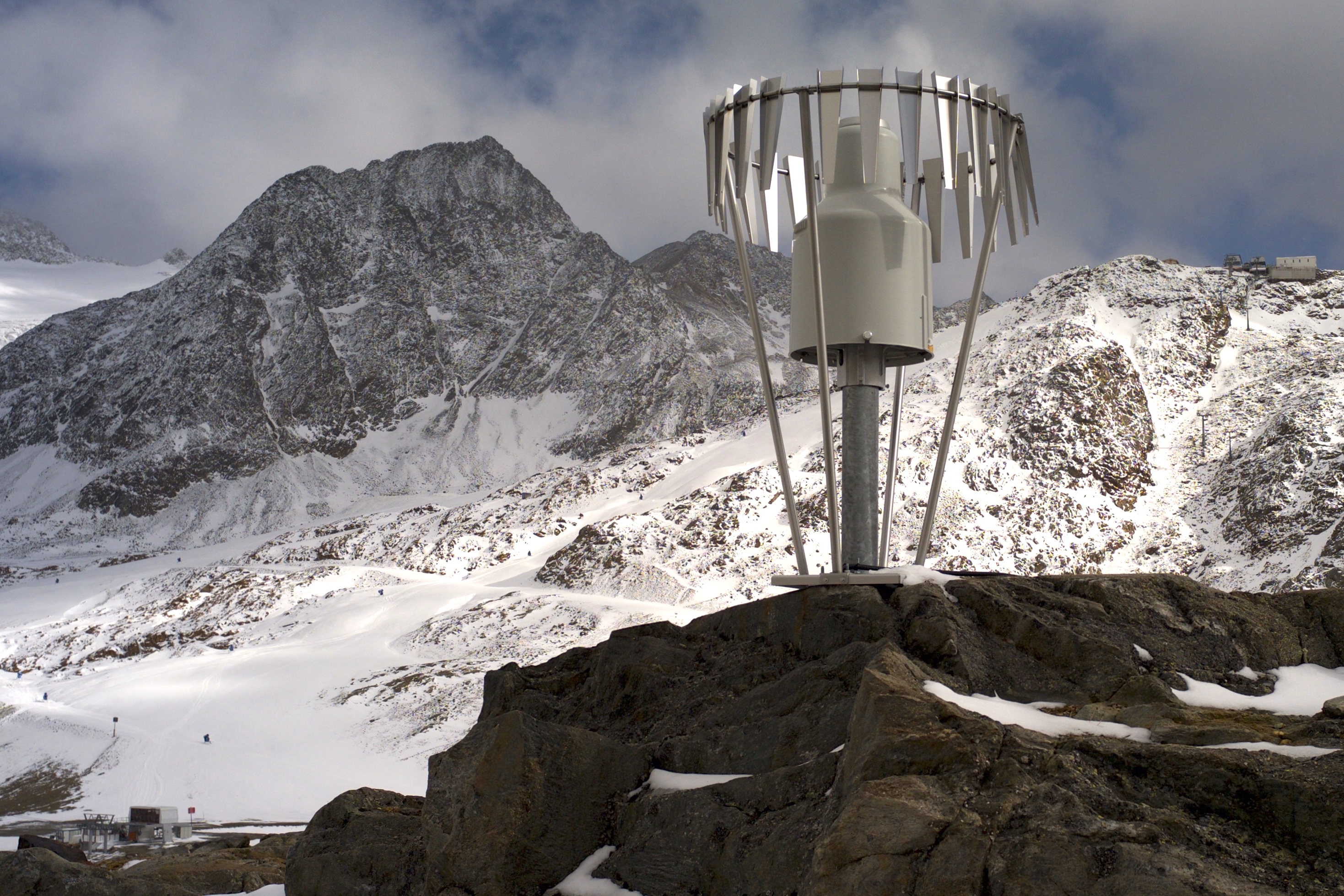
In the Rofental (Ötztal Alps) a consortium of the three institutions, and open to research partners worldwide, concentrates on studying and monitoring cryospheric, atmospheric and hydrological processes and changes with particular attention to the complex topography and climate settings of the Alpine terrain. First documents from glaciers in the Rofental, Ötztal Alps, date back as far as 1601 and regular observations and systematic studies had begun more than 150 years ago. First geodetic maps where generated in the late 19th century, first rain gauges were mounted in 1929 and glacier mass balance time series of Hintereis-, Vernagt- and Kesselwandferner are among the longest uninterrupted world-wide, building a basis for regional hydrological studies, for glacier-climate and ice dynamic research, and for estimating the world wide glacier’s contribution to sea level rise. By 2014, networks of stakes and pits for mass balance monitoring are maintained at Hochjoch-, Hintereis-, Kesselwand- and Vernagtferner by the consortium members. Runoff gauges at Vernagtferner and in Vent (operated by the Hydrological Office of Tyrol) and a network of rain gauges in the Rofental basin are the basis for high mountain hydrological studies. A varying number of automatic weather stations on and in the surroundings of the glaciers are operated by the Rofental consortium. The glaciers in the Rofental are frequently used as a test site for process studies, model development and evaluations and for new remote sensing or ground based methods in glaciological research. A series of airborne LIDAR derived high resolution DTMs of Hintereisferner and its surroundings are available since 2001. They are subject of ongoing evaluations and method comparison studies as well as for monitoring and studying periglacial morphodynamics. The generated data are available from the consortium partners, glaciological key results are annually reported to the World Glacier Monitoring Service (WGMS). A research station on Hintereisferner (with observer status in the Horizon 2020 INTERACT network) and one at Vernagtbach serve as logistic bases for fieldwork. In recent studies, socio-ecological research aspects – e.g. in relation with the use of water for energy production and tourism – comprise the natural scientific investigations.