
soil bulk density
Type of resources
Available actions
Topics
Keywords
Contact for the resource
Provided by
Years
Formats
Representation types
-
Bulk density data of the Gesäuse-Johnsbachtal site.
-
Solid soil chemistry data of the LTER station Zöbelboden from the year 1992
-
Solid soil chemistry data of the LTER station Zöbelboden from the year 2004
-
Solid soil chemistry data of the LTER station Zöbelboden from the year 2014
-
Solid soil chemistry data of the LTER station Zöbelboden from the year 2008
-
LTER Zöbelboden Station Data includes habitat type, parent material, topographical variables, physical and hydrological soil properties, epiphytic lichen host trees, etc. The STATION codes refer to https://deims.org/dataset/956b3718-53fe-4e00-9455-c4132b1195c7; See also the methods section for detail
-
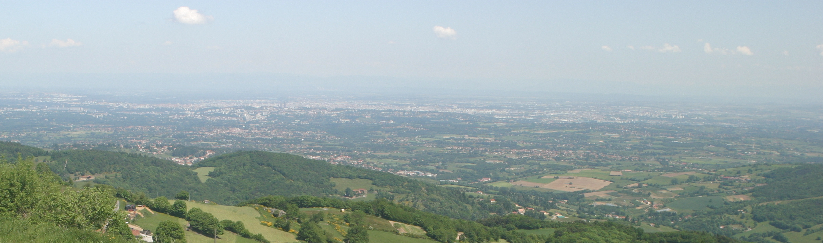
The Yzeron catchment (150 km2) is located to the south-west of Lyon city, France. It forms part of the Observatoire de Terrain en Hydrologie Urbaine (OTHU, 2011) long term observatory. It is representative of French periurban areas and is characterised by a marked topography. The outlet reaches the Rhône river at the elevation of 162 meters and the highest point culminates at 917 m above see level. The slope map calculated from a 25 m resolution Digital Elevation Model (DEM), derived from IGN BDTopo® shows that more than 50% of the catchment has slopes larger than 10%. The geology is contrasted with crystalline formations (granite, gneiss ) in the western part of the catchment and more alluvial and glaciar formations in the eastern part. The land use is heterogeneous. The upstream and western part of the basin is limited by a range of hills covered with forests. The intermediate part is mainly covered with grassland and cultivated lands, mixed with urban nucleus. Thin green corridors remain along rivers, covered with deciduous trees. The downstream part is mainly covered with densely urbanized areas. A fast progression of urbanisation is observed since the eighties. The area is prone to sharp Mediterranean-type flood events due to its steep topography in the upstream part and limited soil water storage capacity overall. The water coming from combined sewer overflow devices is rich of sediments and pollutions, causing quality problems in the rivers, especially during summer storms, where most of the water reaching the river comes from urbanised areas via SODs. Increased erosion of the river banks has also been evidenced with impact on the ecosystems. The catchment is instrumented since 1997 in particular in two sub-catchments with different land uses (Mercier: agriculture and forest) and Chaudanne (agriculture and urban) with rainfall and discharge data. Some information about physico-chemical characteristics are also available.
-

Huai Ma Nai is a small agricultural catchment (93 ha) of northern Thailand, 60 km from the city of Phrae, in a sloping land environment. The objective is to the impacts of land use changes, from mung bean and soya bean to maize, upon hydrological and sedimentary budgets. Agricultural practices are very intensive, based on high quantities of fertilizers, herbicides and pesticides, and mechanized cultivation. The mean slope is 12.9%%. Soils are thin Alfisols and Ultisols with sandy clay loam to clayey texture, high coarse fragment content, low pH, high bulk density and low-medium cation exchange capacity. Monitoring devices include an automatic meteorological station since 2001, and weirs and flume to monitor discharge from nested catchments, suspended sediment and bedload. More information is available on https://mtropics.obs-mip.fr/ and in the following paper: Valentin, C., et al., 2008. Runoff and sediment losses from 27 upland catchments in Southeast Asia: Impact of rapid land use changes and conservation practices. Agric. Ecosyst. Environ. 128, 225–238. https://doi.org/10.1016/j.agee.2008.06.004
-
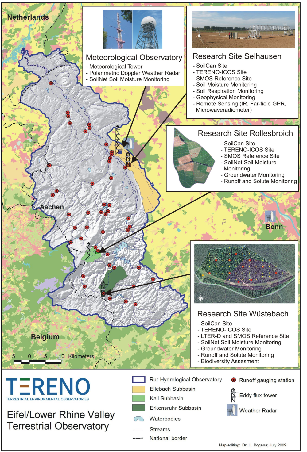
The central monitoring site of the Eifel/Lower Rhine Valley Observatory is the catchment area of the River Rur. It covers a total area of 2354 km² and exhibits a distinct land use gradient: The lowland region in the northern part is characterised by urbanisation and intensive agriculture whereas the low mountain range in the southern part is sparsely populated and includes several drinking water reservoirs. Furthermore, the Eifel National Park is situated in the southern part of the Rur catchment serving as a reference site. Intensive test sites are placed along a transect across the Rur catchments in representative land cover, soil, and geologic settings: In order to obtain spatially distributed information about river discharge rates, the Rur catchment is partitioned into a nested set of sub-catchments that will span distinct assemblages of hydrologic features and several orders of magnitude in drainage area. More detailed measurements and characterisation of smaller, focal catchments are embedded within progressively larger catchments, allowing the critical evaluation and development of scaling strategies. Additionally, for the analysis of the groundwater flow system and groundwater exchange rates on a regional scale, the monitoring of natural tracers of ground and surface waters will be carried out.
-
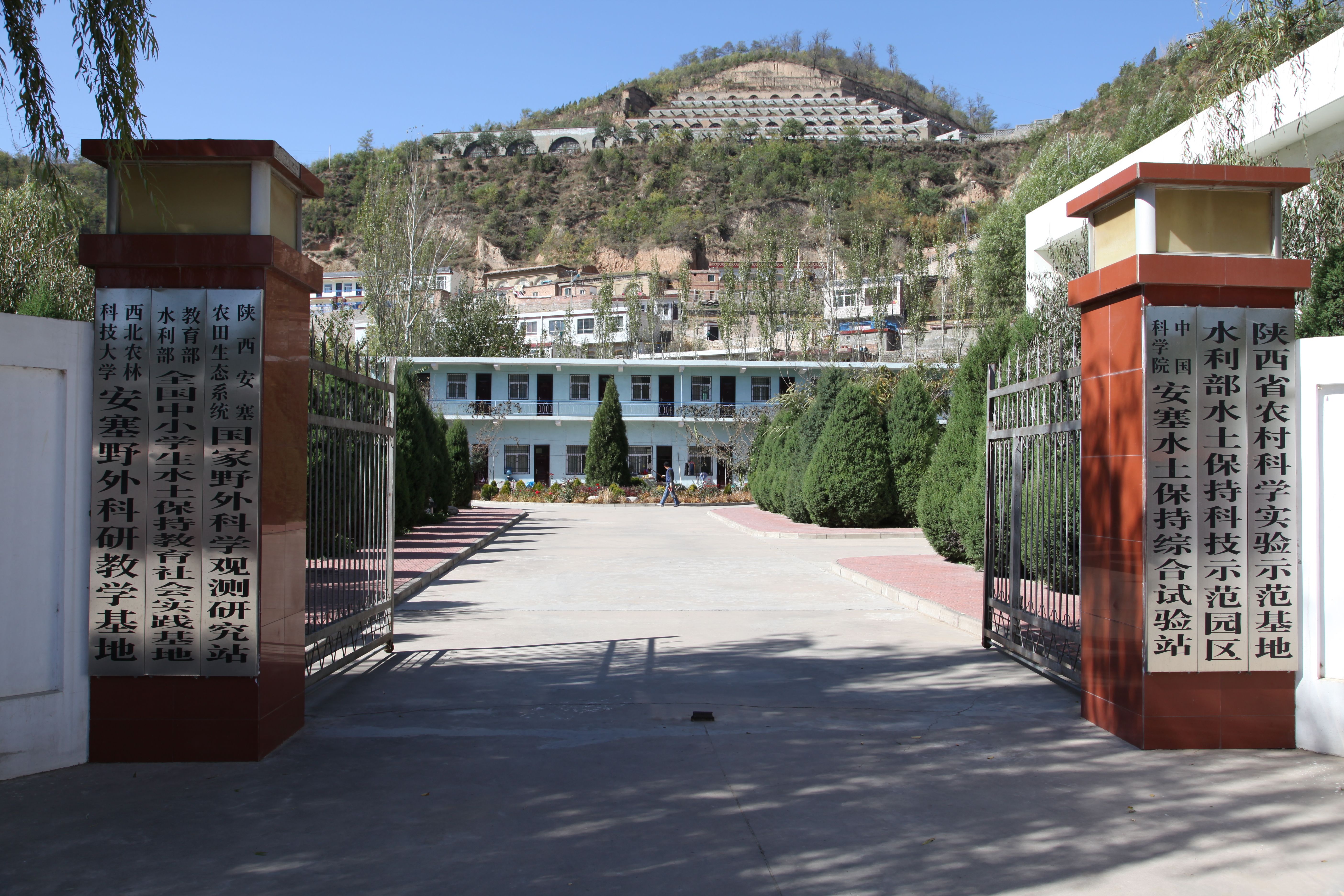
Ansai Integrated Experimental Station on Water and Soil Conservation is a part of Chinese Ecosystem Research Network, which located in the typical loess hilly and gully region and situates near the center of the Loess Plateau in the Shaanxi Province. The loess-derived soils are fertile but extremely susceptible to erosion. Soil erosion in the study area is much higher than that in the southern part of the Loess Plateau. The climate belongs to transition zone of warm temperate semi-humid to semi-arid, which is dry and windy in spring, hot and rainy in summer, and dry and cold in winter. The mean annual temperature is 8.8 °C. The minimum and maximum temperatures are −23.6 °C in February and 36.8 °C in July. The frost-free period is 157 days. The mean annual precipitation is 505 mm, 70% of which falls between July and September in the form of short heavy storm. The soil is silt loam with the contents of sand, silt, and clay being 24%, 65%, and 11%. Ansai station mainly focus on vegetation rehabilitation, monitoring and assessment of rehabilitation, and monitoring in watershed.