
soil carbon dioxide flux
Type of resources
Available actions
Topics
Keywords
Contact for the resource
Provided by
Years
Formats
Representation types
-
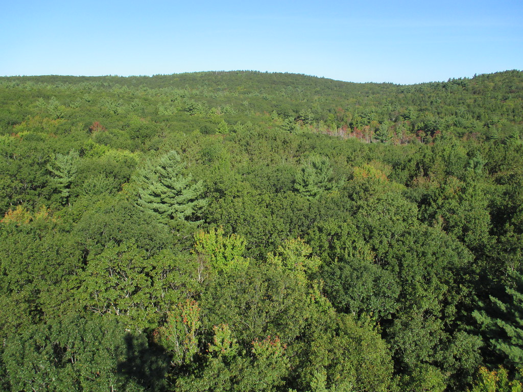
Harvard Forest is a core site in Domain 01: Northeast. Located 73 miles from Boston in Petersham, Massachusetts The Harvard Forest site is spread across 49 km2 of land and is the core NEON site for the Northeast region. Representative habitats at Harvard Forest include northern, transition, and central forests; marshes, swamps, and conifer-dominated bogs; and forest plantations. NEON's meteorological/flux tower and tower sampling plots are located on land owned by Harvard Forest - Harvard University, LTER an forest with a rich history of scientific research. The distributed sampling plots are located along the edge of the Quabbin reservoir which is managed by the Massachusetts Department of Conservation and Recreation, Division of Water Supply Protection. For access to the area along the Quabbin, visitors must be accompanied by a NEON project employee. Total data products collected at this site is 119.
-
The NEON site at the Oak Ridge National Laboratory (ORNL) is a 138.1-km^2 core terrestrial field site located in the Cumberland Plateau within Anderson and Roane Counties, TN. It is encompassed within NEON's Appalachians and Cumberland Plateau Domain 7, which includes the worlds longest expanse of hardwood-forested plateau. This domain is home to some of North America's greatest diversity of fish, mollusk, and wildflower species. ORNL is managed by a combination of the Department of Energy (DOE) and Tennessee Wildlife Resources Agency (TWRA). The Domain hosts four other NEON field sites, two aquatic and two terrestrial, three of which are located in Tennessee. Remote sensing surveys of this field site collect lidar, spectrometer and high-resolution RGB camera data. The flux/meteorological tower at this site is 127 with 6 measurement levels. The tower top extends above the vegetation canopy to allow sensors mounted at the top and along the tower to capture the full profile of atmospheric conditions from the top of the vegetation canopy to the ground. The tower collects physical and chemical properties of atmosphere-related processes, such as humidity, wind, and net ecosystem gas exchange. Precipitation data are collected by a tipping bucket at the top of the tower and a series of throughfalls located in the soil array. This site has five soil plots placed in an array within the airshed of the flux tower. Field ecologists collect the following types of observational data at this site: Terrestrial organisms (birds, ground beetles, mosquitoes, plants, small mammals, soil microbes, ticks), Biogeochemical data, and soil data. Total data products planned for this site: 119
-
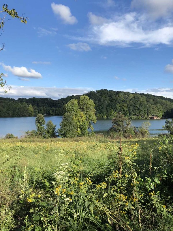
McDiffett Creek (MCDI) is located within the Urban Prairie Research Area approximately 25 km southeast of the KONZ tower. [2] It is a second-order perennial stream flowing through the middle of agricultural land. The Urban Prairie Research Area is a small tract of land composed of native prairie, grazing, hay, and historically cultivated fields. It is managed by the Konza Prairie Biological Station in association with Kansas State University and is located in the Flint Hills region of Kansas just 10km south of Manhattan, KS. The MCDI site is encompassed in the NEON Prairie Peninsula Domain, which includes the largest remaining areas of unplowed tallgrass prairie in North America. The Prairie Peninsula domain consists of grasslands, forests, and agricultural cover types. The Domain hosts four other NEON field sites, one other aquatic and three terrestrial, all of which are located in Kansas. Remote sensing surveys of this site collect lidar, spectrometer and high resolution RGB camera data. This site has one meteorological station located in the riparian area. The met station is outfitted with a subset of the same sensors used at terrestrial sites. Measurements include wind speed and direction, air temperature, barometric pressure, relative humidity, shortwave radiation, and PAR. This site has one phenocam near the stream. This site has one upstream sensor station and one downstream sensor station. Measurements include PAR, temperature, water quality [specific conductivity, chlorophyll a, dissolved oxygen content, pH, turbidity, and fluorescent dissolved organic matter (only downstream)], and nitrate is measured at the downstream station. Eight groundwater wells throughout the site collect specific conductivity, water tempertaure, and elevation of groundwater.Field ecologists collect the following types of observational data at this site: aquatic organisms (Aquatic Microbes (surface water),macroinvertebrates microalgae, plants and macroalgae, zooplankton. Biogeochemical data on plants,sediment water and particulates.As well as physical aquatic data on bathymetric maps, stage,secchi depth and depth profiles, and riparian assessment. Total data products planned for this site: 79
-
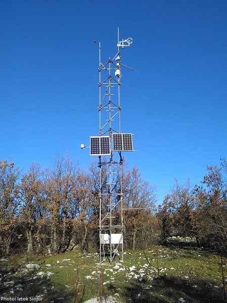
CARBON FLUXES IN TWO SUCCESSIONAL STAGES OF VEGETATION IN THE PODGORSKI KRAS. Research site represents karst grassland and different stages of secondary succession, occasionally affected from forest fires. It is located on karst plateau close to Podgorje village in the sub-mediterranean region of south-west Slovenia. The site is equipped with two Eddy Covariance towers which measure the carbon fluxes in two successional stages of vegetation. The area has undergone major human influences due to its position at the transition between the Mediterranean and central Europe. In fact, agricultural practices, such as overgrazing in the past centuries, led to pronounced destruction of the vegetation cover, causing severe soil erosion and resulting into a stony and bare landscape. However a succession is taking place and different vegetation types, ranging from grasslands to secondary oak forests, are now present. The bedrock is mainly composed of Paleocene and Eocene limestone. The chemical weathering known as karst phenomena led to the formation of Leptosols and Cambisols, which represent insoluble fractions of carbonates. As a result, the soil is superficial, with depths ranging from 0 cm to several decimeters in soil pockets between rocks. The organic matter represents about 12–15% of the topsoil. The climate is referred to as sub-mediterranean, with a mean annual temperature of 10.5 °C, a mean daily temperature of 1.8 °C and 19.9 °C in January and June respectively, and an average annual precipitation around 1370 mm. The growing season ranges from March or April to October.
-
Skogaryd is designed and state of the art equipped for interdisciplinary landscape and atmospheric studies that encompasses the complete catchment from a pristine bog via streams, riparian zones and forests to lakes, as well as the subsequent exchange between the atmosphere and surface waters The station also elucidating Greenhouse Gas (GHG) emissions from drained organic forest soils and are used for testing ecosystem models. The terrestrial sites at Skogaryd measure GHG emissions with eddy covariance (EC), CO2, H2O and N2O/CH4 (site dependent) and abiotic/biotic variables. They also have automatic stream station (flow, DIC/DOC etc.) and will be equipped with cameras/spectrometers for phenological studies and satellite ground truth validation. The forest sites are equipped for below ground studies; suction/gas probes, fine root production, Mycorrhiza, sap flow, above litter fall, tree production etc. At the lake CO2, H2O and CH4 are measured with EC. Abiotic and weather data are monitored. The sites have electric power, internet connection, boardwalks, bridges or boats. They have capacity for chamber/profile studies and process studies.
-
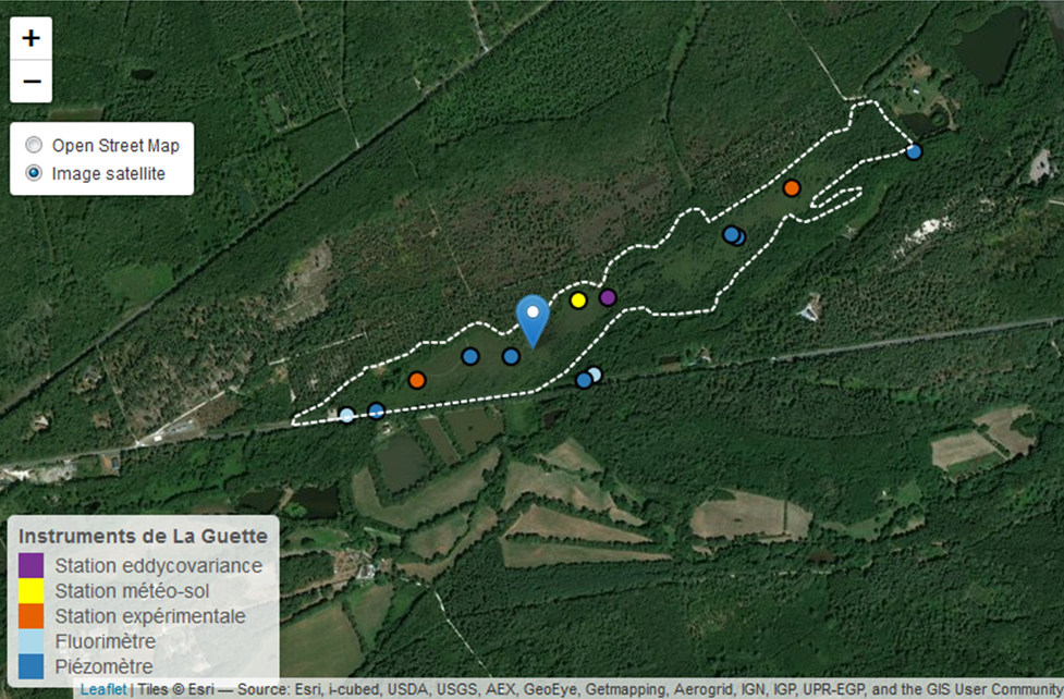
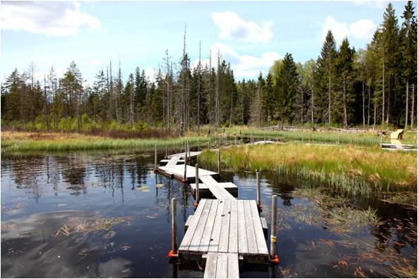
This is a peatland located in Sologne, 80 km south of Orléans. La Guette peatland is one of the four sites of the SNO Tourbières (CNRS). All the sites of the SNO Tourbières are part of OZCAR (French Observatory on the critical zone). The site was hydrologicaly disturbed. Restoration works took place in 2014. A labeling procedure has began to become associated site of ICOS.
-
The Hohes Holz is a mixed beech forest, with an intensive research site with respect to carbon and water cycle at the northern border of the Bode catchment close to Magdeburg, Germany. It is certified as class 1 ecosystem station in ICOS.
-
The LWF research programme provides, on the one hand, long-term data series from the last 20 years, together with a scientific interpretation to national and international policy makers. On the other hand, the available data and latest LWF infrastructure provide an attractive scientific platform for collaboration with both national and international partners. The site is located close to the city of Davos in the canton of Graubuenden, within a natural, coniferous forest stand which mainly consists of 200-390 year-old spruce (Picea abies) trees. Among others, the site is equipped with two meteorological measurement stations; one is located within the forest stand, the second is co-located in the nearby open-field, allowing to measure the forest stand effect on micro-climate. The following parameters are being measured (starting-end year): Atmospheric deposition (throughfall and bulk deposition) (2009-today), Circular vegetation plots (2008-today), Crown Condition Assessment (2006-today), Diameter and Height measurements (2004-today), EC-5 soil water content measurement (2008-today), EC-5 soil water content measurement (2008-today), Foliar analyses (2007-today), Leaf area index (LAI) (2008-today), Litterfall (2009-today), Manual circumference band measurement (2006-today), Matric potential (manual suction cups) (2009-today), O3 Injuries (2009-today), Ozone visible injury assessment (2009-today), Permanent vegetation quadrats (2008-today), Phenological observations (2009-today), Sapflow measurements (1998-today), Soil matrix chemistry (2007-today), Soil solution chemistry (lysimeters) (2010-today), Tree core sampling (), automated point dendrometer measurements (1998-today), automatic circumference band measurement (2006-today), Deadwood sampling (2009-today).
-
Oulanka Research Station is part of the Infrastructure Platform and is situated in Kuusamo as a regional unit of the University of Oulu. The station is located in the Oulanka river valley within the Oulanka National Park (66°22'N, 29°19'E). The area lies within the boreal coniferous forest-zone (Taiga), where Norway spruce and Scots pine prevail. In the Oulanka river valley there are, also many alluvial meadows, stream mouths and crags supporting luxurious plant communities. The bedrock is calcium-rich in places. Bogs, fens and marshes as well as numerous springs, ponds and lakes, brooks and rivers characterize the landscapes. All these factors together create a diverse and exceptional rich environment with rich flora and fauna.In terms of temperature Oulanka has a continental climate. The coldest and warmest ever measured temperatures are -48.0°C and 32.1°C. The difference between the mean temperature of coldest (January, -15°C) and the warmest (July, 15°C) month is 30°C. The mean temperature for the whole year is c. -0.5°C (1967-2009).
-
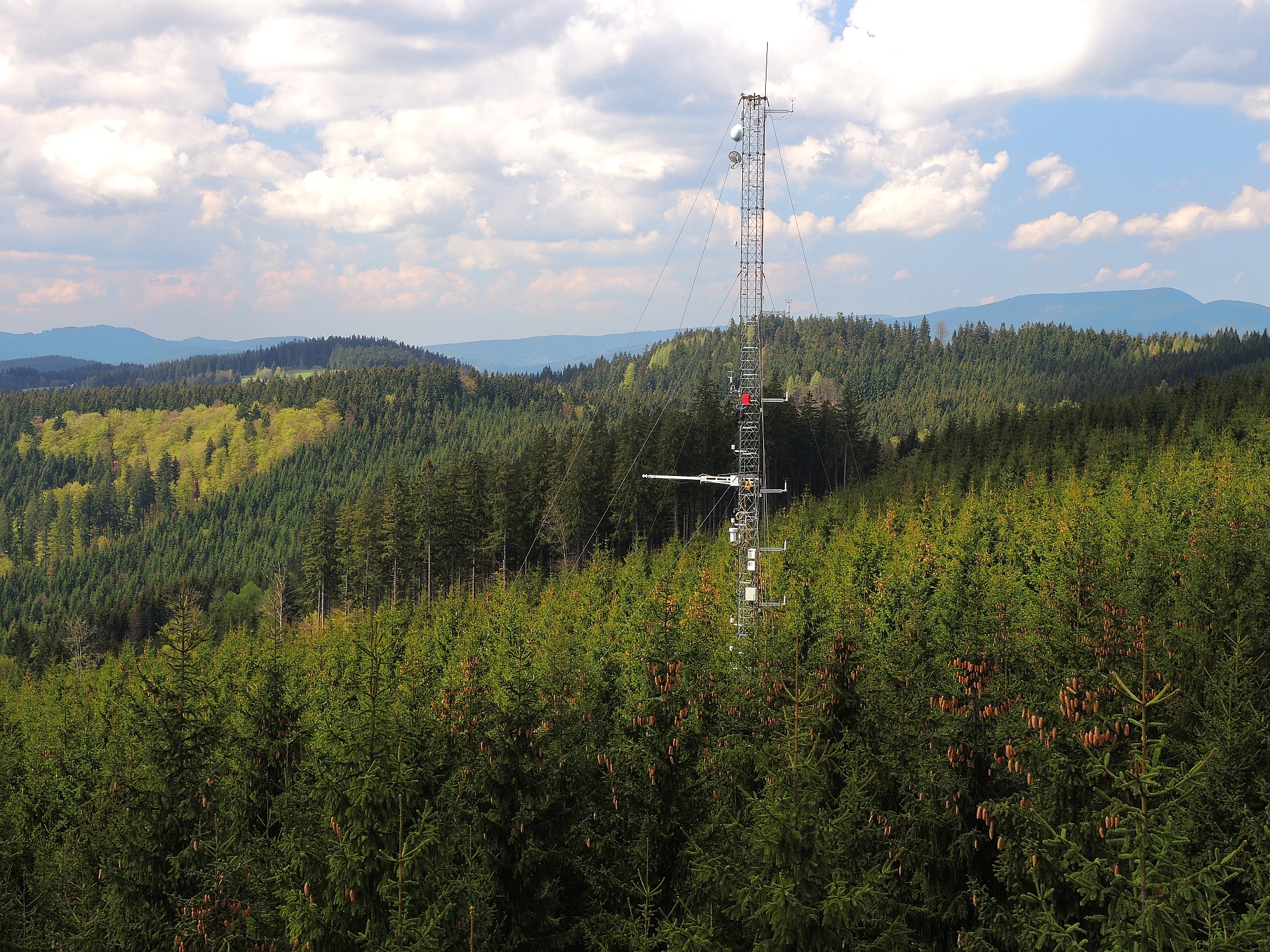
The site Bily Kriz (Bílý Kříž) is located in Moravian-Silesian Beskids Mountains. Ecosystem type: Managed secondary pure Norway spruce stand. Prevailing species: Norway spruce (Picea abies [L.] Karst.) Height of the stand: 17 m (2016) Understory: Vaccinium myrtillus L. Year of plantation: 1981 by 4 years old seedlings