
soil depth
Type of resources
Available actions
Topics
Keywords
Contact for the resource
Provided by
Years
Formats
Representation types
-
None
-
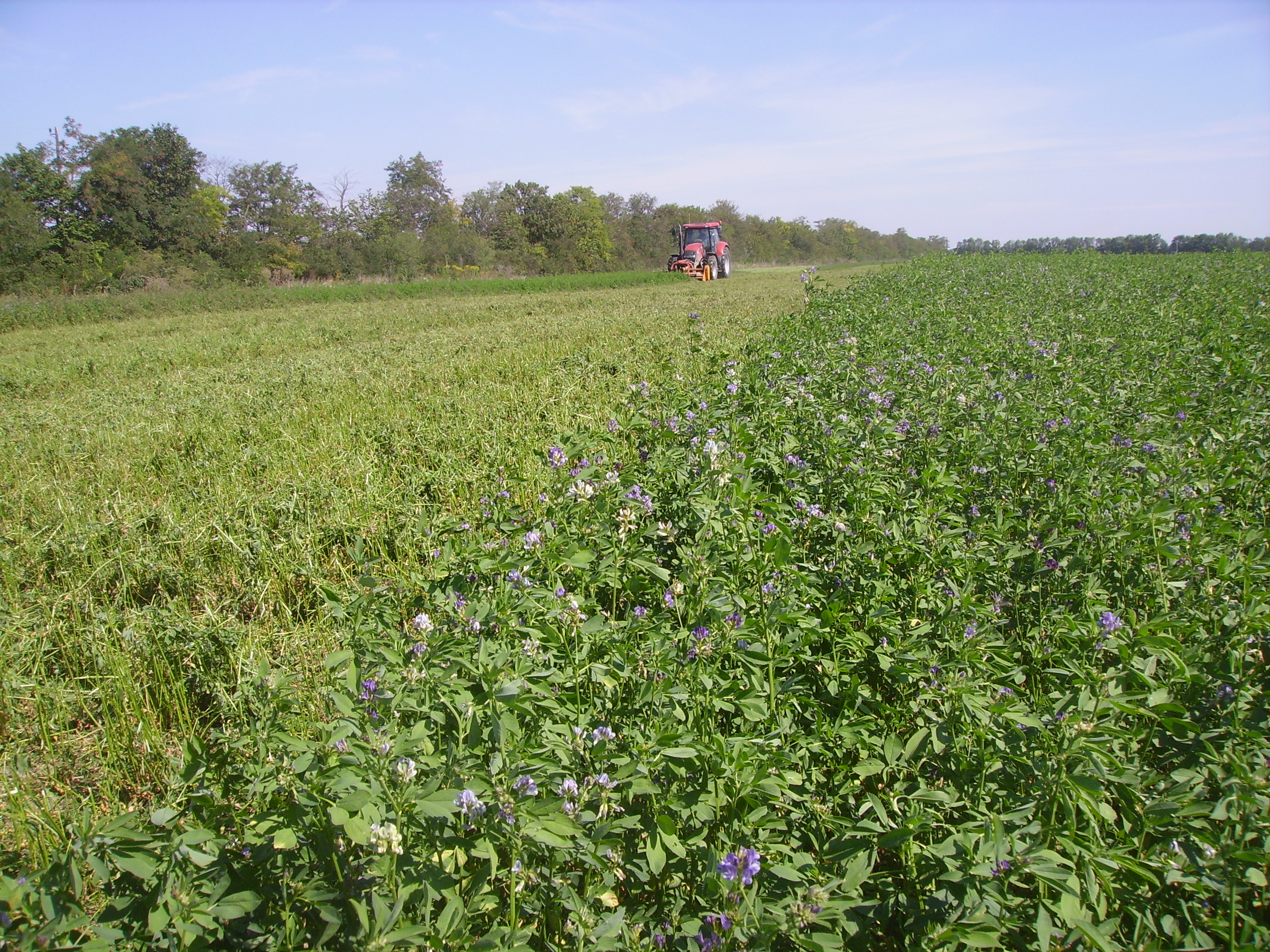
The Rutzendorf Experimental Station is an agricultural research site of the University of Natural Resources and Live Sciences Vienna (BOKU), belonging to the Landwirtschaftliche Versuchswirtschaften GmbH. It is representative for the productive soils managed as arable land in the Marchfeld area (Lower Austria). The soil is described as a silty loamy Calcaric Phaeozem (WRB), a Chernozem according to Austrian soil classification. Management on the farm is without livestock, no organic fertilizers are applied. The farm was converted to organic farming in the production year 2002/03. The 8-year crop rotation comprises luzerne (2 yrs), winter wheat*, grain maize, spring barley*, field peas*, winter wheat, winter rye. Cover crop mixtures are grown where indicated in the crop rotation with an asteric. Current research questions include to study (i) the long-term sustainability and productivity of the stockless organic arable system compared to a livestock-keeping system, (ii) the mitigation of climate change effects on the soil-plant system by reducing soil cultivation intensity, and (iii) the development of biodiversity following the conversion to organic farming and enhancement of landscape elements. Regularly meteorological data, crop yields and quality, physical, chemical and biological soil traits, weed species and diaspores, springtails, wild bees and other animal species are assessed. Studies have been conducted as research projects financed nationally and by the European Union, e.g. in two EIP projects.
-
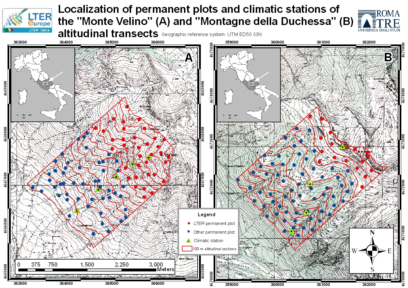
The site includes a large mountainous area in the Central Apennines, almost in the centre of the Italian peninsula and about 70 km west of Rome. It represents an “orographic island” in the Central Mediterranean basin, along the Apennines mountain range. Since 1993, the vegetation has been surveyed at six permanent high elevation plots (Mount Sevice research station, Mount Velino, 2125-2225 m a.s.l.) and (since 2005) at an additional 55 plots along two elevation transects (SW slope of Mount Velino and Mount Morrone), including primary and secondary grasslands, beech forests and alpine tundra. Since 2014, micro-climate data (GLORIA method) have been continuously recorded at the high elevation plots. Vegetation is surveyed yearly in the 6 high elevation plots (each 100 m2 in size) grouped in two cluster-plots (each of 3 plots). Structure and composition changes are studied in two ecologically opposite primary plant communities, both above the timberline: snow-bed grassland and alpine tundra, both characterized by extreme below zero temperatures all year round and frozen soil for 8 months per year, but with very different snow cover duration. Based on the first 30 years of observation, a clear trend toward a decrease of snow dependant species and a parallel increase in drought- and stress-tolerant species has been recognized, linked to a general process of climate change, more accelerated in Southern Europe.
-
The Jornada Basin Long-Term Ecological Research (LTER) program is part of a national network of long-term ecological research sites funded by the US National Science Foundation (NSF). The Jornada LTER program has been continuously funded since 1982 to develop general principles governing changes between grassland and shrubland ecosystems based on long-term data collected in the Chihuahuan Desert. Research themes at the Jornada LTER focus on vegetation change, climate and land use impacts on ecosystem function, and the role of dryland processes in structuring communities and landscapes. We translate our findings to dryland ecosystems around the world, and forecast the dynamics of future ecosystem states in response to changing climate and land use. The Jornada Basin is located in southern New Mexico, USA, approximately 25 km northeast of the city of Las Cruces (32.6 N -106.7 W, elevation 1315 m). Annual precipitation is 24 cm and maximum temperatures average 13 C in January and 36 C in June. The study site is near the northern extent of the Chihuahuan Desert, which is the largest of the North American warm deserts, in a region has undergone large shifts in the relative dominance of grasslands and shrublands over the past century. We partner closely with the USDA-ARS Jornada Experimental Range (JER) and the NMSU Chihuahuan Desert Rangeland Research Center (CDRRC), allowing us to benefit from a long history of rangeland research, and to contribute to science-based management and sustainability practices.The Jornada Basin LTER project is administered by New Mexico State University.
-
This site is located on the territory of National Park “Rila”, Bulgaria. Parangalitsa has been a reserve since 1933. It is situated on part of the southwestern slopes of Rila mountain, covering 1,509 hectares. It contains some of the oldest pine tree forests in Europe with an average age of over 200 years. The site is a part of the network of bioecological stations of Forest Research Institute – BAS and research is focused on highly productive coniferous forests with unique biomass. In the main experimental plots, long-term complex studies were conducted during the period 1979 - 1998, a large-scale database was created and a number of significant scientific results were obtained. In the period 2000 - 2018, separate targeted studies were carried out - focused on some ecosystem processes, which allows the analysis and evaluation of the functioning of ecosystems to be don
-
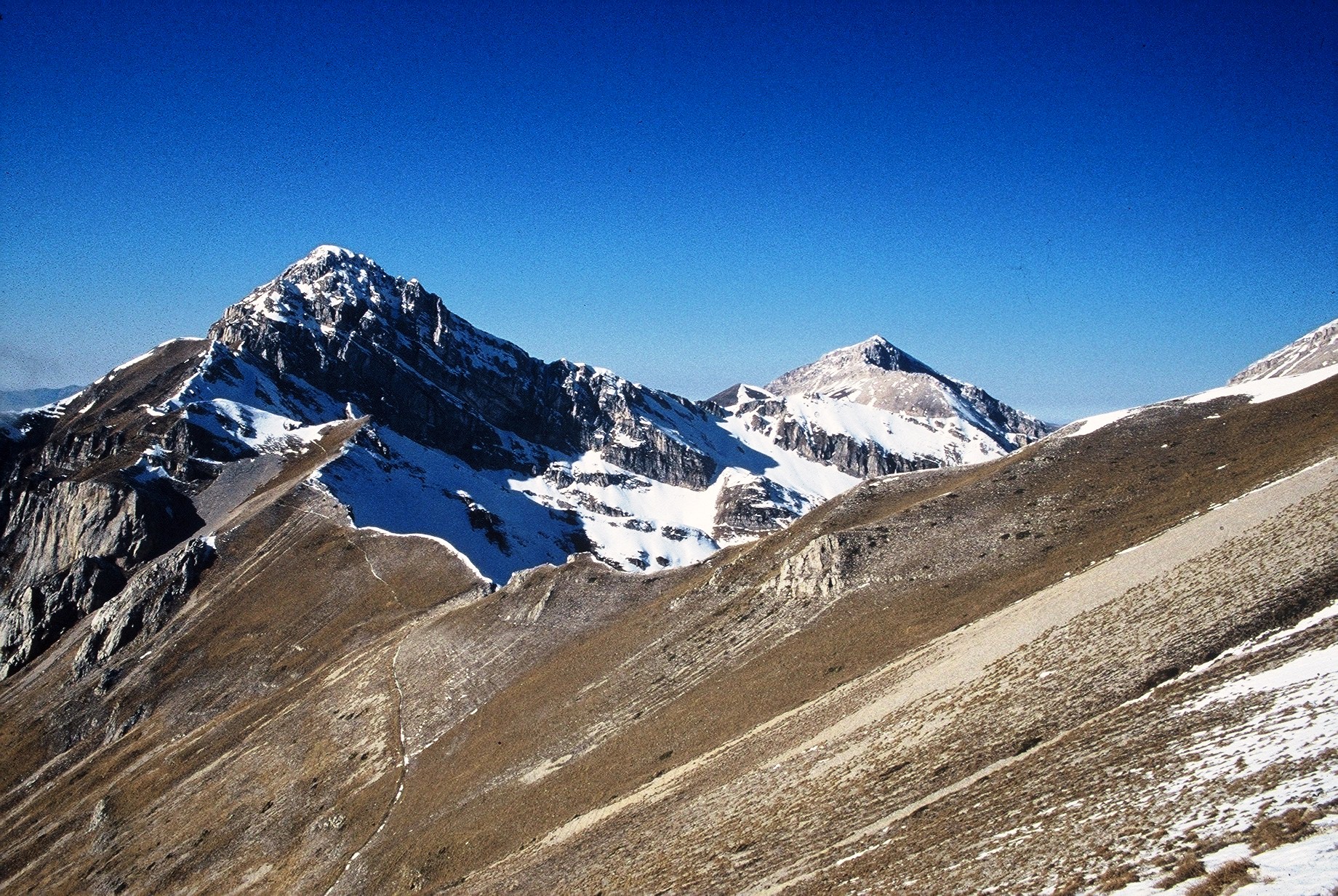
The site consists of high elevation vegetation in central Mediterranean basin, along the Apennines mountain range: xerophitic primary grassland (Pediculari elegantis-Seslerietum tenuifoliae) and mesophitic primary grassland (Luzulo italiacae-Festucetum macratherae), with important resident and migratory bird communities. Six plots, each one 100 m2 large, grouped in two cluster-plots including each one three plots, representative of a larger area of 0,5 km2 ca., ranging from 2100 to 2300 m a.s.l. (alpic and Mediterranean high-mountain belts.
-
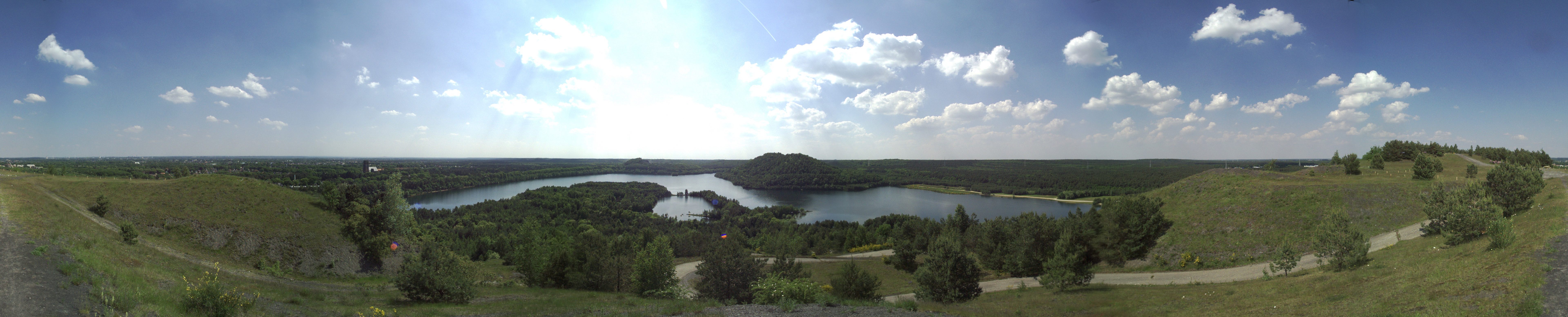
The total NPHK is currently (since 2020) about 12,000 ha, but the eLTER site corresponds to the former perimeter of the NPHK and represents an urbanised protected area of about 60km2 (or 6,000ha) located in the Province of Limburg in the East of Belgium. The NPHK (inaugurated in 2006 and extended from 6000ha to its current 12000ha in 2020), located in a former coal mining area is surrounded by 10 municipalities with more than 200,000 inhabitants, equivalent to a population density of 450/km2 . The park covers a rich variety of habitats, including heathlands, deciduous forest, coniferous forest and fens and evidently the corresponding diversity of fauna and flora. Several research groups from universities and institutes are monitoring and measuring abiotic and biotic parameters throughout the different ecosystems. Research on ecosystem services are also playing a major role, including tourism and mobility.
-
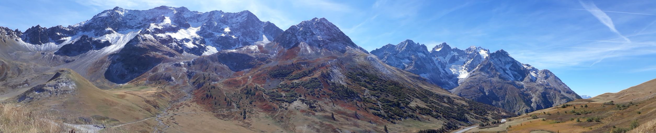
The Lautaret-Oisans platform focuses on the study of socio-ecosystems and the critical zone of the alpine mountains. The research and observation sites are focused on three sub-systems: little-engineered high mountains; alpine pastures; and lakes, rivers and watershed heads. The platform is built around the Lautaret-Roche-Noire site (https://deims.org/8574370e-934e-418a-af63-e15f4cbc5084) and Lautaret Garden infrastructures.
-
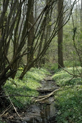
The Aelmoeseneie Forest is a 28.5 ha mixed deciduous forest in the community of Gontrode, just southeast of Ghent. The largest part of the forest is ‘ancient forest’, i.e. it is permanently forested since before 1775, while the forest is surrounded by agricultural land (mostly pastures). The soil consists of a silt loam to loam soil (Planosol), overlaying a mosaic of tertiary clayey and sandy deposits with high base saturation starting at 50 cm depth. Forest management is designed to obtain a more natural tree species composition and to conserve biodiversity. More info can be found at www.aelmoeseneiebos.ugent.be.
-
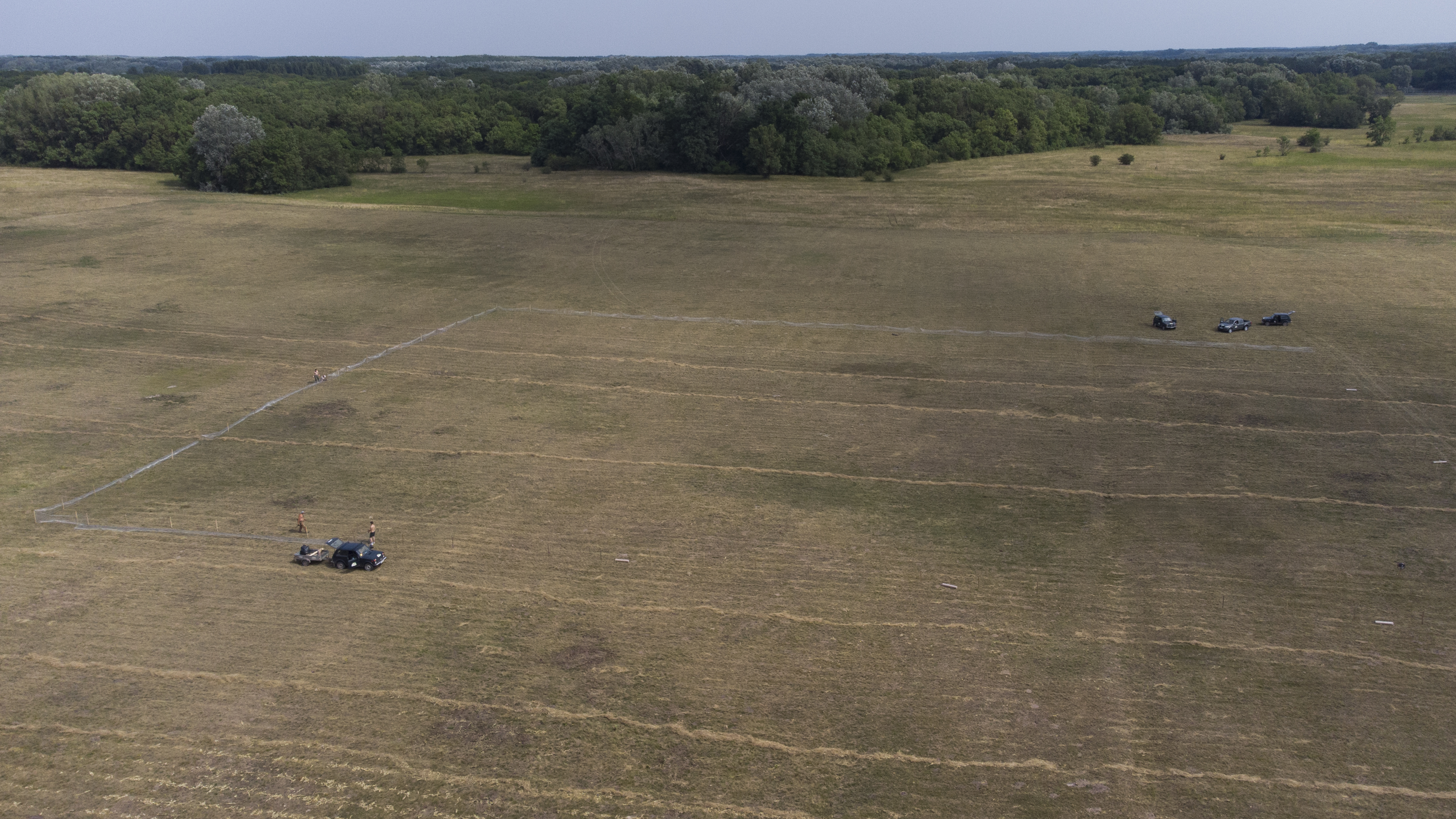
The site is a revitalized young steppe habitat patch, dominated by fescue (Festuca rupicola). The average altitude is around 100 m. The site is a grazing spot and it was recently used for the reintroduction of the European ground squirrel (Spermophilus citellus) to the area after 70 years. Other important species present at the site include Vojvodina blind mole rat (Nannospalax (leucodon) montanosyrmiensis) and Spring meadow saffron (Bulbocodium versicolor).