
soil dry bulk density
Type of resources
Available actions
Topics
Keywords
Contact for the resource
Provided by
Years
Formats
Representation types
-
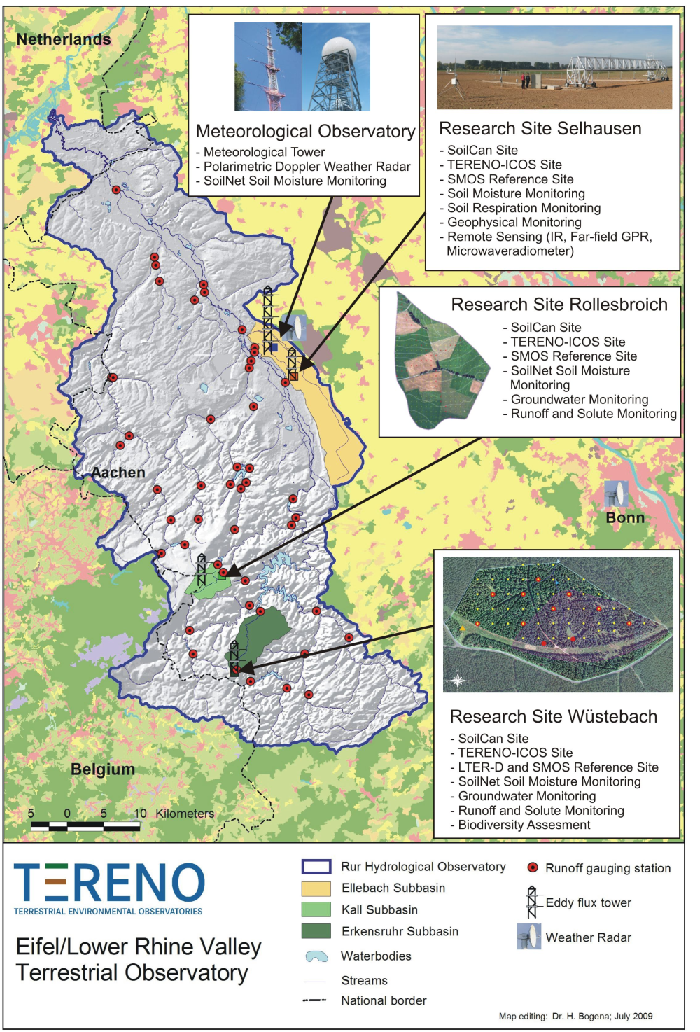
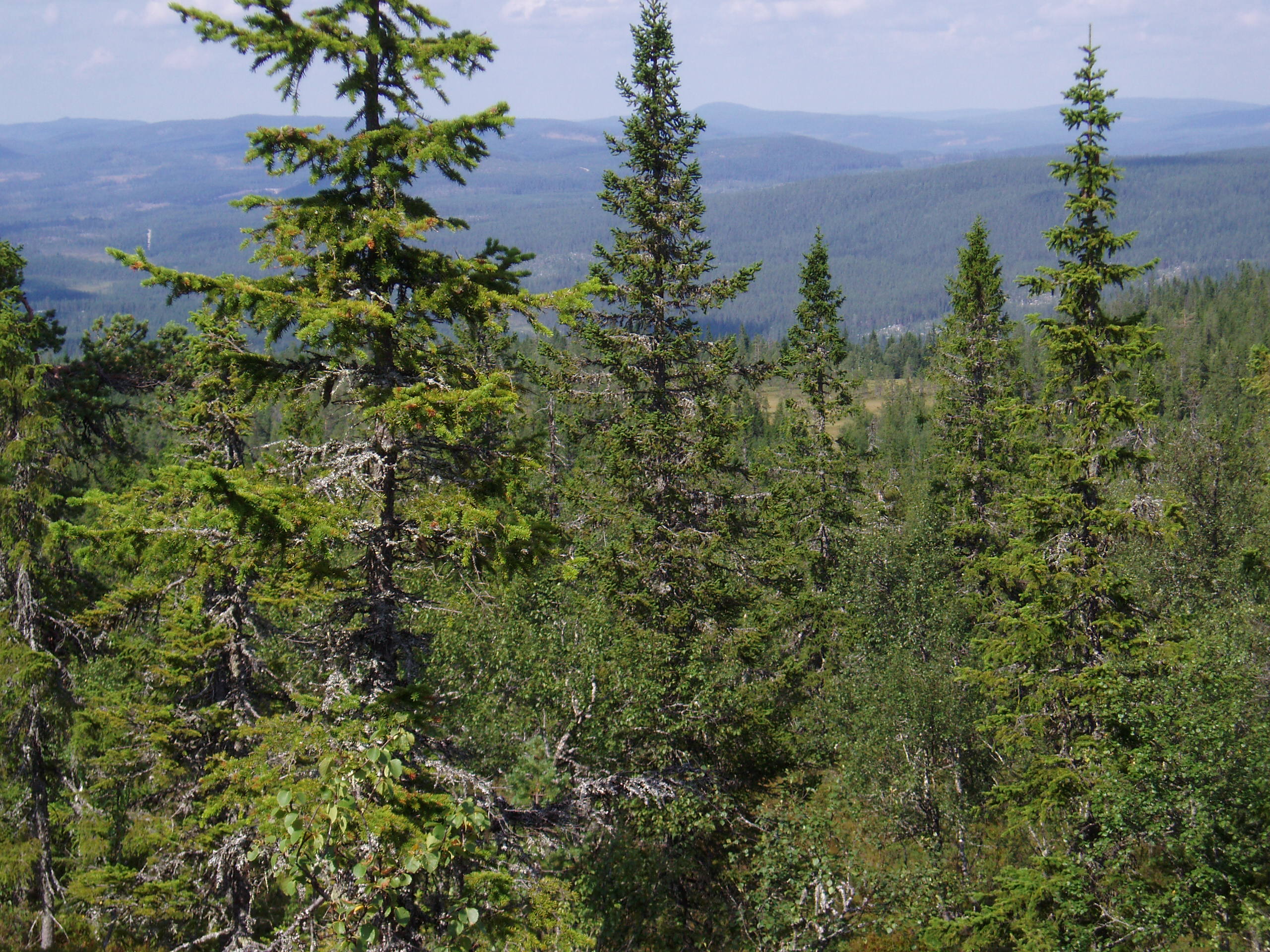
The central monitoring site of the Eifel/Lower Rhine Valley Observatory is the catchment area of the River Rur. It covers a total area of 2354 km² and exhibits a distinct land use gradient: The lowland region in the northern part is characterised by urbanisation and intensive agriculture whereas the low mountain range in the southern part is sparsely populated and includes several drinking water reservoirs. Furthermore, the Eifel National Park is situated in the southern part of the Rur catchment serving as a reference site. Intensive test sites are placed along a transect across the Rur catchments in representative land cover, soil, and geologic settings: In order to obtain spatially distributed information about river discharge rates, the Rur catchment is partitioned into a nested set of sub-catchments that will span distinct assemblages of hydrologic features and several orders of magnitude in drainage area. More detailed measurements and characterisation of smaller, focal catchments are embedded within progressively larger catchments, allowing the critical evaluation and development of scaling strategies. Additionally, for the analysis of the groundwater flow system and groundwater exchange rates on a regional scale, the monitoring of natural tracers of ground and surface waters will be carried out.
-
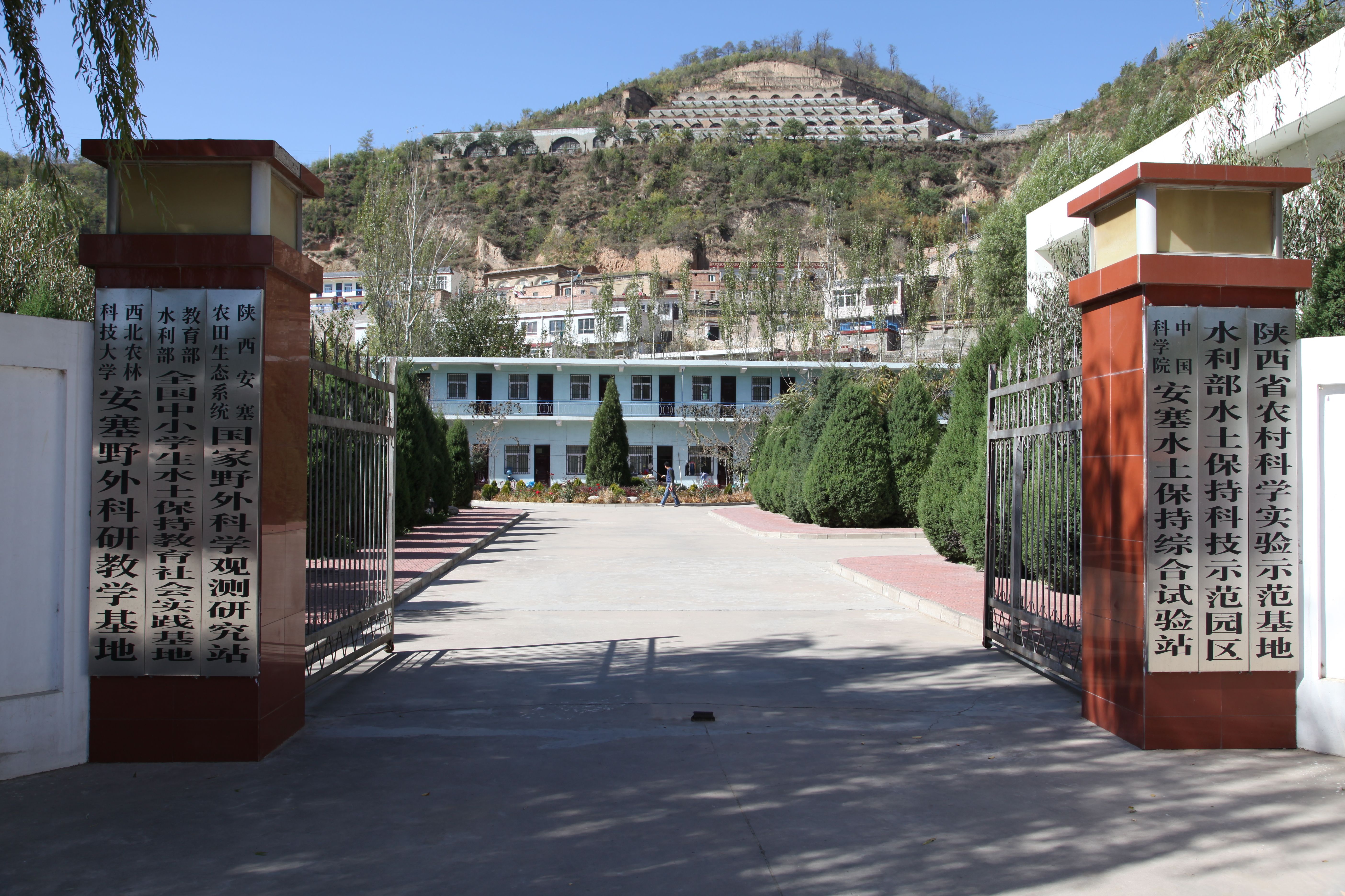
Ansai Integrated Experimental Station on Water and Soil Conservation is a part of Chinese Ecosystem Research Network, which located in the typical loess hilly and gully region and situates near the center of the Loess Plateau in the Shaanxi Province. The loess-derived soils are fertile but extremely susceptible to erosion. Soil erosion in the study area is much higher than that in the southern part of the Loess Plateau. The climate belongs to transition zone of warm temperate semi-humid to semi-arid, which is dry and windy in spring, hot and rainy in summer, and dry and cold in winter. The mean annual temperature is 8.8 °C. The minimum and maximum temperatures are −23.6 °C in February and 36.8 °C in July. The frost-free period is 157 days. The mean annual precipitation is 505 mm, 70% of which falls between July and September in the form of short heavy storm. The soil is silt loam with the contents of sand, silt, and clay being 24%, 65%, and 11%. Ansai station mainly focus on vegetation rehabilitation, monitoring and assessment of rehabilitation, and monitoring in watershed.
-
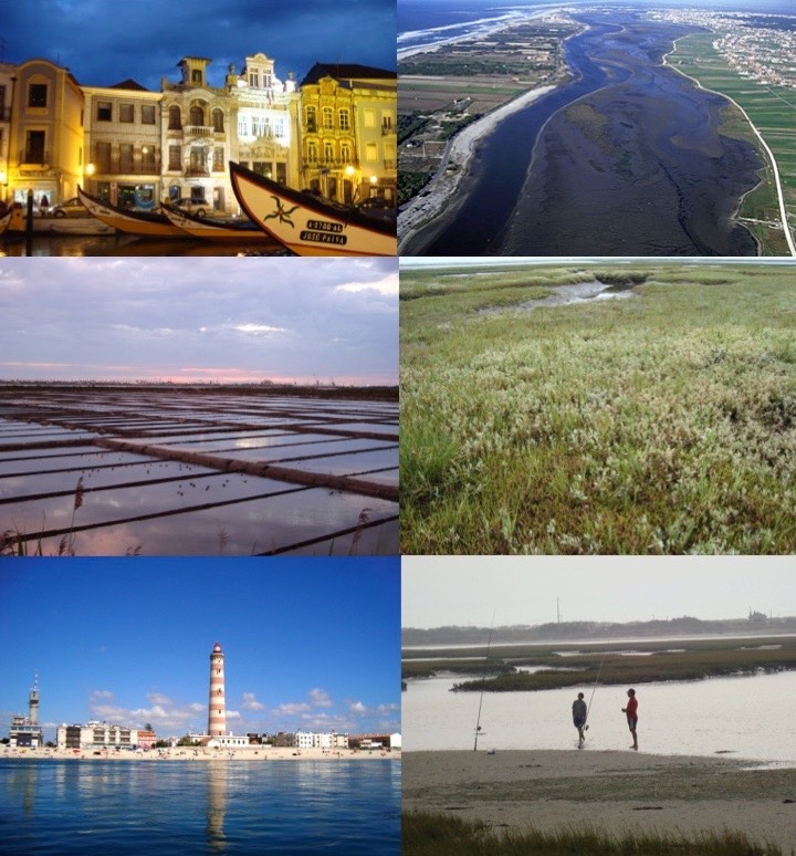
The Ria de Aveiro is a coastal lagoon located in the northwest coast of Portugal, in the western Atlantic Ocean (40º38’N, 08º 45’W). It is a complex social-ecological system that lays between the marine and terrestrial domains. In terms of climatology, this region is under the influence of a temperate maritime climate with a warm period between July and September, and a cold period between December and February. The annual range of the monthly average temperature is around 10ºC. Rainfall occurs mainly between October and May, with higher precipitations in December and January. From the geological point of view, the Ria de Aveiro is a recent feature formed through the accumulation of marine and riverine sediments during the last 1000 years in a wide and shallow bay. These mechanisms have not yet attained equilibrium and the present tendency is to silt up. Much of the present-day geomorphology of the Ria has been determined by human intervention directed to counterbalance this silt-up tendency. The connection between the Ria de Aveiro coastal lagoon and the Atlantic Ocean (through a single inlet of 1.3 km long and 350 m wide) enables the water exchange and the formation of a shallow lagoon. The lagoon is approximately 45 km long, 10 km wide and covers an area of approximately 83 km2 and 66 km2 of wetland at high and low water, respectively. It consists of four main channels with several branches forming island and inner basins. The Ria de Aveiro also integrates the Vouga River estuary and the freshwater wetland Pateira de Fermentelos. The combination of the freshwater discharge and the tidal penetration creates a longitudinal salinity gradient from about 0 in the river to about 36 at the ocean entrance. The landscape of the Ria de Aveiro is shaped into a vary of beaches, dunes, sand flats, mud flats, salt marshes, seagrasses, and small water channels creating farmlands and smallholdings named “Bocage”, which is associated to a rich biodiversity. From these habitats, the salt marshes of the Ria de Aveiro are remarkable due to its large extension and continuity, being one of the largest areas of salt marshes in Portugal and in Europe, housing a rich wintering population of waders. “Bocage” is also relevant due to the rushes (Juncus maritimus) or reeds (Phragmites australis) tidal marshes, rice fields, livestock and woodlands composed by tree species such as Eucalyptus globulus and Pinus pinaster. The Ria de Aveiro is inhabited by waders birds (the flamingo Phoenicopterus roseus, the purple heron Ardea purpurea), birds of prey (the marsh harrier Circus aeruginosus, the black kite Milvus migrans), reptiles (the Iberian emerald lizard Lacerta schreiberi), amphibians (the Iberian painted frog Discoglossus galganoi and the European tree frog Hyla arborea), fishes (lampreys such as the Petromyzon marinus, shad Alosa alosa and eels Anguilla anguilla), and mammals (the otter Lutra lutra, the least weasel Mustela nivalis). The variety of habitats of this area and associated biodiversity, provides of good and services to the population including the regulating, cultural and provisioning ecosystem services. The natural capital of this coastal lagoon is recognized internationally, namely by its classification as Natura 2000 area, Special Protection Area (SPA), Site of Community Importance (SIC) and Ramsar site under the European Habitats and Bird Directives. The major urban settlement in the lagoon watershed area is Aveiro city (60,000 inhabitants approximately). The Ria de Aveiro has enabled the development of economic activities such as commercial fisheries, bait digging, aquaculture, salt pans, a prosperous harbour, maritime traffic, manufacturing, tourism, recreation, sports and agriculture. As a consequence, this area is subject to anthropogenic pressures that impact the coastal lagoon and the adjacent freshwater areas of the Vouga River. The identification of these impacts is a continuous collaborative work between the research institutions and stakeholders who depend on different aspects of the environment, including city dwellers and local organisms. For example, they are local fishermen, divers, surfers, and also members of the jurisdictions regulated by different economic and political systems, such as representatives of the town hall, owners of tourism companies and institutes for conservation of the nature. To counteract the current pressures of the human activities management options have been co-developed, for at least one decade, to implement ecosystem-based management in frame of environmental policies, considering the complexity of the Ria de Aveiro and its connectivity across marine, transitional, freshwater, and terrestrial domains.
-
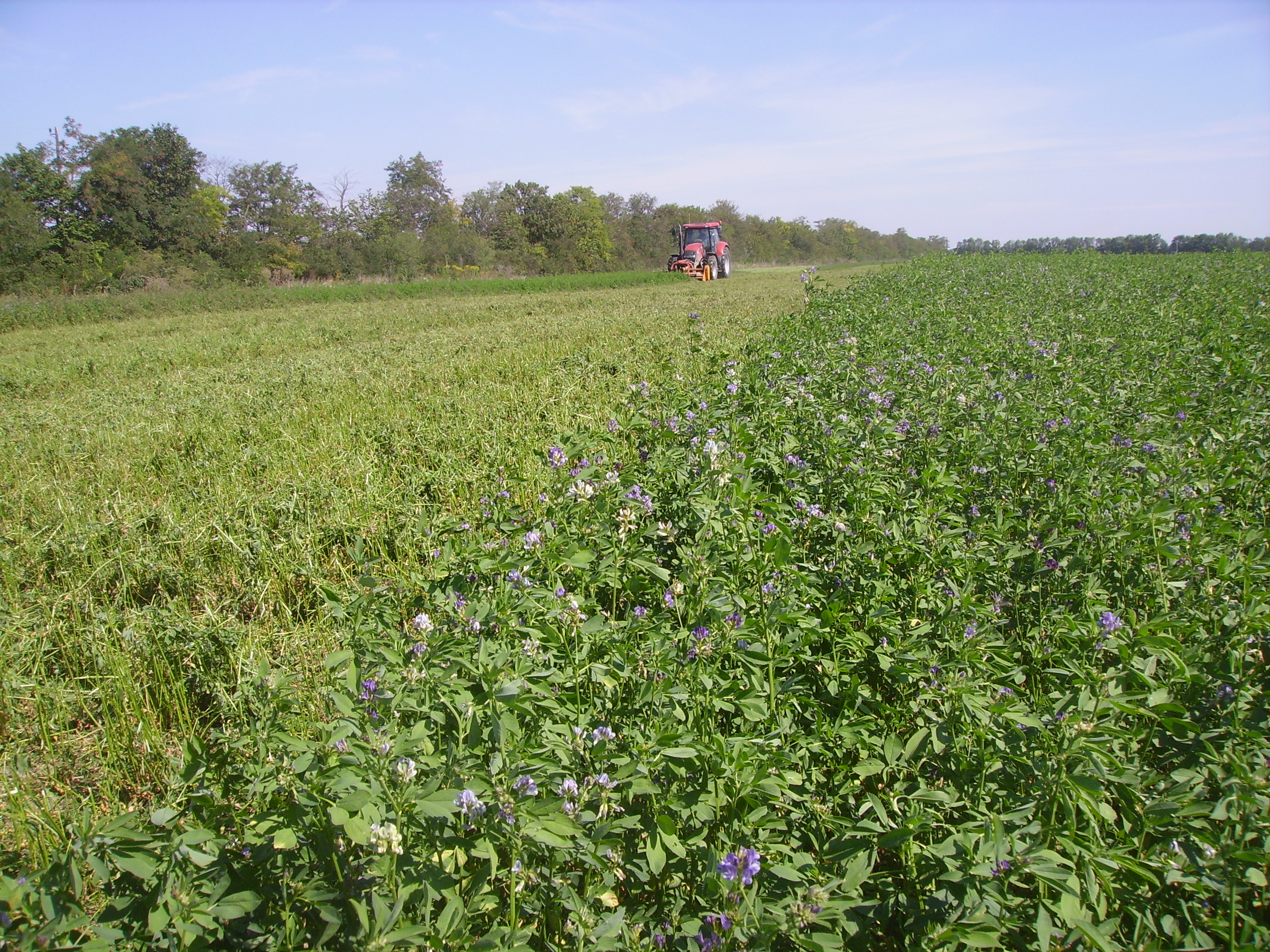
The Rutzendorf Experimental Station is an agricultural research site of the University of Natural Resources and Live Sciences Vienna (BOKU), belonging to the Landwirtschaftliche Versuchswirtschaften GmbH. It is representative for the productive soils managed as arable land in the Marchfeld area (Lower Austria). The soil is described as a silty loamy Calcaric Phaeozem (WRB), a Chernozem according to Austrian soil classification. Management on the farm is without livestock, no organic fertilizers are applied. The farm was converted to organic farming in the production year 2002/03. The 8-year crop rotation comprises luzerne (2 yrs), winter wheat*, grain maize, spring barley*, field peas*, winter wheat, winter rye. Cover crop mixtures are grown where indicated in the crop rotation with an asteric. Current research questions include to study (i) the long-term sustainability and productivity of the stockless organic arable system compared to a livestock-keeping system, (ii) the mitigation of climate change effects on the soil-plant system by reducing soil cultivation intensity, and (iii) the development of biodiversity following the conversion to organic farming and enhancement of landscape elements. Regularly meteorological data, crop yields and quality, physical, chemical and biological soil traits, weed species and diaspores, springtails, wild bees and other animal species are assessed. Studies have been conducted as research projects financed nationally and by the European Union, e.g. in two EIP projects.
-
Soil data of LTER Zöbelboden, Austria. Soil inventory is carried out since 1992 on regular positions (approx 65) in the catchment measuring soil chemistry. Soil water chemistry is measured in forest plots (2-3) using lysimeter sampling and analyses on a bi-weekly to monthly basis. Soil hydraulic characterizations exist for the major soil types in the catchment. Soil CO2 and N2O respiration data is available for some years
-
Nature reserve, Natura 2000, protected coniferous blueberry forest.
-
The study plot was established by the Institute of Forest Ecology (Mendel University in Brno) in 1968, namely in connection with the UNESCO International Biological Programme (IBP) and the UNESCO programme “Man and the Biosphere” (MAB). Research was aimed at the primary production, element and water cycling and the secondary production of invertebrates, birds and small mammals. It refers to a semi-natural floodplain forest free of management measures characterized by the Ulmeto-Fraxinetum carpineum forest type group. Dominant tree species are as follows: Fraxinus excelsior, Quercus robur, Populus nigra, Tilia platyphyllos, and Acer campestre. In consequence of flood control, the local floodplain forest was affected by changes in the water regime (absence of natural floods, fall of the groundwater table) from 1972. In the course of the 1970s and 1980s, it resulted in the insufficient supply of water. Since the 1990s, revitalization measures have been carried out (increasing the ground water level by means of channels) for improving forest health. Changes in the water regime have resulted in the improving condition of the floodplain forest ecosystem that has been documented owing to LTER on the site. Following research activities are carried out there: (i) monitoring selected parameters of the stand microclimate and mesoclimate, (ii) evaluating the moisture balance in the forest ecosystems, (iii) evaluating the water regime and moisture conditions of the floodplain forest ecosystem, (iv) evaluating temperature and moisture conditions, (v) research into the water relations of trees, (vi) evaluating long-term changes in the synusia of small terrestrial mammals of the floodplain forest, and (vii) evaluating decomposition processes.
-
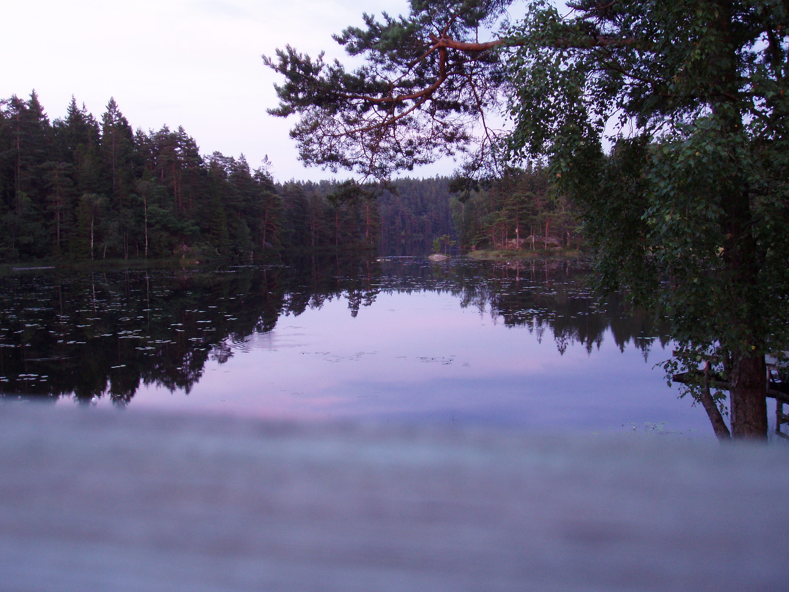
The lake Gårdsjön catchment is 2.1 km2 and includes 5 lakes and a number of headwater streams. It is located 50 km north of Göteborg. The whole area has been intensively studied for the last 30 years by scientists from IVL and from other institutes from Sweden and from abroad. Since 1979 several both national and international projects have been carried out. Smaller sub-catchments were used for experiments ranging from clear cutting, liming, fertilisation, sulphur addition and a combination of these treatments. In 1989 two large manipulation experiments were initiated. In the “Roof” experiment catchment G1 was covered by a transparent plastic roof and for 10 years the polluted precipitation was substituted with clean artificial precipitation sprinkled under the roof in a de-acidification experiment. The adjacent catchment G2 has been fertilised with NH4NO3 since 1991 to study several aspects (soil, water, vegetation) transition from N limited to N saturated conditions. Research at Gårdsjön resulted in three books and a large number of publications, covering different environmental problems, a range of pollutants, aquatic and terrestrial parts of the catchment, soils, vegetation and organisms. The site has served as an educational centre with countless visitors both from Sweden and abroad.
-
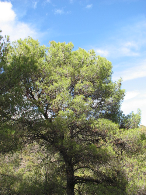
The Intensive Monitoring of Forest Ecosystems (ICP-Forests Level II network) consists currently in 14 monitoring plots representing important Spanish Forest Ecosystems distributed throughout the Spanish mainland showing the most common forest situations of each country and representing rare or endemic situations. The Plot 25 Ph represents a Pinus halepensis pine forest located in the East of the Iberian peninsula. It is a mature monoespecific regular forest. Climatic gradient is Mesomediterranean. The soil is calcareous, shallow and extremely rocky.
-
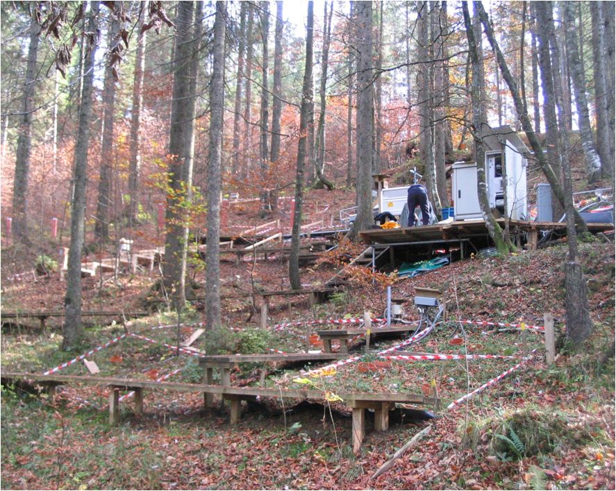
Norway Spruce-Fir-Red Beech Forest on Limestone The experimental site Mühleggerköpfl is located on the northern edge of the Alps and receives air pollutants that are transported over long distances, by predominant westerly winds; local emissions from rural settlements are low. The LTER site has an area of 20 hectares. It is a privately owned mature montane forest rich in Norway spruce in the Northern Limestone Alps at 920 m a.s.l. on a north–north-east facing slope of a mountain (47° 34’ 50” N; 11° 38’ 21” E). The site on an isolated calcareous outcrop in the valley of Achenbach represents a watershedsmall catchment. Routinely measured parameters over the years have included climate (air temperature, precipitation, and air humidity), soil temperature, soil water content, soil solution chemistry, nutrient content of Norway spruce needles, air quality, deposition of N, and surface runoff. The climate is cool and mesic with maximum precipitation in summer and a snow-free period from April/May to November/December. The mean annual air temperature and precipitation from on-site measurements are 6.8°C and 1580 mm, respectively. The annual variability of the precipitation is small. Moist conditions are also evident from the high relative air humidity.