
soil evaporation
Type of resources
Available actions
Topics
Keywords
Contact for the resource
Provided by
Years
Formats
Representation types
-
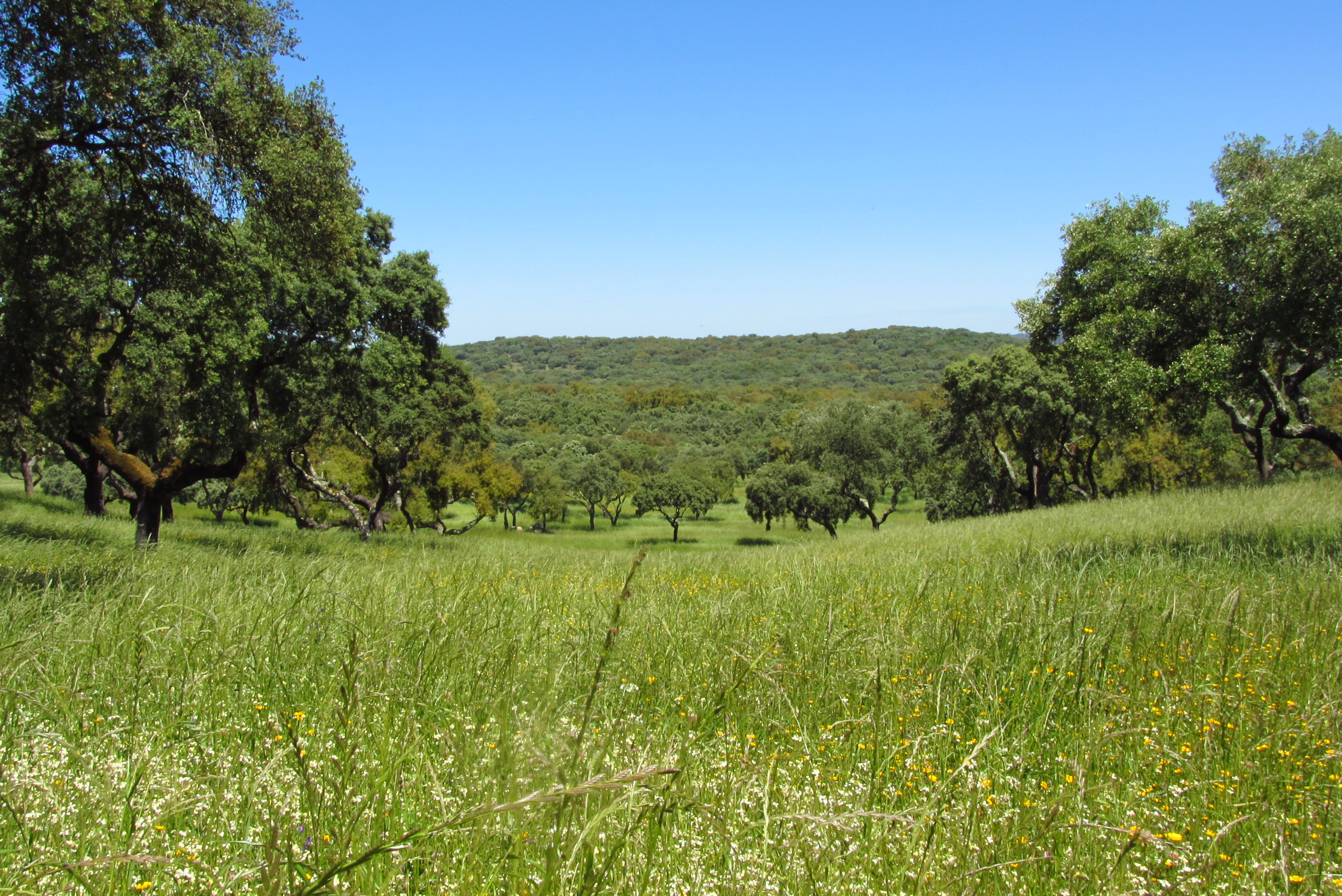
Montados (or dehesas in Spanish) are traditional agro-forestry systems with a savanna type structure, characteristic of the Mediterranean Basin. In Portugal, Montados are mainly distributed in the southern half of the country where the climate is Mediterranean. Annual average precipitation is 600 mm and mean annual temperature is 15ºC, although there is a large variation within the area of distribution of this system. Cork oaks (Quercus suber) and holm oaks (Q. rotundifolia) are the dominant trees, forming pure or mixed stands, with holm oak being dominant in drier regions. Montados with natural or semi-natural pasture and extensive grazing are listed under the EU Habitats Directive (habitat 6310), and are key habitats of Special Areas of Conservation (Habitats Directive) and of Special Protection Areas (Birds Directive), which are part of the Natura 2000 network. Their multifunctional management promotes structural diversity at the stand and landscape level, which combined to a large distribution area and spatial continuity results in high-levels of biodiversity. They are also High Natural Value farmlands that simultaneously fulfill the three criteria considered for their delimitation by the European Commission, since they are dominantly related to a high proportion of semi-natural vegetation, to a mosaic of low intensity agriculture and natural and structural elements and to the presence of rare species (e.g. Lynx pardinus and Aquila pennata). Cork is the most important forest product from Montado systems, with Portugal producing 54% of the world cork. In addition to cork (harvested every 9-12 years), animal production in pastures also provide a source of income. The regulation of water and nutrient cycles and of soil erosion, as well as carbon sequestration are important regulating services to be managed in Montados. From a cultural and recreational perspective, Montados are valued for the landscape aesthetics, natural values and cultural heritage. Strategic actions have been put in place to conciliate human use and biodiversity conservation, such as the publication of national regulations that legally protect the cork and holm oaks. But the most significant one might be forest certification, which has been promoting practices of responsible forest management in more than 70,000 ha of Montado, around 30% of the total certified Portuguese forest area.
-
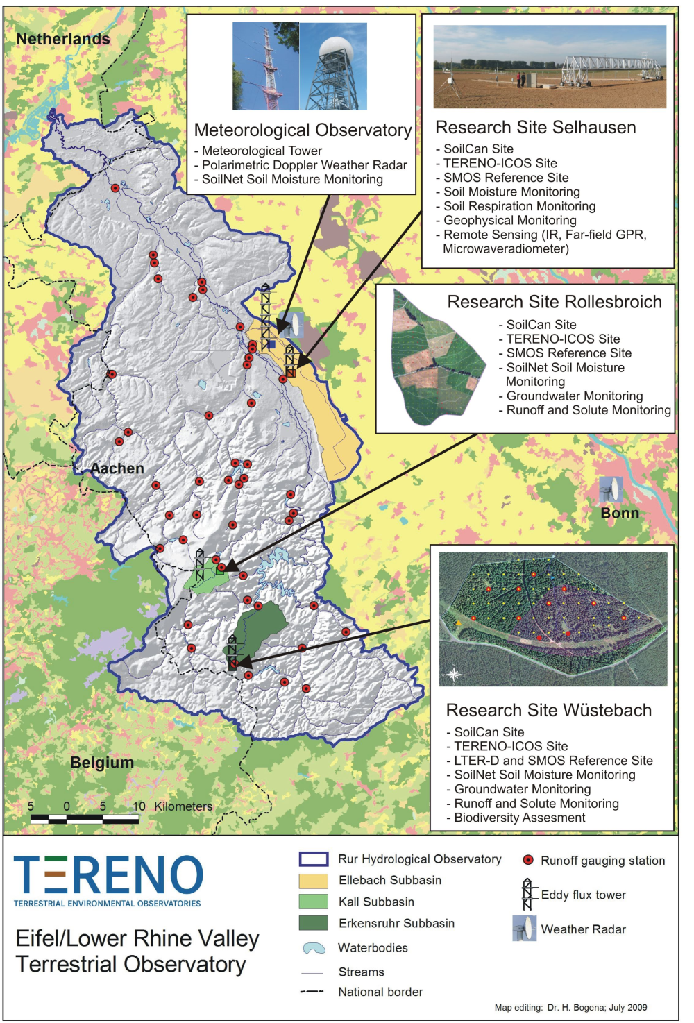
The central monitoring site of the Eifel/Lower Rhine Valley Observatory is the catchment area of the River Rur. It covers a total area of 2354 km² and exhibits a distinct land use gradient: The lowland region in the northern part is characterised by urbanisation and intensive agriculture whereas the low mountain range in the southern part is sparsely populated and includes several drinking water reservoirs. Furthermore, the Eifel National Park is situated in the southern part of the Rur catchment serving as a reference site. Intensive test sites are placed along a transect across the Rur catchments in representative land cover, soil, and geologic settings: In order to obtain spatially distributed information about river discharge rates, the Rur catchment is partitioned into a nested set of sub-catchments that will span distinct assemblages of hydrologic features and several orders of magnitude in drainage area. More detailed measurements and characterisation of smaller, focal catchments are embedded within progressively larger catchments, allowing the critical evaluation and development of scaling strategies. Additionally, for the analysis of the groundwater flow system and groundwater exchange rates on a regional scale, the monitoring of natural tracers of ground and surface waters will be carried out.
-
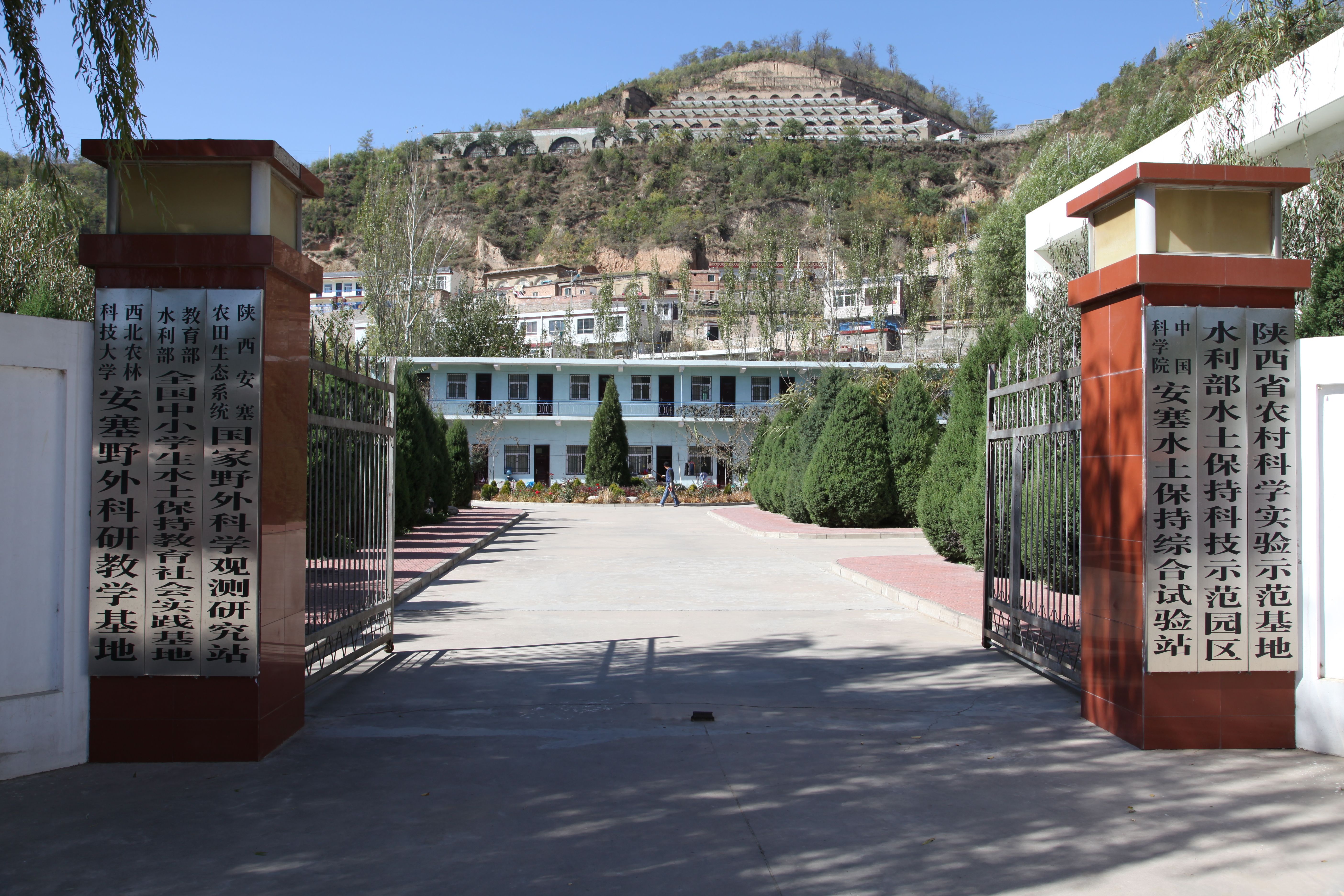
Ansai Integrated Experimental Station on Water and Soil Conservation is a part of Chinese Ecosystem Research Network, which located in the typical loess hilly and gully region and situates near the center of the Loess Plateau in the Shaanxi Province. The loess-derived soils are fertile but extremely susceptible to erosion. Soil erosion in the study area is much higher than that in the southern part of the Loess Plateau. The climate belongs to transition zone of warm temperate semi-humid to semi-arid, which is dry and windy in spring, hot and rainy in summer, and dry and cold in winter. The mean annual temperature is 8.8 °C. The minimum and maximum temperatures are −23.6 °C in February and 36.8 °C in July. The frost-free period is 157 days. The mean annual precipitation is 505 mm, 70% of which falls between July and September in the form of short heavy storm. The soil is silt loam with the contents of sand, silt, and clay being 24%, 65%, and 11%. Ansai station mainly focus on vegetation rehabilitation, monitoring and assessment of rehabilitation, and monitoring in watershed.
-
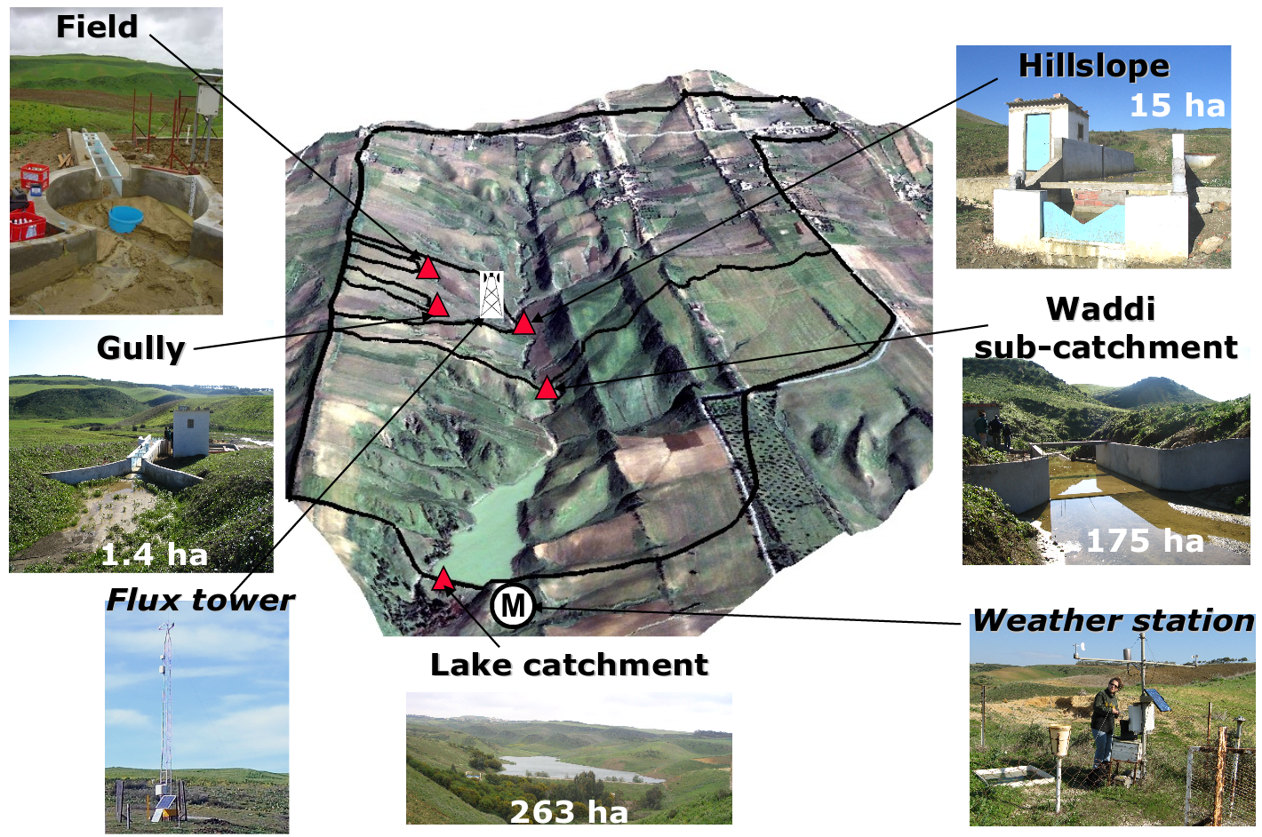
Small agricultural catchment (263 ha) in a Mediterranean environment with 20 years of data: impact of global change (climate and anthropogenic activities as agricultural practices) on water and erosion balance, fluxes and quality. Soils: Calcic Cambisols (63.5%), Regosols (25.5%), Eutric Regosols (9.6%) and Chromic Vertisols (1.4%). Main cultures: cereals and leguminous. Continuous automatic measurements at nested scales from plot to catchment outlet (surface runoff, shallow groundwaters, surface-atmosphere fluxes) and continuous monitoring of anthropogenic activities . More information available on http://www.obs-omere.org. Kamech experimental catchment belongs to the French SOERE-RBV Network.
-
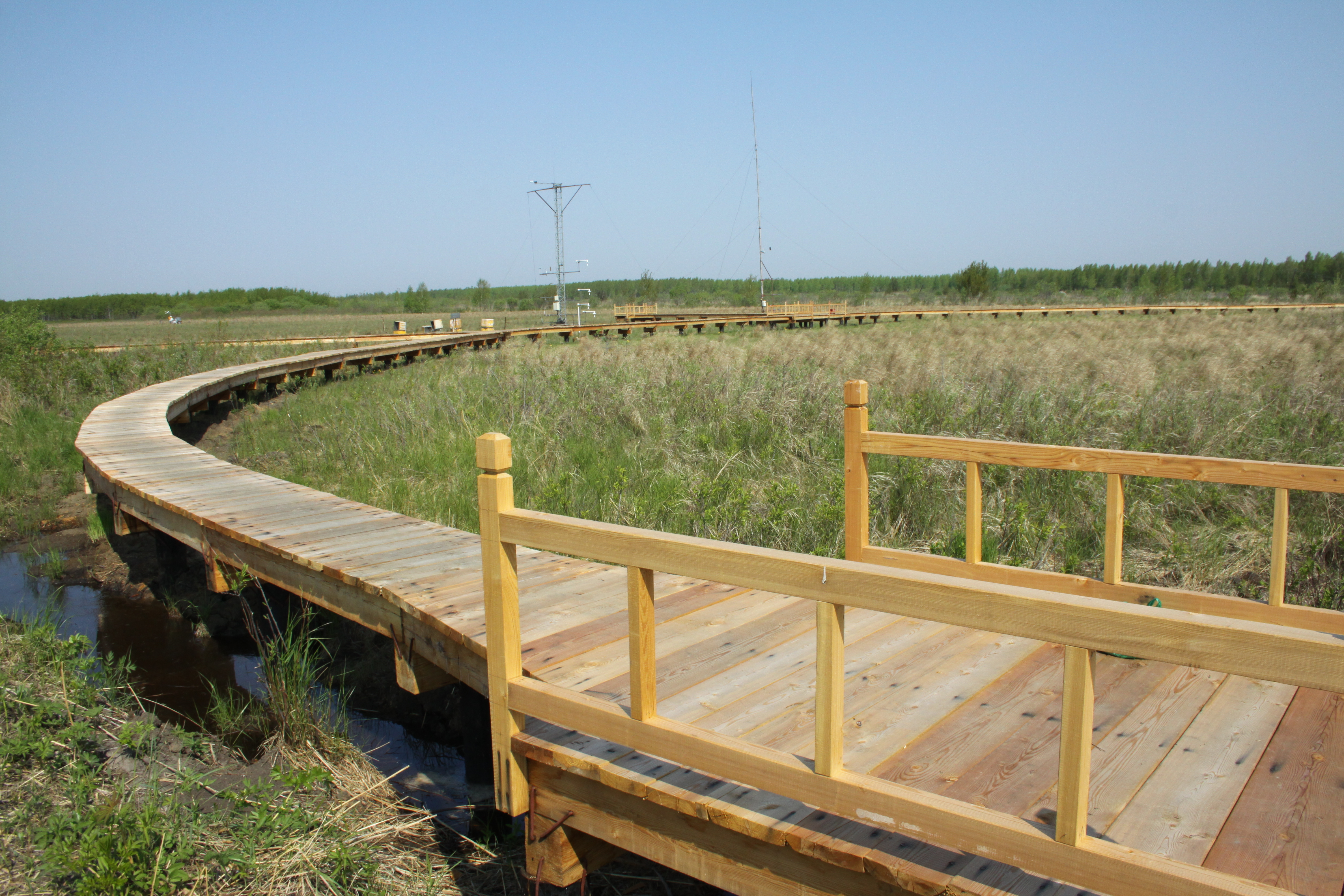
Sanjiang Plain Marsh Ecological Experimental Station (SJM) is located in one of the largest marshes distribution areas, Sanjiang Plain, which is a low plain formed by the Heilongjiang River, Songhua River, Wusuli River. The station (133°31′E,47°35′N) has an altitude of ~56 m.a.s.l, belongs to the temperate continental monsoon climate zone, with the mean annual temperature of 1.9℃, and annual rainfall of ~600 mm. The area has an annual frost-free period of 125 d and is a typical seasonal frozen area with the freezing and thawing period from early November until the middle of June in the next year. The dominated vegetation composition are Carex lasiocapa, Carex pseudocuraica, Carex meyeriana, Glyceria spiculosa, Deyeuxia angustifolia, and the soil types are mainly meadow bog soil, humus bog soil and gley white paper clay, white pulp meadow soil, etc.The main crops are soybeans and rice in this area.
-
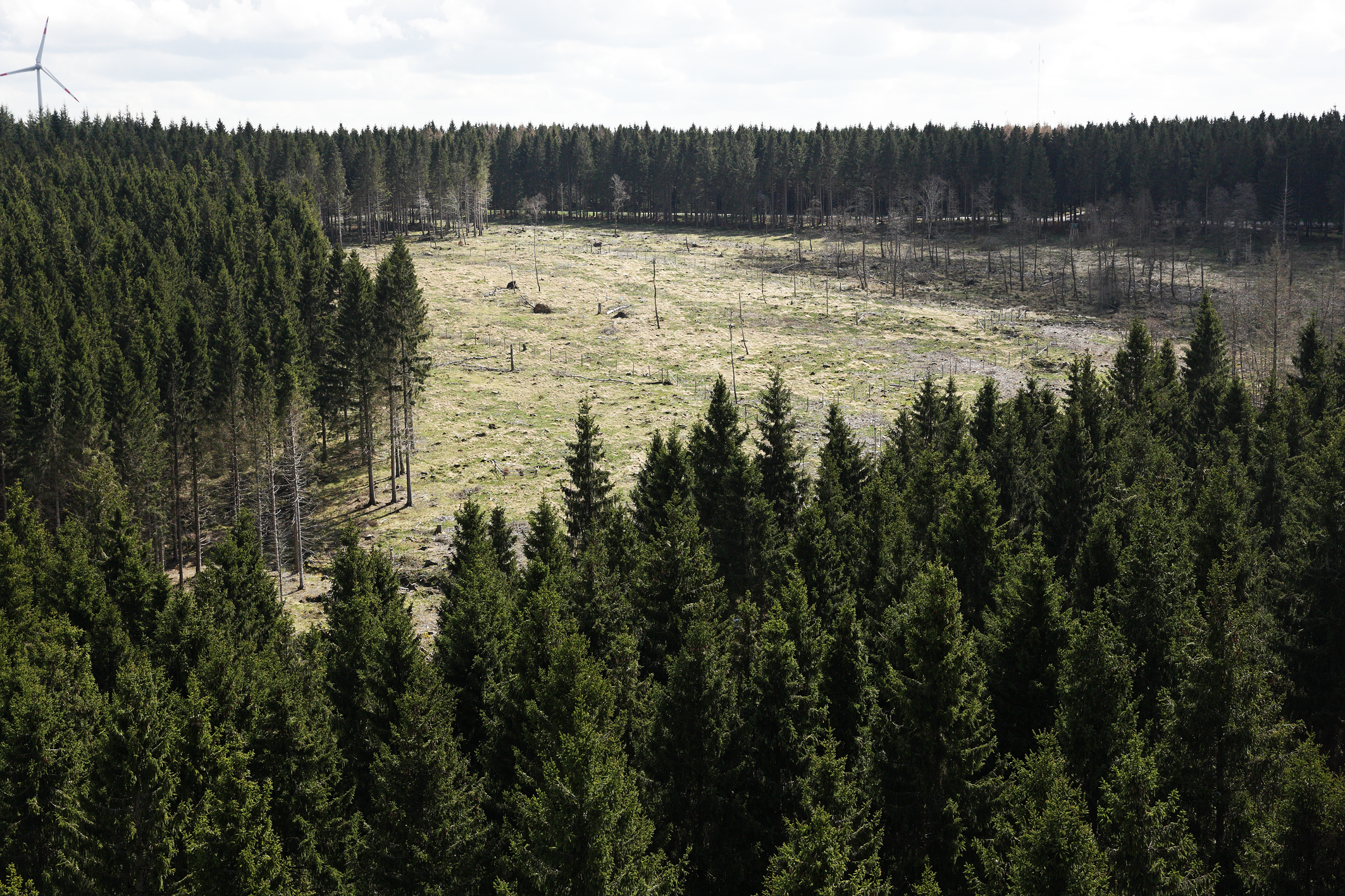
The Wüstebach catchment is located in the Eifel National Park and covers an area of 38.5 ha, with mean altitude of about 610 m. The geology is dominated by Devonian shale, which is covered by a periglacial solifluction layer of about 1–2 m thickness. Cambisols and Planosols have developed on the hillslopes, whereas Gleysols and Histosols have formed in the valley. The main soil texture is silty clay loam and the litter layer has a thickness between 0.5 and 14 cm. The mean annual precipitation is about 1200 mm. Norway Spruce planted in 1946 is the prevailing vegetation type. During late summer/early autumn of 2013, trees were almost completely removed in an area of 9 ha by the national park forest management in order to promote the natural regeneration of near-natural deciduous forest from spruce monoculture forest.
-
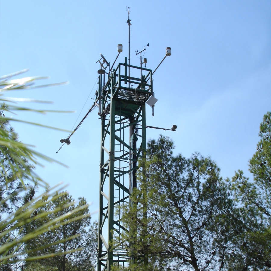
The Yatir Research site was set up in 2000 at the center of the Yatir Forest, a 2'800 ha afforestation system of mainly P. halepensis trees, and is located on the southern end of the Hebron mountain range and at the northern edge of the Negev desert (31° 20’ N; 35° 3’ E; elevation 600 to 850 meters above sea level). Most of the area was planted during the 1960s-1970s. The site is located in the transition zone between the semi-arid and arid Mediterranean climates. Average air temperature for January and July is 10 and 25°C, respectively. Mean annual potential ET is 1600 mm, and mean annual precipitation is 285 mm. Only winter precipitation occurs in this region, creating a distinctive wet season (winter, December to March) and an extended dry season (summer, June to October), with short transition periods between them: a wetting season (autumn) and a drying season (spring). Research in the site mainly focuses on ecophysiology and ecohydrology, energy, carbon and water budgets, influence of stand density (through manipulation experiments), boundary layer dynamics and ecosystem interactions with the climate.
-
Located in Huitong County, Hunan Province (26°45´N and 109°30´E), Huitong National Research Station of Forest Ecosystem is affiliated to the Institute of Applied Ecology of Chinese Academy of Sciences. This region marks a transition from Yun-Gui Plateau to the hills along the southern bank of Yangtze River and belongs to the up reach of Yuan River, a tributary of the Yangtze. The altitude ranges from 300 m to 1100 m above the sea level. The densely grouped hills and valleys feature the topography in this region, which determining forestry to be the major method of land use in this County. The mother rock mainly consists of grayish green slate, metamorphic rock and sandy shale. With relatively deeper layer, red earth or reddish yellow earth are generally distributed from 300m to 600m above sea level, and mountainous yellow earth above 600m. This region has a typical climate of Central Subtropical Zone, with average annual temperature of 16.5℃. The annual rainfall and annual evaporation range from 1200 to 1400mm and from 1100 to 1300mm, respectively, with average relative humidity of 83% and 300 days of frost-free period. The zonal vegetation is evergreen broad-leaved forest typical of subtropics, with the major species component of Castanopsis spp.and Lithocarpus spp.
-
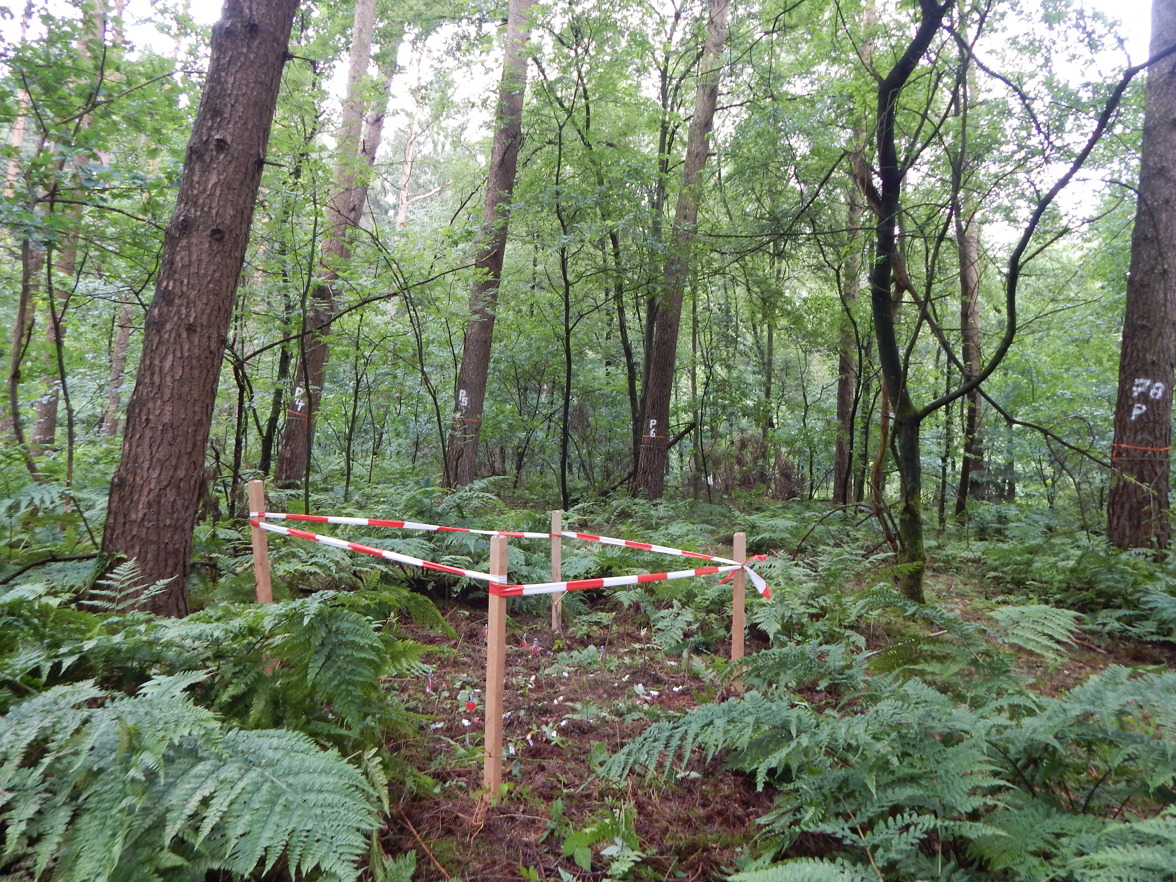
Quercus robur and Pinus silvestris forests on glacio-fluvial sediments
-
Intensive Forest Monitoring site with Pinus silvestris - Betula pendula forest