
soil gravimetric water content
Type of resources
Available actions
Topics
Keywords
Contact for the resource
Provided by
Years
Formats
Representation types
-

Hydrometeorological and biogeochemical observations within 5 embedded catchments (from 0.2 to 14.5 km2). Alpine Mediterranean climate with heavy rainfall and flash floods in automn. The geology is mainly granite. The land use is mainly grassland and forest. More information at http://www.ohmcv.fr
-
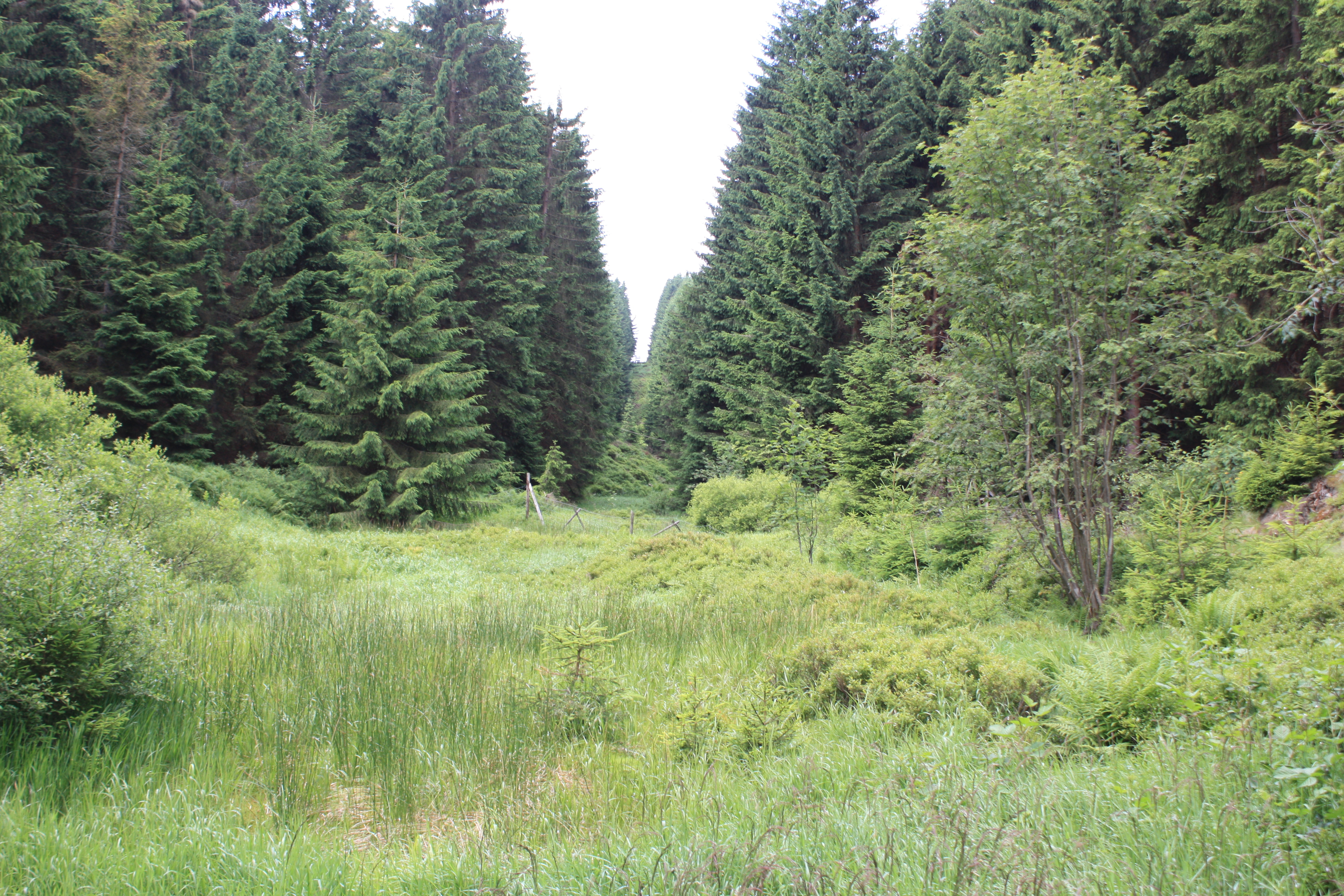
Coniferous forest.
-
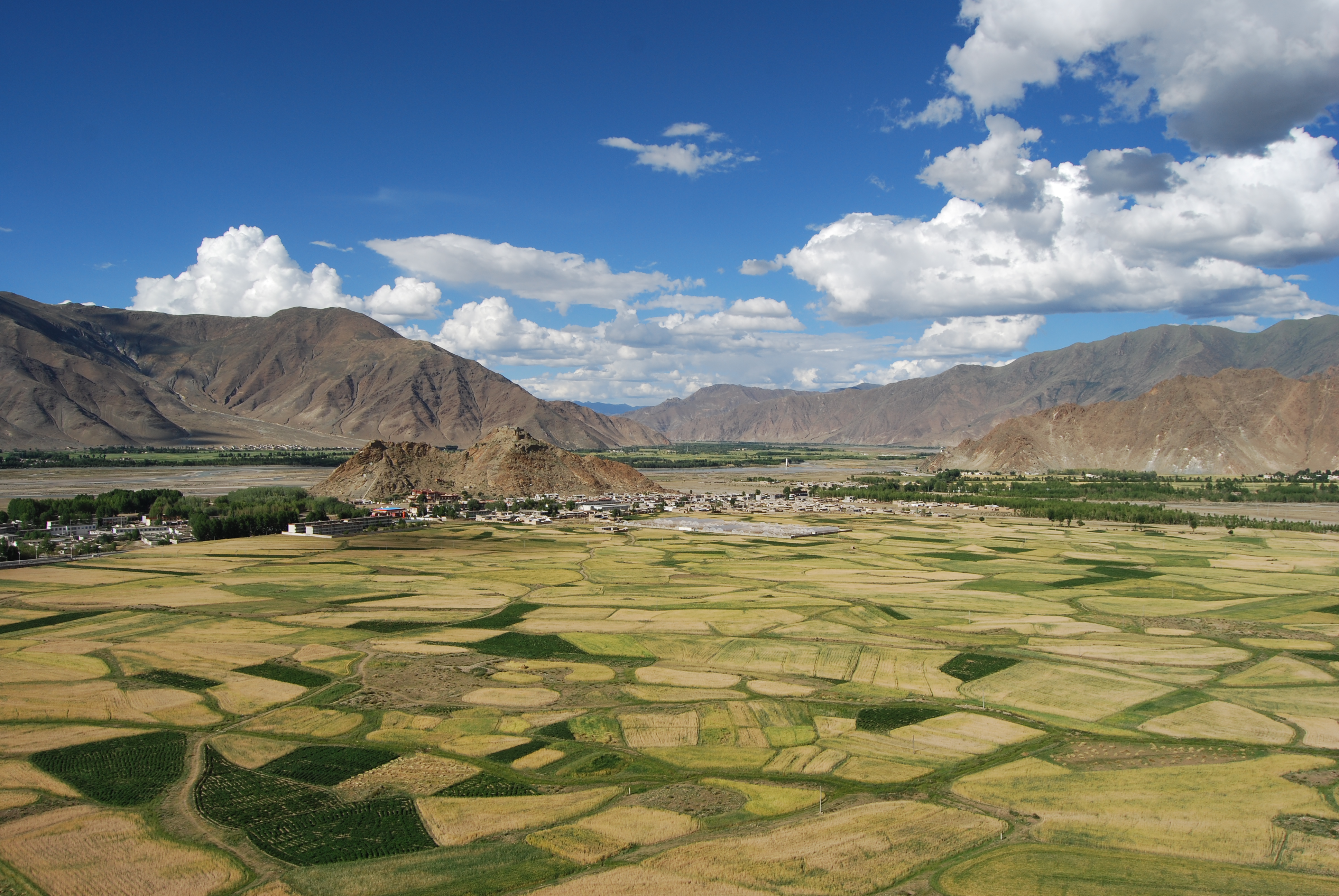
The Lhasa Plateau Ecosystem Research Station is situated at Dagze county, with approximately 3688 m above sea level, Tibet Autonomous Region. It is one of the highest elevation agro-ecological station in World.
-
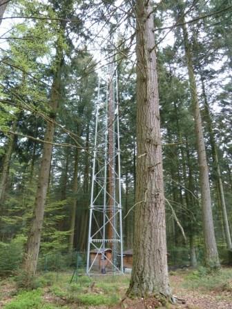
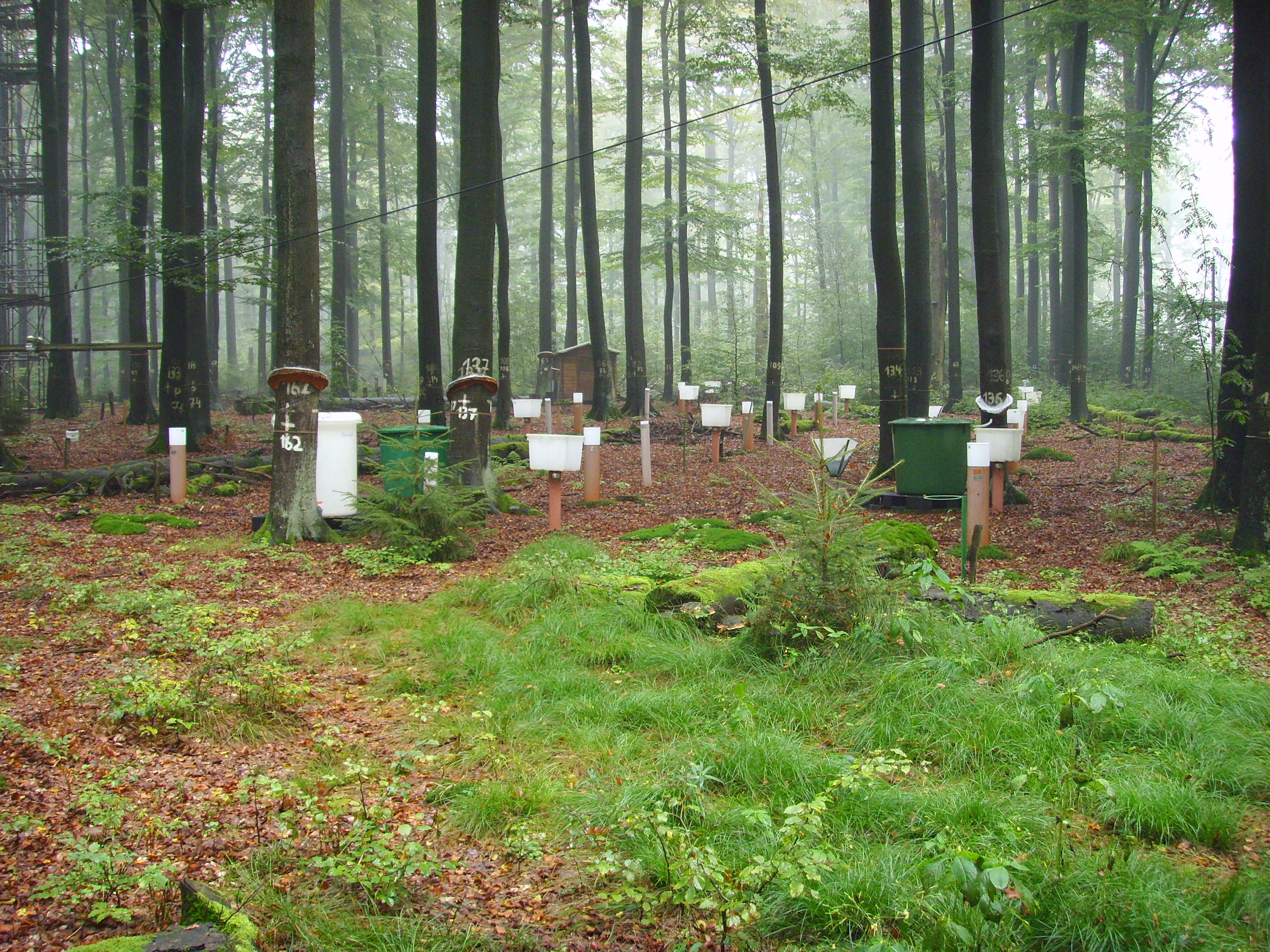
The site is a mixed mature forest composed mainly of Fagus Sylvatica, Pseudotsuga menziesii and Picea abies. The soil (100-150 cm deep) is a silty and stony soil with B structural horizon composed by schist and phyllades. Fluxes of CO2 and water vapour and micrometeorological measurements are performed above the forest by an eddy-covariance system installed on a tower since 1996. During the successive measurement years, several complementary campaigns have been organised : forest inventory, automatic soil respiration measurements, advection, ecosystem water budget, diffusion of CO2 and stable isotopes in soil, volatile organic compounds fluxes, soil carbon content inventory, monthly evolution of nitrogen deposition... Research activities are carried out by the University of Liège (GxABT) and the Université catholique de Louvain (UCL) within the ICOS infrastructure.
-

Dong Cao is a small agricultural catchment (47 ha) of northern Vietnam, located at 70 km from Hanoi, in a sloping land environment. The objective is to monitor the impacts of land use changes (from cassava to fodder and tree plantations) and possible climate changes upon hydrological and sedimentary fluxes and budgets. The catchment has an elevation of 125 m to 485 m and slopes range from 15 to 120%. Monitoring devices include an automatic meteorological station, and weirs to monitor discharge, suspended sediment and bedload. More information is available on https://mtropics.obs-mip.fr/ and in the following paper: Valentin, C., et al., 2008. Runoff and sediment losses from 27 upland catchments in Southeast Asia: Impact of rapid land use changes and conservation practices. Agric. Ecosyst. Environ. 128, 225–238. https://doi.org/10.1016/j.agee.2008.06.004
-
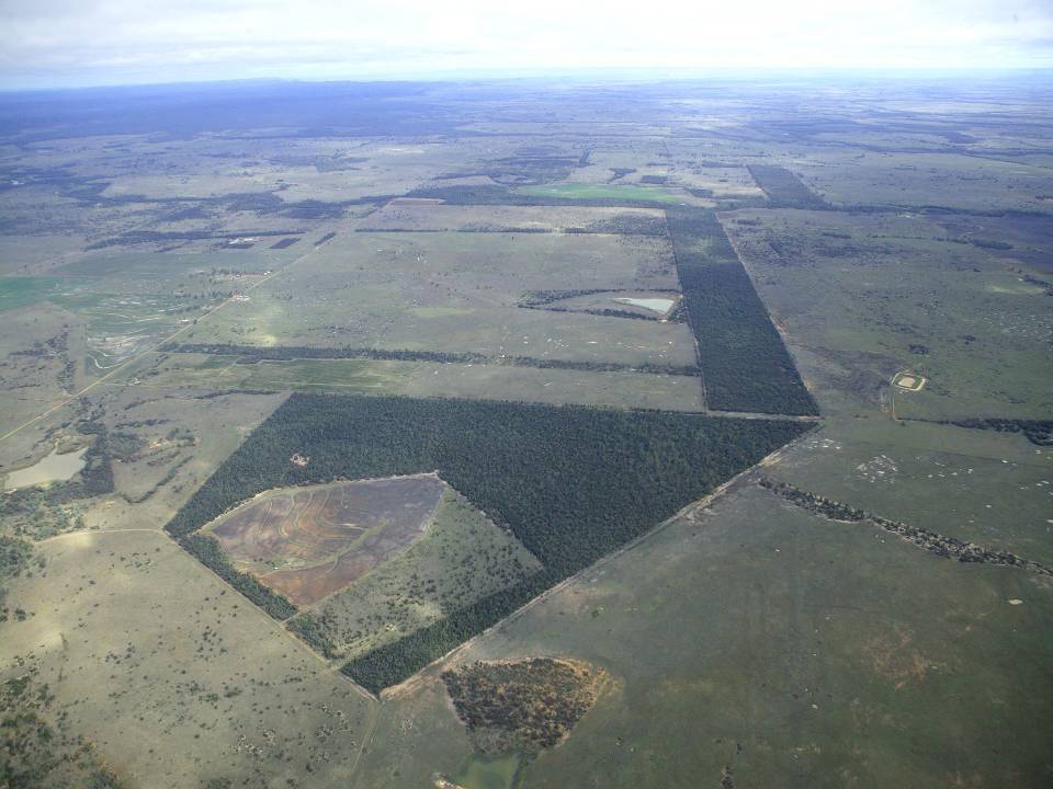
The aim of the Brigalow Catchment Study is to determine the effects of land clearing and land use change on hydrology, water quality, soil fertility and crop and animal productivity in the Brigalow Belt bioregion of central Queensland, Australia
-
Solling Experimental Forest
-
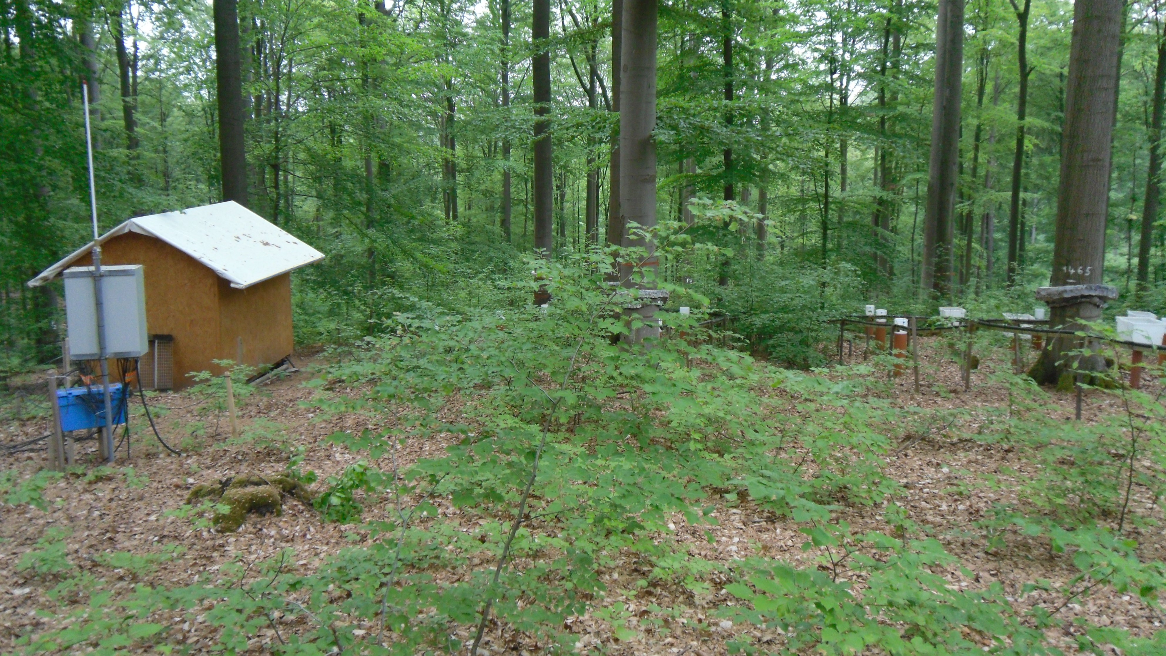
Krofdorf Forest hydrological research area 4 catchments: A1 (9 ha), A2 (20 ha), B1 (11 ha), B2 (14 ha)
-
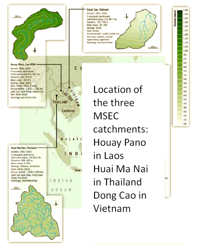
Houay Pano is a small agricultural catchment (60 ha) of northern Lao PDR, 10 km from the UNESCO world heritage city of Luang Phrabang, in a sloping land environment monitored since 1998. The objective is to monitor the impact of land use changes from annual crops (upland rice, Job’s tear and maize, cultivated with slash and burn system) to perennial (teak trees), and of climate changes upon hydrological and sedimentary fluxes and budgets, along with water quality (including microbial contamination). The mean slope is 48%. Alfisol, Ultisol, Entisol developed on shale and shist. Monitoring devices include an automatic meteorological station, weirs to monitor discharge from nested catchments, suspended sediment, and bedload, piezometers, and electrical resistivity. More information is available on https://mtropics.obs-mip.fr/ and in the following papers: Boithias, L., et al., 2021. The Multiscale TROPIcal CatchmentS critical zone observatory M-TROPICS dataset II: land use, hydrology and sediment production monitoring in Houay Pano, northern Lao PDR. Hydrol. Process. 35, e14126. https://doi.org/10.1002/hyp.14126 Ribolzi, O., et al., 2017. From shifting cultivation to teak plantation: effect on overland flow and sediment yield in a montane tropical catchment. Sci. Rep. 7, 3987. https://doi.org/10.1038/s41598-017-04385-2 Valentin, C., et al., 2008. Runoff and sediment losses from 27 upland catchments in Southeast Asia: Impact of rapid land use changes and conservation practices. Agric. Ecosyst. Environ. 128, 225–238. https://doi.org/10.1016/j.agee.2008.06.004 More information is available on https://mtropics.obs-mip.fr/ and in the following papers: Boithias, L., et al., 2021. The Multiscale TROPIcal CatchmentS critical zone observatory M-TROPICS dataset II: land use, hydrology and sediment production monitoring in Houay Pano, northern Lao PDR. Hydrol. Process. 35, e14126. https://doi.org/10.1002/hyp.14126 Ribolzi, O., et al., 2017. From shifting cultivation to teak plantation: effect on overland flow and sediment yield in a montane tropical catchment. Sci. Rep. 7, 3987. https://doi.org/10.1038/s41598-017-04385-2 Valentin, C., et al., 2008. Runoff and sediment losses from 27 upland catchments in Southeast Asia: Impact of rapid land use changes and conservation practices. Agric. Ecosyst. Environ. 128, 225–238. https://doi.org/10.1016/j.agee.2008.06.004
-
Forest Hydrological Research Basin Lange Bramke