
soil macrofauna abundance
Type of resources
Available actions
Topics
Keywords
Contact for the resource
Provided by
Years
Formats
Representation types
-
The site is located between two bio -geographical zones arid and hyper-arid, the research is carried out by both sides. The arid side is characterized by remains of terraces from the Nabatean agriculture runoff. The main research topics that being studied in the site are: biodiversity, climate change, runoff hydrology. The arid zone is a geo hydrological ecological system which is depended on a combination of rainfall and runoff that creates water enriched parches that support relatively high biodiversity. The hyper arid zone is runoff depended system the source of runoff are stipe, slope consist on bare bedrock, biological activities are constructed in the dry riverbeds that functions as sinks for the runoff generated from the slopes.
-
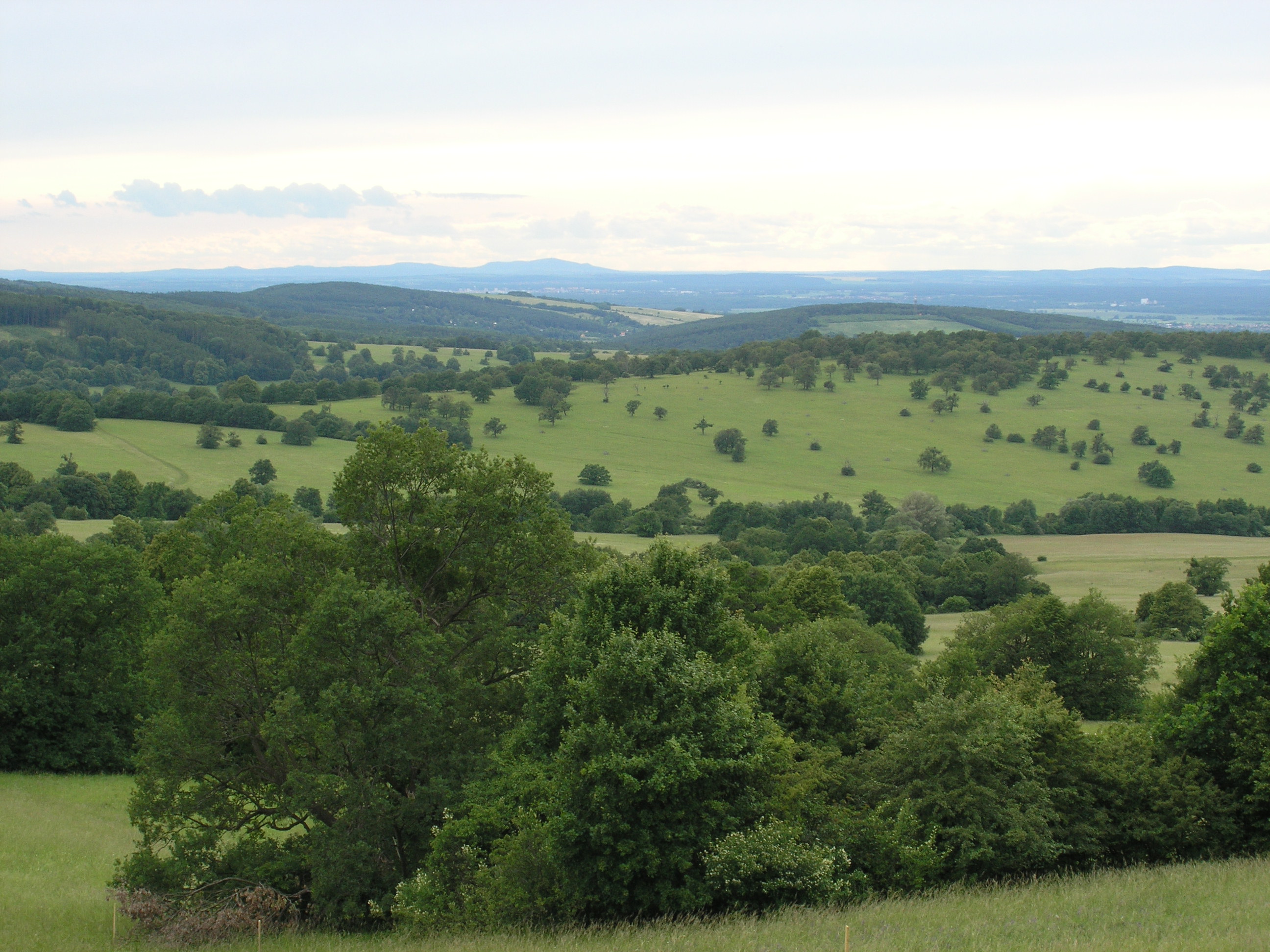
The White Carpathian (Bílé Karpaty) Mts. are important especially for their vast species-rich meadows with many rare and endangered species, often having here very large populations or remarkably isolated occurrences distant from the centres of their natural ranges. Čertoryje Nature Reserve and its buffer zone, which form the majority of the LTER site, is the largest area of this precious habitat in the White Carpathians. Meadows which were not fertilized (or even ploughed up) under socialist agriculture in the second half of the 20th century are the most valuable. These meadows are usually situated on steep slopes which were hardly accessible to the machinery and were thus often totally abandoned and gradually overgrew with expansive grasses and scrub. Their current biological diversity therefore needs resumption of the former extensive management (scrub elimination and subsequent regular mowing without fertilization). These resoration activities started here in the mid 1980s. A fine-scale monitoring of vegetation succession after management restoration at one of these plots is a component of the long-term research here since 1989. The opposite extreme of socialist agricultural management of species-rich meadows was their conversion to arable land. These fields have been gradually re-grassed since 1989. Restoration of the former species-richness is however very slow (or even impossible) and needs special restoration measures. Hence another objective of the local long-term research is the succession on re-grassed arable fields. Spatially detailed observations take place on the eastern slope of the Výzkum hill and are aimed to find out an optimalized economic method of restoring a species-rich meadow (four variants are tested). Except vegetation succession, also the development of several soil fauna coenoses (Testacea, Nematoda, Oribatida, Collembola, Enchytraeidae, Lumbricidae, Oniscidea, Diplopoda, Chilopoda, Opiliones, and Carabidae) has been studied here since 2000. Since 2009, also succession in a broader landscape context is studied, taking into account restored grasslands in a major part of the whole White Carpathian Mountains. More than one tenth of the localities from this landscape study takes place directly in the LTER site, representing about 100 hectares regrassed by a regional species-rich seed mix since 2000 and 30 hectares regrassed by a commercial clover-grass seed mix in the late nineties. The research is focused on both plants (mainly vascular plants, additionally also bryophytes) and animals (Auchenorrhyncha, Heteroptera, Lepidoptera: Hesperioidea, selected phytophagous Coleoptera).
-
Restinga semideciduous broadleaf forest with trees varying between 4 and 10 meters tall growing on nutrient-poor white sand soils distributed parallel to the Atlantic coastline. Mean annual temperature is 26oC and mean annual precipitation is 1746mm, concentrated between March and August. Dry season length (months < 100 mm) experience considerable interannual variation (3-9 months) and averages 6.2 months.
-
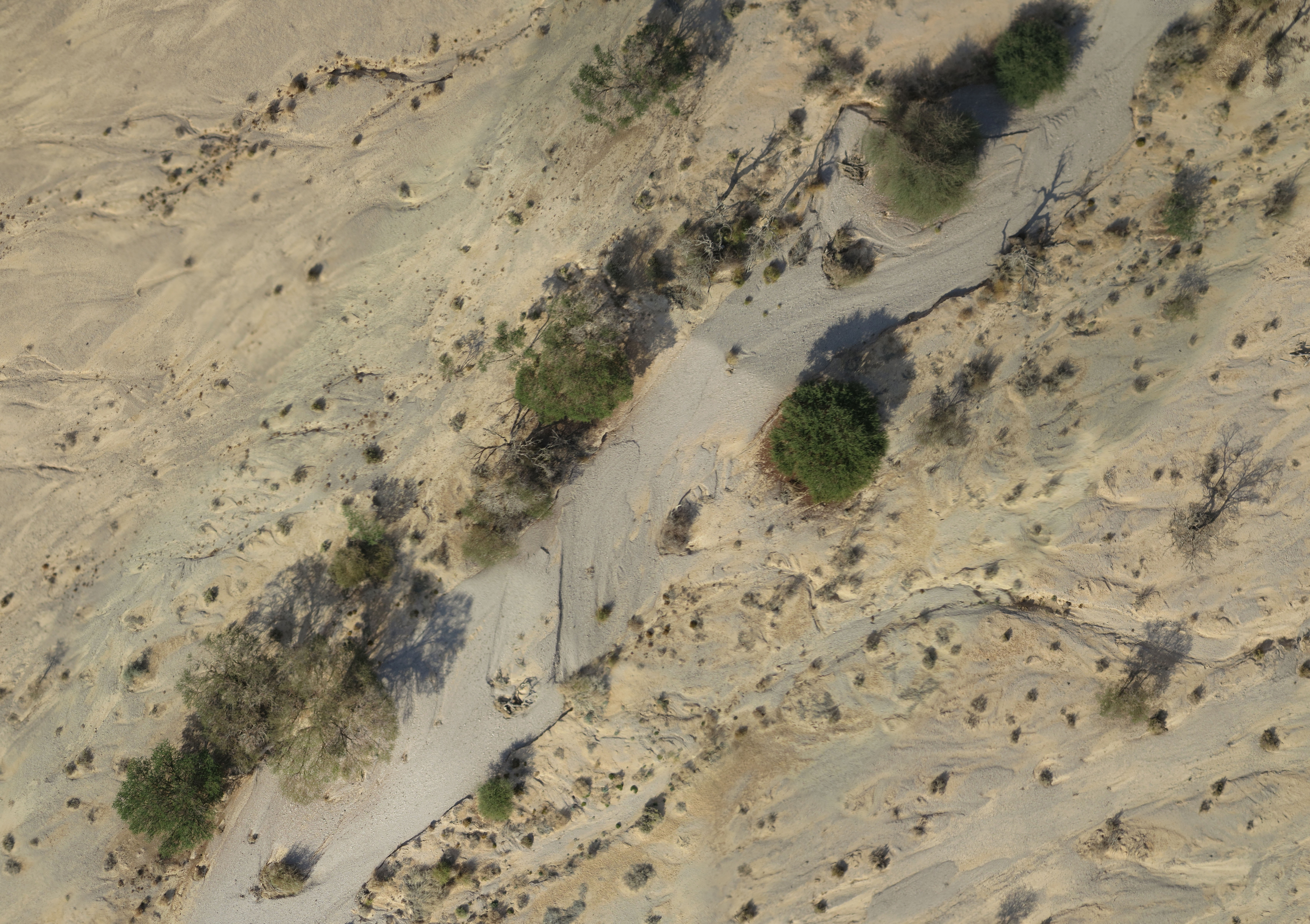
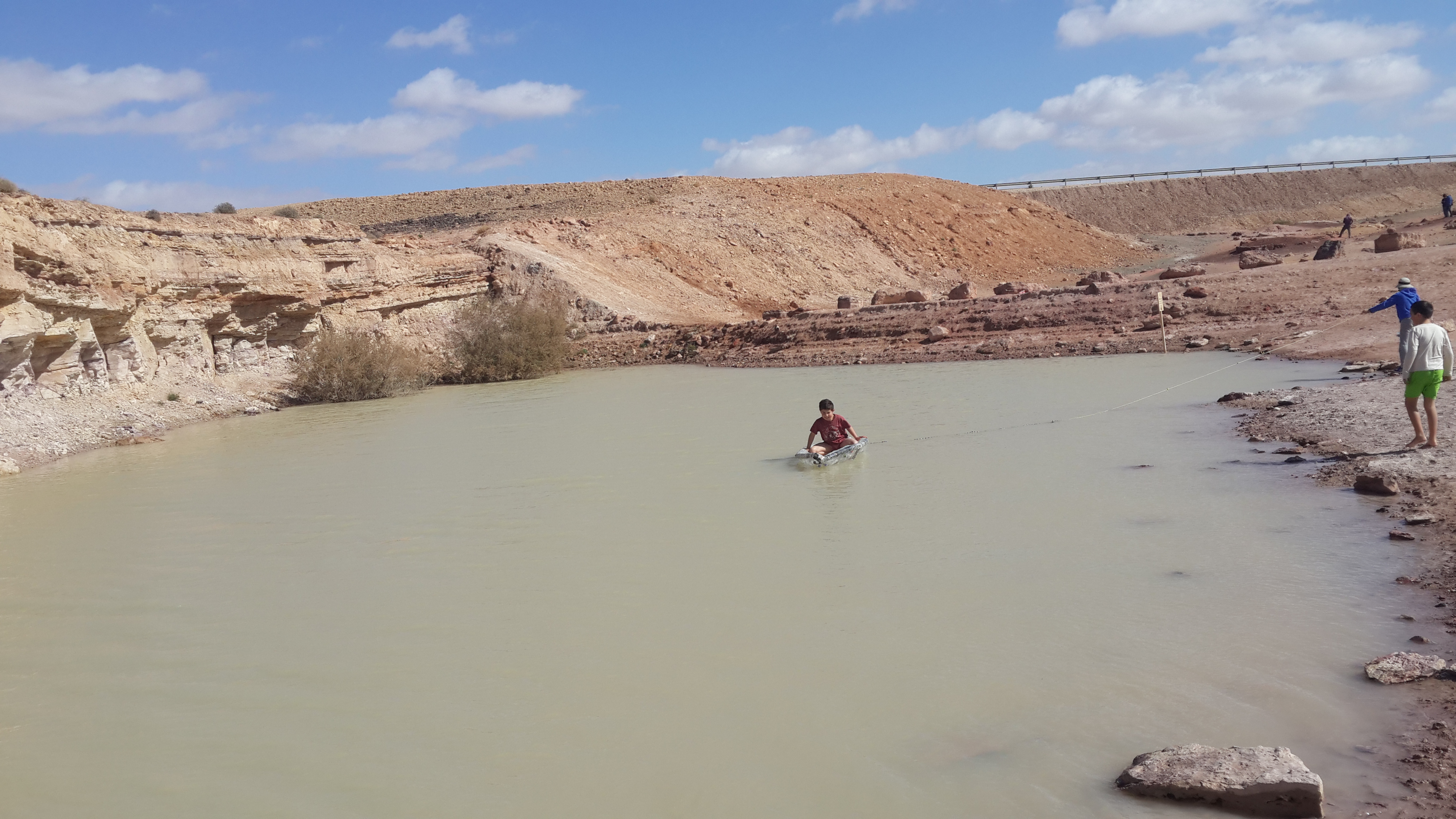
A small watershed that collects floods and run-off. The lowest place is home to a (relativity) dense Acacia savana. The slopes are completely bare. The wadi is covered with alluvium resting on a 6 m layer of red surface of late Pleistocene, which includes silt, clay and fine sand. Rainfall is 30 mm
-
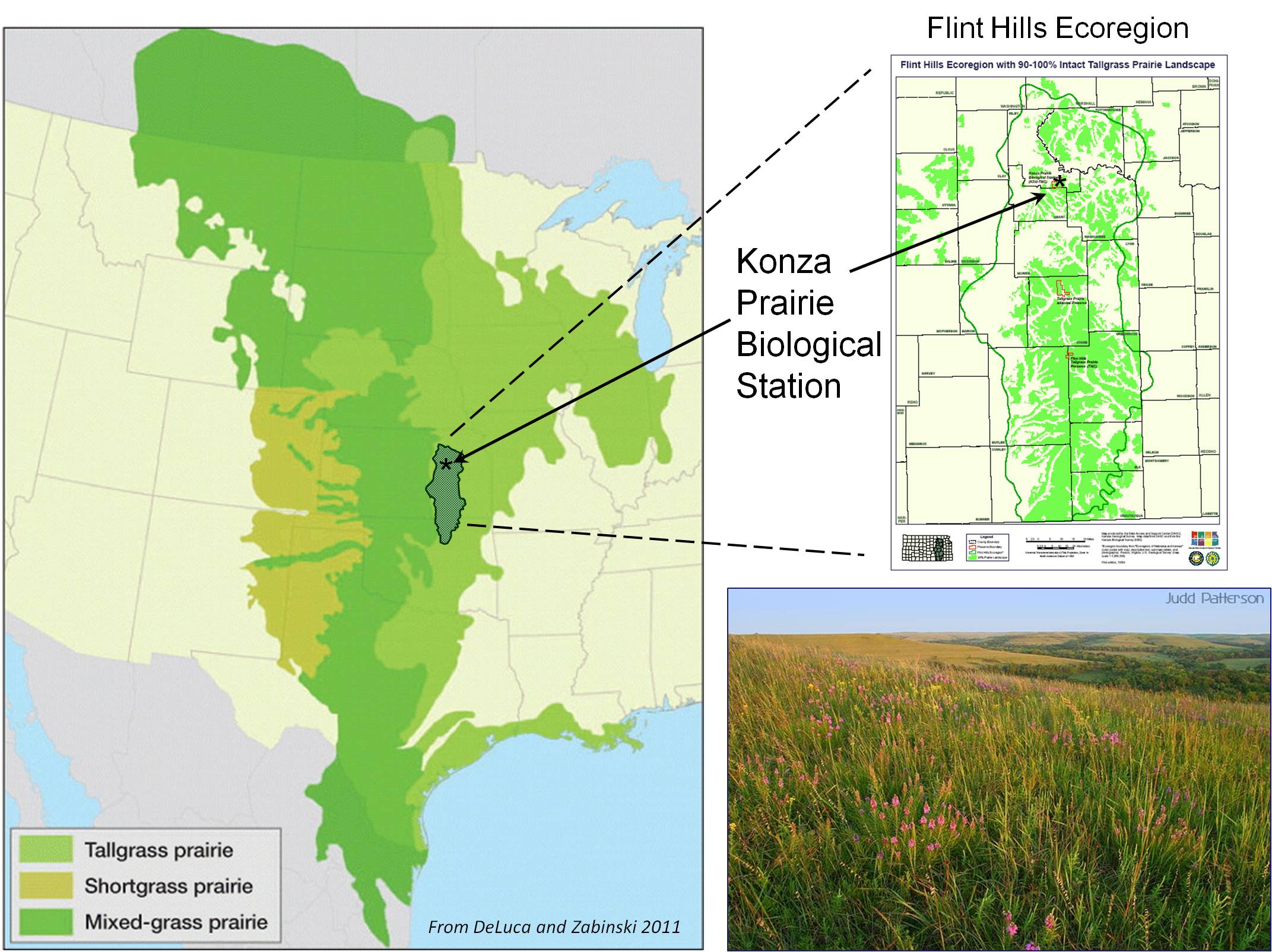
The primary research site for the Konza Prairie LTER program is the Konza Prairie Biological Station (KPBS), a 3,487-ha native tallgrass prairie preserve and research station jointly owned by The Nature Conservancy and Kansas State University. The KPBS is located in the Flint Hills of northeastern Kansas (39°05’ N, 96°35’ W), a grassland region of steep-slopes overlain by shallow limestone soils unsuitable for cultivation. The climate is continental, with mean annual precipitation of 835 mm yr-1, but high variability. KPBS is topographically complex (320 to 444 m asl), and soil type and depth vary with topography. Soils are silty clay loams, formed from thick colluvial and alluvial deposits ≥2 m in lowlands, while hillside and upland soils are shallow. Soils overlay alternating layers of limestone and shale, contributing to complex subsurface hydrology. Vegetation is primarily (>90%) native tallgrass prairie dominated by perennial C4 grasses, but precipitation is sufficient to support woody vegetation, making periodic drought, fire and grazing critical for maintaining grassland. Numerous sub-dominant grasses, forbs and woody species contribute to high floristic diversity (>600 plant species). The entire Kings Creek watershed, a USGS Benchmark Stream, is located on Konza. Hardwood forests occur along major stream courses. Several agricultural fields and restored prairies are located on site. Overall, the site is representative of native tallgrass prairie, with selected areas representing other contemporary land use practices (e.g., agriculture, restored grasslands, cattle and bison grazing).
-
The tidal flats between Den Helder in the Netherlands and Esbjerg in Denmark are the largest continuous tidal flats in the world and one of the last areas in Europe where nature can still develop to a great extent without human influence. So that this can continue, the German coastal states declared it as National Parks: in 1985 the Schleswig- Holstein Wadden Sea, in 1986 Lower Saxony Wadden Sea and in 1990 the Hamburg Wadden Sea. The Wadden Sea in Schleswig-Holstein, Niedersachsen and the Netherlands was placed on the UNESCO World Heritage List in 2009.
-
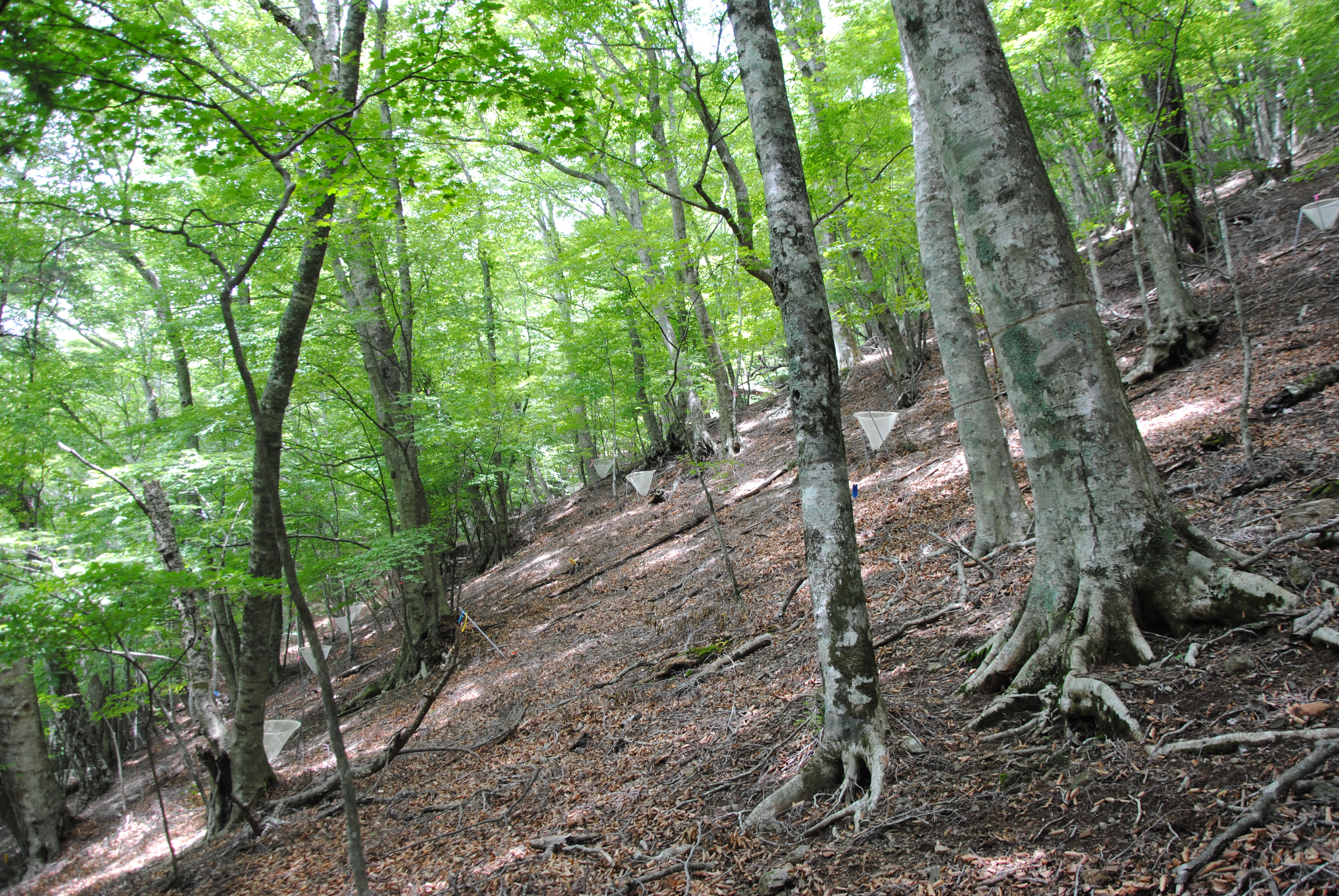
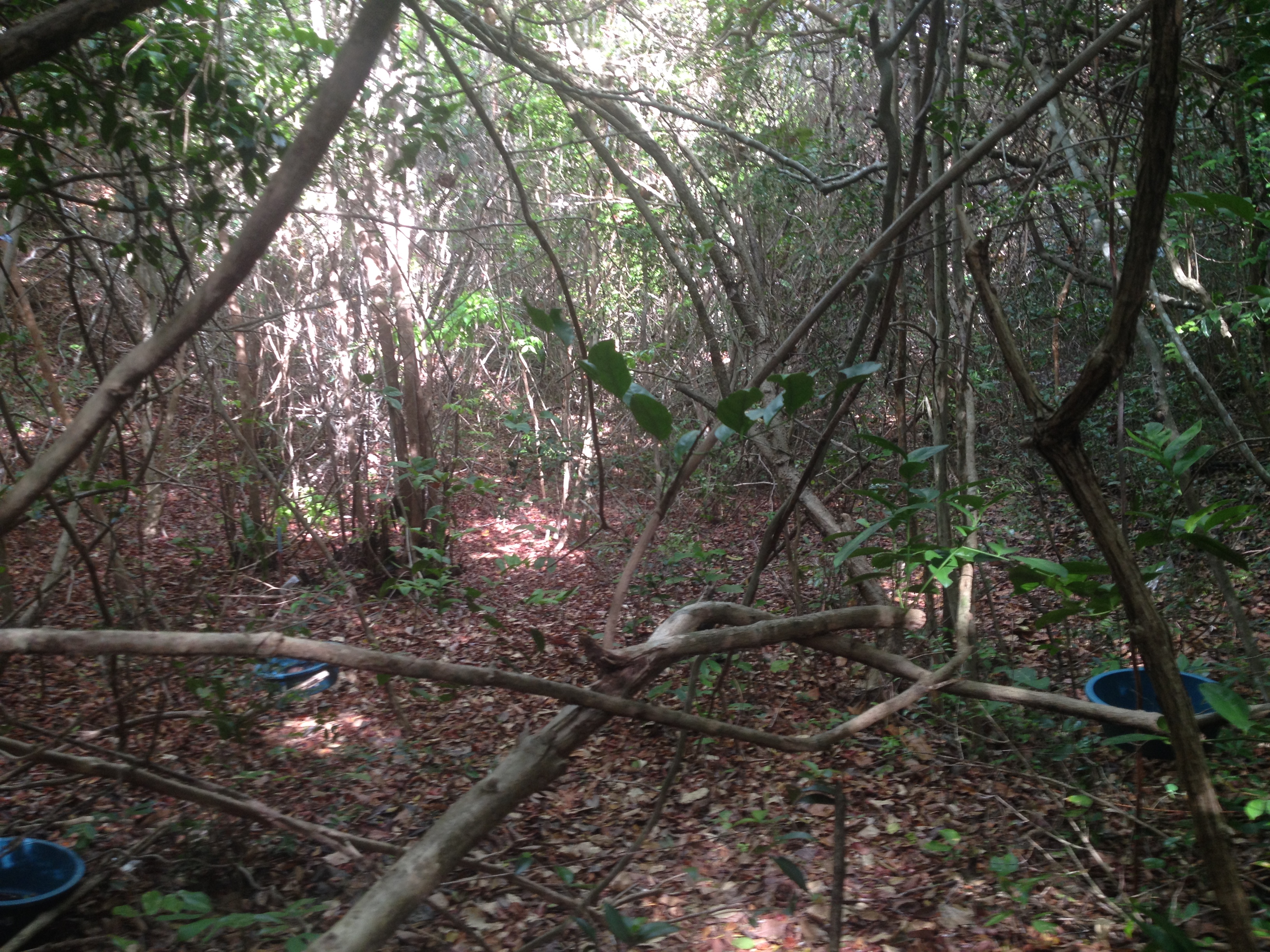
The site is located in a primeval forest in The University of Tokyo Chichibu Forest (UTCF), as a field of research and education about forest science in the cool-temperate region. UTCF covers at 5,812 ha and occupies elevations ranging from 600 m to 1,600 m, which is composed of various types of natural forest stands.
-
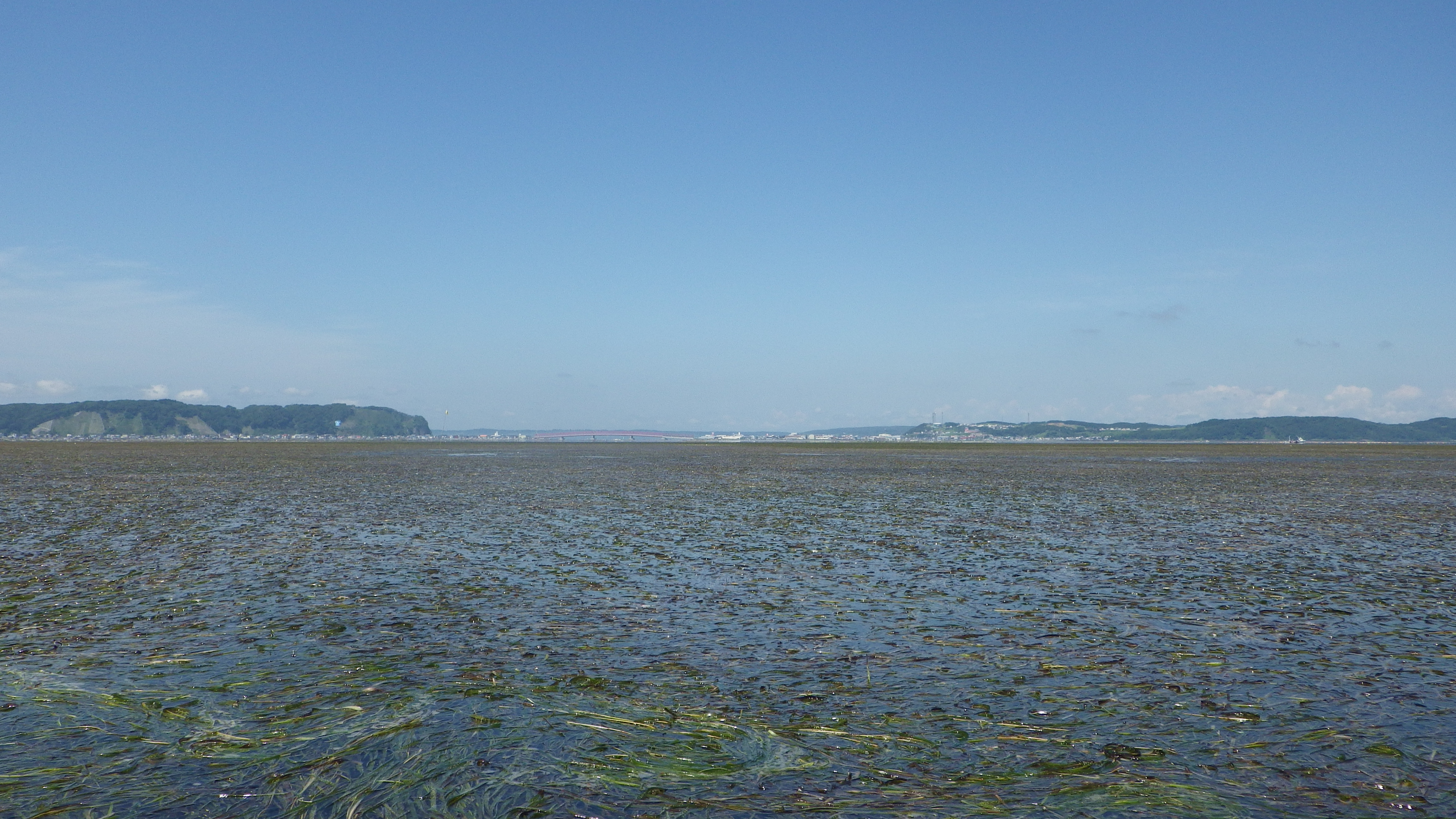
Akkeshi JaLTER site locate along the Pacific coast of Eastern Hokkaido. It consists of various habitats such as Bekanbeushi river system, Akkeshi-ko estuary and Akkeshi Bay, which formed an ecotone connecting freshwater, brackish water and marine environment.
-
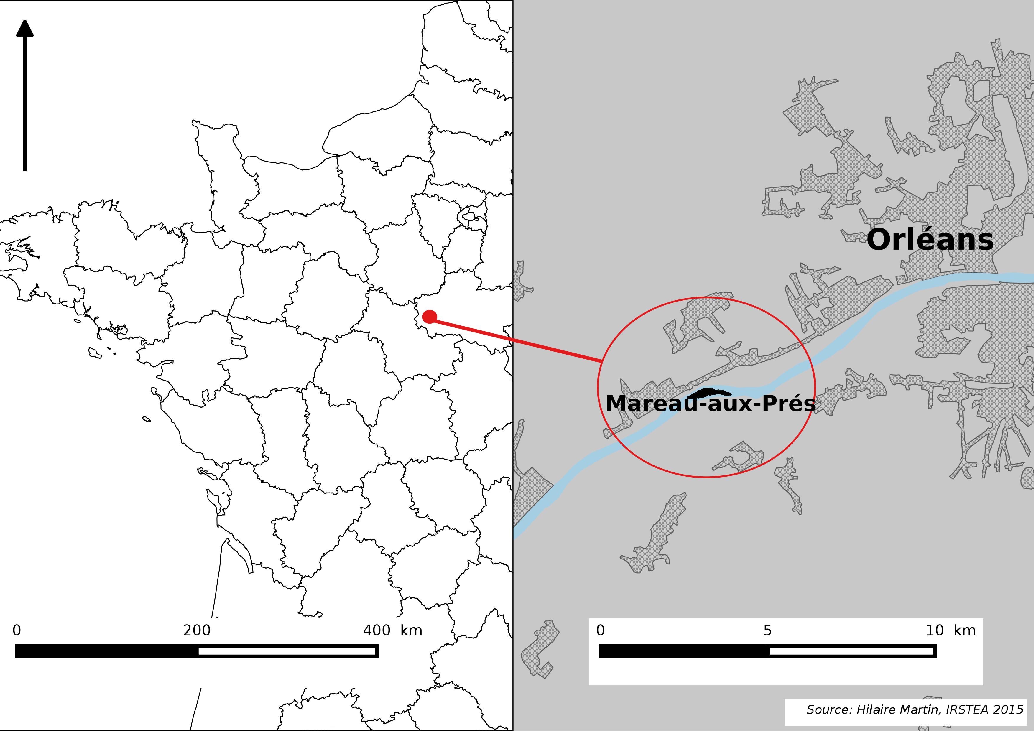
The Mareau-aux-Prés islands, along the Loire river, are characterized by a multiple channel pattern, where natural limestone riffles influence the morphology and spatial distribution of vegetated islands, secondary channels and alluvial bars. Within these islands, in september 2012, fluvial management operations (FMO) were launched. The vegetation of the central sandy-gravelly bar (3 ha area) was uprooted and the bar level lowered in order to maintain the flow capacity of the river. A new sandy-gravelly bar appeared in spring 2013, ideal field support for studying long-term ecological issues. A multidisciplinary research program (‘BioMareau’ project) is currently being conducted from 2012 to 2019, focusing on biodiversity recolonization and on interactions and feedbacks between biotic and abiotic compartments.
-
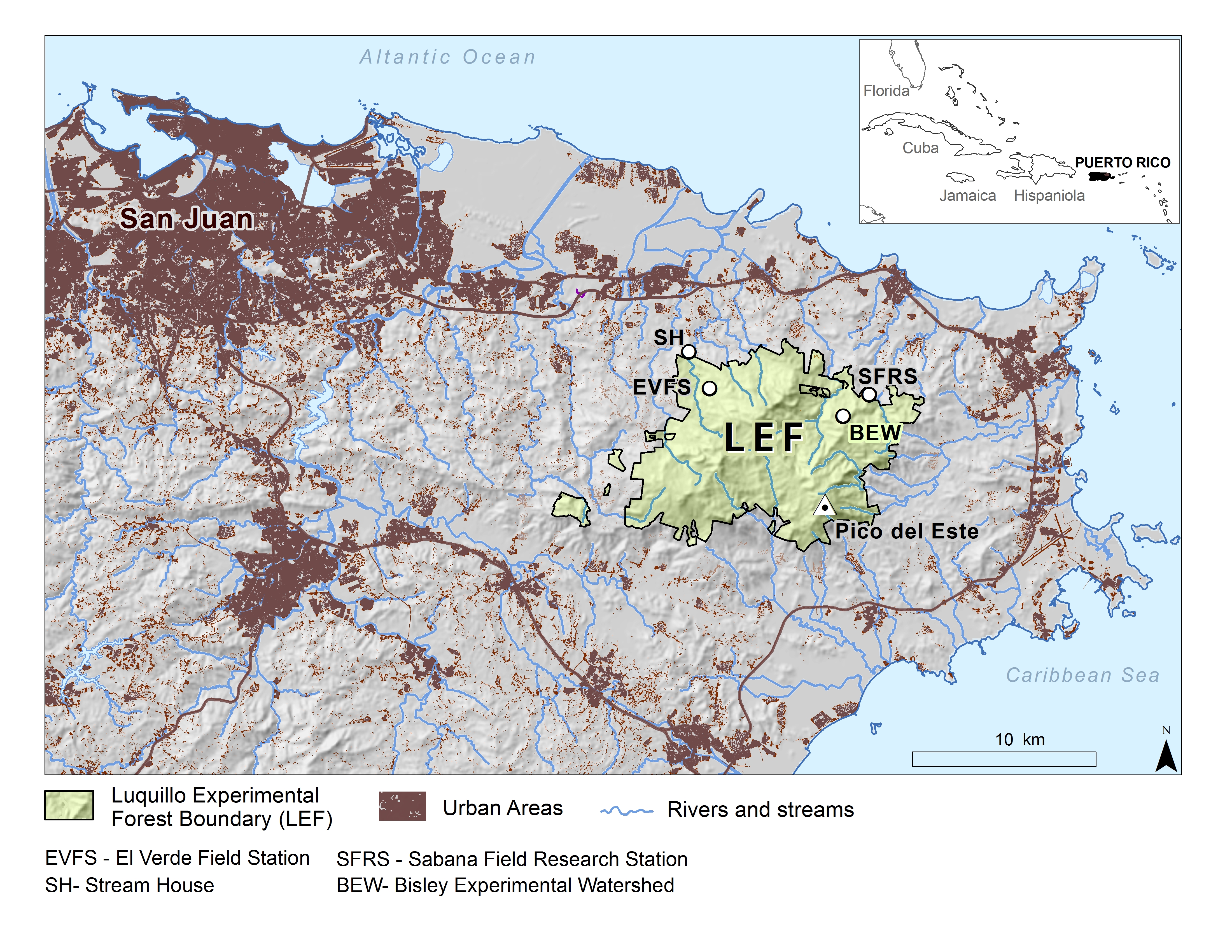
The majority of the Luquillo Long-Term Ecological Research (LUQ) program takes place in the Luquillo Mountains of Puerto Rico. This tropical setting has steep environmental gradients, a varied natural disturbance regime, and a history of human land use. Of the mountain area, 11,330 hectares are included in the Luquillo Experimental Forest (LEF), which is congruent with El Yunque National Forest, part of the U.S. National Forest system. The mountains rise to over 1075 m. Prevailing winds coming off the ocean from the east drop rain as they rise over the mountains; thus rainfall increases with elevation, ranging from about 3530 mm/year at low elevations to 4850 mm/year higher up. February through April are the drier months, but monthly rainfall is variable. Mean monthly temperatures at lowest elevations range from about 23.5ºC in January to 27ºC in September, and at the highest elevations from 17ºC to 20ºC (Climate and Hydrology). The geology of the Luquillo Mountains is mainly described as igneous rock formed in the Cretaceous, with some intrusive materials from the Tertiary. Soils are deep, weathered, and moderately rich in nutrients. Little humus accumulates, due to rapid decomposition, except in local areas at upper elevations, where decomposition seems to be inhibited by waterlogging. There are four main life zones, delineated on the basis of temperature and precipitation (Holdridge System), in the Luquillo Mountains: subtropical wet and subtropical rain forests are found at low and mid elevations, lower montane rain and lower montane wet forests at high elevations. There is also an area of subtropical moist forest at low elevations on the southwest slope. Natural disturbances in the Luquillo Mountains include hurricanes, landslides, treefalls, droughts, and floods. Human disturbances, mainly in the past, include road construction, charcoal production, clearing for pasture and crops, creation of coffee plantations, and logging. The forests are classified into four types: "tabonuco forest", "palo colorado forest", "palm forest", and "elfin woodland forest". Ascending the Luquillo Mountains through these forest types, shows a distinctive forest dynamic with the average tree height and diameter, number of tree species, and basal area (cross sectional area of tree stems) tend to decrease, while stem density increases. Epiphytes become more common with elevation. The animal community in the Luquillo Mountains exhibits several distinctive characteristics that affect the structure of its food web. The characteristics are a product of tropical location, disturbance regime, and spatial and temporal constraints related to island size, distance and history of isolation from continents. The only native mammal in the area are bats, all other mammals (cats, rats, and mongooses) are introduced. Birds include several species endemic to Puerto Rico, such as the Puerto Rican Tody, an understory insectivore, and the Puerto Rican Parrot, an endangered species. Streams in the Luquillo Mountains have steep channels with many boulders and series of pools and riffles. The dynamics of stream ecosystems are strongly influence by physical factors, such as the rapid change in elevation from headwaters to coastal plains, the intensity and frequency of rainfall events, and the high temporal variability of stream discharge.