
soil microbial diversity
Type of resources
Available actions
Topics
Keywords
Contact for the resource
Provided by
Years
Formats
Representation types
-
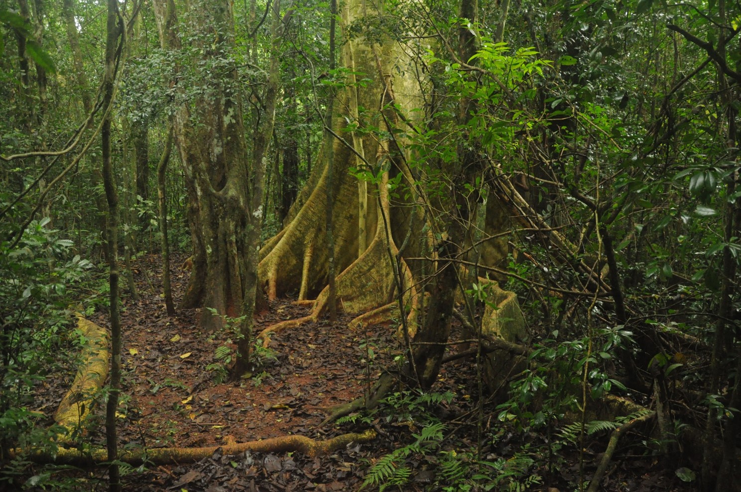
The site is composed by a set of Atlantic Forest fragments and restoration sites scattered in an agricultural landscape in north of Parana state, south Brazil. The forest in this region is a seasonal semi-deciduous form of Atlantic Forest, which undergone strong conversion rates from 1940 to 1980 and presently has only 8% forest cover, distributed in a myriad of small fragments. Forest fragmentation, fertilizer and pesticide leakage from agricultural fields and urbanization are the main regional drivers of environmental change. In each sub-site (forest fragment or restoration site) we are sampling flora, fauna and ecosystem attributes (forest biomass, litter fall, litter decomposition etc). The site is maintained by Londrina State University
-
The restoration sites are located in abandoned arable land and clear-cut tree plantations mostly, but not entirely within LTER Fulophaza that is a high diversity site, both in terms of habitats and species, in the Kiskunság Sand Ridge. It uses some of the central facilities of the KISKUN LTER, such as the meteorological station and the field research station with accommodation opportunities, and a couple of long term monitoring sites and field experiments.
-
Heshan station (112 °54' E, 22 °41' N) is located in Heshan County, Guangdong Province, China. It is one of the core stations of the Chinese Ecological Research Network (CERN) of the Chinese Academy of Sciences (CAS.). The station was co-established by South China Institute of Botany (Renamed as South China Botanical Garden in 2002), CAS and Heshan Institute of Forest Science in 1984 based on the experience and knowledge of previous studies in a degraded costal ecosystem. Natural Conditions:The station is located in the central part of Guangdong Province with a typical climate of south subtropical monsoon. The soil is laterite. The mean annual temperature is 21.7 C, the mean rainfall is 1700 mm, and the mean evaporation is 1600 mm. The region is a hilly agricultural zone with 78.6% of hilly land, 17.1% of farming land and 4.3% of water body. The zonal vegetation is evergreen broad-leaved forest of typical subtropics. Research Areas:The research areas of the station include but not limited to the followings: 1) Study on canopy water flux of Acacia mangiun forest in the hilly lands of South China by applying sap flow technique; 2) Ecosystem carbon cycling; 3) Conservation genetics of cryptocarya chinensis population in lower subtropical fragmented forest; 4) N2O emission from main types of agricultural and forest lands in tropical and lower subtropical region of China; 5) comparative study on restoration progress between degraded tropical and subtropical ecosystems; 6) effects of landfills on soil biota and water quality; 7) impacts of forest composition on restoration progress; 8) mechanisms of adaptation of invasive species; 9) effects of girdling and defoliation on plant resource use efficiency and soil processes (root exudation, soil respiration and soil biota); 10) confounding effects of manure application on eucalyptus forest and on NEP (Net Ecosystem productivity); 11) nematodes as bio-indicators of different ecosystems.
-
The Kellogg Biological Station (KBS) is located in southwest Michigan in the eastern portion of the U.S. cornbelt, 50 km east of Lake Michigan in the SW corner of the state (42° 24′ N, 85° 24′ W, elevation 288 m). Annual rainfall at KBS averages 1,005 mm/y with about half falling as snow; potential evapotranspiration (PET) exceeds precipitation for about 4 months of the year. Mean annual temperature is 10.1 °C. KBS is 1600 ha of cropping systems, successional communities, and small lakes. Surrounding KBS is a diverse, rural-to-semirural landscape typical of the U.S. Great Lakes and upper Midwest regions. The diversity of land use, soil and vegetation types, and aquatic habitats within a 50-km radius of the Station is high. Most of southwest Michigan is on the pitted outwash plain of the morainic system left by the last retreat of the Wisconsin glaciation, circa 12,000 years ago. Soils in the area developed on glacial till, and include well- and poorly-drained alfisols, mollisols, and entisols. Most regional soils are sandy loam and silty clay loam of moderate fertility, principal Station soils are Typic Hapludalfs. Land use around KBS ranges from urban (Kalamazoo, with a metropolitan population of 180,000, is 20 km south of the Station) to rural; vegetation ranges from cultivated and early successional old fields to older growth oak-hickory and beech-maple forests; and aquatic habitats include more than 200 bodies of water of different morphometries, alkalinities, and degrees of eutrophication within 50 km. Cropping systems in the area are typical of the U.S. cornbelt — mainly corn/soybean rotations with wheat of varying importance, and alfalfa an important forage crop. KBS yields are typical of non-irrigated yields elsewhere in the North Central Region. KBS LTER research is carried out in a variety of experimental systems. The most important of these is the Main Cropping System Experiment (MCSE), which was started in 1989 and consists of 11 different cropping systems or successional plant communities, ranging from annual corn-soybean-wheat rotations to late-successional deciduous forest. All communities are replicated within the landscape.
-
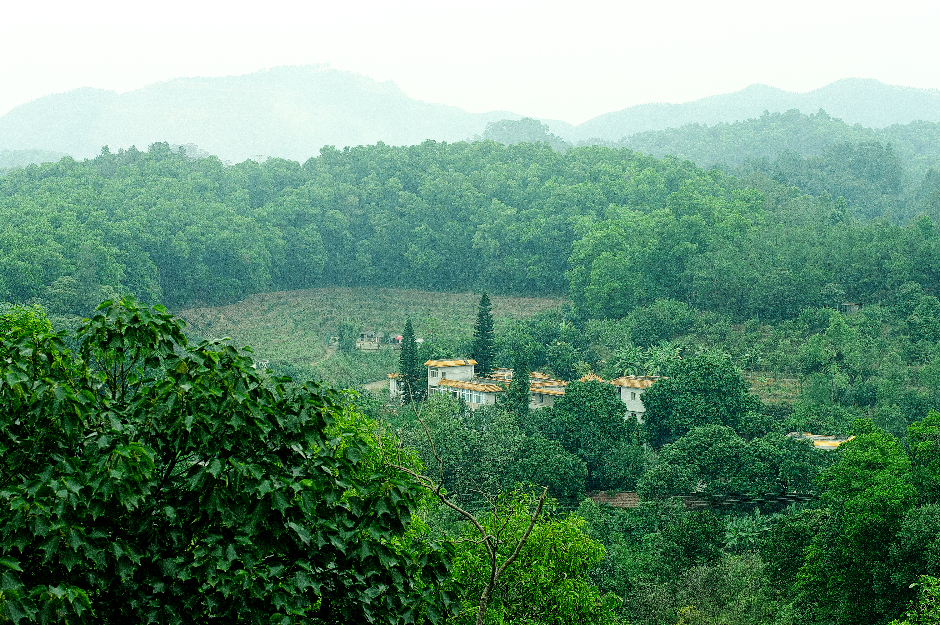
Covers an elevational gradient from 0 to 2,200 m in the Serra dos Órgãos mountain range, with high elevation grasslands (campos de altitude), cloud and lowland rainforests in the Atlantic Forest biome. In the lowlands it includes fragmented landscapes due to deforestation occurred in the last 500 years, with a variety of land uses in the matrix were fragments are inserted. Long term studies and monitoring actions focus on the effects two main factors: effects of climate change and land use. Presents high species richness, embracing a National Park (Parque Nacional da Serra dos Órgãos), a state park (Parque Estadual dos Três Picos), a private reserve (Reserva Ecológica Guapiaçu), and other federal and state protected areas.
-
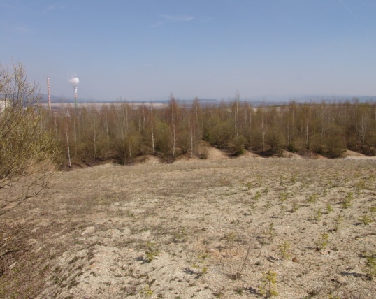
Sokolov post-mining ecosystems represent a unique LTER study area comprising forest and non-forest ecosystems developing after reclamation or by spontaneous revegetation on heaped overburden from brown coal mining. Several 1 ha sites are studied since 1992 (10 sites intensively and over 50 sites occasionally). Research has been focused on interactions between soil, plants and soil organisms and their role in soil formation and biogeochemical cycles restoration. Great attention has been paid to comparison of long-term development of reclaimed and non-reclaimed sites and to the effect of different tree species, types of substrates and heaping technique used during reclamation. Series of sites of known age (15–70 years) developing on similar substrate represent a great opportunity for ecological research using a chronosequence approach.
-
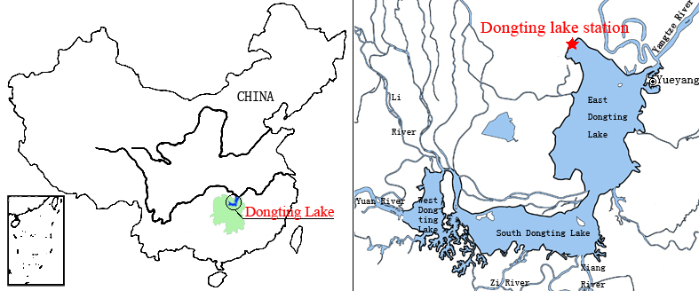
Dongting Lake Station (29º30'N, 112º48'E) located in East Dongting Lake in Yueyang City, Hunan Province. The station has good geographical advantage, convenient transportation, for about 180 kilometers from Changsha, the capital of Hunan Province. Dongting Lake located in the northeast of Hunan Province, the south shore of Jing River (in the middle of the Yangtze River) is the second largest freshwater lake of China.
-
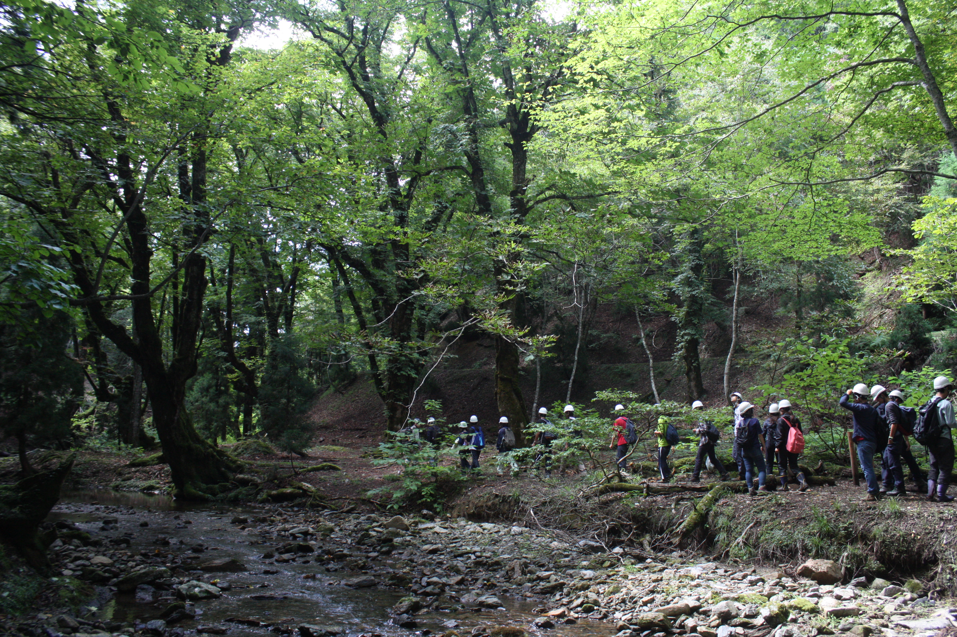
Ashiu Forest Research Station is located in the northeastern border part of Kyoto Prefecture in main island Honshu and stretches 6km east to west and 7km north to south in a rectangular shape. The area is characterized by high relief with altitudes ranging from 355 to 959 m above the sea level and encompasses the headwater zones of Yura River flowing into Wakasa bay, the Sea of Japan. This region is situated in the transition part between cool temperate forests and warm temperate forests. There is a heavy snowfall ranging from 1 to 3m in winter seasons. More than half of Ashiu Forest Research Station is covered with old-growth forests. In cool temperate forests above 600m altitude, the main species are beech (Fagus crenata), Japanese ceder (Cryptomeria japonica), deciduous oak (Quercus crispula). In warm temperate forests under 600m altitude, evergreen and deciduous oaks (Quercus salicina and Quercus sessilifolia) can be seen. There are two noteworthy characteristics in Ashiu Forest Research Station. Firstly, its high biodiversity. Since the establishment of the Research Station in 1921, new plant or vertebrate species/ varieties have been found. 801 woody, herbaceous and fern species have been recorded (Yasuda and Nagamasu 1995). Nationally protected species such as Japanese serow (Capricornis crispus) and Giant Saramander (Andrias japonicas) can be seen. Secondly, Ashiu Forest Research Station has been used not only for research and education but also for ecotourism by local stakeholders for more than 20 years, which has great opportunities for inter- and transdisciplinary studies.
-
The UNESCO-biosphere reserve „Schorfheide-Chorin“ was established in 1990 over an area of approx. 1.300 square kilometres, and is one of the largest protected areas in Germany. Situated in the North-eastern part of Brandenburg, including a major part of the regions Uckermark and Barnim, it represents an impressive cultural landscape with more than 320 lakes, thousands of bogs and mires, extended forests, meadows and arable land. The so-called Schorfheide and the Chorin end moraine curve are two different landscapes, seen under a culture-historical aspect. The Schorfheide stretches along the west side of the motor way A 11 (Berlin-Poland). The Chorin end moraine curve extends East of the motor way. 75 communities and three small towns (Oderberg, Joachimsthal and Greiffenberg) with a total of 35.000 residents are situated in the protected area. The main concept behind the biosphere reserve is the consideration of human impact on the land. It is meant to encourage producers to work in a sustainable manner. Thus, 79 % of the area can be used by man. To protect natural resources, priority is given to organic agriculture and forestry and to an extensive-pasture economy. One of the most important supporting partners is the association “Kulturlandschaft Uckermark e.V.” (For promotion of the Cultural landscape Uckermark)
-
Waroneu is a 83 ha forested catchment located in the east of Belgium (« Hertogenwald »: Duke's forest) within the municipality of Baelen. In 2011, it was covered with 38% conifers (mainly Picea abies), 45% deciduous trees (Fagus sylvatica, Quercus robur, Betula pendula), and 17% open space. Biogeochemistry (nutrient and organic carbon in throughfall, rainfall, soil solution and outlet) has been studied since 1991. The catchment was limed in 1992 with 3T/ha dolomite and 200 kg/ha potassium sulfate. Since 2013, biogeochemistry and soil microbial parameters (microbial biomass, N mineralization, basal respiration) are studied in 6 intensive plots, reflecting major combinations of vegetation and upper soil caracteristics within the catchment.