
soil mobile water content
Type of resources
Available actions
Topics
Keywords
Contact for the resource
Provided by
Years
Formats
Representation types
-
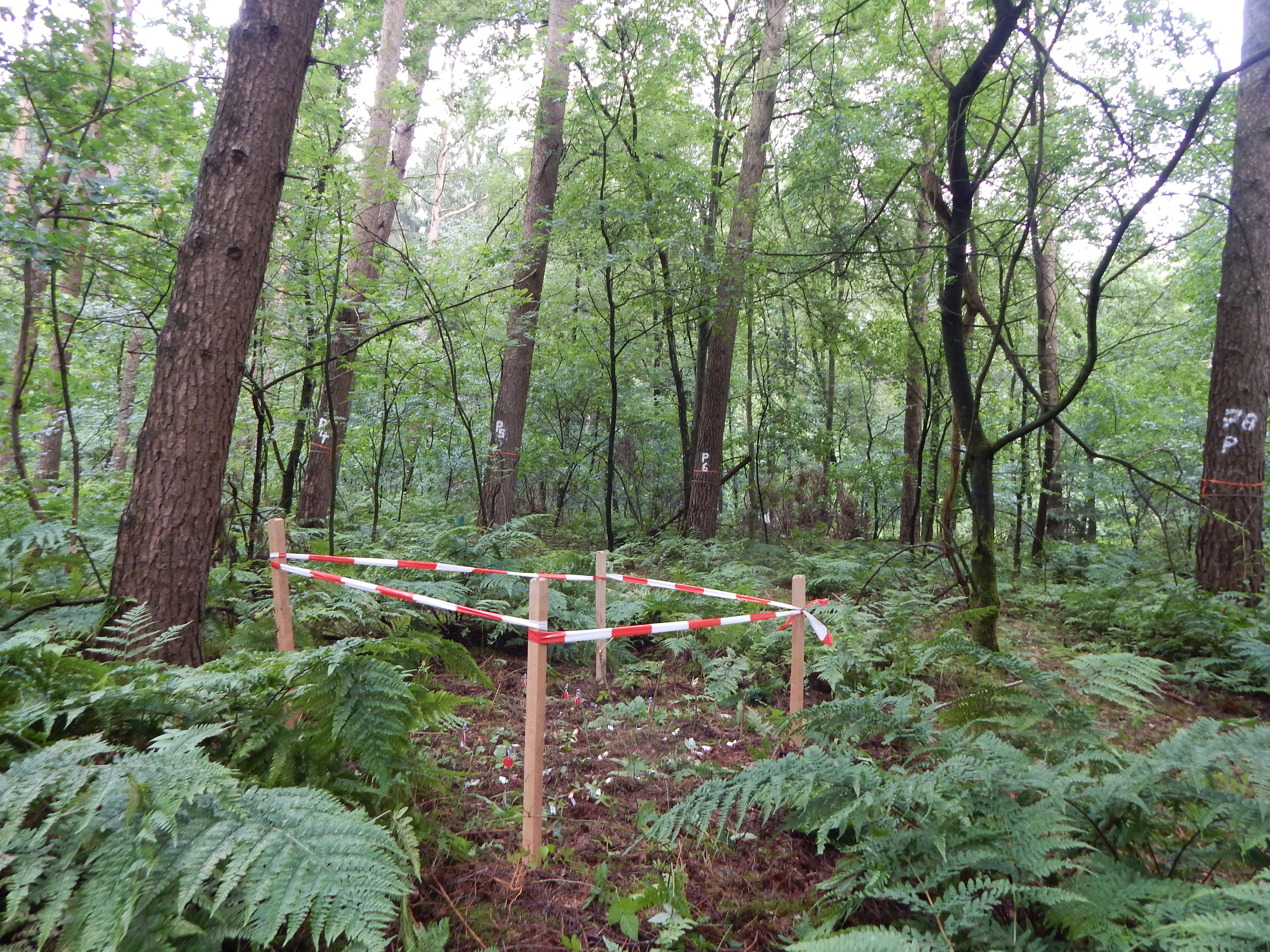
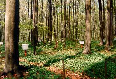
ICP forest monitoring plots: 0.5 ha of fenced stand + 20 m buffer area. Managment, data collection and reserch activities carried on by catholic university of Louvain (UCL)
-
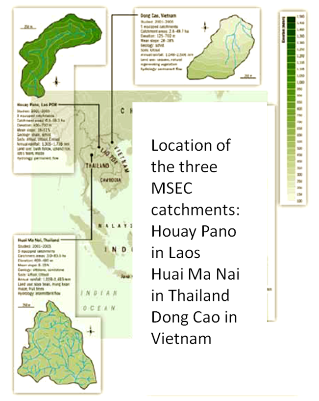
Dong Cao is a small agricultural catchment (47 ha) of northern Vietnam, located at 70 km from Hanoi, in a sloping land environment. The objective is to monitor the impacts of land use changes (from cassava to fodder and tree plantations) and possible climate changes upon hydrological and sedimentary fluxes and budgets. The catchment has an elevation of 125 m to 485 m and slopes range from 15 to 120%. Monitoring devices include an automatic meteorological station, and weirs to monitor discharge, suspended sediment and bedload. More information is available on https://mtropics.obs-mip.fr/ and in the following paper: Valentin, C., et al., 2008. Runoff and sediment losses from 27 upland catchments in Southeast Asia: Impact of rapid land use changes and conservation practices. Agric. Ecosyst. Environ. 128, 225–238. https://doi.org/10.1016/j.agee.2008.06.004
-
Located in Huitong County, Hunan Province (26°45´N and 109°30´E), Huitong National Research Station of Forest Ecosystem is affiliated to the Institute of Applied Ecology of Chinese Academy of Sciences. This region marks a transition from Yun-Gui Plateau to the hills along the southern bank of Yangtze River and belongs to the up reach of Yuan River, a tributary of the Yangtze. The altitude ranges from 300 m to 1100 m above the sea level. The densely grouped hills and valleys feature the topography in this region, which determining forestry to be the major method of land use in this County. The mother rock mainly consists of grayish green slate, metamorphic rock and sandy shale. With relatively deeper layer, red earth or reddish yellow earth are generally distributed from 300m to 600m above sea level, and mountainous yellow earth above 600m. This region has a typical climate of Central Subtropical Zone, with average annual temperature of 16.5℃. The annual rainfall and annual evaporation range from 1200 to 1400mm and from 1100 to 1300mm, respectively, with average relative humidity of 83% and 300 days of frost-free period. The zonal vegetation is evergreen broad-leaved forest typical of subtropics, with the major species component of Castanopsis spp.and Lithocarpus spp.
-
The site established in 1958. We can still find in the site the remains of terraces from the Nabatean agriculture runoff. The main research topics that being studied in the site are: biodiversity, climate change, runoff hydrology
-
Intensive Forest Monitoring site with Pinus silvestris - Betula pendula forest
-
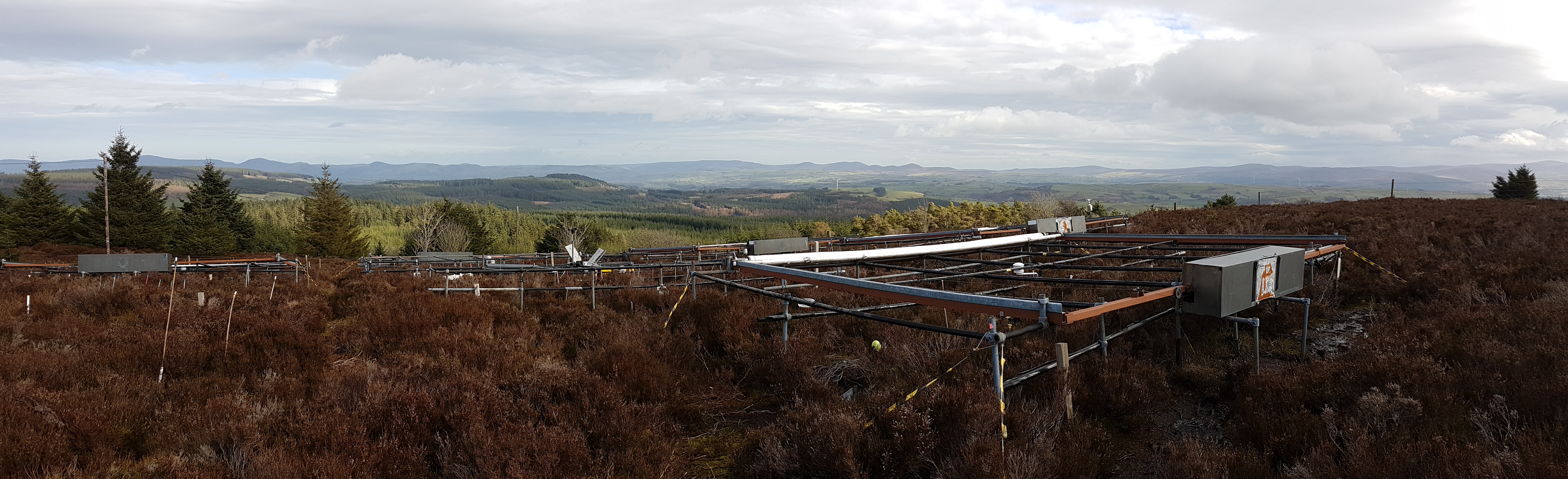
The site is located in Clocaenog Forest in North East Wales (53o 03’ 19’’N -03o 27’ 55’’ W). It is a typical upland west-atlantic moorland, dominated by the evergreen shrub Calluna vulgaris (heather). Heather makes up >60% of the plant biomass at the site, but Vaccinium myrtillus and Empetrum nigrum are also present.
-
Forest Hydrological Research Basin Lange Bramke
-
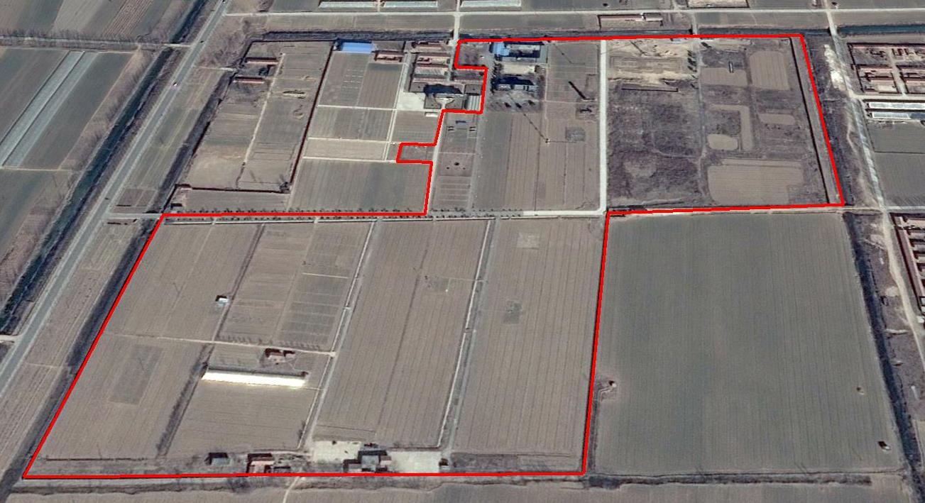
The Yucheng Comprehensive Experiment Station (YCES) of Chinese Academy of Sciences (CAS) is located at the irrigation district of the Yellow River Basin in the Huang-Huai-Hai Plain, also called North China Plain. Physiognomy is characterized as hinterland covered mainly by fluvo-aquic soil (Fluvisol or cambisal) and salinized fluvo-aquic soil in the Yellow River Alluvial Plain. This region is dominated by warm-temperate semi-humid monsoon climate with ample energy and water resources. Historically, natural disasters such as drought, waterlogging, salinization, and wind erosion frequently occurred, resulting in vulnerable ecological environment and low grain production. Integrated improvements and managements were deployed in last several decades, and this region has become suitable for planting winter wheat, corn, cotton, and soybean with high yields in the Huang-Huai-Hai Plain. Research objectives and contents Objectives: regional sustainable agriculture rational utilization of natural resources such as water, land, climate, biomass, etc. Contents: conducting long-term observations and experiments understanding the mechanism of energy transfer and mass cycle in farmlands developing models from point to regional scales improving and developing instruments and measurement methods improving agro-ecosystem managements demonstrating research results and technologies Research achievements: Outstanding research results and massive experiment data have been achieved at the YCES. The achievements cover research fields of farmland evapotranspiration, crop water use, water transfer mechanism, experimental remote sensing techniques, regional agriculture demonstration, and technology transfer. More than 1,000 papers, 15 monograph books, and 5 data sets have been published. A number of awards were granted by national, CAS, and international academic organizations, for example, Agriculture Prize granted by the Third World Academy of Sciences Science and Technology Progress Award by Chinese Academy of Sciences National Top Award of Science and Technology Progress
-
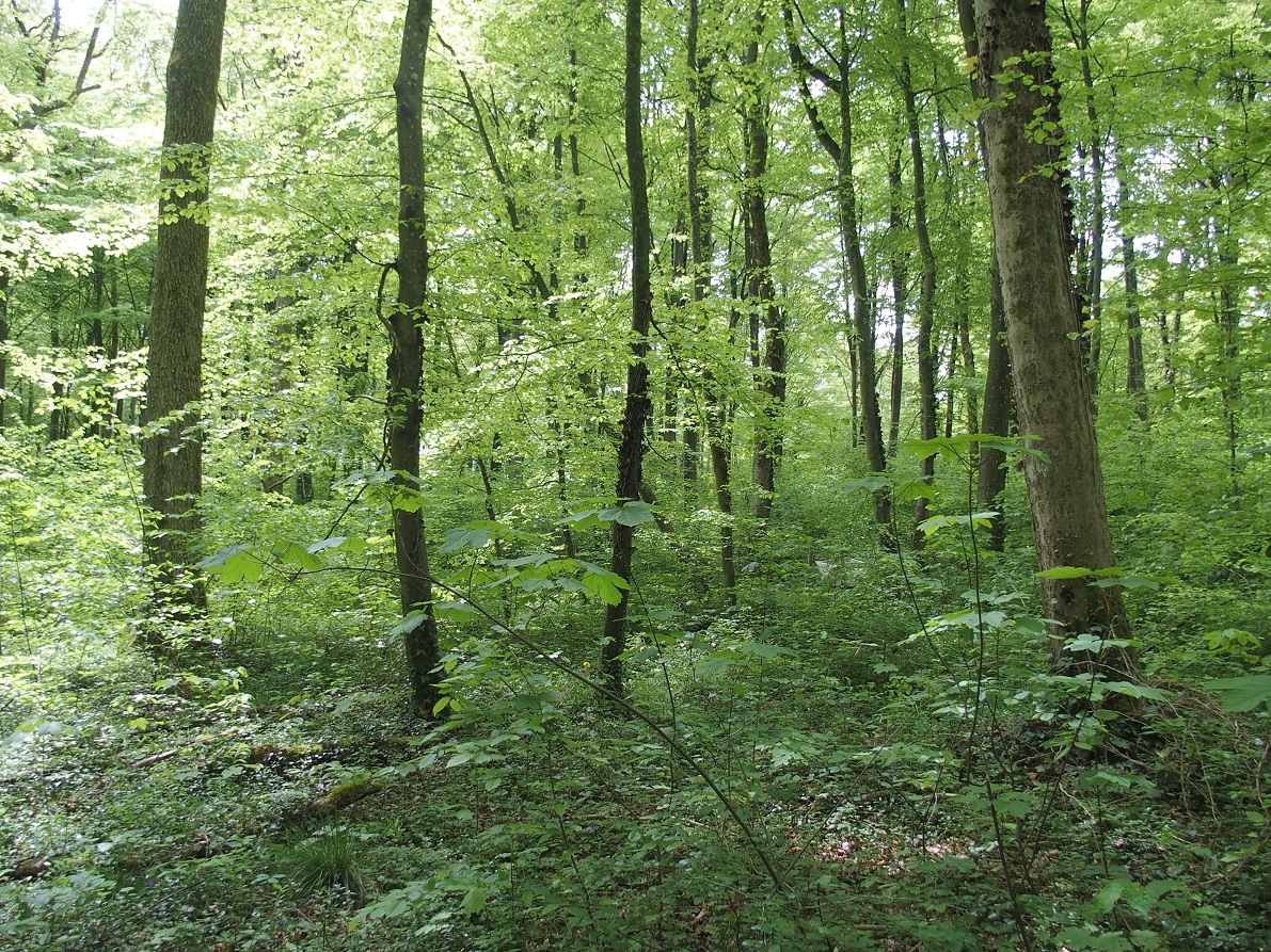
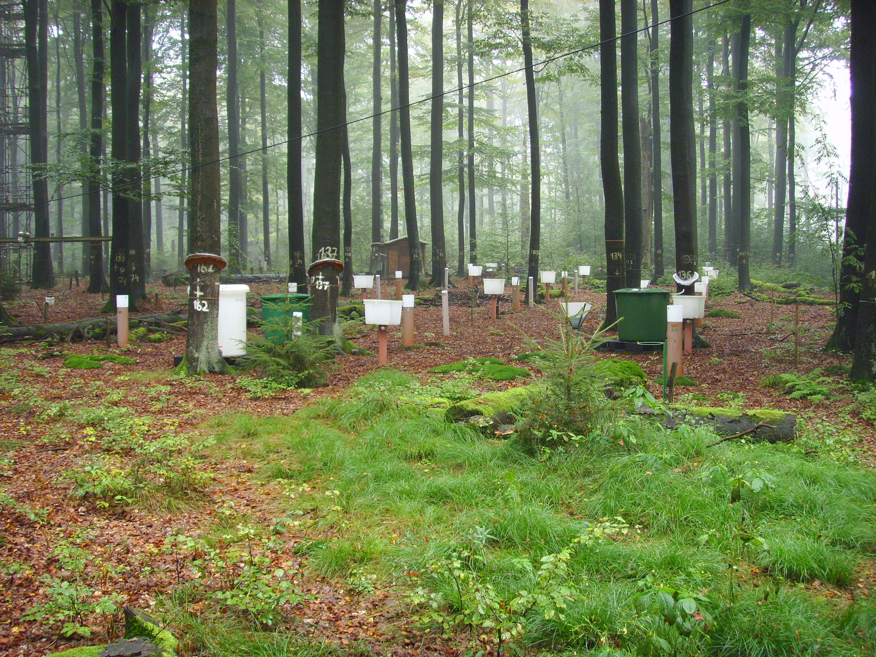
Fagus sylvatica forest on limestone plateau
-
Solling Experimental Forest