
soil moisture content
Type of resources
Available actions
Topics
Keywords
Contact for the resource
Provided by
Years
Formats
Representation types
Update frequencies
-
Field work - plot measurements (n=18)
-
This site is part of the BFW project "Klimaforschungswald". The aim of this research project is to evaluate which tree species will fullfil the important tasks and functions of the forest ecosystem in the future. Furthermore, temperature and precipitation fluctuations in particular are to be documented in order to be able to map a possible trend and the influence of the growing vegetation. The climate research forest is also intended to be a communication and recreation forest for the population, which can be experienced through an educational trail with display boards.
-
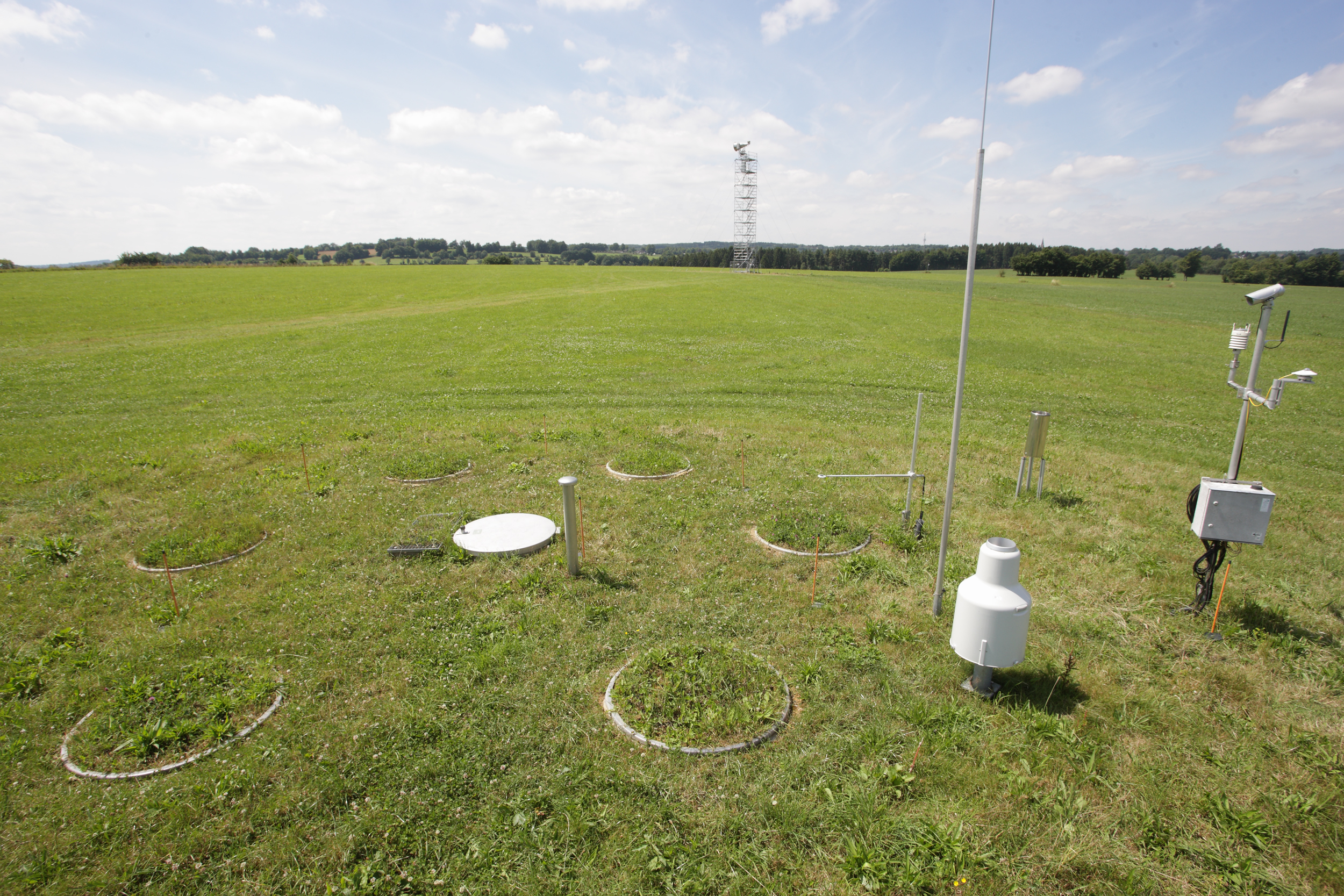
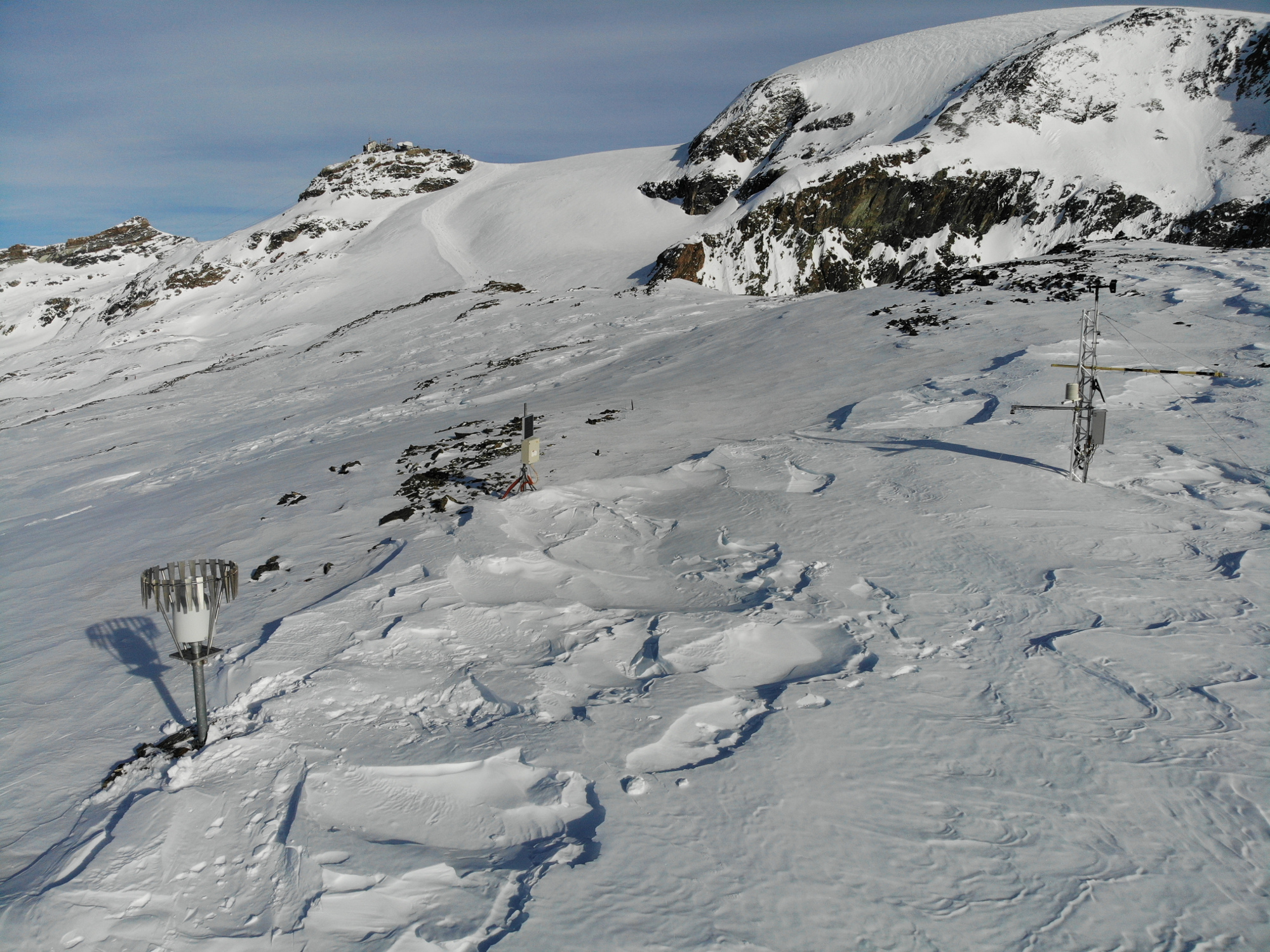
The Rollesbroich site is located in the low mountain range “Eifel” near the German-Belgium border and covers the area of the small Kieselbach catchment (40 ha) with altitudes ranging from 474 to 518 m.a.s.l.. The climate is temperate maritime with a mean annual air temperature and precipitation of 7.7 °C and 1033 mm, respectively, for the period from 1981 to 2001. Soils are dominated by (stagnic) Cambisols and Stagnosols on Devonian shales with occasional sandstone inclusions that are covered by a periglacial solifluction clay–silt layer. The mountainous grassland vegetation is dominated by perennial ryegrass (Lolium perenne) and smooth meadow grass (Poa pratensis). The study site is highly instrumented. All components of the water balance (e.g. precipitation, evapotranspiration, runoff, soil water content) are continuously monitored using state-of-the-art instrumentation, including weighable lysimeters, runoff gauges, cosmic-ray soil moisture sensors, a wireless sensor network that monitors soil temperature, and soil moisture at 189 locations in different depths (5, 20 and 50 cm) throughout the study site. Periodically also different chamber measurements were made to access soil or plant gas exchange.
-
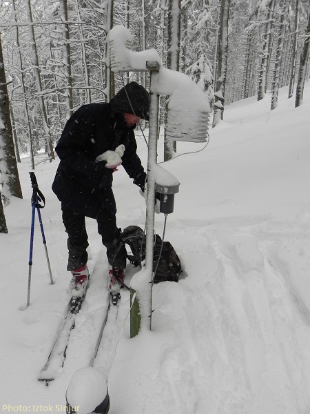
MIXED NORWAY SPRUCE AND BEECH FOREST ON POHORJE MOUNTAINS IN SLOVENIA. The mixed spruce and beech mountain forest is located in the Pohorje mountains, North-East Slovenia. The site is core plot of the ICP Forests - the International Co-operative Programme on Assessment and Monitoring of Air Pollution Effects on Forests operating under the UNECE Convention on Long-range Transboundary Air Pollution (CLRTAP) – monitoring network. The site located at 1289 m above sea level and consists of a 1 ha plot of mixed Fagus sylvatica (L.) and Picea abies (Karst) forest. Bedrock material is Dioritoid (Tonalite) and the soil was classified as Dystric Cambisols (WRB 2007). There are ongoing measurements of Crown condition, Foliar analysis, Soil survey, Soils solution analysis, Increment measurements, Ground vegetation assessment, Deposition measurements, Meteorological measurements, Tree Phenological observations, Air quality monitoring, etc.
-
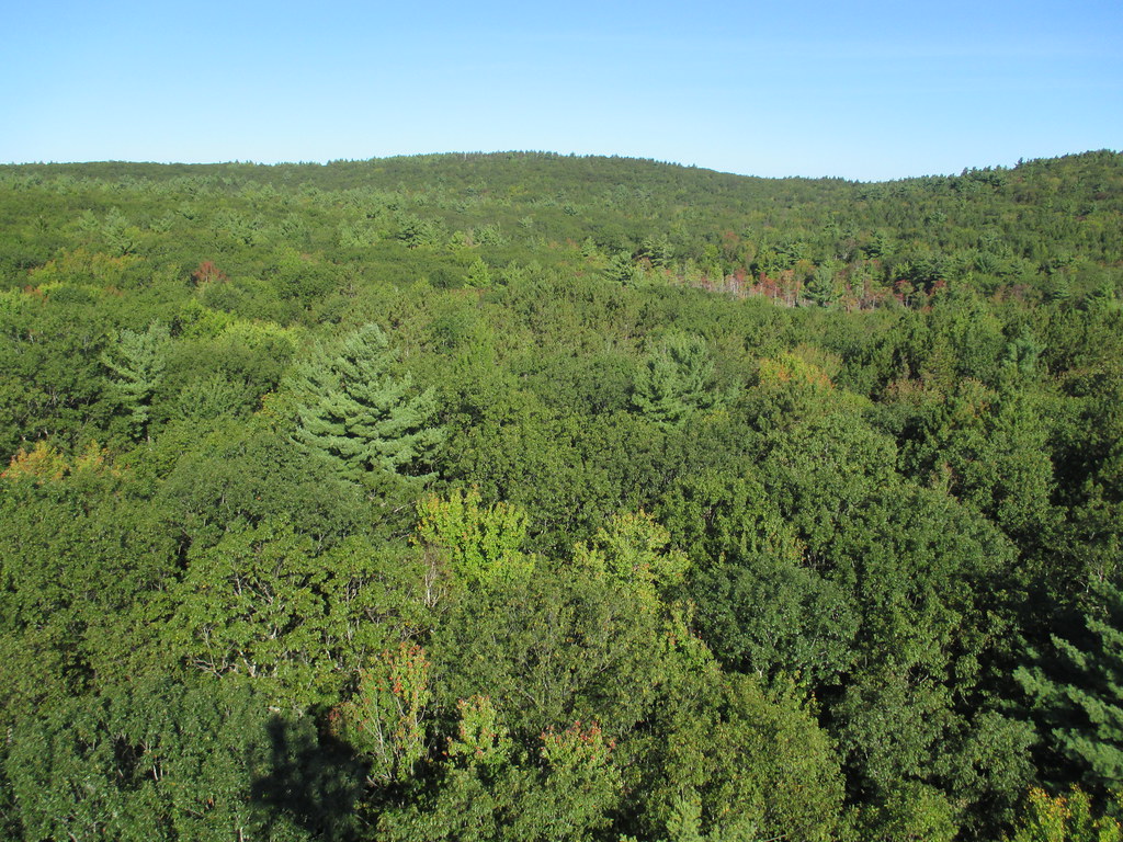
Harvard Forest is a core site in Domain 01: Northeast. Located 73 miles from Boston in Petersham, Massachusetts The Harvard Forest site is spread across 49 km2 of land and is the core NEON site for the Northeast region. Representative habitats at Harvard Forest include northern, transition, and central forests; marshes, swamps, and conifer-dominated bogs; and forest plantations. NEON's meteorological/flux tower and tower sampling plots are located on land owned by Harvard Forest - Harvard University, LTER an forest with a rich history of scientific research. The distributed sampling plots are located along the edge of the Quabbin reservoir which is managed by the Massachusetts Department of Conservation and Recreation, Division of Water Supply Protection. For access to the area along the Quabbin, visitors must be accompanied by a NEON project employee. Total data products collected at this site is 119.
-
Cime bianche, Colle Superiore di Cime Bianche, (Valtournenche, Aosta), +398720 +5086095; Valle d'Aosta region
-
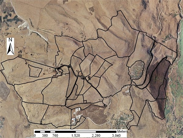
Grazing research site
-
Mars, Mont Mars, (Fontainemore, Aosta)
-
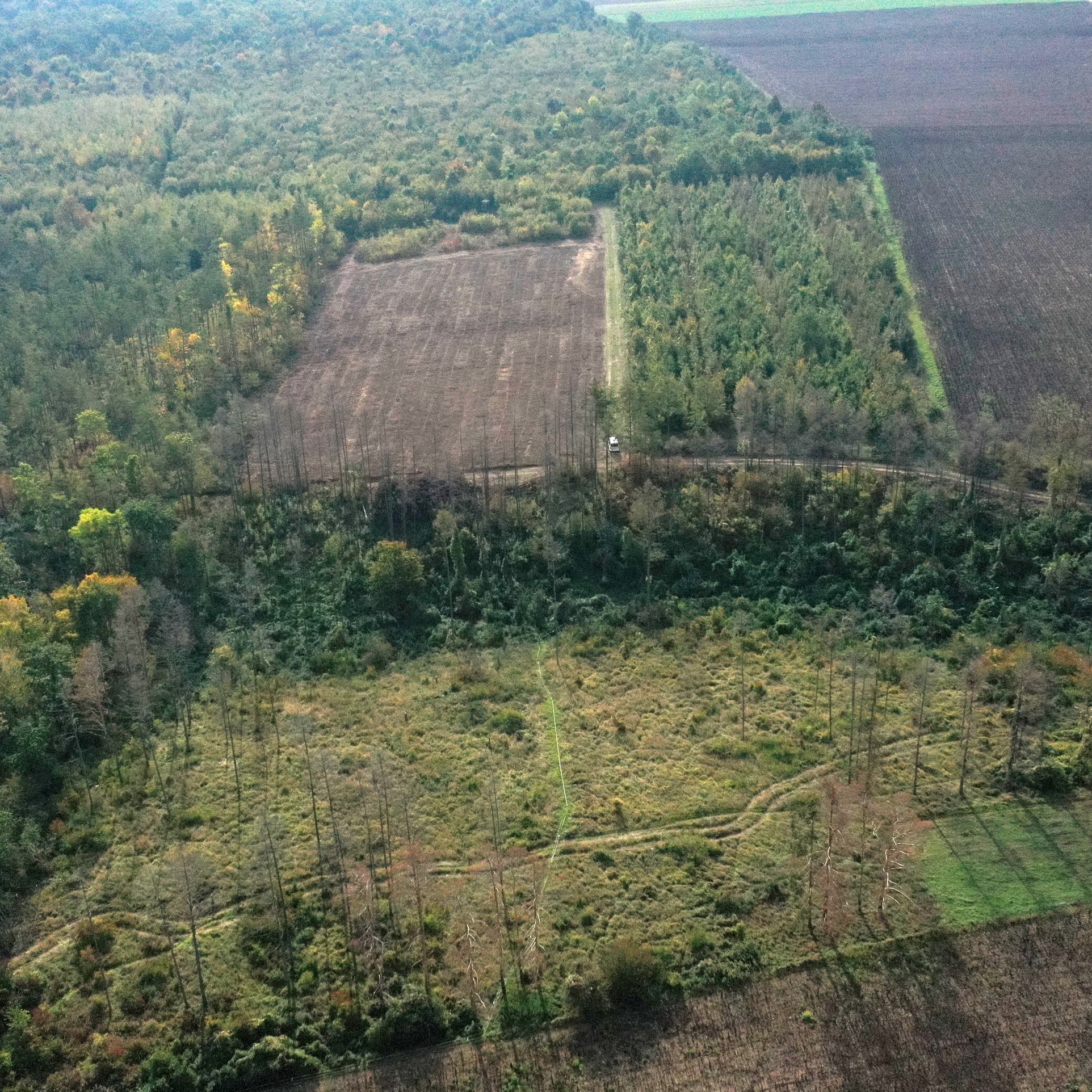
Network of cold scree slope observation. Cold scree slopes are debris slopes which lower part is overcooled by seasonally alternating air circulations. "Abyssal" ecosystems develop on the cooled part, with dwarf trees, arctic-alpine plant, moss and lichen associations, on moor type humus. These sites show a unique combination of geomorphologically induced microclimate, vegetation, soil and soil microfauna. The network of monitoring sites is distributed over the French Alps and Jura mountains.
-
The ENGAGE working group (Geomorphological Systems and Risk Research at the Institute for Geography and Regional Research) has been running a long-term monitoring project to investigate landslides in Lower Austria. Landslides (translational and rotational failures, debris flows, rock avalanches, rock falls, etc.) number among the most abundant natural hazards in Lower Austria. Resulting from sporadic phases of activity it is essential to generate specific long-term measurement series, enabling the analysis of changes in surface movements as well as underground in connection with triggering factors. Therefore, in 2014 the project “NoeSLIDE – Monitoring diverse types of landslides in Lower Austria” was initiated. The research sites are compiled under the parent site "LTER NoeSLIDE" which has three subsites, of which one is the Salcher Landslide Observatory. The Salcher landslide is located in the municipality of Gresten, Scheibbs district, Province of Lower Austria. It is located on an unwooded hillside area that slopes from west to east (at around 435 to 470 m above sea level / slope between 5 ° and max. 20 °) and is enclosed on three sides by anthropogenic features (streets / houses). The processes at the Salcher landslide are to be classified as rotational landslide, with more than one sliding surface being assumed. The currently active area is ~ 4,000 m², the area to be potentially activated is ~ 20,000 m². In addition to traditional methods such as the installation of a weather station, piezometers, inclinometers, TDR (time-domain reflectometry) probes, GNSS (global navigation satellite system), Tachymeters, methods such as continuous terrestrial laser scanning, UAV applications and permanent geoelectric are used.