
soil moisture field capacity
Type of resources
Available actions
Topics
Keywords
Contact for the resource
Provided by
Years
Formats
Representation types
-
Field work - plot measurements (n=18)
-
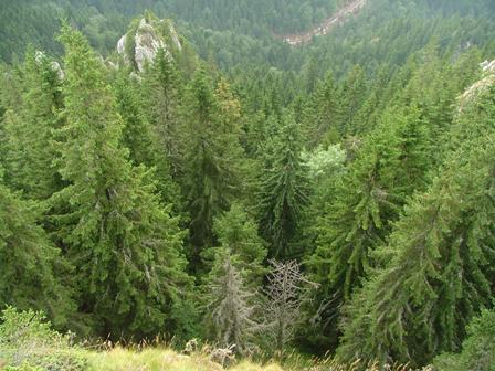
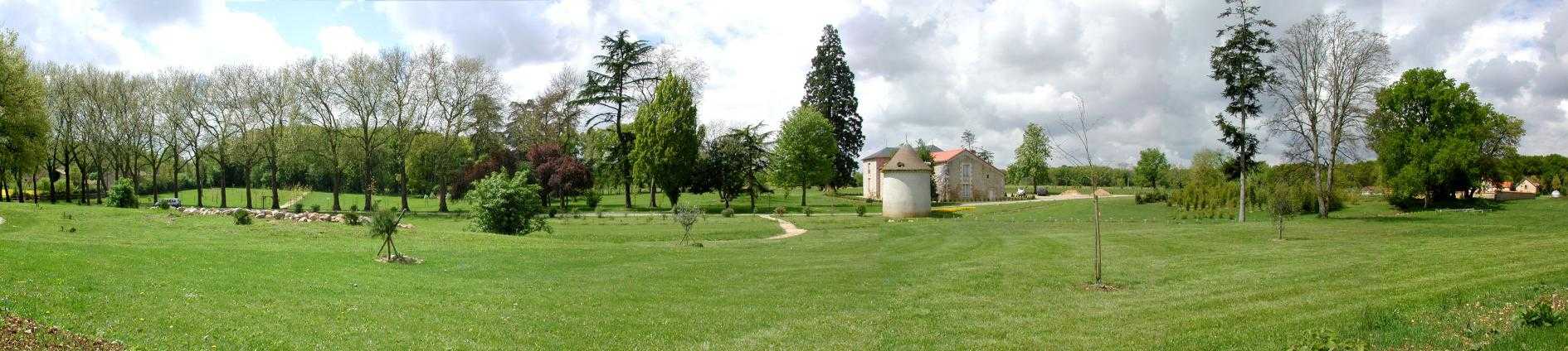
Tara mountain is a part of Dinaric Alps with an average height of 1200 m above sea level and is a typical forested area located in western Serbia. Its forests are among the best preserved and most productive forests in Europe and represent the greatest natural value of Tara. The area has a temperate continental climate with subalpine influences. High humidity is caused by currents from the Drina canyon and daily mist. More than 75% of the area is covered with mixed forest of beech, fir and spruce. Tara is a well known refugium for many relict and endemic plant species among which the most valuable and recognizable is the endemic and relict Serbia spruce, Picea omorica (Pancic) Purkyně with very limited range to about only 60 ha.
-
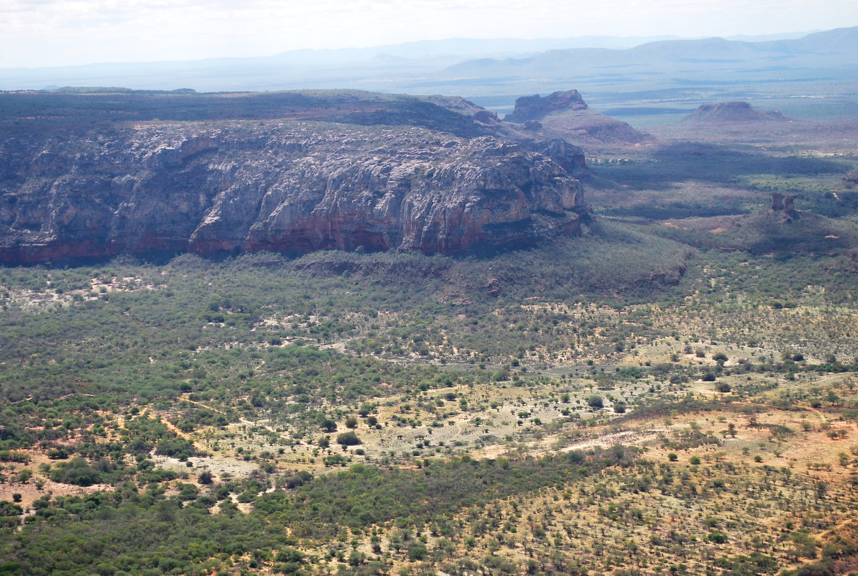
The present proposal aims to assess how human disturbance and changes in rainfall regime affect the Caatinga ecosystem’s biota at different levels of biological organization (i.e, from populations to ecosystem level), by correlating these aspects with the theoretical reference shown in macro trends already documented in the tropics. The project will be developed in Catimbau National Park, a polygon of approximately 63,000 ha, and one of the most important protected areas in the Caatinga. The Park presents vocation for ecological studies of long-term and thus to become an LTER site due to a series of reasons: (1) it has a biological, archaeological and landscape heritage of inestimable value, (2) it shelters areas with different historical land use and anthropic disturbance on the vegetation of Caatinga, (3) there are already in place several research initiatives and training of human resources, and (4) in term of unit management aspects, logistics and infrastructure are favorable for long-term initiatives. Furthermore, the implementation and achievement of this project’s objectives are centered on: (1) establishment of a set of 30 permanent plots, (2) periodic multi-taxa inventories, (3) continuous monitoring of environmental and anthropogenic variables (4) consolidation of biological, land usage and environmental data on the basis of GIS type and (5) dissemination / transfer of information through a wide range of instruments.This proposal will be implemented by a network composed of 23 researchers supported by a number of undergraduate / graduate students, all from six national institutions and three other overseas. The main core of the graduate programs are Plant Biology, Biology Animal and Fungal Biology, all at the Federal University of Pernambuco (UFPE). In summary, the "LTER Catimbau National Park" is an important proposal and has the ability to expand knowledge about how dry biota respond to land use changes and precipitation, with all the implications that these answers may have for the management of biodiversity and the achievement of sustainable development in semi-arid regions.
-
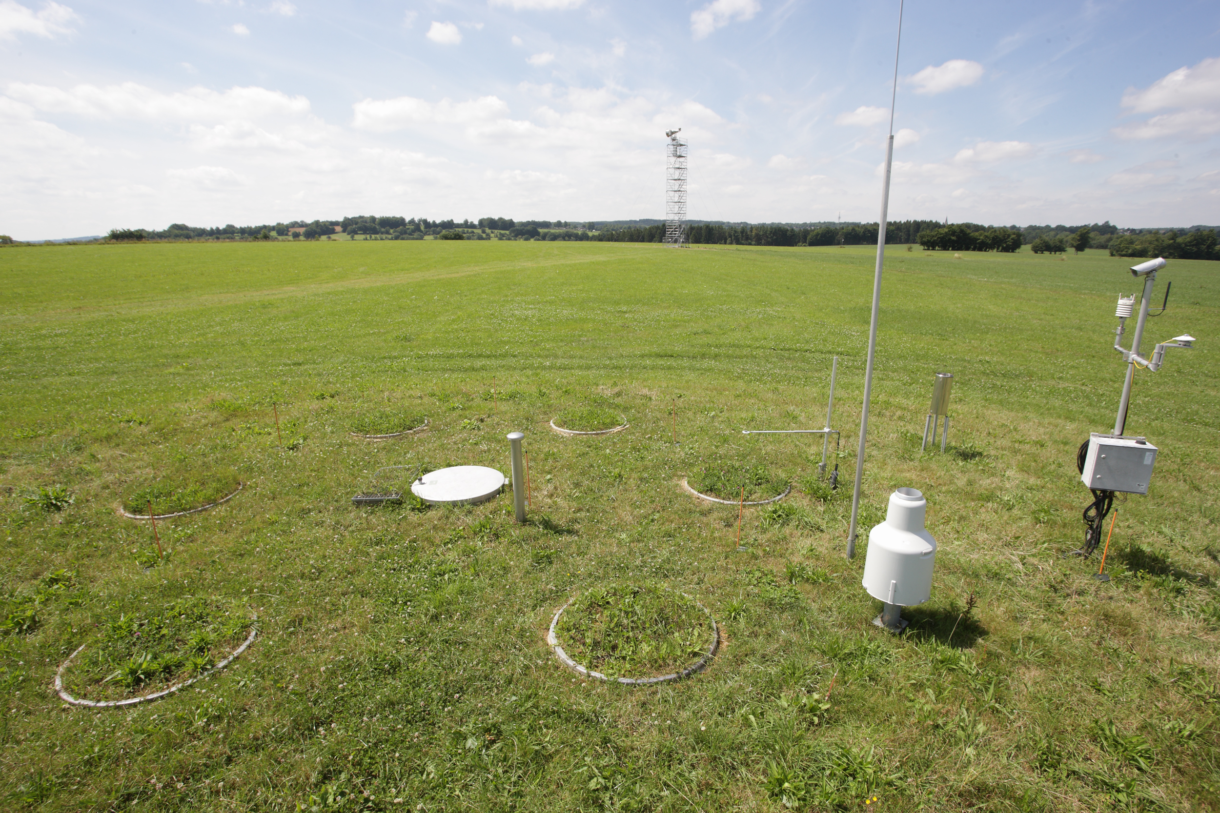
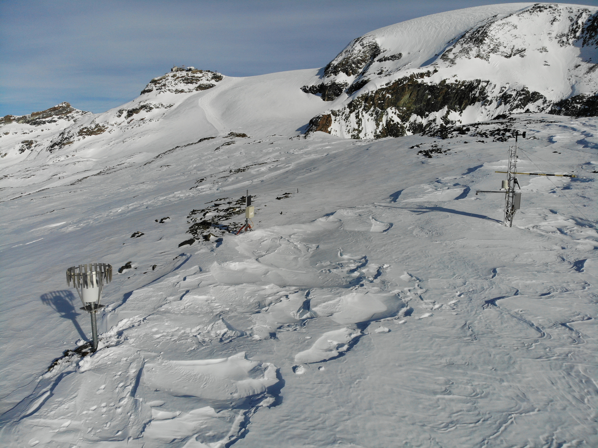
The Rollesbroich site is located in the low mountain range “Eifel” near the German-Belgium border and covers the area of the small Kieselbach catchment (40 ha) with altitudes ranging from 474 to 518 m.a.s.l.. The climate is temperate maritime with a mean annual air temperature and precipitation of 7.7 °C and 1033 mm, respectively, for the period from 1981 to 2001. Soils are dominated by (stagnic) Cambisols and Stagnosols on Devonian shales with occasional sandstone inclusions that are covered by a periglacial solifluction clay–silt layer. The mountainous grassland vegetation is dominated by perennial ryegrass (Lolium perenne) and smooth meadow grass (Poa pratensis). The study site is highly instrumented. All components of the water balance (e.g. precipitation, evapotranspiration, runoff, soil water content) are continuously monitored using state-of-the-art instrumentation, including weighable lysimeters, runoff gauges, cosmic-ray soil moisture sensors, a wireless sensor network that monitors soil temperature, and soil moisture at 189 locations in different depths (5, 20 and 50 cm) throughout the study site. Periodically also different chamber measurements were made to access soil or plant gas exchange.
-
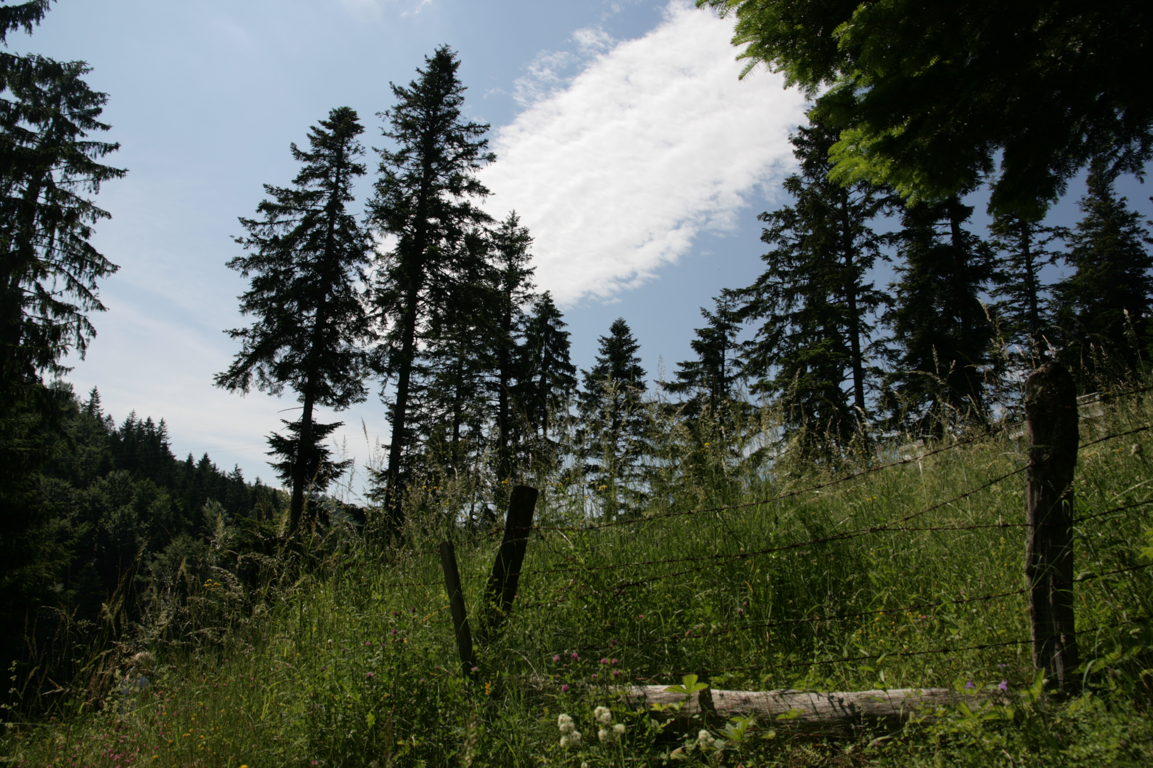
Kopaonik is the largest and the longest mountain range in Serbia located in its central part. It is proclaimed a national park in 1981. The observatory site in Kopaonik is located in strictly protected spruce forest, on the lower distribution of spruce zone on the border zone with beach forest. The mountain is characterized by alternating climate conditions; from warmer sub-mediterranean climate in the lowest part of the mountain to cold subalpine climate in high elevation areas. Vertical profile of the mountain with different climate zones and geological diversity resulted in high habitat diversity. The largest part of the area is covered by climatologically adapted mixed deciduous and coniferous forest having obvious zonal transition. A large number of endemic and relict plant species makes Kopaonik one of the most significant biodiversity centers in Serbia. Main threats to the area besides soil erosion present logging, deforestation and tourism.
-
Located 2 km east of the Science Campus of the University of Poitiers, the Hydrogeological Experimental Site (HES) occupies an area of 12 hectares on land belonging to the University. From the geologic viewpoint the SEH occupies the north flank of the “Seuil du Poitou”, a huge Mesozoic carbonate plateau marking the transition between the Aquitaine and Paris sedimentary basins. The studies conducted at the SEH focus mainly on the Dogger Aquifer. The experimental layout now comprises 35 boreholes, including two vertical and two inclined cored holes.
-
Cime bianche, Colle Superiore di Cime Bianche, (Valtournenche, Aosta), +398720 +5086095; Valle d'Aosta region
-
In Doñana a manual weather station exists since 1978 equiped with analogical instruments from which EBD-CSIC personnel once a day, records maximum and minimun air temperature and total precipitation. This manual station has been supervised by the State Meteorological Agency (AEMET) until 2008. Since 2008, on the same site, AEMET has installed a new measurement station with modern instrumentation that allows automated data recording (temperature, precipitation, wind, humidity, etc.). Since November 2008 EBD-CSIC installed additional weather stations on different sites and varying time intervals, consisting of a multisensor of VAISALA brand. At some of these measure points other data related to the study of climate (soil humidity, soil temperature, solar radiation, CO2 flow, etc.) are being recorded. Additional weather stations in or near the Doñana area are managed by the Ministries of Agriculture and Environment of the Junta de Andalucía and by research entities like the National Institute for Aerospace Tecnology (INTA) and the Geological and Mining Institute of Spain (IGME)
-
Grazing research site
-
In Doñana official groundwater level and recharge monitoring is done by the Guadalquivir Water Authority (Confederacion Hidrografica del Guadalquivir CHG). Levels are recorded monthly at 195 measurement points distributed throughout the whole area (unsaturated zone) with starting dates between 1974 and 1994. Additional measurements related with groundwater recharge and chemical composition, covering different periods and areas, are made by research entities. Geological and Mining Institute of Spain (IGME) installed soil moisture sensors and piezometers in the sandy soils of Doñana in 2008 and one lysimeter has been installed in 2016