
soil nitrate leaching
Type of resources
Available actions
Topics
Keywords
Contact for the resource
Provided by
Years
Formats
Representation types
-
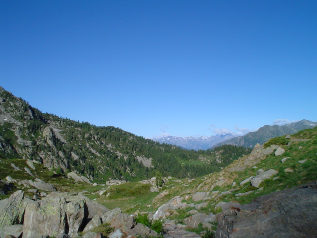
Mars, Mont Mars, (Fontainemore, Aosta)
-
Soil data of LTER Zöbelboden, Austria. Soil inventory is carried out since 1992 on regular positions (approx 65) in the catchment measuring soil chemistry. Soil water chemistry is measured in forest plots (2-3) using lysimeter sampling and analyses on a bi-weekly to monthly basis. Soil hydraulic characterizations exist for the major soil types in the catchment. Soil CO2 and N2O respiration data is available for some years
-
Nature reserve, Natura 2000, protected coniferous blueberry forest.
-
Waroneu is a 83 ha forested catchment located in the east of Belgium (« Hertogenwald »: Duke's forest) within the municipality of Baelen. In 2011, it was covered with 38% conifers (mainly Picea abies), 45% deciduous trees (Fagus sylvatica, Quercus robur, Betula pendula), and 17% open space. Biogeochemistry (nutrient and organic carbon in throughfall, rainfall, soil solution and outlet) has been studied since 1991. The catchment was limed in 1992 with 3T/ha dolomite and 200 kg/ha potassium sulfate. Since 2013, biogeochemistry and soil microbial parameters (microbial biomass, N mineralization, basal respiration) are studied in 6 intensive plots, reflecting major combinations of vegetation and upper soil caracteristics within the catchment.
-
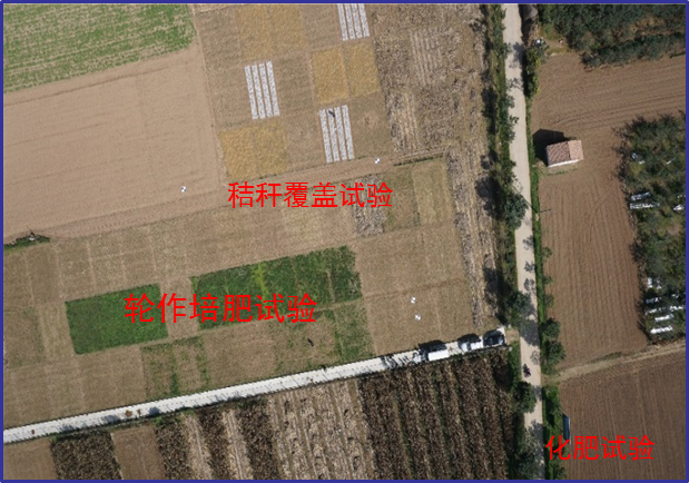
Changwu station was found in 1984 as one of field experiment stations of Institute of Soil and Water Conservation, Chinese Academy of Sciences (ISWC, CAS). It joined the Chinese Ecosystem Research Network (CERN) organized by CAS in 1991 and the National Ecosystem Research Network of China (CNERN) in 2005 by the Ministry of Science and Technology of the People’s Republic of China. The station located in Wangdong Village, Hongjia town, Changwu County, Shaanxi Province, 200 km away from Xi’an city. Its location is E107°41′ and N35°12′, south of the Loess Plateau. It belongs to the warm temperate semi-humid continental monsoon climate. Mean annual precipitation is 580mm and temperature 9.1℃, frost-free day 171. The elevation is about 1200 m and the depth of ground water is 50-80m. Main crops are winter wheat, spring maize, potato, sorghum, millet, beans and so on. The zonal soil is called Heilu soil with a parent material of clay loam Malan loess paleosol soil with an average depth in excess of 100m that were deposited during the Quaternary period. It belongs to the high table land - gully region, and a typical rain-fed agricultural area on the Loess Plateau. Wangdong small watershed, which the station located in, is 6.3km2. Three landform types are high table land, slop land called “Liang” and valley, which occupy the total area of watershed with 35%, 35.6% and 29.4%, respectively. The soil is deep and has good physical properties, like reservoir, support the agro-ecological system.
-
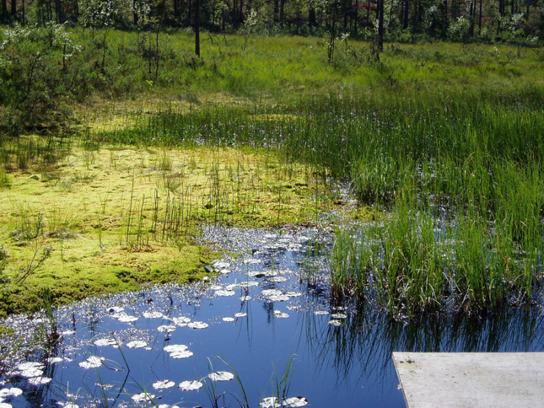
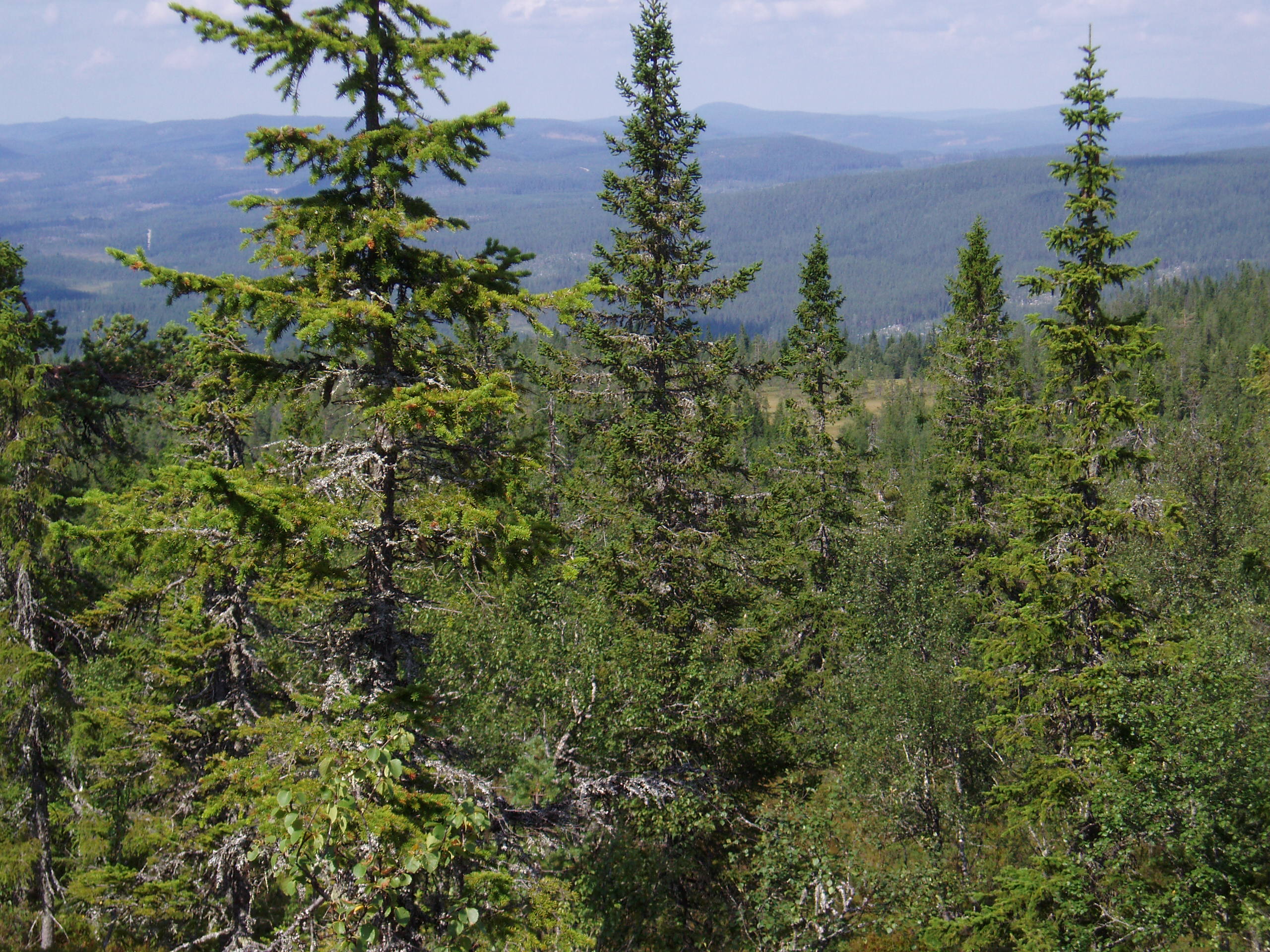
Coniferous forests and mire.
-
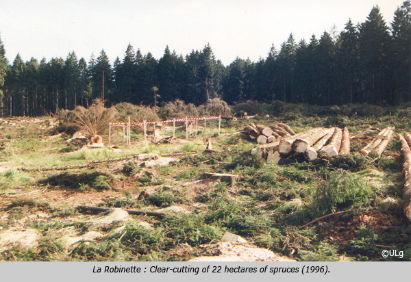
La Robinette is a 81 ha catchment located in the east of Belgium (« Hertogenwald »: Duke's forest) within the municipality of Baelen. Biogeochemistry (nutrient and organic carbon in throughfall, rainfall, soil solution and outlet) has been studied since 1991 as a reference catchment within the frame of a liming experiment (Waroneu catchment) and critical loads calculations. The catchment, initially covered by Picea abies, was subjected to windthrow, reducing coverage to 46% (1990s) and experimental clearcut of 22 ha (1996), followed by afforestation with deciduous species in 1998. Four 2-ha plots were planted with deciduous species in alternate rows. Alder, rowan, birch and oak were also planted within the catchment. In 2012, the catchment was covered by 8% mature and 41% young conifers (Picea abies), 7% deciduous trees (Fagus sylvatica, Quercus robur, Betula pendula, Alnus glutinosa, Sorbus aucuparia, Salix caprea ), 44% open space. Biogeochemical measurements have been complemented with experiments on litterfall, litter decomposition, soil respiration, N cycle processes. Flux and meteorological data have been collected from 2007 to 2011 (CarboEurope) and from end 2016 (ICOS). In addition, since 2013, biogeochemistry and soil microbial parameters (microbial biomass, N mineralization, basal respiration) are studied in 6 intensive plots, reflecting major combinations of vegetation and upper soil characteristics within the catchment.
-

The study plot was established by the Institute of Forest Ecology (Mendel University in Brno) in 1968, namely in connection with the UNESCO International Biological Programme (IBP) and the UNESCO programme "Man and the Biosphere" (MAB). The study plot is carried out in the natural forest region 30 – Drahanská Vrchovina upland (Drahanský bioregion, 1.52) about 1 km west of the village of Němčice in the Czech Republic on the modal oligotrophic Cambisol (KAmd´) of a fir-beech forest vegetation zone (4 FVZ) with forest type 5S1 – Abieto-Fagetum mesotrophicum with Oxalis acetosella (4AB3 – Fageta quercino abietina, union Luzulo-Fagion, association Luzulo-Fagetum) at an a altitude of 600–660 m at sites of autochthonous mixed forests. Research is aimed at ecological aspects of the transformation of spruce monocultures and optimation of management procedures at the application of sustainable management in forests. Recently, research is aimed at possibilities of the adaptation of forest stands on effects of an expected climate change. The main oriented research in present is: (i) study of mesoclimate and microclimate, (ii) evaluation of water balance, (iii) phenology of tree species, (iv) study of biogeochemical cycle (carbon, nitrogen, sulphur), (v) study of decomposition and soil processes, and (vi) evaluation of biodiversity.
-
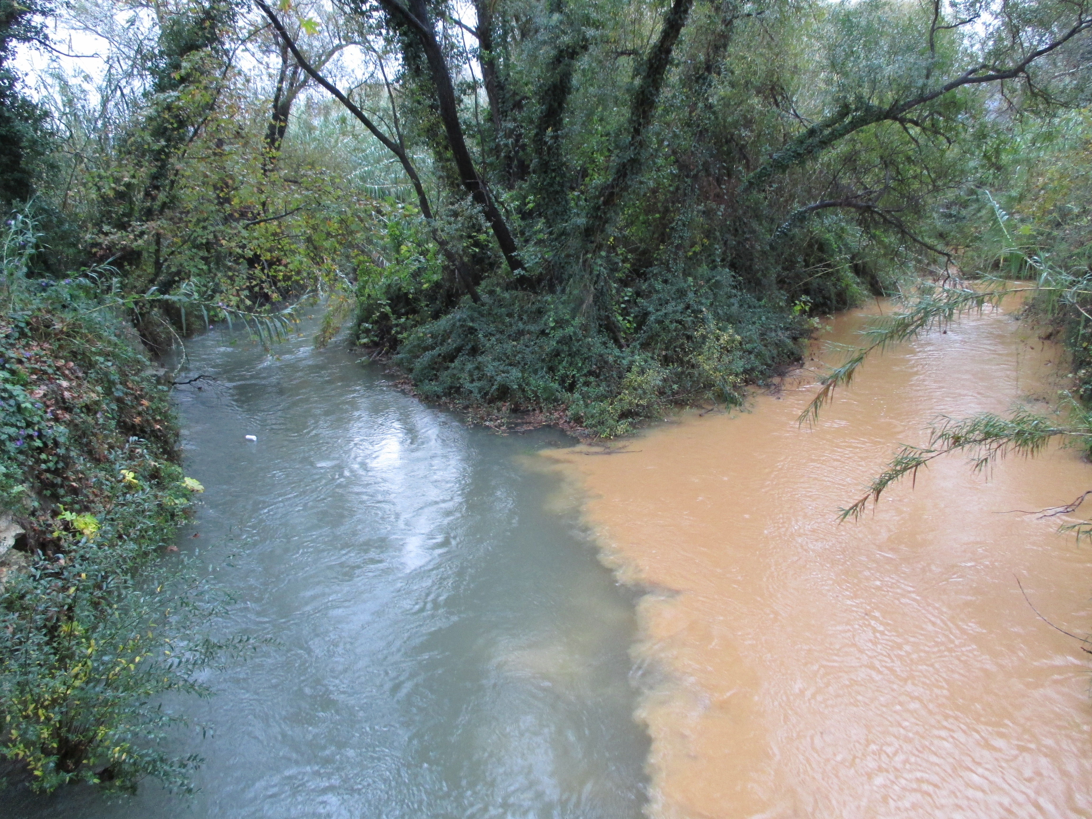
The Koiliaris River watershed is a Critical Zone Observatory that represents severely degraded soils due to heavy agricultural impact such as grazing, over many centuries. It represents Mediterranean soils under imminent threat of desertification (soil carbon loss) due to climate change that is predicted by the UN IPCC for the region over the next century. It is located in Western Crete, Greece. There are 17 communities in the catchment. The total area is 130 sqkm and the total length of the river is 36 km. Intensive hydrologic and geochemical monitoring has been conducted since 2004 while the site has historical data since the ‘60s. In addition, high-frequency hydrologic and water quality monitoring stations have been deployed to obtain data for the characterization of the hydrologic and biogeochemical processes with varying process response-times. There are 3 meteorological stations within the watershed and several outside. Water quality data of surface and groundwater have been collected since 2004. Koiliaris-CZO is managed by the Laboratory of Hydrochemical Engineering & Remediation of Soil (H.E.R.S. Lab) of the Technical University of Crete.
-
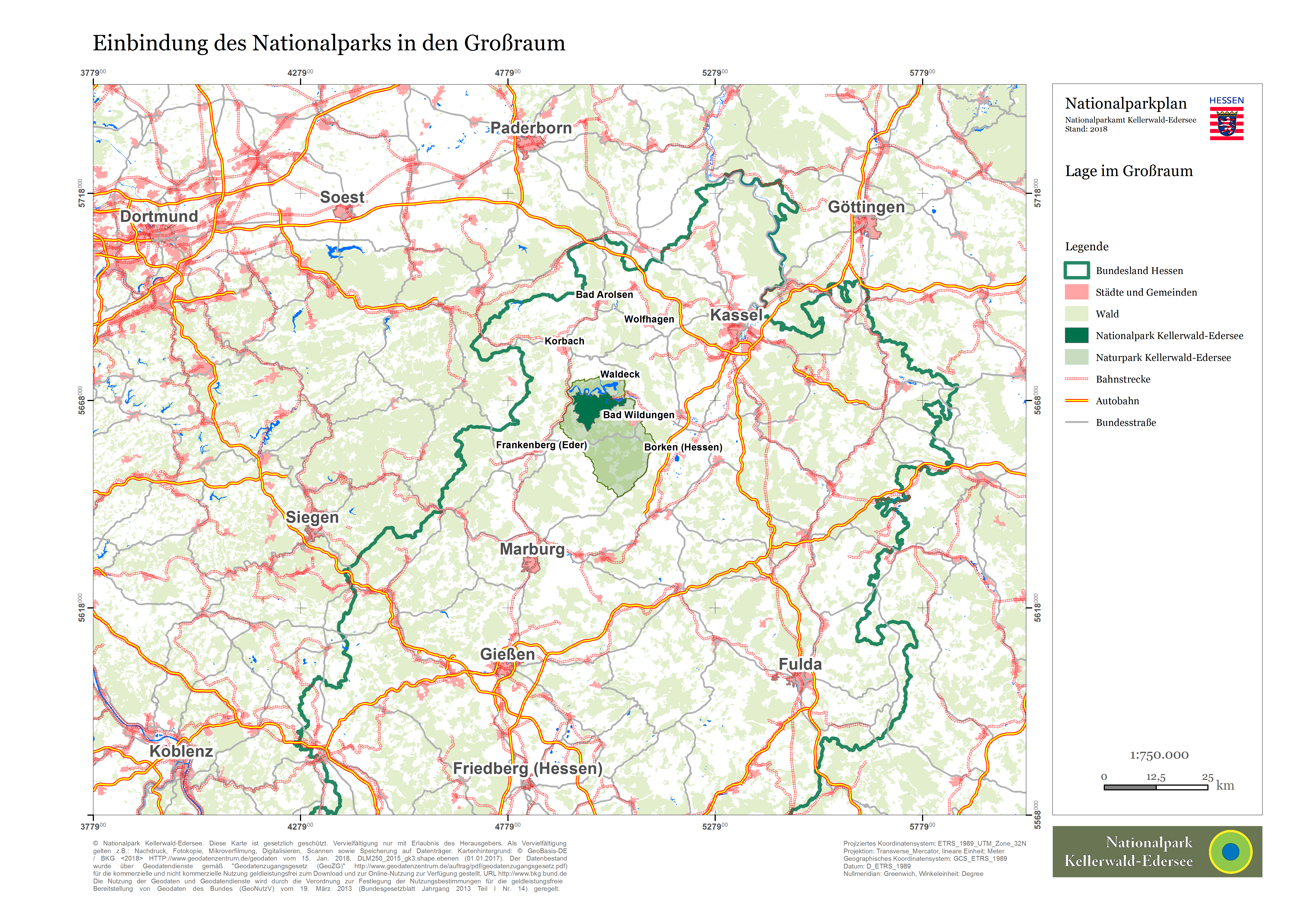
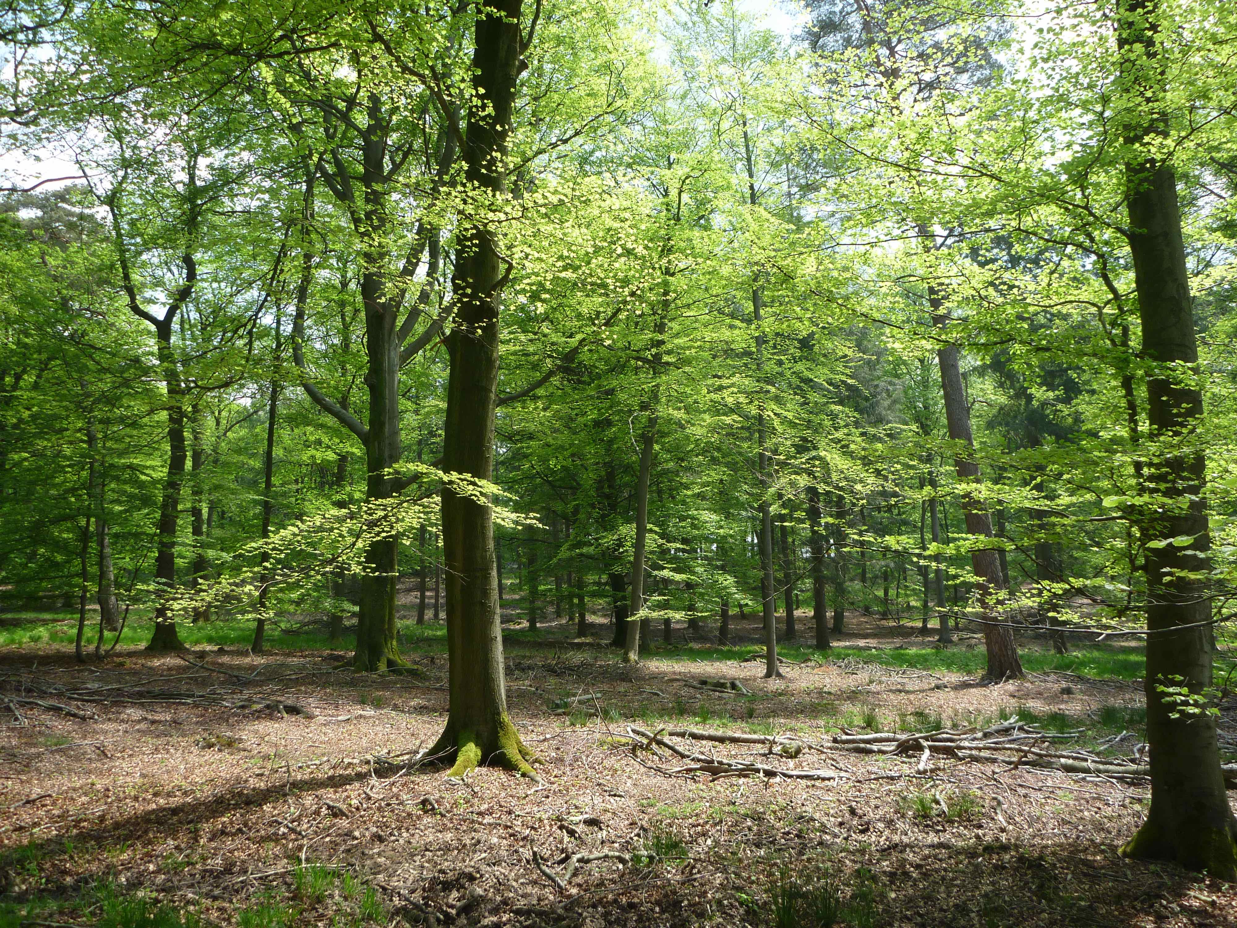
The first national park in Hesse protects one of the last large beech forests in Central Europe which is neither dissected by roads nor settlements on a total surface area of 5,738 ha. Its Luzulo-Fagetum beech forests of the lower altitudinal zone are among the last ones in Central Europe as regards size, coherence and closeness to nature. They are characterized by an outstandingly high proportion of deadwood and remnants of primeval forest. Typical cohabitations of birds and bats as well as inhabitants of deadwood including primeval forest indicators are distinguishing features of the calm forest landscape – evidencing the international importance and qualification to be recognized as World Natural Heritage. Hardwoods and rocky slope forests, dry oak forests, streamside forests, firewitch-vegetated bedrocks, pure-water springs and creeks as well as wooded meadow valleys and remnants of rough pastures complete the extraordinary ensemble.