
soil nutrient
Type of resources
Available actions
Topics
Keywords
Contact for the resource
Provided by
Years
Formats
Representation types
-
The site is located in the Southern Carpathians (Romania). The predominant ecosystems are grasslands located above tree line, dominated by Carex curvula, Juncus trifidus (alpine zone) and Festuca airoides, Nardus stricta (subalpine zone). The site consists of monitoring points in subalpine and alpine meadows in the Bâlea-Paltinul area.
-
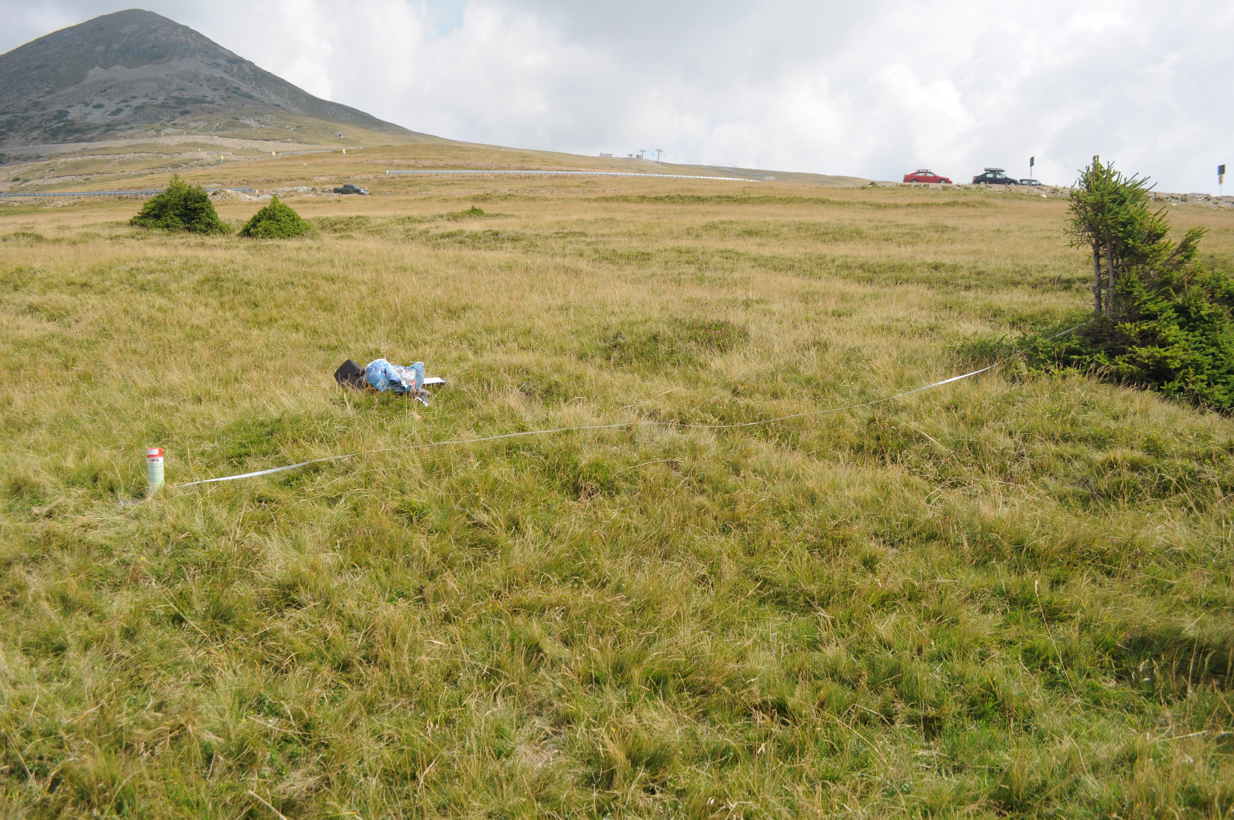
The site is located in the Southern Carpathians (Romania). The predominant ecosystems are grasslands located above tree line, dominated by Carex curvula, Juncus trifidus (alpine zone) and Festuca airoides, Nardus stricta, Festuca nigrescens (subalpine zone). The site consists of monitoring points in subalpine and alpine meadows.
-
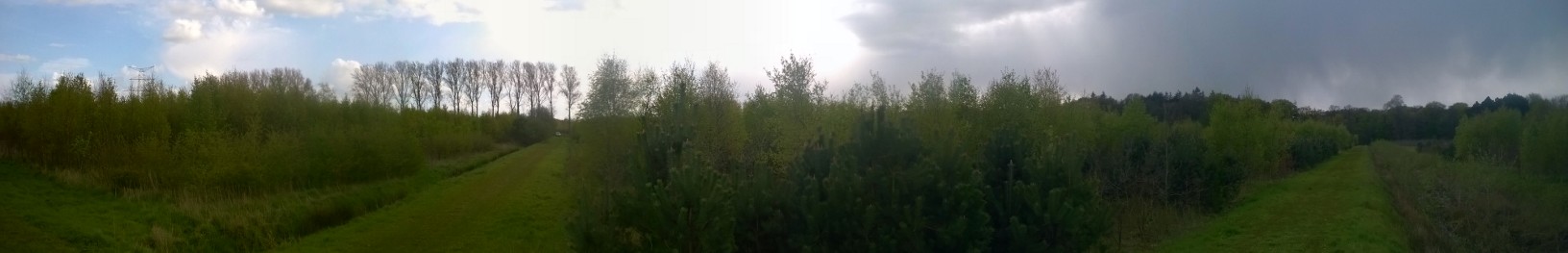
FORBIO is an innovative, large-scale forest biodiversity experiment established in Belgium between 2009 and 2012. The acronym stands for assessment of the effects of tree species diversity on FORest BIOdiversity and ecosystem functioning. At three sites with contrasting site conditions, plots were planted with one up to four tree species. Various aspects of ecosystem functioning will be compared between plots that differ in tree species richness but have developed under the same abiotic conditions. The sites are located in Gedinne (Gribelle, Gouverneurs), Hechtel-Eksel and Zedelgem.
-
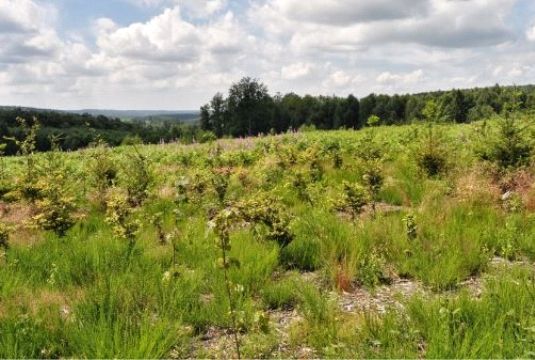
FORBIO is an innovative, large-scale forest biodiversity experiment established in Belgium between 2009 and 2012. The acronym stands for assessment of the effects of tree species diversity on FORest BIOdiversity and ecosystem functioning. At three sites with contrasting site conditions, plots were planted with one up to four tree species. Various aspects of ecosystem functioning will be compared between plots that differ in tree species richness but have developed under the same abiotic conditions. The sites are located in Gedinne (Gribelle, Gouverneurs), Hechtel-Eksel and Zedelgem.
-
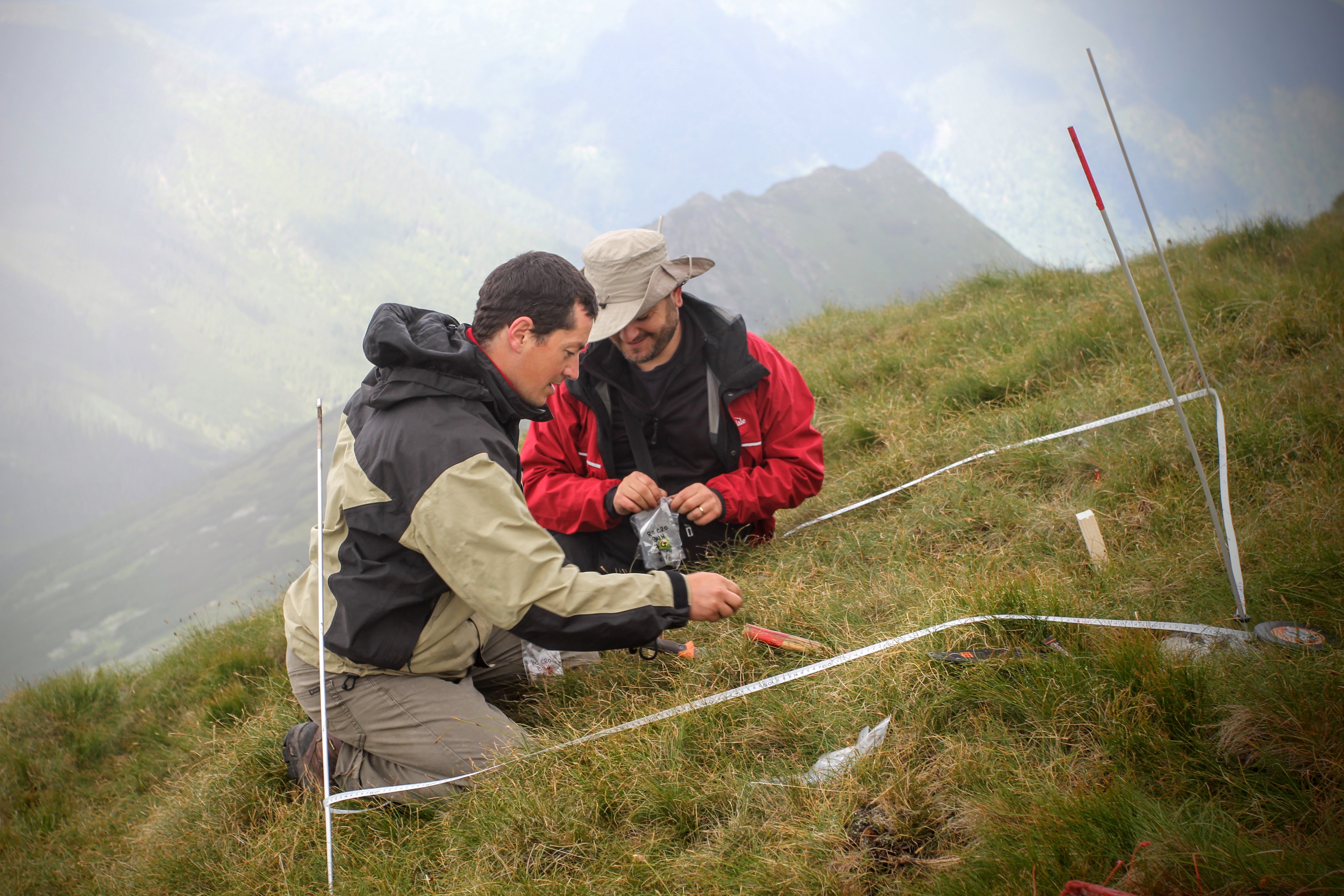
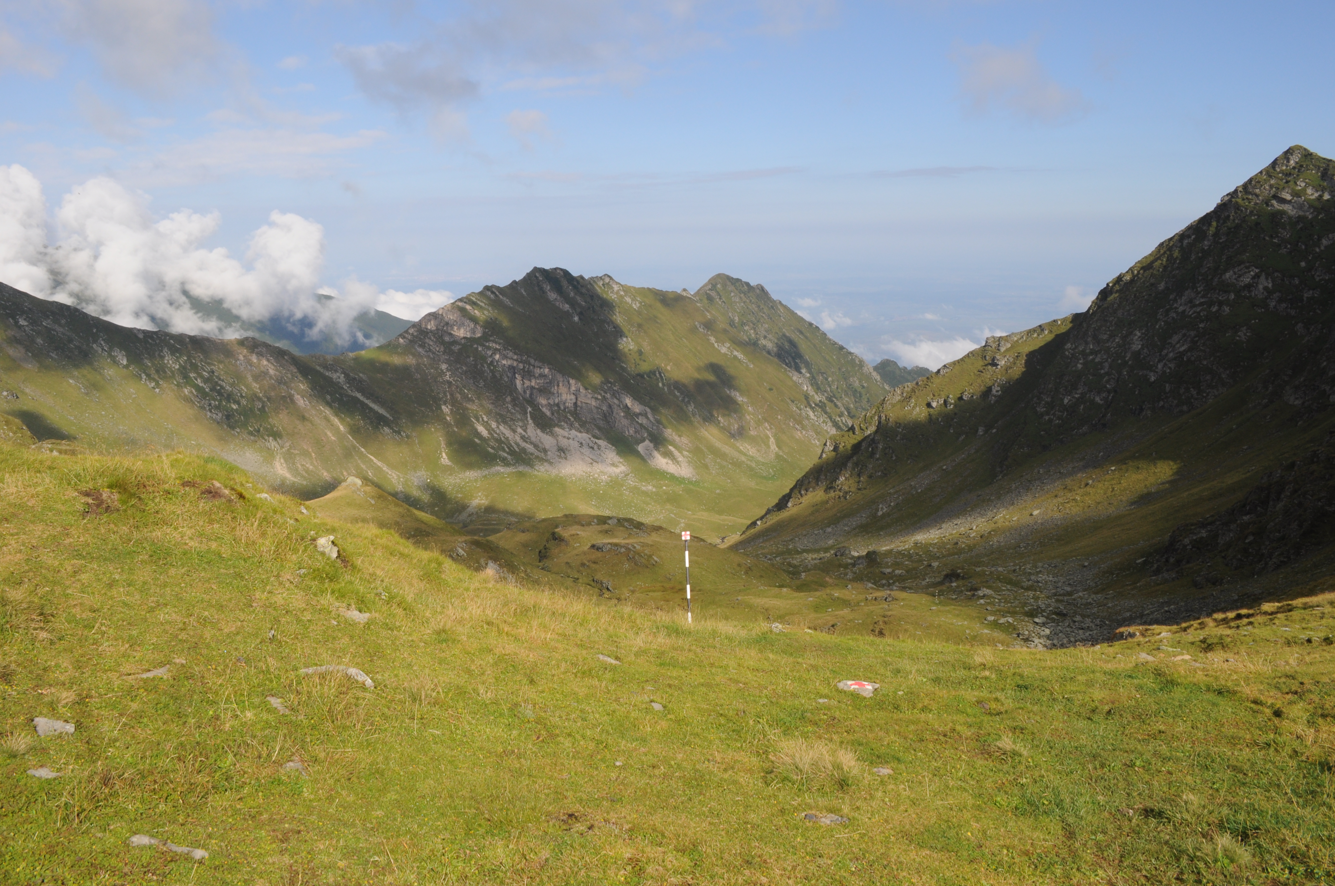
The site is located in the Eastern Carpathians (Romania). The predominant ecosystems are grasslands located above tree line, dominated by Carex curvula, Juncus trifidus (alpine zone) and Nardus stricta, Festuca airoides (subalpine zone). The site consists of monitoring points in subalpine and alpine meadows across the whole range of the Rodna Mountains.
-
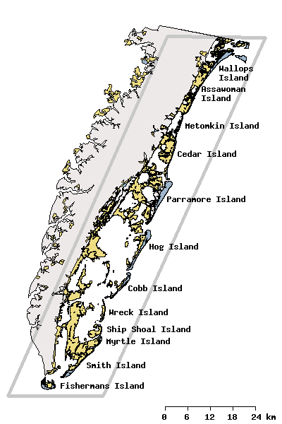
Research activities of the VCR/LTER focus on the mosaic of transitions and steady-state systems that comprise the barrier-island/lagoon/mainland landscape of the Eastern Shore of Virginia. Primary study sites are located on Hog Island, Parramore Island and mainland marshes near Nassawadox VA. The VCR/LTER uses field laboratory and housing facilities at the Anheuser-Busch Coastal Research Center in Oyster, VA.
-
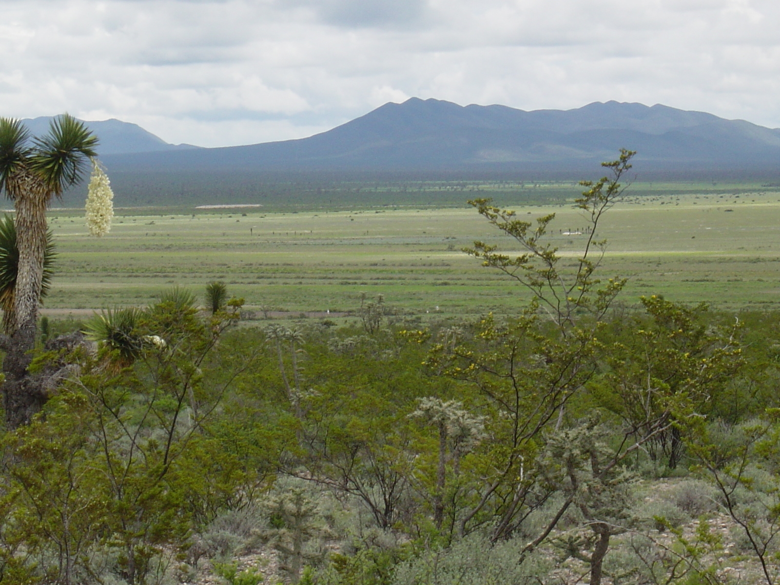
Los esfuerzos de investigación se enfocan a la región del altiplano mexicano conocida como “El Tokio”, donde se distribuyen los pastizales gipsófilos y salinos en el noreste de México y la cual es reconocida como una región prioritaria para la conservación de especies de aves residentes endémicas y migratorias. El área se caracteriza por valles intermontanos en los cuales se presentan suelos con altos contenidos de yeso y carbonatos de calcio, así como pastizales de porte bajo que no rebasan los 15 cm de altura en promedio. En estos valles habita el perrito llanero mexicano (Cynomys mexicanus), especie clave en el ecosistema. La vegetación circundante a estos valles está caracterizada por matorrales de gobernadora (creosote bush) con elementos sobresalientes de Yucca. El área es fuertemente impactada por actividades agrícolas y ganaderas, las cuales se llevan a cabo desordenadamente y sin medidas de mitigación.
-
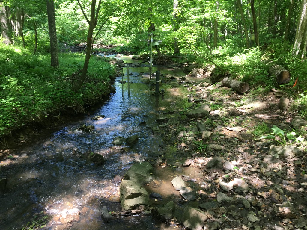
The Posey Creek (POSE) core aquatic site is part of NEON's Mid-Altantic Domain 2 sites. POSEY is a wadeable stream near Front Royal, VA and is located on the Smithsonian Conservation Biology Institute land. It is a shallow stream (<40 cm at average flow) and 3 - 5 m wide (6 meters wide during high flows). This site has one meteorological station located in the riparian area. The met station is outfitted with a subset of the same sensors used at terrestrial sites. Measurements include wind speed and direction, air temperature, barometric pressure, relative humidity, shortwave radiation, and PAR. This site has one upstream sensor station and one downstream sensor station. Measurements include PAR, temperature, water quality [specific conductivity, chlorophyll a, dissolved oxygen content, pH, turbidity, and fluorescent dissolved organic matter (only downstream)], and nitrate is measured at the downstream station. Eight groundwater wells throughout the site collect specific conductivity, water tempertaure, and elevation of groundwater. Field ecologists collect the following types of observational data at this site: aquatic organisms (Aquatic Microbes (surface water), macroinvertebratesmicroalgae, plants and macroalgae, zooplankton. Biogeochemical data on plants,sediment water and particulates. As well as physical aquatic data on bathymetric maps, stage,secchi depth and depth profiles, and riparian assessment. Total data products planned for this site: 78
-
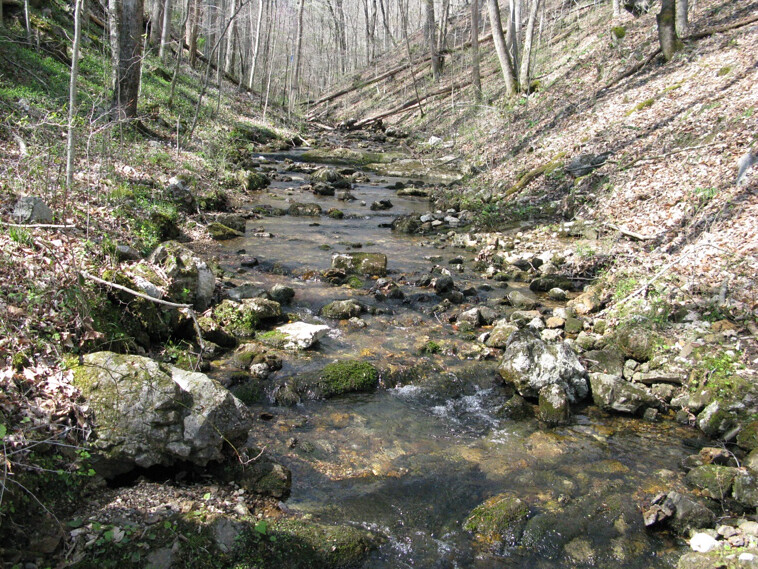
Walker Branch is a core wadeable stream site located in the deciduous forest of the Oak Ridge Reservation in eastern Tennessee. This site is part of NEON's Appalachians and Cumberland Plateau Domain 7. Remote sensing surveys of this site collect lidar, spectrometer and high resolution RGB camera data. This site has one meteorological station located in the riparian area. The met station is outfitted with a subset of the same sensors used at terrestrial sites. Measurements include wind speed and direction, air temperature, barometric pressure, relative humidity, shortwave radiation, and PAR. This site has one upstream sensor station and one downstream sensor station. Measurements include PAR, temperature, water quality [specific conductivity, chlorophyll a, dissolved oxygen content, pH, turbidity, and fluorescent dissolved organic matter (only downstream)], and nitrate is measured at the downstream station. Three groundwater wells throughout the site collect specific conductivity, water tempertaure, and elevation of groundwater. Field ecologists collect the following types of observational data at this site: aquatic organisms (Aquatic Microbes (surface water),macroinvertebrates microalgae, plants and macroalgae, zooplankton. Biogeochemical data on plants,sediment water and particulates.As well as physical aquatic data on bathymetric maps, stage,secchi depth and depth profiles, and riparian assessment.Total data products planned for this site: 78
-
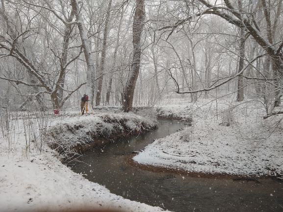
The Lewis Run relocateable aquatic site is a small 2nd order wadeable stream located about 60 miles west of Washington DC in Clarke County, Virginia. The majority of the stream reach flows past and through agricultural lands on the Casey Trees property. This site is one of two aquatic sites found within Domain 02, the Mid-Atlantic. This site has one meteorological station located in the riparian area. The met station is outfitted with a subset of the same sensors used at terrestrial sites. Measurements include wind speed and direction, air temperature, barometric pressure, relative humidity, shortwave radiation, and PAR. This site has one upstream sensor station and one downstream sensor station. Measurements include PAR, temperature, water quality [specific conductivity, chlorophyll a, dissolved oxygen content, pH, turbidity, and fluorescent dissolved organic matter (only downstream)], and nitrate is measured at the downstream station. Eight groundwater wells throughout the site collect specific conductivity, water tempertaure, and elevation of groundwater. Field ecologists collect the following types of observational data at this site: aquatic organisms (Aquatic Microbes (surface water), macroinvertebratesmicroalgae, plants and macroalgae, zooplankton. Biogeochemical data on plants,sediment water and particulates. As well as physical aquatic data on bathymetric maps, stage,secchi depth and depth profiles, and riparian assessment.Total data products planned for this site: 78