
soil organic carbon
Type of resources
Available actions
Topics
Keywords
Contact for the resource
Provided by
Years
Formats
Representation types
-
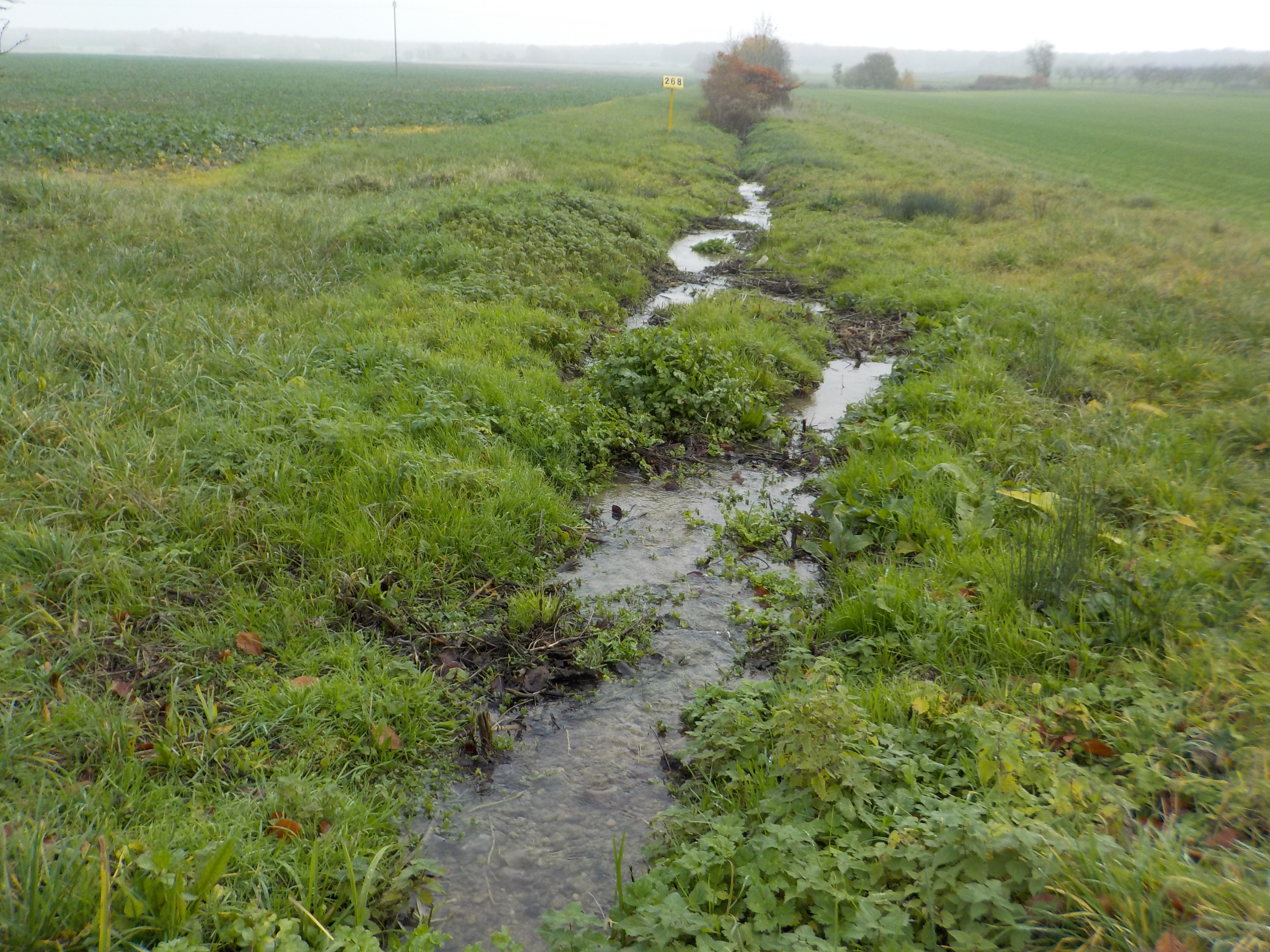
The state forest of La Reine is a humid forest of about 5000 ha located in the south of the plain of Woëvre and at the foot of the Meuse hills in France. Numerous ponds and puddles are scattered throughout the forest and it is crossed by many small, more or less natural streams. Upstream of the forest, these waterways are impacted by human activities (large-scale farming, housing without collective sanitation in particular). Since 2019, the Moselle Basin Workshop Zone has been working on the implementation of a workshop site to understand the bio-hydrogeological functioning of three of these streams, particularly in terms of natural purification. Sampling campaigns are regularly organized in the streams and in ponds.
-
None
-
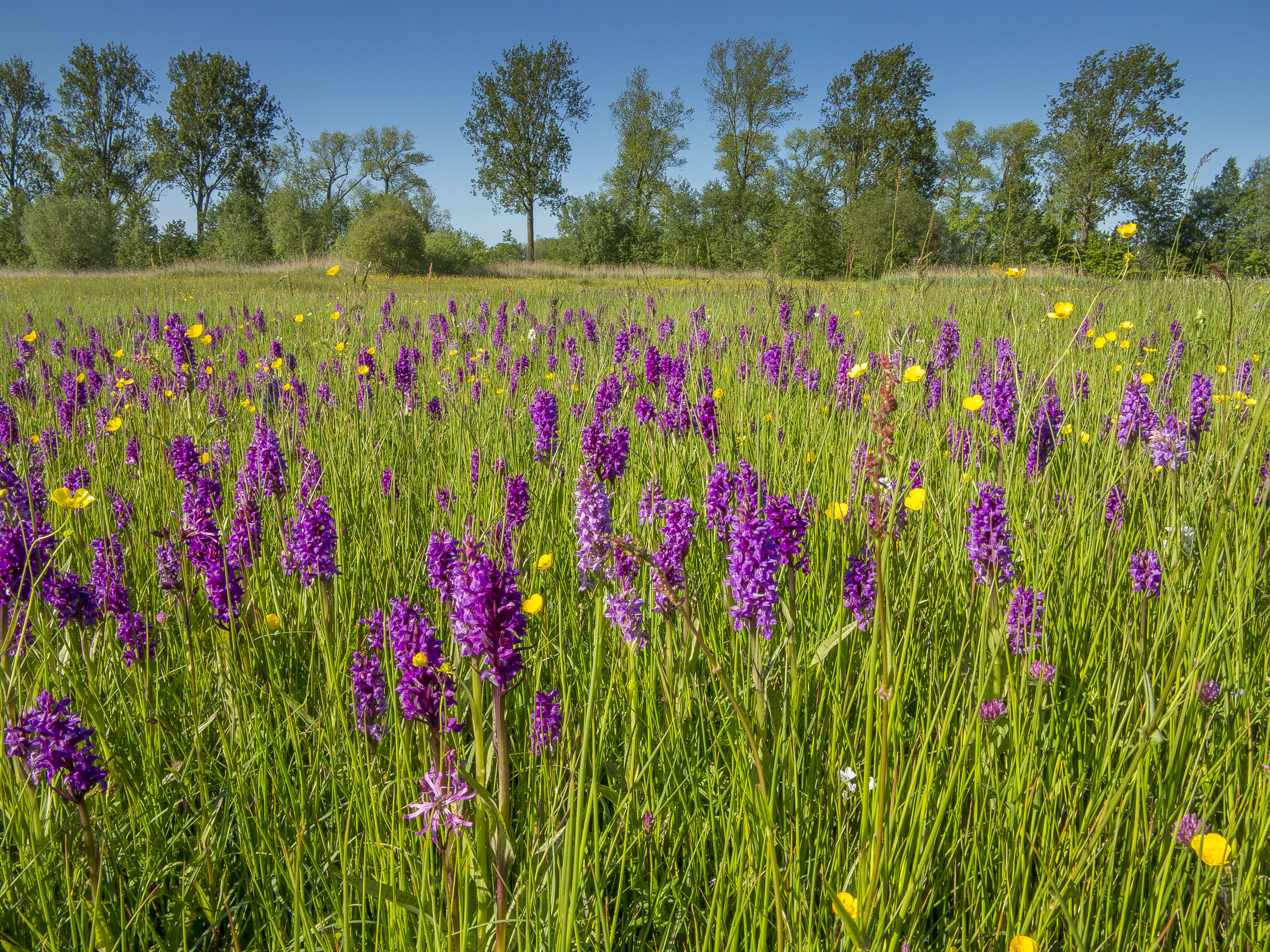
Fen meadow and transition mire nature reserve
-
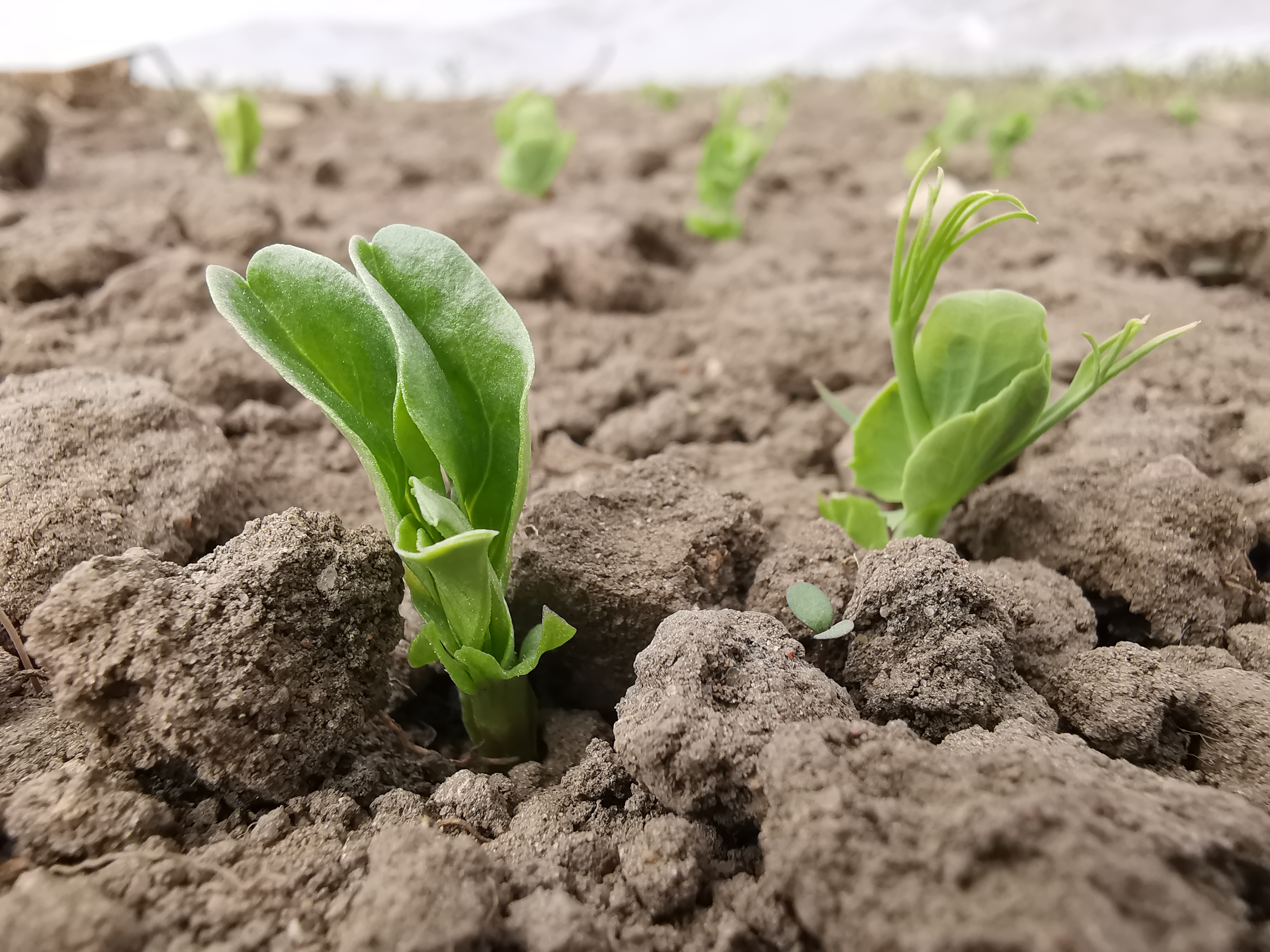
SITES Lönnstorp research station is situated in the Scanian agricultural landscape between Malmö and Lund and has a focus on the design, sustainable development and assessment of arable cropping systems, in conventional and organic farming. The research station is available for research within ecology, agronomy, environmental science, agroecology and other disciplines. SITES Lönnstorp research station have access to 60 hectares of conventional and 18 hectares of organic farm land, mainly cultivated with annual crops, representative for agricultural practise in southern Sweden. The station is also a part of SITES, Swedish Infrastructure for Ecosystem Science. SITES is a nationally co-ordinated infrastructure for terrestrial and limnological field research. In 2016, SAFE (SITES Agroecological Field Experiment) was established at the research station. SAFE make it possible to compare four different agroecosystems, a conventional reference system, an organic system, a perennial system and an agroecological intensified system.
-
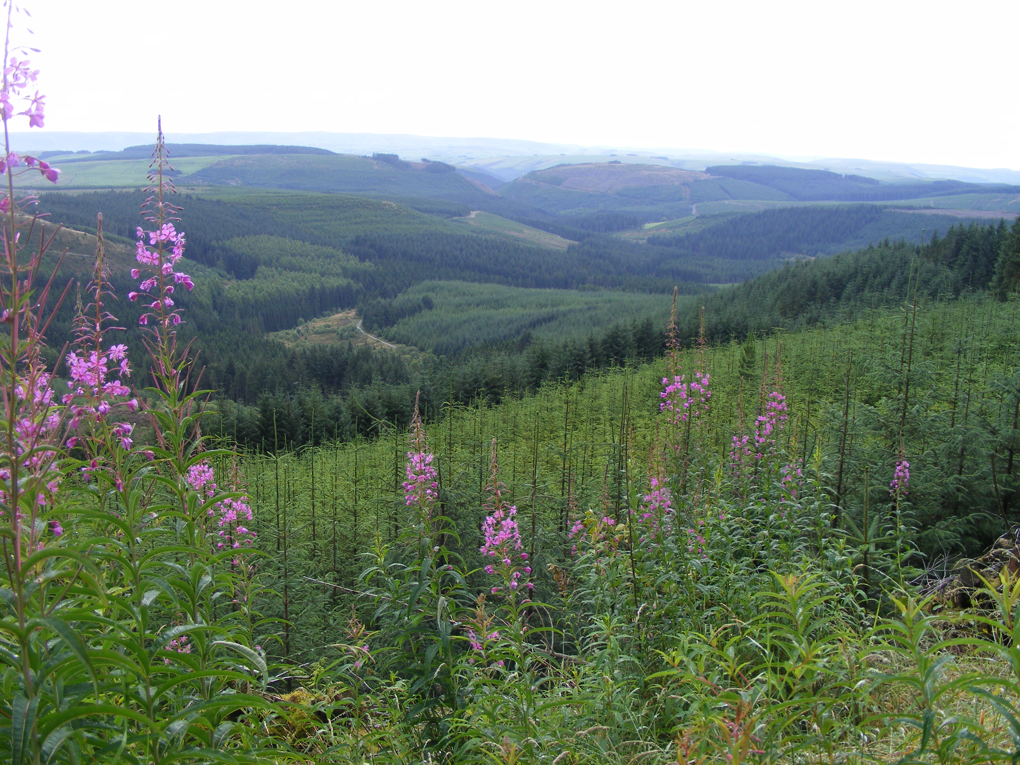
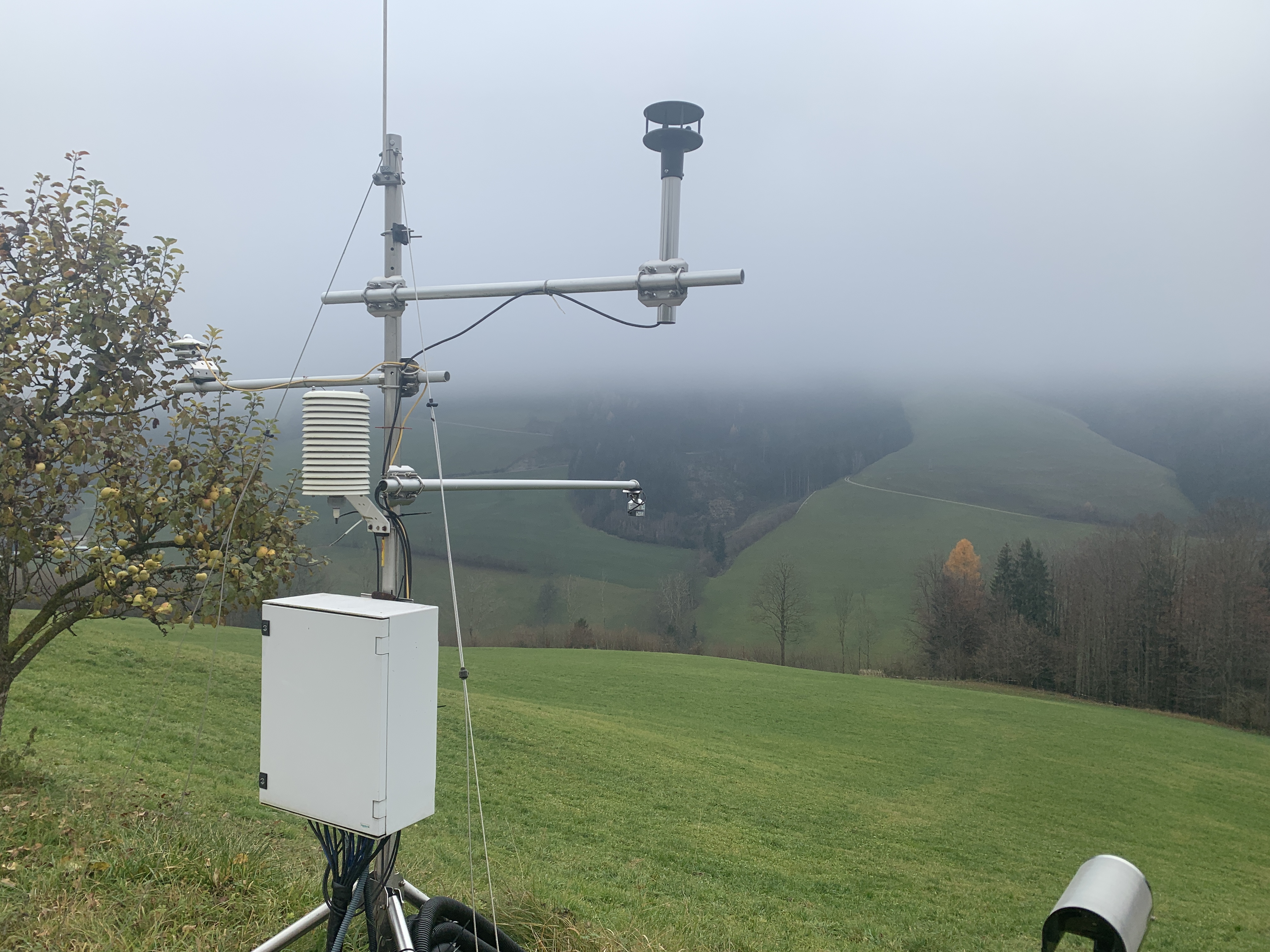
Plynlimon is at the headwaters of the Rivers Severn and Wye. The infrastructure at Plynlimon consists of 10 instrumented research catchments representing different land use options on the same geological parent material. It is the UK’s Critical Zone Observatory, part of the EU and global network of CZOs and is an ExpeER site. The infrastructure records high temporal resolution river flow and meteorological data (40 year data record) and stream water and precipitation chemistry for cations, anions, trace metals, nutrients, pH and alkalinity (30 year data record) and some data for suspended sediment. The site has an extensive spatial data library including topography, digital terrain model (DTM), soils, geology and vegetation/land-use available, open access, through the Environmental Information Data Centre (https://catalogue.ceh.ac.uk/documents/91961a0f-3158-4d00-984d-91eb1e03e8bd). Sub sites in the catchments represent a range of upland management types: mature/clear cut/replanted conifer forest; acid grassland; eroding peatland; improved grassland.Samples analysed for a wide range of major, minor and trace components. Bulk precipitation and cloudwater chemistry is also measured at one location.
-
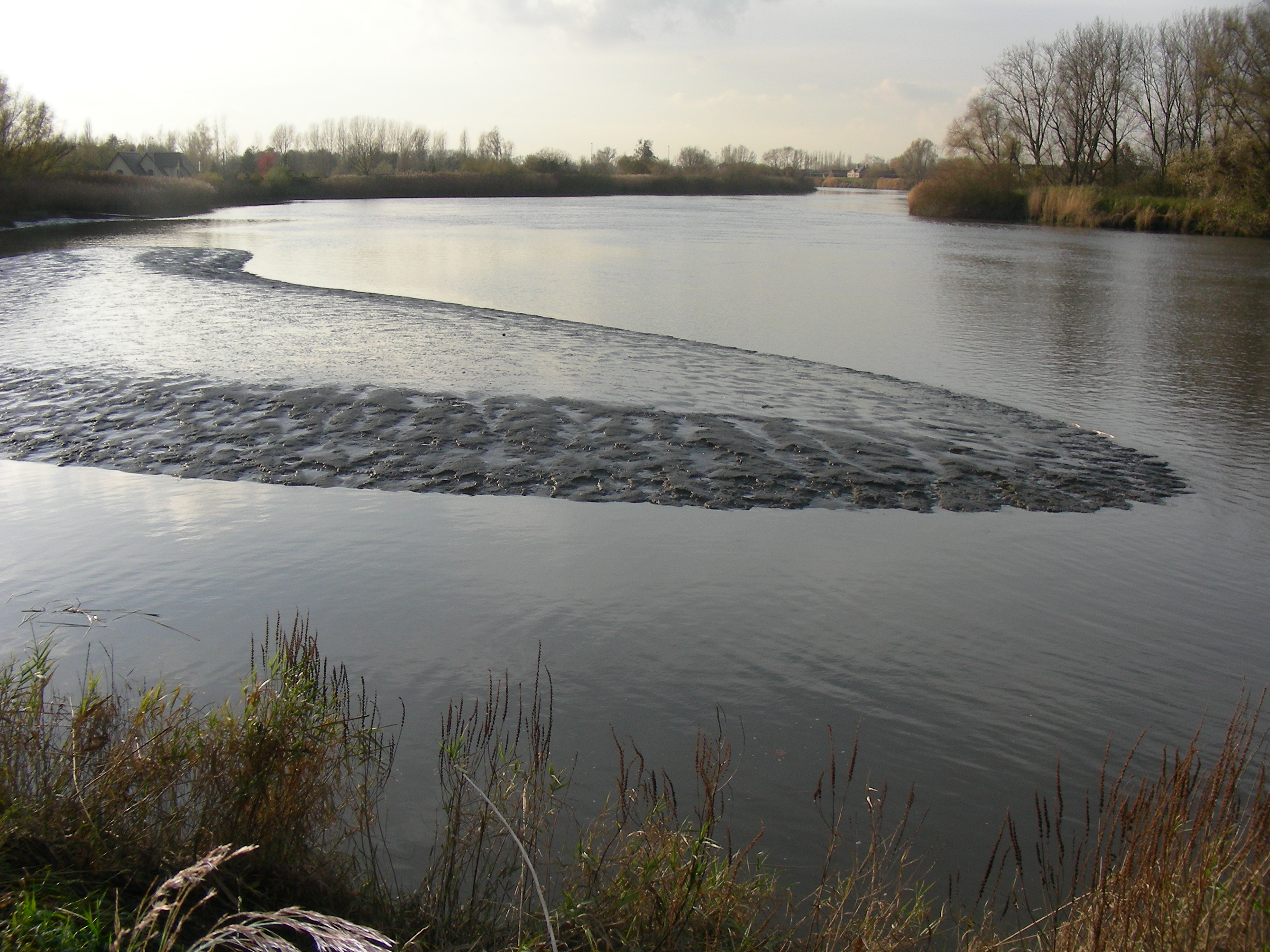
The study site starts at the mouth of the river (Vlissingen, the Netherlands) and extends to Gent, 160 km from the mouth, where tidal influence is stopped by sluices. The tributaries the Durme and the Rupel, with the Nete , Dijle and Zenne are also under tidal influence and are considered part of the estuary. The natural inundated areas around the river and the valleys up to 5m TAW are also part of the study system.
-
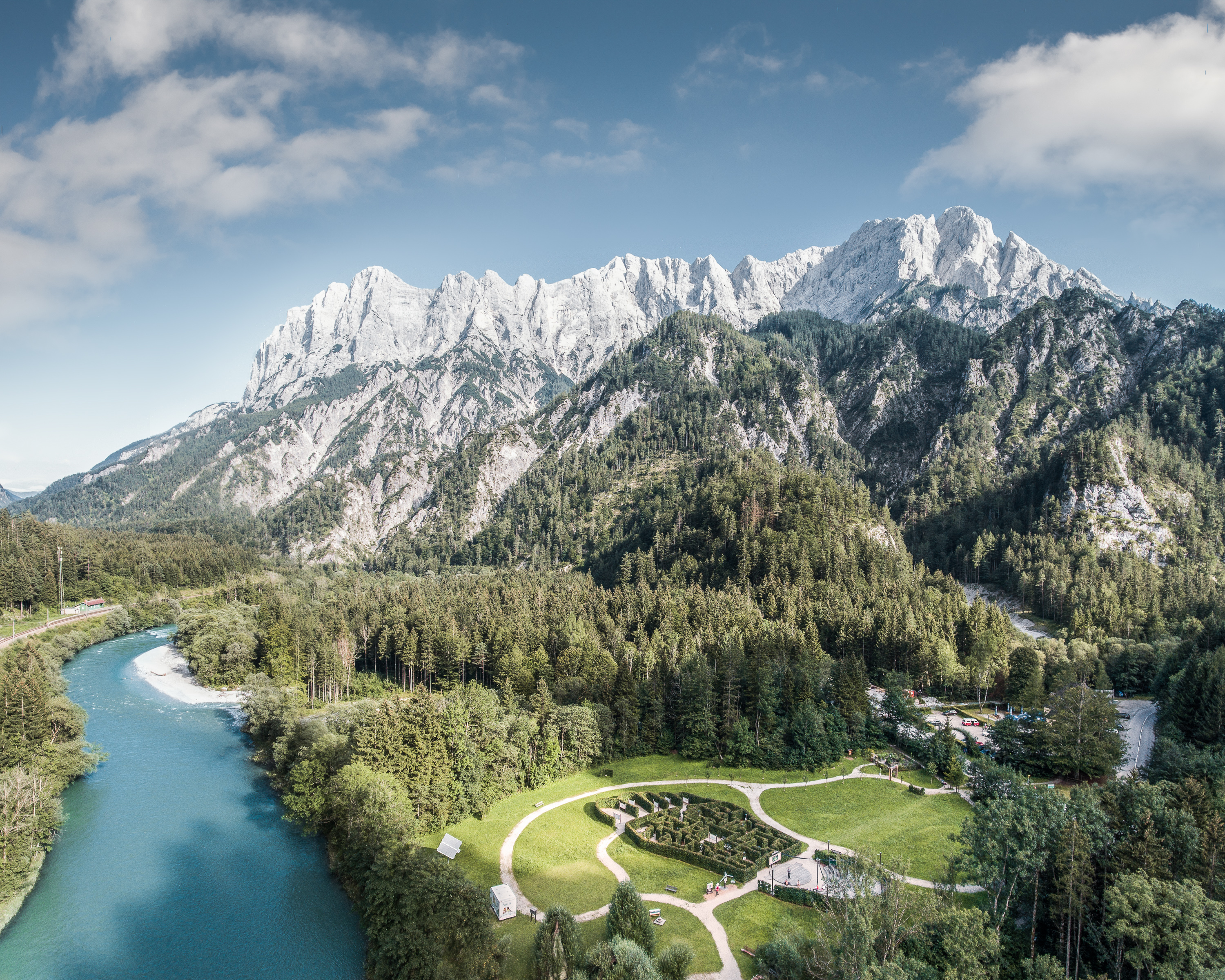
The Gesäuse Nationalpark and the Johnsbach valley belong to the Ennstal Alps, a part of the Northern Limestone Alps. They are situated in the province of Styria in the center of Austria. Together, they form the joint test site named Gesäuse-Johnsbachtal. This region is characterized by a mountainous landscape which is cut by the river “Enns”. In the north, it borders Eisenwurzen Nature Park and is only 6 km away from the Kalkalpen, a National Park in Upper Austria. In the south, the borders are the Eisenerzer Alps. The total area of the site is about 155 km². The terrain shows a great elevation range from 600-700 m in the Johnsbach valley to over 2300 m in the summit region of the Gesäuse, with Hochtor (2369 m) being the highest mountain. Due to the great range of altitude differences within small areas the Gesäuse-Johnsbachtal shows extremely diverse habitats and, consequently, species of animals and plants. In general, the landscape is dominated by mountain forests along with high Alpine rock formations and meadows. These complex topographic, hydrological, geological, geomorphological and meteorological conditions pose a scientific challenge for all kinds of environmental monitoring and modeling.
-
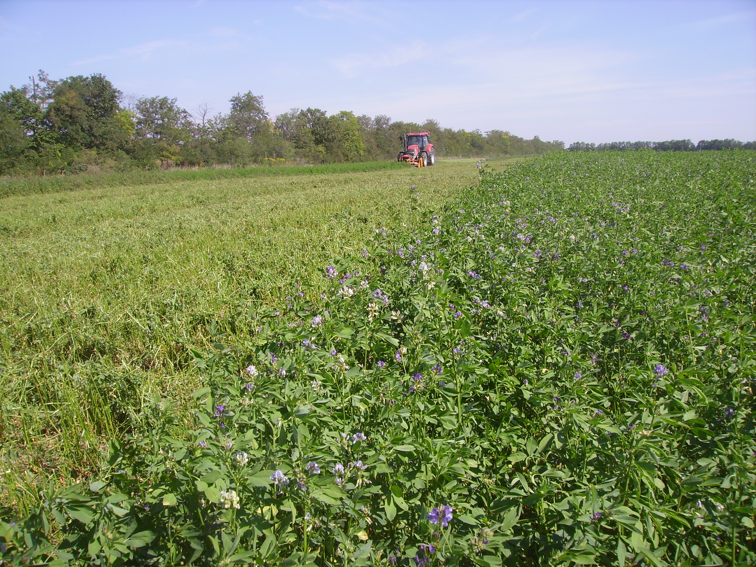
The Rutzendorf Experimental Station is an agricultural research site of the University of Natural Resources and Live Sciences Vienna (BOKU), belonging to the Landwirtschaftliche Versuchswirtschaften GmbH. It is representative for the productive soils managed as arable land in the Marchfeld area (Lower Austria). The soil is described as a silty loamy Calcaric Phaeozem (WRB), a Chernozem according to Austrian soil classification. Management on the farm is without livestock, no organic fertilizers are applied. The farm was converted to organic farming in the production year 2002/03. The 8-year crop rotation comprises luzerne (2 yrs), winter wheat*, grain maize, spring barley*, field peas*, winter wheat, winter rye. Cover crop mixtures are grown where indicated in the crop rotation with an asteric. Current research questions include to study (i) the long-term sustainability and productivity of the stockless organic arable system compared to a livestock-keeping system, (ii) the mitigation of climate change effects on the soil-plant system by reducing soil cultivation intensity, and (iii) the development of biodiversity following the conversion to organic farming and enhancement of landscape elements. Regularly meteorological data, crop yields and quality, physical, chemical and biological soil traits, weed species and diaspores, springtails, wild bees and other animal species are assessed. Studies have been conducted as research projects financed nationally and by the European Union, e.g. in two EIP projects.
-
Landslides (translational and rotational slides, debris flows, rock avalanches, rock falls, etc.) rank among the most common natural hazards in Lower Austria. As these processes often inherit sporadic phases of activity, it is essential to generate specific long-term measurement series, enabling the analysis of surface and sub-surface dynamics in connection with potential triggering factors. Therefore, in 2014 the project “NoeSLIDE – Monitoring diverse types of landslides in Lower Austria” was initiated. Three subsites are summarized under the parent site "LTER NoeSLIDE".where various types of landslide processes, Hofermühle (complex earth slide - earth flow), Gresten (Salcher landslide) and Brandstatt are monitored with "classic" as well as novel approaches. This includes surface and subsurface monitoring systems. The main research aims comprise implementation of long-term monitoring systems (10+ years) for continuous observation of gravitational mass movements, testing of novel and innovative methods on multiple locations and data availability in a WebGIS application for simple online analyses for authorized users.
-
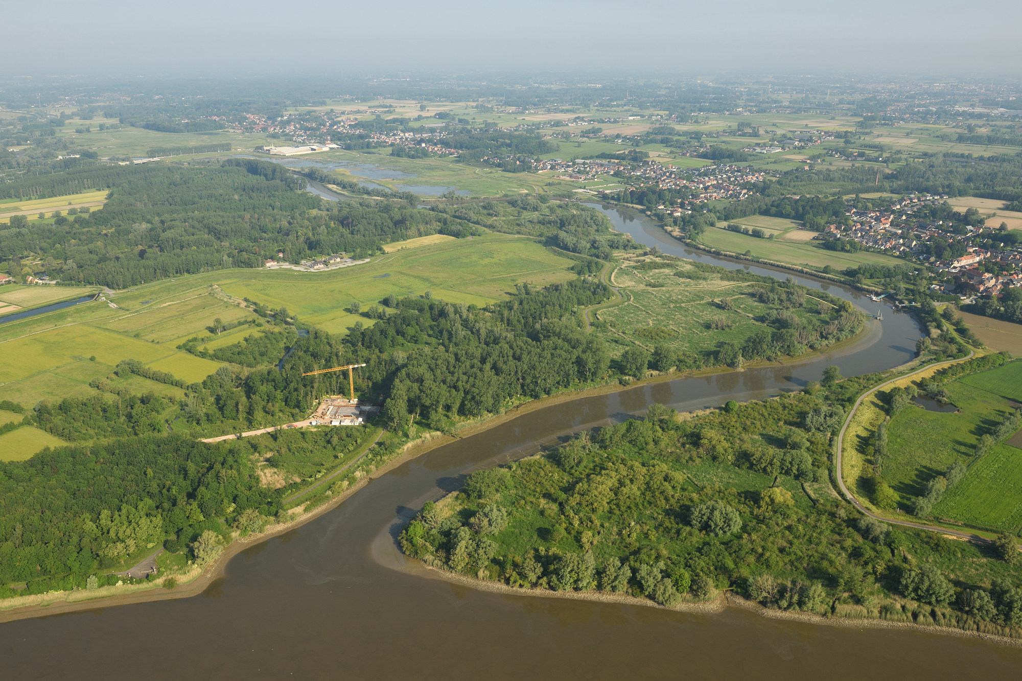
The Durme debouchment is a subsite (12 ha) of the Scheldt Estuary and its alluvial plains. The setup for deployed in the context of eLTER_RI is a cross-shore open-air laboratory open for other researchers and students to experiment in a long-term in-situ setup. The responses studied are on the level of sediment, infauna of tidal flats, (ground)water levels, carbon (including microphytobenthos and green-house gases), (ground)water quality and marsh vegetation (plant biodiversity, biomass). An end-goal is to provide long term field data to develop numerical eco-morphodynamic model(s) that is/are able to predict the effect of changed water budgets on carbon sequestration or greenhouse gas emissions, biodiversity (by eDNA), macro-invertebrate production and changes in tidal wetland plant species distribution and production in a cross-shore approach.