
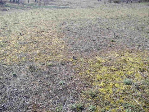
soil organic residual
Type of resources
Available actions
Topics
Keywords
Contact for the resource
Provided by
Years
Formats
Representation types
-
The restoration sites are located in abandoned arable land and clear-cut tree plantations mostly, but not entirely within LTER Fulophaza that is a high diversity site, both in terms of habitats and species, in the Kiskunság Sand Ridge. It uses some of the central facilities of the KISKUN LTER, such as the meteorological station and the field research station with accommodation opportunities, and a couple of long term monitoring sites and field experiments.
-
The Kellogg Biological Station (KBS) is located in southwest Michigan in the eastern portion of the U.S. cornbelt, 50 km east of Lake Michigan in the SW corner of the state (42° 24′ N, 85° 24′ W, elevation 288 m). Annual rainfall at KBS averages 1,005 mm/y with about half falling as snow; potential evapotranspiration (PET) exceeds precipitation for about 4 months of the year. Mean annual temperature is 10.1 °C. KBS is 1600 ha of cropping systems, successional communities, and small lakes. Surrounding KBS is a diverse, rural-to-semirural landscape typical of the U.S. Great Lakes and upper Midwest regions. The diversity of land use, soil and vegetation types, and aquatic habitats within a 50-km radius of the Station is high. Most of southwest Michigan is on the pitted outwash plain of the morainic system left by the last retreat of the Wisconsin glaciation, circa 12,000 years ago. Soils in the area developed on glacial till, and include well- and poorly-drained alfisols, mollisols, and entisols. Most regional soils are sandy loam and silty clay loam of moderate fertility, principal Station soils are Typic Hapludalfs. Land use around KBS ranges from urban (Kalamazoo, with a metropolitan population of 180,000, is 20 km south of the Station) to rural; vegetation ranges from cultivated and early successional old fields to older growth oak-hickory and beech-maple forests; and aquatic habitats include more than 200 bodies of water of different morphometries, alkalinities, and degrees of eutrophication within 50 km. Cropping systems in the area are typical of the U.S. cornbelt — mainly corn/soybean rotations with wheat of varying importance, and alfalfa an important forage crop. KBS yields are typical of non-irrigated yields elsewhere in the North Central Region. KBS LTER research is carried out in a variety of experimental systems. The most important of these is the Main Cropping System Experiment (MCSE), which was started in 1989 and consists of 11 different cropping systems or successional plant communities, ranging from annual corn-soybean-wheat rotations to late-successional deciduous forest. All communities are replicated within the landscape.
-
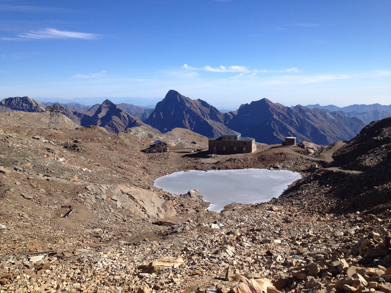
The "Istituto Scientifico Angelo Mosso" research site is located on the watershed between Piedmont and Valle d'Aosta (NW-Italy), in the Municipality of Alagna Valsesia (Monte Rosa massif). The Scientific Laboratories of the "Angelo Mosso Institute" at Col d’Olen (2901 m a.s.l.), the heart of this research site, were built between 1905 and 1907, when it became clear that the Capanna Regina Margherita on Monte Rosa (4554 m a.s.l.), as a high-elevation research centre, had become insufficient to the increasing number of requests for use by the international scientific community. From here the idea promoted by Angelo Mosso (1846-1910), professor of human physiology at the University of Turin, to add an additional structure to the Observatory of the Capanna Regina Margherita for make larger laboratories available to researchers and allow study stays at high elevation. This project soon became a reality thanks to the intervention of Queen Regina Margherita, Ministries of Education and Agriculture, the Italian Alpine Club and various personalities of the time. The research conducted at the Institute did not concern only human physiology, but also other disciplines, including alpine meteorology and glaciology, thanks also to the presence of the Meteorological Observatory that flanked the Institute, directed in the years 1925-40 by Umberto Monterin. It is now home to an automatic snow and weather station, managed by the Alpine Troops-Meteomont service. In addition to the University of Turin, the research groups that operate at the site and contribute to data collection and implementation are currently CNR-IRSA, Alpine Troops Command-Service Meteomont, Monterosa 2000 SpA and Monterosa SpA (Monterosa Ski), Protected areas of Valsesia, ARPA Piemonte, ARPA Valle d'Aosta and Sesia Val Grande Geopark. In addition to the valuable historical series of climate data, a series of research activities are devoted to the study of snow-soil-vegetation interactions, with particular reference to carbon dynamics e soil nitrogen (Magnani et al. 2017a,b; Freppaz et al. 2019). In addition, investigations are performed focusing on the chemical characteristics of high-elevation surface waters, fed by different cryospheric features such as rock glaciers, glaciers, and permafrost (Colombo et al. 2018a,b; 2019a,b; 2020; Vione et al., 2021). New research lines, aimed at investigating the most recent environmental challenges, have been added to the previous ones. For instance, investigations on sources and routes of atmospheric carbon and nitrogen species are ongoing. References: Colombo N. et al. (2018a), https://doi.org/10.1002/esp.4257. Colombo N. et al. (2018b), https://doi.org/10.1016/j.scitotenv.2018.05.098. Colombo N. et al. (2019a), https://doi.org/10.1016/j.scitotenv.2019.06.233. Colombo N. et al. (2019b), https://doi.org/10.1007/s00027-019-0670-z. Colombo N. et al. (2020), https://doi.org/10.1016/j.catena.2020.104700. Freppaz M. et al. (2019), https://doi.org/10.3897/natureconservation.34.30737. Magnani A. et al. (2017a), https://doi.org/10.1657/AAAR0016-037. Magnani A. et al. (2017b), https://doi.org/10.1016/j.catena.2017.03.007. Vione D. et al. (2021), https://doi.org/10.1016/j.scitotenv.2020.143464.
-
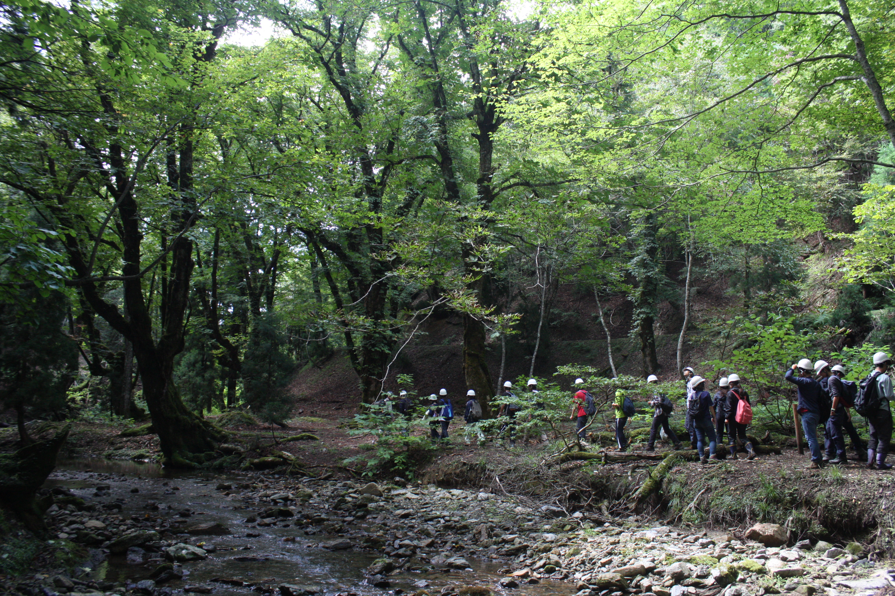
Ashiu Forest Research Station is located in the northeastern border part of Kyoto Prefecture in main island Honshu and stretches 6km east to west and 7km north to south in a rectangular shape. The area is characterized by high relief with altitudes ranging from 355 to 959 m above the sea level and encompasses the headwater zones of Yura River flowing into Wakasa bay, the Sea of Japan. This region is situated in the transition part between cool temperate forests and warm temperate forests. There is a heavy snowfall ranging from 1 to 3m in winter seasons. More than half of Ashiu Forest Research Station is covered with old-growth forests. In cool temperate forests above 600m altitude, the main species are beech (Fagus crenata), Japanese ceder (Cryptomeria japonica), deciduous oak (Quercus crispula). In warm temperate forests under 600m altitude, evergreen and deciduous oaks (Quercus salicina and Quercus sessilifolia) can be seen. There are two noteworthy characteristics in Ashiu Forest Research Station. Firstly, its high biodiversity. Since the establishment of the Research Station in 1921, new plant or vertebrate species/ varieties have been found. 801 woody, herbaceous and fern species have been recorded (Yasuda and Nagamasu 1995). Nationally protected species such as Japanese serow (Capricornis crispus) and Giant Saramander (Andrias japonicas) can be seen. Secondly, Ashiu Forest Research Station has been used not only for research and education but also for ecotourism by local stakeholders for more than 20 years, which has great opportunities for inter- and transdisciplinary studies.
-
The UNESCO-biosphere reserve „Schorfheide-Chorin“ was established in 1990 over an area of approx. 1.300 square kilometres, and is one of the largest protected areas in Germany. Situated in the North-eastern part of Brandenburg, including a major part of the regions Uckermark and Barnim, it represents an impressive cultural landscape with more than 320 lakes, thousands of bogs and mires, extended forests, meadows and arable land. The so-called Schorfheide and the Chorin end moraine curve are two different landscapes, seen under a culture-historical aspect. The Schorfheide stretches along the west side of the motor way A 11 (Berlin-Poland). The Chorin end moraine curve extends East of the motor way. 75 communities and three small towns (Oderberg, Joachimsthal and Greiffenberg) with a total of 35.000 residents are situated in the protected area. The main concept behind the biosphere reserve is the consideration of human impact on the land. It is meant to encourage producers to work in a sustainable manner. Thus, 79 % of the area can be used by man. To protect natural resources, priority is given to organic agriculture and forestry and to an extensive-pasture economy. One of the most important supporting partners is the association “Kulturlandschaft Uckermark e.V.” (For promotion of the Cultural landscape Uckermark)
-
The HMA-LTSER focuses on the Helsinki Metropolitan Area, comprising of the most urbanised part of Finland from the capital city of Helsinki to the city of Lahti 100 km North-East. Monitoring and research on long-term ecological and socio-economic phenomena are carried out by different departments at the University of Helsinki and Helsinki University of Technology under the Urban Studies Network. The cities of Espoo, Helsinki, Lahti and Vantaa, as the network partners, contribute to the LTSER by offering data for research, as well as applying research outputs in planning, policy-making and civic activities. Each of the Urban Studies partner has wide experience in its own field (urban ecosystem studies, urban ecology, urban geography, urban economics, urban sociology etc.), but the HMA-LTSER is a new approach to establish a joint long-term research environment for selected urban sites and themes. The climate data presented here is based on Normal period of 1981-2010 in Helsinki.
-
Restinga semideciduous broadleaf forest with trees varying between 4 and 10 meters tall growing on nutrient-poor white sand soils distributed parallel to the Atlantic coastline. Mean annual temperature is 26oC and mean annual precipitation is 1746mm, concentrated between March and August. Dry season length (months < 100 mm) experience considerable interannual variation (3-9 months) and averages 6.2 months.
-
A small watershed that collects floods and run-off. The lowest place is home to a (relativity) dense Acacia savana. The slopes are completely bare. The wadi is covered with alluvium resting on a 6 m layer of red surface of late Pleistocene, which includes silt, clay and fine sand. Rainfall is 30 mm
-
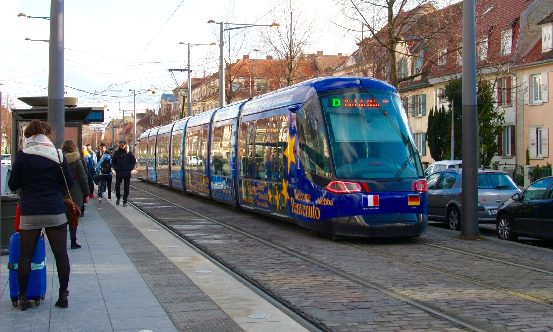
The LTSER Zone Atelier Environnementale Urbaine belongs to LTER-France network and is located in eastern France.The Zone Atelier Environnementale Urbaine ZAEU was created in 2010. It focuses on urban area and urban socioecosystem research questions. The main objective is to define how to facilite an harmonious development according to the city needs without badly impacting the natural system around. The Eurometropole of Strasbourg is a close partner of the ZAEU: local authorities participate to the research experimentations and observation campains. Six working groups are dealing with natural systems in order to better understand the urban ecosystem (biodiversity, hydrology, air and climate, urban metabolism) and the socio system (social and economic dimensions of the society and the individuals, groups behavior and values, politics strategies). In the working groups, we study issues like hydrological system processes in the urban area, population health, energy consomption and production at the city scale, pollutions and contaminations of the various spheres, refusal management with regards to the context of global changes, sustainable development and transitions (economy, ecology, energy).
-
The Harvard Forest is a collection of five properties, totaling about 1500 hectares, in Petersham, Massachusetts. Petersham is a rural town in Worcester County, Massachusetts, about 60 miles west of Boston. It is largely in the Swift River Watershed, and lies near the center of a twenty-mile wide band of hilly uplands that form the eastern edge of the Connecticut Valley. The north part of the town is rolling and the south more distinctly hilly; the lowest basins are about 200 m above sea level, the flats around 400m. Th e climate is cool temperate. Petersham, like many of the adjacent towns, was settled in the early 18th century, extensively cleared and farmed in the next hundred years, and then progressively abandoned after about 1830. Reforestation proceeded quickly, and by the time of the first Harvard Forest maps in 1909 HF was almost entirely wooded. Th e common forest types are dominated, variously, by red oak, red maple, white pine, or hemlock. Most are of low or average fertility and under 100 years old. Hemlock is now locally dominant in many stands that have been continuously forested; oaks, red maples and pines are the common dominants in stands that developed in old fields.