
soil parameter
Type of resources
Available actions
Topics
Keywords
Contact for the resource
Provided by
Years
Formats
Representation types
-
Soil particle size distribution data of the Gesäuse-Johnsbachtal site.
-
Soil pH data of the Gesäuse-Johnsbachtal site.
-
Infiltration rate data of the Gesäuse-Johnsbachtal site.
-
The size is owned and managed by the Taiwan Agricultural Research Institute. This site is a part of Taiwan Long-Term Agricultural Research Site.
-
The site is owned and managed by the Taiwan Agricultural Research Institute. This site is a part of Taiwan Long-Term Agricultural Research Site.
-
Soil base saturation data of the Gesäuse-Johnsbachtal site.
-
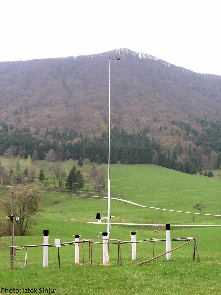
http://meteo.gozdis.si/?page_id=50 (only in SLO language)
-
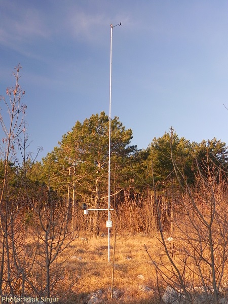
http://meteo.gozdis.si/?page_id=55 (only in SLO language)
-
The Vallon de Roche Noire is situated between the Col du Lautaret and the Col du Galibier, in the French Alps, and extends from 2300 m to more than 2800 m. The catchment is mainly covered by alpine meadows and is surrounded by flysch cliffs. It represents an almost undisturbed alpine pasture landscape.
-
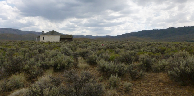
Reynold’s Creek Experimental Watershed, ID The D-DIRT experiment in Idaho was established in 2013,and is situated at the Reynold’s Creek Experimental Watershed (RCEW), which is also the site of the Reynold’s Creek Critical Zone Observatory (CZO) (http://criticalzone.org/reynolds/research/). The RCEW is located in the Owyhee Range in southwest Idaho, and situated along a 1000 m elevation range, it encompasses a wide range of environments typical of the intermountain region of the western USA. Precipitation in the RCEW generally increases with elevation from less than 250 mm/y to greater than 1100 mm/y, while mean annual temperature decreases by about 5°C, from 10.2°C to 5.6°C. Rain is the dominant form of precipitation in the RCEW, with snow dominating in the highest elevations. Corresponding vegetation types include sagebrush steppe in the lower elevations, transitioning to mountain sagebrush, western juniper, aspen and coniferous forest. An extensive description of the RCEW environment can be found in Seyfried et al., (2001). The RCEW-DIRT site is one of the sites in the D-DIRT network (Dryland Detrital Inputs and Removal Treatments), and is located at the lowest elevation (1184m) at RCEW (43°15’ N,116°46’ W). Mean annual temperature at the site is 10.2°C, and mean annual precipitation is 236mm. The vegetation consists of a patchy mosaic of shrubs and grasses. The main shrub is big sagebrush (Artemisia tridentata), and common herbaceous species at the site are P. secunda, P. spicata, and B. tectorum.