
soil particle size
Type of resources
Available actions
Topics
Keywords
Contact for the resource
Provided by
Years
Formats
Representation types
-
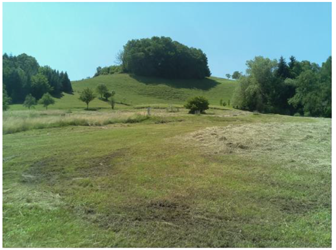
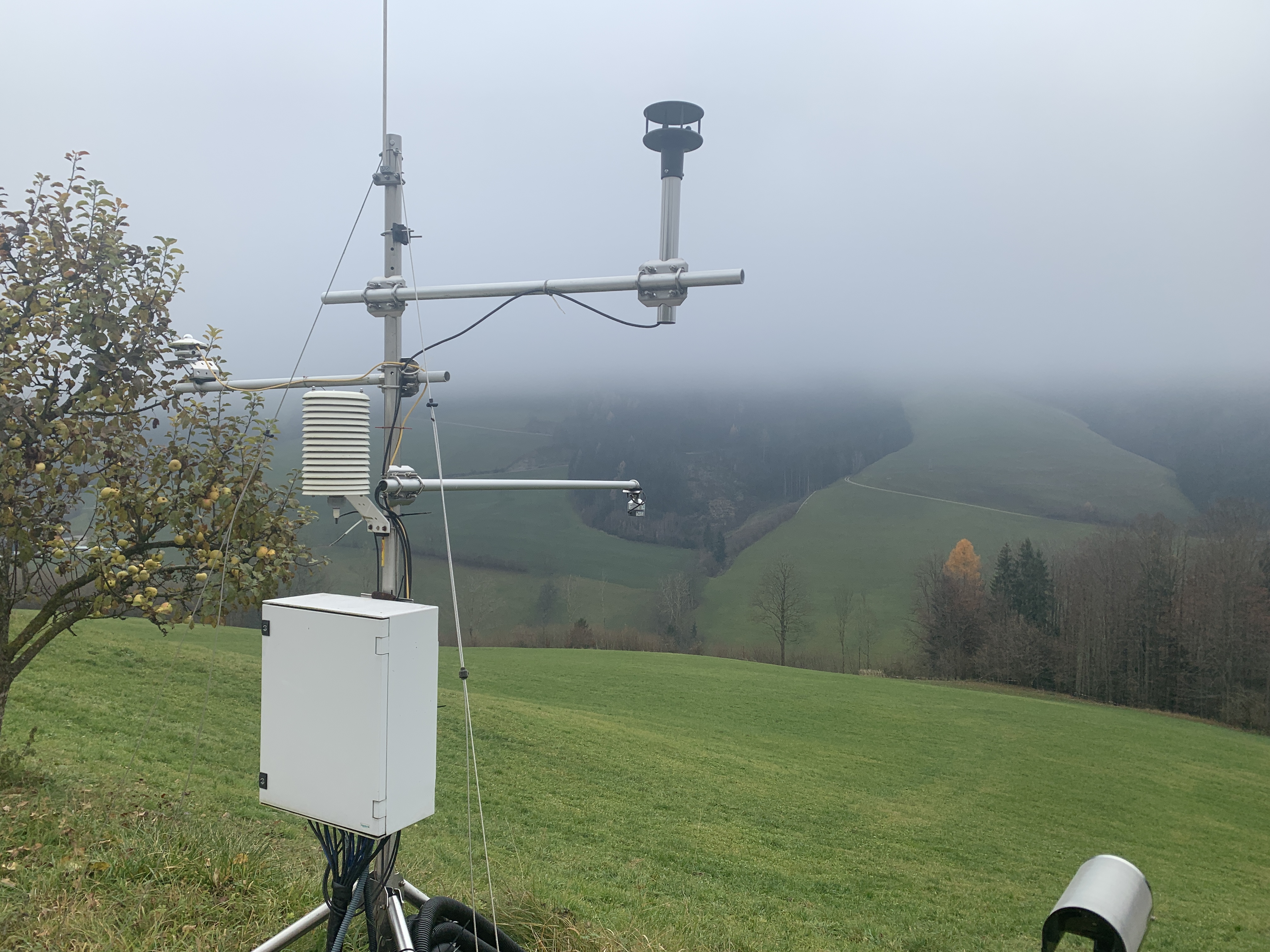
The ENGAGE working group (Geomorphological Systems and Risk Research at the Institute for Geography and Regional Research) has been running a long-term monitoring project to investigate landslides in Lower Austria. Landslides (translational and rotational failures, debris flows, rock avalanches, rock falls, etc.) number among the most abundant natural hazards in Lower Austria. Resulting from sporadic phases of activity it is essential to generate specific long-term measurement series, enabling the analysis of changes in surface movements as well as underground in connection with triggering factors. Therefore, in 2014 the project “NoeSLIDE – Monitoring diverse types of landslides in Lower Austria” was initiated. The research sites are compiled under the parent site "LTER NoeSLIDE" which has three subsites, of which one is the Salcher Landslide Observatory. The Salcher landslide is located in the municipality of Gresten, Scheibbs district, Province of Lower Austria. It is located on an unwooded hillside area that slopes from west to east (at around 435 to 470 m above sea level / slope between 5 ° and max. 20 °) and is enclosed on three sides by anthropogenic features (streets / houses). The processes at the Salcher landslide are to be classified as rotational landslide, with more than one sliding surface being assumed. The currently active area is ~ 4,000 m², the area to be potentially activated is ~ 20,000 m². In addition to traditional methods such as the installation of a weather station, piezometers, inclinometers, TDR (time-domain reflectometry) probes, GNSS (global navigation satellite system), Tachymeters, methods such as continuous terrestrial laser scanning, UAV applications and permanent geoelectric are used.
-
GLORIA Master Site.The 3497m-peak Mount Schrankogel belongs to the highest mountains of the Austrian Alps. Its northern and eastern side is surrounded by glaciers and glacier forelands. Its southern to western faces, however, are not interrupted by glacier Established in 1994 as the first comprehensive alpine to nival long-term monitoring site for high-altitude vegetation in the Alps, with ca. 1000 permanent plots of 1x1m arranged in transects of 30x3m or smaller ranging from 2900m to 3450m. Main purpose is ecological climate impact research. In 2001 it became a master site of the GLORIA network: e.g. method development and testing for species recording in 1x1m plots for GLORIA was partly conducted on Schrankogel. The first major resurvey of plots was made in 2004, the second resurvey was conducted in 2014. Besides long-term monitoring, several other research approaches were/are carried out at the Schrankogel site, such as species and vegetation modeling, vegetation mapping, phenological studies of alpine and nival plants, exclosure studies for grazing impacts at the lower altitudes of the site, soil studies, snow pattern studies (two permanent snow cameras), surface and soil-temperature measurements. In 2014, the the scope was extended to other organism groups such as soil microbiota, soil mesofauna (Oribatida and Collembola in particular), and surface-dwelling arthropods. Site setup, resurveys, or other activities were/are supported by: the Austrian Academy of Sciences through a national grant of the International Geosphere–Biosphere and the UNESCO MaB Programmes, by the Austrian and through the Institute of Mountain Research (IGF) of the Academy; by the Austrian Federal Ministry of Science and Research; the Austrian Federal Ministry of Agriculture, Forestry, Environment and Water Management; the Swiss MAVA Foundation; the Government of Tyrol; the project ALARM (Assessing Large-Scale Risks for Biodiversity with Tested Methods; No. GOCE-CT-2003-506675) in the FP-6 of the EU; the Austrian Climate Research Programme (ACRP: GZ B368633 ACRP6 - SCHRANKOGEL_20YEARS - KR13AC6K11076). For further details on Schrankogel_GLORIA see: http://www.gloria.ac.at/?a=42&b=56
-
The ENGAGE working group (Geomorphological Systems and Risk Research at the Institute for Geography and Regional Research) has been running a long-term monitoring project to investigate landslides in Lower Austria. Landslides (translational and rotational failures, debris flows, rock avalanches, rock falls, etc.) number among the most abundant natural hazards in Lower Austria. Resulting from sporadic phases of activity it is essential to generate specific long-term measurement series, enabling the analysis of changes in surface movements as well as underground in connection with triggering factors. Therefore, in 2014 the project “NoeSLIDE – Monitoring diverse types of landslides in Lower Austria” was initiated. The research sites are compiled under the parent site "LTER NoeSLIDE" which has three subsites, of which one is the Hofermühle Landslide Observatory. The Hofermühle site is located in the district of Waidhofen a.d. Ybbs, Lower Austria. The site is located in the Flysch Zone, a geologically predestined zone known to be extremely prone to landslide processes in Austria. Within the 0.15 km² hydrological catchment of the Hofermühle torrent, landslide processes can be defined as complex, being constituted by shallow earth sliding in the middle and gently inclined part of the catchment nearby the torrent, accumulation of material and resulting earth flowing down the steepening torrent path. It can be defined as complex earth slide - earth flow, which has shown different phases of activity in the last 10 years on different parts of the landslide mass. Major activation occurred in 2011 (subsidence via sliding by 2 m in 2 weeks), re-activation in 2013 (formation of earth flow with 20m/h) and processes have slowed down significantly since then to only a few cm to dm per year on the parts affected by sliding – as far as known. To investigate both surface and sub-surface dynamics and potential interrelations, a varity of permant and individual measurement techniques are applied at the study site. Direct investigations include dynamic probing, percussion drilling and core sampling. Hydro-meteorological parameters are acquired via TDRs (time domain reflectrometry) probes, piezometers for groundwater estimation and a meteorological station (precipitation, temperature, snow height, wind, solar radiation). Sub-surface displacements are measured with both manual and automatic inclinometers. Surface dynamics are investigated via multi-temporal TLS (terrestrial laser scanning) and UAV-based SfM (unmanned aerial vehicle; structure from motion) data. Data from permanent installations is given in 5 min resolution (TDR, piezometer, meteorological station, inclinometer).
-
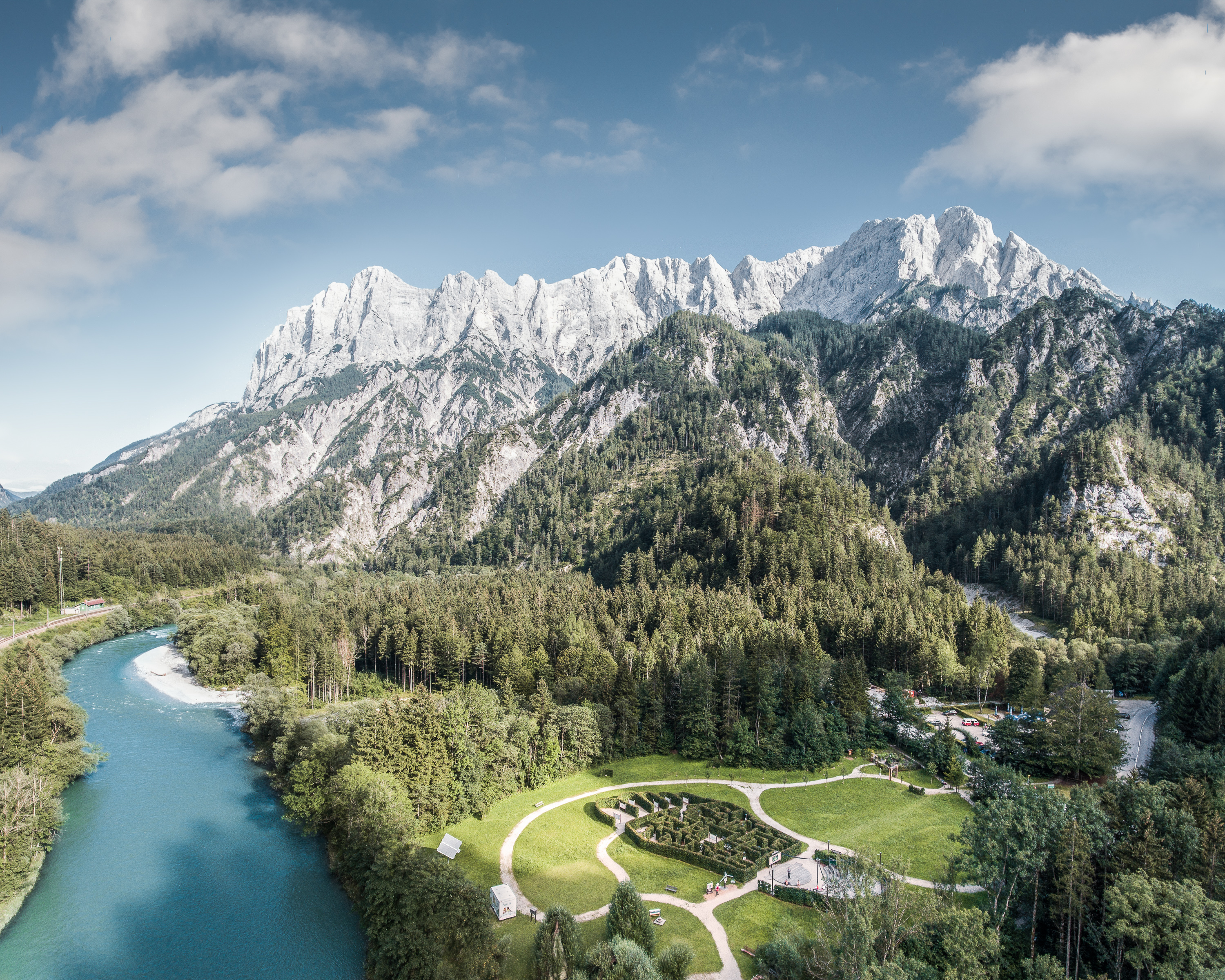
The Gesäuse Nationalpark and the Johnsbach valley belong to the Ennstal Alps, a part of the Northern Limestone Alps. They are situated in the province of Styria in the center of Austria. Together, they form the joint test site named Gesäuse-Johnsbachtal. This region is characterized by a mountainous landscape which is cut by the river “Enns”. In the north, it borders Eisenwurzen Nature Park and is only 6 km away from the Kalkalpen, a National Park in Upper Austria. In the south, the borders are the Eisenerzer Alps. The total area of the site is about 155 km². The terrain shows a great elevation range from 600-700 m in the Johnsbach valley to over 2300 m in the summit region of the Gesäuse, with Hochtor (2369 m) being the highest mountain. Due to the great range of altitude differences within small areas the Gesäuse-Johnsbachtal shows extremely diverse habitats and, consequently, species of animals and plants. In general, the landscape is dominated by mountain forests along with high Alpine rock formations and meadows. These complex topographic, hydrological, geological, geomorphological and meteorological conditions pose a scientific challenge for all kinds of environmental monitoring and modeling.
-
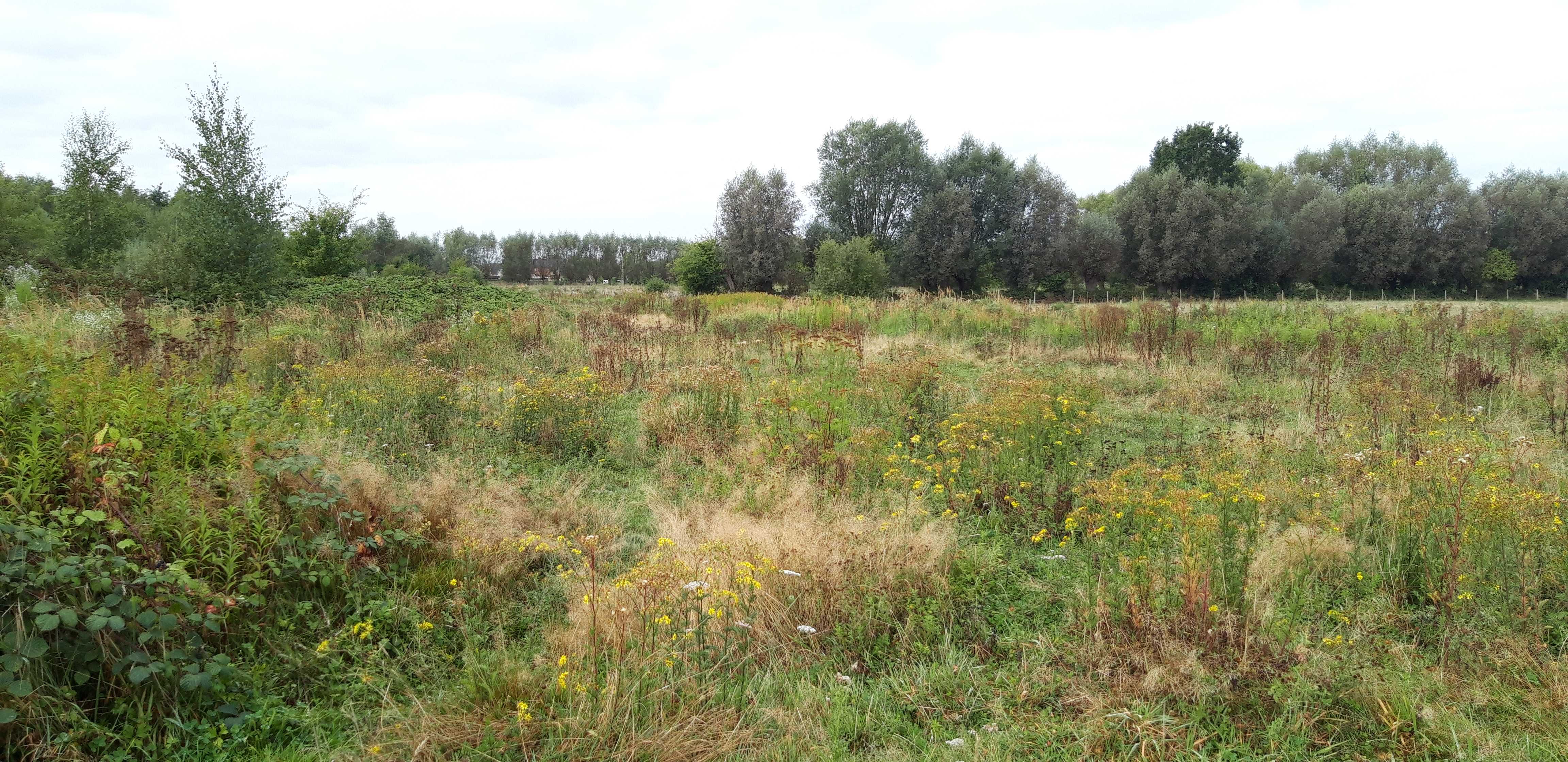
Landslides (translational and rotational slides, debris flows, rock avalanches, rock falls, etc.) rank among the most common natural hazards in Lower Austria. As these processes often inherit sporadic phases of activity, it is essential to generate specific long-term measurement series, enabling the analysis of surface and sub-surface dynamics in connection with potential triggering factors. Therefore, in 2014 the project “NoeSLIDE – Monitoring diverse types of landslides in Lower Austria” was initiated. Three subsites are summarized under the parent site "LTER NoeSLIDE".where various types of landslide processes, Hofermühle (complex earth slide - earth flow), Gresten (Salcher landslide) and Brandstatt are monitored with "classic" as well as novel approaches. This includes surface and subsurface monitoring systems. The main research aims comprise implementation of long-term monitoring systems (10+ years) for continuous observation of gravitational mass movements, testing of novel and innovative methods on multiple locations and data availability in a WebGIS application for simple online analyses for authorized users.
-
Hohe Tauern NP was established more than 40 years ago as one of the biggest protected areas in Central Europe to protect at long-term wide areas of the Austrian main-ridge of the Alps. The 1.856 square kilometre Hohe Tauern National Park is split into a 1.213 square kilometre core zone and a 643 square kilometre buffer zone and stretches over three provinces. Until the first and largest national park in Austria was actually created, the three provinces of Carinthia, Salzburg and Tyrol had to establish the corresponding legal framework. The Provincial Parliament of Carinthia passed the legislation to create the Hohe Tauern National Park in 1981. Salzburg followed with its national park legislation in 1984, followed by Tyrol in 1992. In this 40 years Hohe Tauern NP established the Nationalpark idea in its region working together with all stakeholders (land owners, tourism, majors, hunting organisations, governmental departments…). The International Union for the Conservation of Nature IUCN awarded Carinthia in 2001 and Salzburg and Tyrol in 2006 with the international recognition of a national park with its "Category II" listing. The distinction that the national park has with a core zone, where nature can develop without human influence and a buffer zone, where traditional cultivation could be continued was key for gaining this international recognition. Contractual agreements between landowners, hunters and the national park paved the way and were pioneering for many protected areas. Hohe Tauern NP contains 3 main zones: - core zone (km²): 1.078 - buffer zone (km²): 643 - special protected areas (km²): 135 About 845 km² of the area is nature zone, which remains untouched by humans (no land use based on IUCN criteria, i.e. no hunting, no grazing). The altitudinal belts from the valleys to the summits of the three-thousand-metre-tall mountains represent an exceptional biodiversity. This is home to many plants and wildlife species originating from the Central Asian tundra, the Arctic and even Southern Europe. The preservation of all significant Alpine ecosystems across large areas of the Hohe Tauern National Park has been unimpaired. More than one third of all plant species recorded in Austria can be found in the national park. For mammals, birds, reptiles and amphibians, this figure is at around 50%. Even those animals that were nearly extinct in almost all of Europe at the beginning of the 19th century are now provided a safe habitat in the Hohe Tauern National Park. This impressive biodiversity is a result of the different prevailing climatic, geological, geomorphological and hydrological conditions in the high mountains and the differing adaptation strategies of the plants and animals. The Tauern Window – a unique tectonic window in terms of shape and size – provides insight into the deepest tectonic layer of the Alps and is thus key for understanding the geological structure of the Alps. Rocks of differing ages, different origins and different chemical composition harbour a genuine hoard of up to 200 different minerals. Nature protection (ecosystems/Natura2000 habitats) and species conservation projects play a big role in the work and history of Hohe Tauern NP (e.g. bearded vulture, ibex, golden eagle, …). The NP and its work do not stop at the protected areas borders and for a lot of species it is important that the whole region is aware of its impacts on biodiversity. According to the altitude gradation of the Hohe Tauern National Park "high mountain habitat types" are typical. Based on the aerial photo interpretation of the National Park montane to alpine grassland and pastures dominate with a third. This also reflects the zoning with the outer zone in the sense of an Alpine cultural landscape zone with alpine pastures – and the transition to the high alpine core zone. The core zone is formed by the "eternal ice" of the glaciers around the highest mountains of Austria as well as scree slopes with and without pioneer vegetation dominate. CORINE Land Cover L3 (2018): 35 % bare rocks, 24 % natural grasslands, 20 % sparsely vegetated areas, 9 % coniferous forest, 7 % glaciers and perpetual snow, 2 % moors and heathland, 1 % pastures.
-
This site is located on the territory of National Park “Rila”, Bulgaria. Parangalitsa has been a reserve since 1933. It is situated on part of the southwestern slopes of Rila mountain, covering 1,509 hectares. It contains some of the oldest pine tree forests in Europe with an average age of over 200 years. The site is a part of the network of bioecological stations of Forest Research Institute – BAS and research is focused on highly productive coniferous forests with unique biomass. In the main experimental plots, long-term complex studies were conducted during the period 1979 - 1998, a large-scale database was created and a number of significant scientific results were obtained. In the period 2000 - 2018, separate targeted studies were carried out - focused on some ecosystem processes, which allows the analysis and evaluation of the functioning of ecosystems to be don
-
The total NPHK is currently (since 2020) about 12,000 ha, but the eLTER site corresponds to the former perimeter of the NPHK and represents an urbanised protected area of about 60km2 (or 6,000ha) located in the Province of Limburg in the East of Belgium. The NPHK (inaugurated in 2006 and extended from 6000ha to its current 12000ha in 2020), located in a former coal mining area is surrounded by 10 municipalities with more than 200,000 inhabitants, equivalent to a population density of 450/km2 . The park covers a rich variety of habitats, including heathlands, deciduous forest, coniferous forest and fens and evidently the corresponding diversity of fauna and flora. Several research groups from universities and institutes are monitoring and measuring abiotic and biotic parameters throughout the different ecosystems. Research on ecosystem services are also playing a major role, including tourism and mobility.
-
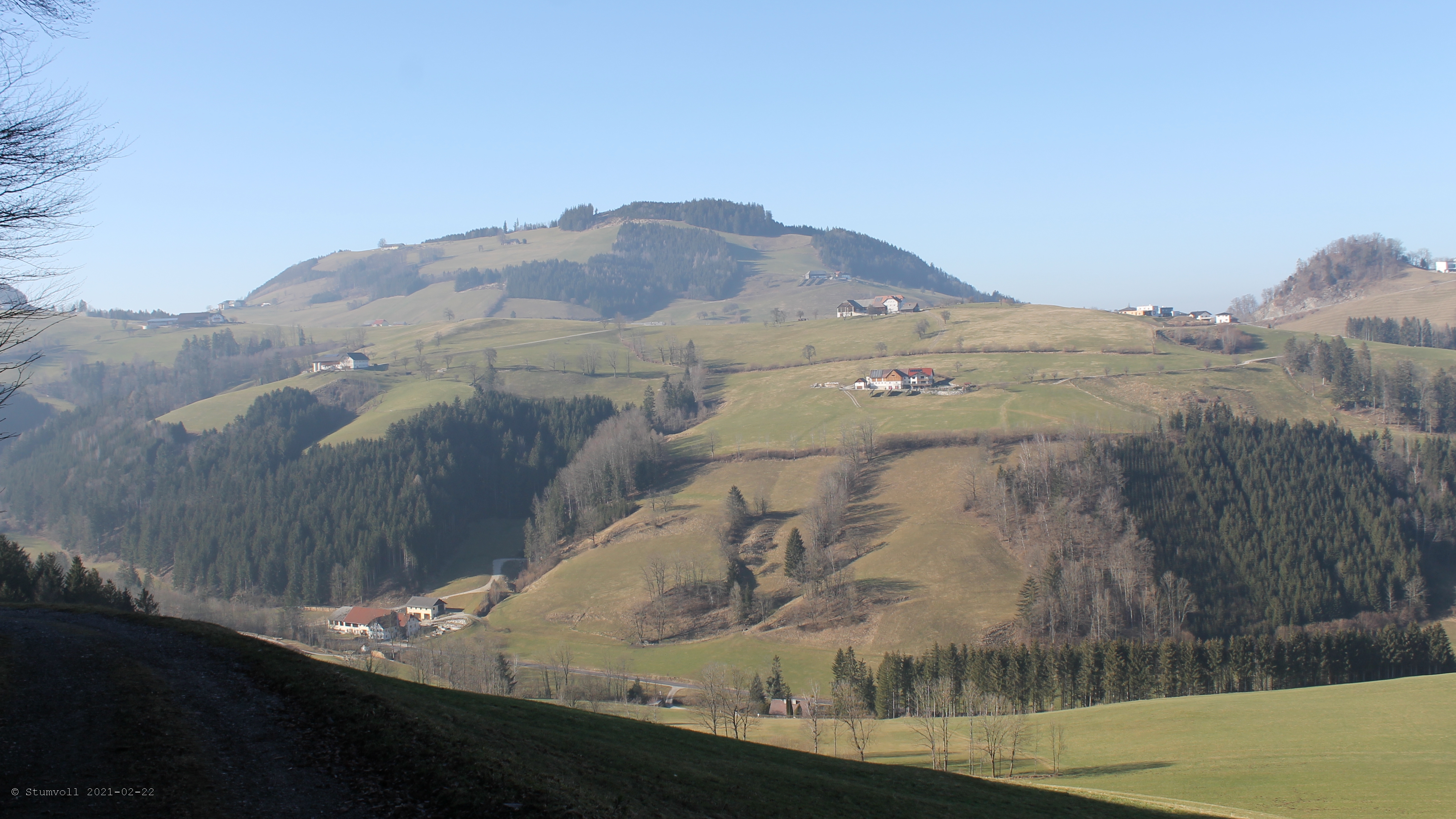
The Nature reserve Bos t’Ename is situated on the Belgian loess belt about 25 km south of Ghent. It has an area of 160 ha. 60 ha mixed deciduous ‘ancient forest’ forest, 40 ha restoration of woodpasture on former agricultural land, 35 ha regeneration of forest in a silt quary, 25 ha semi open cultural landscape (meadows, hedges,…). "Bos t'Ename" belongs to one of the classified lanscapes of Flanders The woodland where previously managed as coppice with standards. The history is exceptionally well studied. It is managed as multifunctional forest containing strict forest reserves an coppice with standards.
-
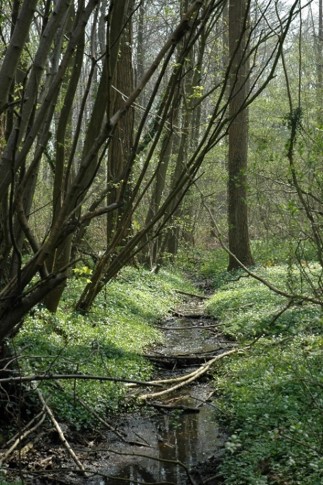
The Aelmoeseneie Forest is a 28.5 ha mixed deciduous forest in the community of Gontrode, just southeast of Ghent. The largest part of the forest is ‘ancient forest’, i.e. it is permanently forested since before 1775, while the forest is surrounded by agricultural land (mostly pastures). The soil consists of a silt loam to loam soil (Planosol), overlaying a mosaic of tertiary clayey and sandy deposits with high base saturation starting at 50 cm depth. Forest management is designed to obtain a more natural tree species composition and to conserve biodiversity. More info can be found at www.aelmoeseneiebos.ugent.be.