
soil porosity
Type of resources
Available actions
Topics
Keywords
Contact for the resource
Provided by
Years
Formats
Representation types
-

Huai Ma Nai is a small agricultural catchment (93 ha) of northern Thailand, 60 km from the city of Phrae, in a sloping land environment. The objective is to the impacts of land use changes, from mung bean and soya bean to maize, upon hydrological and sedimentary budgets. Agricultural practices are very intensive, based on high quantities of fertilizers, herbicides and pesticides, and mechanized cultivation. The mean slope is 12.9%%. Soils are thin Alfisols and Ultisols with sandy clay loam to clayey texture, high coarse fragment content, low pH, high bulk density and low-medium cation exchange capacity. Monitoring devices include an automatic meteorological station since 2001, and weirs and flume to monitor discharge from nested catchments, suspended sediment and bedload. More information is available on https://mtropics.obs-mip.fr/ and in the following paper: Valentin, C., et al., 2008. Runoff and sediment losses from 27 upland catchments in Southeast Asia: Impact of rapid land use changes and conservation practices. Agric. Ecosyst. Environ. 128, 225–238. https://doi.org/10.1016/j.agee.2008.06.004
-
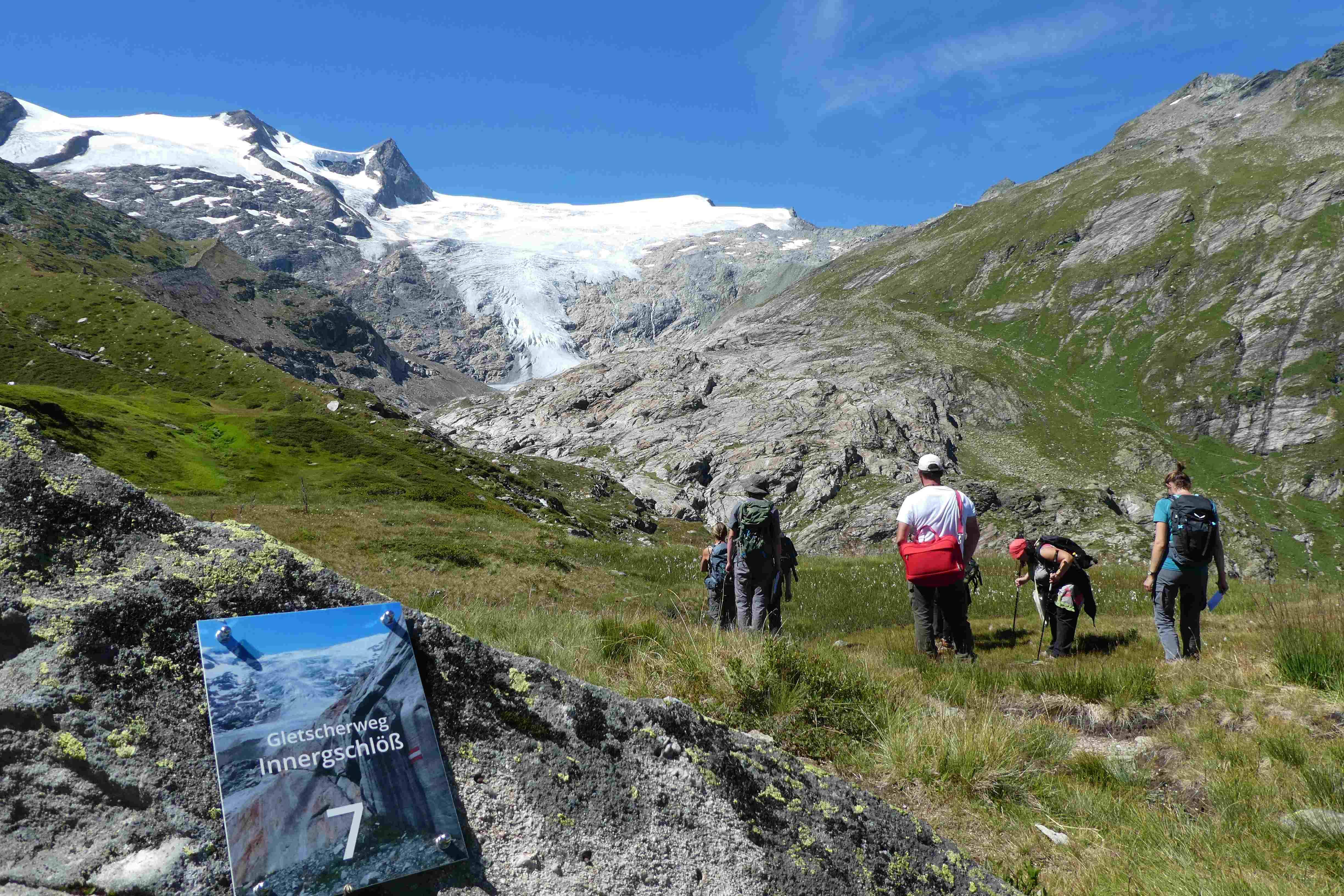
Hohe Tauern NP was established more than 40 years ago as one of the biggest protected areas in Central Europe to protect at long-term wide areas of the Austrian main-ridge of the Alps. The 1.856 square kilometre Hohe Tauern National Park is split into a 1.213 square kilometre core zone and a 643 square kilometre buffer zone and stretches over three provinces. Until the first and largest national park in Austria was actually created, the three provinces of Carinthia, Salzburg and Tyrol had to establish the corresponding legal framework. The Provincial Parliament of Carinthia passed the legislation to create the Hohe Tauern National Park in 1981. Salzburg followed with its national park legislation in 1984, followed by Tyrol in 1992. In this 40 years Hohe Tauern NP established the Nationalpark idea in its region working together with all stakeholders (land owners, tourism, majors, hunting organisations, governmental departments…). The International Union for the Conservation of Nature IUCN awarded Carinthia in 2001 and Salzburg and Tyrol in 2006 with the international recognition of a national park with its "Category II" listing. The distinction that the national park has with a core zone, where nature can develop without human influence and a buffer zone, where traditional cultivation could be continued was key for gaining this international recognition. Contractual agreements between landowners, hunters and the national park paved the way and were pioneering for many protected areas. Hohe Tauern NP contains 3 main zones: - core zone (km²): 1.078 - buffer zone (km²): 643 - special protected areas (km²): 135 About 845 km² of the area is nature zone, which remains untouched by humans (no land use based on IUCN criteria, i.e. no hunting, no grazing). The altitudinal belts from the valleys to the summits of the three-thousand-metre-tall mountains represent an exceptional biodiversity. This is home to many plants and wildlife species originating from the Central Asian tundra, the Arctic and even Southern Europe. The preservation of all significant Alpine ecosystems across large areas of the Hohe Tauern National Park has been unimpaired. More than one third of all plant species recorded in Austria can be found in the national park. For mammals, birds, reptiles and amphibians, this figure is at around 50%. Even those animals that were nearly extinct in almost all of Europe at the beginning of the 19th century are now provided a safe habitat in the Hohe Tauern National Park. This impressive biodiversity is a result of the different prevailing climatic, geological, geomorphological and hydrological conditions in the high mountains and the differing adaptation strategies of the plants and animals. The Tauern Window – a unique tectonic window in terms of shape and size – provides insight into the deepest tectonic layer of the Alps and is thus key for understanding the geological structure of the Alps. Rocks of differing ages, different origins and different chemical composition harbour a genuine hoard of up to 200 different minerals. Nature protection (ecosystems/Natura2000 habitats) and species conservation projects play a big role in the work and history of Hohe Tauern NP (e.g. bearded vulture, ibex, golden eagle, …). The NP and its work do not stop at the protected areas borders and for a lot of species it is important that the whole region is aware of its impacts on biodiversity. According to the altitude gradation of the Hohe Tauern National Park "high mountain habitat types" are typical. Based on the aerial photo interpretation of the National Park montane to alpine grassland and pastures dominate with a third. This also reflects the zoning with the outer zone in the sense of an Alpine cultural landscape zone with alpine pastures – and the transition to the high alpine core zone. The core zone is formed by the "eternal ice" of the glaciers around the highest mountains of Austria as well as scree slopes with and without pioneer vegetation dominate. CORINE Land Cover L3 (2018): 35 % bare rocks, 24 % natural grasslands, 20 % sparsely vegetated areas, 9 % coniferous forest, 7 % glaciers and perpetual snow, 2 % moors and heathland, 1 % pastures.
-
The study plot was established by the Institute of Forest Ecology (Mendel University in Brno) in 1968, namely in connection with the UNESCO International Biological Programme (IBP) and the UNESCO programme “Man and the Biosphere” (MAB). Research was aimed at the primary production, element and water cycling and the secondary production of invertebrates, birds and small mammals. It refers to a semi-natural floodplain forest free of management measures characterized by the Ulmeto-Fraxinetum carpineum forest type group. Dominant tree species are as follows: Fraxinus excelsior, Quercus robur, Populus nigra, Tilia platyphyllos, and Acer campestre. In consequence of flood control, the local floodplain forest was affected by changes in the water regime (absence of natural floods, fall of the groundwater table) from 1972. In the course of the 1970s and 1980s, it resulted in the insufficient supply of water. Since the 1990s, revitalization measures have been carried out (increasing the ground water level by means of channels) for improving forest health. Changes in the water regime have resulted in the improving condition of the floodplain forest ecosystem that has been documented owing to LTER on the site. Following research activities are carried out there: (i) monitoring selected parameters of the stand microclimate and mesoclimate, (ii) evaluating the moisture balance in the forest ecosystems, (iii) evaluating the water regime and moisture conditions of the floodplain forest ecosystem, (iv) evaluating temperature and moisture conditions, (v) research into the water relations of trees, (vi) evaluating long-term changes in the synusia of small terrestrial mammals of the floodplain forest, and (vii) evaluating decomposition processes.
-
This site is located on the territory of National Park “Rila”, Bulgaria. Parangalitsa has been a reserve since 1933. It is situated on part of the southwestern slopes of Rila mountain, covering 1,509 hectares. It contains some of the oldest pine tree forests in Europe with an average age of over 200 years. The site is a part of the network of bioecological stations of Forest Research Institute – BAS and research is focused on highly productive coniferous forests with unique biomass. In the main experimental plots, long-term complex studies were conducted during the period 1979 - 1998, a large-scale database was created and a number of significant scientific results were obtained. In the period 2000 - 2018, separate targeted studies were carried out - focused on some ecosystem processes, which allows the analysis and evaluation of the functioning of ecosystems to be don
-
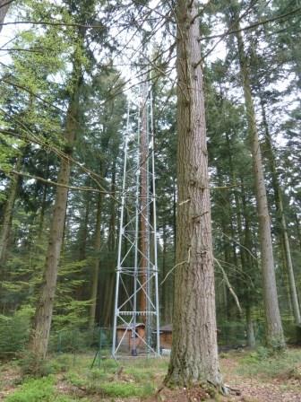
The site is a mixed mature forest composed mainly of Fagus Sylvatica, Pseudotsuga menziesii and Picea abies. The soil (100-150 cm deep) is a silty and stony soil with B structural horizon composed by schist and phyllades. Fluxes of CO2 and water vapour and micrometeorological measurements are performed above the forest by an eddy-covariance system installed on a tower since 1996. During the successive measurement years, several complementary campaigns have been organised : forest inventory, automatic soil respiration measurements, advection, ecosystem water budget, diffusion of CO2 and stable isotopes in soil, volatile organic compounds fluxes, soil carbon content inventory, monthly evolution of nitrogen deposition... Research activities are carried out by the University of Liège (GxABT) and the Université catholique de Louvain (UCL) within the ICOS infrastructure.
-
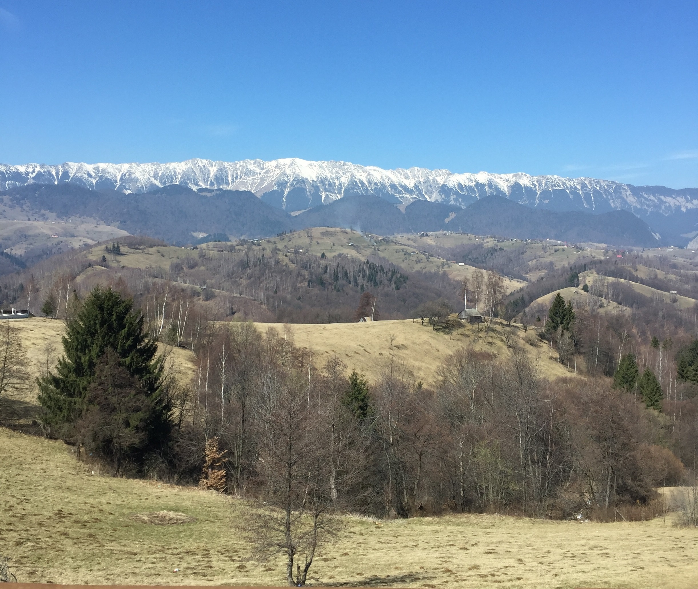
The site is located in the south-central part of Romania, in the Bucegi and Piatra-Craiului Mts of the Southern Carpathians. Bucegi - Piatra Craiului are located in the Romanian southern Carpathians (Bucegi NP (32.500 ha) and Piatra-Craiului NP (13.800 ha). In 2003, these areas were nominated as two ILTER Sites and in 2008 as LTER - Europe sites (Bucegi - Piatra Craiului). The diversity and vast richness of Bucegi - Piatra Craiului vegetation, with many endemic species and rich fauna which includes endangered species and unique plant communities like chamois, bear, lynx and wolf were the main reasons for the natural and national park designated status of Bucegi - Piatra Craiului.
-
The Lautaret-Oisans platform focuses on the study of socio-ecosystems and the critical zone of the alpine mountains. The research and observation sites are focused on three sub-systems: little-engineered high mountains; alpine pastures; and lakes, rivers and watershed heads. The platform is built around the Lautaret-Roche-Noire site (https://deims.org/8574370e-934e-418a-af63-e15f4cbc5084) and Lautaret Garden infrastructures.
-

The study plot was established by the Institute of Forest Ecology (Mendel University in Brno) in 1968, namely in connection with the UNESCO International Biological Programme (IBP) and the UNESCO programme "Man and the Biosphere" (MAB). The study plot is carried out in the natural forest region 30 – Drahanská Vrchovina upland (Drahanský bioregion, 1.52) about 1 km west of the village of Němčice in the Czech Republic on the modal oligotrophic Cambisol (KAmd´) of a fir-beech forest vegetation zone (4 FVZ) with forest type 5S1 – Abieto-Fagetum mesotrophicum with Oxalis acetosella (4AB3 – Fageta quercino abietina, union Luzulo-Fagion, association Luzulo-Fagetum) at an a altitude of 600–660 m at sites of autochthonous mixed forests. Research is aimed at ecological aspects of the transformation of spruce monocultures and optimation of management procedures at the application of sustainable management in forests. Recently, research is aimed at possibilities of the adaptation of forest stands on effects of an expected climate change. The main oriented research in present is: (i) study of mesoclimate and microclimate, (ii) evaluation of water balance, (iii) phenology of tree species, (iv) study of biogeochemical cycle (carbon, nitrogen, sulphur), (v) study of decomposition and soil processes, and (vi) evaluation of biodiversity.
-
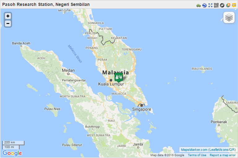
From 1970 to 1974, the Pasoh FRIM Research Station (Pasoh FRS) has been a site for intensive research of lowland rain forest ecology and dynamics under a joint research project between University of Malaya and the International Biological Programme (IBM). Pasoh forest was also the main study site for the Reproductive Biology of Forest Trees Project, a joint research project between University of Aberdeen and University of Malaya from 1974 to 1978. Since then, various research projects on biodiversity, forest productivity, flora, fauna, micrometeorology, soils, hydrology and nutrient cycling were conducted in collaboration with local universities.. In December 1977, Forest Research Institute Malaysia (FRIM) took over the management of the research station from University of Malaya. This was made possible through the collaboration with the Negeri Sembilan State Forestry Department. The Pasoh forest station has since become a leading tropical forest field research station. This could not have been possible without the commitment from the state forestry department to gazette 1,840 ha of the Pasoh reserve as a Research Forest. All research activities are monitored by the Pasoh Research Committee (PRC) in FRIM since 1999. The Director of the Negeri Sembilan Forestry Department is also a Committee member. The main attraction of the Pasoh Reserve is its floristically rich forest. A total of 335,256 stems 1 cm dbh (diameter at breast height) and above belonging to 814 species, 294 genera and 78 families has been recorded within an area of 50 ha. The most common plant families are the Euphorbiaceae and Annonaceae among the smaller trees, and the Dipterocarpaceae, Leguminosae and Burseraceae. The most common species is Xerospermum noronhianum (Sapindaceae) locally known as ‘rambutan pacat,/em>’, which accounts for 2.5% of the total number of plants. For trees above 30 cm dbh, the most abundant species is Shorea leprosula (meranti tembaga), a member of the Diptrerocarpaceae family. Being an isolated forest surrounded by oil palm estates and other land uses, forest gaps, formed by windthrow of a large tree or a group of trees, are a fairly common feature at Pasoh. Within these gaps, one can find many regenerating seedlings and saplings. Although Pasoh lacks charismatic animals such as tigers and elephants, it still harbours a good composition of small mammals, primates and birds Today Pasoh is not only the site of many research studies by both local scientists and scientists from abroad but is also an educational centre for school children, college and university students as well as the general public.
-
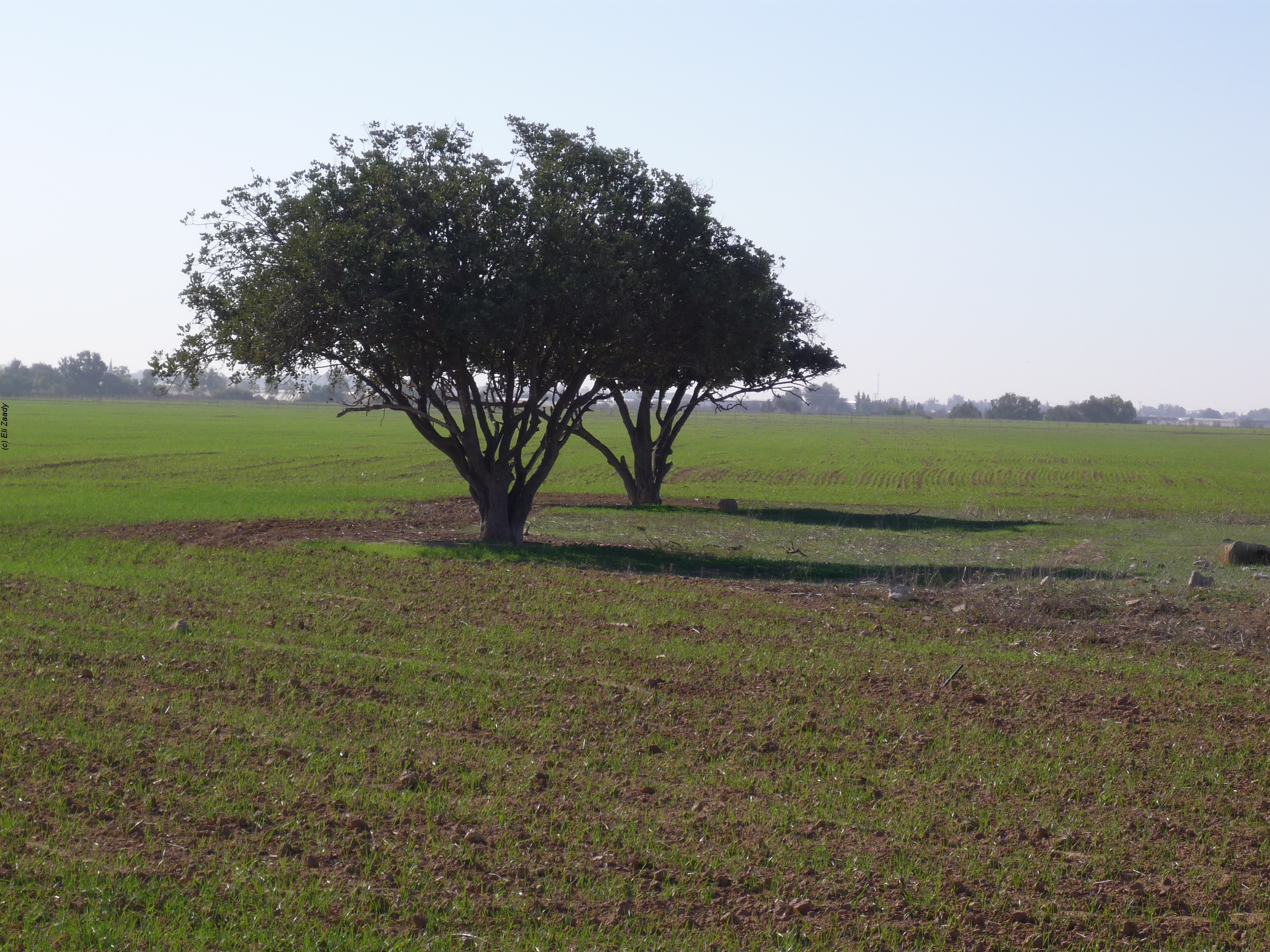
A Loess plain is devoted to agro – ecosystem and climate change research. The site is subdivided into permanent plots which are exposed to various manipulations. The manipulations include introducing of various crops and various grazing regime. The manipulation provides data on the effect of management and rainfall regime on agricultural productivity. In addition, the area includes ecological plots to study a natural succession, penology and productivity under various rainfall regimes. The site is also used to study climate change in relation to rainfall and runoff patterns. An important study is the dynamic of geophytes that are important as cultural ecosystem service in the area. A new research direction is to study ecosystem development under various rainfall and runoff patterns.