
soil respiration
Type of resources
Available actions
Topics
Keywords
Contact for the resource
Provided by
Years
Formats
Representation types
-
The LTER site Zöbelboden was equipped with highly modern infrastructure to assess the effects of extreme climate events on the forest ecosystem. The instruments include eddy covariance measurements for CO2 and water vapor fluxes at a tower (900 m a.s.l), and soil respiration auto-chambers, as well as combined sap flow sensors with automated dendrometers in the main footprint area of the eddy tower. This is the so called intensive plot 2 (IP2), which is equipped by a number of different field measurement devices for long-term monitoring (lysimeters water sampling, soil moisture and temperature sensors, manual dendrometers, deposition, litter fall) and supplemented by other monitoring activities (tree inventory, needle and leaf chemistry, soil chemistry). An optical multi-parameter probe for dissolved nitrogen and carbon was installed in the measuring weir of the catchment runoff at 577 m a.s.l. There, weekly water quality, runoff, and meteorology is monitored since many years. The related metadata refer to the soil respiration measurements.The raw data (exclusive periods of serious malfunction of the device) can be viewed and downloaded via the link provided using the station name “ZOE_0677P07”, “ZOE_0687P01”, “ZOE_0674P03”, “ZOE_0675P09”, “ZOE_0683P03”, “ZOE_0685P03”. Quality-assured data are available and will be provided by the contact person upon request. See methods for a short description of the QA-method.
-
This dataset provides data on automated high resolution soil respiration measurements as micromoles of Carbon dioxide per square metre per second. Automated high resolution soil measurements were carried out in campaigns in 2013 and 2014. Campaigns were carried out monthly between June and October 2013 and in June and August 2014 capturing the plants growing season. Data were collected from the climate change field site, Climoor, that is located in the Clocaenog forest, North East Wales. The experimental field site consists of three untreated control plots three plots where the plant canopy air is artificially warmed during night time hours and three plots where rainfall is excluded from the plots at least during the plants growing season (March to September). Measurements were taken with automated soil respiration chambers. The Climoor field experiment intends to answer questions regarding the effects of warming and drought on ecosystem processes. Plot level soil respiration measurements are important to investigate soil carbon dynamics and changes in soil carbon cycling and storage under the imposed climatic treatments. Soil respiration measurements were carried out by trained CEH Bangor members of staff.
-
This dataset contains soil respiration data from the Climoor fieldsite in Clocaenog forest, north-east Wales. Measurements began in March 1999 at the field site, and were repeated in approximately bi-weekly intervals until June 2015 (although there are some larger gaps for technical or logistical reasons in this 14 year dataset). The data were collected using 3 different methods/machines over the years: static chambers, soil respiration chamber and Environmental Gas Monitor (EGM)-4 (from PP Systems), and soil respiration chamber and Automated Soil Gas Flux System Li8100 (from Licor Biosciences). The method used is detailed in the data and described further in the supporting documentation. Data was collected by CEH staff and PhD students trained in the use of the different methods / machines. Climoor is a climate change manipulation experiment that utilises automated roof technology to produce drought and warming experimental treatments that reflect climate change predictions for the next 20-30 years.
-
Soil data of LTER Zöbelboden, Austria. Soil inventory is carried out since 1992 on regular positions (approx 65) in the catchment measuring soil chemistry. Soil water chemistry is measured in forest plots (2-3) using lysimeter sampling and analyses on a bi-weekly to monthly basis. Soil hydraulic characterizations exist for the major soil types in the catchment. Soil CO2 and N2O respiration data is available for some years
-
Nature reserve, Natura 2000, protected coniferous blueberry forest.
-
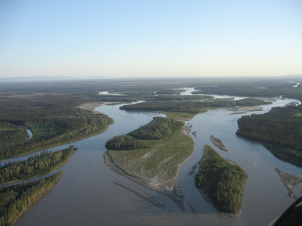
The Bonanza Creek Experimental Forest (BCEF), located approximately 20 km southwest of Fairbanks, Alaska, was established in 1963 with about 3360 ha (8,300 acres) of upland, interior Alaska boreal forest. In 1969, the experimental forest was enlarged to 5053 ha (12,487 acres) to include representative floodplain forests along the Tanana River. The Forest is within the Tanana Valley State Forest, a unit managed by the Division of Forestry, State of Alaska. In 1987 the Bonanza Creek Long-Term Ecological Research program was established, with BCEF as its primary research site.
-
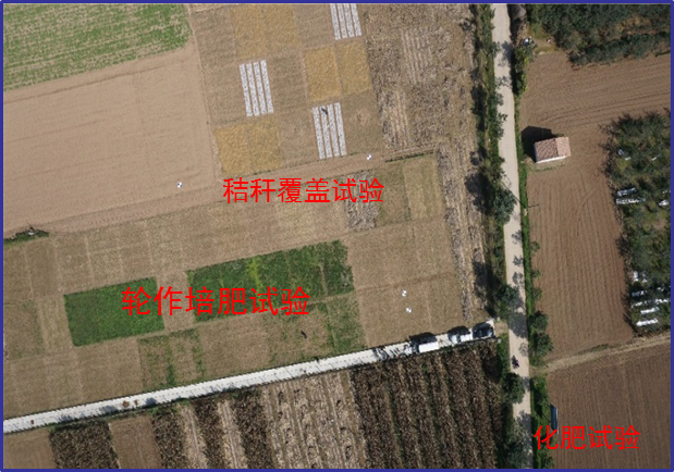
Changwu station was found in 1984 as one of field experiment stations of Institute of Soil and Water Conservation, Chinese Academy of Sciences (ISWC, CAS). It joined the Chinese Ecosystem Research Network (CERN) organized by CAS in 1991 and the National Ecosystem Research Network of China (CNERN) in 2005 by the Ministry of Science and Technology of the People’s Republic of China. The station located in Wangdong Village, Hongjia town, Changwu County, Shaanxi Province, 200 km away from Xi’an city. Its location is E107°41′ and N35°12′, south of the Loess Plateau. It belongs to the warm temperate semi-humid continental monsoon climate. Mean annual precipitation is 580mm and temperature 9.1℃, frost-free day 171. The elevation is about 1200 m and the depth of ground water is 50-80m. Main crops are winter wheat, spring maize, potato, sorghum, millet, beans and so on. The zonal soil is called Heilu soil with a parent material of clay loam Malan loess paleosol soil with an average depth in excess of 100m that were deposited during the Quaternary period. It belongs to the high table land - gully region, and a typical rain-fed agricultural area on the Loess Plateau. Wangdong small watershed, which the station located in, is 6.3km2. Three landform types are high table land, slop land called “Liang” and valley, which occupy the total area of watershed with 35%, 35.6% and 29.4%, respectively. The soil is deep and has good physical properties, like reservoir, support the agro-ecological system.
-

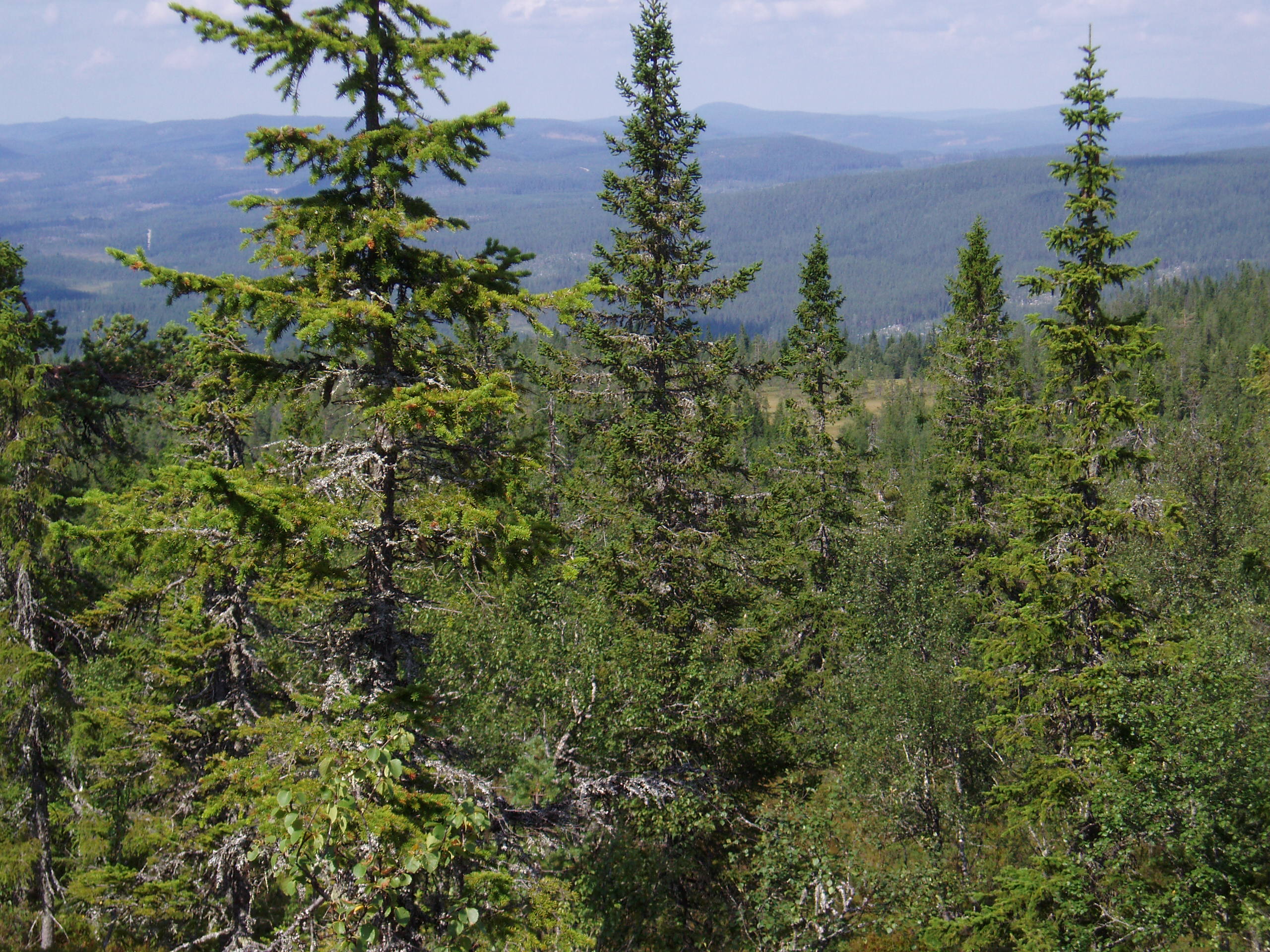
The study plot was established by the Institute of Forest Ecology (Mendel University in Brno) in 1968, namely in connection with the UNESCO International Biological Programme (IBP) and the UNESCO programme "Man and the Biosphere" (MAB). The study plot is carried out in the natural forest region 30 – Drahanská Vrchovina upland (Drahanský bioregion, 1.52) about 1 km west of the village of Němčice in the Czech Republic on the modal oligotrophic Cambisol (KAmd´) of a fir-beech forest vegetation zone (4 FVZ) with forest type 5S1 – Abieto-Fagetum mesotrophicum with Oxalis acetosella (4AB3 – Fageta quercino abietina, union Luzulo-Fagion, association Luzulo-Fagetum) at an a altitude of 600–660 m at sites of autochthonous mixed forests. Research is aimed at ecological aspects of the transformation of spruce monocultures and optimation of management procedures at the application of sustainable management in forests. Recently, research is aimed at possibilities of the adaptation of forest stands on effects of an expected climate change. The main oriented research in present is: (i) study of mesoclimate and microclimate, (ii) evaluation of water balance, (iii) phenology of tree species, (iv) study of biogeochemical cycle (carbon, nitrogen, sulphur), (v) study of decomposition and soil processes, and (vi) evaluation of biodiversity.
-
Sanjiang Plain Marsh Ecological Experimental Station (SJM) is located in one of the largest marshes distribution areas, Sanjiang Plain, which is a low plain formed by the Heilongjiang River, Songhua River, Wusuli River. The station (133°31′E,47°35′N) has an altitude of ~56 m.a.s.l, belongs to the temperate continental monsoon climate zone, with the mean annual temperature of 1.9℃, and annual rainfall of ~600 mm. The area has an annual frost-free period of 125 d and is a typical seasonal frozen area with the freezing and thawing period from early November until the middle of June in the next year. The dominated vegetation composition are Carex lasiocapa, Carex pseudocuraica, Carex meyeriana, Glyceria spiculosa, Deyeuxia angustifolia, and the soil types are mainly meadow bog soil, humus bog soil and gley white paper clay, white pulp meadow soil, etc.The main crops are soybeans and rice in this area.
-
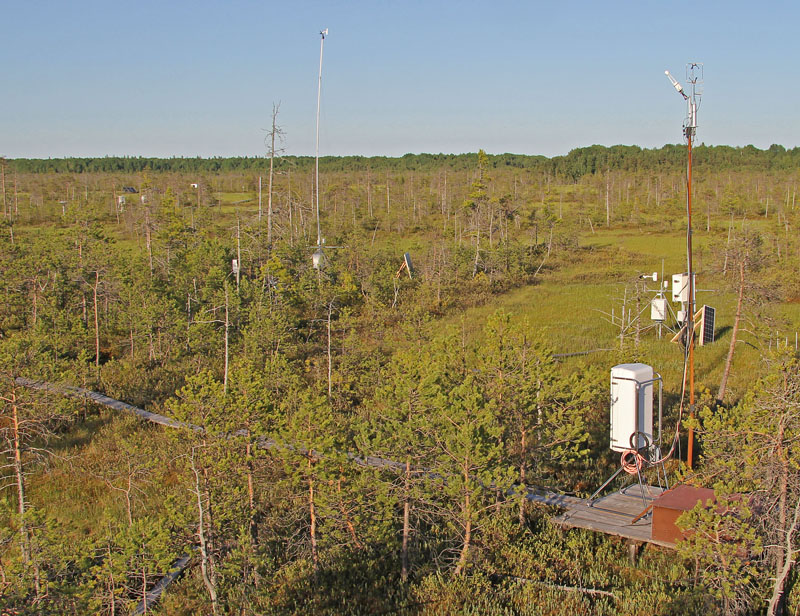
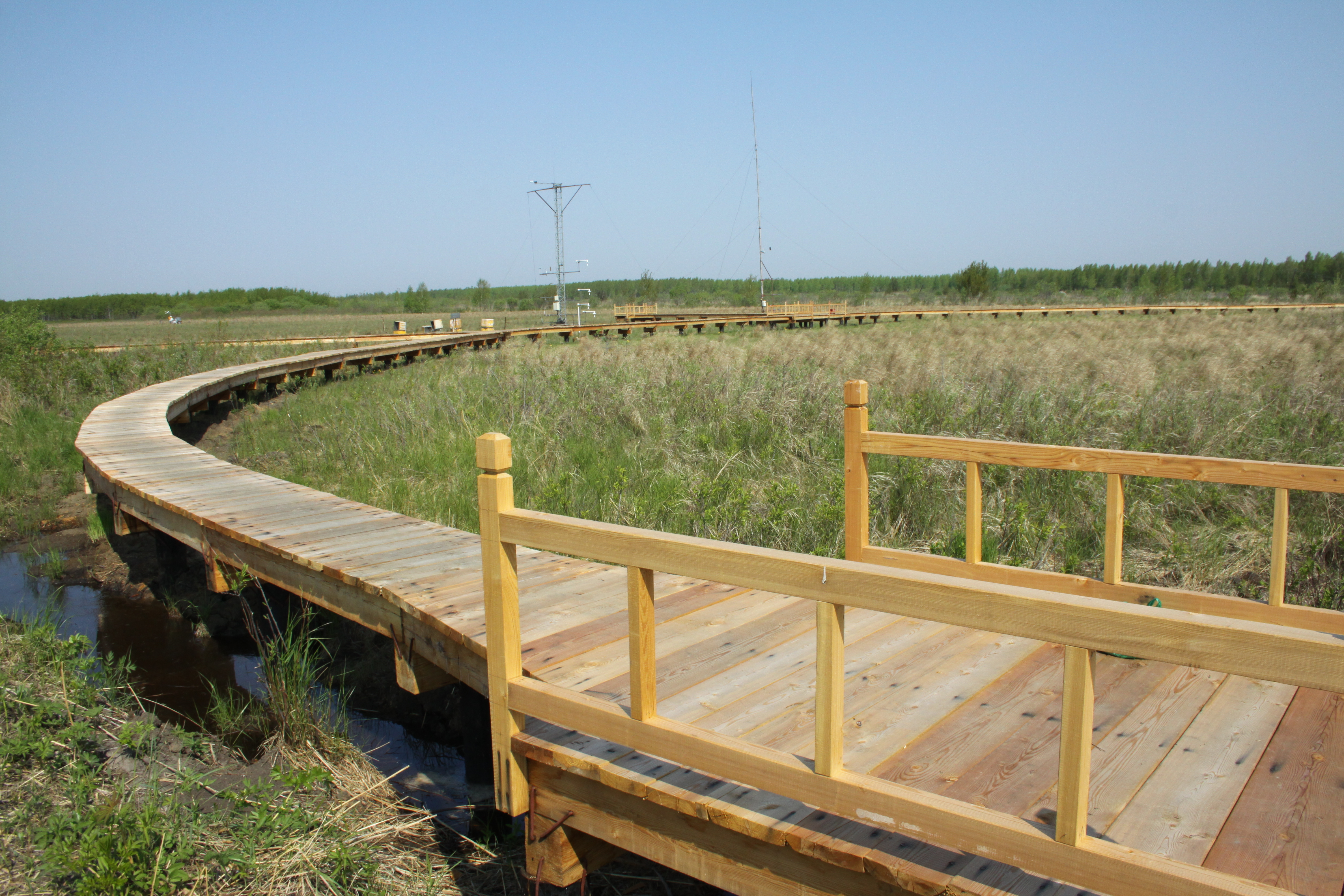
Mukhrino Field Station is owned and run by the UNESCO Chair on Environmental Dynamics and Climate Change at the Yugra State University, Khanty-Mansiysk, Russia. The Mukhrino Field Station is located at the east bank of the Irtysh River near the confluence with the Ob River in the central taiga area of Western Siberia (60°54’ N, 68°42’ E), 30 km south-west of the town of Khanty-Mansiysk (60 000 inhabitants). Due to the severe continental climate, the environmental conditions in the region are comparable with the sub-arctic zone of Northern Europe. The research site is representative for the Western Siberian pristine carbon accumulating peatland ecosystem (“plain mires”). The mires cover c. 60 % of the land surface and can be regarded as important sources/sinks of greenhouse gases and aerosols. The main mire type of the site is raised bogs of the type Pine-dwarf shrubs-bogs (Ryam) characterized by pine trees, Ledum palustre and dwarf shrubs, with areas of Sphagnum fuscum. Interspersed are mires of the type Poor fens (partly drained in the summer) dominated by Carex lasiocarpa and other graminoids, and Sphagnum balticum. Also ridge-hollow complexes, consisting of bog ridges and poor fen hollows are present.